Immerse yourself in the tranquillity of the Belgian countryside while cycling through Hoogstraten.
Cycling routes from Hoogstraten
Hoogstraten, located in the Province of Antwerpen in Belgium, offers a cycling-friendly environment for road and gravel cyclists. The locality features well-signposted cycling routes that showcase the natural beauty of the surrounding countryside. With its flat landscape, Hoogstraten is ideal for relaxed rides and leisurely exploration. Cyclists can take in the sights of the charming Belgian villages, picturesque vineyards, and verdant farmland. Hoogstraten is a lovely destination for cyclists looking for a leisurely and scenic ride through the tranquil Belgian countryside.
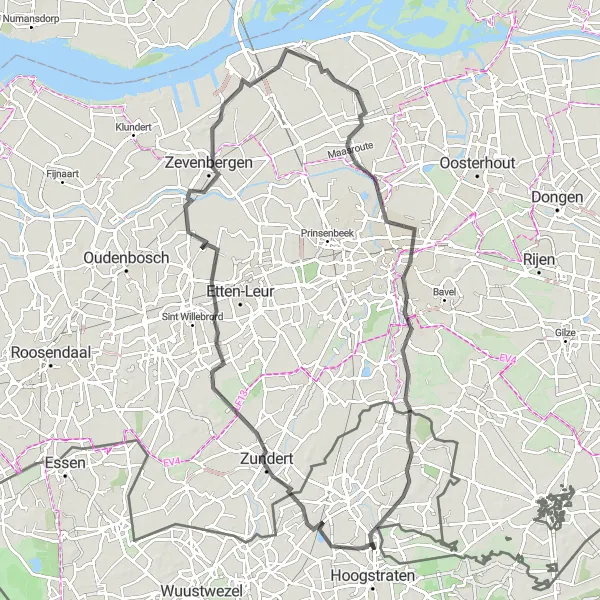
Embark on a challenging road cycling experience starting near Hoogstraten and explore stunning landscapes along the way.
Get ready for a thrilling road cycling adventure with this 90km route starting near Hoogstraten. With challenging terrains and a total ascent of 109m, this ride takes you through beautiful countryside and vibrant towns such as Zundert, Zevenbergen, and Meerle. Highlights along the route include the Molenberg, a picturesque hill offering panoramic views at a distance of 38km from the start, and the historic town of Terheijden at a distance of 61km. Overall, this route promises an exciting journey for experienced cyclists and showcases the captivating landscapes and cultural heritage of the area.
Loenhout Discovery
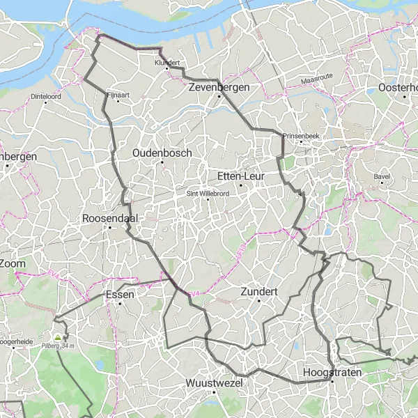
Discover hidden gems and scenic routes on this road cycling journey starting from Hoogstraten.
Embark on an exciting road cycling adventure with a total distance of 106km and an ascent of 103m, starting from Hoogstraten. This route takes you through picturesque countryside, charming towns, and historical landmarks. Highlights along the way include the quaint town of Loenhout at a distance of 9km, the scenic Achtmaal at a distance of 18km, as well as the historic towns of Oud Gastel, Klundert, and Effen. With a moderate difficulty level, this route offers a perfect blend of natural splendor, cultural heritage, and challenging terrains.
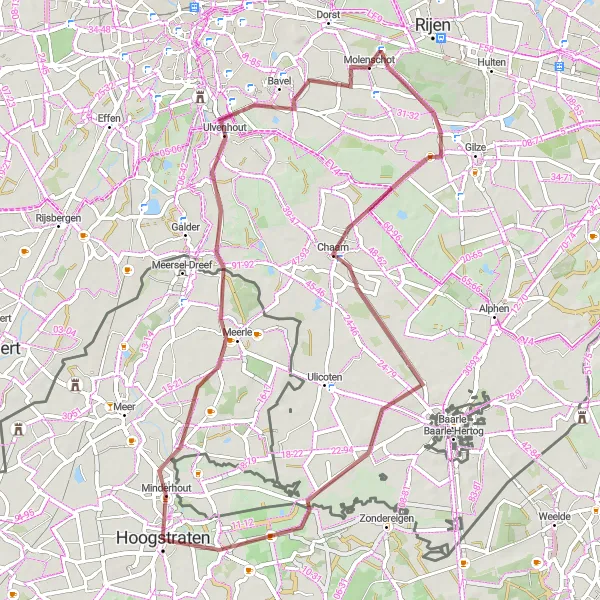
Cycle through scenic countryside and indulge in nature's beauty on this gravel route near Hoogstraten.
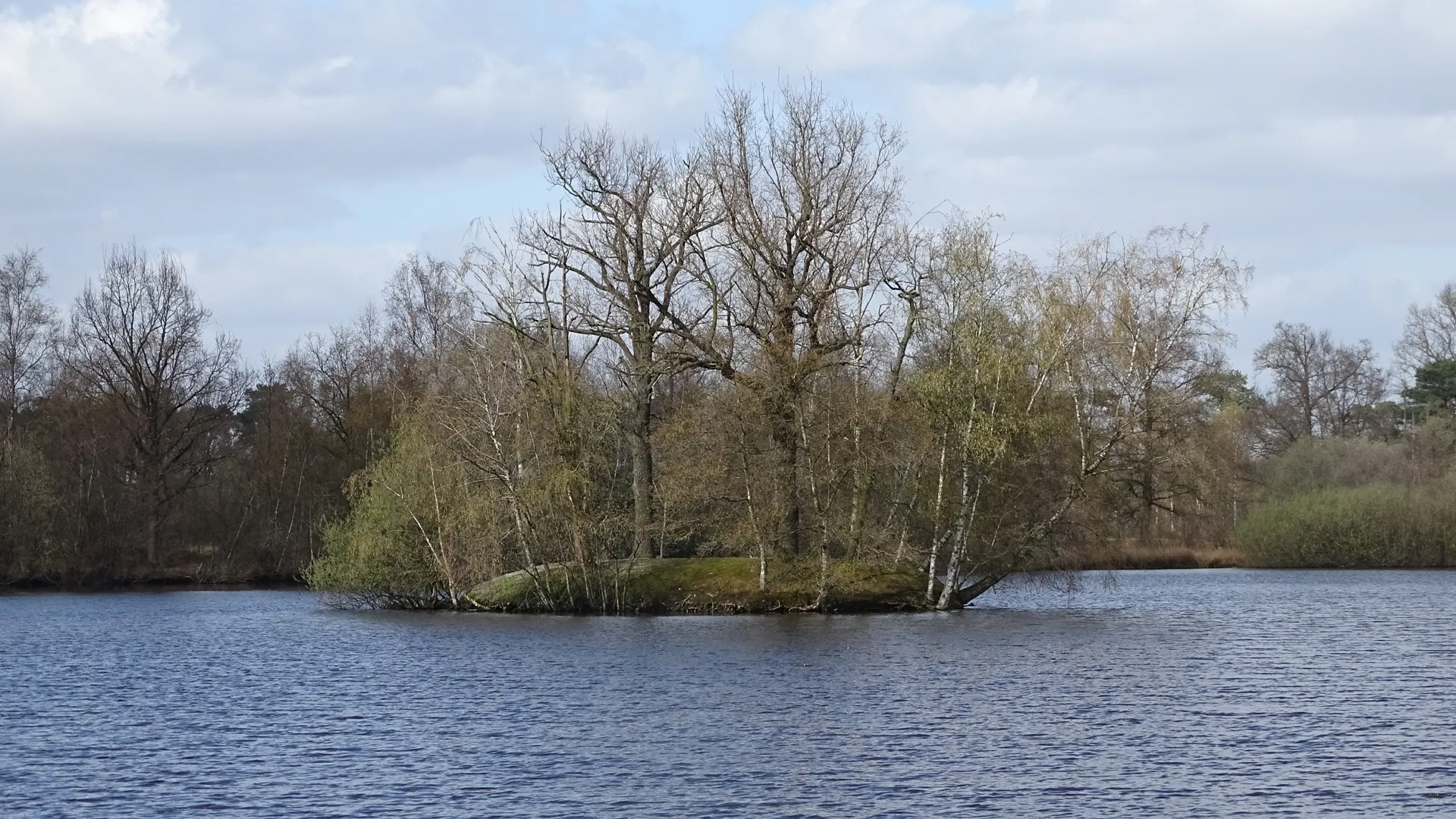
Embark on a picturesque 59km gravel cycling route starting from Hoogstraten. With a moderate difficulty level and a total ascent of 68m, this ride takes you through the serene landscapes of Belgian and Dutch countryside. Highlights along the route include the Ulvenhout, a charming town situated at a distance of 17km from the start, and Wortel, a small town renowned for its natural surroundings and historic character at a distance of 57km. Overall, this route offers a perfect escape to nature and allows you to explore the beauty of the region.
Hoogstraten to Sint-Lenaarts
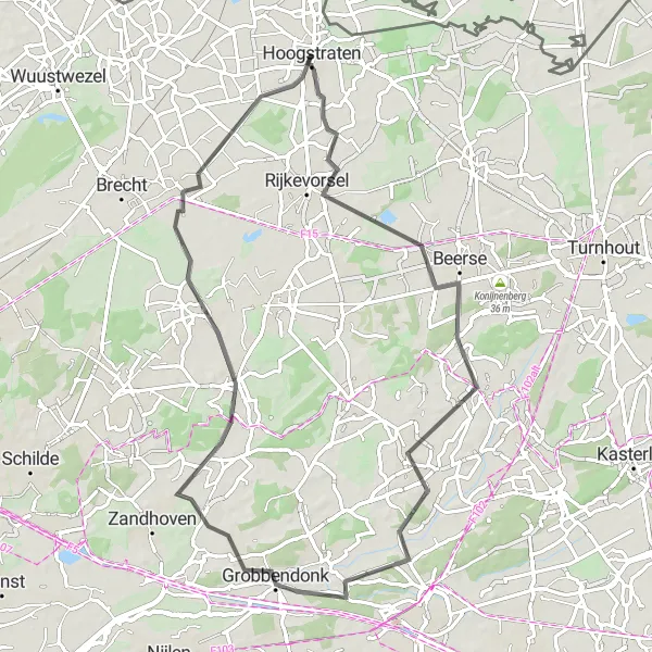
An exhilarating road cycling route with a varied landscape and charming towns
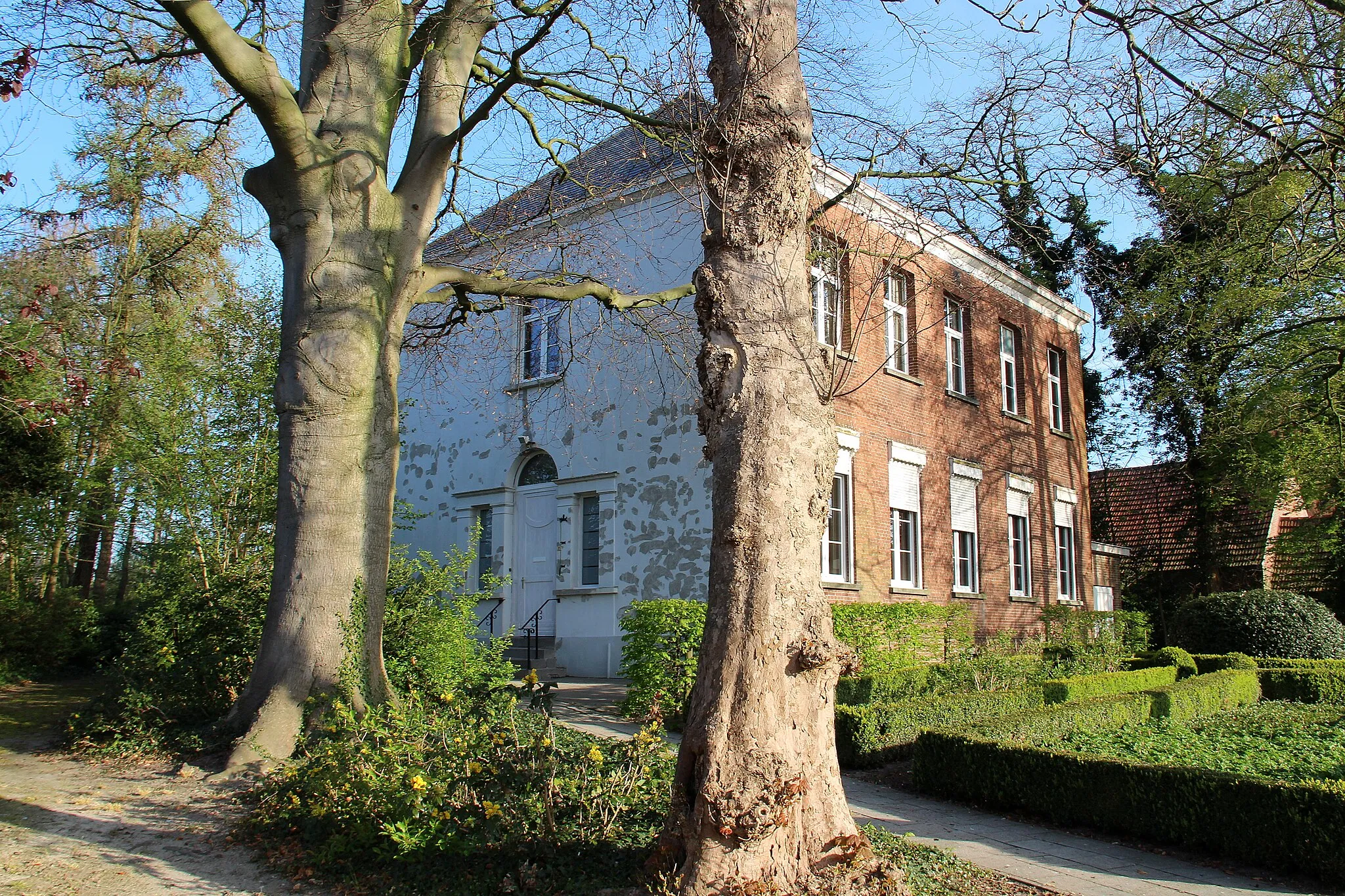
This road cycling route takes you from Hoogstraten to Sint-Lenaarts, offering a diverse landscape of open fields and picturesque towns. The route covers a total distance of 68 km with a moderate ascent of 81 meters. Starting in Hoogstraten, you will pass through Beerse, Lille, Grobbendonk, and Zoersel before reaching the endpoint at Sint-Lenaarts. Enjoy the idyllic countryside scenery as you pedal along smooth roads. The difficulty level of this route is rated 3 out of 5, suitable for well-trained amateurs. The epicness level is 3 out of 5, offering a pleasant cycling experience without any legendary climbs. Highlights along the way include exploring the charming town of Lille and its rich history, and visiting the historic Sint-Lenaarts with its old churches and beautiful architecture. Overall, this route offers a delightful cycling experience through scenic landscapes and historic towns.
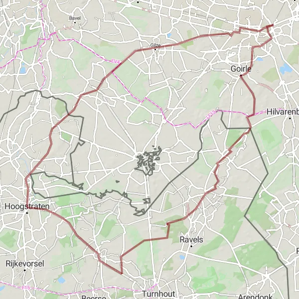
Discover the beautiful Kempentoren along this gravel route near Hoogstraten
Experience the scenic beauty and architectural wonders of the Kempentoren on this 87km gravel cycling route starting from Hoogstraten. With a moderate difficulty level and a total ascent of 126m, this ride takes you through the charming towns of Chaam and Goirle, before reaching the iconic Kempentoren in Paleis-Raadhuis. The route also offers an opportunity to visit the Uitkijktoren, a popular lookout tower at a distance of 52km from the start. Overall, this route provides a diverse mix of gravel terrain, cultural highlights, and scenic landscapes.
A scenic road cycling route passing through picturesque landscapes
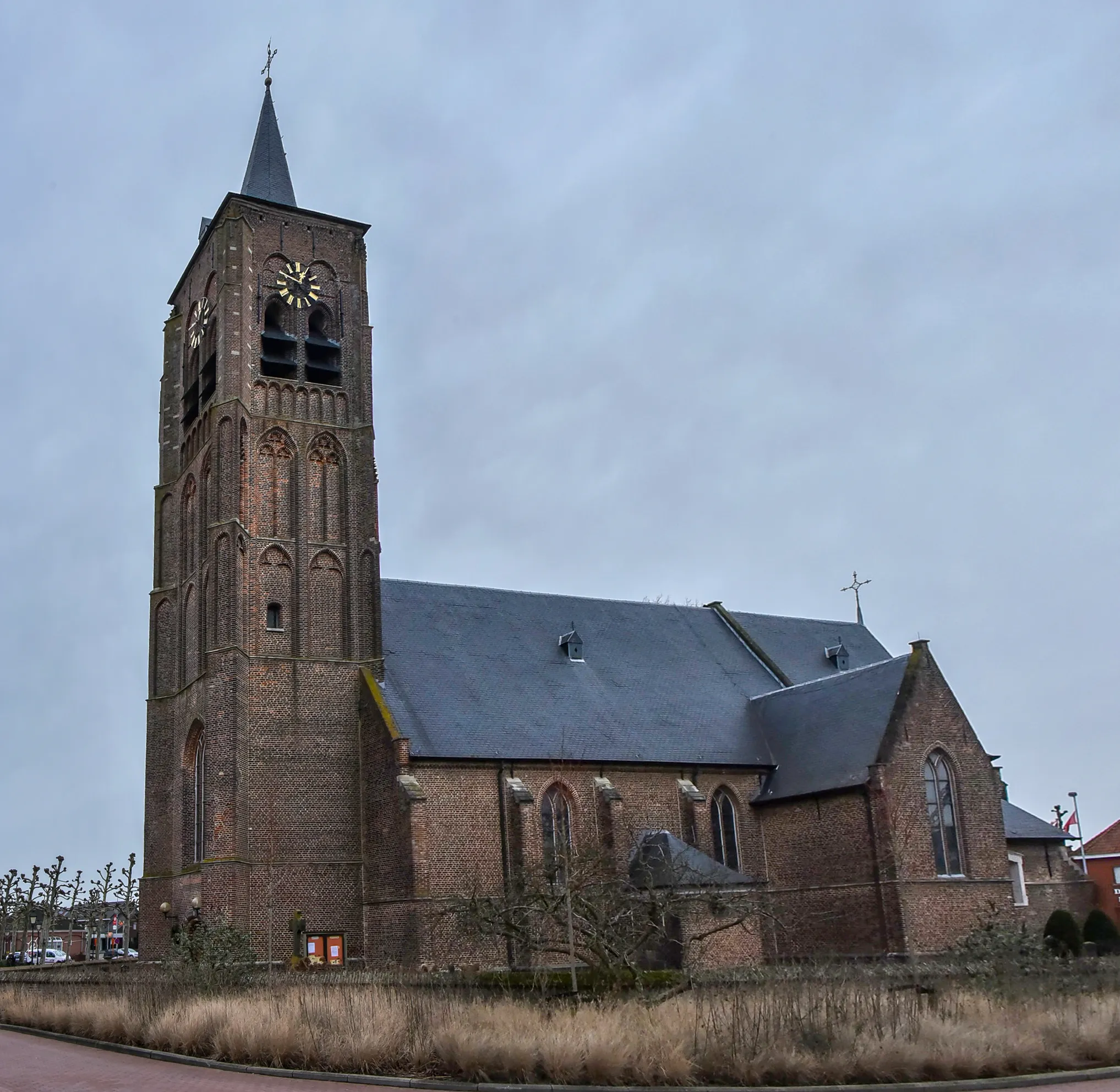
Embark on a scenic road cycling route starting from Hoogstraten and ending at Konijnenberg. This route covers a distance of 57 km with a moderate ascent of 48 meters. The route takes you through charming towns and offers picturesque views of the surrounding countryside. The difficulty level of this route is rated 2 out of 5, suitable for amateur cyclists. The epicness level is 2 out of 5, providing a pleasant cycling experience without any legendary climbs. Highlights along the way include visiting the town of Hoogstraten with its historical buildings and exploring the picturesque Konijnenberg. Overall, this route offers a leisurely cycling experience through scenic landscapes and the opportunity to explore charming towns.
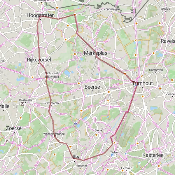
An exciting gravel cycling route showcasing the scenic beauty of Merksplas and Rijkevorsel
Embark on an exciting gravel cycling route through Merksplas and Rijkevorsel, covering a distance of 53 km with an ascent of 47 meters. This route takes you through picturesque landscapes and offers a thrilling gravel riding experience. The difficulty level of this route is rated 2 out of 5, suitable for amateur gravel riders. The epicness level is 2 out of 5, providing an enjoyable cycling experience without any legendary climbs. Highlights along the way include exploring the town of Merksplas and its historic sites, and experiencing the serene beauty of Rijkevorsel. Overall, this route offers a fantastic gravel cycling adventure through breathtaking landscapes and quaint towns.
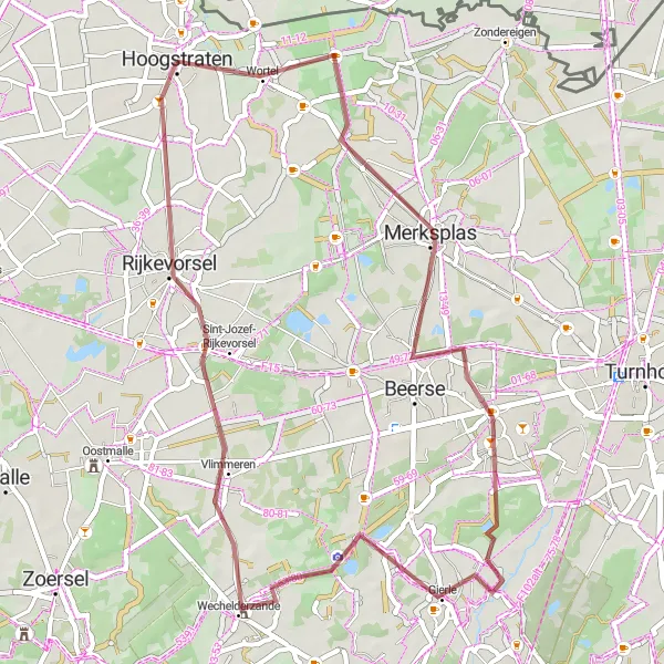
Experience the thrill of gravel cycling through scenic Beerse and Rijkevorsel
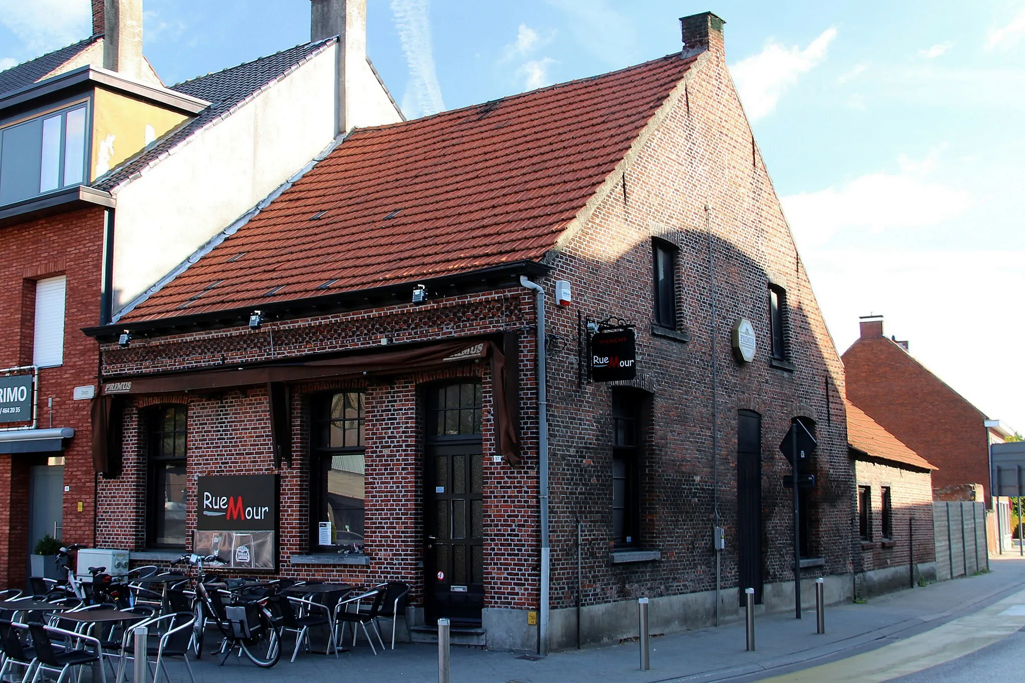
Embark on a gravel cycling adventure through Beerse and Rijkevorsel, covering a distance of 49 km with an ascent of 53 meters. This route offers a unique riding experience on gravel roads surrounded by beautiful landscapes. The difficulty level of this route is rated 2 out of 5, suitable for amateur gravel riders. The epicness level is 2 out of 5, providing an enjoyable cycling experience without any legendary climbs. Highlights along the way include exploring the town of Beerse with its charming cafes and local beer, and riding through the picturesque countryside of Rijkevorsel. Overall, this route is perfect for gravel enthusiasts seeking a unique and immersive cycling experience.
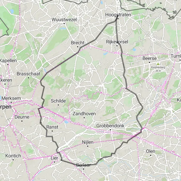
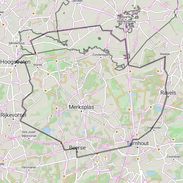
A challenging road cycling route with diverse landscapes and historic towns
Embark on a challenging road cycling route from Hoogstraten to Sint-Lenaarts, covering a total distance of 94 km with an ascent of 86 meters. This route offers a diverse landscape, including open fields, rural areas, and charming historic towns. The difficulty level of this route is rated 4 out of 5, suitable for experienced amateur cyclists. The epicness level is 3 out of 5, providing a challenging and rewarding cycling experience without any legendary climbs. Highlights along the way include exploring the town of Lille, known for its Flemish architecture, and visiting the historical sites in Sint-Lenaarts. Overall, this route offers a challenging and scenic cycling adventure through diverse landscapes and picturesque towns.
Brecht Tour
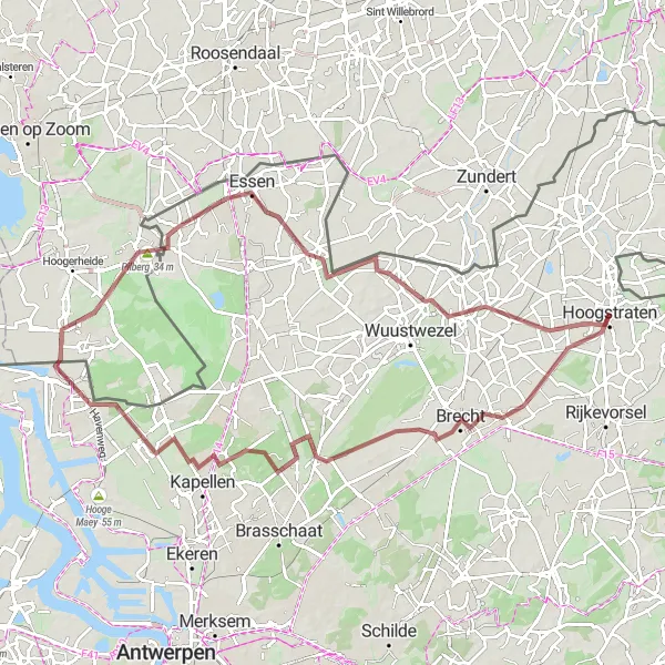
Cycle through scenic landscapes and visit historical landmarks on this gravel route starting near Hoogstraten.
Discover the beauty of Brecht and its surroundings on this 88km gravel cycling route. With a moderate difficulty level and an ascent of 112m, this ride takes you through picturesque countryside and charming towns such as Kapellen and Essen. Highlights along the route include the Pilberg, a hill offering stunning views at a distance of 53km from the start, and the Braken, a natural area known for its rich biodiversity at a distance of 76km. Overall, this route provides a perfect blend of natural beauty and historical landmarks.
Cycling routes nearby:

Nearby regions: