Cyclist's Paradise in Kdyně
Cycling routes from Kdyne
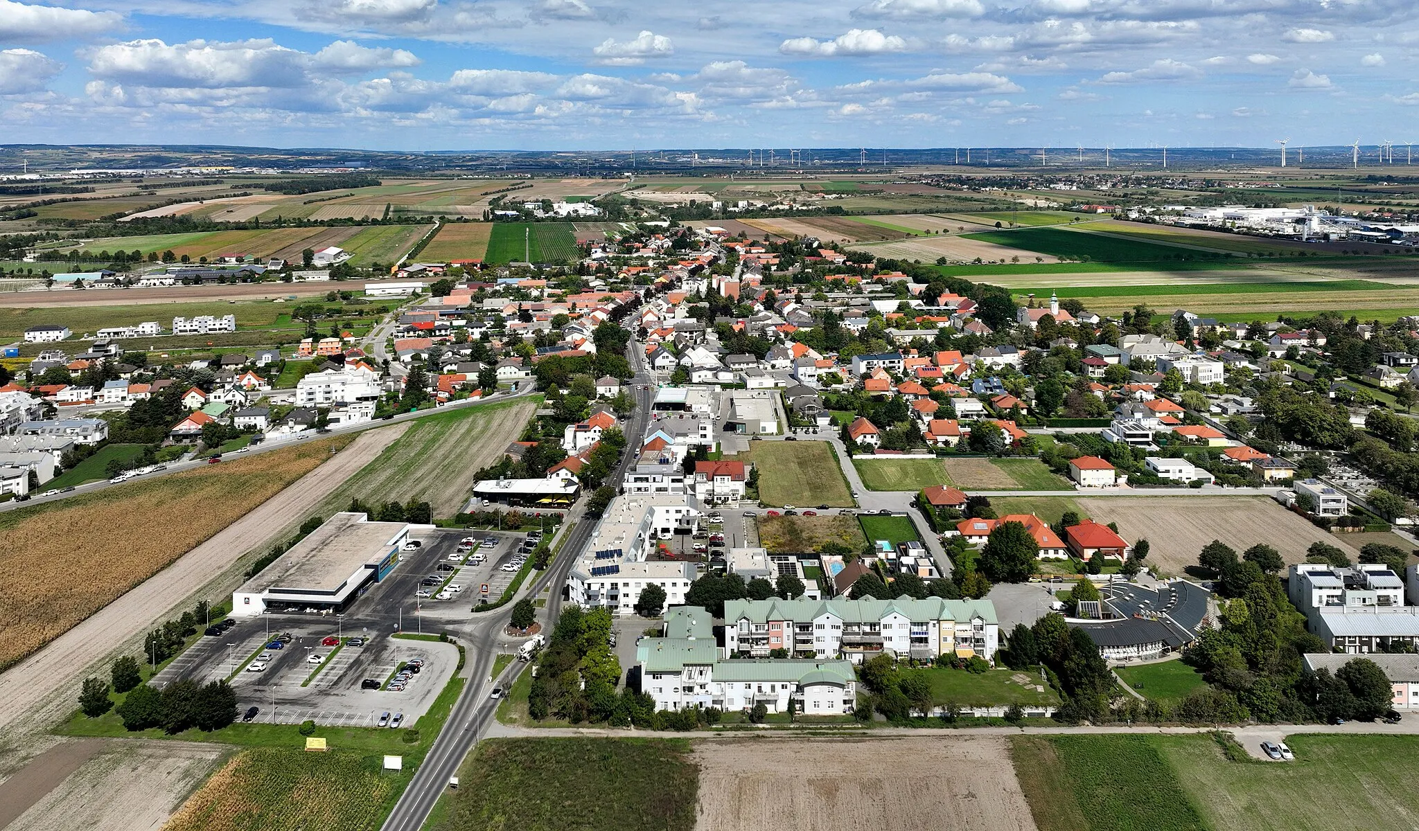
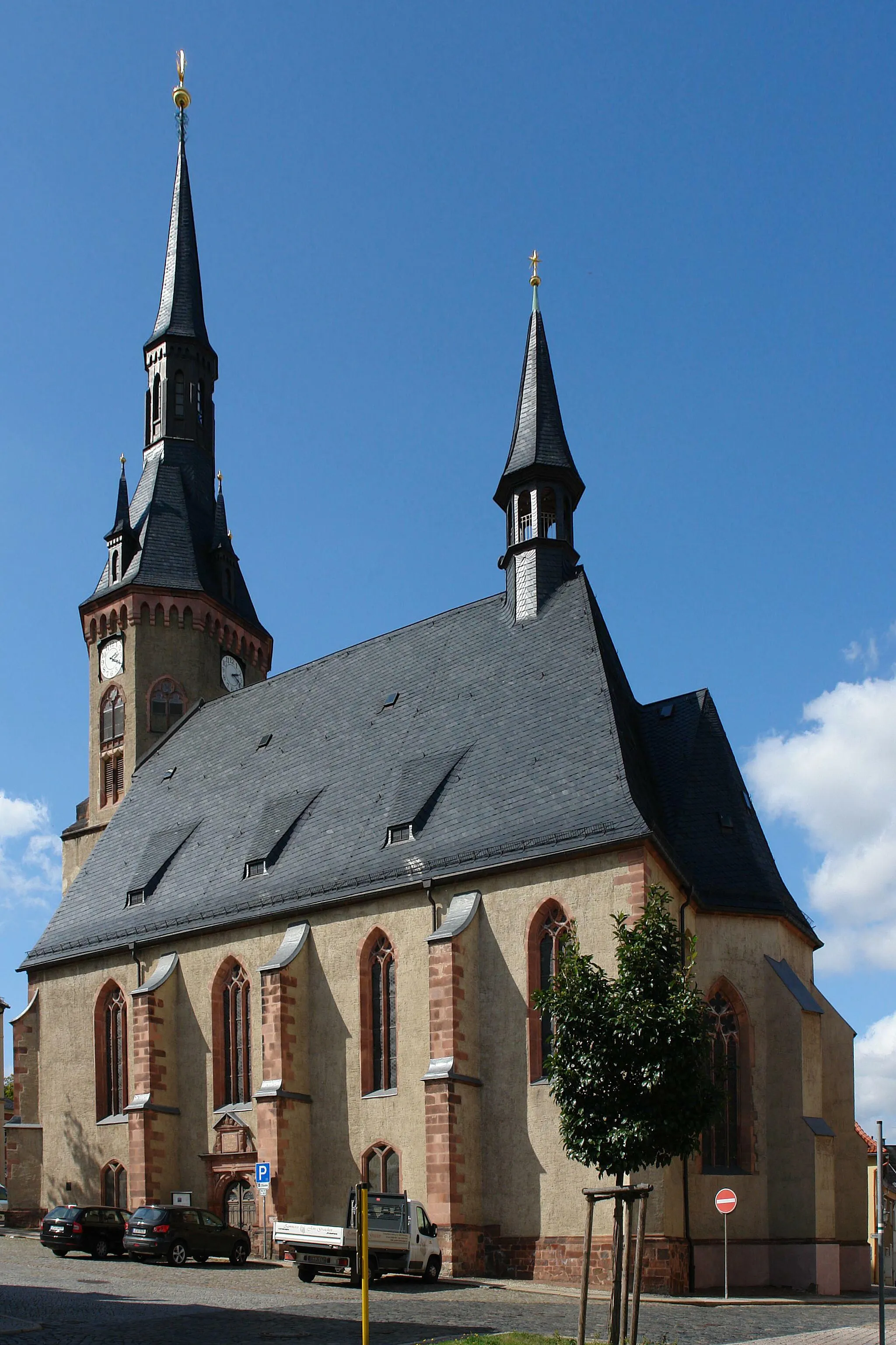
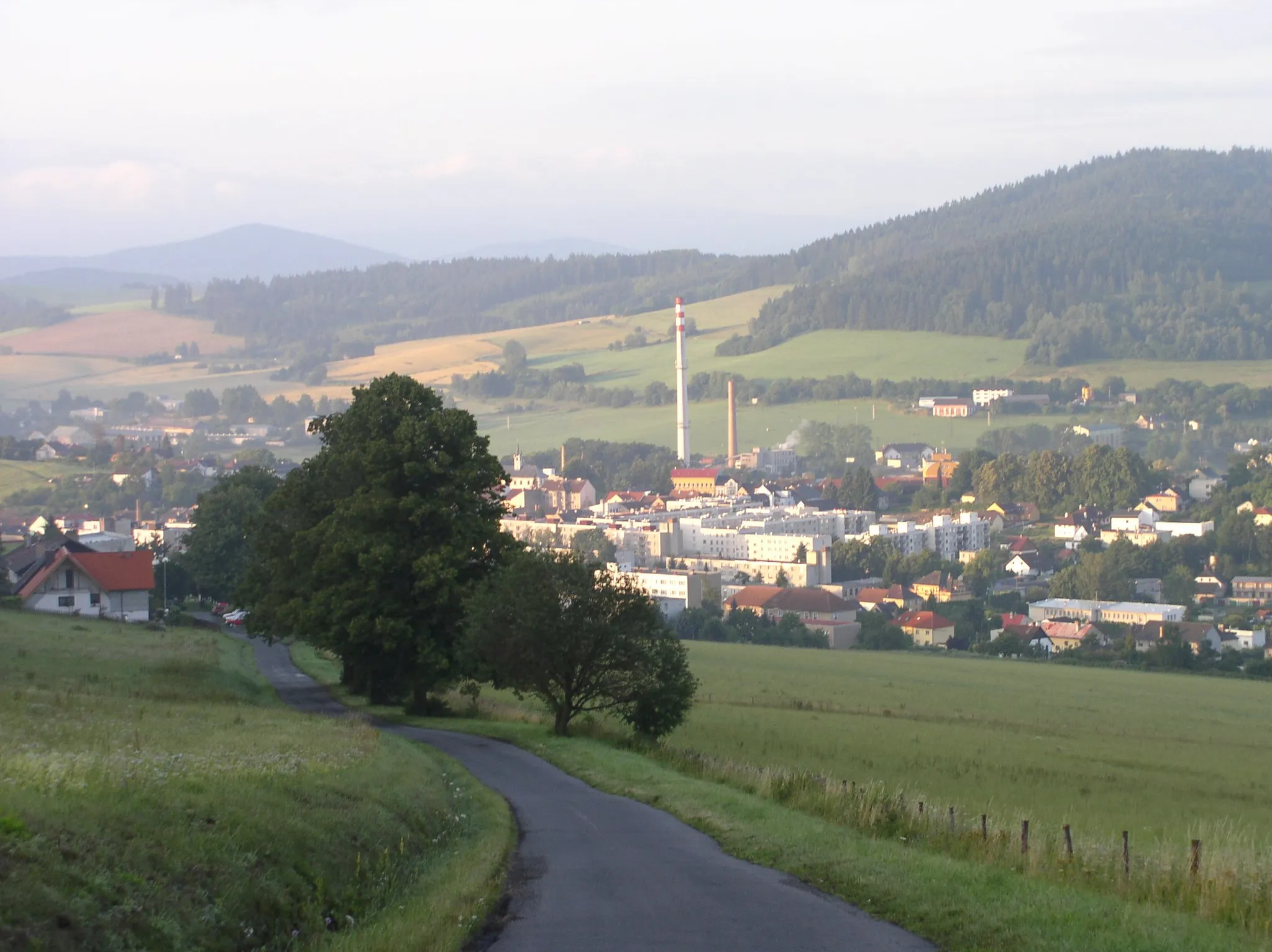
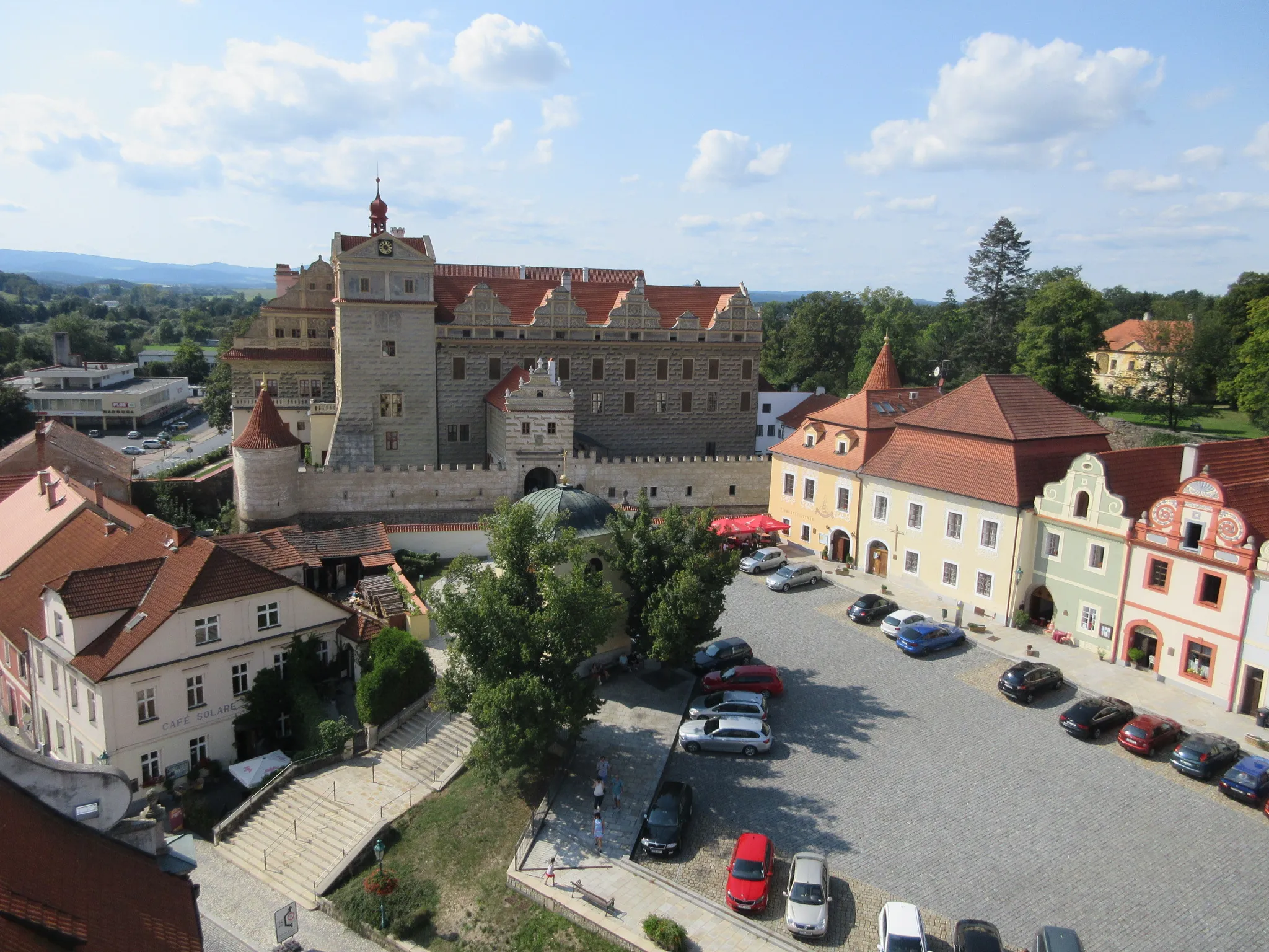
Kdyně is a small town located in the Jihozápad region of the Czech Republic. It offers a range of cycling opportunities for both road and gravel cyclists. The town is surrounded by scenic countryside, with picturesque views of rolling hills and lush forests. There are several popular cycling routes in the area, including the Kdyně Loop and the Lipka Trail, which offer a mix of challenging climbs and fast descents. Additionally, Kdyně is renowned for its proximity to well-known climbs like Hoštka and Kostekovice. Overall, Kdyně is a great locality for cyclists, with its beautiful landscapes and varied routes.
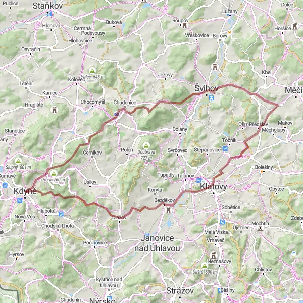
Experience the untouched beauty of the Czech countryside on this gravel cycling route from Kdyně to Čertův vrch, passing through Bolfánek and Soustov.
Starting in Kdyně, this gravel cycling route takes you on a journey through scenic countryside and hidden villages. Bolfánek offers breathtaking views of the surrounding landscape, while Soustov mesmerizes with its tranquility. The route includes a total ascent of 1170 meters and covers a distance of 66 kilometers. It is suitable for well-trained amateur cyclists seeking an adventurous ride in unspoiled nature.
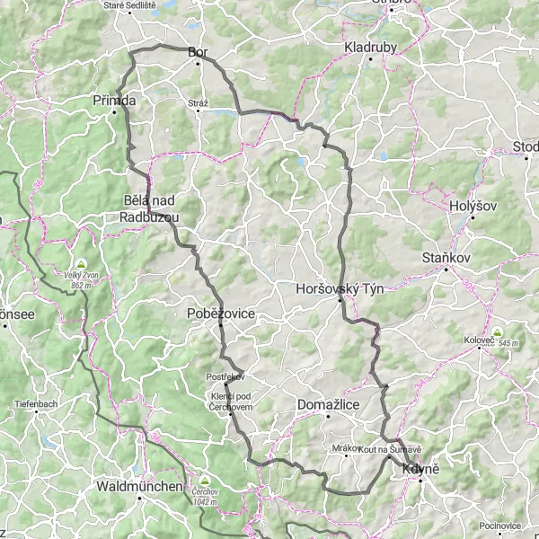
Embark on an exciting road cycling journey from Kdyně to Bílka, passing through Salka and conquering the legendary Staré Sedlo.
This road cycling route starts in Kdyně and takes you through picturesque villages and scenic countryside. As you pedal along, you'll encounter the breathtaking Salka, which offers stunning panoramic views. The legendary climb of Staré Sedlo awaits, providing a challenging but rewarding ascent. The route includes a total ascent of 1465 meters and covers a distance of 126 kilometers. It is suitable for well-trained amateur cyclists looking for a thrilling cycling adventure with epic climbs and beautiful landscapes.
Embark on an adventurous gravel ride from Kdyně to Čertův vrch, uncovering the beauty of Herštýn and Soustov along the way.
Starting in Kdyně, this thrilling gravel route takes you to Čertův vrch, passing through the enchanting Herštýn. As you pedal further, you'll encounter the scenic beauty of Soustov, with its stunning landscapes and rolling hills. The route includes a total ascent of 1003 meters and covers a distance of 48 kilometers. It is suitable for well-trained amateur cyclists seeking an epic adventure in the rugged countryside.
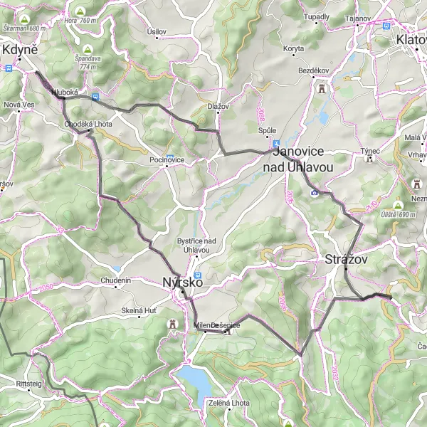
Embark on a scenic road cycling adventure from Kdyně to Javorice, passing through Únějovice and Chodská Lhota.
This road cycling route starts in Kdyně and takes you through picturesque villages and charming countryside settings. Únějovice offers traditional architecture and a peaceful atmosphere, while Chodská Lhota mesmerizes with its rolling hills and scenic beauty. The route includes a total ascent of 850 meters and covers a distance of 51 kilometers. It is suitable for well-trained amateur cyclists looking to explore the scenic beauty of the region.
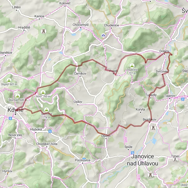
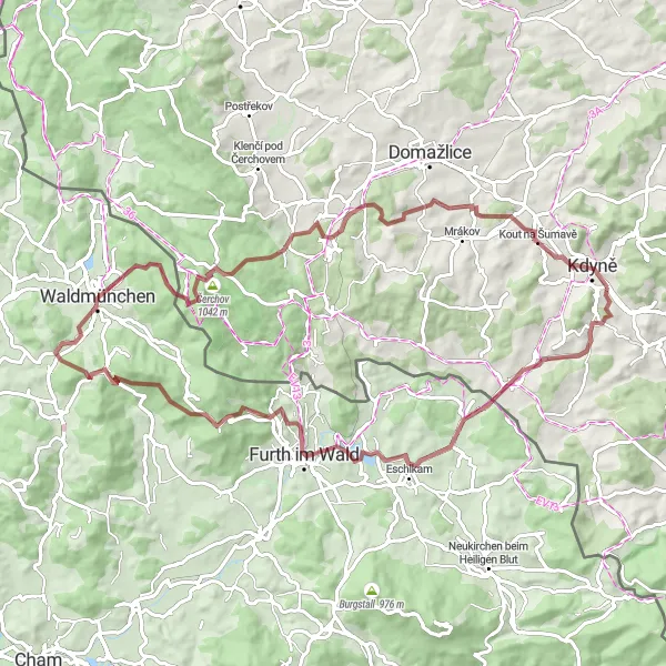
Embark on an exciting gravel adventure through the scenic landscapes of the Kdyně region.
This gravel cycling route takes you off the beaten path and into the wild nature of the Kdyně region. With a distance of 59 km and an ascent of 733 meters, this route is suitable for confident gravel riders. Rated with an epicness score of 3, it offers diverse terrain and beautiful natural surroundings. The difficulty level is assessed as 2, making it accessible for well-trained amateur riders seeking a new challenge.
Kdyně to Vojtěška Loop
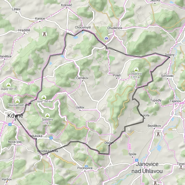
Discover the scenic beauty of the Kdyně region on this road cycling route.
This road cycling route takes you through the picturesque region around Kdyně, offering stunning views of the countryside and several highlights along the way. With a moderate difficulty level and a distance of 53 km, this route is suitable for well-trained amateur cyclists. The epicness of this route is rated at 3, as it provides a pleasant cycling experience without any particularly challenging sections.
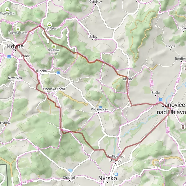
An off-road gravel route from Kdyně to Brnířov passing through majestic Koráb and picturesque Petrovice nad Úhlavou.
This off-road gravel route starts in Kdyně and takes you through the stunning Koráb, which offers panoramic views of the surrounding countryside. As you continue, you'll pass through the charming village of Petrovice nad Úhlavou, known for its historic castle and beautiful hiking trails. The route includes a total ascent of 687 meters and covers a distance of 40 kilometers. It is suitable for well-trained amateur cyclists and offers an epic experience with its breathtaking scenery.
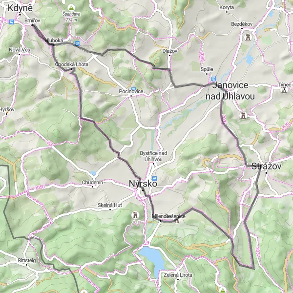
Experience a mix of challenging climbs and scenic landscapes on this long-distance road cycling route.
This road cycling route offers a perfect blend of challenging climbs and picturesque scenes, making it ideal for experienced cyclists seeking an adrenaline rush. With an ascent of 853 meters and a distance of 53 km, this route provides a good workout for well-trained amateur riders. Rated with an epicness score of 4, the route features a variety of landscapes, from rolling hills to stunning viewpoints. The difficulty level is assessed as 3, as it includes some demanding sections but is manageable with proper training.
Uncover the hidden gems of the Kdyně region on this road cycling route.
This road cycling route offers a unique opportunity to explore lesser-known locations in the Kdyně region. With a distance of 44 km and an ascent of 585 meters, this route is suitable for novice to intermediate cyclists. Rated with an epicness score of 2, it provides a pleasant cycling experience with some interesting points of interest along the way. The difficulty level is assessed as 2, making it accessible for amateurs. Expect charming villages, historic landmarks, and breathtaking views of the countryside.
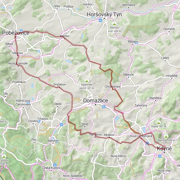
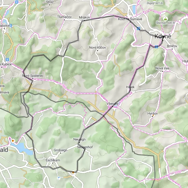
Embark on a challenging gravel adventure from Kdyně to Všeruby and back.
This gravel cycling route is designed for experienced riders seeking an intense challenge. With a distance of 79 km and an ascent of 1,648 meters, this route will push your limits. The epicness score is rated at 5, as it includes several legendary climbs and famous spots. The difficulty level is assessed as 5, making it suitable only for highly trained cyclists with advanced technical skills. Expect demanding terrains, steep climbs, and thrilling descents.
Cycling routes nearby:

Nearby regions: