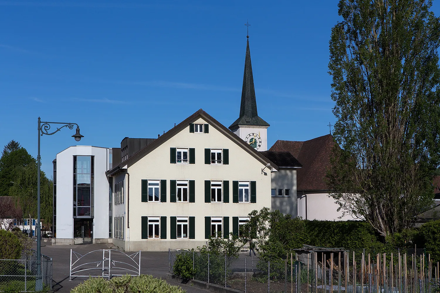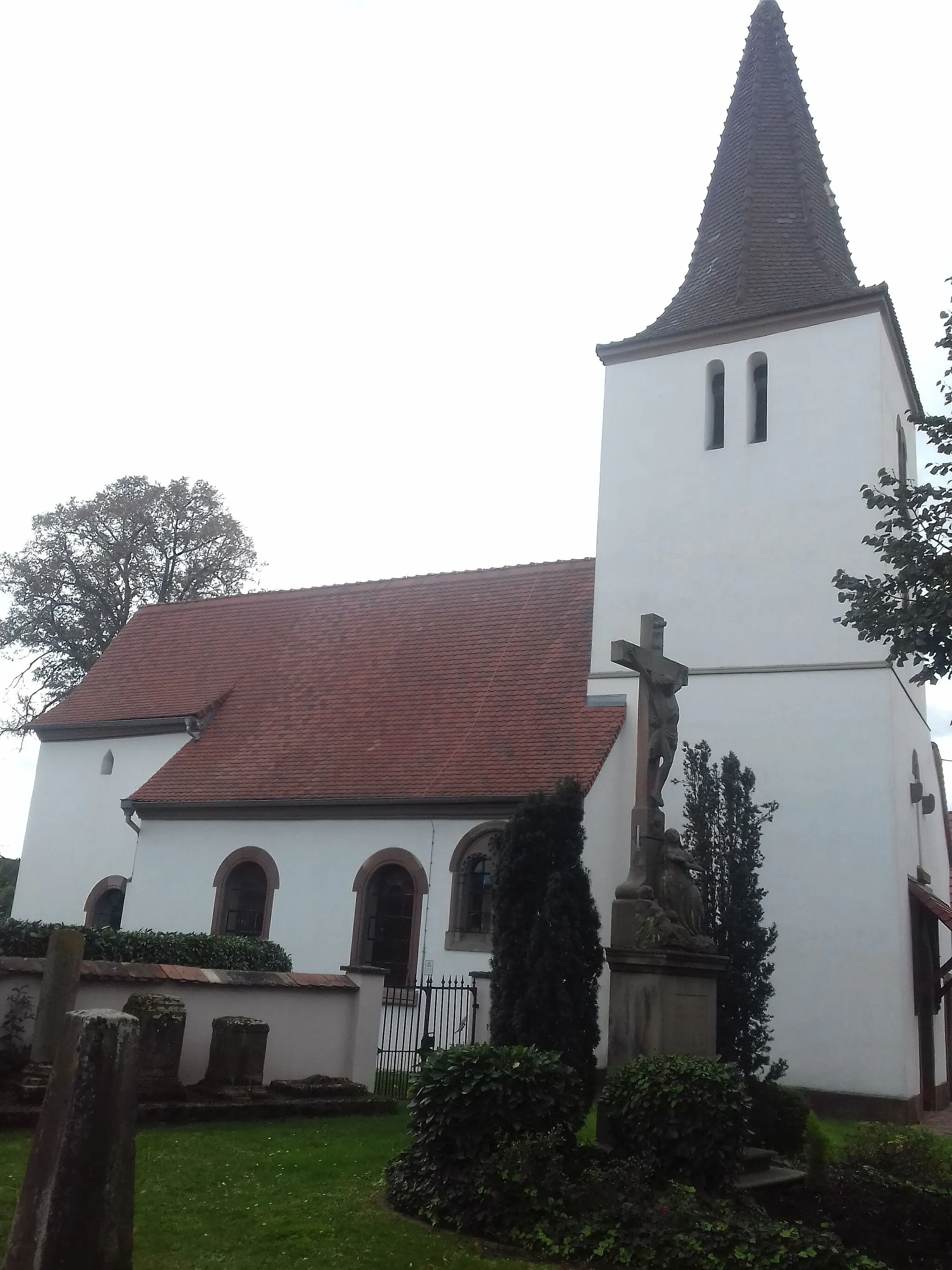
Immerse yourself in the beauty of Bischwiller in Alsace
Cycling routes from Bischwiller
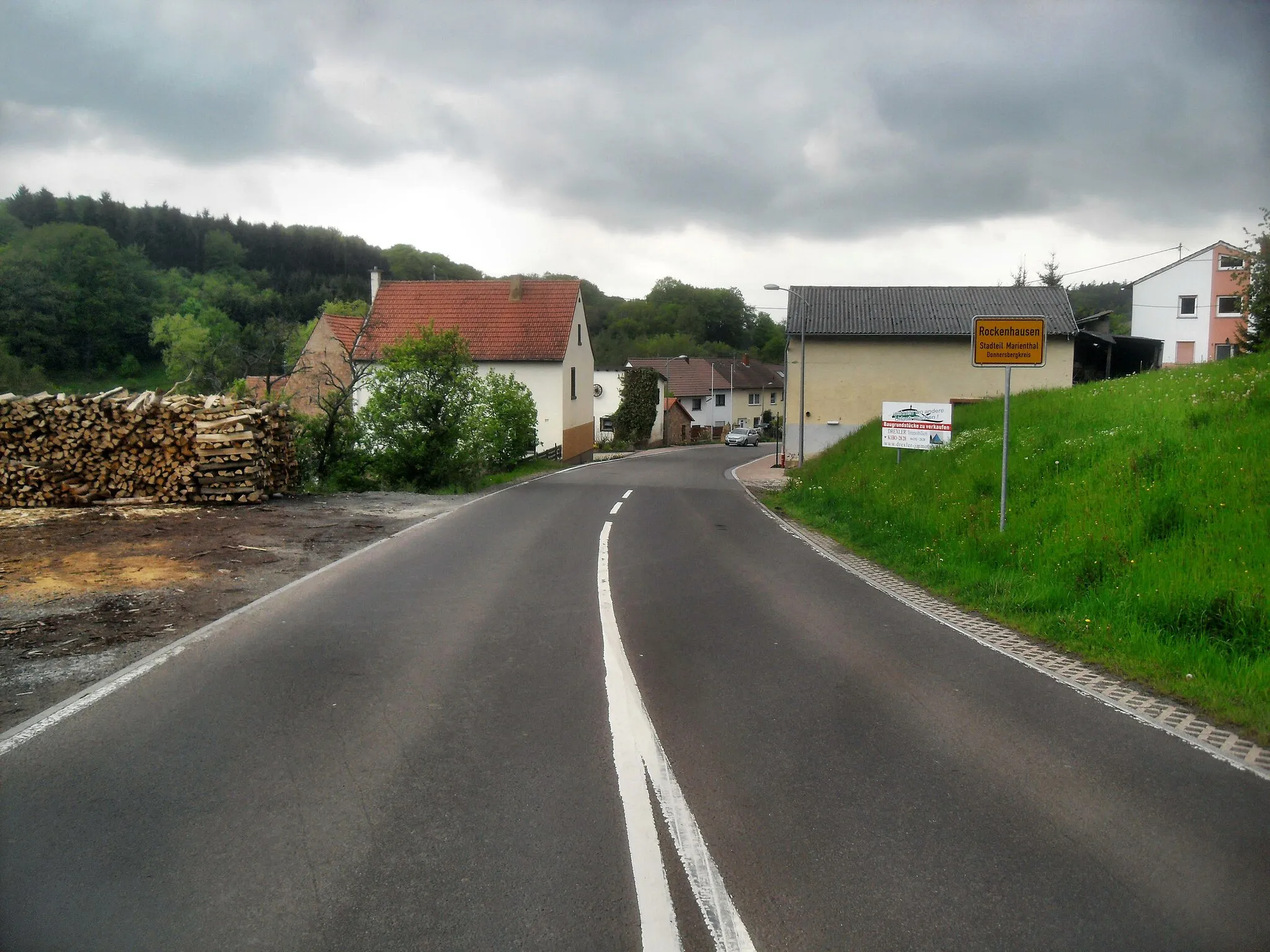
Bischwiller is a locality situated in the Alsace region of France. From a road and gravel cyclist's viewpoint, Bischwiller offers picturesque routes and quiet country roads to navigate. The area is known for its scenic vineyards and traditional villages, providing a charming backdrop for cycling adventures. While Bischwiller itself does not have any famous climbs, the nearby Mont Sainte-Odile provides a challenging ascent for those seeking a more intense cycling experience.
Gravel Adventure to Bischwiller
Embark on a thrilling gravel adventure to Bischwiller and its surroundings
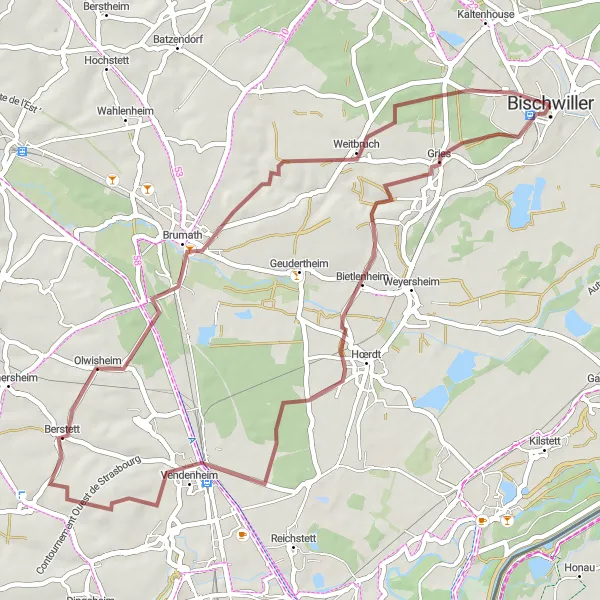
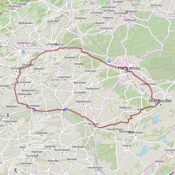
This gravel cycling route covers a distance of 49 km with an ascent of 232 m, offering a challenging yet rewarding ride through the scenic landscapes near Bischwiller. Explore highlights such as Bietlenheim, Berstett, Brumath, Weitbruch, and finally, Bischwiller itself.
Conquer the mountains around Bischwiller on this epic cycling challenge
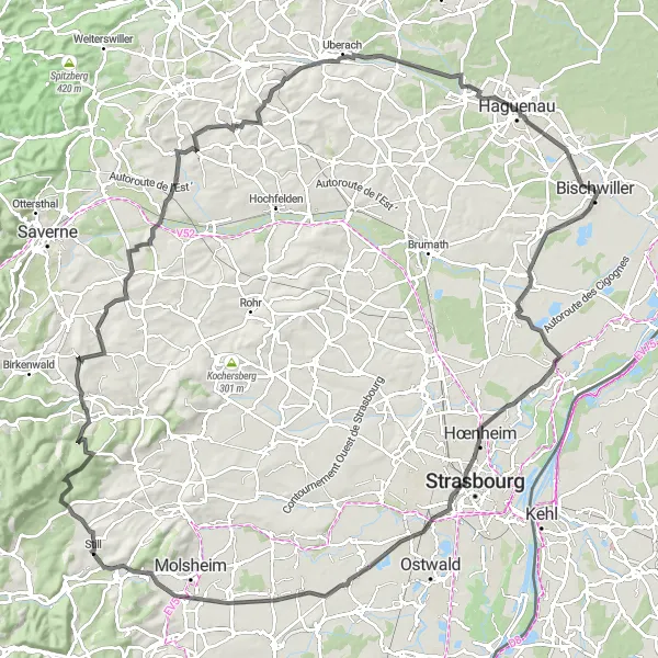
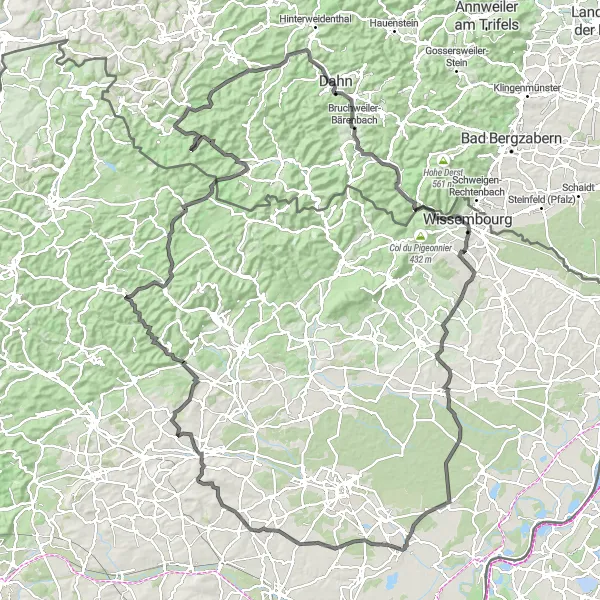
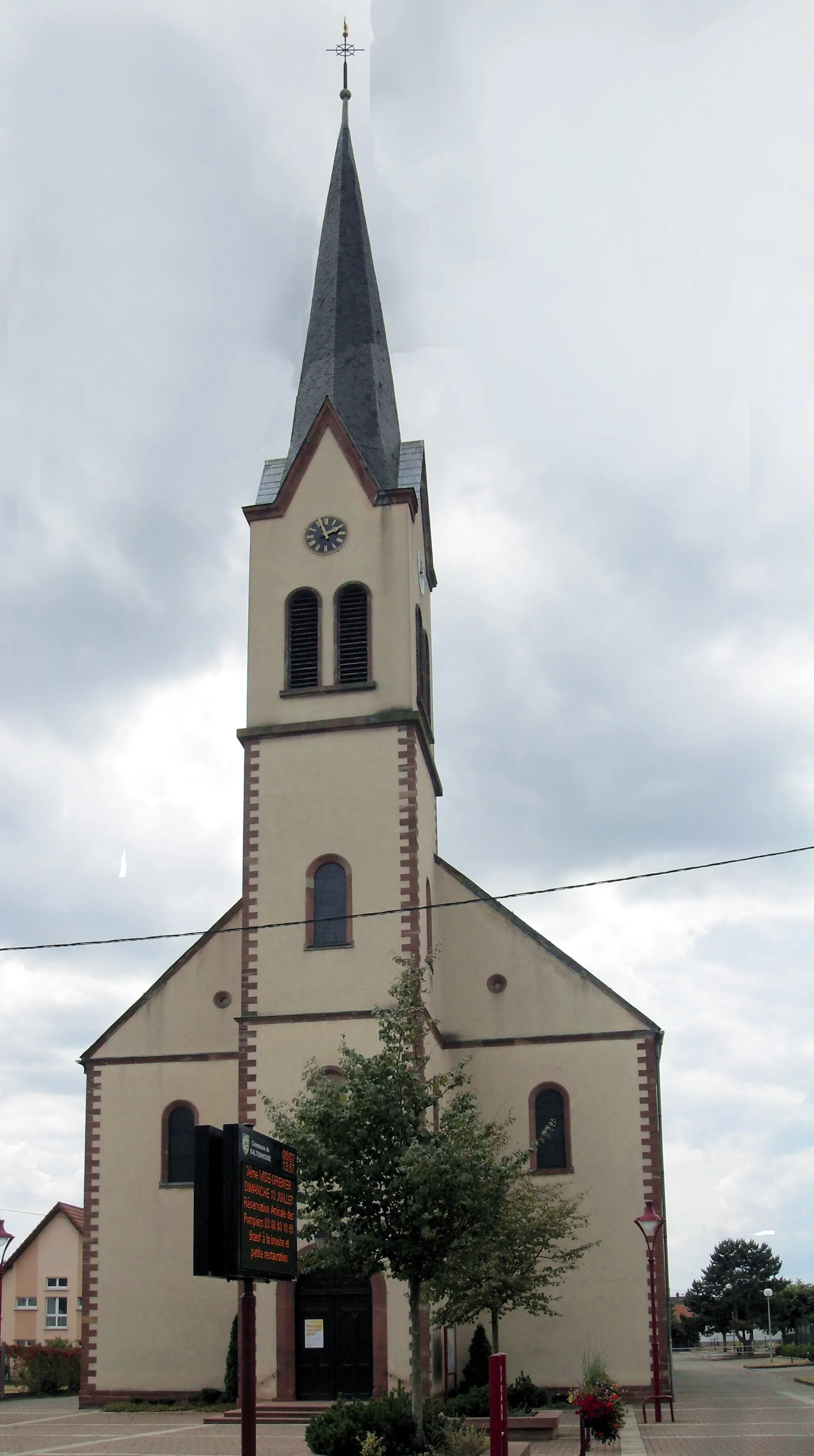
Experience the ultimate mountain challenge with this road cycling route near Bischwiller. With an ascent of 826 m and a distance of 132 km, this route is reserved for experienced cyclists seeking a thrilling adventure. Highlights include Weyersheim, La Wantzenau, Toit du Parking Wodli, Dorlisheim, Col du Schanz, Cosswiller, Gottesheim, Buswiller, Schweighouse-sur-Moder, and Kaltenhouse.
Explore the charming countryside of Alsace on this road cycling route
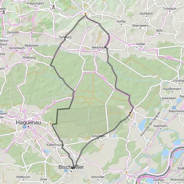
This road cycling route takes you through the scenic countryside of Alsace, starting near Bischwiller. Along the way, you'll pass through the picturesque Camp d'Oberhoffen and Surbourg, both offering beautiful views. The route includes some moderate ascent with a total of 265 meters. Overall, it's a great option for experienced cyclists looking to enjoy the beauty of this region.
Gravel Adventure in Alsace
Embark on an adventurous gravel cycling journey through the heart of Alsace
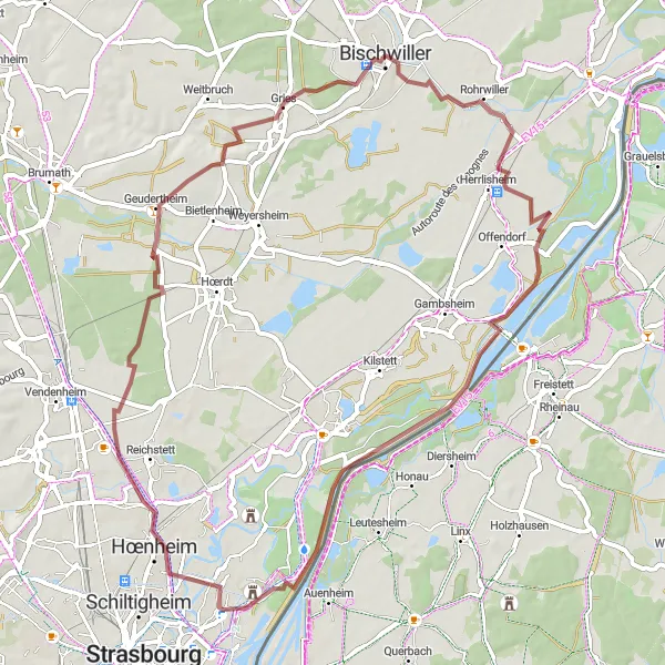
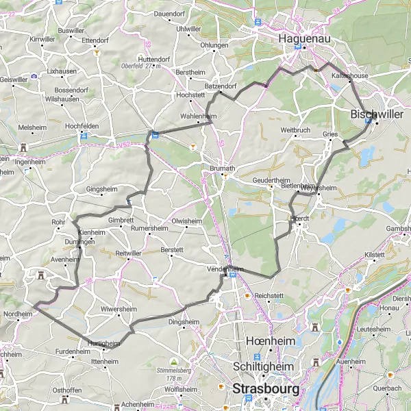
This gravel cycling route starting near Bischwiller takes you on an exciting adventure through the heart of Alsace. With a distance of 59 kilometers and a moderate ascent of 131 meters, it's a suitable option for gravel enthusiasts. On the way, you'll pass by Herrlisheim, a village known for its rich history and charming countryside views. The Micro Centrale Électrique, a small yet impressive hydroelectric power station, is another highlight along the route. As you continue, don't miss the chance to explore the grand Château de Pourtalès, nestled in a serene setting. The route concludes in Bischwiller, offering a satisfying end to your gravel adventure.
Embark on a grand tour around Bischwiller and nearby towns
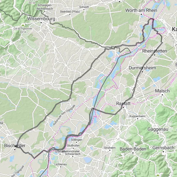
With a distance of 115 km and an ascent of 388 m, this road cycling route showcases the beauty of Bischwiller and its neighboring towns. Explore highlights like Soufflenheim, Wintzenbach, Neuburg am Rhein, Durmersheim, Rastatt, Greffern, and Rohrwiller, while enjoying moderately challenging terrain and breathtaking views.
Experience the beauty of Bischwiller and its neighboring towns
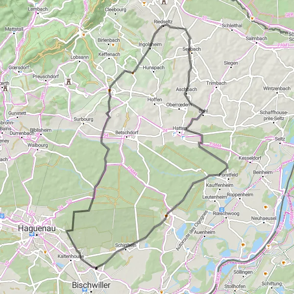
Cycle through the picturesque towns of Oberhoffen-sur-Moder, Reimerswiller, Riedseltz, Aschbach, Forstfeld, Soufflenheim, and Schirrhein on this road cycling route. With a total distance of 68 km and an elevation gain of 389 m, this route offers a moderately challenging ride with stunning countryside views.
Embark on a picturesque gravel tour with a memorable stop in Scherlenheim
Embark on a picturesque gravel tour starting from Bischwiller and culminating with a memorable stop in Scherlenheim. Covering a total distance of 66 km with an ascent of 320 m, this route offers a scenic journey through charming villages and beautiful countryside. Suitable for riders of intermediate level, this gravel tour promises a delightful combination of natural beauty and cultural heritage.
Embark on an epic road adventure culminating in Oberhoffen-sur-Moder
Take on the challenge of an epic scenic road adventure from Bischwiller to Oberhoffen-sur-Moder, covering a total distance of 160 km with an impressive ascent of 1743 m. Immerse yourself in the stunning landscapes of Alsace as you conquer this legendary route. Designed for experienced cyclists, this demanding route rewards with breathtaking views and plenty of exhilarating climbs. Prepare to be awed by the natural beauty and enjoy the sense of accomplishment as you reach your destination.
Experience a scenic road cycling adventure near Bietlenheim
Embark on a scenic road cycling adventure starting near Bietlenheim. With a total distance of 83 km and an ascent of 420 m, this route allows you to discover the charm of Alsace's picturesque countryside. Suitable for well-trained amateur cyclists, this route offers a combination of gentle slopes and scenic stretches along country roads. Immerse yourself in the natural beauty of the region and enjoy the rewarding challenges along the way.
Gravel Expedition to Bischwiller
Venture on a fascinating gravel expedition ending in Bischwiller
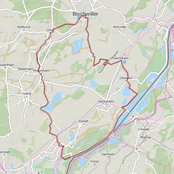
Embark on a captivating gravel expedition beginning near Bischwiller and covering a total distance of 46 km with an ascent of 97 m. Enjoy the varied terrain and immerse yourself in the beauty of the countryside as you pedal towards Bischwiller. Suitable for riders of all levels, this route promises to captivate and inspire with its scenic views and peaceful surroundings.
Cycling routes nearby:


Nearby regions: