Experience the diverse cycling routes and Alsatian charm in Vendenheim, Alsace.
Cycling routes from Vendenheim
Vendenheim is a small town located in the Alsace region of France. From a cyclist's perspective, this locality offers varied riding experiences suitable for different skill levels. The area provides a mix of flat terrain and gentle slopes, allowing for both leisurely rides and moderately challenging climbs. Vendenheim is surrounded by charming Alsatian villages known for their half-timbered houses and vineyards. Additionally, the region offers excellent cycling infrastructure and well-marked routes, making it easy for cyclists to navigate and explore. Overall, Vendenheim is an attractive destination for cycling enthusiasts looking to enjoy the scenic beauty of Alsace while still having diverse cycling options.
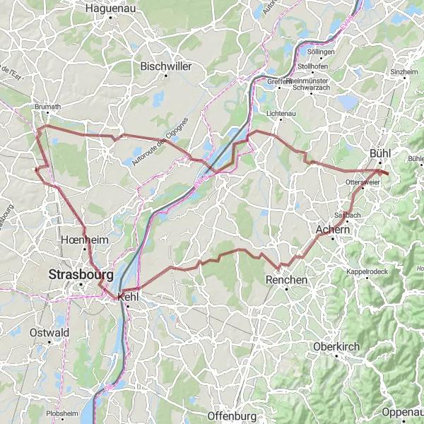
Explore the beautiful landscapes and vantage points from Vendenheim to Mirador de chasse.
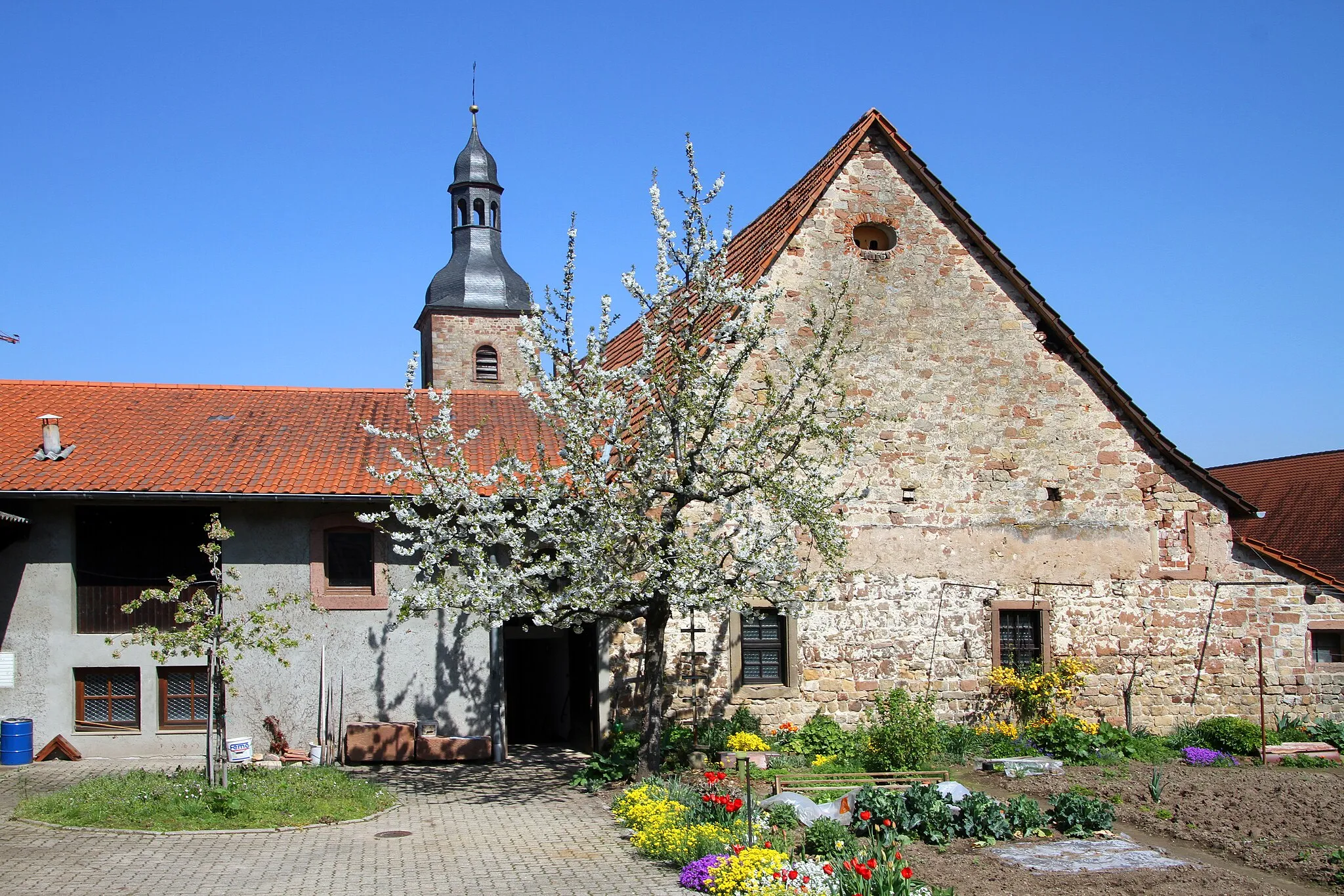
This cycling route takes you through the scenic countryside of Alsace, showcasing its natural beauty and charming villages. With a distance of 100 km and an ascent of 296 meters, this gravel route offers a moderate challenge for well-trained amateurs. Along the way, you'll pass through highlights such as Bietlenheim with its historic church, Gambsheim known for its picturesque surroundings, Hatzenweier offering breathtaking views, and Sasbach with its idyllic vineyards. Make sure to stop by Zierolshofen for a refreshing break before reaching the final destination of Mirador de chasse, a hidden gem offering stunning panoramic views.

Climb up the hills of Gingsheim and Zinswiller
This route takes you through the beautiful hills of Gingsheim and Zinswiller, offering stunning views of the Alsace countryside. The route has a moderate level of difficulty with a total ascent of 644 meters, making it suitable for well-trained amateur cyclists. The epicness level of this route is 3, offering a challenging but rewarding ride.
Gambsheim Loop
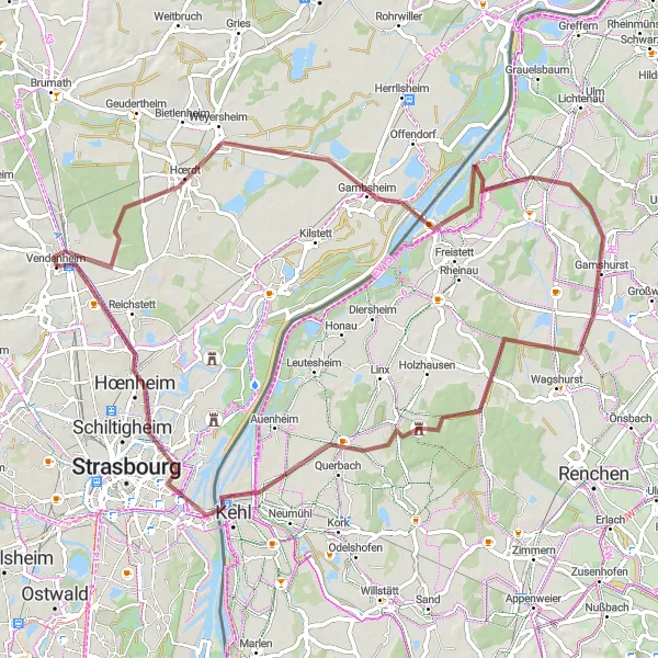
Discover the charm of Gambsheim on this scenic gravel route from Vendenheim.
This gravel route covers a distance of 74 km with an ascent of 204 meters. It is suitable for riders of moderate experience. The highlight of this route is the town of Gambsheim, known for its picturesque streets lined with traditional half-timbered houses and colorful flower boxes. The route also takes you through beautiful countryside, with rivers and small villages along the way.
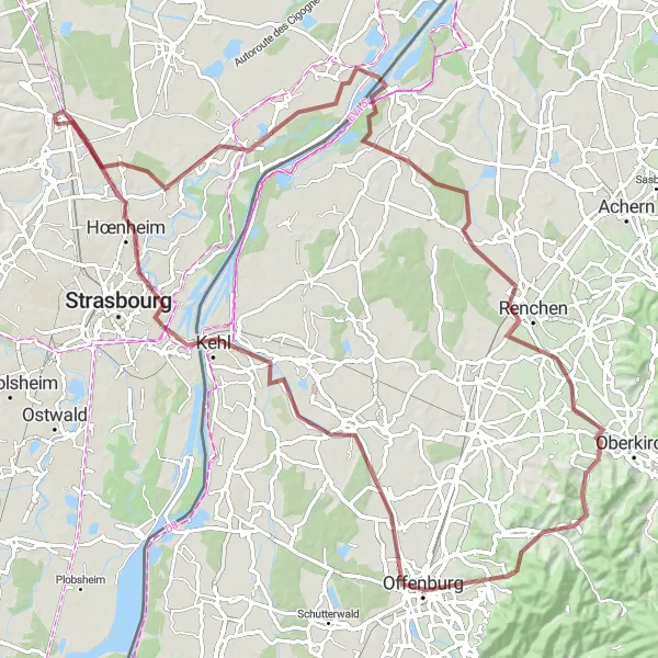
Cycle through picturesque villages and admire the scenic beauty on this gravel route from Vendenheim to Willstätt.
With a distance of 96 km and an ascent of 421 meters, this gravel route is suitable for experienced riders. The route passes through charming villages, including Kilstett, Renchen, Geigerskopf, and Durbach, offering a mix of natural beauty, vineyards, and historic landmarks. Willstätt is a highlight of this route, known for its well-preserved timber-framed houses and scenic surroundings.
Vendenheim to Hœrdt
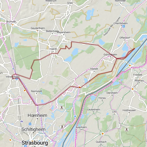
Experience the beauty and tranquility of the route from Vendenheim to Hœrdt.
This 45 km gravel route offers a leisurely ride through the scenic landscapes surrounding Vendenheim. With an ascent of 77 meters, it is suitable for cyclists of all levels. Along the way, you'll encounter highlights such as Gambsheim, known for its charming ambiance, Kilstett with its peaceful atmosphere, and Souffelweyersheim where you can explore its rich history. Enjoy the calmness of the rural countryside and take in the lush greenery. Whether you're looking for a relaxing ride or an opportunity to discover the hidden gems of Alsace, this route has something for everyone.
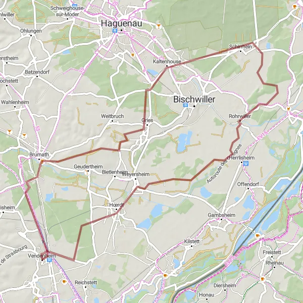
Embark on a gravel adventure through Kurtzenhouse and Schirrhein
This gravel cycling route takes you on an adventurous journey through the rustic villages of Kurtzenhouse and Schirrhein. With a total distance of 60 kilometers and an ascent of 147 meters, this route is suitable for intermediate-level gravel cyclists. Explore the picturesque landscapes of the Alsace region and experience the tranquility of rural life. The epicness level for this route is 2.
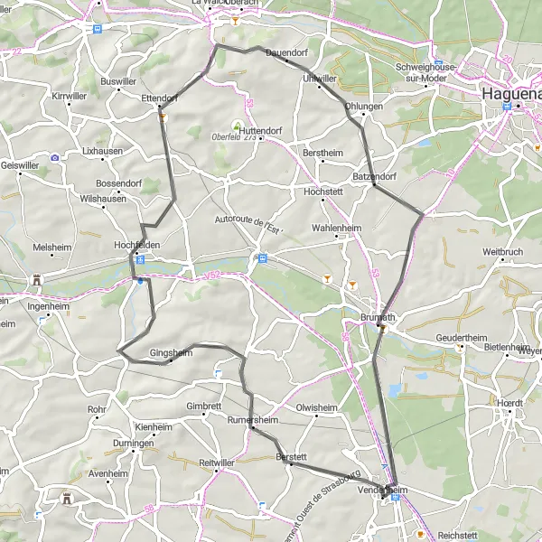
Discover hidden villages and Brumath Castle
This road cycling route takes you through hidden villages and leads to the majestic Brumath Castle. With a total distance of 60 kilometers and an ascent of 433 meters, this route offers a moderate level of difficulty. The route is quite scenic and picturesque, with stunning views of the Alsace countryside. The epicness level for this route is 3.
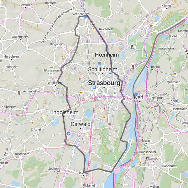
Enjoy a scenic road cycling tour around Vendenheim and its neighboring towns.
This road cycling route covers a distance of 55 km with a manageable ascent of 139 meters. It is suitable for all levels of riders, including beginners. The route takes you through the towns of Hœnheim, Eschau, Eckbolsheim, and Mundolsheim, showcasing the picturesque landscapes and cultural heritage of the region. Along the way, riders can enjoy charming architecture, historic landmarks, and tranquil settings.
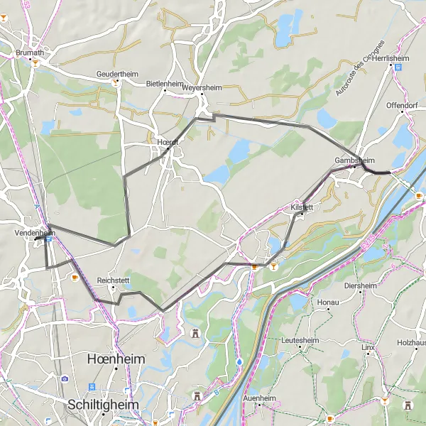
Discover the historic sights of Weyersheim
This road cycling route takes you on a journey of discovery through Weyersheim and its surrounding areas. With a total distance of 41 kilometers and a slight ascent of 39 meters, this route is suitable for leisurely rides and sightseeing. Explore the rich history of Weyersheim and visit its notable landmarks. The epicness level for this route is 2.
Vendenheim to Kienheim and back
Cycle through the scenic towns of Kienheim and Dettwiller on this gravel route near Vendenheim
This gravel route takes you through picturesque towns and countryside near Vendenheim. With a total distance of 61 km and an ascent of 420 meters, it is suitable for moderately experienced riders. The route offers a mix of scenic landscapes, including farms, vineyards, and forests.
Cycling routes nearby:


Nearby regions: