Langoiran - Cycling through vineyards and conquering challenging climbs
Cycling routes from Langoiran
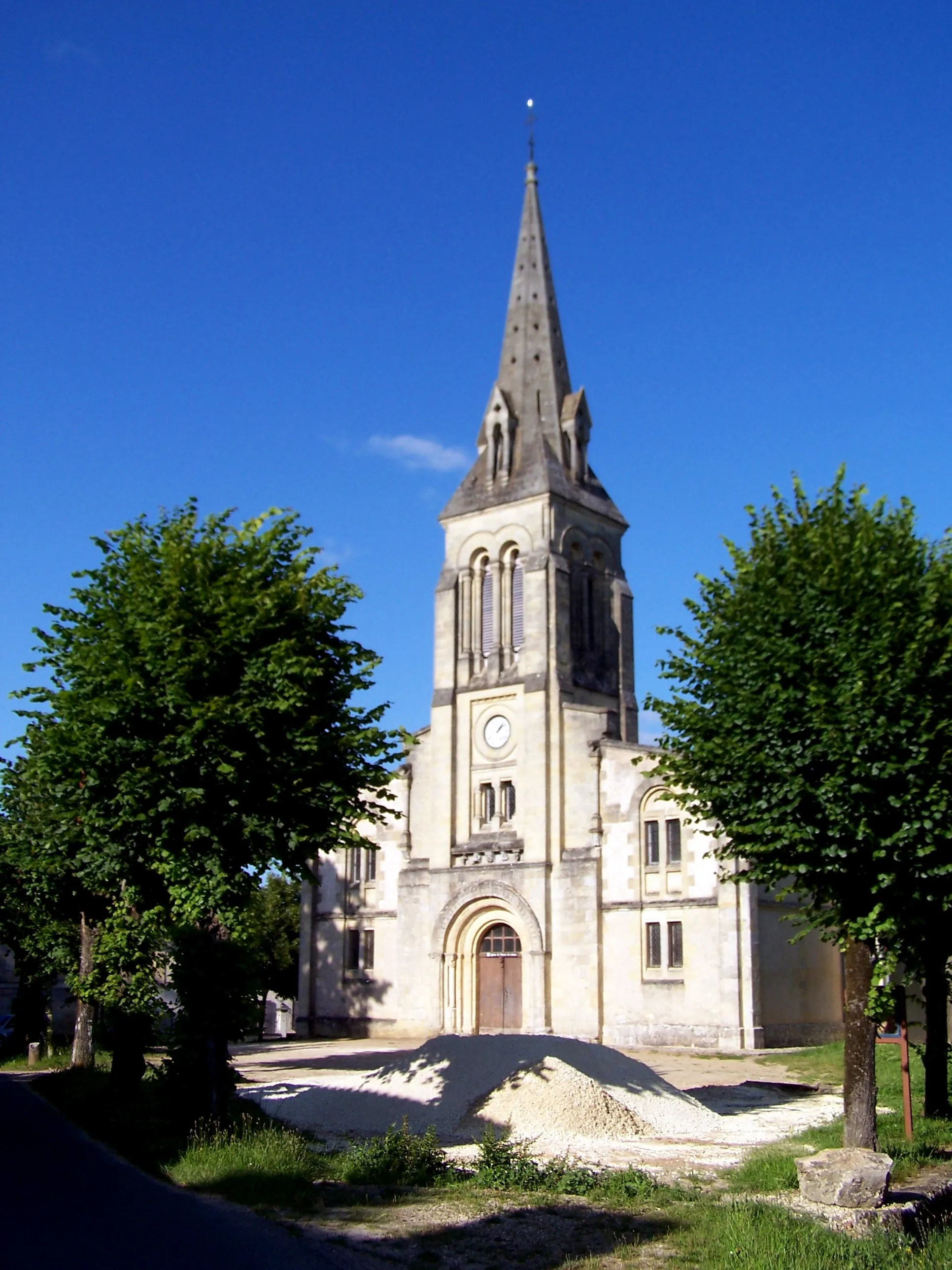
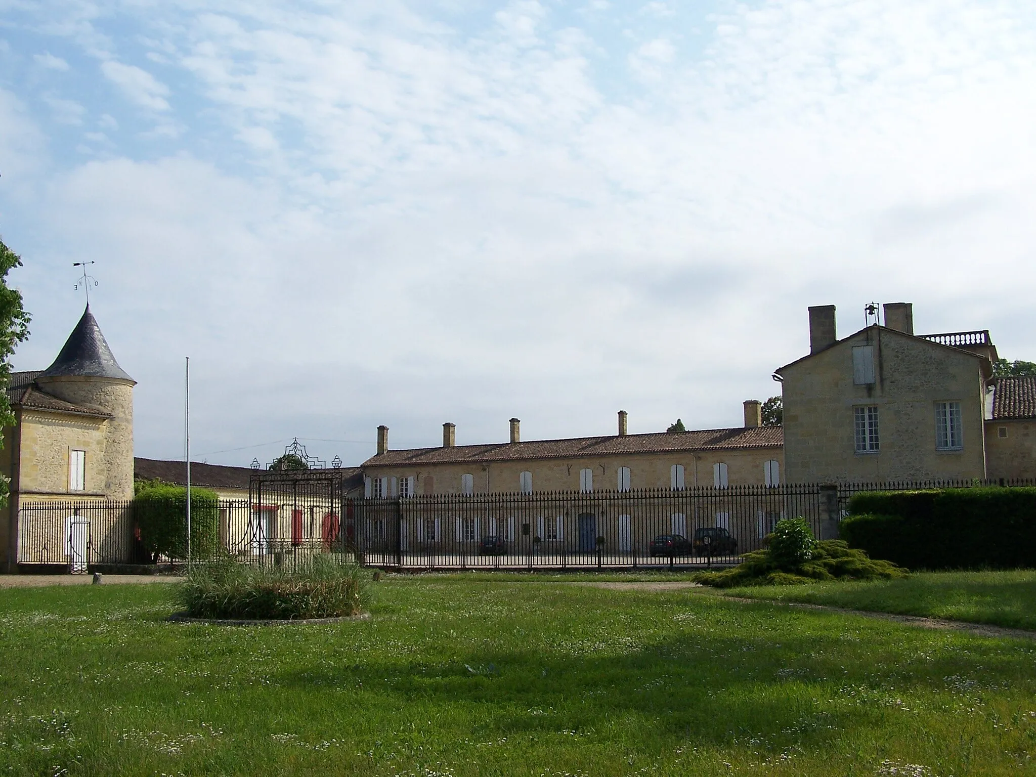
Langoiran, located in the Aquitaine region of France, is a scenic locality that provides road and gravel cyclists with an enjoyable riding experience. Situated on the banks of the Garonne River, Langoiran offers beautiful views of the surrounding vineyards and charming countryside. One of the famous cycling spots nearby is the Route des Vins de Bordeaux, where cyclists can ride through the prestigious vineyards of Bordeaux, tasting exquisite wines along the way. Langoiran is also home to a well-known climb, the Côte de Langoiran, which challenges cyclists with its steep gradient. With its picturesque landscapes and cycling-friendly routes, Langoiran is a great destination for cyclists of all levels.
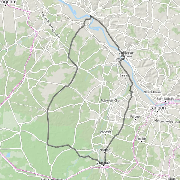
Indulge in the flavors of Aquitaine on this scenic road cycling route.
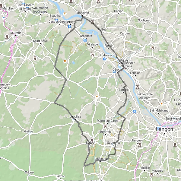
Embark on a wine-filled adventure starting from Langoiran. This 75 km road route takes you through picturesque vineyards and charming villages. With a total ascent of 249 meters, this ride offers a pleasant cycling experience suitable for all skill levels.
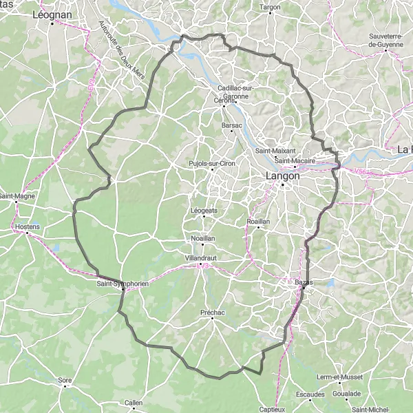
Embark on a historic cycling journey exploring the intriguing landmarks of Aquitaine.
Discover the fascinating history of Aquitaine on this 133 km road cycling route starting near Langoiran. Traverse through picturesque villages such as Bourideys and Louchats while taking in the breathtaking views. With a total ascent of 748 meters, this challenging ride is suitable for experienced cyclists.
Gravelto Ayguemorte-les-Graves
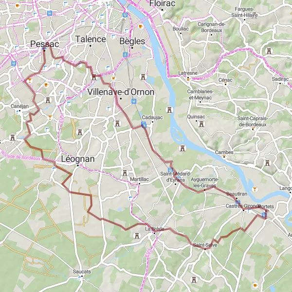
An adventurous gravel ride to Ayguemorte-les-Graves
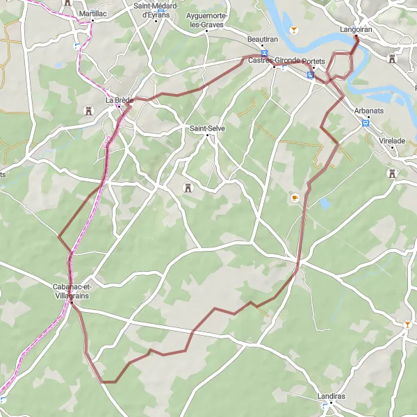
Embark on an exciting gravel ride starting near Langoiran and explore the scenic landscapes as you make your way to Ayguemorte-les-Graves. This route is suitable for experienced riders who enjoy off-road cycling. With a moderate ascent of 226 meters and a distance of 62 kilometers, this ride offers a challenging yet rewarding experience.
Exploring Rural Landscapes
Experience the beautiful countryside and charming villages near Langoiran.
This round-trip cycling route starting near Langoiran in Aquitaine, France takes you through picturesque rural landscapes and enchanting villages. The route offers a combination of quiet country roads and scenic gravel paths, providing a unique cycling experience for enthusiasts. The overall distance is approximately 50 kilometers, with a total ascent of 173 meters. Get ready to immerse yourself in the beauty of Aquitaine's countryside and discover the hidden gems along the way.
The Gravel Challenge
Experience the thrill of gravel cycling through picturesque villages and scenic trails.
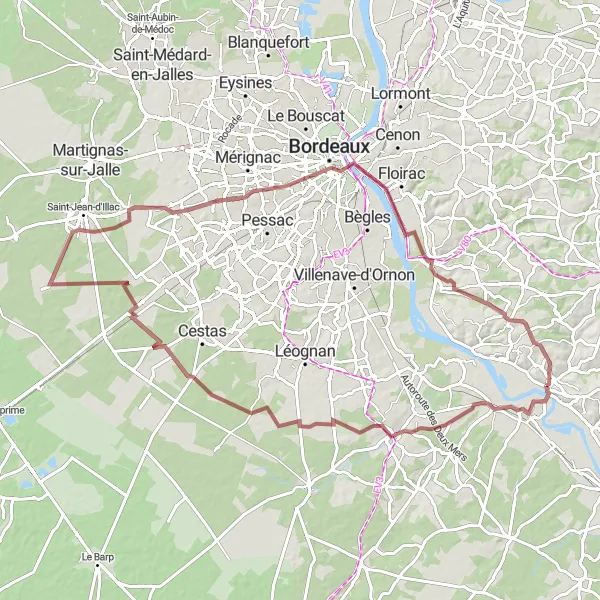
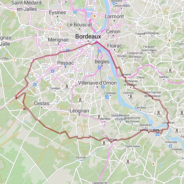
Embark on an exciting gravel adventure starting from Langoiran. This 91 km route takes you through beautiful landscapes, including the charming village of La Brède and the historic Tour Pey Berland in Bordeaux. With a total ascent of 278 meters, this ride is suitable for amateur cyclists looking for a moderate challenge.
Roads of Beauty
Immerse yourself in the stunning beauty of Aquitaine on this road cycling route.
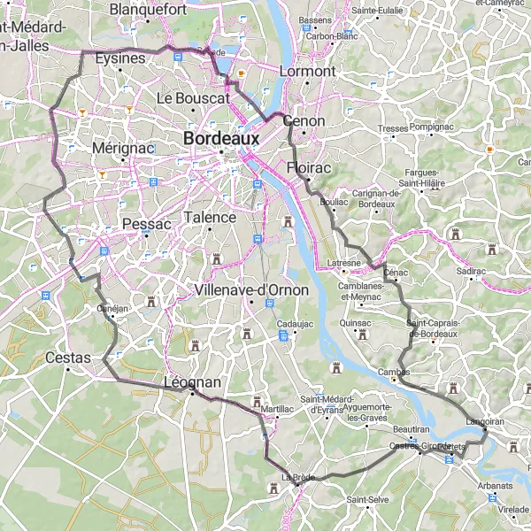
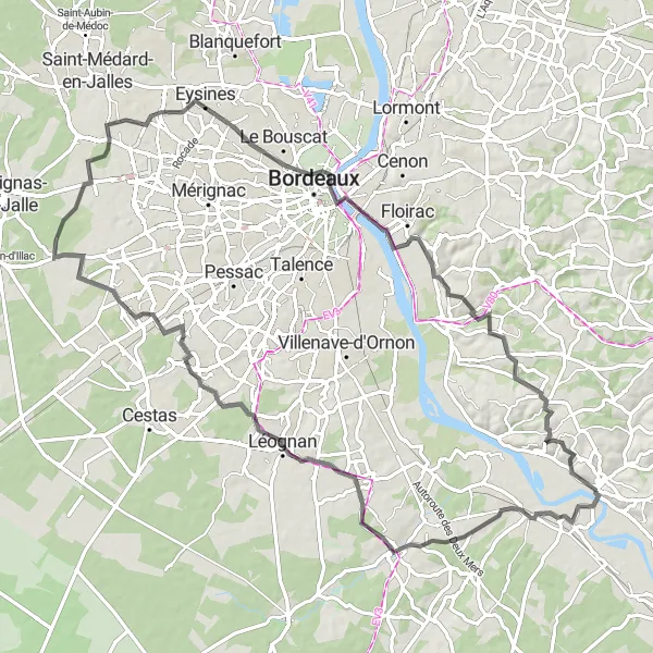
Embark on a scenic journey starting near Langoiran. This 89 km road route takes you through the captivating scenery of Château Belin and the majestic Jacques Chaban-Delmas Bridge. With a total ascent of 446 meters, this ride offers a moderate challenge for well-trained amateur cyclists.
Road to Langoiran
A scenic road ride to Langoiran
Embark on a scenic road ride to Langoiran, starting from Le Chene. With a moderate ascent of 244 meters and covering a distance of 62 kilometers, this route offers a delightful cycling experience through picturesque landscapes and charming villages.
Discover the charm of Saint-Caprais-de-Bordeaux on a thrilling gravel ride
Embark on an epic gravel adventure from Langoiran to Saint-Caprais-de-Bordeaux. Ride through scenic landscapes and charming villages as you cover a distance of 82 kilometers with an ascent of 243 meters. This route is perfect for experienced gravel riders looking for a challenging yet rewarding journey.
Uncover the hidden gems of Aquitaine on this road cycling route.
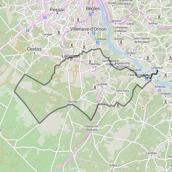
Experience the beauty of Aquitaine on this 78 km road cycling route starting from Langoiran. Discover the charming village of Saint-Morillon and the scenic Saucats while enjoying gentle rolling hills. With a total ascent of 248 meters, this ride is suitable for intermediate cyclists.
An adventurous road ride to Le Tourne
Get ready for an exciting road cycling adventure from Langoiran to Le Tourne. Covering a distance of 89 kilometers with an ascent of 466 meters, this route is perfect for experienced riders seeking a challenging and scenic journey. Enjoy the beautiful landscapes and discover the charm of the surrounding villages.
Cycling routes nearby:

Nearby regions: