![Cover image](https://images.tarmacs.app/cycling-routes/covers/france/aquitaine/trelissac-5.webp)
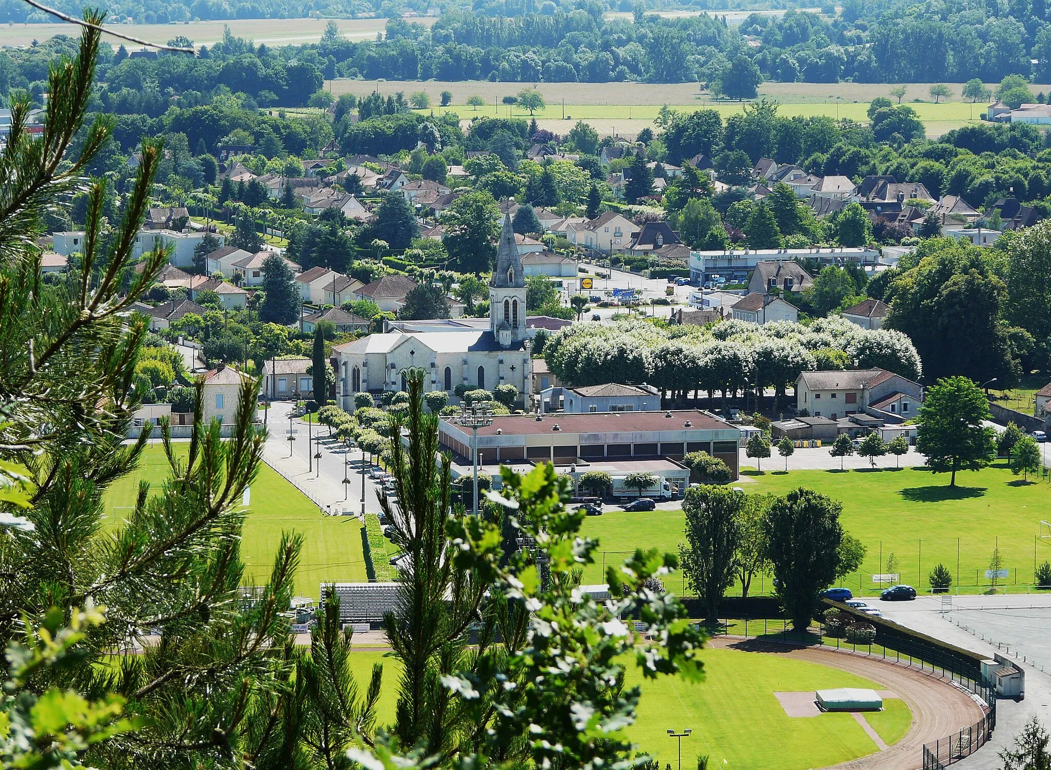
Explore the scenic countryside and legendary cycling routes of Trélissac.
Cycling routes from Trelissac
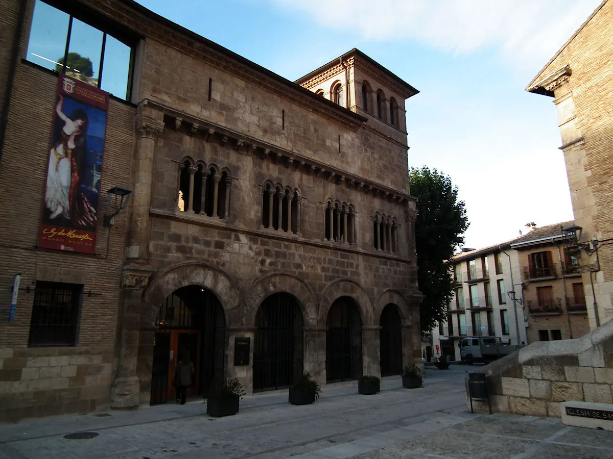
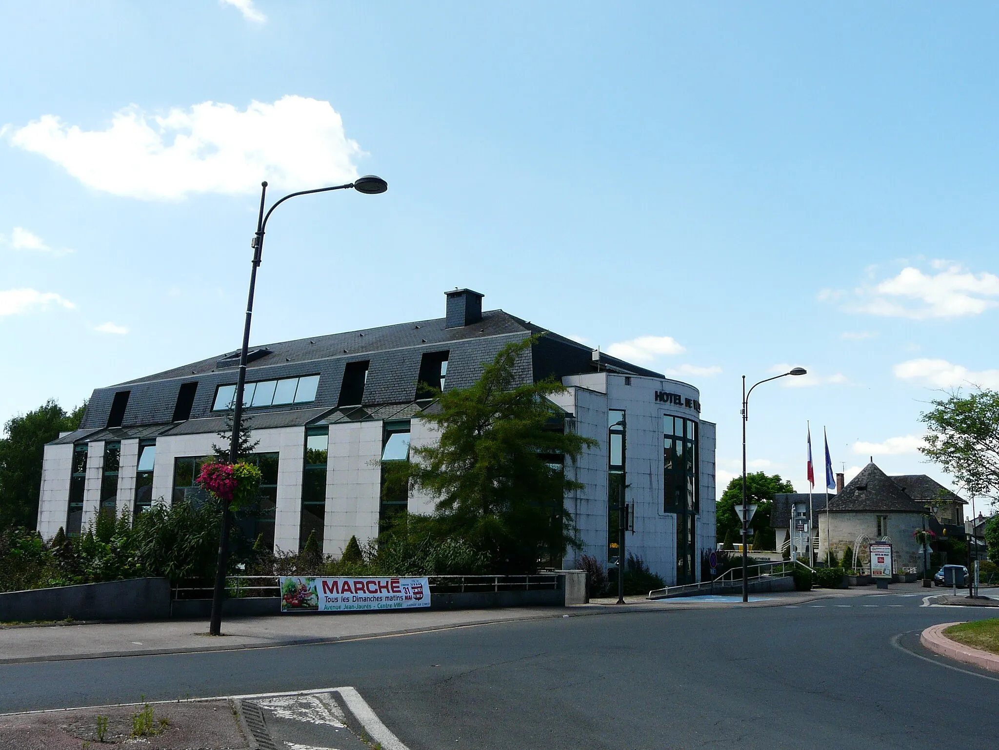
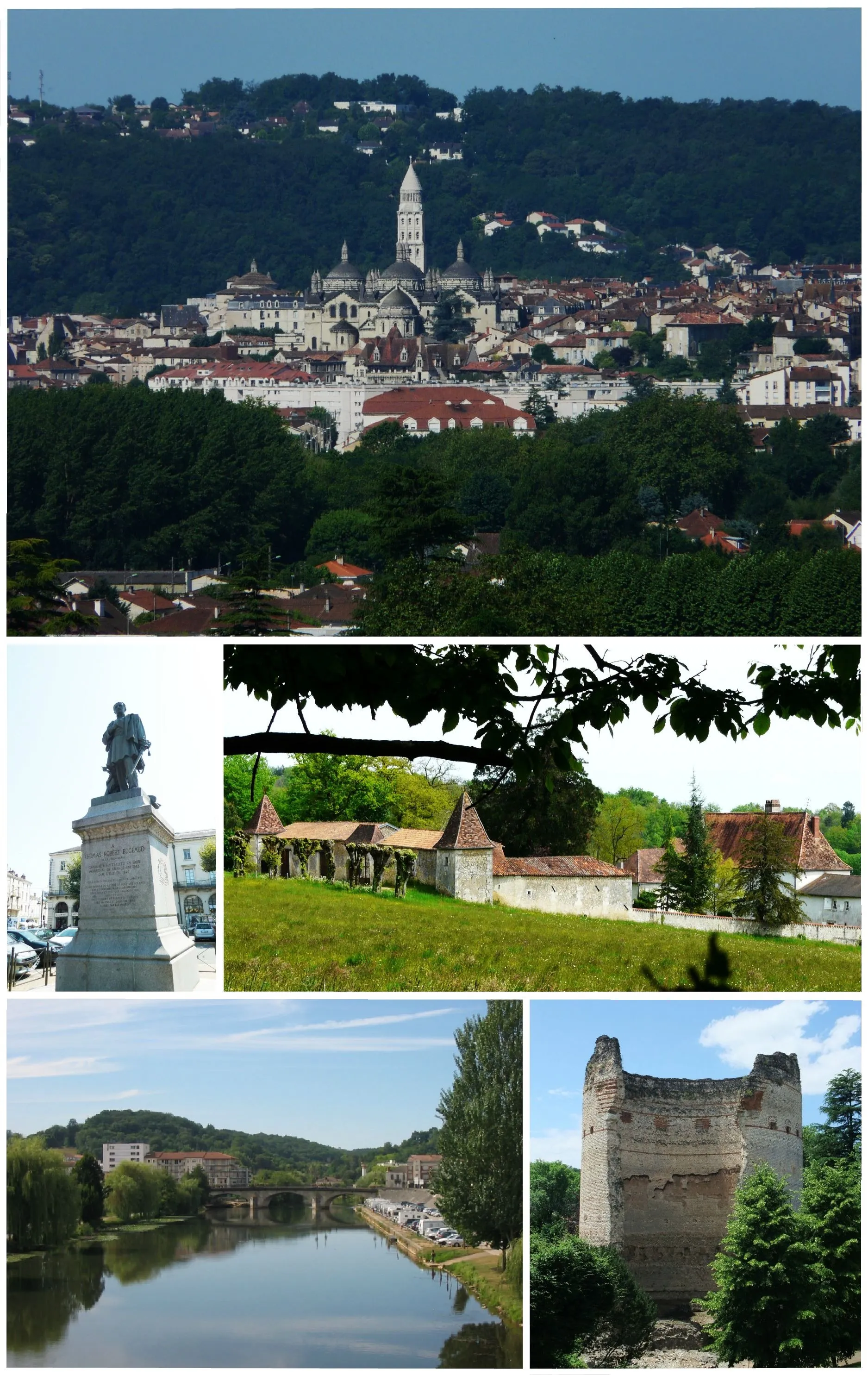
Trélissac, located in Aquitaine, France, offers a scenic and enjoyable cycling experience. The locality is surrounded by beautiful countryside, with rolling hills and charming villages to explore. The road and gravel cyclist will find a mix of quiet country roads and well-maintained gravel paths that provide both challenging climbs and relaxing rides. Trélissac is also home to several famous cycling routes, including the popular Circuit des Mont llv-pif. With its accessible and varied terrain, Trélissac is a fantastic destination for cyclists of all levels.
![Map miniature of "Gravel Adventure to Gabillou" cycling inspiration in Aquitaine, France. Generated by Tarmacs.app cycling route planner](https://images.tarmacs.app/cycling-routes/routemaps/600/france/aquitaine/trelissac/gravel/338943.webp)
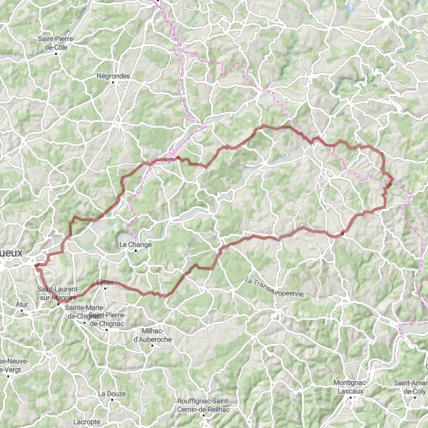
Embark on an epic gravel adventure to Gabillou through beautiful landscapes.
Get off the beaten path and feel the thrill of gravel riding with this 104-kilometer route to Gabillou. With an ascent of 1456 meters, this route provides a challenging and adventurous experience for seasoned cyclists.
![Map miniature of "Countryside Charm and Serene Rivers" cycling inspiration in Aquitaine, France. Generated by Tarmacs.app cycling route planner](https://images.tarmacs.app/cycling-routes/routemaps/600/france/aquitaine/trelissac/road/338939.webp)
Immerse yourself in the tranquility of the Aquitaine countryside on this road cycling route.
Discover the rustic countryside charm of the Aquitaine region on this road cycling route. With a total distance of 64 kilometers and an ascent of 719 meters, this route is suitable for intermediate cyclists. Experience the beauty of serene rivers, idyllic villages, and rolling hills as you pedal through the heart of Aquitaine.
![Map miniature of "Exploring the Dordogne Valley" cycling inspiration in Aquitaine, France. Generated by Tarmacs.app cycling route planner](https://images.tarmacs.app/cycling-routes/routemaps/600/france/aquitaine/trelissac/gravel/338991.webp)
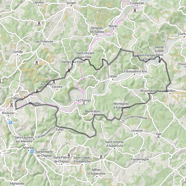
Embark on a gravel adventure through the picturesque Dordogne Valley.
This gravel route takes you through the stunning Dordogne Valley, known for its dramatic limestone cliffs and charming medieval villages. With a total distance of 86 kilometers and an ascent of 1016 meters, this route is suitable for well-trained amateurs. Experience the thrill of cycling through breathtaking landscapes and discover fascinating cultural highlights along the way.
![Map miniature of "Château-l'Évêque and Eyvirat Circuit" cycling inspiration in Aquitaine, France. Generated by Tarmacs.app cycling route planner](https://images.tarmacs.app/cycling-routes/routemaps/600/france/aquitaine/trelissac/road/338918.webp)
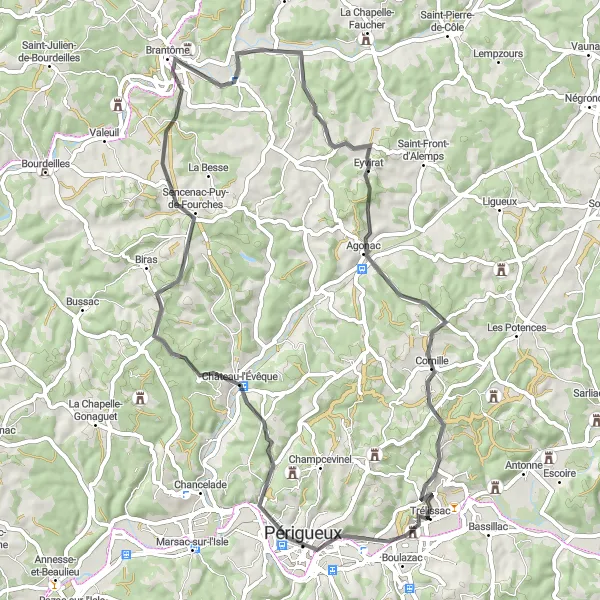
Discover Château-l'Évêque and Eyvirat on this picturesque cycling route near Trélissac.
Immerse yourself in the charming landscapes and cultural attractions of Château-l'Évêque and Eyvirat with this 62-kilometer route. With an ascent of 714 meters, this route offers a moderate challenge for cyclists.
![Map miniature of "Trélissac and Savignac-les-Églises Loop" cycling inspiration in Aquitaine, France. Generated by Tarmacs.app cycling route planner](https://images.tarmacs.app/cycling-routes/routemaps/600/france/aquitaine/trelissac/road/338920.webp)
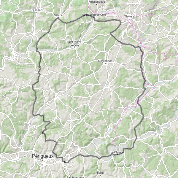
Ride through picturesque countryside from Trélissac to Savignac-les-Églises.
This scenic route takes you through Aquitaine's beautiful countryside, passing through charming villages and showcasing the region's natural beauty. With a total distance of 110 kilometers and an ascent of 1426 meters, this route offers a moderate challenge to riders.
![Map miniature of "Trélissac to Champcevinel Ride" cycling inspiration in Aquitaine, France. Generated by Tarmacs.app cycling route planner](https://images.tarmacs.app/cycling-routes/routemaps/600/france/aquitaine/trelissac/road/338900.webp)
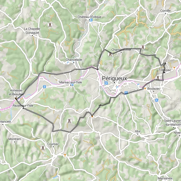
Cycle from Trélissac to Champcevinel and discover the region's charming towns.
Embark on a leisurely ride from Trélissac to Champcevinel and explore the picturesque towns along the way. With a total distance of 43 kilometers and an ascent of 531 meters, this route is ideal for cyclists looking for a pleasant and scenic journey.
![Map miniature of "Trélissac to Château de Glane Loop" cycling inspiration in Aquitaine, France. Generated by Tarmacs.app cycling route planner](https://images.tarmacs.app/cycling-routes/routemaps/600/france/aquitaine/trelissac/road/338965.webp)
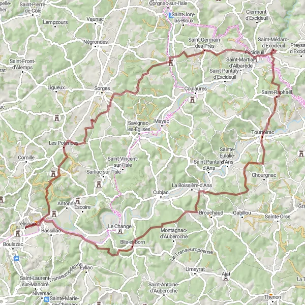
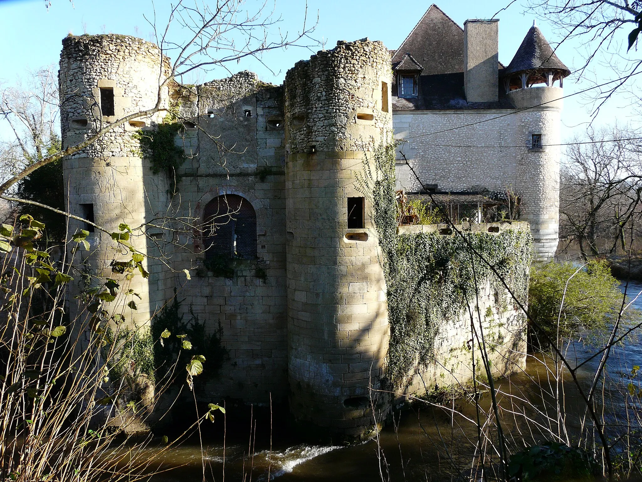
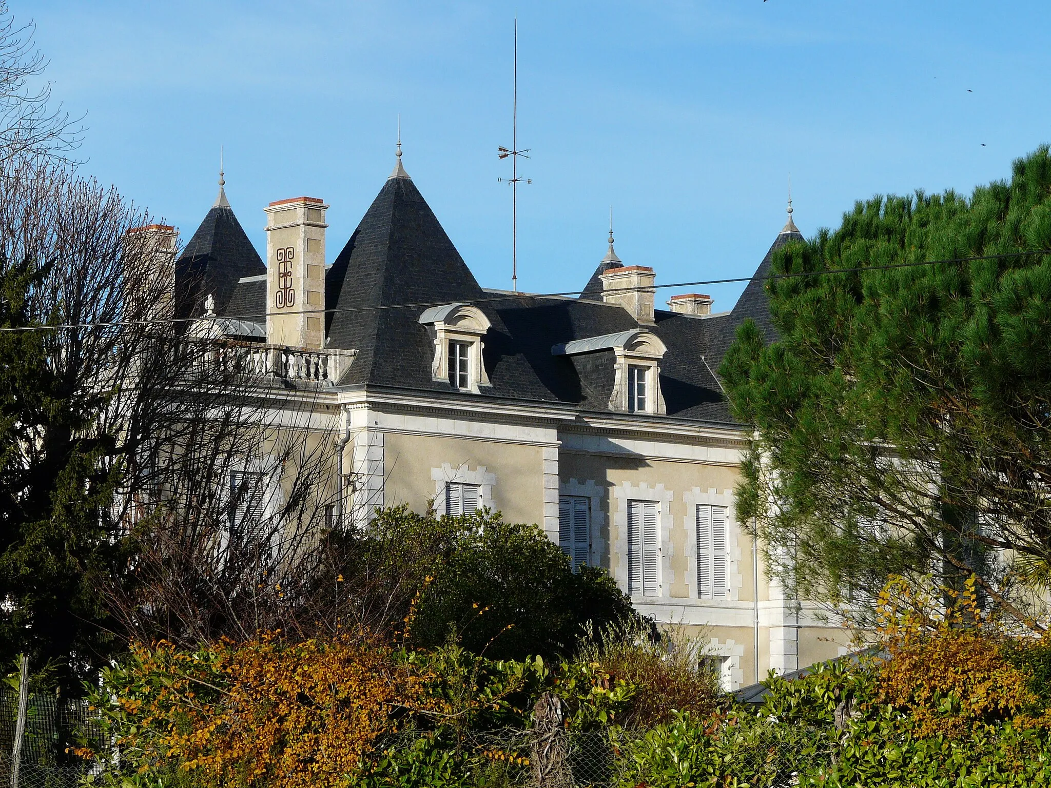
Explore scenic roads to reach the historical Château de Glane
This round-trip cycling route takes you from Trélissac to the majestic Château de Glane and back. The route covers a distance of 100 kilometers with a total ascent of 1037 meters. It provides a diverse blend of landscapes, charming villages, and stunning viewpoints.
![Map miniature of "Trélissac to Château Magne Route" cycling inspiration in Aquitaine, France. Generated by Tarmacs.app cycling route planner](https://images.tarmacs.app/cycling-routes/routemaps/600/france/aquitaine/trelissac/road/338940.webp)
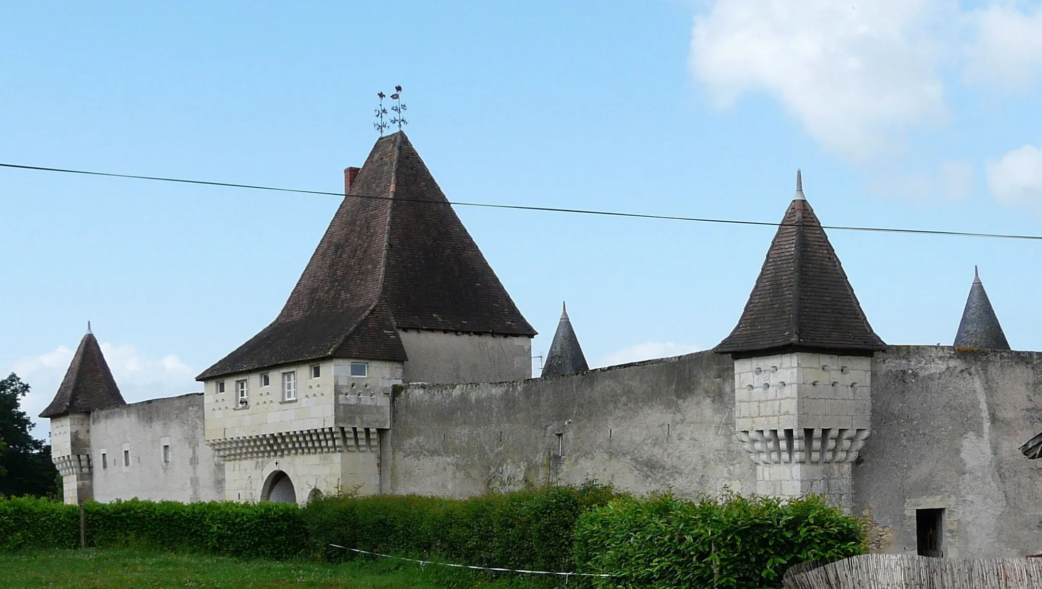
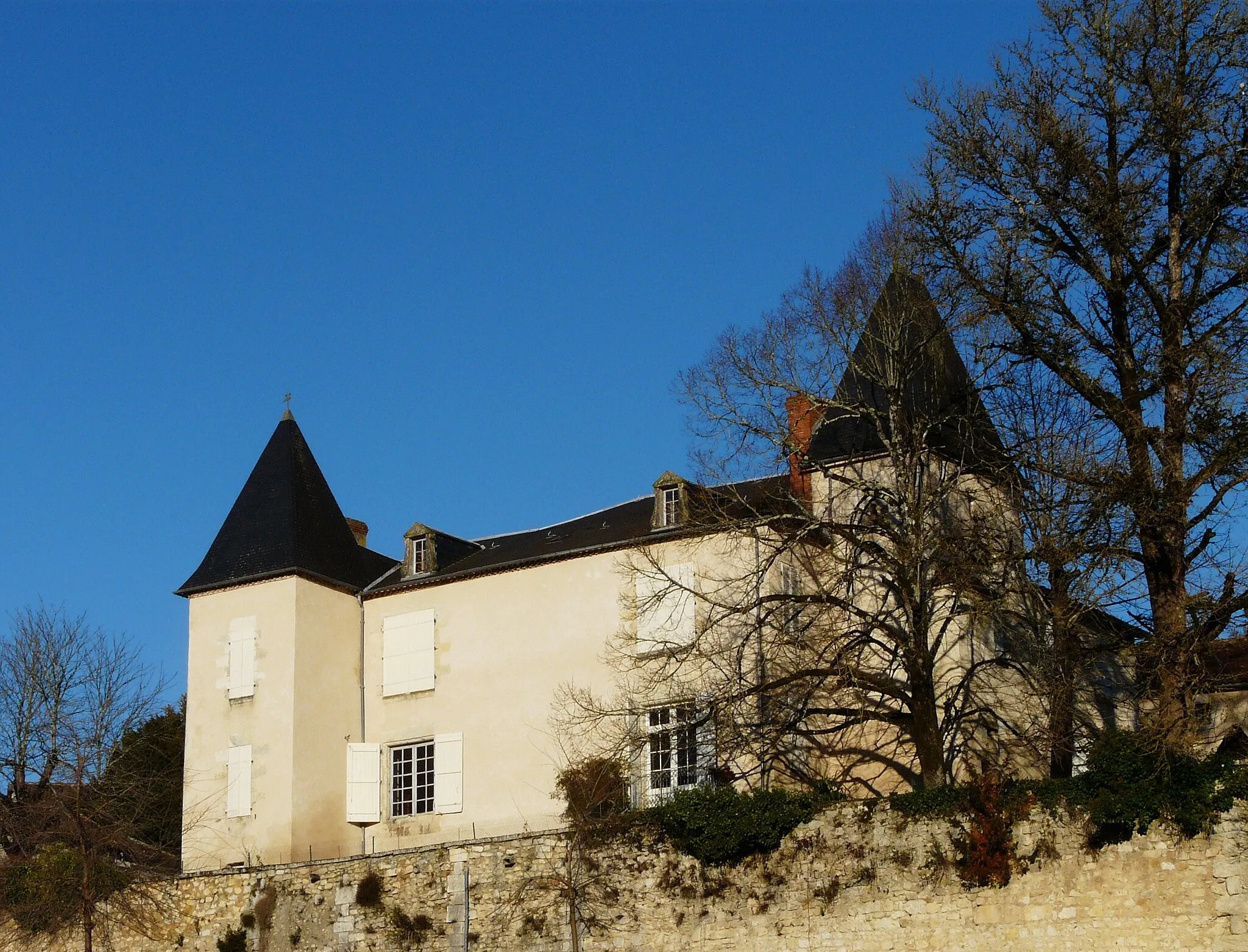
Ride from Trélissac to Château Magne and experience the region's historic landmarks.
Explore the historical attractions of Aquitaine with this route from Trélissac to Château Magne. With a distance of 81 kilometers and an ascent of 909 meters, this route offers a moderate challenge for cyclists.
![Map miniature of "Majestic Castles and Scenic Landscapes" cycling inspiration in Aquitaine, France. Generated by Tarmacs.app cycling route planner](https://images.tarmacs.app/cycling-routes/routemaps/600/france/aquitaine/trelissac/gravel/338956.webp)
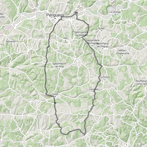
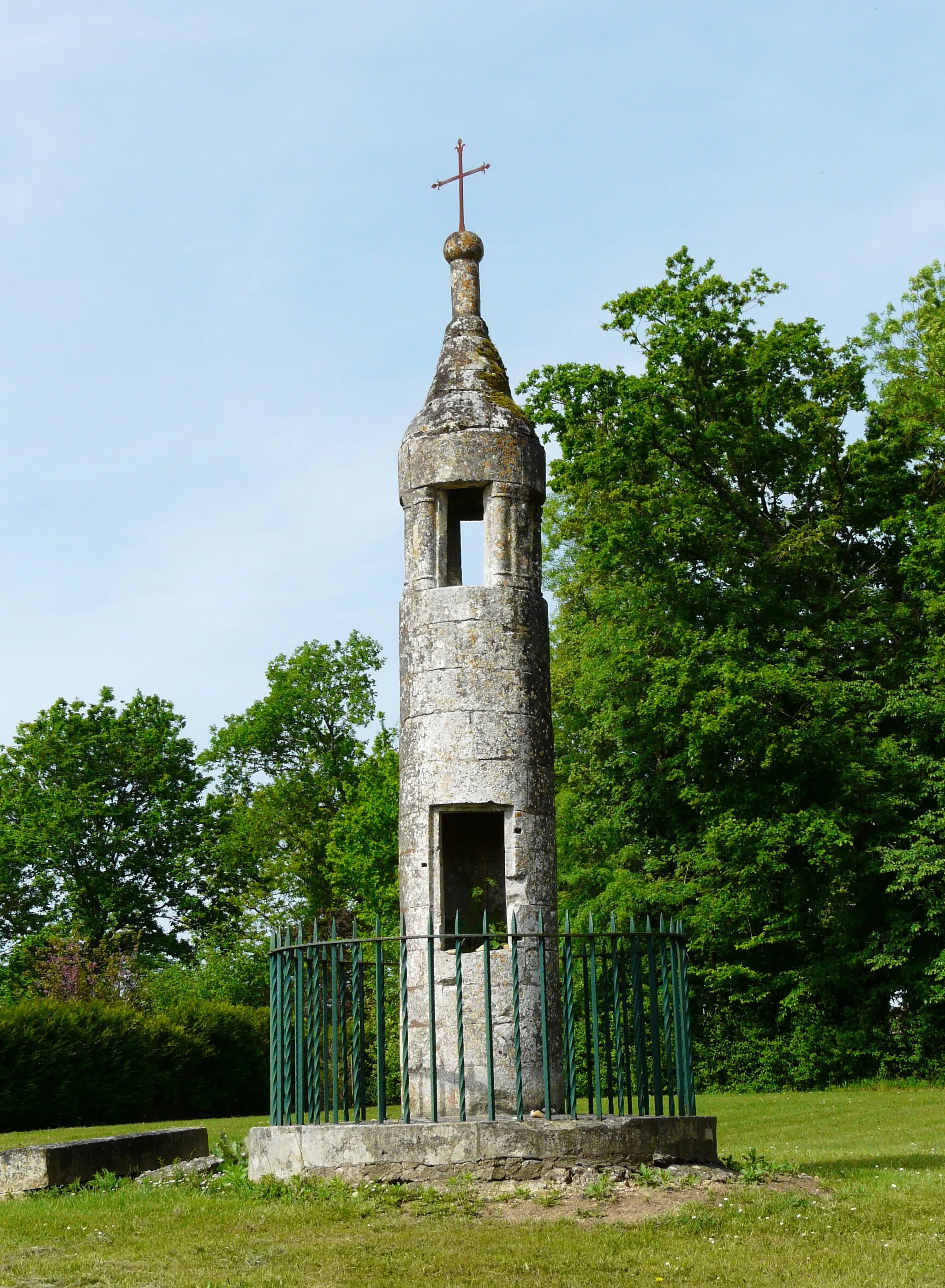
Immerse yourself in the history and beauty of the region while cycling through charming villages.
This gravel route showcases the majestic castles and scenic landscapes of the Aquitaine region. With a distance of 82 kilometers and an ascent of 1199 meters, this route requires a moderate level of fitness. Enjoy the thrill of exploring historic landmarks and be mesmerized by the natural beauty along the way.
![Map miniature of "Challenge the Hills of Périgueux" cycling inspiration in Aquitaine, France. Generated by Tarmacs.app cycling route planner](https://images.tarmacs.app/cycling-routes/routemaps/600/france/aquitaine/trelissac/road/338970.webp)
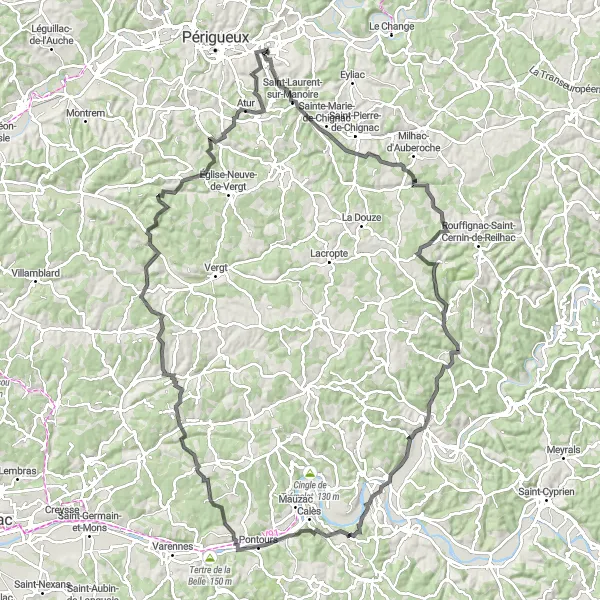
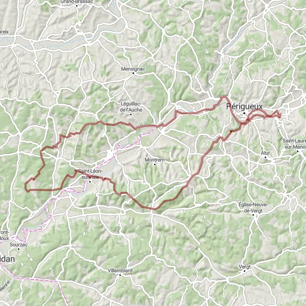
Take on the hilly terrain around Périgueux for a challenging road cycling experience.
This demanding road cycling route is not for the faint of heart, with an ascent of 1691 meters and a distance of 124 kilometers. Admire the stunning scenery as you conquer the challenging climbs around Périgueux. This route is recommended for experienced cyclists who are looking for a true test of their skills and endurance.
Cycling routes nearby:
![Image of Bassillac](https://images.tarmacs.app/cycling-routes/covers/france/aquitaine/bassillac-4.webp)
![Image of Champcevinel](https://images.tarmacs.app/cycling-routes/covers/france/aquitaine/champcevinel-5.webp)
![Image of Périgueux](https://images.tarmacs.app/cycling-routes/covers/france/aquitaine/perigueux-5.webp)
![Image of Atur](https://images.tarmacs.app/cycling-routes/covers/france/aquitaine/atur-4.webp)
![Image of Chancelade](https://images.tarmacs.app/cycling-routes/covers/france/aquitaine/chancelade-4.webp)
![Image of Notre-Dame-de-Sanilhac](https://images.tarmacs.app/cycling-routes/covers/france/aquitaine/notre-dame-de-sanilhac-5.webp)
![Image of Agonac](https://images.tarmacs.app/cycling-routes/covers/france/aquitaine/agonac-4.webp)
![Image of Razac-sur-l'Isle](https://images.tarmacs.app/cycling-routes/covers/france/aquitaine/razac-sur-l-isle-3.webp)
![Image of Vergt](https://images.tarmacs.app/cycling-routes/covers/france/aquitaine/vergt-5.webp)
Nearby regions:
![Image of País Vasco](https://images.tarmacs.app/cycling-routes/covers/spain/pais-vasco/murguia-5.webp)
![Image of Comunidad Foral de Navarra](https://images.tarmacs.app/cycling-routes/covers/spain/comunidad-foral-de-navarra/estella-lizarra-3.webp)
![Image of Aragón](https://images.tarmacs.app/cycling-routes/covers/spain/aragon/alcaniz-5.webp)
![Image of Cataluña](https://images.tarmacs.app/cycling-routes/covers/spain/cataluna/batea-5.webp)
![Image of Pays de la Loire](https://images.tarmacs.app/cycling-routes/covers/france/pays-de-la-loire/pellouailles-les-vignes-4.webp)
![Image of Limousin](https://images.tarmacs.app/cycling-routes/covers/france/limousin/sainte-fereole-3.webp)
![Image of Poitou-Charentes](https://images.tarmacs.app/cycling-routes/covers/france/poitou-charentes/couhe-3.webp)
![Image of Midi-Pyrénées](https://images.tarmacs.app/cycling-routes/covers/france/midi-pyrenees/brens-4.webp)
![Image of Auvergne](https://images.tarmacs.app/cycling-routes/covers/france/auvergne/lezoux-1.webp)