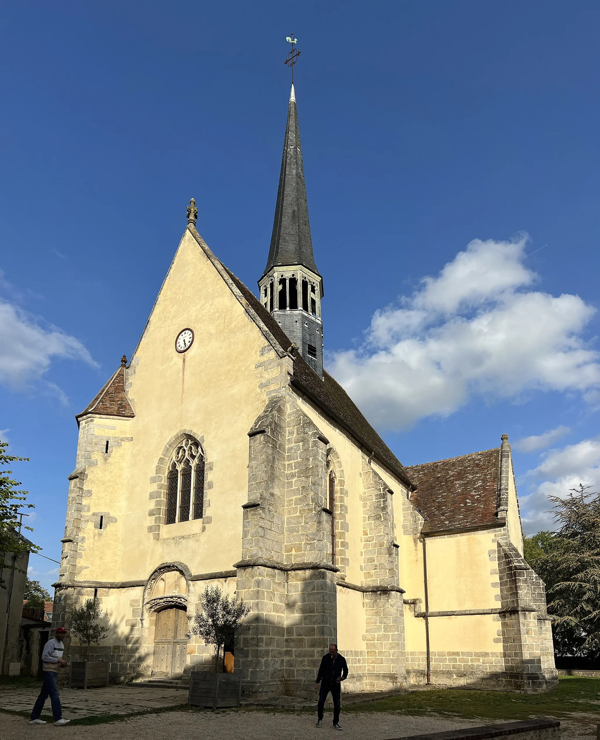
Tranquil Beauty in Haute-Normandie
Cycling routes from Tourville-la-Riviere
Tourville-la-Rivière, situated in Haute-Normandie, France, offers a unique cycling experience for both road and gravel cyclists. The town is surrounded by beautiful countryside and charming rural roads, providing endless opportunities for exploration. While it may not have any world-famous climbs nearby, Tourville-la-Rivière's peaceful atmosphere and stunning natural beauty make it a worthwhile destination for any cycling enthusiast.
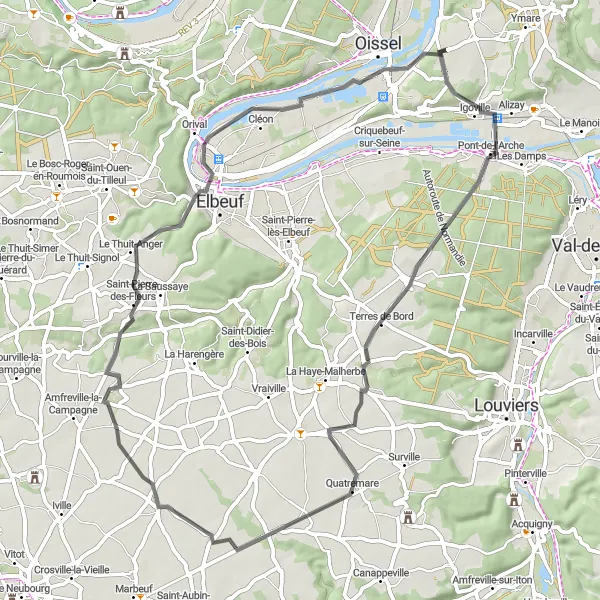
Scenic Ride to Elbeuf
Cycle through charming towns and picturesque landscapes on your way to Elbeuf from Tourville-la-Rivière
This road cycling route spans 72 kilometers, featuring an ascent of 534 meters. Suitable for experienced riders seeking scenic views and cultural encounters, the route takes you through charming towns and beautiful countryside, culminating in the medieval town of Elbeuf.
Experience the beauty of Valleys and Mounts on this scenic road cycling route.
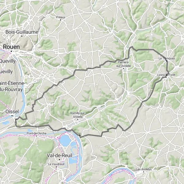
Embark on an 80km road cycling adventure through the picturesque valleys and mounts near Tourville-la-Rivière. With an ascent of 650m, this route offers a moderate level of difficulty for amateur cyclists. Highlights along the route include Les Authieux-sur-le-Port-Saint-Ouen (3km), Perruel (27km), Gaillardbois-Cressenville (50km), Amfreville-sous-les-Monts (66km), the Table d'Orientation de la Cote des Deux Amants at 68km, providing stunning views of the surrounding landscapes, before returning back to Tourville-la-Rivière.
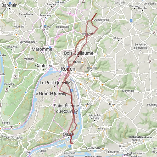
Embark on an exciting gravel adventure near Tourville-la-Rivière
This gravel cycling adventure near Tourville-la-Rivière covers a distance of 58 kilometers and includes an ascent of 335 meters. It is suitable for experienced gravel riders looking for a challenge. The route takes you through various terrains and features several highlights along the way.
Discover the charming city of Tourville-la-Rivière on this scenic road cycling route.
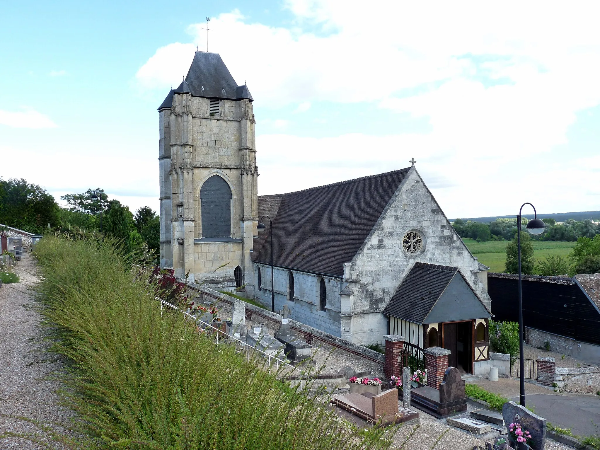
Experience the beauty of Haute-Normandie on this 66km road cycling route. With a moderate ascent of 451m, the route provides a good challenge for amateur cyclists. Starting from Tourville-la-Rivière, you'll pass by the picturesque town of Caudebec-lès-Elbeuf at 10km, where you can take a break and enjoy the beautiful views. Continuing on, you'll ride through Le Troncq (29km), La Haye-du-Theil (36km), Le Thuit-Simer(41km), La Londe(48km), and Mairie Oissel(63km) before reaching Tourville-la-Rivière once again.
Experience the beauty of nature and delve into the history of the surrounding areas near Tourville-la-Rivière
This gravel cycling route covers a distance of 85 kilometers with an ascent of 765 meters. It is recommended for experienced gravel riders seeking both scenic views and historic sites. The ride takes you through picturesque landscapes and past notable landmarks.
Immerse yourself in the scenic countryside and charming villages surrounding Tourville-la-Rivière
Explore the beautiful countryside and quaint villages near Tourville-la-Rivière with this road cycling route. The 60-kilometer journey includes an ascent of 369 meters and is suitable for well-trained amateurs. Along the way, you'll encounter picturesque landscapes and charming village settings.
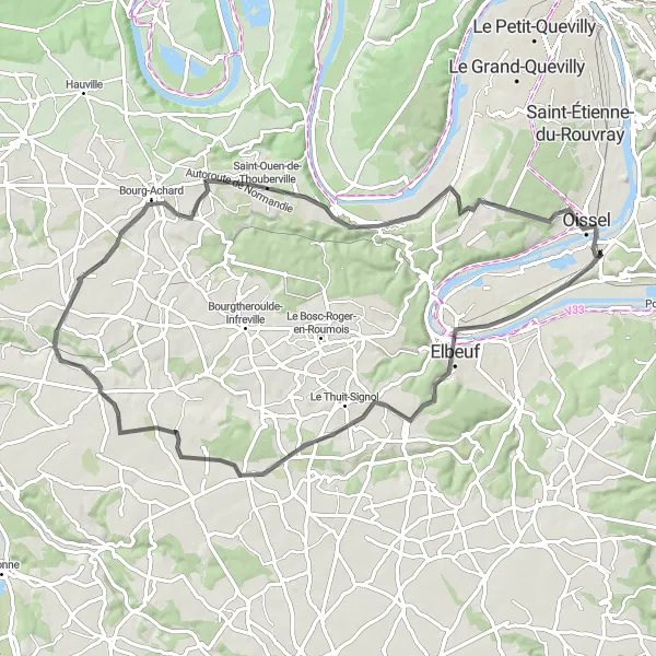
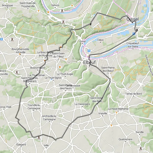
Elbeuf Loop
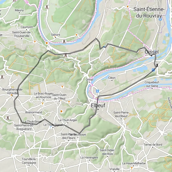
A scenic route through the charming towns of Haute-Normandie
The Elbeuf Loop is a picturesque cycling route that takes you through the beautiful towns of Haute-Normandie. This 48-kilometer road cycling route features enchanting landscapes, historical landmarks, and vibrant culture. With a moderate ascent of 467 meters, the route offers a good challenge for well-trained amateur cyclists. The route starts near Tourville-la-Rivière and takes you through the highlights of Elbeuf, Le Thuit-Simer, Moulineaux, and Mairie Oissel before returning to Tourville-la-Rivière.
Explore the beautiful towns and countryside near Tourville-la-Rivière
This cycling route takes you through the scenic towns and countryside near Tourville-la-Rivière in Haute-Normandie, France. With a distance of 50 kilometers and an ascent of 529 meters, it is suitable for well-trained amateur cyclists. The route offers a mix of road surfaces and features various highlights along the way.
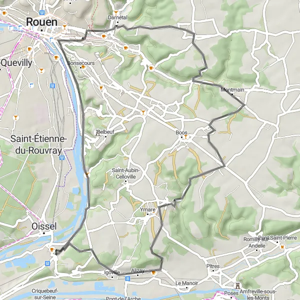
A thrilling road cycling adventure through the charming countryside near Tourville-la-Rivière.
Embark on a 62km road cycling route starting from Tourville-la-Rivière, traversing through the picturesque countryside. The route features a moderate ascent of 464m, providing a good challenge for amateur cyclists. Highlights along the way include Les Authieux-sur-le-Port-Saint-Ouen (3km), Bourg-Beaudouin (19km), Ménesqueville (29km), Amfreville-sous-les-Monts (48km), the Table d'Orientation de la Cote des Deux Amants at 49km, and Alizay (56km), before returning back to Tourville-la-Rivière.
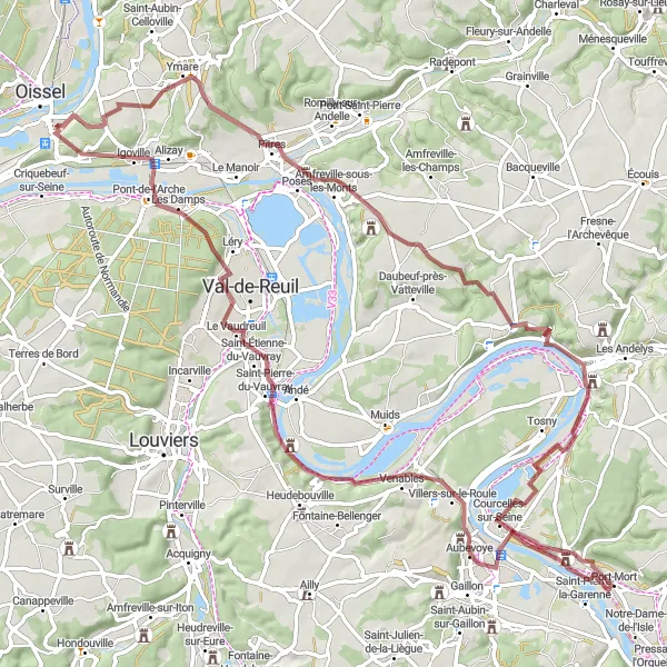
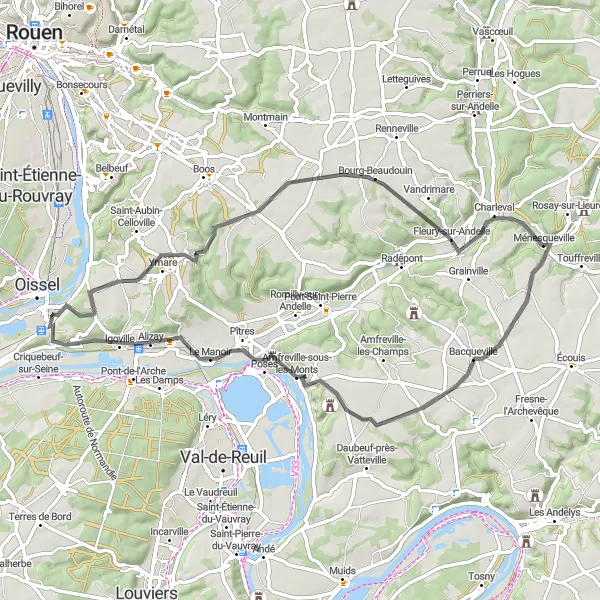
Roy Island Loop
Explore the captivating Roy Island on this adventurous road cycling route.
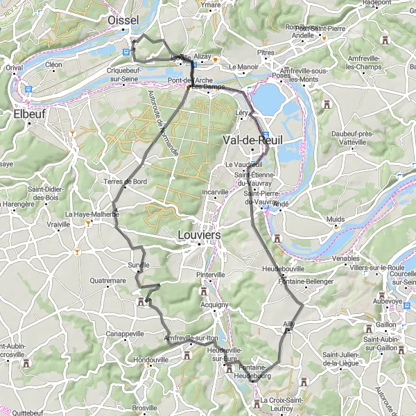
Embark on a 73km road cycling adventure starting from Tourville-la-Rivière and discover the beauty of Roy Island. With an ascent of 549m, this route poses a moderate challenge for cyclists. Along the way, you'll pass by Île du Roy (12km), Ailly (28km), Amfreville-sur-Iton (39km), Montaure (55km), Pont-de-l'Arche (65km), and finally, Tourville-la-Rivière at the 73km mark.
Cycling routes nearby:


Nearby regions: