Escape to the rural charm of Ozouer-le-Voulgis and experience thrilling rides through Forêt de Fontainebleau.
Cycling routes from Ozouer-le-Voulgis
Ozouer-le-Voulgis, located in Ile-de-France, France, is a charming town that caters well to road and gravel cyclists. Cyclists can enjoy peaceful rides through the region's countryside, which is characterized by its rolling hills and vineyards. The town offers a range of amenities for cyclists, including bike-friendly accommodations and cafes. One of the notable cycling spots near Ozouer-le-Voulgis is the Forêt de Fontainebleau which provides a plethora of off-road cycling trails amidst the lush forest. For those seeking a challenge, Fontainebleau also offers rocky climbs and technical descents. With its mix of peaceful rural roads and thrilling off-road trails, Ozouer-le-Voulgis is a cyclist's paradise.
Enjoy a scenic road ride starting from Ozouer-le-Voulgis and passing through charming villages and natural landscapes
This scenic road ride starts at Ozouer-le-Voulgis and covers a total distance of 70 kilometers with an ascent of 295 meters. Suitable for well-trained amateur cyclists, the route takes you through charming villages, rolling hills, and beautiful natural landscapes. With a mix of flat sections and some moderate climbs, this ride offers a great balance of challenge and enjoyment.
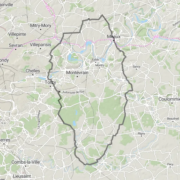
Embark on a picturesque road cycling adventure through the beautiful countryside surrounding Ozouer-le-Voulgis.
This road cycling route offers riders a scenic journey through the picturesque countryside near Ozouer-le-Voulgis. With a challenging ascent of 707 meters and a distance of 112 kilometers, this route is suitable for experienced cyclists seeking a challenge. The highlight of this circuit is the visit to the charming village of Villevaudé and the enchanting Penchard, both offering stunning views and a chance to immerse in local culture. Riders can also admire the beauty of Iverny and Dammartin-sur-Tigeaux on their way. The route ends with a visit to the quaint village of Ozouer-le-Voulgis.
Grand Gravel Tour
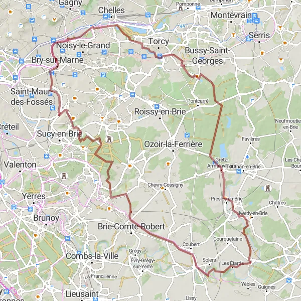
Embark on a grand gravel tour of the region, passing through iconic landmarks and picturesque towns
This challenging gravel route covers a distance of 68 kilometers with a total ascent of 230 meters. Suitable for experienced amateur cyclists, the route offers a combination of flat sections, rolling hills, and some challenging climbs. Along the way, you will pass through iconic landmarks and picturesque towns, offering a diverse and rewarding cycling experience.
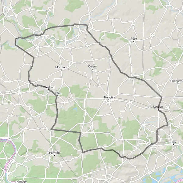
Challenge yourself with this scenic road cycling loop, featuring beautiful highlights and stunning landscapes.
This challenging road cycling route takes riders through scenic landscapes and picturesque villages near Ozouer-le-Voulgis. With a difficult ascent of 525 meters and a distance of 98 kilometers, this route is suitable for experienced cyclists seeking a demanding ride. The highlight of this loop is the visit to the historic Château de Chaumes-en-Brie, offering a glimpse into the region's rich history. Riders can also admire the beauty of Gastins and Coutençon, both with charming streets and idyllic landscapes. The route continues through Bombon, known for its beautiful panoramic views, before returning to Ozouer-le-Voulgis.
Scenic Brie Route
Discover the scenic beauty of the Brie region on this challenging gravel route near Ozouer-le-Voulgis
This challenging gravel route covers a distance of 86 kilometers with a total ascent of 367 meters. Suitable for experienced amateur cyclists, the ride takes you through the stunning landscapes of the Brie region, offering breathtaking views and peaceful countryside roads. With a mix of flat sections, rolling hills, and some demanding climbs, this route provides a great challenge for adventurous riders.
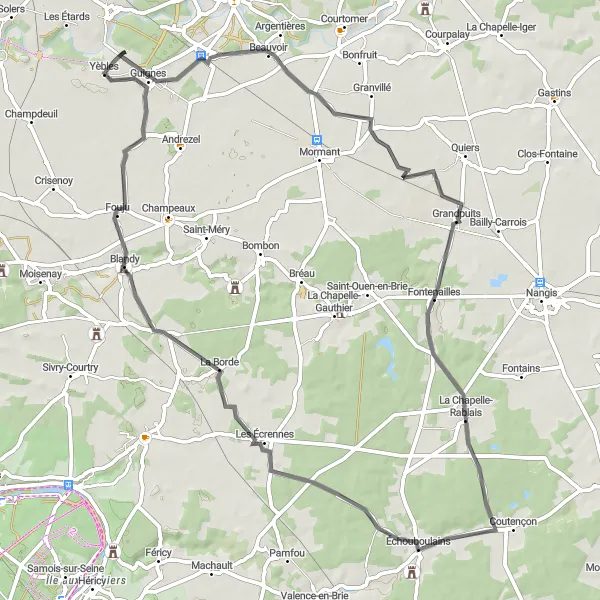
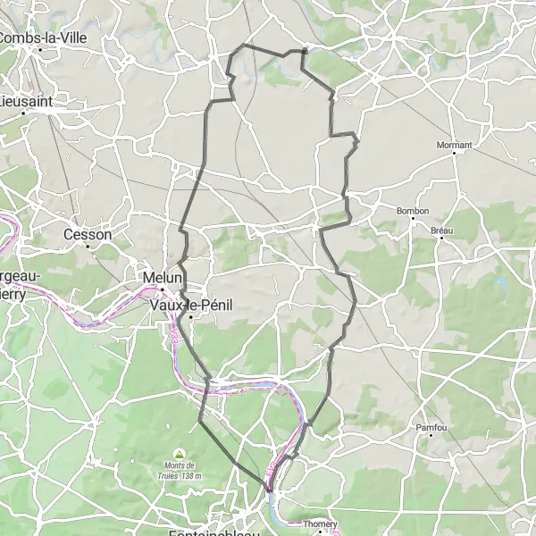
Embark on a scenic road cycling adventure from Ozouer-le-Voulgis to the enchanting Château de Blandy-les-Tours.
This road cycling route offers breathtaking views and takes riders on a journey through the charming towns and beautiful countryside near Ozouer-le-Voulgis. With an ascent of 196 meters and a distance of 67 kilometers, this route is suitable for intermediate cyclists. The highlight of this tour is the visit to the impressive Château de Blandy-les-Tours, a medieval fortress with stunning architecture. Along the way, riders can also admire the beauty of Grandpuits and enjoy a break in the picturesque town of Échouboulains.
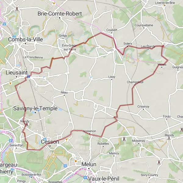
Explore the scenic countryside and charming village of Champdeuil on this gravel route near Ozouer-le-Voulgis
This gravel route takes you through picturesque landscapes and the charming village of Champdeuil. With a total distance of 57 kilometers and an ascent of 171 meters, this ride is suitable for well-trained amateur cyclists. The route offers a mix of flat and rolling terrain, providing a good challenge for riders.
Embark on an adventurous gravel ride through the scenic landscapes and historic towns near Yèbles
This scenic gravel route covers a distance of 72 kilometers with a total ascent of 283 meters. Suitable for well-trained amateur cyclists, the route offers a mix of flat sections, rolling hills, and some challenging climbs, providing a good balance of difficulty. Along the way, you will pass through picturesque landscapes and historic towns, offering a glimpse into the rich cultural heritage of the region.
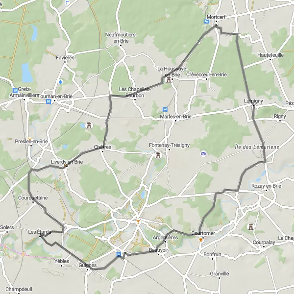
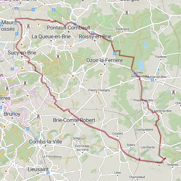
Experience the idyllic beauty of Ozouer-le-Voulgis and discover the scenic villages along this road cycling loop.
This road cycling route allows riders to immerse themselves in the idyllic beauty of the villages surrounding Ozouer-le-Voulgis. With a moderate ascent of 221 meters and a distance of 59 kilometers, this route is suitable for cyclists of all levels. The highlight of this loop is the visit to Liverdy-en-Brie, a quaint village with charming streets and traditional French architecture. Riders can also enjoy the peaceful atmosphere of Mortcerf and explore the picturesque village of Lumigny. The route passes through Verneuil-l'Étang before returning to Ozouer-le-Voulgis.
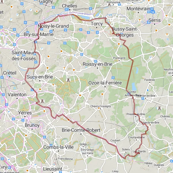
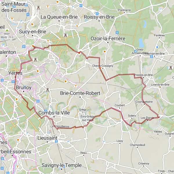
Explore the gravel roads around Ozouer-le-Voulgis and discover the charming village of Soignolles-en-Brie.
This gravel route takes you on a scenic journey through the countryside near Ozouer-le-Voulgis. With a moderate ascent of 297 meters and a distance of 86 kilometers, riders of all skill levels can enjoy this picturesque ride. The highlight of this route is the visit to the historic Château de Ferrières, located at kilometer 62. Riders can also admire the beautiful Terrasse de Chennevières and the charming town of Boissy-Saint-Léger.
Cycling routes nearby:


Nearby regions: