Cycling through vineyards and coastal roads in Bourgneuf-en-Retz.
Cycling routes from Bourgneuf-en-Retz
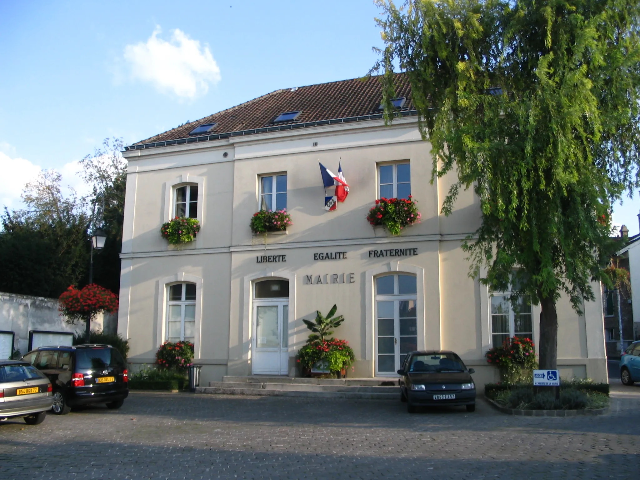
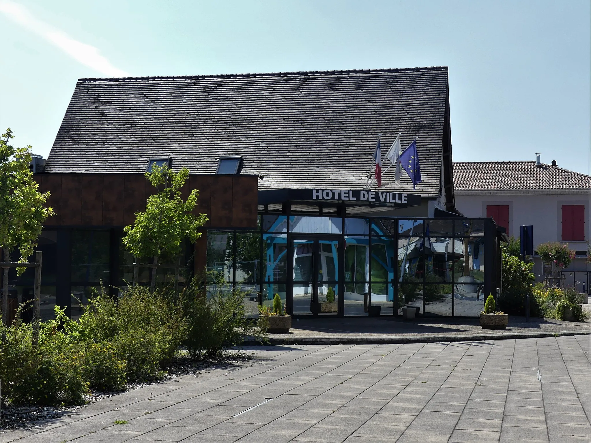
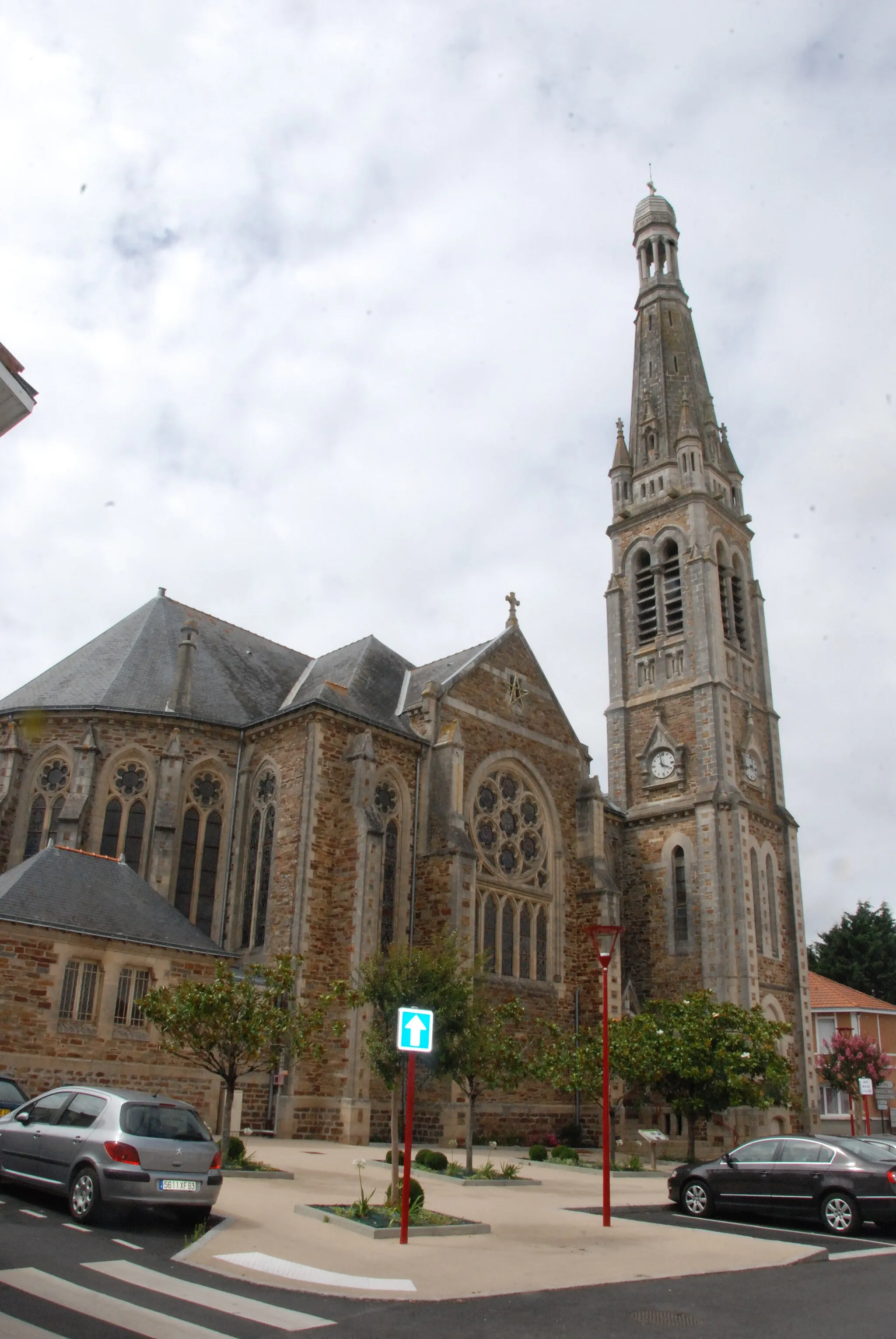
Bourgneuf-en-Retz in Pays de la Loire, France is a picturesque town with beautiful countryside roads that are perfect for road and gravel cycling. Cyclists can enjoy stunning coastal views as they ride along the Loire River. The region is also known for its vineyards, offering cyclists a chance to explore the local wine culture. Nearby, you will find the famous climb of Mont des Alouettes, which is a regular feature in the Tour de France. With its scenic routes and challenging climbs, Bourgneuf-en-Retz is a great destination for cyclists of all levels.
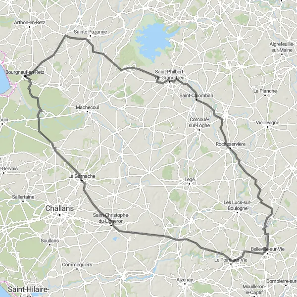
Embark on an epic cycling adventure through the diverse landscapes of the Pays de la Loire region
This challenging road cycling route takes you through a variety of landscapes and picturesque towns in the Pays de la Loire region. With 372 meters of ascent over a distance of 113 kilometers, it's perfect for experienced cyclists looking for a long and rewarding ride. Highlights along the way include the historic town of Saint-Même-le-Tenu, the scenic landscapes of Touvois, the charming town of Palluau, and the majestic Château d'eau d'Apremont. Don't miss the opportunity to explore Apremont's vibrant town center and enjoy the panoramic views from the water tower.
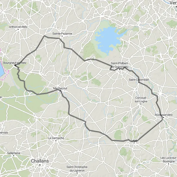
Experience the beauty of nature and history on this scenic road cycling route near Bourgneuf-en-Retz
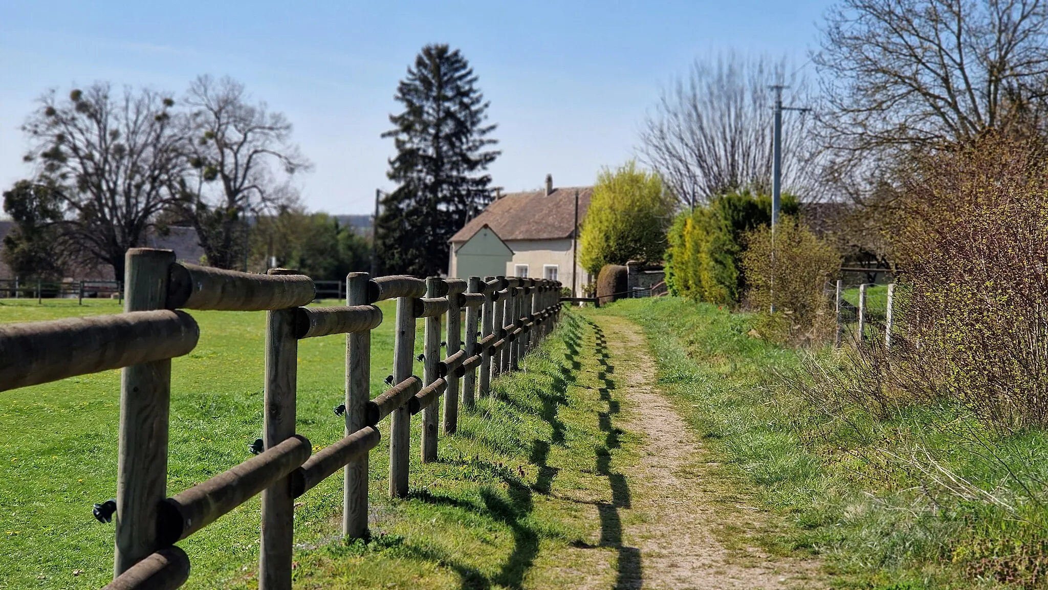
This road cycling route takes you through stunning natural landscapes and historic sites near Bourgneuf-en-Retz. With a total distance of 99 km and an ascent of 276 m, this route is recommended for experienced cyclists looking for a longer ride with challenging sections. Along the way, you'll pass through picturesque villages and encounter highlights such as the observatory on the church bell tower in Saint-Hilaire-de-Chaléons, offering panoramic views of the surrounding countryside. Rocheservière, another highlight, is known for its medieval castle and well-preserved historic center. Overall, this route provides a blend of natural beauty and historical richness, showcasing the best of Pays de la Loire.
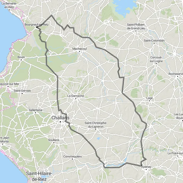
Discover the cycling highlights of the Pays de la Loire region on this epic road cycling route
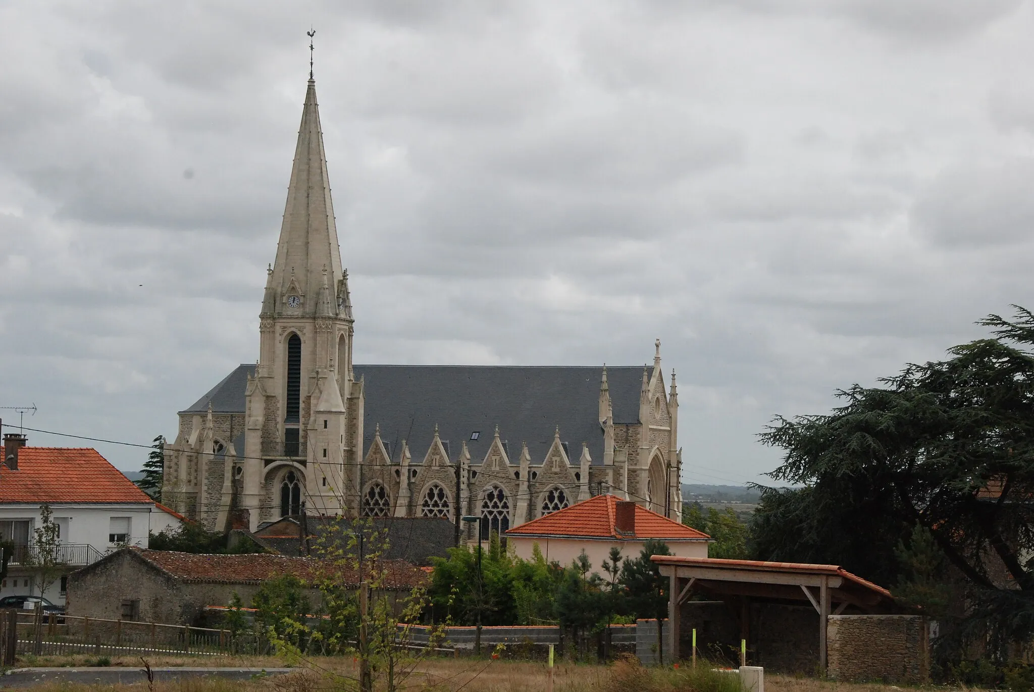
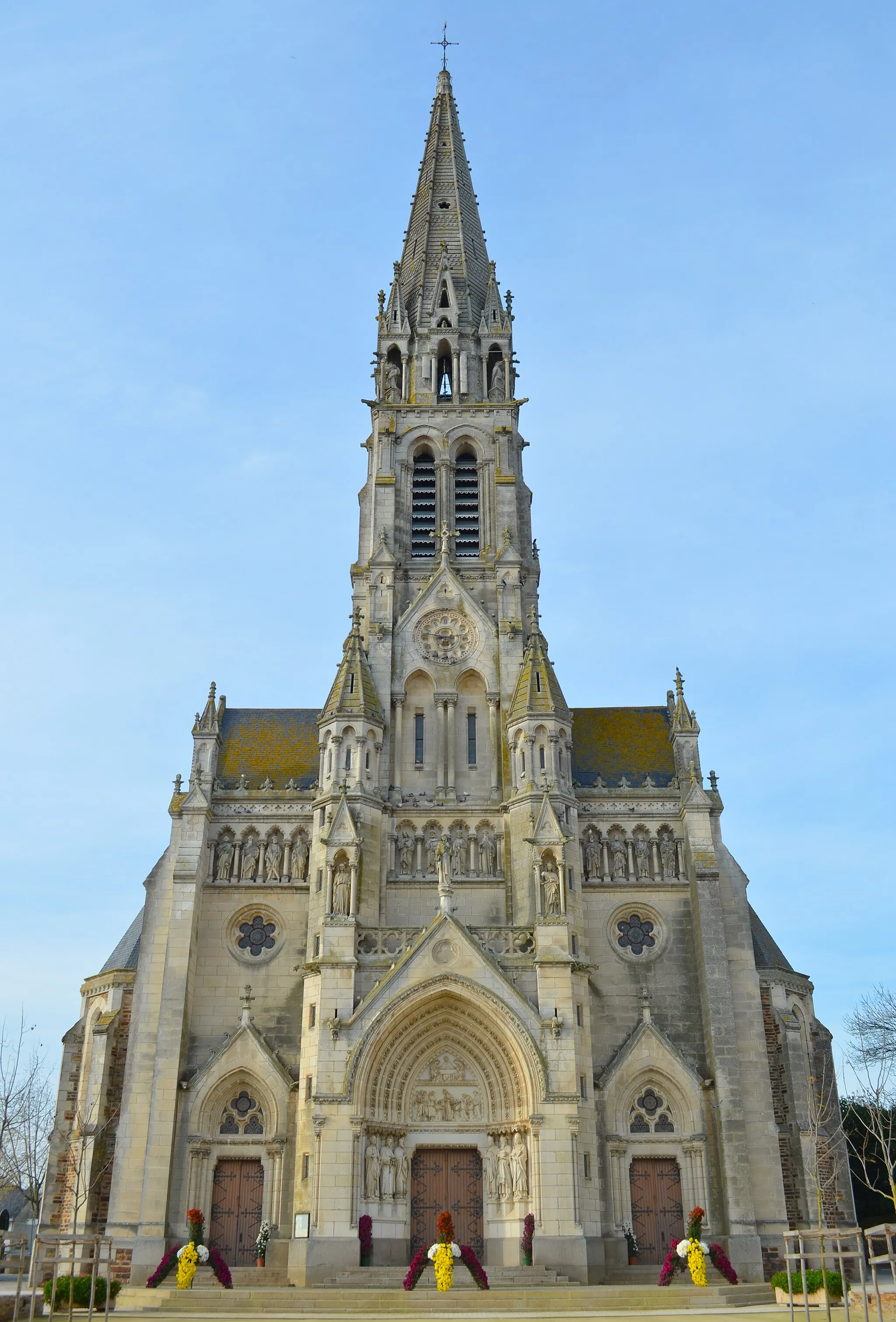
Embark on an epic cycling adventure through the beautiful landscapes and charming towns of the Pays de la Loire region. This challenging road cycling route covers 419 meters of ascent over a distance of 134 kilometers, making it perfect for experienced cyclists looking for a long and rewarding ride. Highlights along the way include the picturesque town of Saint-Hilaire-de-Chaléons, the historic Saint-Lumine-de-Coutais, and the stunning views from the Observatoire du clocher de l'église. Don't miss the opportunity to explore Saint-Philbert-de-Grand-Lieu's charming town center, the rocky landscapes of Rocheservière, and the vibrant town of Belleville-sur-Vie. The route also passes through Palluau, Saint-Christophe-du-Ligneron, La Garnache, and ends back in Bourgneuf-en-Retz.
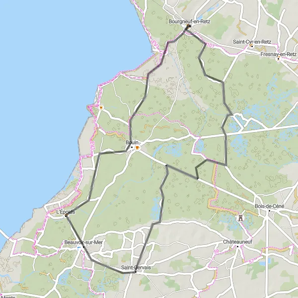
Experience the natural beauty of the Pays de la Loire region on this road cycling route
Explore the picturesque landscapes of the Pays de la Loire region on this beautiful road cycling route. With just 47 meters of ascent over a distance of 48 kilometers, it's an easy and enjoyable ride. Highlights along the way include the charming towns of Saint-Gervais and Bouin, as well as the opportunity to revisit Bourgneuf-en-Retz, the starting point of the route. Take in the stunning views of the countryside and enjoy the peaceful atmosphere of the region.
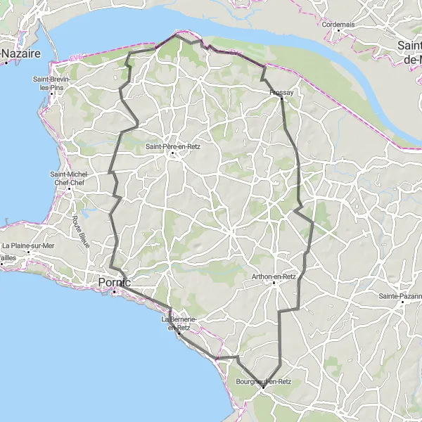
Embark on an exciting journey through coastal landscapes and windy roads on this road cycling route
This challenging road cycling route is ideal for experienced cyclists looking for a thrilling adventure. With 272 meters of ascent over a distance of 80 kilometers, the route offers a mix of coastal beauty and countryside charm. Highlights along the way include the picturesque towns of La Bernerie-en-Retz and Corsept, as well as the unique Zone de l'éolienne occupée, a wind turbine site. Don't miss the opportunity to explore Frossay and its stunning waterfront views, as well as Chéméré with its charming French countryside.
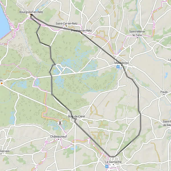
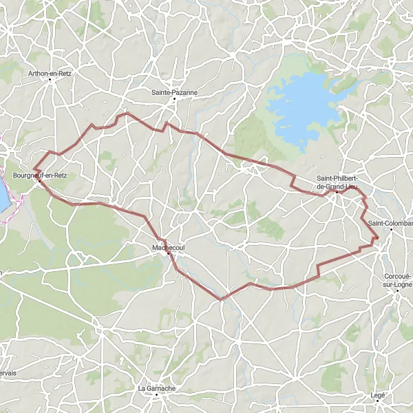
Explore the historic villages and scenic landscapes near Bourgneuf-en-Retz on this road cycling route
This road cycling route takes you on a journey through historic villages and scenic landscapes near Bourgneuf-en-Retz. With a distance of 47 km and an ascent of 65 m, this route is suitable for cyclists of all fitness levels. Starting near Bourgneuf-en-Retz, you'll encounter highlights such as Machecoul, known for its medieval castle and charming streets. La Garnache, another highlight, boasts a historic church and traditional stone houses. As you cycle towards Bourgneuf-en-Retz, you'll have the opportunity to visit Bois-de-Céné, a peaceful village surrounded by nature. Overall, this route offers a combination of history, culture, and natural beauty, making it a perfect choice for a leisurely cycling trip.
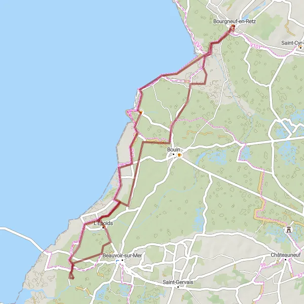
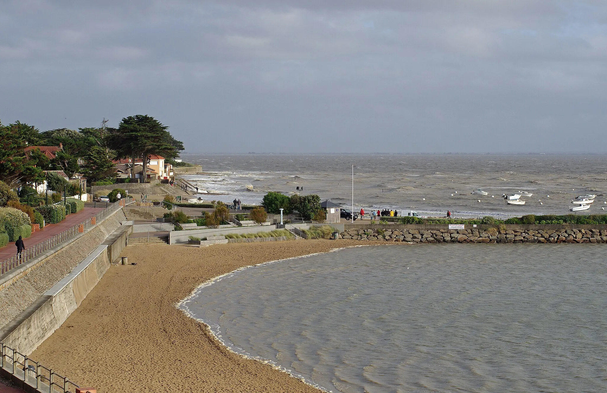
Embark on a thrilling gravel adventure along the picturesque coastline near Bourgneuf-en-Retz
This gravel cycling route offers a thrilling adventure along the picturesque coastline near Bourgneuf-en-Retz. With a distance of 47 km and minimal ascent, this route is suitable for cyclists of all fitness levels. Starting in Bourgneuf-en-Retz, you'll follow the coastline, enjoying stunning views of the sea and rugged cliffs. Highlights along the way include Port des Champs, a charming harbor with colorful fishing boats and traditional seafood restaurants. Bouin, another highlight, is a historic village known for its traditional architecture and narrow streets. Overall, this route offers a unique opportunity to explore the coastal beauty of Pays de la Loire.
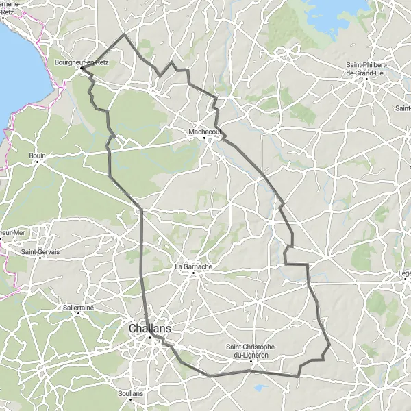
Embark on a scenic road trip through the picturesque countryside near Bourgneuf-en-Retz
This road cycling route takes you through the charming countryside near Bourgneuf-en-Retz, offering breathtaking views and quiet roads. Spanning a distance of 89 km with an ascent of 172 m, this route is suitable for cyclists of moderate fitness levels. Starting in Bourgneuf-en-Retz, you'll pedal through picturesque villages and rolling hills, experiencing the beauty of the Pays de la Loire region. Highlights along the way include the quaint village of Paulx, known for its historic church and quaint streets. As you approach Bourgneuf-en-Retz, you'll have the opportunity to visit the town and explore its rich history and culture. Overall, this route offers a peaceful and scenic journey through the French countryside.
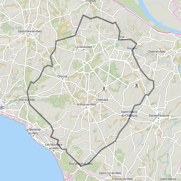
Explore the beautiful countryside of Bourgneuf-en-Retz on this scenic cycling route
This round-trip cycling route takes you through the picturesque towns of Rouans and Saint-Hilaire-de-Chaléons. Along the way, you'll enjoy stunning views of the countryside and quaint village charm. The route is relatively easy, with just 292 meters of ascent over a distance of 64 kilometers. It's perfect for well-trained amateur cyclists looking to explore the Pays de la Loire region.
Discover the lush Retz Forest on this gravel cycling route
This gravel path takes you through the beautiful Retz Forest, allowing you to immerse yourself in nature while enjoying a challenging ride. With a total distance of 75 km and an ascent of 181 m, this route is suitable for experienced cyclists looking for a mix of adventure and natural beauty. The route starts near Bourgneuf-en-Retz, a charming town located in the heart of Pays de la Loire. As you cycle through the forest, you'll encounter various highlights along the way, including the stunning sight of the observatory on top of the church bell tower in Saint-Lumine-de-Coutais. Overall, this route offers a unique cycling experience in the scenic countryside of Pays de la Loire.
Cycling routes nearby:


Nearby regions: