Coastal Cycling in Angoulins and Île de Ré
Cycling routes from Angoulins
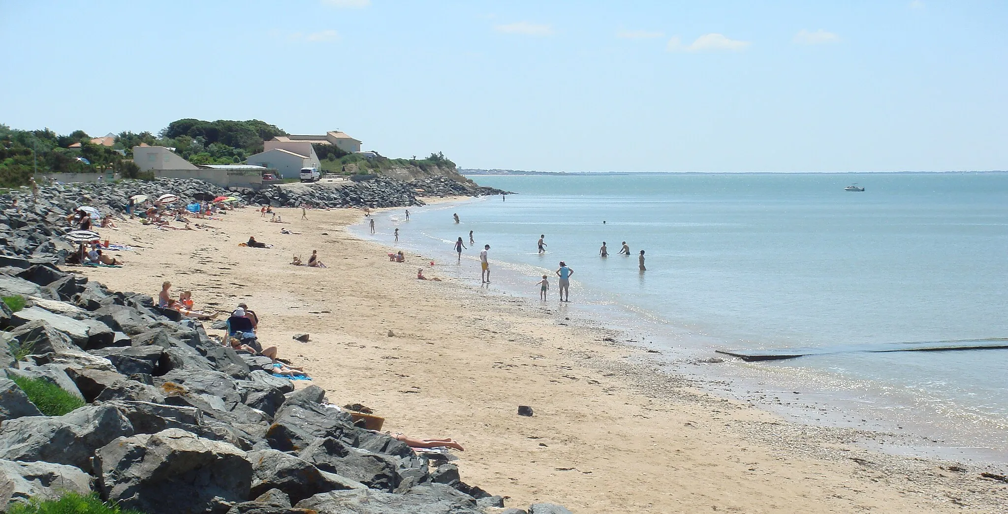
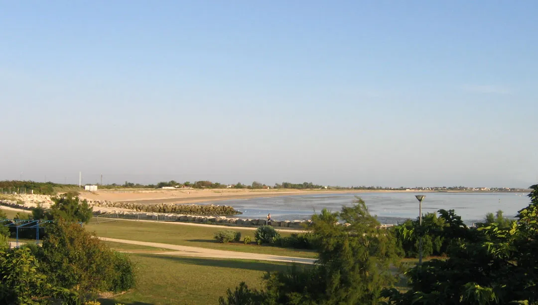
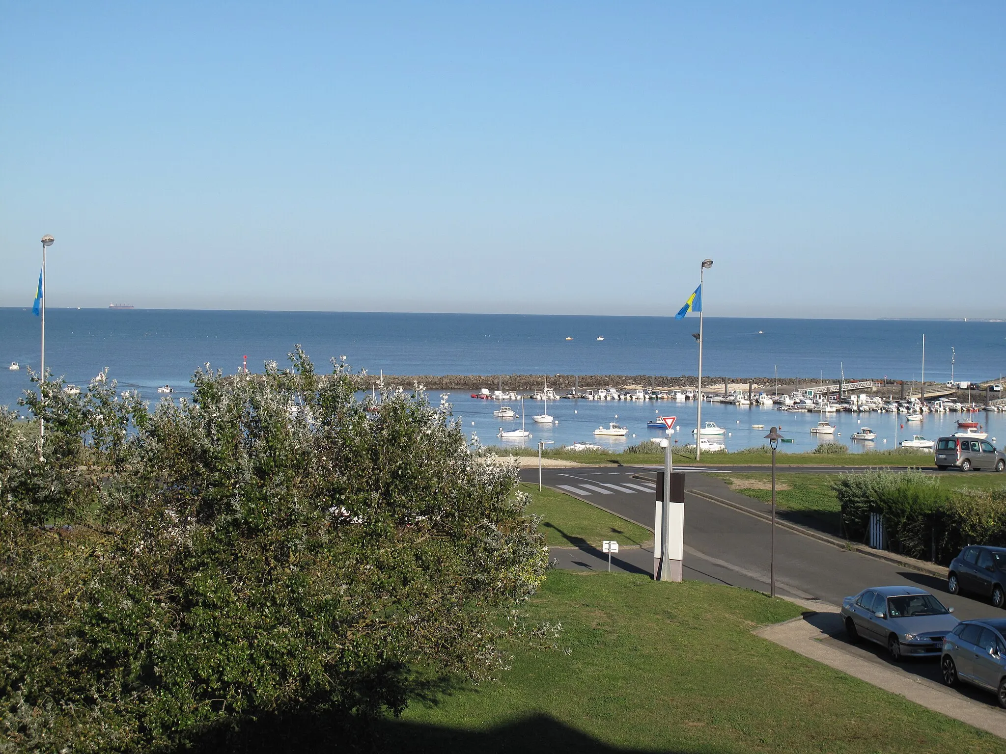
Angoulins is a charming coastal locality in the Poitou-Charentes region of France. From a cyclist's point of view, Angoulins offers scenic coastal roads with beautiful views of the Atlantic Ocean. The bike-friendly infrastructure in this area makes it easy to navigate and explore the surrounding towns and villages. One of the famous cycling spots near Angoulins is the Île de Ré, a popular island destination known for its cycling paths and picturesque landscapes. Cyclists visiting Angoulins can enjoy a combination of beachside rides, relax on sandy shores, and explore the captivating island nearby.
Experience the stunning coastal beauty of Angoulins
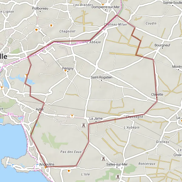
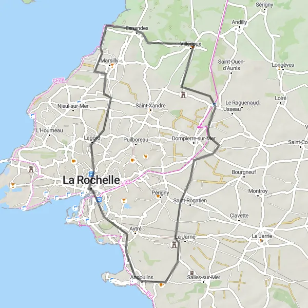
Immerse yourself in the natural beauty of Angoulins as you embark on this gravel cycling route. With a distance of 30 kilometers and an ascent of 59 meters, this route is perfect for a leisurely ride along the coast. Explore highlights such as Aytré and Dompierre-sur-Mer, where you can admire the picturesque landscapes and charming villages. The route also takes you through Angoulins, a coastal town with sandy beaches and rich maritime history. Take a moment to relax and soak in the beautiful views of the Atlantic Ocean.
Aytré - Pouillé Loop
Embark on a scenic cycling adventure from Aytré to Pouillé, exploring picturesque landscapes and rural charm.
This 130km route offers a challenging cycle starting from Aytré and passing through the peaceful village of Esnandes. Continue the journey through Sainte-Radégonde-des-Noyers and Pouillé, soaking in the beautiful rural scenery. The ascent of 304m adds to the overall difficulty of this route, making it ideal for experienced cyclists. Overall, this route offers a diverse mix of landscapes, rural charm, and a challenging level of difficulty.
Cycling along the coast
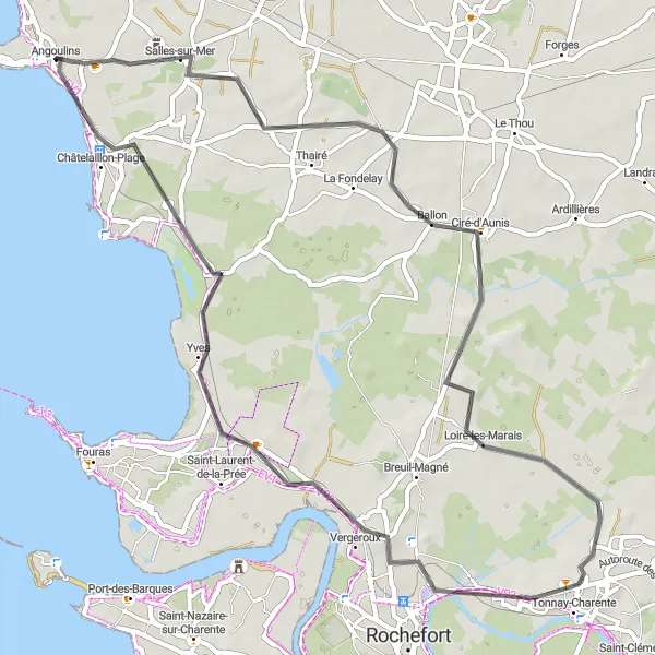
This route takes you along the beautiful coastline from Salles-sur-Mer to Châtelaillon-Plage. With a total distance of 64 km and an ascent of 167 m, it is an enjoyable ride for cyclists of all levels. The highlight of this route is circling Ciré-d'Aunis, a quaint town with charming streets and historic buildings. Another highlight is Tonnay-Charente, situated on the banks of the Charente River and known for its picturesque scenery. Vergeroux and Châtelaillon-Plage also offer stunning views of the ocean.
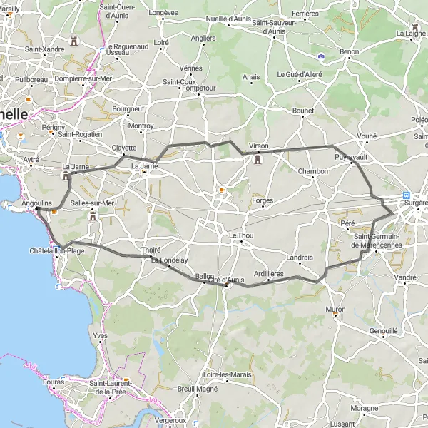
Discover the scenic gravel routes from Angoulins to Vérines
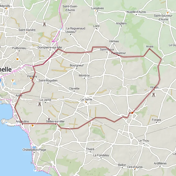
Embark on a gravel cycling adventure from Angoulins to Vérines and experience the scenic beauty of the region. With a distance of 52 kilometers and an ascent of 112 meters, this route is perfect for intermediate cyclists looking for a challenge. Discover highlights such as Dompierre-sur-Mer and Virson, where you can explore the charming villages and immerse yourself in the local culture. Don't miss the opportunity to visit Angoulins, a coastal town with sandy beaches and a rich maritime heritage.
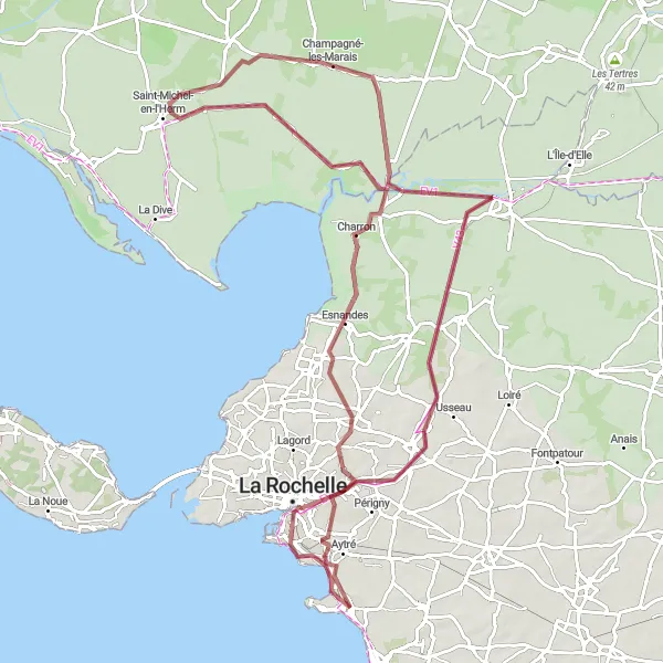
Explore the beautiful coastline from Angoulins to La Rochelle
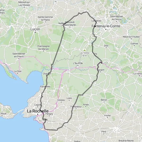
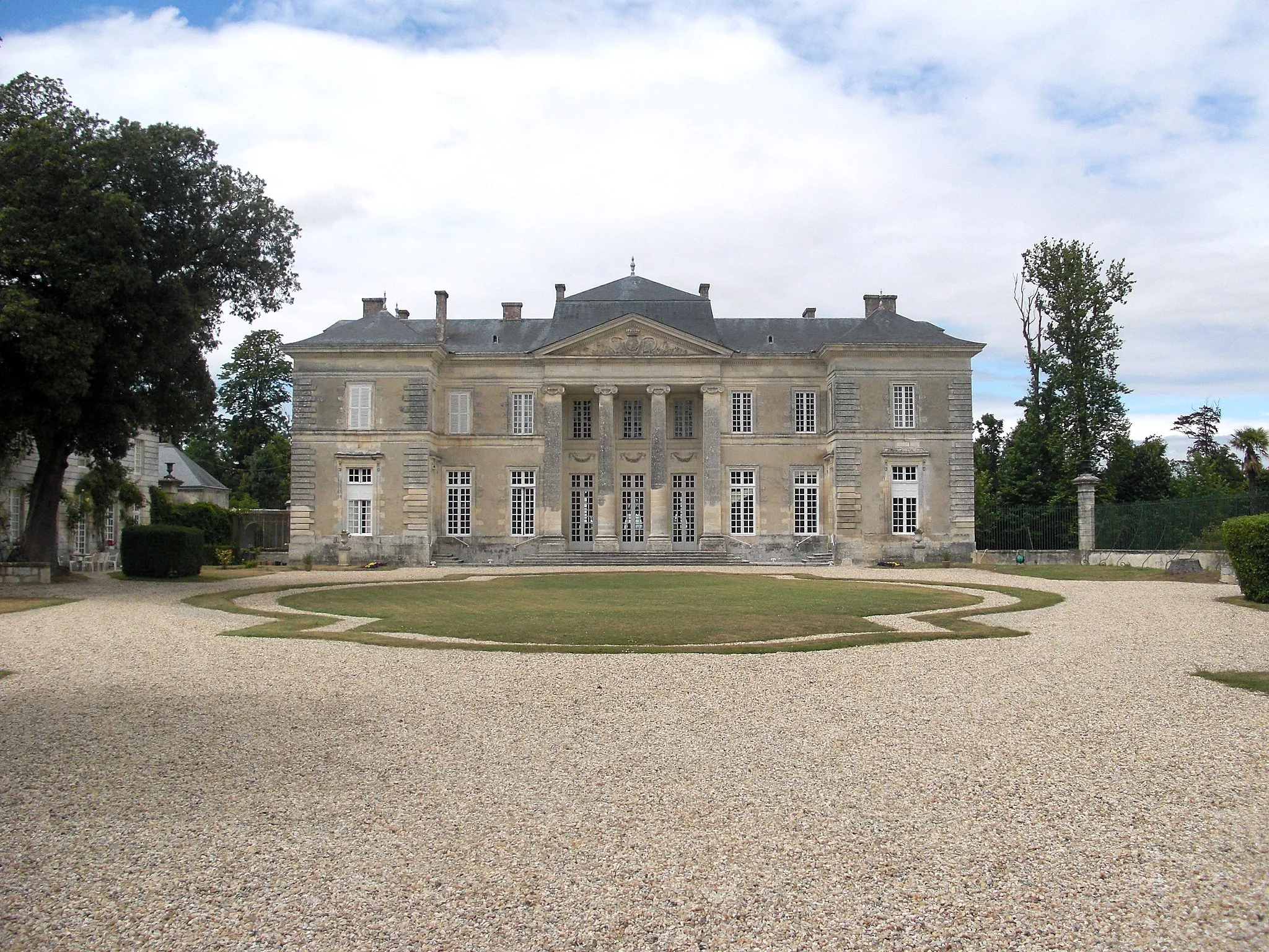
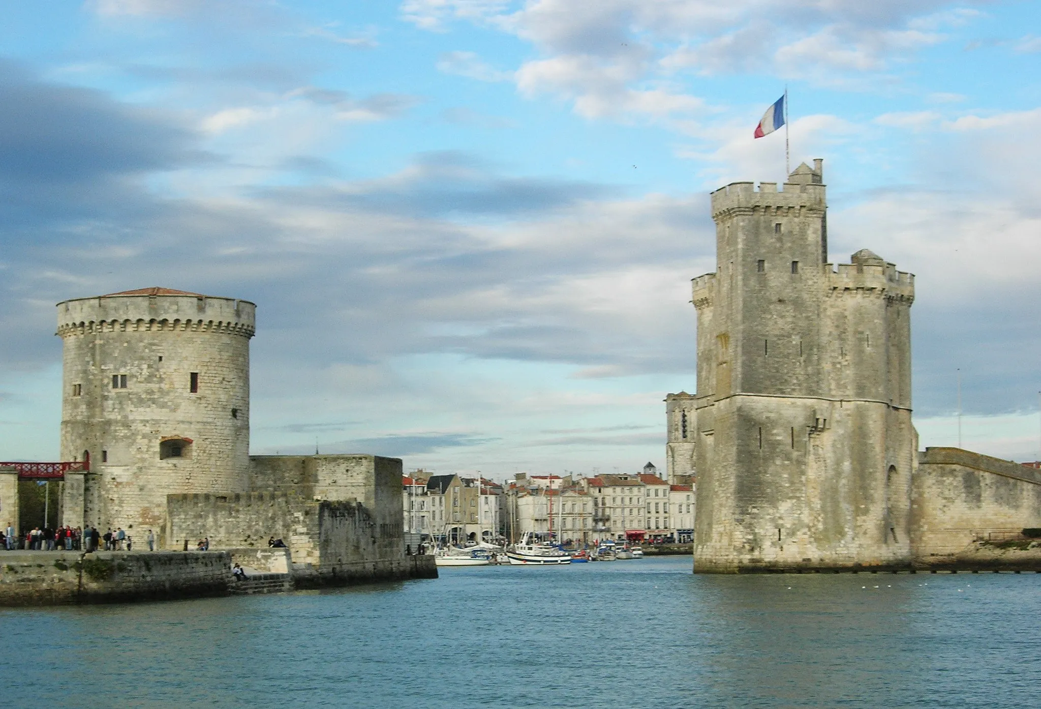
Embark on a scenic cycling adventure along the coast of Angoulins and La Rochelle. This route offers stunning views of the Atlantic Ocean and charming coastal towns. With a total distance of 105 kilometers and an ascent of 81 meters, this gravel route is perfect for intermediate cyclists. The route passes through highlights such as Esnandes, Saint-Michel-en-l'Herm, and Champagné-les-Marais. Don't miss the opportunity to visit Les Longeards, where you can experience the rich history and culture of the region. As you approach La Rochelle, make sure to stop by the iconic Tour de la Chaîne, a famous landmark in the city.
Experience the coastal beauty and historic towns on this scenic cycling loop from La Jarne to Châtelaillon-Plage.
Covering a distance of 66km, this route starts from La Jarne and takes you along the coast, passing through Virson and Saint-Germain-de-Marencennes. The route includes a moderate ascent of 152m, providing a good challenge. Enjoy the scenic views of the coastline and visit the charming town of Châtelaillon-Plage. Overall, this route offers a mix of coastal scenery, historic towns, and a moderate level of difficulty.
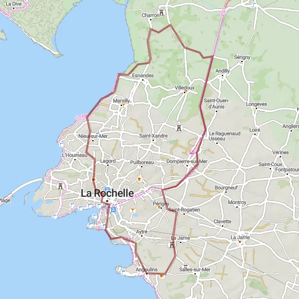
Explore the rugged coastal beauty from Aytré to Mouillepied
Embark on a thrilling gravel adventure along the coast from Aytré to Mouillepied. With a distance of 59 kilometers and an ascent of 113 meters, this route offers a mix of challenging terrain and stunning coastal scenery. Explore highlights such as Nieul-sur-Mer and La Jarne, where you can immerse yourself in the natural beauty of the region. Don't miss the opportunity to visit Aytré, a small town known for its beautiful beach and nature reserve. As you cycle along the coast, enjoy panoramic views of the Atlantic Ocean.
Explore the stunning coastal scenery of La Rochelle and Angoulins
Experience the breathtaking beauty of the coastal landscape as you embark on this road cycling route between La Rochelle and Angoulins. With a distance of 48 kilometers and an ascent of 91 meters, this route is suitable for cyclists of all levels. Discover the highlights of La Rochelle, including the iconic Tour de la Chaîne and the charming village of Esnandes. As you make your way towards Angoulins, take in the stunning views of the Atlantic Ocean. Don't miss the opportunity to visit La Rochelle's Table d'orientation de la Pointe Saint-Clément and enjoy panoramic views of the coastline.
La Rochelle - L'Île-d'Elle Loop
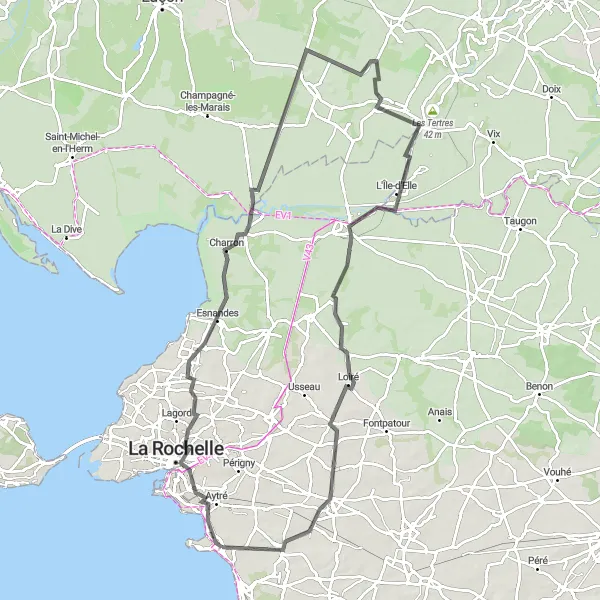
Explore the charming town of La Rochelle and venture to the peaceful island of L'Île-d'Elle on this scenic cycling loop.
Covering a distance of 99km, this route starts from La Rochelle and takes you through Esnandes and Sainte-Radégonde-des-Noyers. Ride along the tranquil countryside and visit the picturesque island of L'Île-d'Elle. With a moderate ascent of 161m, this route offers a good challenge for intermediate cyclists. Overall, this route combines coastal beauty, rural charm, and a moderate level of difficulty.
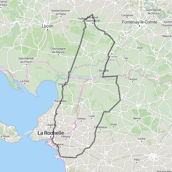
Explore the beautiful La Rochelle and the historic Tour de la Chaîne on this scenic cycling loop.
This 118km route starts near Angoulins and takes you through the charming town of La Rochelle. You'll ride along the coast, passing through Esnandes and Sainte-Radégonde-des-Noyers. The route includes a challenging ascent of 202m, offering a good workout for cyclists. Overall, this route offers a mix of coastal scenery, cultural landmarks, and a moderate level of difficulty.
Cycling routes nearby:

Nearby regions: