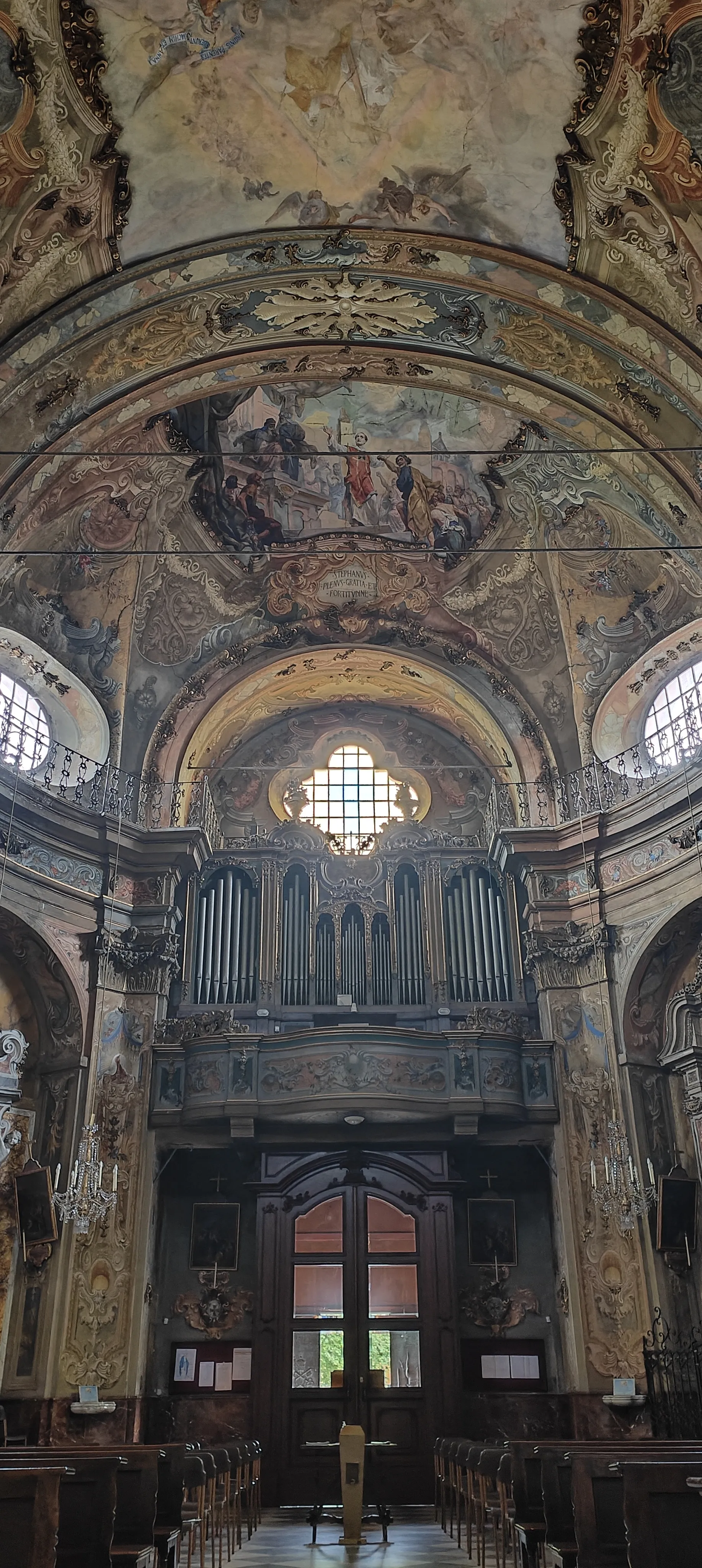
Tranquil town with access to challenging climbs and beautiful coastlines.
Cycling routes from Ceyreste
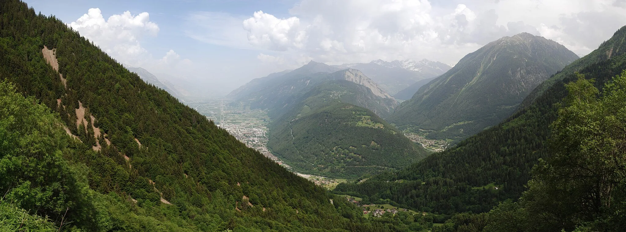
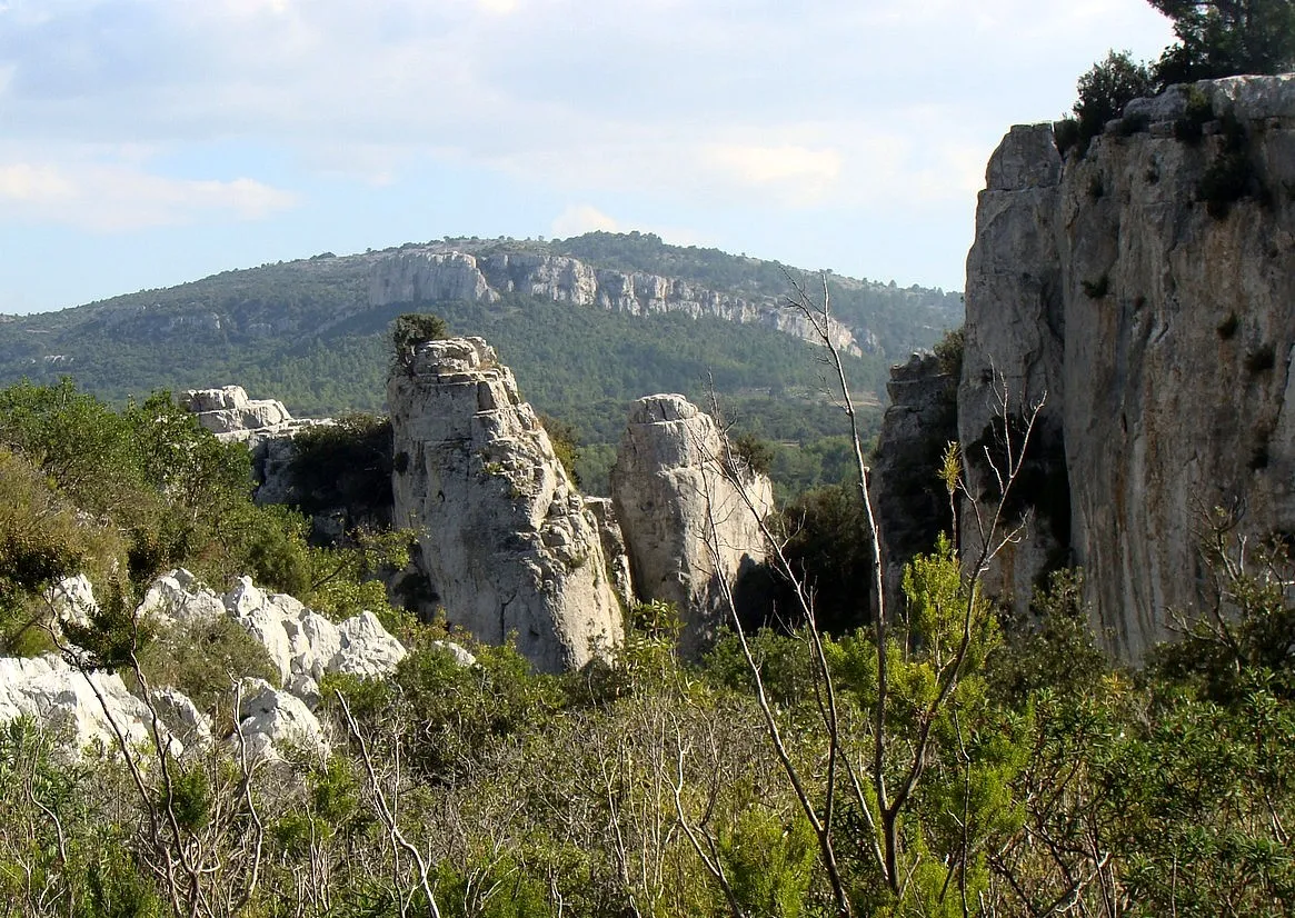
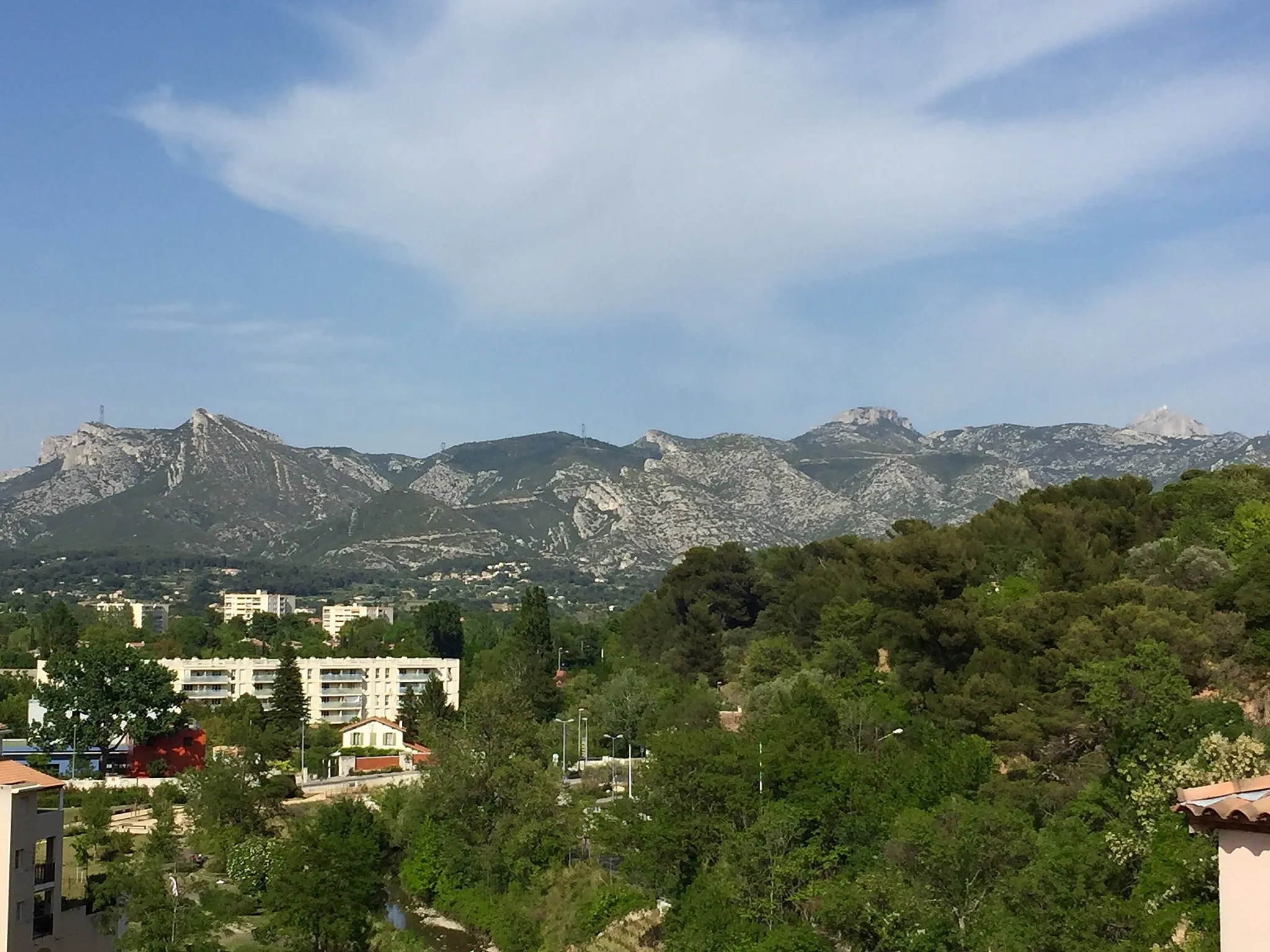
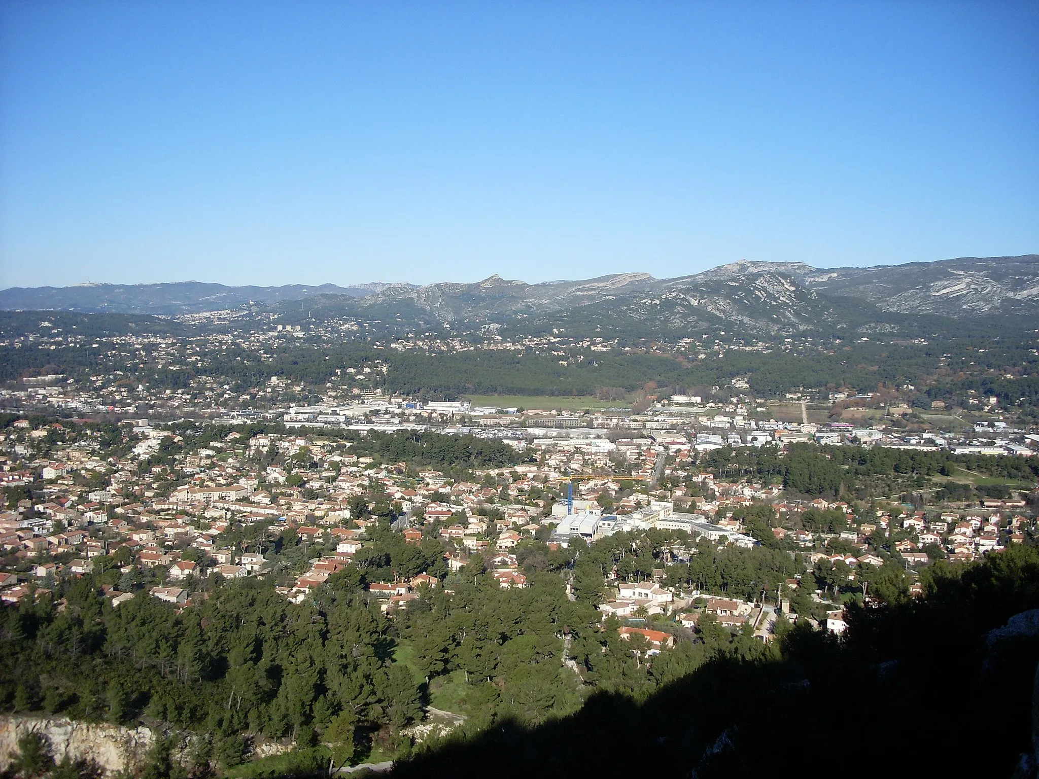
Ceyreste is a small town located in the region of Provence-Alpes-Côte d’Azur, France. From a cyclist's perspective, Ceyreste offers a mix of flat and hilly terrains, making it suitable for both road and gravel cycling. The town itself has a peaceful and tranquil atmosphere, providing a pleasant cycling experience. Road cyclists can explore the challenging climbs in the nearby Calanques National Park, offering breathtaking views of the Mediterranean Sea. Gravel cyclists can enjoy the scenic routes through forests and countryside. Overall, Ceyreste is a great destination for cyclists looking for diverse terrains and stunning landscapes.
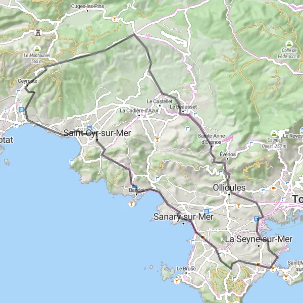
Experience the diverse landscapes of the region with highlights including Le Télégraphe, Le Camp du Castellet, and Sainte-Croix.
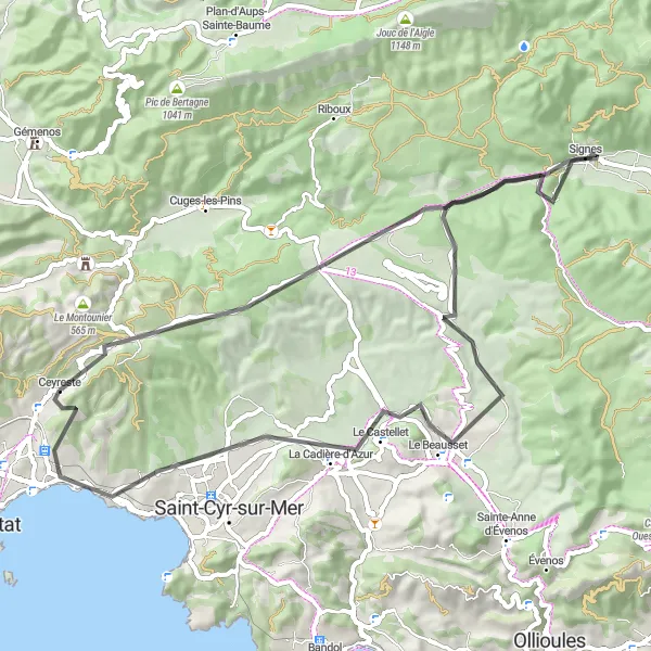
Starting near Ceyreste, this road cycling route offers a delightful journey through varied landscapes, from picturesque villages to scenic mountain passes. Highlights along the way include Le Télégraphe, an ancient telecommunications tower offering panoramic views, and Sainte-Croix, a charming village known for its historic architecture. With a total distance of 61 kilometers and an elevation gain of 849 meters, this route provides a moderate challenge for amateur cyclists. Glide through olive groves, vineyards, and quaint hamlets as you explore the stunning Provence-Alpes-Côte d'Azur region. With a difficulty rating of 2 and an epicness rating of 3, this route is suitable for cyclists looking for a mix of natural beauty and cultural attractions.

Discover the scenic beauty of Provence on this road cycling route.
The Scenic Route showcases the stunning landscapes and charming villages of Provence. Starting in Ceyreste, you'll ride along peaceful country roads and enjoy breathtaking views of rolling hills and vineyards. Highlights of the route include Le Camp du Castellet, a medieval campsite with panoramic views, and the coastal town of Saint-Cyr-sur-Mer, famous for its beautiful beaches. With a moderate difficulty level, this route is suitable for cyclists of all levels. The epicness level is rated at 2, offering a scenic ride without extreme challenges.

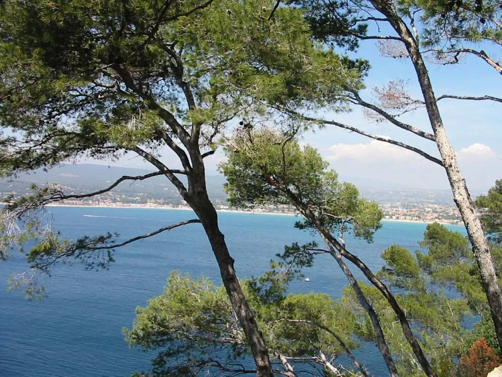
Embark on a thrilling coastal adventure on this gravel cycling route near Ceyreste.
This coastal gravel route near Ceyreste offers an exhilarating journey along the stunning Mediterranean coastline. Cyclists can enjoy the beauty of Le Télégraphe, Le Grand Caunet, and Pointe du Cerveau along the way. With a moderate difficulty level, this route is suitable for well-trained amateur cyclists who appreciate picturesque coastal scenery. The carefully curated highlights along the route provide opportunities to explore charming towns and soak up the coastal ambiance.

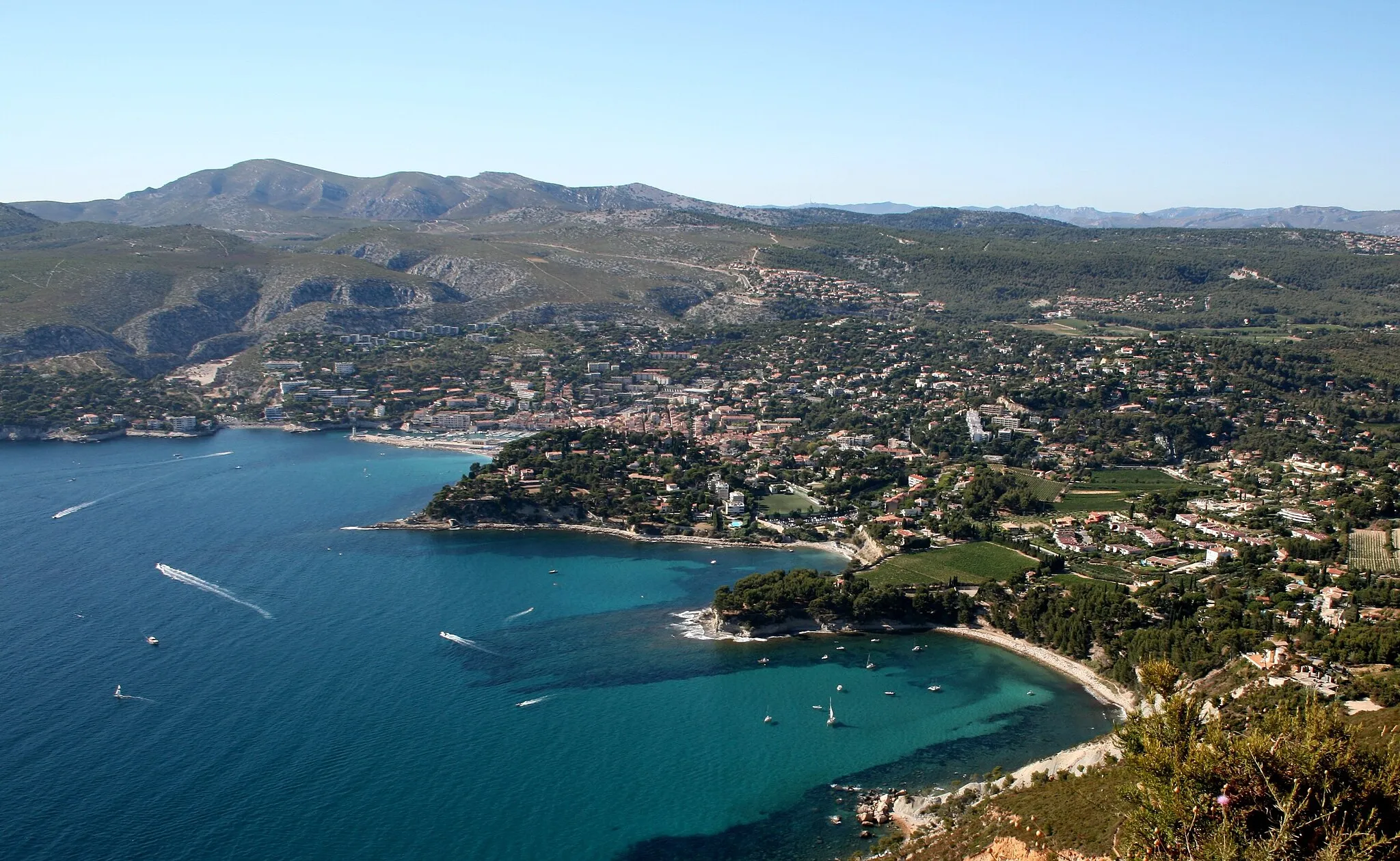
A scenic road route showcasing the natural beauty of Provence-Alpes-Côte d'Azur with highlights including Cassis, Monts de la Gineste, and Pas d'Ouillier.
This round-trip road cycling route starting near Ceyreste takes you through stunning landscapes and attractions like the iconic Cassis, the picturesque Monts de la Gineste, and the challenging Pas d'Ouillier. With a distance of 64 kilometers and an ascent of 1103 meters, it provides an enjoyable challenge for amateur cyclists. The route offers breathtaking views of the countryside and coastline, allowing riders to immerse themselves in the beauty of Provence-Alpes-Côte d'Azur. The highlights along the route provide additional points of interest and variety, ensuring a memorable cycling experience. With a difficulty rating of 3 and an epicness rating of 4, this route is perfect for intermediate cyclists looking for a rewarding and picturesque ride.

Venture through the rugged terrain and scenic landscapes on this gravel biking route near Ceyreste.
This gravel cycling route near Ceyreste offers a thrilling adventure through picturesque landscapes and challenging terrains. Cyclists can expect to experience the beauty of Col de l'Ange, Riboux, and Colle d'Espinas along the way. With a moderate difficulty level, this route is suitable for well-trained amateur cyclists who are looking to push their limits. The carefully curated highlights along the route offer opportunities to immerse in the natural beauty of the region and enjoy the thrill of gravel biking.
Embark on a picturesque road cycling journey starting from Ceyreste.
This road cycling route starting from Ceyreste showcases the stunning landscapes of the Provence-Alpes-Côte d'Azur region. Cyclists can enjoy the beauty of Pié Redon, La Seyne-sur-Mer, Six-Fours-les-Plages, and Colle de Reyne along the way. With a moderate difficulty level, this route is suitable for well-trained amateur cyclists who seek a balance between scenic beauty and a challenging ride. From coastal stretches to picturesque countryside, this route provides a diverse range of landscapes to explore.
Embark on an epic cycling adventure through picturesque landscapes near Ceyreste.
This road cycling route near Ceyreste offers the ultimate adventure for avid cyclists. Boasting challenging terrains and breathtaking landscapes, cyclists can experience Le Télégraphe, Le Camp du Castellet, Pays de Sainte-Croix, Mont Faron, Évenos, Pointe du Cerveau, and La Cadière-d'Azur, among others. With a difficulty level suited for well-trained amateurs, this route provides an unmatched exploration of Provence-Alpes-Côte d'Azur. From legendary climbs to famous cycling spots, this route is guaranteed to leave a lasting impression.
Provencal Hills Loop
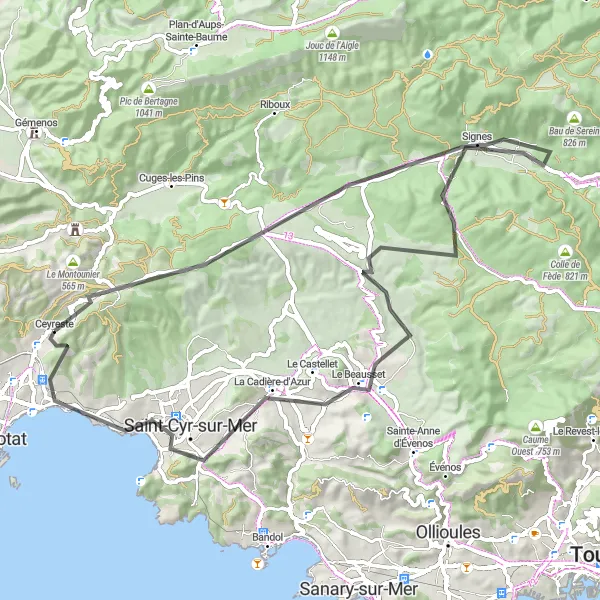
Experience the charm of Provence as you cycle through scenic hills and picturesque villages.
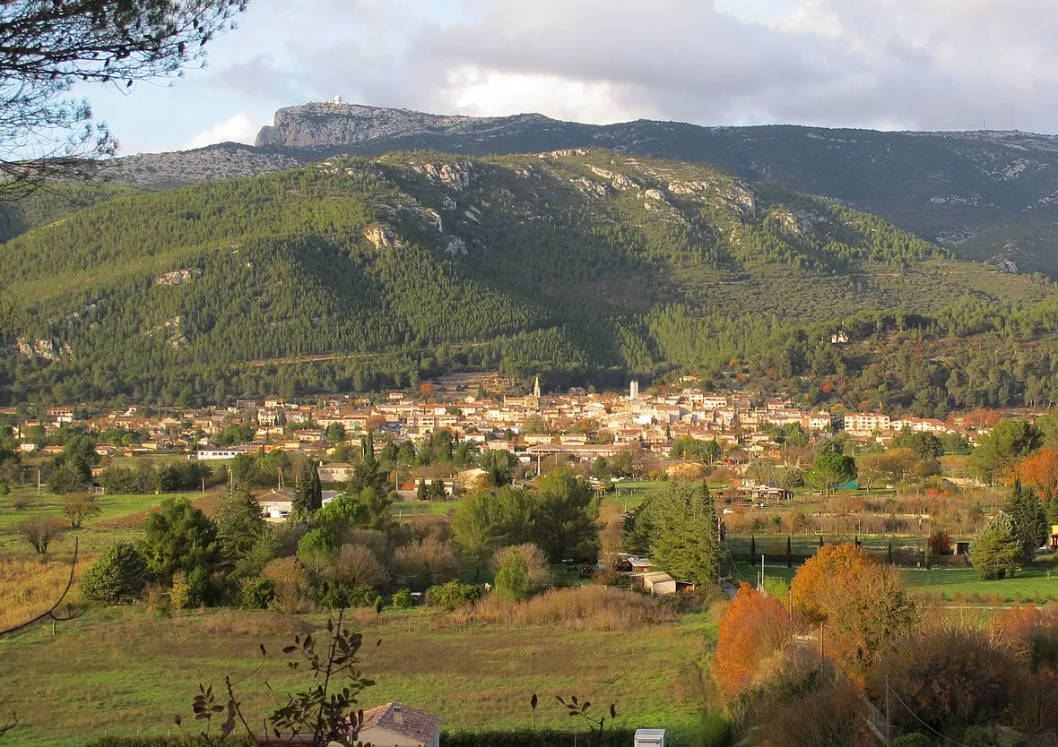
The Provencal Hills Loop takes you through the beautiful countryside of Provence, with its rolling hills, vineyards, and medieval villages. Starting in Ceyreste, a quaint village nestled in the hills, you'll ride along quiet country roads and enjoy breathtaking views of the surrounding landscapes. The route includes several highlights, such as the historic Le Télégraphe, an ancient signaling tower, and the picturesque Lavoir, a traditional washhouse. With a moderate difficulty level, this route is suitable for well-trained amateur cyclists looking for a challenging but rewarding ride. The epicness of this route is rated at 3, offering a memorable cycling experience without extreme challenges.

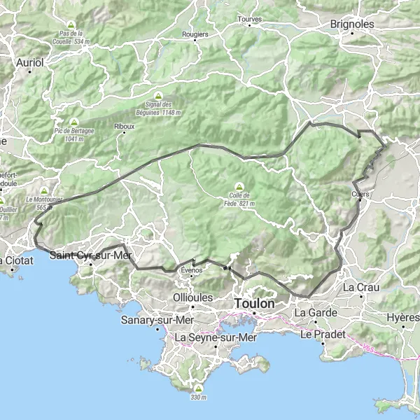
Embark on an epic cycling adventure with highlights including Cassis, Monts de la Gineste, and Col de l'Ange.
This challenging road cycling route starting near Ceyreste offers an extraordinary adventure through some of the most stunning landscapes in the region. Highlights along the way include the iconic Cassis, the majestic Monts de la Gineste, and the grueling Col de l'Ange. With a distance of 116 kilometers and an ascent of 2015 meters, this route is reserved for experienced cyclists seeking an epic challenge. The route showcases the diverse beauty of Provence-Alpes-Côte d'Azur, from the rugged coastline to the breathtaking mountain passes. With a difficulty rating of 4 and an epicness rating of 5, this route promises an unforgettable cycling experience that will leave you in awe of nature's wonders.

Explore the scenic beauty of Ceyreste and Provence-Alpes-Côte d’Azur on this thrilling cycling trail
Embark on a memorable cycling journey through the picturesque landscapes and cultural landmarks of Ceyreste and Provence-Alpes-Côte d’Azur. This round-trip route offers a perfect mix of challenging ascents, mesmerizing vistas, and charming villages. Enjoy the warm Mediterranean climate as you pedal through historic towns and lush vineyards, discovering hidden gems along the way.
Cycling routes nearby:


Nearby regions: