Discover scenic diversity in Aouste-sur-Sye on your bike.
Cycling routes from Aouste-sur-Sye
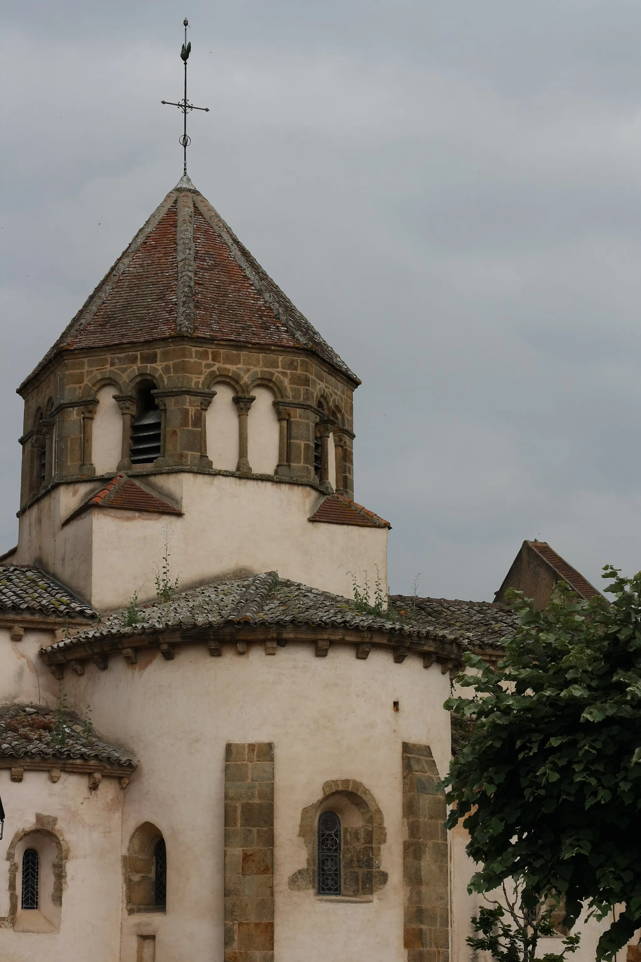
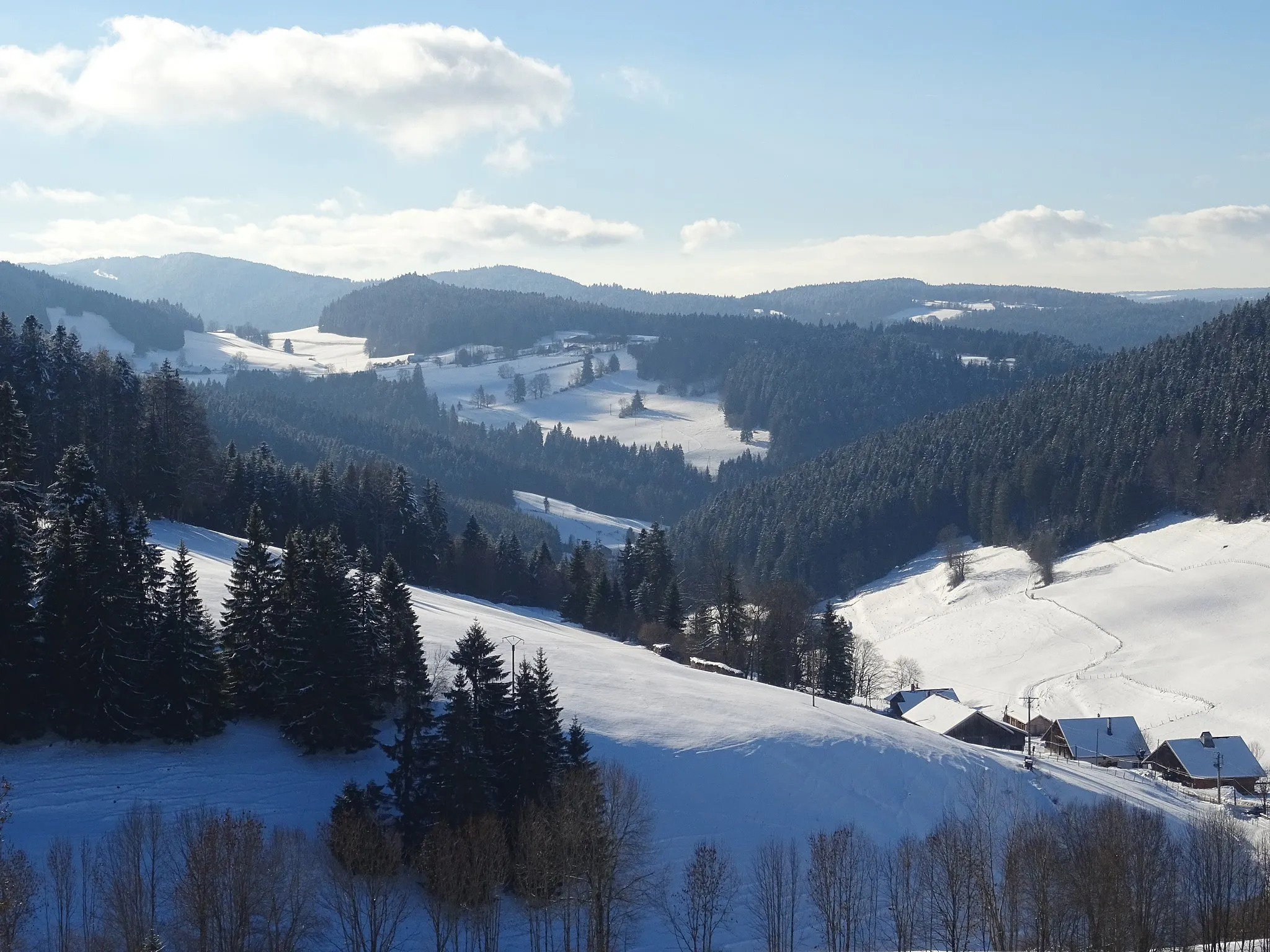
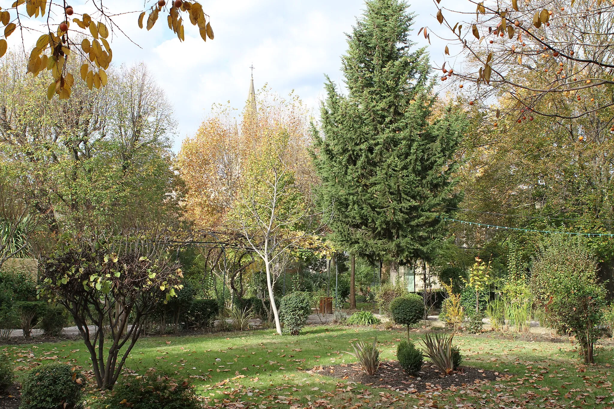
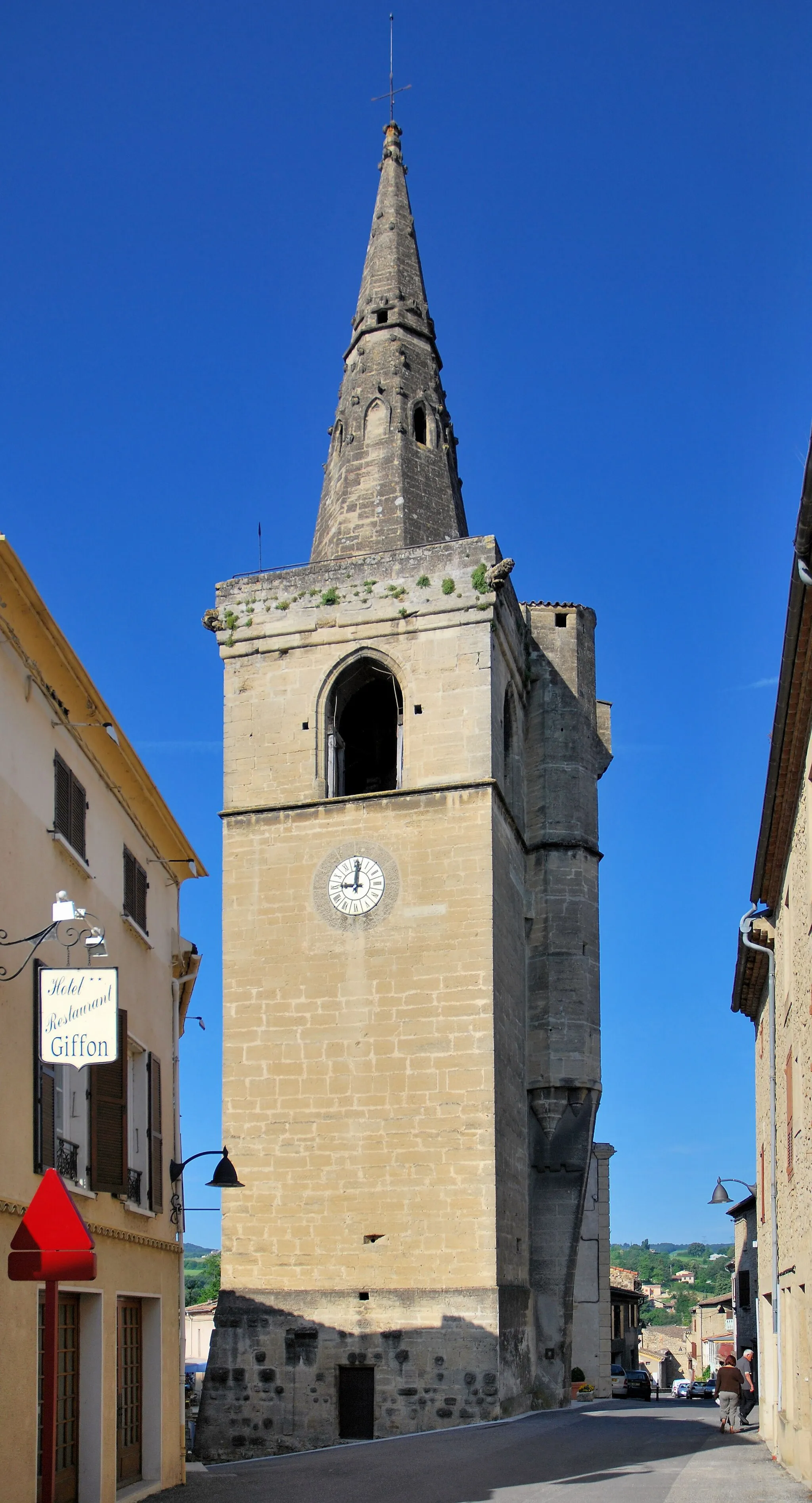
Aouste-sur-Sye is a charming locality situated in the Rhône-Alpes region of France. From a cyclist's perspective, it offers diverse terrain with both flat roads and challenging climbs. The locality is known for its stunning natural beauty, with the Drôme River running through it and surrounding mountains providing a dramatic backdrop. While Aouste-sur-Sye may not have any specific famous cycling-related spots or well-known climbs, it is a fantastic base for exploring the region and enjoying a variety of cycling routes.
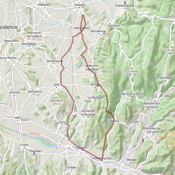
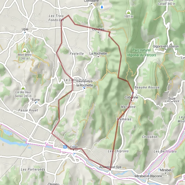
Gravel ride to Eurre and Cobonne
Enjoy a gravel ride through the scenic villages of Eurre and Cobonne
This gravel ride takes you through the beautiful villages of Eurre and Cobonne. With a total ascent of 818 meters and a distance of 51 kilometers, it is a challenging yet rewarding route suitable for experienced gravel riders. The route offers stunning views of the surrounding countryside and takes you along picturesque rural roads. Highlights of the ride include the charming village of Eurre, known for its old stone houses and traditional Provençal atmosphere, and the historic village of Cobonne with its medieval architecture.
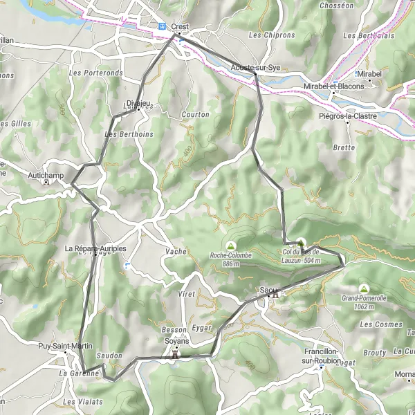
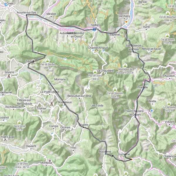
Experience the challenge of climbing Col du Pas de Lauzun and enjoy the beautiful landscape of Saou
This road cycling route will take you through the challenging climb of Col du Pas de Lauzun and the picturesque landscape of Saou. With a total ascent of 656 meters and a distance of 39 kilometers, it is suitable for well-trained amateurs. The route offers stunning views of the surrounding mountains and takes you through scenic country roads. Highlights of the ride include the famous Col du Pas de Lauzun and the beautiful village of Saou.
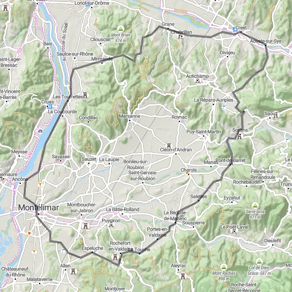
Embark on a road cycling adventure to discover the historic towns of Montélimar and Mirmande
This road cycling route offers an adventurous journey to the historic towns of Montélimar and Mirmande. With a total ascent of 969 meters and a distance of 92 kilometers, it is a challenging route suitable for experienced cyclists. The route takes you through scenic countryside and offers breathtaking views throughout the ride. Highlights of the adventure include the historic town of Montélimar, known for its production of nougat, and the picturesque village of Mirmande, recognized as one of the most beautiful towns in France.
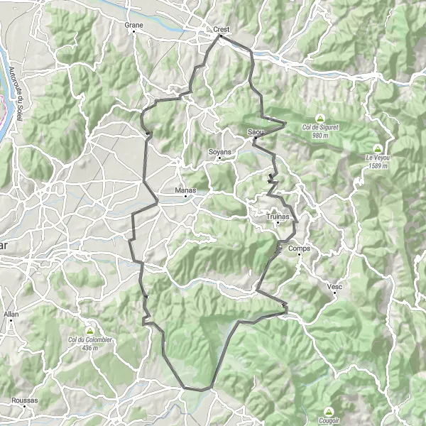
Discover the charming villages of Cobonne and Crest on this gravel ride
This gravel route takes you through the picturesque villages of Cobonne and Crest. With a total ascent of 582 meters and a distance of 31 kilometers, it is a moderate challenge suitable for well-trained amateurs. The route offers beautiful views of the surrounding countryside and takes you through scenic rural roads. Highlights of the ride include the historic village of Cobonne and the medieval town of Crest with its famous tower.
The Valence Loop
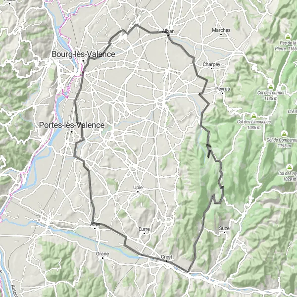
Cycle through beautiful landscapes and visit historical landmarks on this road cycling route.
Embark on a road cycling journey that takes you from Aouste-sur-Sye to Valence and back. This 95-kilometer route features an ascent of 999 meters, providing a moderate to challenging ride for well-trained amateur cyclists. Along the way, you'll encounter highlights such as Allex, Valence, Alixan, Combovin, Col Jérôme Cavalli, and Cobonne. Experience a blend of natural beauty, historical sites, and vibrant towns on this diverse cycling adventure.
Explore the scenic surroundings and charming villages on this road cycling route.
Embark on a picturesque road cycling adventure that takes you through the stunning countryside surrounding Aouste-sur-Sye in Rhône-Alpes, France. With a total distance of 77 kilometers and an ascent of 820 meters, this route offers a moderate challenge suitable for well-trained amateur cyclists. The route passes through highlights such as Beaufort-sur-Gervanne, Col de la Croix, Vachères-en-Quint, Die, Espenel, Aubenasson, and ultimately returns to Aouste-sur-Sye. Enjoy the diverse landscapes, quaint villages, and breathtaking views along the way.
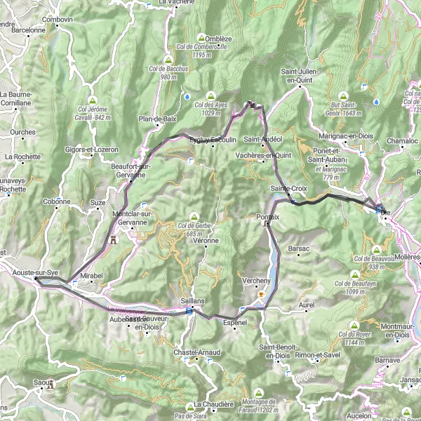
Conquer the challenge of Col de Tavard and explore the scenic villages of Espenel and Saint-Benoit-en-Diois
This challenging road cycling route takes you through the scenic villages of Espenel and Saint-Benoit-en-Diois, showcasing the magnificent landscapes of the region. With a total ascent of 1281 meters and a distance of 87 kilometers, it is suitable for experienced cyclists seeking a tough adventure. The route offers breathtaking views, challenging climbs, and captivating countryside roads. Highlights of the route include the picturesque village of Espenel, nestled in the Diois region, and the charming village of Saint-Benoit-en-Diois, famous for its fortified church and stunning panoramic views.
Drome Valley Loop
Embark on a scenic journey through beautiful Drome Valley on this road cycling route.
The Drome Valley Loop is a picturesque road cycling route that takes you through the beautiful landscapes of the Drome Valley in the Rhône-Alpes of France. With a total ascent of 1579m and a distance of 102km, this route offers a moderately challenging ride with plenty of stunning scenery along the way. Starting in Aouste-sur-Sye, you'll pass through charming villages, tackle scenic mountain climbs, and enjoy panoramic views of the surrounding countryside. [Highlight Scoring and Descriptions] - Aouste-sur-Sye (Score: 5/5): Starting point of the route, Aouste-sur-Sye is a small village nestled in the Drome Valley, surrounded by beautiful nature. - Col du Pas de Lauzun (Score: 3/5): At 7km on the route, Col du Pas de Lauzun is a mountain pass with a moderate climb and stunning views of the valley. - Francillon-sur-Roubion (Score: 4/5): Located at 16km on the route, Francillon-sur-Roubion is a charming village known for its historic architecture and peaceful atmosphere. - Col de Boutière (Score: 4/5): At 26km on the route, Col de Boutière is a scenic mountain pass that offers beautiful vistas of the surrounding countryside. - La Charousse (Score: 4/5): Located at 42km on the route, La Charousse is a picturesque hamlet with traditional stone houses and stunning views. - Roche-Saint-Secret-Béconne (Score: 3/5): At 47km on the route, Roche-Saint-Secret-Béconne is a medieval village perched on a rocky hill, offering panoramic views. - La Bégude-de-Mazenc (Score: 4/5): Located at 69km on the route, La Bégude-de-Mazenc is a charming village with narrow streets, historic buildings, and a lively market. - Col de la Grosse Pierre (Score: 4/5): At 76km on the route, Col de la Grosse Pierre is a challenging mountain pass that rewards with stunning views. - Charols (Score: 4/5): Located at 76km on the route, Charols is a small village known for its medieval castle and beautiful scenery. - Crest (Score: 4/5): At 99km on the route, Crest is a historic town with a majestic castle perched on a hill, offering panoramic views of the region. The Drome Valley Loop is a scenic and enjoyable cycling route that showcases the beauty of the Drome Valley. With its moderate difficulty level and stunning highlights, this route is perfect for cyclists looking to immerse themselves in the charm of the region while enjoying a memorable ride.

Discover the stunning landscapes of the Drome on this road cycling adventure.
The Tour of the Drome is a fantastic road cycling route that takes you through the stunning landscapes of the Drome region in the Rhône-Alpes of France. With a total ascent of 2121m and a distance of 118km, this route offers a challenging yet rewarding experience for avid cyclists. Along the way, you'll pass through picturesque villages, climb scenic mountain passes, and enjoy breathtaking views of the surrounding countryside. [Highlight Scoring and Descriptions] - Espenel (Score: 4/5): Located at 15km on the route, Espenel is a charming village known for its traditional stone houses and natural beauty. - Saint-Benoit-en-Diois (Score: 3/5): At 22km on the route, Saint-Benoit-en-Diois is a quaint village known for its medieval architecture and peaceful atmosphere. - Col de Tavard (Score: 4/5): Located at 31km on the route, Col de Tavard is a mountain pass famous for its challenging climb and stunning views. - Col du Portail (Score: 5/5): At 43km on the route, Col du Portail is a legendary climb that offers breathtaking views of the surrounding mountains. - Volvent (Score: 3/5): Located at 48km on the route, Volvent is a small village with a beautiful church and scenic landscapes. - Col de la Croix (Score: 4/5): At 57km on the route, Col de la Croix is a popular mountain pass known for its challenging ascent and magnificent views. - Cornillon-sur-l'Oule (Score: 2/5): Located at 65km on the route, Cornillon-sur-l'Oule is a picturesque village with narrow streets and traditional houses. - Col Lescou (Score: 3/5): At 79km on the route, Col Lescou is a mountain pass with a moderate climb and stunning vistas. - Bouvières (Score: 3/5): Located at 83km on the route, Bouvières is a small village with historic charm and panoramic views. - Bourdeaux (Score: 4/5): At 95km on the route, Bourdeaux is a medieval village known for its beautiful architecture and vibrant atmosphere. - Petit-Pomerolle (Score: 3/5): Located at 108km on the route, Petit-Pomerolle is a hamlet surrounded by picturesque countryside. The Tour of the Drome is a challenging and scenic cycling route that takes you through some of the most beautiful landscapes in the region. With its diverse terrain and amazing highlights, this route is sure to impress both amateur and experienced cyclists alike.
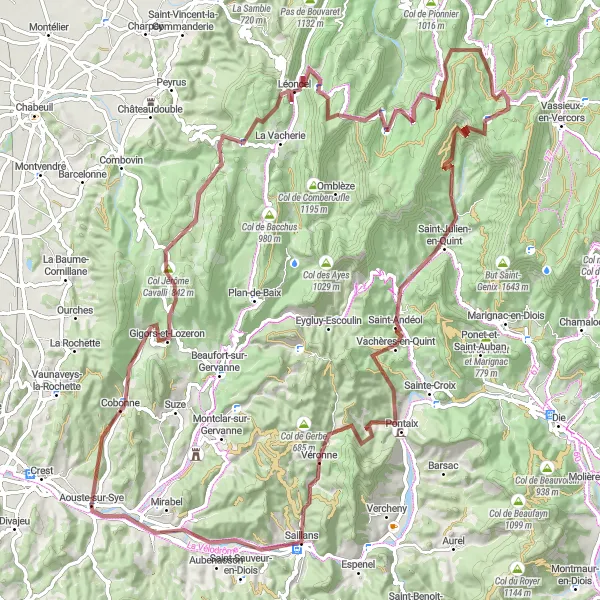
Embark on an epic gravel adventure through the rugged landscapes surrounding Aouste-sur-Sye.
Prepare for an adrenaline-filled gravel cycling experience on this 113-kilometer route boasting an ascent of 2,745 meters. Suitable for experienced cyclists, the Gigors-et-Lozeron Gravel Ride takes you through Gigors-et-Lozeron, Col Jérôme Cavalli, Léoncel, Col de la Bataille, Font d'Urle, Infernet, Vachères-en-Quint, Véronne, and finally back to Aouste-sur-Sye. Immerse yourself in the untamed beauty of Rhône-Alpes as you conquer challenging climbs and marvel at breathtaking views.
Cycling routes nearby:


Nearby regions: