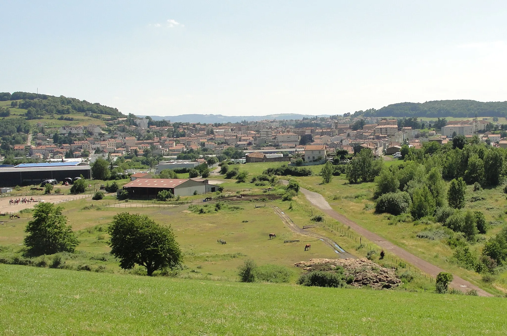
Discover the diverse terrain and natural beauty of Roche-la-Molière on your bike.
Cycling routes from Roche-la-Moliere
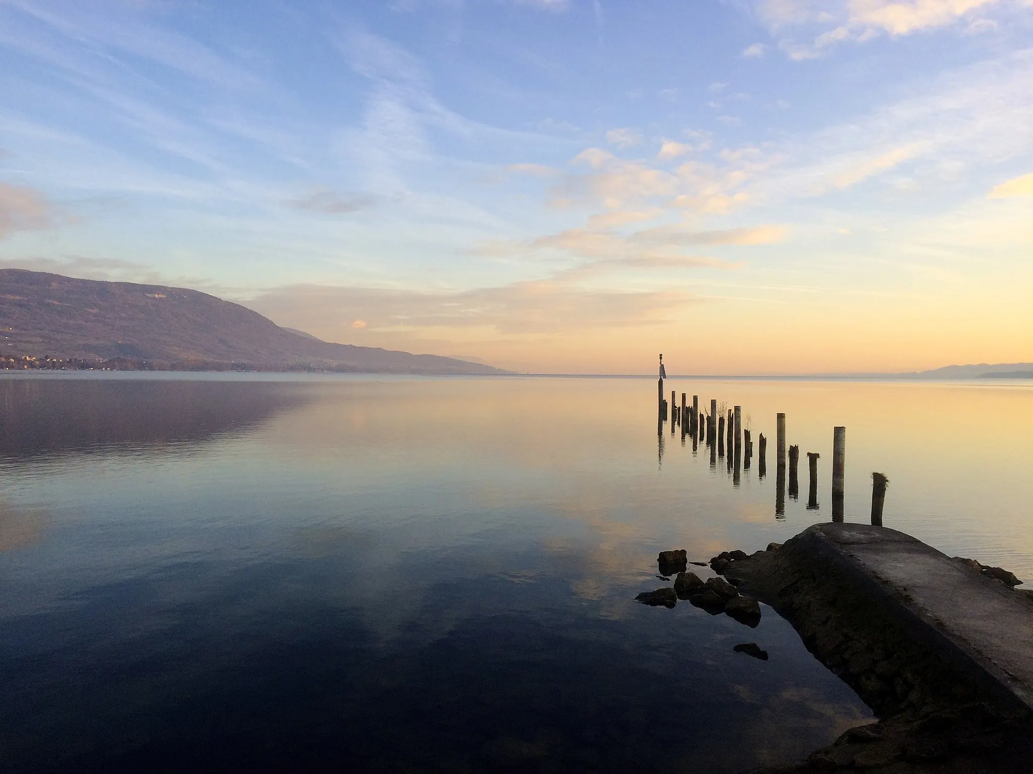
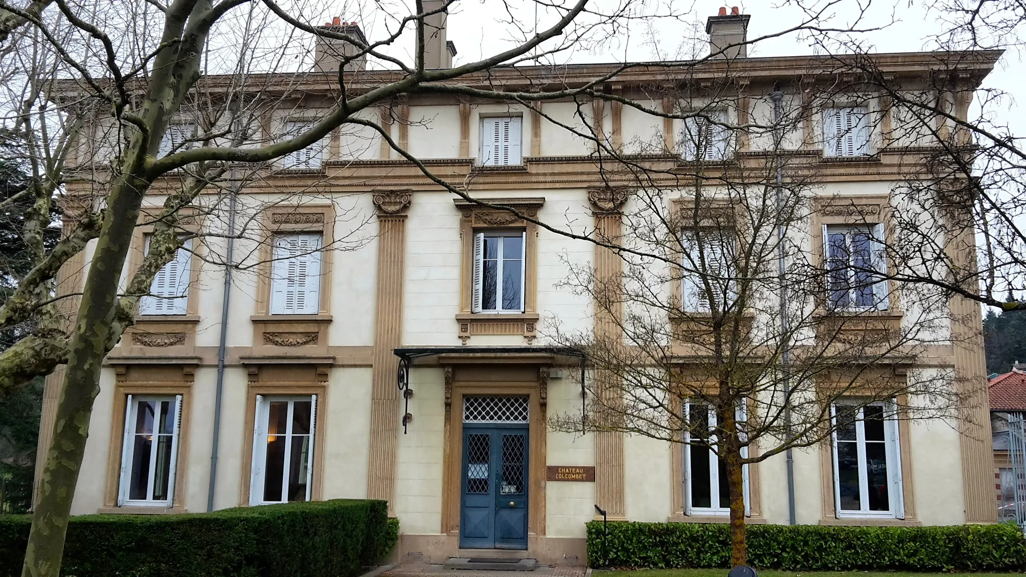
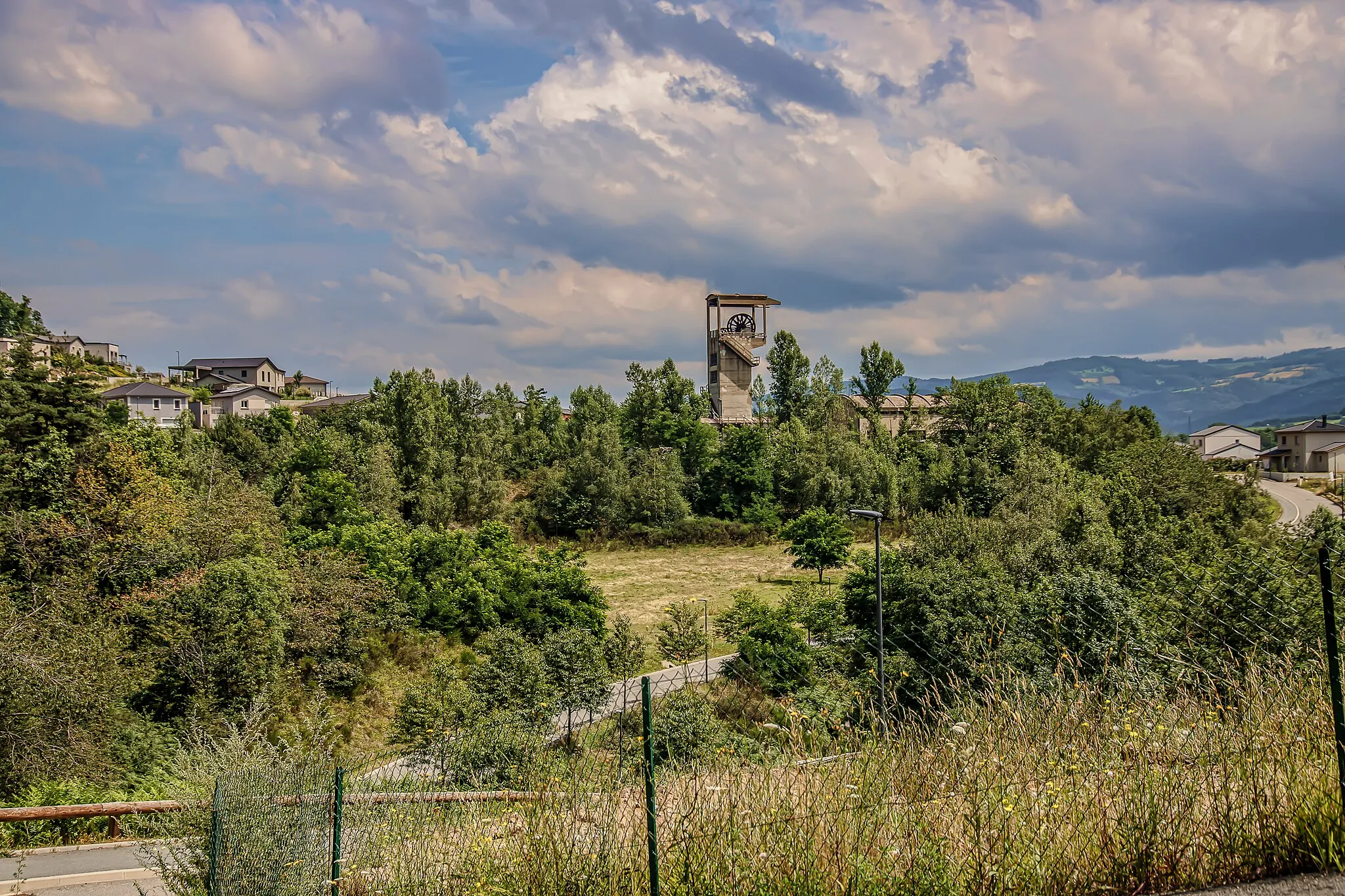
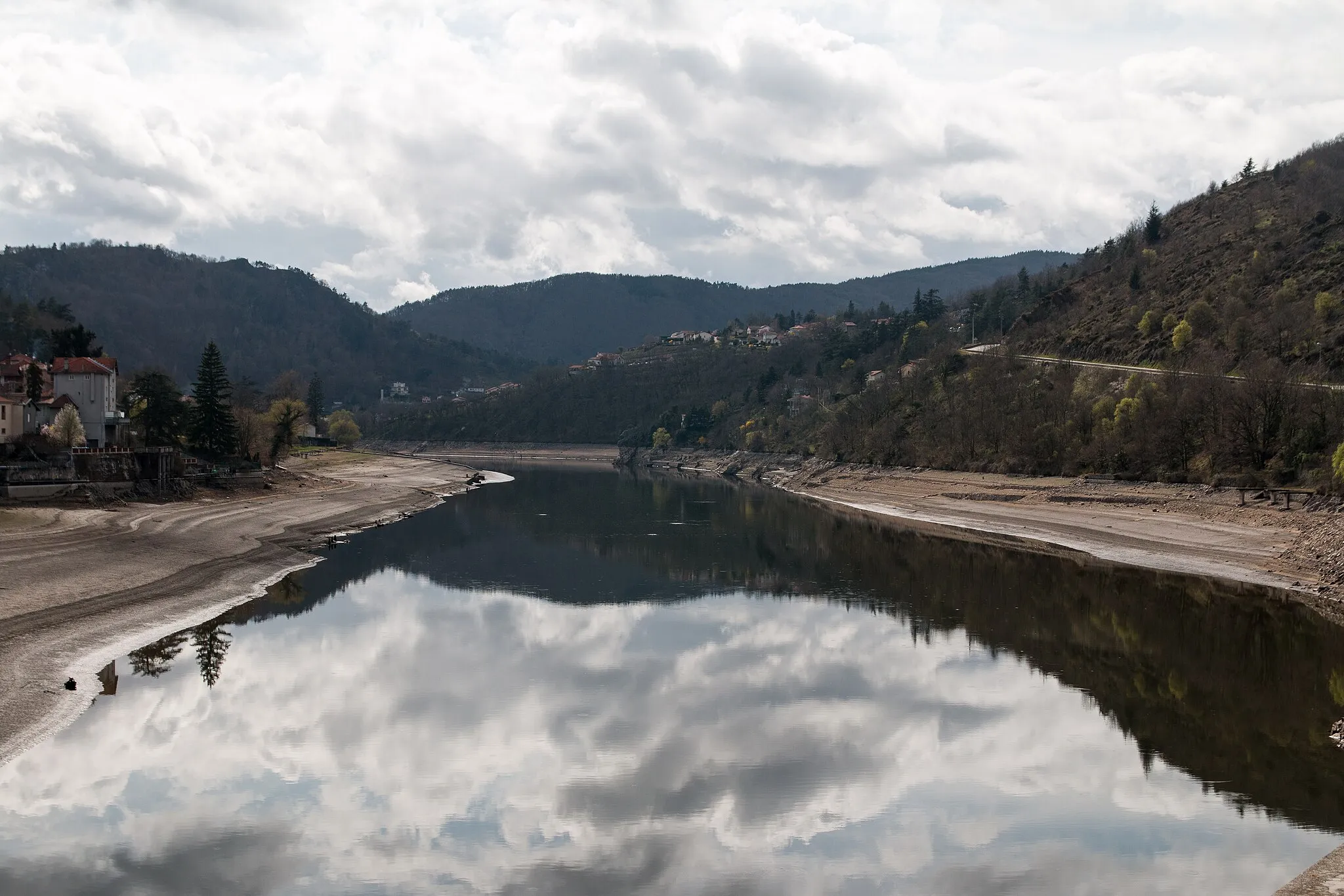
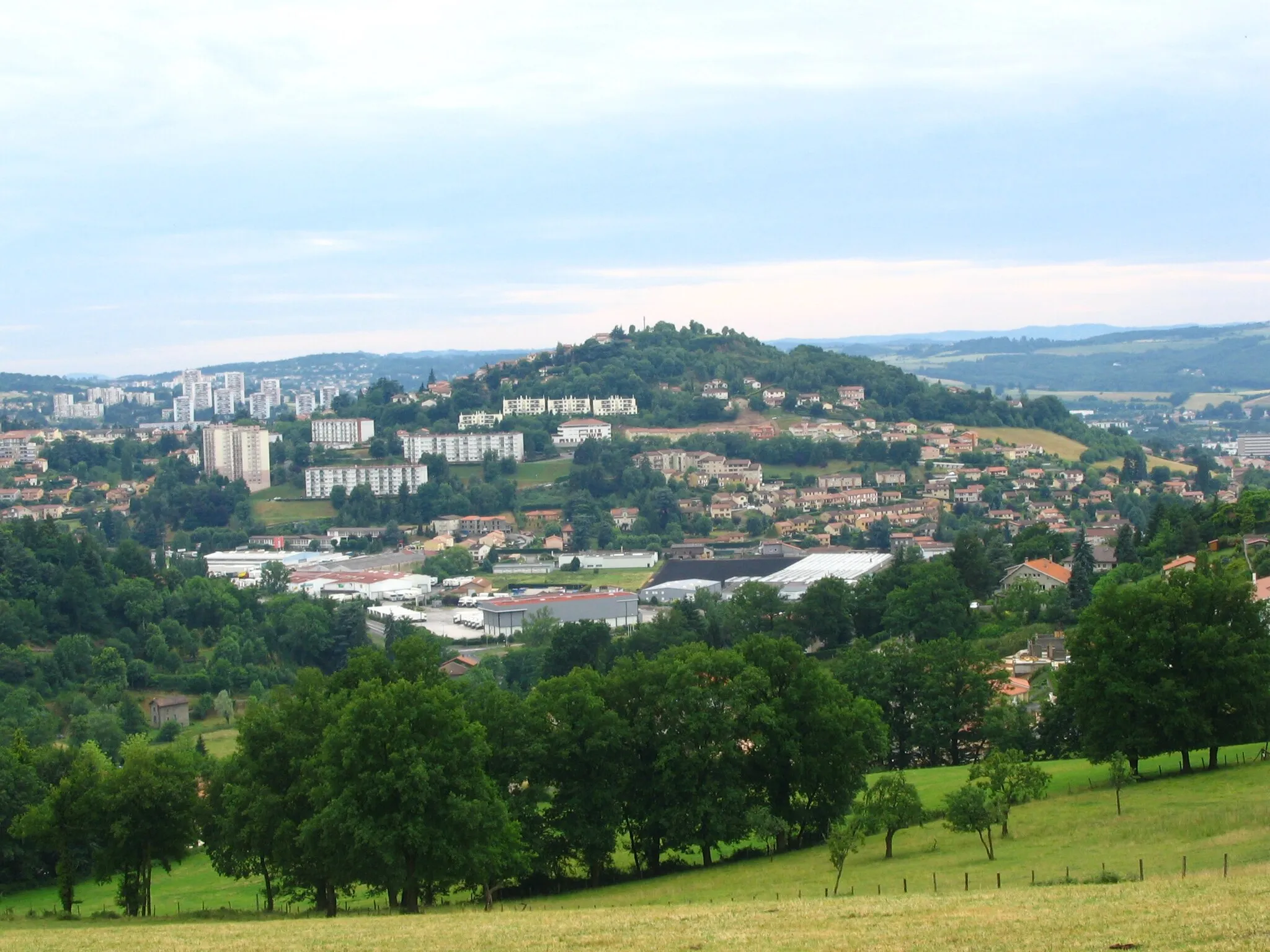
Roche-la-Molière is situated in the Rhône-Alpes region of France. From a cyclist's perspective, Roche-la-Molière offers a variety of terrains, including hilly routes and flat roads. The area is surrounded by natural beauty, with forests and mountains to explore. One of the well-known cycling climbs nearby is the Col de la République, which offers a challenging ascent and breathtaking views. In addition to cycling, Roche-la-Molière offers opportunities for hiking and other outdoor activities. With its diverse terrain and stunning scenery, Roche-la-Molière is a great destination for cyclists and outdoor enthusiasts.
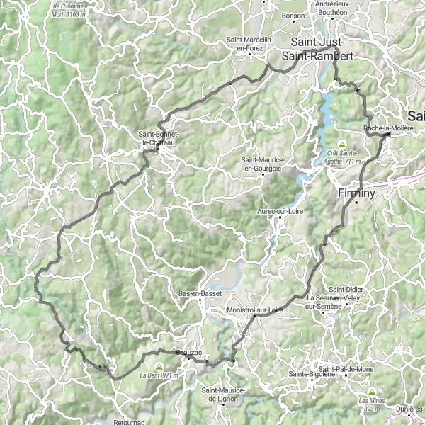
Embark on a scenic journey to the picturesque village of Solignac-sous-Roche
Immerse yourself in the breathtaking landscapes near Roche-la-Molière with this 115-kilometer round-trip cycling route. With an ascent of 2148 meters, it offers a challenging adventure for experienced cyclists. Traverse picturesque towns like Pont-Salomon and Monistrol-sur-Loire and marvel at the stunning scenery. The road conditions are ideal for road biking, ensuring a smooth and enjoyable ride.

Take on the challenge of this road cycling route in the Rhône-Alpes region
This road cycling route offers a challenging and scenic ride through the beautiful landscapes of the Rhône-Alpes region. With a distance of 101 kilometers and an ascent of 1662 meters, this route is suitable for well-trained amateur cyclists. From historic towns to picturesque countryside, this route provides a taste of the rich cultural and natural heritage of the region.
Journey to Saint-Priest-en-Jarez
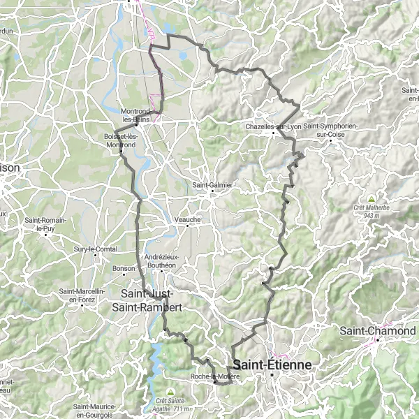
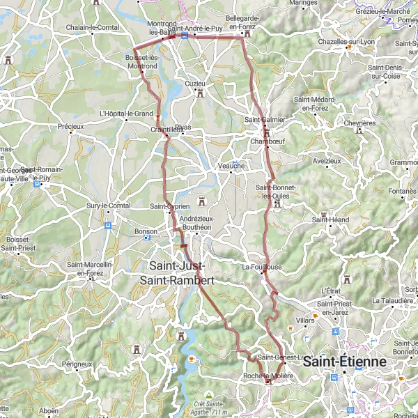
Embark on an adventurous journey to the charming village of Saint-Priest-en-Jarez
Discover the enchanting landscapes near Roche-la-Molière with this 106-kilometer round-trip cycling route. With an ascent of 1412 meters, it presents a challenging opportunity for cyclists. Pedal through scenic countryside and picturesque villages like Craintilleux and Saint-André-le-Puy. The road surface is suitable for road biking enthusiasts, ensuring a smooth and enjoyable ride throughout the route.
Explore the charming Loire Valley along this gravel route
This gravel route takes you through the beautiful Loire Valley, offering stunning scenery and a mix of challenging climbs and fast descents. The route starts near Roche-la-Molière and covers a distance of 65 kilometers with an ascent of 1456 meters. It is suitable for experienced and well-trained amateur cyclists.
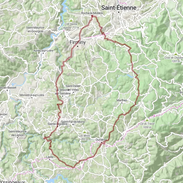
Embark on a thrilling gravel adventure through the stunning Pilat Regional Natural Park
This challenging gravel route takes you through the picturesque Pilat Regional Natural Park. With a distance of 92 kilometers and an ascent of 2156 meters, this route offers a mix of breathtaking climbs, fast descents, and scenic vistas. Suitable for experienced cyclists, this route is sure to provide an unforgettable adventure.
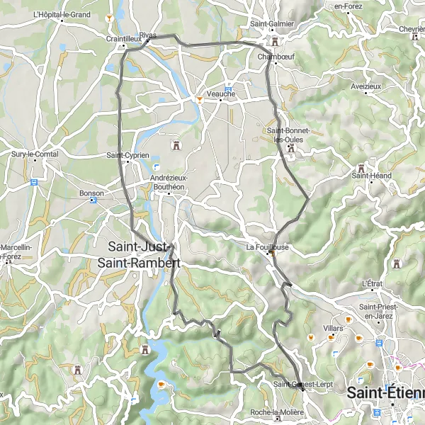
Experience the captivating landscapes and quaint villages of Saint-Genest-Lerpt
This round-trip cycling route takes you through the stunning landscapes near Roche-la-Molière. With a distance of 51 kilometers and an ascent of 550 meters, it offers a moderate challenge for cyclists. Explore charming villages along the way, such as Saint-Just-Saint-Rambert and La Fouillouse. The road surface is suitable for road biking enthusiasts, providing a smooth ride throughout the journey.
Discover the natural beauty of the Forez Mountains on this gravel trail
This scenic gravel route takes you through the stunning Forez Mountains. With a distance of 65 kilometers and an ascent of 692 meters, this route offers a mix of rolling hills, beautiful forests, and charming villages. Suitable for cyclists of all levels, this trail is perfect for nature lovers and those seeking a tranquil cycling experience.
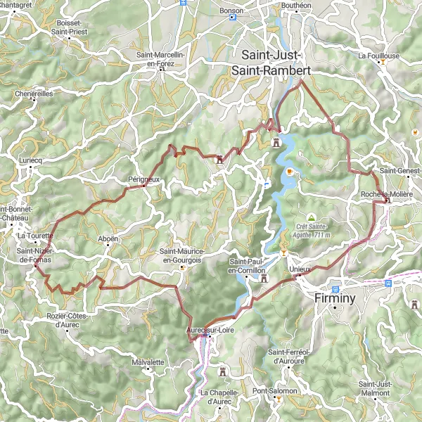
Cycling Adventure to Périgneux
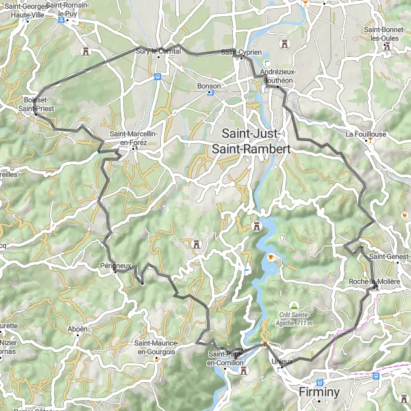
Embark on an exciting cycling journey to the idyllic town of Périgneux
Explore the scenic beauty of Roche-la-Molière with this 69-kilometer round-trip cycling route. With an ascent of 1131 meters, it presents a moderate challenge for cyclists. Admire magnificent landscapes along the way, passing through picturesque villages like Saint-Paul-en-Cornillon and Saint-Marcellin-en-Forez. The road surface is perfect for road biking, providing a smooth ride throughout the route.

Embark on an exciting gravel adventure to Mont Morin
Experience the thrill of gravel cycling near Roche-la-Molière with this 84-kilometer round-trip route. With an ascent of 1606 meters, it offers a challenging adventure for cyclists seeking off-road excitement. Immerse yourself in nature as you explore the stunning landscapes and quaint villages along the way. The gravel terrain provides an exhilarating ride for gravel biking enthusiasts.

Embark on a thrilling gravel tour, exploring the Loire Valley and the Monts du Forez
This challenging gravel tour takes you through the picturesque Loire Valley and the Monts du Forez. With a distance of 91 kilometers and an ascent of 1900 meters, this tour offers breathtaking landscapes, charming villages, and historic landmarks. Suitable for experienced cyclists, this tour is a perfect opportunity to explore the natural and cultural beauty of the region.
Cycling routes nearby:

Nearby regions: