A hidden gem for cyclists with rolling hills, challenging climbs, and stunning mountain views at Hoherodskopf.
Cycling routes from Ulrichstein
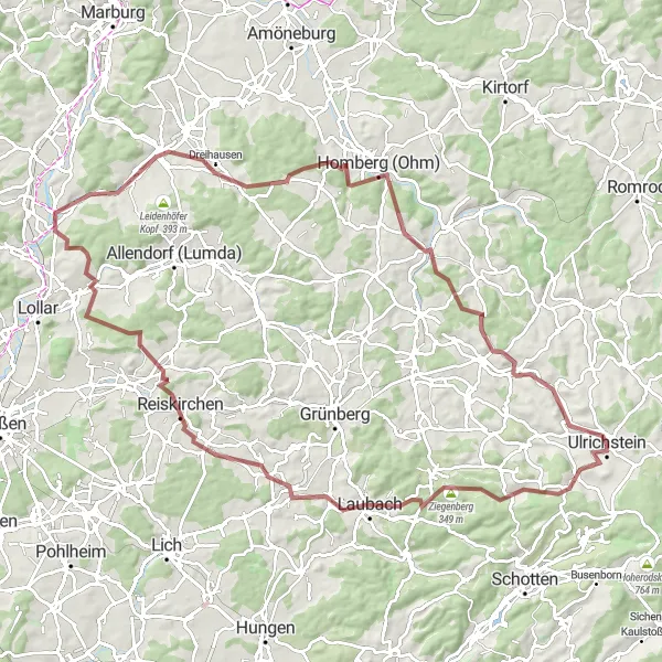
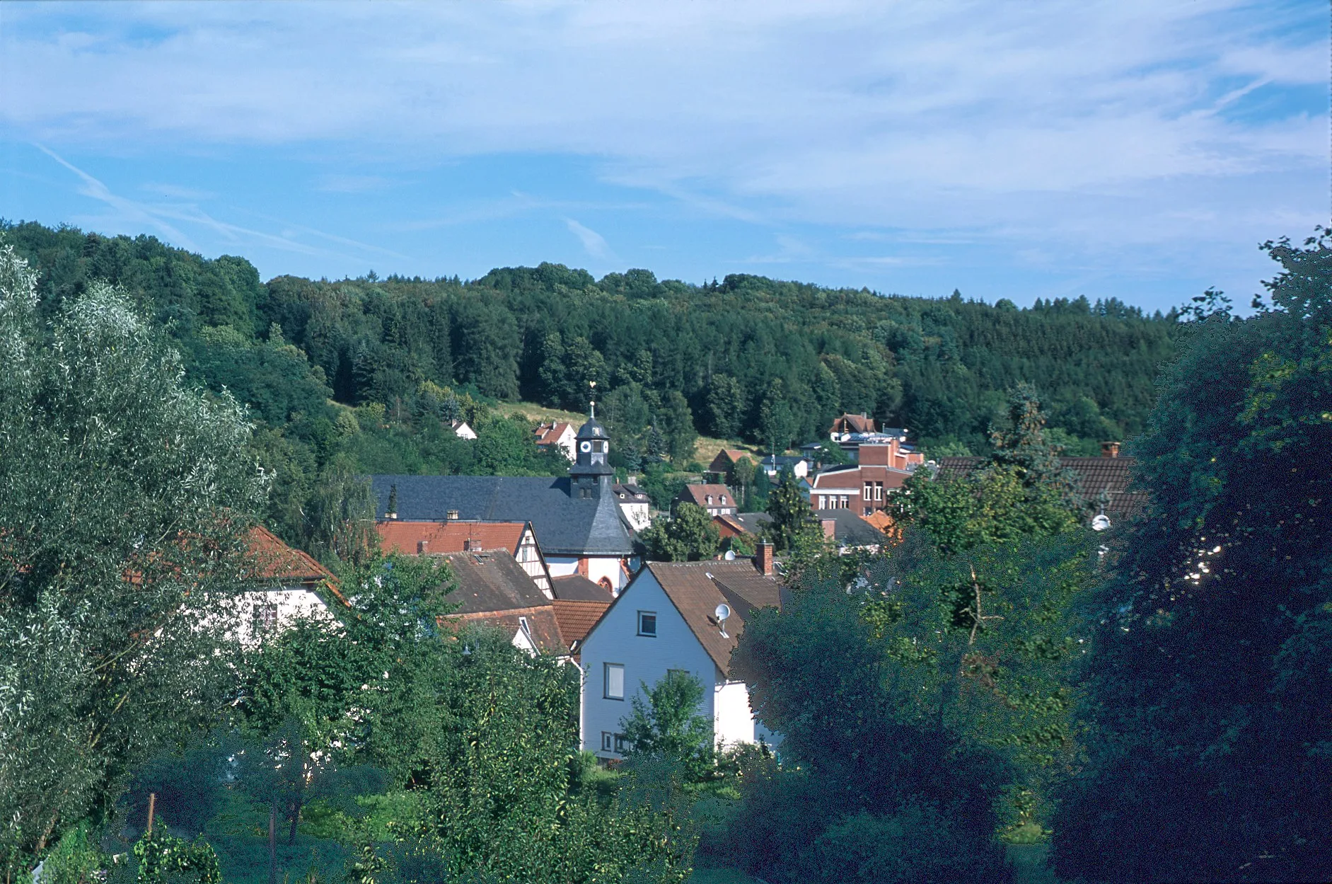
Ulrichstein is a locality located in Gießen, Germany. As a cyclist, Ulrichstein offers a mix of road and gravel routes through beautiful countryside and dense forests. The area features rolling hills and challenging climbs, making it suitable for experienced cyclists. A well-known cycling climb nearby is the ascent to Hoherodskopf, a mountain with magnificent panoramic views from the summit. Overall, Ulrichstein is a hidden gem for cyclists looking for peaceful rides in a scenic natural setting.
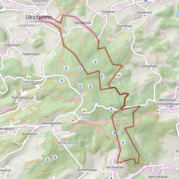
A scenic gravel road route through beautiful countryside
The Countryside Adventure is a 38 km gravel road cycling route that takes you on a delightful journey through picturesque countryside. With an ascent of 687 meters, this route offers a moderate challenge for cyclists. The highlight of the route is Geiselstein, a scenic hill that rewards you with stunning views of the surrounding landscapes. Other notable highlights along the way include Ellersberg, where you can indulge in the natural beauty of the region, and Kopf, a hill that adds excitement to the route. Overall, the Countryside Adventure provides a scenic and enjoyable cycling experience for riders looking to explore the beauty of the countryside.
The Century Challenge
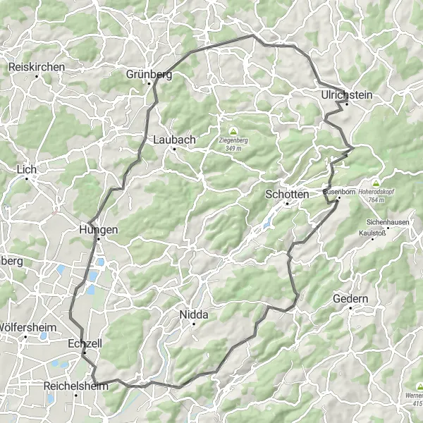
An epic road cycling route with legendary climbs
The Century Challenge is a 100 km road cycling route that will test the limits of experienced cyclists. With an ascent of 1287 meters, this route offers an epic adventure for riders seeking legendary climbs. The highlight of the route is the Hauberg, a steep climb that challenges even the most seasoned cyclists. Other notable highlights along the way include Rudingshain, a quaint village with stunning rural scenery, and Strenzelberg, a hill with captivating views of the surrounding area. Overall, the Century Challenge offers a thrilling and physically demanding cycling experience for riders looking for legendary climbs and unforgettable landscapes.
Discover the beautiful countryside around Ulrichstein and visit the charming village of Meiches.
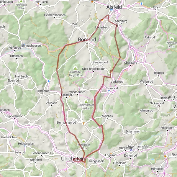
This round-trip cycling route takes you through the scenic landscapes near Ulrichstein, giving you a taste of the natural beauty of the region. With a total distance of 107 kilometers, this route is perfect for a day-long adventure. Along the way, you'll encounter rolling hills, peaceful villages, and stunning views. The highlight of the route is a visit to the picturesque village of Meiches, known for its traditional architecture and tranquil atmosphere.
Embark on a stunning cycling journey through beautiful landscapes and iconic landmarks.
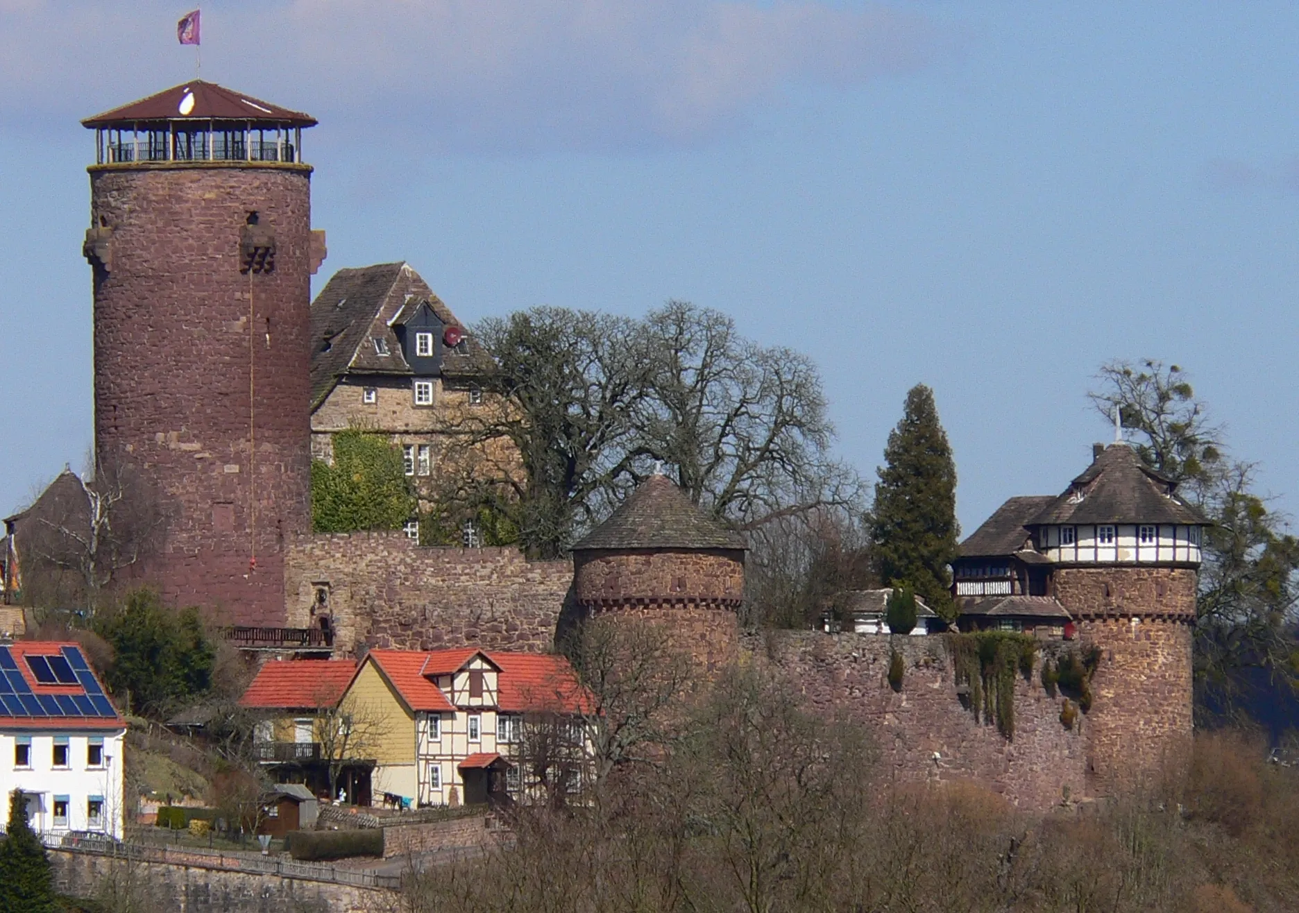
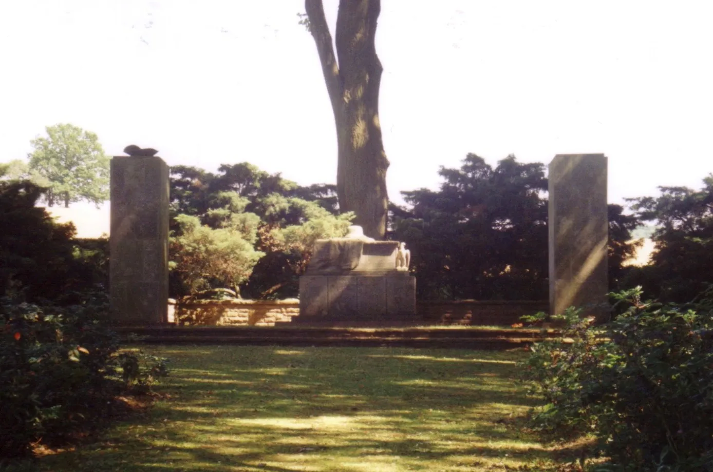
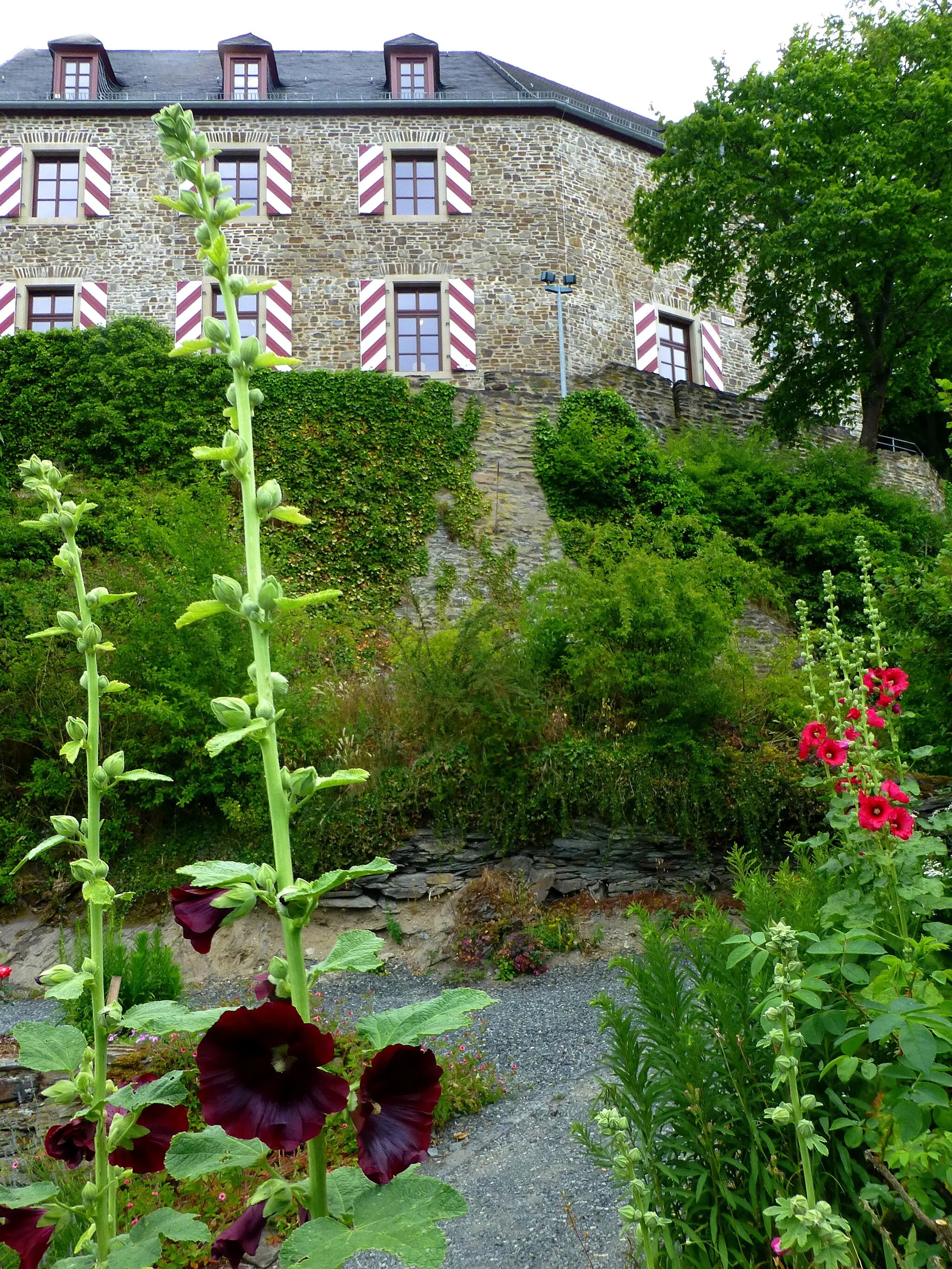
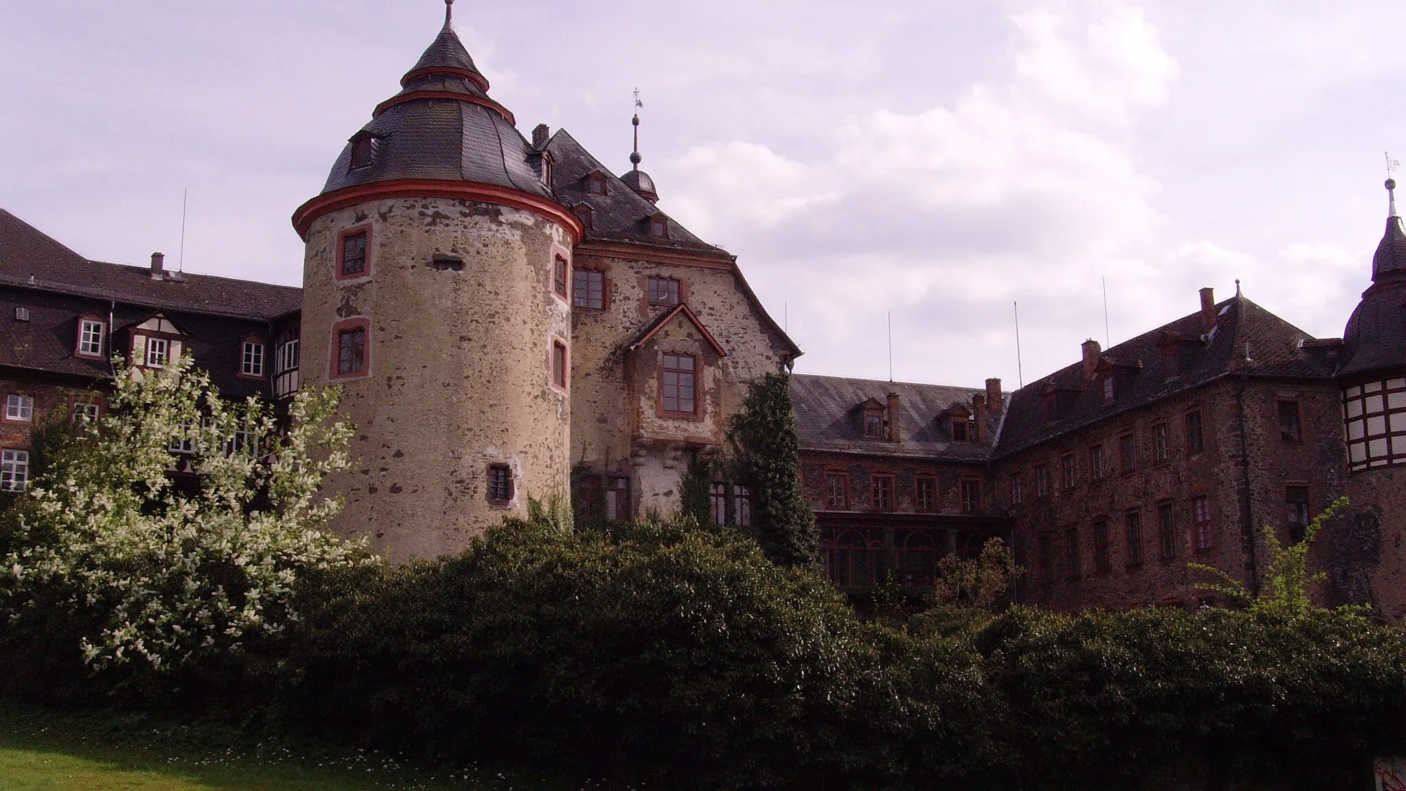
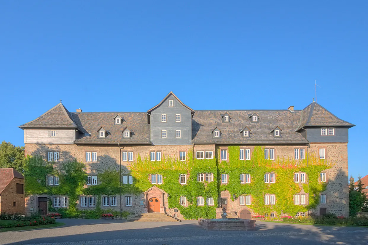
This round-trip cycling route starting near Ulrichstein takes you through picturesque villages and scenic countryside. With a moderate difficulty rating, the route offers a fulfilling challenge for well-trained amateur cyclists. Journey highlights include the Schweinskopf mountain, Nieder-Breidenbach village, Alsfeld town, Wernges village, Vaitsberg castle, Ulrichstein castle, and Bergfried tower. The route covers a total distance of 70 kilometers with an ascent of 958 meters. Enjoy breathtaking views, experience the rich history of the region, and take in the serene beauty of nature.
Embark on an adventurous gravel cycling journey through rugged terrains and natural beauty.
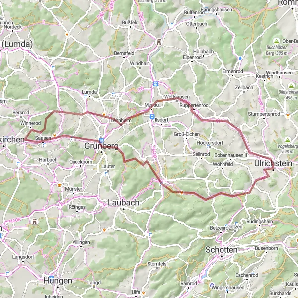
For gravel cycling enthusiasts, this round-trip route near Ulrichstein promises an exhilarating off-road experience. With moderate difficulty, the route offers challenging terrains matched with breathtaking scenery. Take in the tranquil forests, rolling hills, and hidden gems along the way. Highlights include the Hauberg woods, Galgenberg hill, Grünberg town, Kirschberg vineyard, Beltershain village, Unter-Seibertenrod hamlet, Ulrichstein castle, and the Bergfried tower. Covering approximately 63 kilometers and with an ascent of 883 meters, this route is perfect for those seeking an off-the-beaten-path cycling adventure.
A scenic gravel route through the picturesque German countryside
Immerse yourself in the beauty of the German countryside with this scenic gravel route. Spanning over 52 km with an ascent of 752 meters, the route offers a mix of rolling hills, quaint villages, and stunning natural landscapes. The tranquil atmosphere and captivating beauty of the surroundings make this a truly memorable cycling experience.
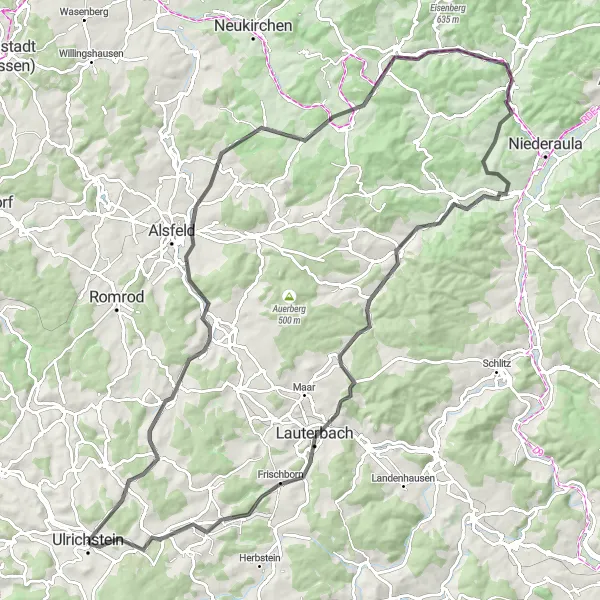
A challenging road cycling route with spectacular climbs
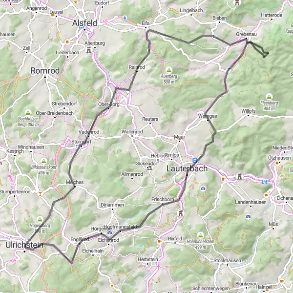
The Hilltops Adventure is a 76 km road cycling route that will test the endurance of even the most well-trained amateurs. With an ascent of 1017 meters, this route offers a thrilling challenge for cyclists looking to push themselves to the limit. The highlight of the route is the Totenköppel, a hilltop with stunning panoramic views that make the steep climb worthwhile. Other notable highlights along the way include Unter-Sorg, a historic village with traditional German architecture, and Lauterbach, a vibrant town with a rich cultural heritage. Overall, the Hilltops Adventure is a challenging and rewarding cycling experience for riders seeking epic climbs and breathtaking scenery.
Conquer demanding ascents and experience the thrill of an epic road cycling journey.
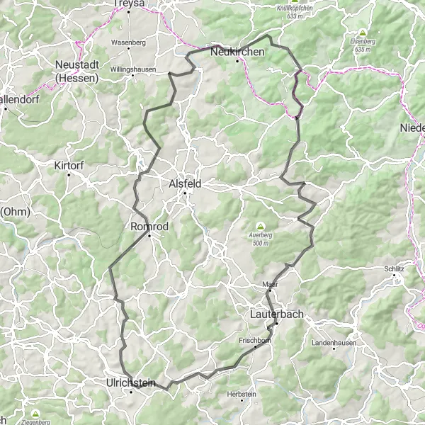
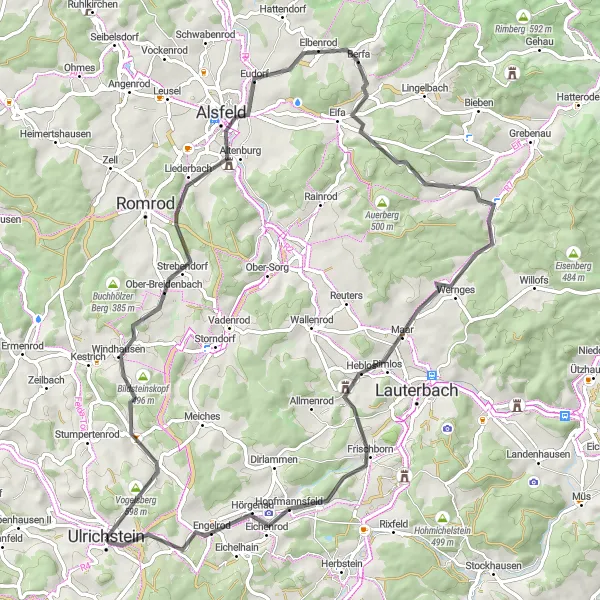
This challenging road cycling route starting near Ulrichstein takes you on an ultimate century ride through diverse landscapes and iconic landmarks. The route showcases the beauty of the region while pushing cyclists to their limits. Highlights include the formidable Burg Ulrichstein, Platte mountain, Romrod town, Christerode village, Hohebaum hill, Warthübel peak, Bilskuppe, Lauterbach town, Wehrberg, Hopfmannsfeld village, and Kopf mountain. With a total distance of 114 kilometers and an ascent of 1572 meters, this route is only suitable for experienced and well-trained cyclists seeking a truly epic adventure.
Embark on a thrilling off-road gravel adventure through varying terrains and hidden treasures.
For gravel enthusiasts seeking an adventurous challenge, this route from Ulrichstein to Gemünden offers an invigorating journey with off-road excitement. With a moderate difficulty rating, the route showcases the rugged beauty of the region, passing through Gaulskopf mountain, Platte hill, Reiskirchen village, Bellnhausen hamlet, Rote Mark forest, Rondinchen village, Burg Gemünden castle, and Ulrichstein castle. Covering a total distance of 106 kilometers and ascending 1559 meters, this gravel adventure promises stunning landscapes, rich historical landmarks, and an authentic off-road cycling experience.
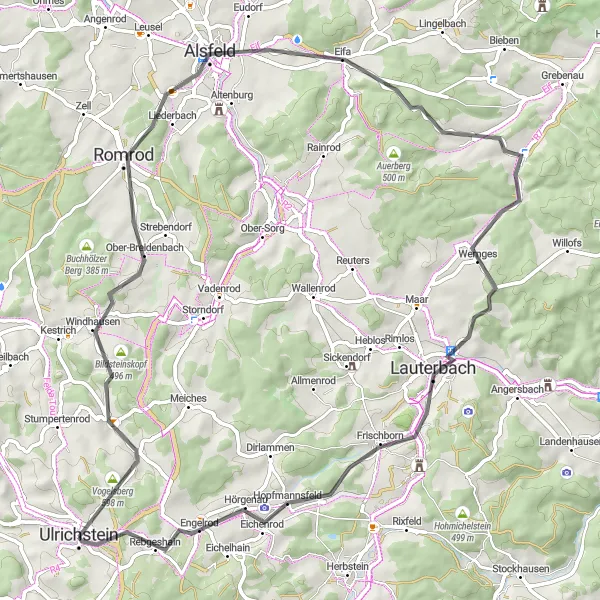
Embark on a thrilling cycling adventure through historic towns and remarkable landmarks.
Immerse yourself in the captivating beauty of the Alsfeld and Ulrichstein region with this round-trip cycling route. The route features moderate difficulty, making it ideal for well-trained amateur cyclists seeking a fulfilling challenge. Highlights along the way include the picturesque village of Helpershain, the iconic Schweinskopf mountain, the historic town of Alsfeld, the enchanting Bilskuppe, Heblos village, Ulrichstein castle, and the Bergfried tower. Covering a total distance of 76 kilometers and ascending 1000 meters, this route offers breathtaking views and cultural exploration opportunities.
Cycling routes nearby:


Nearby regions: