A cyclist's paradise in Zeulenroda
Cycling routes from Zeulenroda
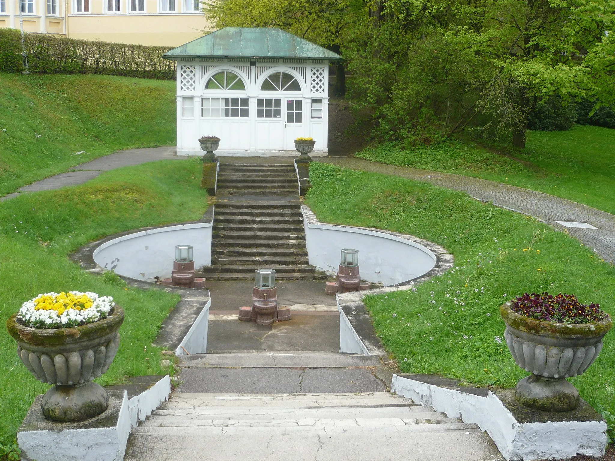
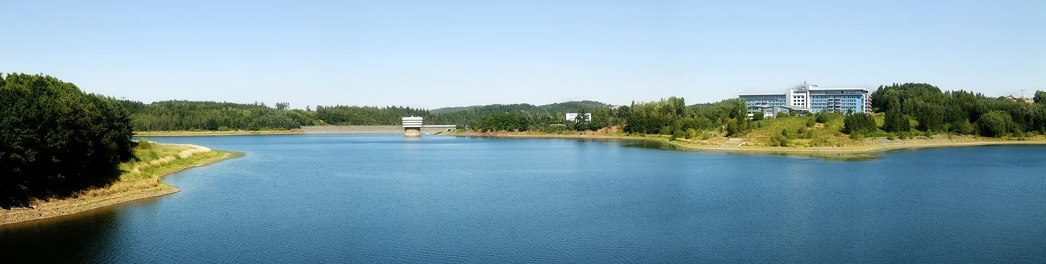
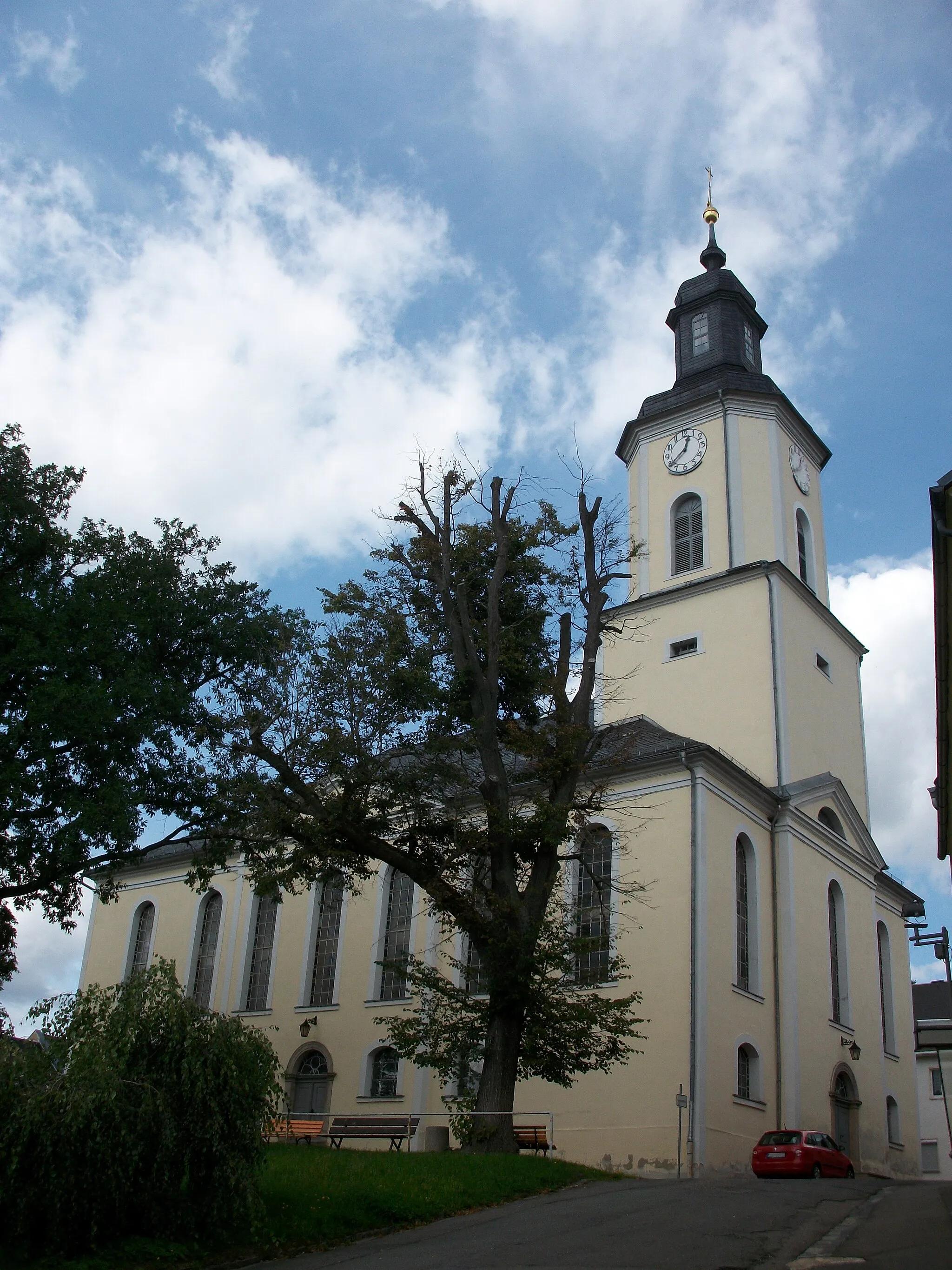
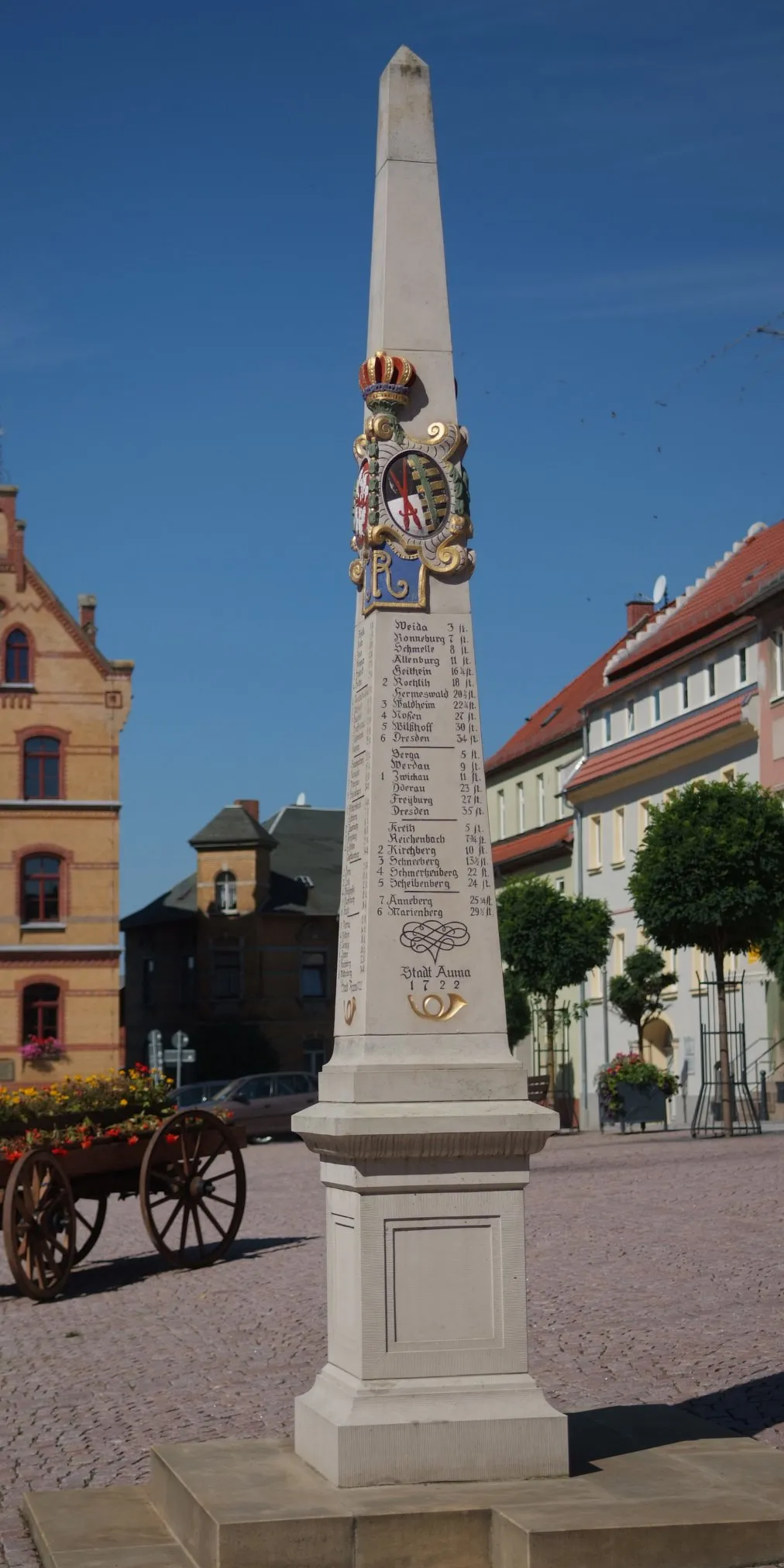
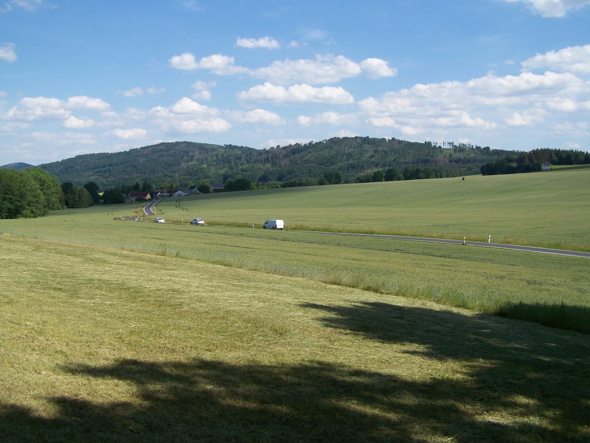
Zeulenroda, situated in Thüringen, Germany, is a delightful destination for road and gravel cyclists. The locality offers a combination of flats, rolling hills, and moderate climbs, providing cyclists with a diverse range of terrains and challenges. Zeulenroda features well-maintained cycling paths that wind through picturesque forests and charming villages. While not home to any legendary climbs, the surrounding hills and scenic routes make it a popular spot for active outdoor enthusiasts. Additionally, Zeulenroda's large reservoir offers opportunities for watersports and a relaxing setting after a day of cycling adventures.
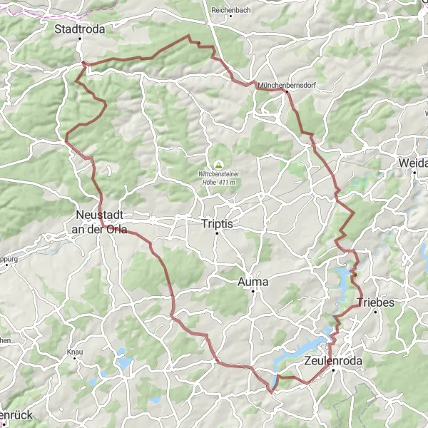
Adventure through Orla Valley
Explore the charming Orla Valley on this adventurous road ride
Take in the beauty of the Orla Valley and its surrounding landscapes on this 73 km road loop with a challenging ascent of 985 m. Highlights of the route include the Neustadt an der Orla, a charming town with historic architecture, and the Bismarckturm Neustadt an der Orla, offering stunning views over the valley. Take a moment to appreciate the breathtaking vista from the lookout point at Blick über Auma. Don't miss out on starting and ending your adventure in Zeulenroda, a vibrant town with plenty of cycling opportunities.
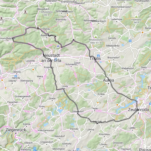
Göschitz to Auma Gravel Route

Explore the beautiful villages and landscapes of Göschitz and Auma on this thrilling gravel route.
This distinctive gravel route takes you through the charming villages of Göschitz and Auma, offering stunning views of the Thuringian landscapes. With a total ascent of 1,442 meters and a distance of 91 kilometers, this route is suitable for experienced gravel bikers. The terrain varies from challenging climbs to smooth descents, providing a thrilling off-road adventure. Throughout the journey, you'll encounter numerous highlights, including the historic Göschitz village, the scenic Weisbach, and the impressive Auma Castle. This route promises a true exploration of the region's natural beauty and historical landmarks.
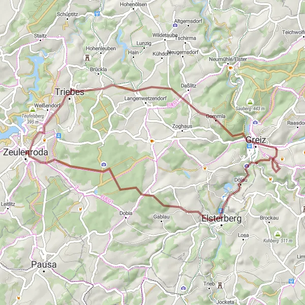
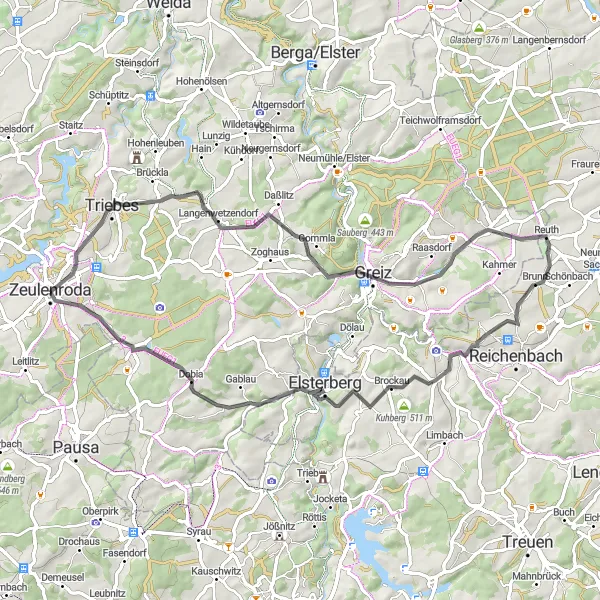
Immerse yourself in the beauty of Thuringia on this scenic gravel route from Zeulenroda to Elsterberg.
This gravel route from Zeulenroda to Elsterberg takes you through the captivating landscapes and hidden gems of Thuringia. With an ascent of 701 meters and a distance of 48 kilometers, this route is suitable for intermediate gravel riders. Explore the picturesque town of Zeulenroda before venturing into the secluded village of Gommla. Enjoy panoramic views at the Gommla viewpoint and pass through the historic village of Klingenstein, known for its well-preserved buildings. The route continues to showcase the beauty of Thuringia's countryside, with highlights including the scenic Elsterberg and the impressive Aussichtsturm Moorerlebnispfad observation tower. Immerse yourself in Thuringia's natural beauty and discover the charm of its lesser-known rural areas.
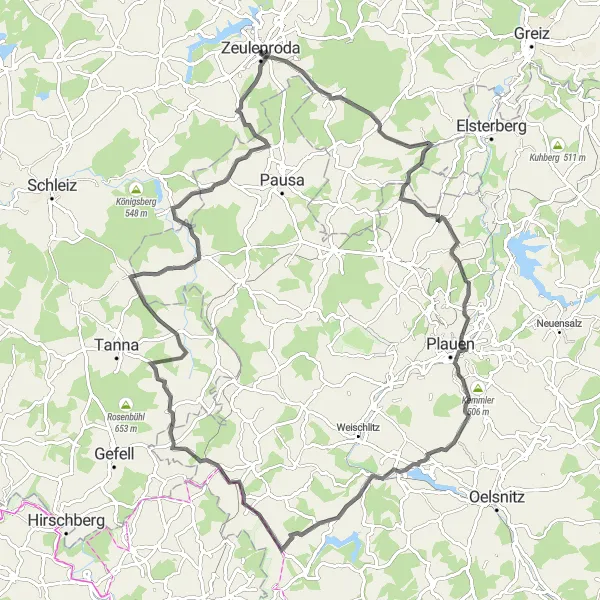
Push yourself to the limits with the Thuringian Hills Challenge
Get ready for a true challenge through the Thuringian Hills on this 95 km road route with a demanding ascent of 1376 m. Highlights along the route include the picturesque village of Pöllwitz and the impressive Jößnitz. Don't miss the opportunity to cycle up the Galgenberg and enjoy panoramic views from the top. As you approach Thierbach, take in the remarkable Thierbach bridge. Celebrate your achievement at Schöne Höhe, where you can witness one of the best sunsets in the area.

Embark on an epic road journey from Weckersdorf to Pahren, filled with challenging climbs and stunning vistas.
This road route from Weckersdorf to Pahren takes you on an epic journey through Thuringia's breathtaking landscapes and historic sites. With a total ascent of 1,490 meters and a distance of 106 kilometers, this route is best suited for experienced road cyclists. Prepare yourself for challenging climbs, thrilling descents, and scenic vistas along the way. Discover gems like the Lückenmühle, known for its peaceful surroundings and beautiful watermill. Enjoy the panoramic views from the Lothrahügel and Schliefert, and explore Solkwitz with its captivating charm. The route ends in Pahren, where you can relax and celebrate your achievement at local cafes and restaurants.
Zeulenroda Loop
Discover the picturesque landscapes around Zeulenroda
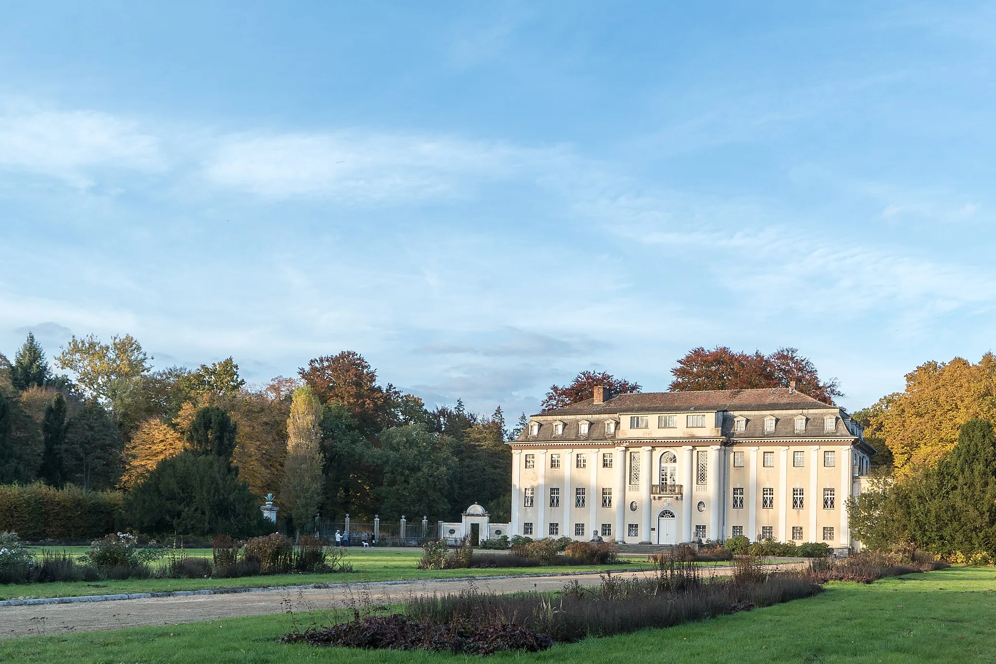
The Zeulenroda Loop takes you on a scenic adventure through the charming Thuringian countryside. With a total distance of 66 km and an ascent of 923 m, this road route is suitable for well-trained amateurs. The highlights along the route include historic landmarks such as the Sommerpalais and Karlshöhe, offering breathtaking views of the surrounding area. Don't miss the Lerchenhübel and Pöllwitz, two idyllic spots perfect for a pit stop. Overall, this route offers a great mix of challenging terrain and beautiful scenery.

Uncover the scenic beauty of Thuringia on this road route from Zeulenroda to Dörtendorf.
This road route from Zeulenroda to Dörtendorf takes you through the picturesque landscapes of Thuringia, showcasing the region's natural beauty and historical highlights. With an ascent of 933 meters and a distance of 83 kilometers, this route is suited for intermediate road cyclists. Starting in Zeulenroda, you'll cycle through scenic areas like Auma, Kleinbocka, and Wittchensteiner Höhe, which offer beautiful vistas and quaint German villages. Take in panoramic views from vantage points such as Wittchensteiner Höhe and enjoy the serenity of the Eisenhammer. Discover historical landmarks like the Hinterthür open-air museum in Eineborn and explore the charming village of Dörtendorf, known for its idyllic rural beauty.
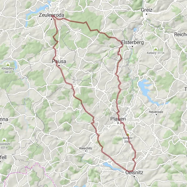
Adventurous Gravel Ride
Saddle up and experience an adventurous gravel ride near Zeulenroda
Get off the beaten path and explore the surrounding nature on this 88 km gravel ride with an ascent of 1402 m. The picturesque landscapes along the way include the Köthnitz, a charming village surrounded by lush greenery, and the impressive Teufelsberg. Take a moment to appreciate the beautiful Schloss Wolfersdorf - Zur Fröhlichen Wiederkunft, a castle with a rich history. Don't miss the opportunity to stop at Teichberg, where you can enjoy a tranquil moment by the pond. Finish your journey at the scenic Teufelsberg and take in the stunning panoramic views of the Thuringian Forest.
Embark on a thrilling gravel journey from Zeuenroda to Alberthöhe, surrounded by stunning natural landscapes.
This gravel route offers a captivating journey from Zeulenroda to Alberthöhe, showcasing the beauty of Thuringia's natural landscapes. With an ascent of 1,143 meters and a distance of 75 kilometers, this route is suitable for experienced gravel cyclists. Starting in Zeulenroda, you'll cycle through scenic areas, including the Moorerlebnispfad with its impressive view tower, the breathtaking Alberthöhe, and the historic villages of Steinsdorf and Taltitz. This route delivers a mix of challenging climbs and smooth descents, making it a thrilling gravel adventure. Explore the hidden gems along the way and enjoy the serenity of Thuringia's picturesque countryside.
Gravel Adventure

Embark on an exciting gravel adventure near Zeulenroda
Looking for an off-road cycling experience? The Gravel Adventure route is perfect for you. This 67 km loop with 920 m of ascent offers a thrilling ride through forest trails and gravel paths. Highlights of the route include the Alberthöhe and Bärensteinturm, both offering stunning panoramic views. Don't miss the Aussichtsturm Moorerlebnispfad, where you can enjoy a bird's-eye view of the local moor. Zeulenroda, the start and end point of the route, offers a great starting point to explore the surrounding nature and enjoy some local cuisine.
Cycling routes nearby:


Nearby regions: