Exploring scenic routes and local climbs in Nagydorog.
Cycling routes from Nagydorog
Nagydorog, located in Dél-Dunántúl, Hungary, is a cycling-friendly locality with diverse routes catering to different skill levels. The area offers a mix of flat plains and rolling hills, providing pleasant rides through charming countryside and picturesque villages. Cyclists can explore scenic routes along the Danube River or challenge themselves on some of the well-known local climbs, such as Boszkó Hill or Octopus Circuit. The locality's tranquil atmosphere and stunning landscapes make Nagydorog a suitable choice for both leisurely and more adventurous rides.
Gravel Adventure

An adventurous gravel cycling route with highlights including a scenic hill and a traditional village.
The Gravel Adventure is a thrilling and scenic route through the Dél-Dunántúl region. Starting near Nagydorog, this route takes you off the beaten path and onto gravel roads. One of the highlights of this route is Vajta, a picturesque village known for its traditional houses and friendly locals. Another highlight is Alsószentiván, a small village at the foot of a scenic hill. Cyclists will enjoy the challenging terrain and breathtaking views along the way.
The Vajta Gravel Cycling Route

Experience the thrill of off-road cycling on the Vajta gravel route
Venture off the beaten path on the Vajta gravel cycling route. Stretching across 61 kilometers with a total ascent of 269 meters, this route is suitable for gravel bike enthusiasts. Embark on an exhilarating journey through diverse terrains, passing through Vajta, Alsószentiván, and Németkér. With a difficulty rating of 2 and an epicness rating of 3, this route offers an exciting adventure for cyclists seeking a different kind of challenge. Along the way, you'll uncover highlights such as the picturesque countryside of Alsószentiván and the charming village of Németkér.
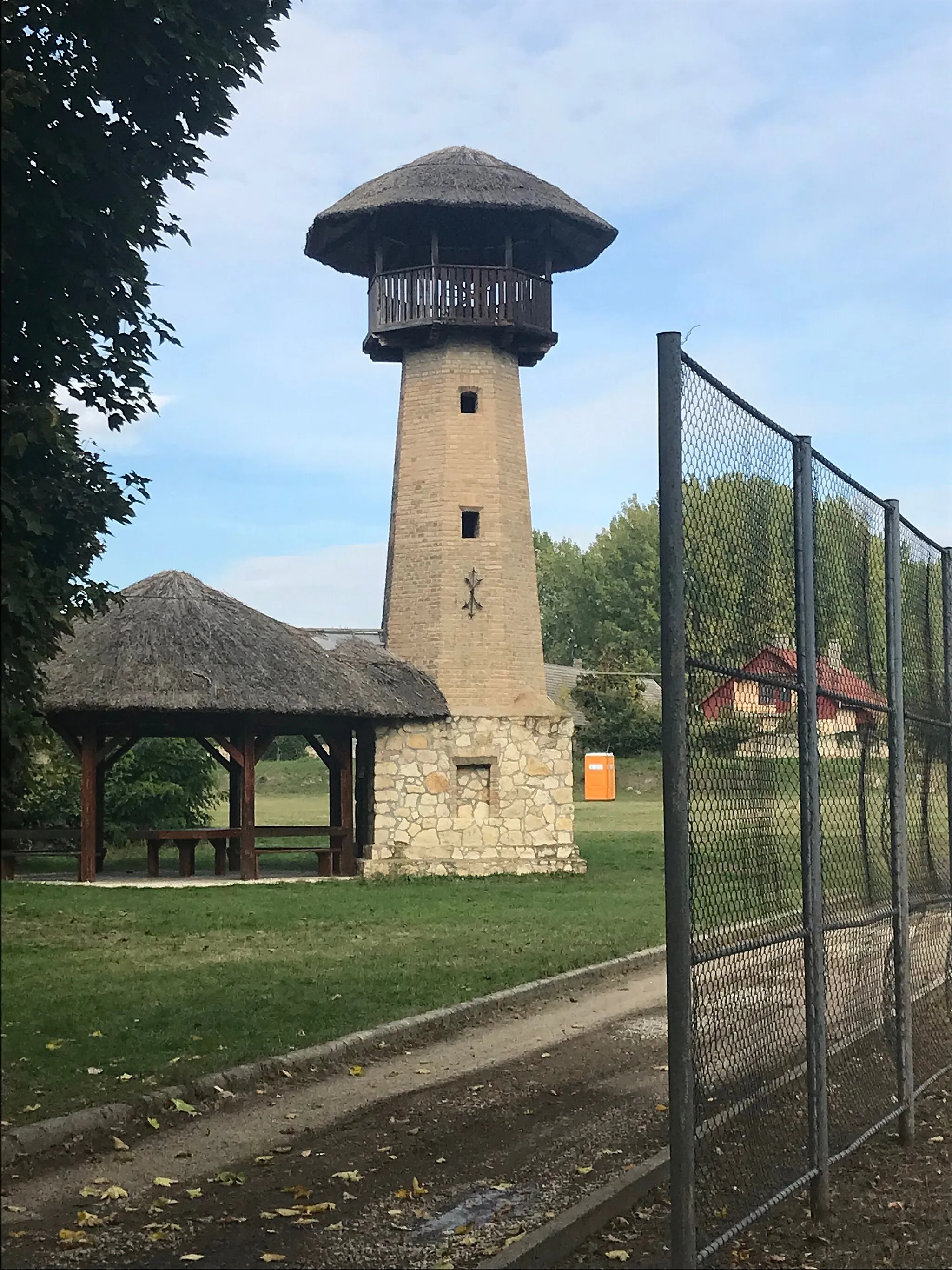
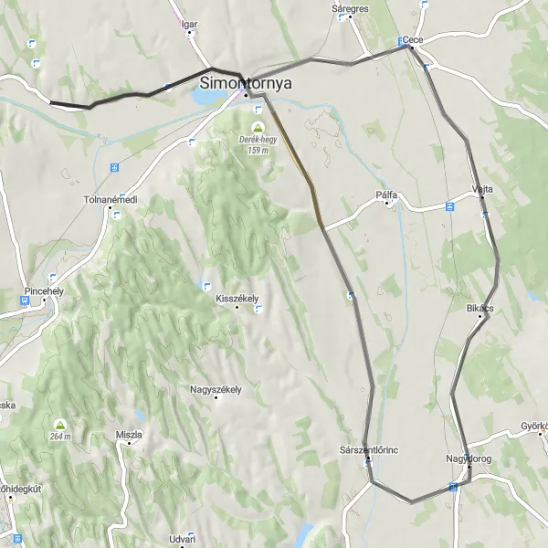
Embark on an unforgettable road cycling adventure through Sárszentlőrinc
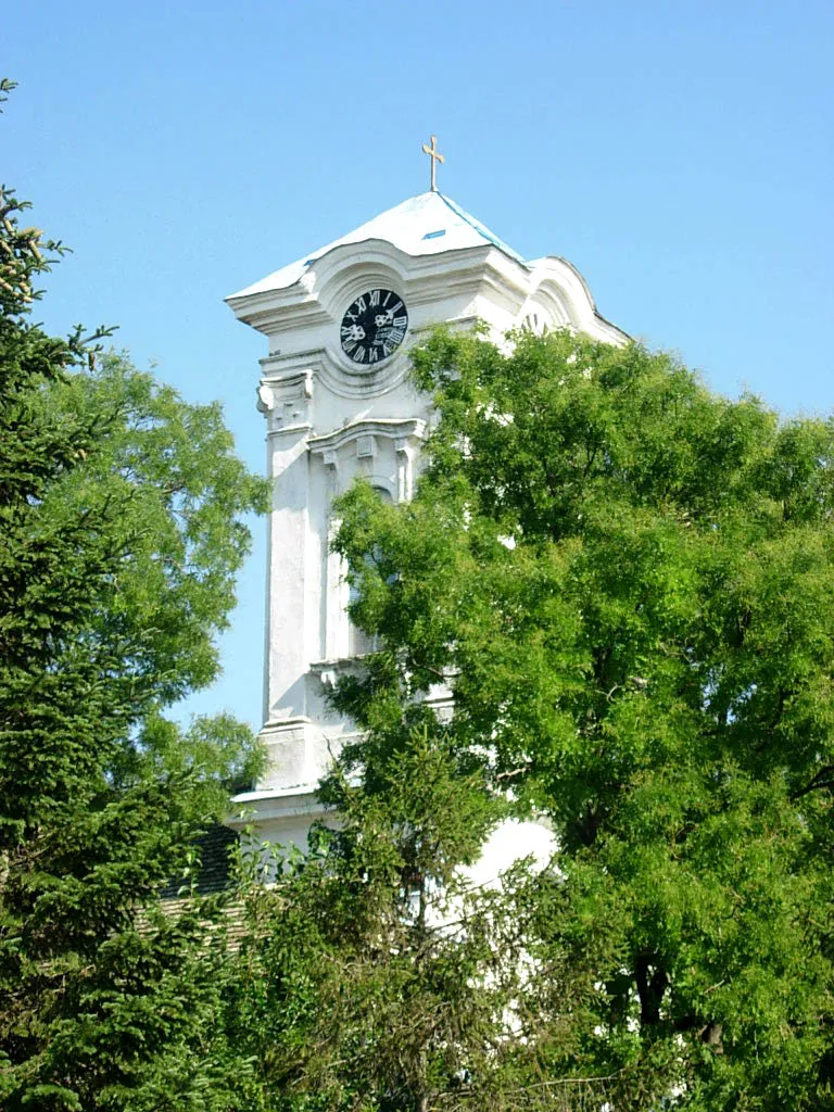
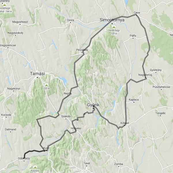
Cycle your way through the captivating landscapes of Sárszentlőrinc on this memorable road cycling route. Covering a distance of 143 kilometers and featuring a challenging ascent of 821 meters, this route is tailored for experienced cyclists seeking a long-distance adventure with rewarding climbs. Explore the beautiful countryside as you pass through Sárszentlőrinc, Söréttorony, Gyönk, Hőgyész, Döbrököz, Gyulaj, Keszőhidegkút, Pincehely, Simontornya, and Cece. With a difficulty rating of 4 and an epicness rating of 5, this route promises an epic cycling experience in the heart of Hungary.
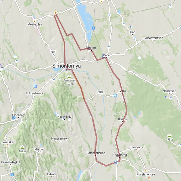
Discover the hidden gems of Sárszentlőrinc on this captivating gravel route
Embark on an enchanting journey along the Sárszentlőrinc gravel cycling route. With a total distance of 62 kilometers and an elevation gain of 162 meters, this route is perfect for gravel bike enthusiasts of all levels. Traverse through Sárszentlőrinc, Derék-hegy, Simontornya, Sáregres, and Vajta, and immerse yourself in the natural beauty of Dél-Dunántúl. The difficulty rating is 2, and the epicness rating is 3, making it an excellent choice for exploring the region's hidden gems. Highlights along the route include Sárszentlőrinc, Derék-hegy, Simontornya, Sáregres, and Vajta.
Southern Loop
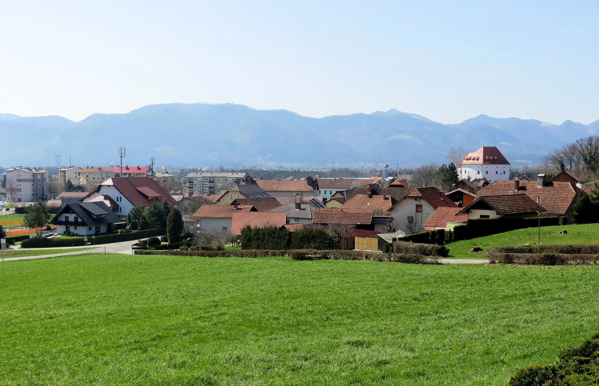
A scenic road cycling route with highlights including the ancient Simontornya Castle and the charming village of Cece.
The Southern Loop offers a scenic and enjoyable road cycling experience. Starting near Nagydorog, the route takes you through beautiful countryside and quaint villages. One of the highlights of this route is the Simontornya Castle, an ancient castle located on top of a hill. The castle offers stunning views of the surrounding landscape and is worth a visit. Another highlight is the village of Cece, known for its charming atmosphere and traditional architecture. Overall, the Southern Loop is a great choice for cyclists who want to enjoy the beauty of the Dél-Dunántúl region of Hungary.
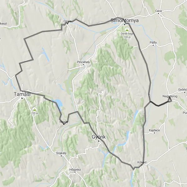
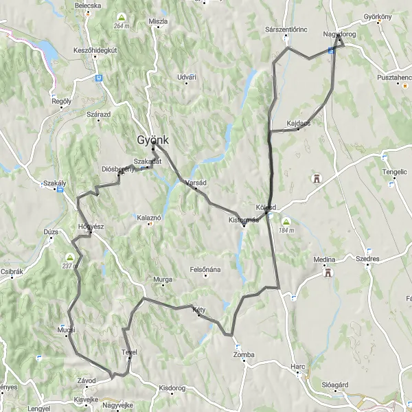
A scenic route through the vineyards of Southern Transdanubia
Embark on a delightful cycling journey through the picturesque landscapes of Southern Transdanubia. This road route, spanning 112 kilometers and encompassing a total ascent of 601 meters, showcases the region's vibrant wine culture and stunning countryside. Along the way, you'll pass quaint villages and ancient castles, including the notable highlights of Borjád, Söréttorony, Varsád, Regöly, Tamási, Fürged, Ozora, Derék-hegy, and Sárszentlőrinc.
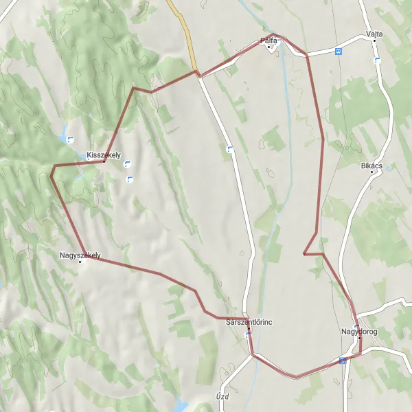
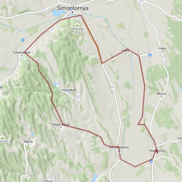
Experience the off-road thrill of Székely Hills on this gravel cycling route.
Embark on an exhilarating gravel adventure through the rugged terrain of Székely Hills. This 40-kilometer route, with an ascent of 318 meters, is perfect for intermediate-level cyclists seeking an off-road challenge. Along the way, you'll encounter the highlights of Sárszentlőrinc, Kisszékely, and Pálfa, immersing yourself in the natural beauty of the region and enjoying breathtaking views of rolling hills and dense forests.
Embark on an exhilarating gravel adventure through Sárszentlőrinc and its surroundings
Immerse yourself in the thrill of gravel cycling with the Sárszentlőrinc gravel route. With a distance of 51 kilometers and a challenging ascent of 312 meters, this route is perfect for gravel bike enthusiasts seeking an exciting off-road experience. Cycle through varied terrain as you explore Sárszentlőrinc, Nagyszékely, Simontornya, Derék-hegy, and Pálfa. With a difficulty rating of 3 and an epicness rating of 3, this route offers a thrilling adventure in a stunning natural setting.
Transdanubian Countryside Loop
Embrace the beauty of Transdanubia on this captivating cycling route.
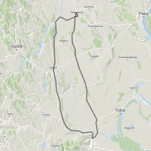
Experience the enchanting countryside of Transdanubia on this scenic road cycling route spanning 71 kilometers. With a moderate ascent of 198 meters, this route is perfect for leisurely rides. Immerse yourself in the idyllic landscapes as you pass through various highlights, including the sites of Harc, Kölesd, Söréttorony, and Sárszentlőrinc. Discover charming villages, enjoy the tranquility of rural life, and bask in the natural beauty of the region.
A scenic road cycling route exploring the beautiful countryside near Nagydorog.
This round-trip cycling route starting near Nagydorog provides a delightful journey through the stunning countryside of Dél-Dunántúl, Hungary. With a total distance of 102 kilometers and an elevation gain of 799 meters, this route offers a challenging yet rewarding experience for well-trained amateur cyclists. Enjoy picturesque landscapes, charming villages, and cultural highlights along the way.
Cycling routes nearby:
Nearby regions: