Discover the hilly terrain and stunning landscapes of the Duhallow region, including the iconic Moll's Gap climb.
Cycling routes from Millstreet
Millstreet, located in the Southern region of Ireland, offers a mix of road and gravel cycling opportunities. The surrounding area is dotted with winding roads that pass through charming villages and rolling countryside. Cyclists can explore the picturesque Duhallow region, famous for its hilly terrain and stunning landscapes. A well-known spot for cyclists in this area is the renowned Moll's Gap climb, which offers challenging gradients and spectacular views of the surrounding mountains. Millstreet is a popular destination for cyclists seeking challenging rides and breathtaking scenery.
Millstreet to Killarney Loop
Cycling through stunning landscapes from Millstreet to Killarney
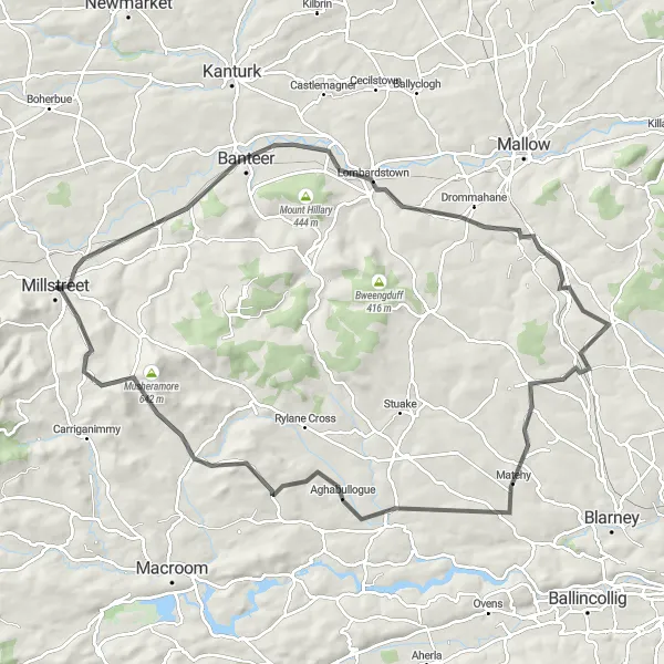
Embark on a scenic journey from Millstreet to Killarney and be mesmerized by the stunning landscapes along the way. This 96 km road cycling route offers a delightful mix of rolling hills and charming countryside. With an ascent of 983 meters, this route will test your endurance while providing breathtaking views. Explore highlights such as Claragh Mountain, where you can witness panoramic vistas, and Farranfore, a picturesque village with a rich history. Finally, reach the enchanting town of Killarney, renowned for its national park and vibrant atmosphere.
Discover the scenic countryside around Millstreet on this road cycling route
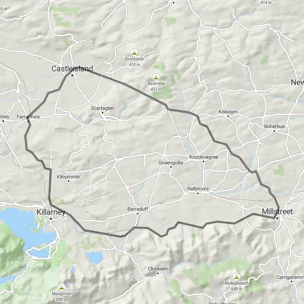
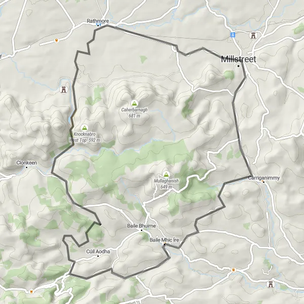
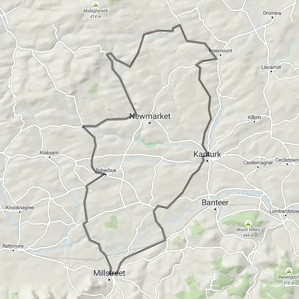
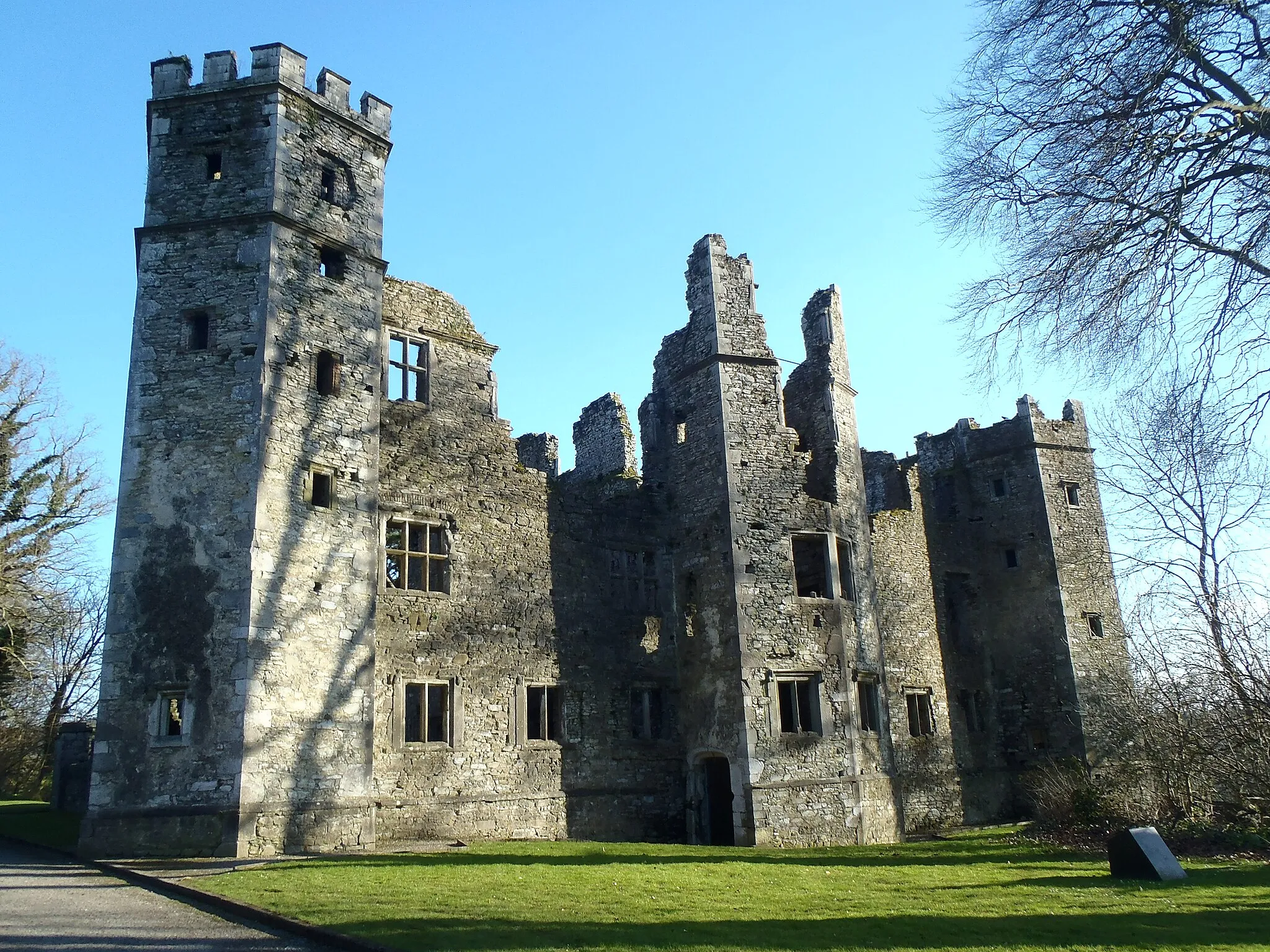
Experience the beauty of the Millstreet countryside on this road cycling route. Covering a distance of 99km with an ascent of 1029m, this loop offers a challenging and rewarding ride. Start your journey in Millstreet (0km) and cycle through highlights such as Banteer (14km), Lombardstown (23km), and Castle Barrett (35km) with its impressive medieval tower. As you continue, immerse yourself in the picturesque landscapes and enjoy a visit to Carrignamuck Tower House (66km) for a glimpse into the region's history. Finally, make your way to Musherabeg (90km) and take in the stunning views before heading back to Millstreet. This route provides a varied and enjoyable cycling experience, showcasing the best of Southern Ireland.
Carrigaphooca Castle Loop

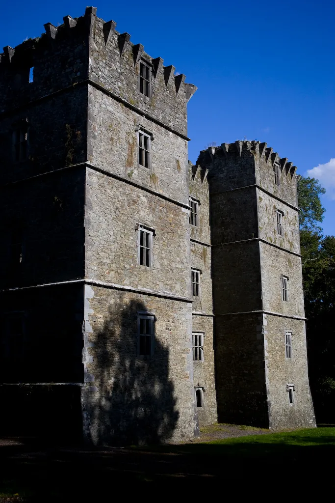
Experience the charm of Carrigaphooca Castle on this road cycling route
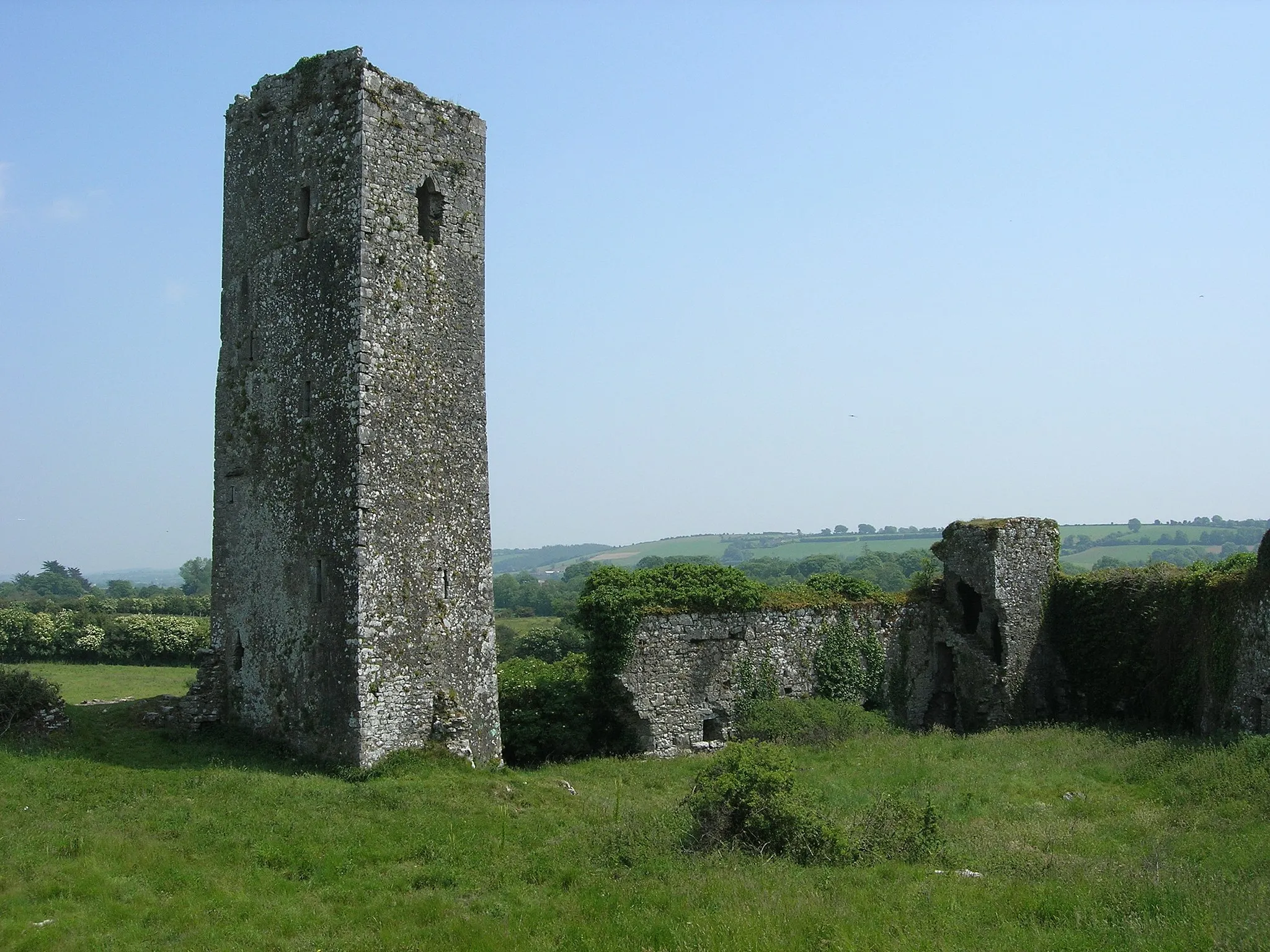
Embark on a scenic cycling adventure to Carrigaphooca Castle on this 56km road cycling route. With a total ascent of 777m, this route offers a moderate challenge suitable for intermediate cyclists. Begin your journey by exploring Musherabeg (8km) and taking in the panoramic views. Continue to Carrigaphooca Castle (25km) and discover this impressive Norman fortress situated in the heart of the Irish countryside. As you pedal through Ballymakeera (34km), delight in its charming atmosphere and picturesque surroundings. Finally, tackle the climb up Knockullane (41km) and be rewarded with stunning vistas of the surrounding landscape. This route provides a picturesque cycling experience, highlighting the region's natural beauty and historical landmarks.

Discover the beautiful landscapes of Millstreet and conquer the heights of Seefin East Top.
This challenging road cycling route takes you through the stunning countryside near Millstreet. With a total ascent of 867 meters and a distance of 61 kilometers, it offers a rewarding experience for well-trained cyclists. The highlight of the route is the ascent to Seefin East Top, where you can enjoy panoramic views of the surrounding mountains. Other notable highlights include the picturesque Mullinhassig Waterfall and the historic Musherabeg village.
Scenic road cycling route through the picturesque countryside near Ballymakeera
Experience the picturesque countryside near Ballymakeera with this 71 km road cycling loop. With an ascent of 771 meters, this route provides a challenging yet rewarding ride. Immerse yourself in the beauty of the rolling hills and charming rural landscapes. Highlights include Ballymakeera, a quaint village known for its friendly locals and traditional Irish culture. Journey through Rathmore, a small town with historical charm, and finally return to Millstreet, where you can unwind and explore its vibrant community.
Kanturk Loop
Discover the beauty of Kanturk and its surroundings on this road cycling route
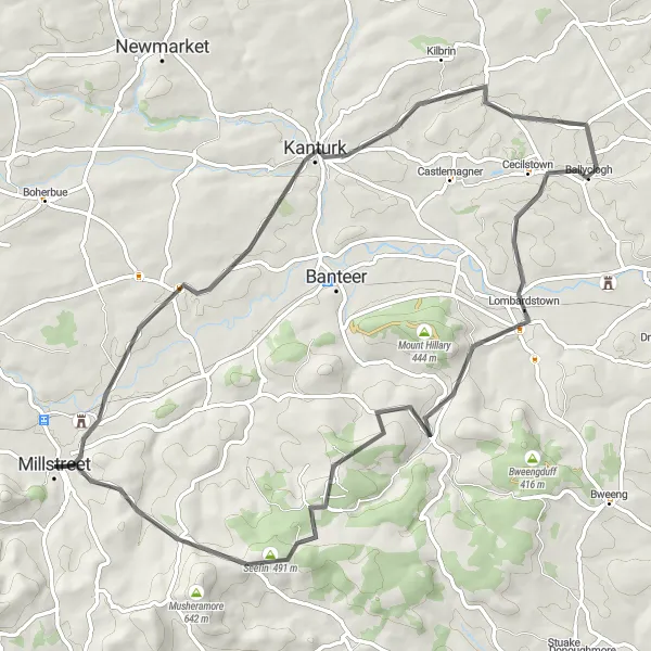
Experience the stunning landscapes around Kanturk on this 74km road cycling route with an ascent of 926m. Start your adventure in Millstreet (0km) and make your way to Kanturk (18km), a charming market town known for its historic buildings and welcoming atmosphere. Journey through Lombardstown (42km) and admire its picturesque setting before reaching Seefin East Top (62km), offering spectacular views. This route provides a varied cycling experience, combining historic landmarks, scenic beauty, and challenging climbs. Immerse yourself in the enchanting countryside of Southern Ireland and discover the hidden gems along the way.
Embark on an adventurous journey through Kilgarvan and Cummeenboy, offering stunning landscapes and hidden treasures.
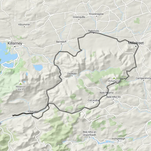
This exhilarating road cycling route near Millstreet takes you through diverse terrain and stunning natural beauty. With a total ascent of 1143 meters and a distance of 106 kilometers, it offers a challenging experience for experienced cyclists. The highlights of the route include visits to the charming villages of Kilgarvan and Cummeenboy, where you can immerse yourself in traditional Irish culture. Be sure to enjoy the panoramic views from Kilgarvan Mountain and take time to explore the beautiful landscapes surrounding Millstreet.
Embark on a historic journey to two magnificent castles - Carrigadrohid Castle and Kilcrea Castle.
This scenic road cycling route near Millstreet offers a unique combination of history and natural beauty. With a total ascent of 1442 meters and a distance of 106 kilometers, it is suitable for experienced cyclists seeking a challenging adventure. The highlights of the route include visits to the stunning Carrigadrohid Castle and the majestic Kilcrea Castle. Along the way, you can also enjoy scenic views of the Burren and explore charming villages like Kilmurry and Coppeen.
Boherbue Loop
Explore the charming village of Boherbue on this road cycling route
Cycle through the scenic countryside surrounding Millstreet on this road cycling route. With a distance of 87km and an ascent of 807m, this loop provides a moderate challenge suitable for intermediate cyclists. Begin your journey in Millstreet (0km) and continue to Boherbue (13km), a picturesque village known for its warm hospitality and traditional Irish culture. Pedal through Kanturk (66km), a historic market town that offers a blend of history and natural beauty. Immerse yourself in the peaceful nature of the Southern Irish landscape, with highlights including charming towns, rolling hills, and friendly locals. This route provides a delightful cycling experience, showcasing the beauty and charm of Southern Ireland.
Discover the cultural heritage of Inchigeelagh and Ballyvourney on this scenic road cycling route.
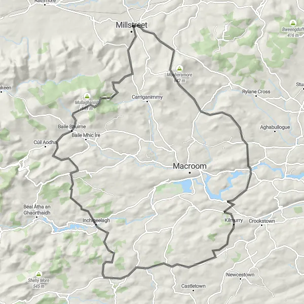
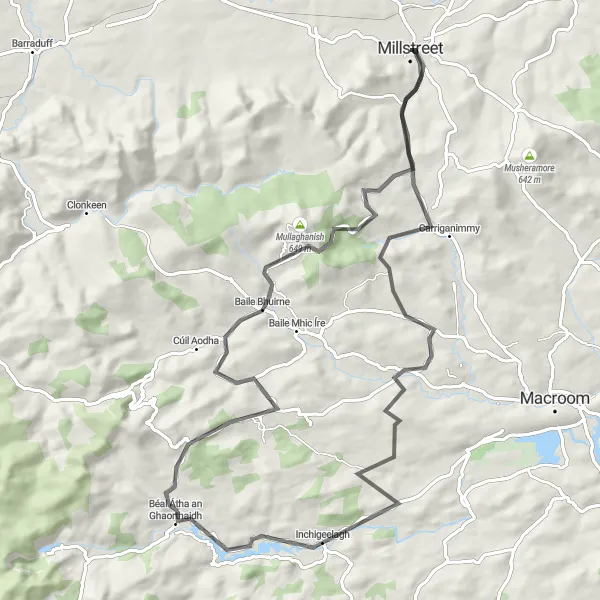
This enjoyable road cycling route near Millstreet takes you through picturesque landscapes and historic villages. With a total ascent of 982 meters and a distance of 83 kilometers, it offers a moderate challenge for cyclists of intermediate level. The highlights of the route include visits to the charming villages of Inchigeelagh and Ballyvourney, where you can immerse yourself in the local culture and heritage. Don't miss the opportunity to climb Knockullane and enjoy the breathtaking views from its summit.
Cycling routes nearby:


Nearby regions: