Cycling paradise in Opolskie
Cycling routes from Kedzierzyn-Kozle
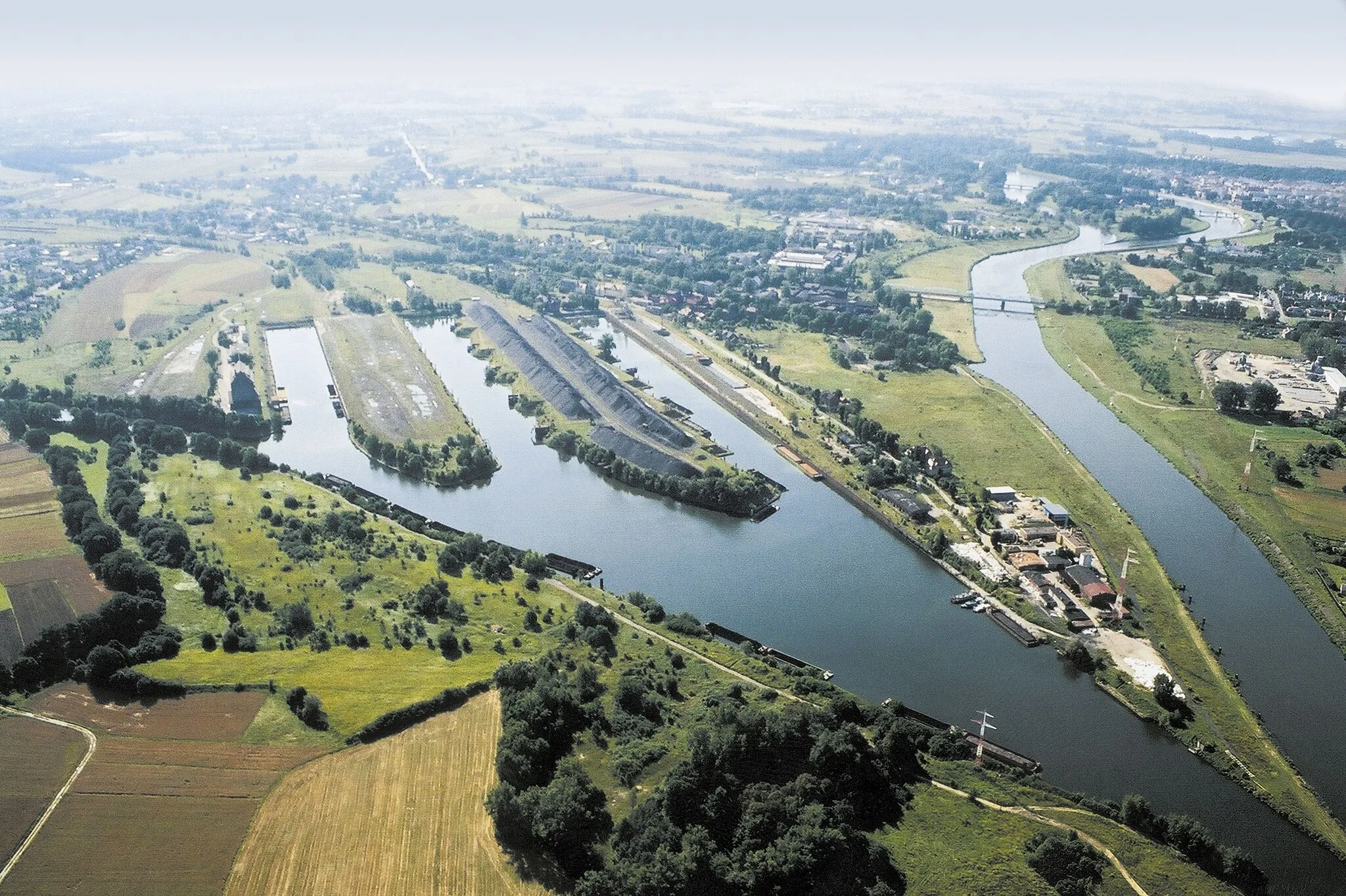
Kędzierzyn-Koźle is a town located in the Opolskie region of Poland. From a cyclist's perspective, Kędzierzyn-Koźle offers a range of cycling routes suitable for both road and gravel cyclists. The town is surrounded by beautiful nature, including the Odra River, which adds to the scenic experience. Kędzierzyn-Koźle is also known for hosting the Tour de Pologne, a prestigious cycling race. Additionally, there are several popular climbs nearby, such as Glinianka, which attract cyclists looking for a challenging ride. Overall, Kędzierzyn-Koźle is a great locality for cycling enthusiasts due to its varied routes and cycling events.
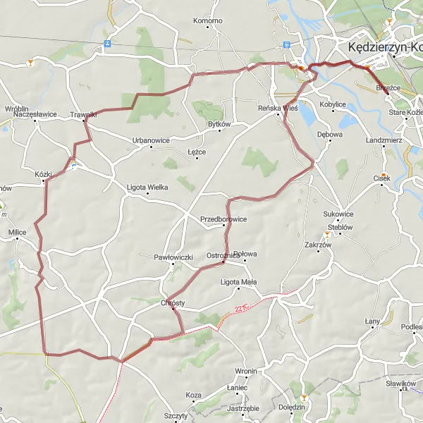
A scenic gravel ride to Większyce
Embark on a captivating cycling adventure from Kędzierzyn-Koźle to Większyce. This gravel route covers a distance of 67 km and offers stunning views of the countryside. Highlights along the way include Reńska Wieś at 8 km, Radoszowy at 27 km, Grudynia Wielka at 38 km, Trawniki at 49 km, and Większyce at 59 km. With a moderate difficulty level, this route is suitable for well-trained amateur cyclists seeking a scenic escape. Its epicness rating of 4 ensures a memorable and fulfilling cycling experience.
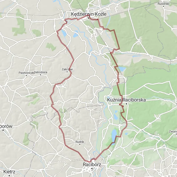
Exploring highlights in and around Koźle
This round trip takes you on a journey to discover the beautiful city of Koźle and its surrounding areas. Starting in Kędzierzyn-Koźle, the route leads you through a mix of gravel and road paths, covering a distance of 83 km. Along the way, you'll encounter several highlights, including the picturesque Grabówka at 12 km, the historic Dąb Sobieskiego at 35 km, and Polska Cerekiew at 61 km. The route offers a moderate level of difficulty, making it suitable for well-trained amateur cyclists. With an epicness rating of 4, this route provides a great adventure for cycling enthusiasts.
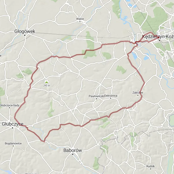
A scenic ride to Radoszowy and beyond
Embark on a captivating cycling journey from Kędzierzyn-Koźle to Radoszowy and beyond. This gravel route covers a distance of 86 km and offers breathtaking landscapes along the way. Highlights include the starting point in Kędzierzyn-Koźle, Polska Cerekiew at 21 km, Radoszowy at 28 km, and Kazimierz at 59 km. The route, with a moderate level of difficulty, is suitable for well-trained amateur cyclists. With an epicness rating of 4, this route promises an unforgettable adventure.
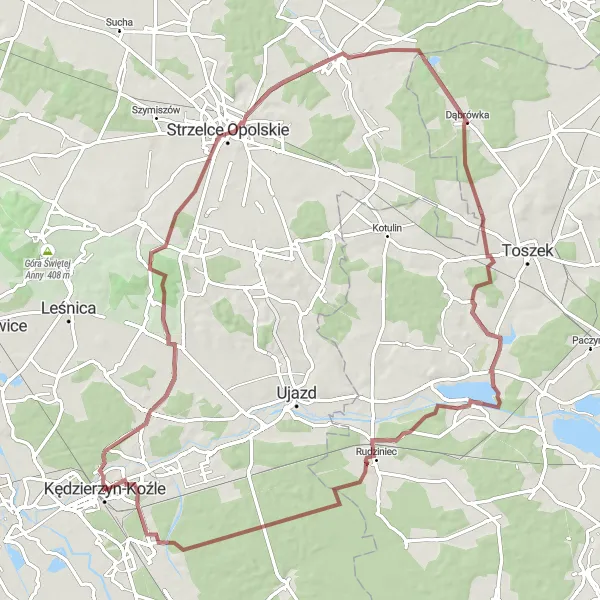
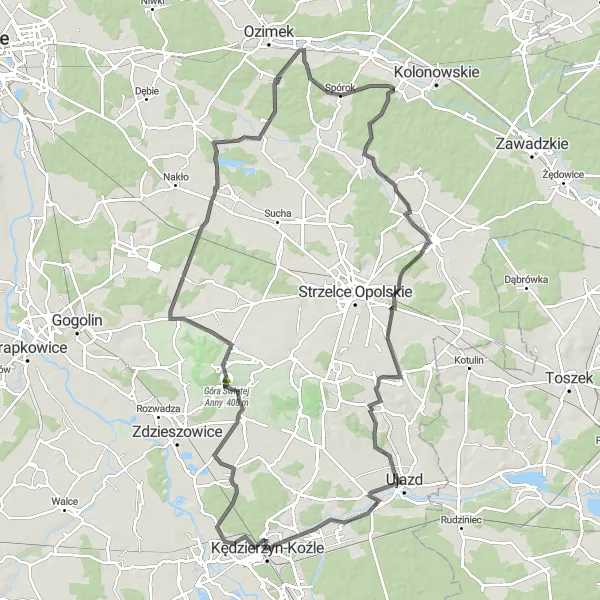
Embark on a gravel adventure from Kędzierzyn-Koźle and explore the charming town of Strzelce Opolskie.
This 85-kilometer gravel route takes you through scenic landscapes and peaceful countryside. With an ascent of 471 meters, it offers a moderate challenge for adventurous cyclists. Enjoy the tranquility of the open roads and immerse yourself in the rich history and charm of Strzelce Opolskie.
Cycle along stunning landscapes and visit the picturesque village of Czarnocin on this road cycling route.
Enjoy the beauty of the Opolskie region on this 80-kilometer road cycling route. With an ascent of 262 meters, it offers a moderate level of difficulty and is suitable for cyclists of all levels. Take in the breathtaking views and make a stop in the charming village of Czarnocin to explore its natural wonders and historical attractions.
Embark on an epic road cycling adventure from Kędzierzyn-Koźle and uncover the hidden gems of the region.
Get ready for an exciting road cycling journey through picturesque landscapes and charming towns. Covering a distance of 112 kilometers with an ascent of 478 meters, this route offers a mix of natural beauty and cultural attractions. It is recommended for experienced cyclists due to its length and moderate difficulty level.
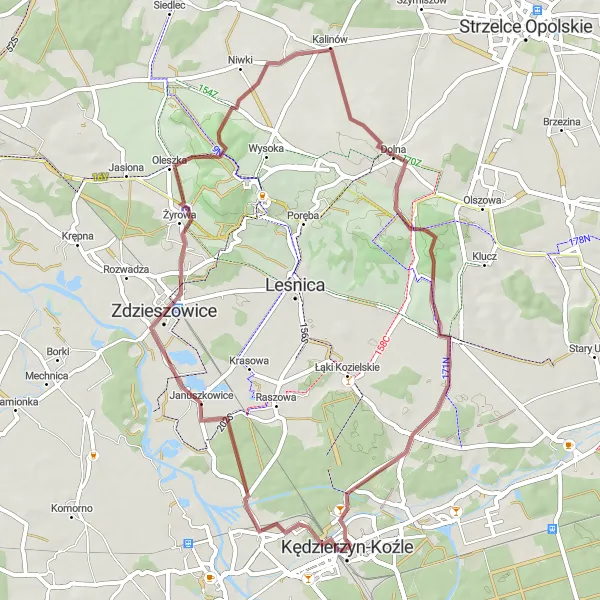
Discover the beauty of Kędzierzyn-Koźle and its surroundings on this scenic gravel route.
This gravel route takes you through picturesque landscapes around Kędzierzyn-Koźle, offering a mix of natural beauty and cultural attractions. The route covers a total distance of 51 kilometers with an ascent of 382 meters. Expect a moderate level of difficulty and a high level of enjoyment as you traverse gravel roads and explore the highlights along the way.
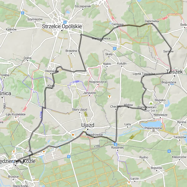
Embark on a challenging road cycling loop from Kędzierzyn-Koźle to Sławięcice and test your cycling skills.
This 81-kilometer road cycling route offers a challenging adventure for experienced cyclists. With an ascent of 410 meters, it provides a good workout and rewards cyclists with stunning views along the way. Enjoy the scenic countryside and make a stop in Klucz, Dąbrówka, and Sławięcice to explore their unique charm.
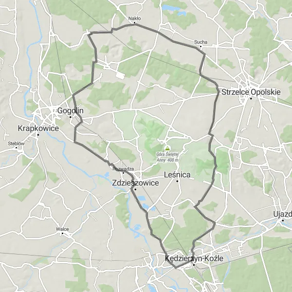
An exhilarating ride to Syfon Kłodnicy
Embark on an epic cycling journey from Kędzierzyn-Koźle to Syfon Kłodnicy. This road route covers a distance of 111 km and takes you through scenic landscapes and historical sites. Highlights along the way include Ligota Górna at 24 km, Izbicko at 37 km, Kasztal at 67 km, Buczki at 90 km, Sławięcice at 102 km, and the iconic Syfon Kłodnicy at 109 km. With a difficulty rating of 4, this route is suitable for well-trained amateur cyclists who enjoy a challenge. Its epicness rating of 5 guarantees a truly legendary cycling experience.
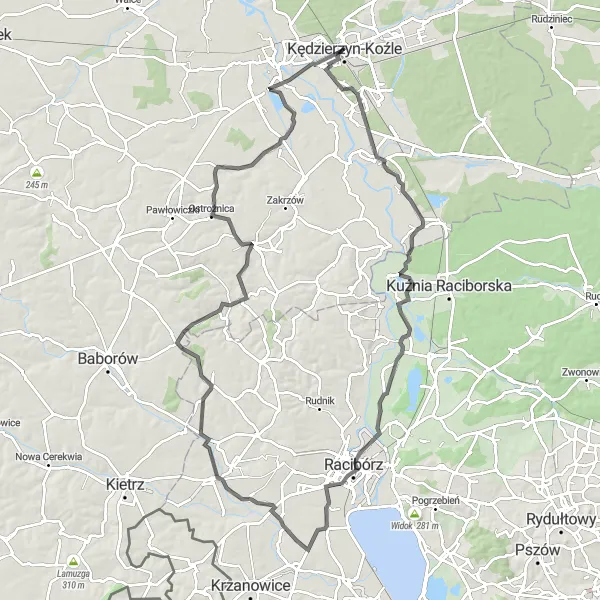
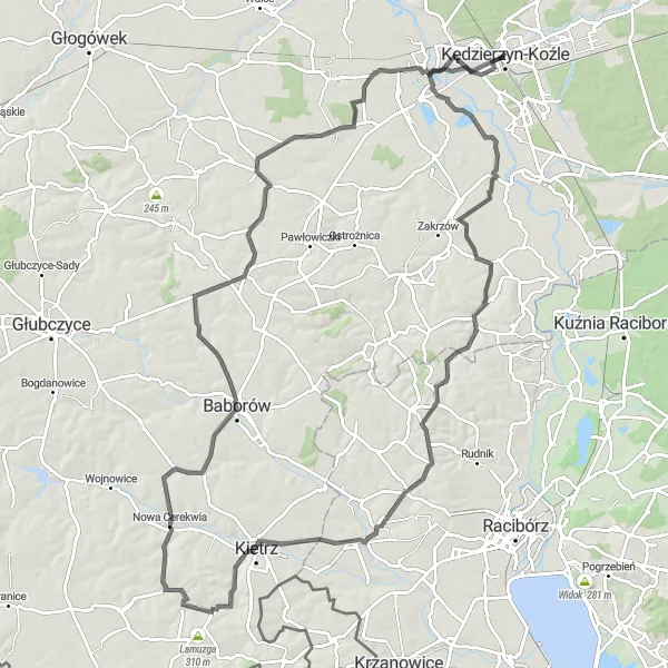
Explore charming villages and historical sites
This road route takes you on a mesmerizing adventure from Kędzierzyn-Koźle to Naczysławki. Covering a distance of 98 km, the route leads you through a variety of landscapes and highlights. Starting in Kędzierzyn-Koźle, you'll encounter Turze at 23 km, Bulwary Nadodrzańskie at 36 km, Sudół at 42 km, Cyprzanów at 50 km, Krowiarki at 60 km, and Naczysławki at 84 km. The route presents a moderate level of difficulty, making it suitable for well-trained amateur cyclists. With an epicness rating of 4, this route ensures an unforgettable cycling experience.
Cycling routes nearby:
Nearby regions: