Scenic cycling in Ostschweiz, Switzerland
Cycling routes from Diepoldsau
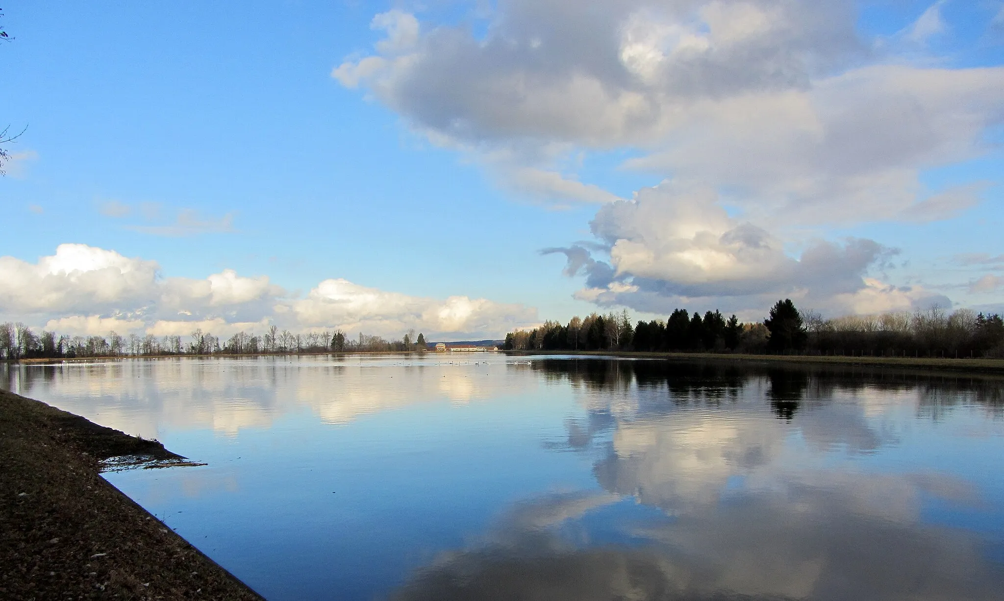
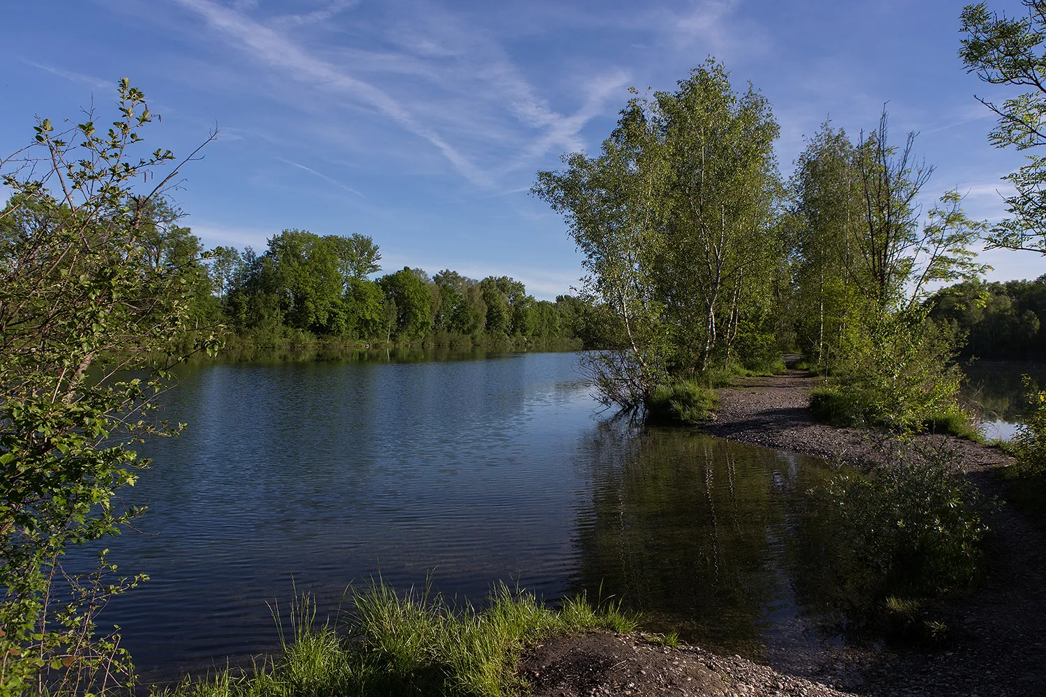
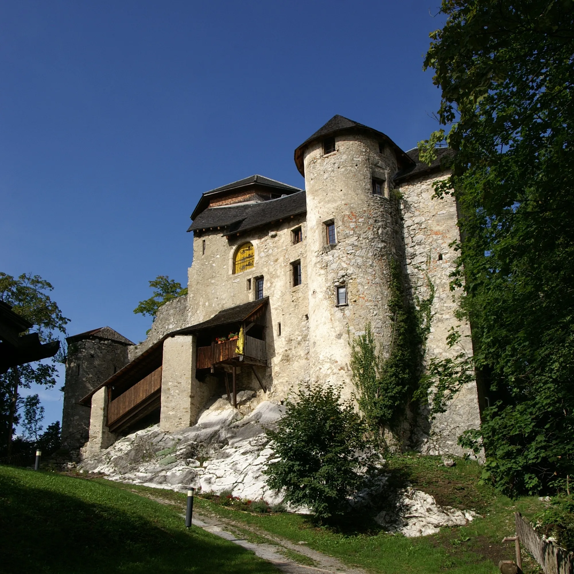
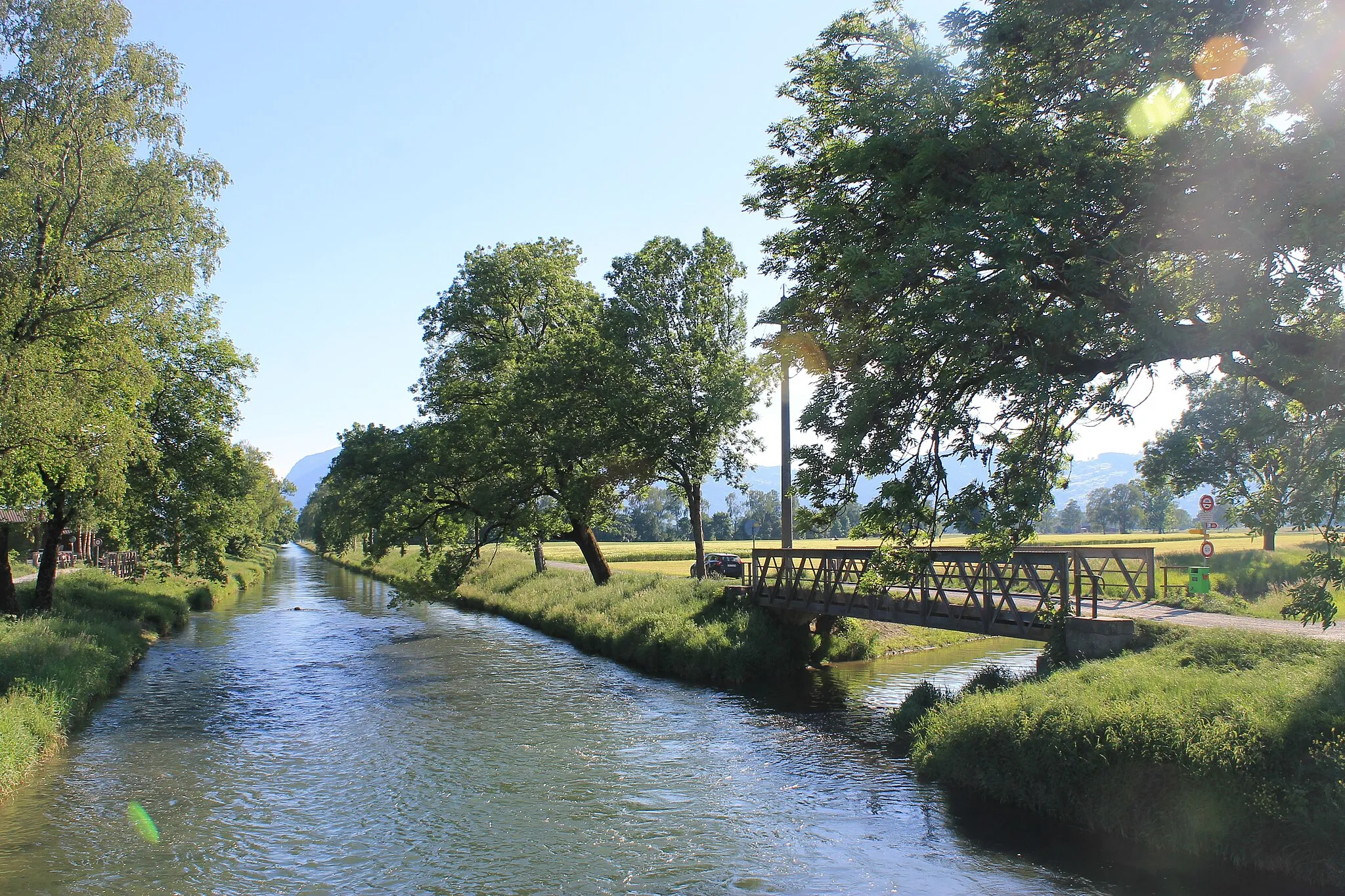
Diepoldsau, located in Ostschweiz, Switzerland, is a charming locality surrounded by breathtaking landscapes. The roads in Diepoldsau are in excellent condition, providing a smooth cycling experience. Cyclists can explore the nearby Rheintal region, offering gentle rolling hills and vineyards. Diepoldsau is also close to the Rhein River, providing picturesque views during rides. With its cyclist-friendly environment and scenic routes, Diepoldsau is highly recommended for road and gravel cyclists.
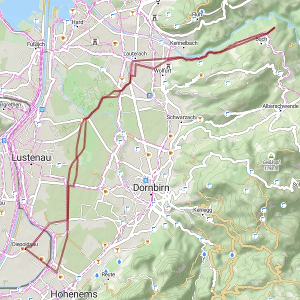
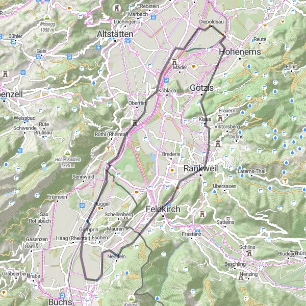
Embark on an adventurous gravel ride exploring Diepoldsau and its hidden gems
Discover the thrill of gravel cycling on this 45-kilometer route around Diepoldsau. With an ascent of 414 meters, the Diepoldsau Gravel Adventure is perfect for adventure seekers looking for a mix of scenic beauty and off-road excitement. This route offers highlights that include Lauterach, a charming town with a rich history, and Wolfurt, famous for its beautiful nature reserves. The difficulty rating for this gravel route is 4 out of 5, making it suitable for experienced cyclists. Get ready for an exciting ride filled with stunning landscapes and cultural discoveries!
Look forward to breathtaking views as you cycle around the scenic hills near Diepoldsau.
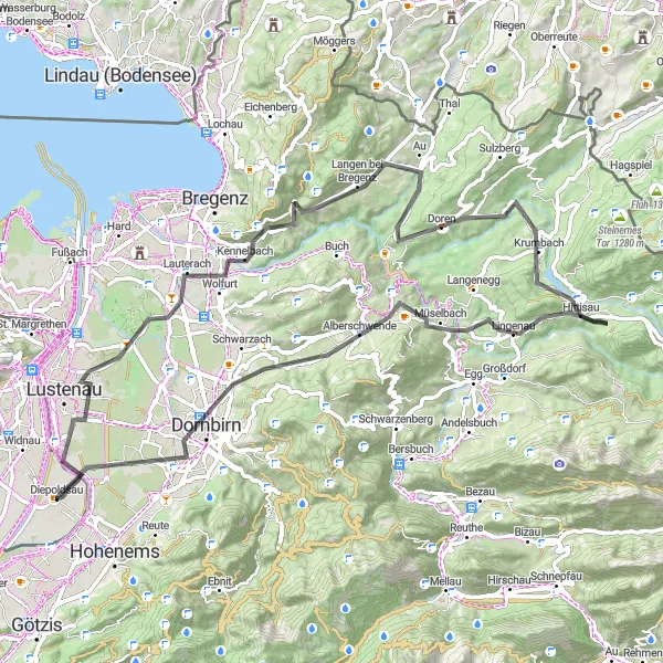
This route takes you on a challenging journey through picturesque landscapes and charming villages. With a total ascent of 1,141 meters over a distance of 77 kilometers, get ready for some tough climbs and thrilling descents. However, the mesmerizing vistas along the way, particularly at Farnach and Alberschwende, make it all worthwhile. This road route is perfect for experienced cyclists seeking both a physical and visual adventure.
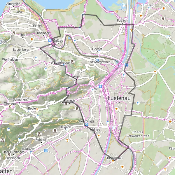
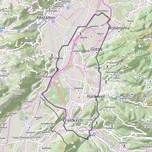
Enjoy a leisurely ride on mostly flat terrain, exploring the charm and tranquility around Diepoldsau.
This road route takes you on a relaxing journey through the enchanting landscapes surrounding Diepoldsau. With a moderate ascent of 394 meters over a distance of 39 kilometers, it's an ideal choice for leisure cyclists or those seeking a more laid-back ride. The highlight of this route is the peaceful village of Walzenhausen, where you can catch a glimpse of the lake in the distance. As you cycle through Footach and Loacker Berg, take in the beautiful scenery before reaching Diepoldsau, where you can wrap up your ride in tranquility.
Altach Loop
Experience the stunning nature and scenic views around Altach
Explore the beautiful Altach in this delightful round-trip cycling route. With a distance of 60 kilometers and an ascent of 345 meters, this road route is suitable for cyclists of all levels. The Altach Loop offers incredible highlights including the charming village of Soele, the historic town of Ganta, and the picturesque Feldkirch. It is a moderately difficult route with a rating of 3 out of 5 in terms of difficulty and is definitely worth experiencing for its scenic beauty and cultural attractions.
Götzis Challenge
Conquer the challenging route around Götzis and soak in the breathtaking scenery
Embark on a challenging 54-kilometer road cycling adventure around Götzis. With an ascent of 576 meters, the Götzis Challenge offers a thrilling experience for experienced cyclists. This route takes you through the picturesque village of Soele, the historic town of Ganta, and the beautiful landscapes of Göfis. Nofels, another highlight along the way, offers magnificent panoramic views of the Rhine River. Rated as a 4 out of 5 on the difficulty scale, this route is perfect for those seeking a demanding cycling challenge amidst stunning natural beauty and cultural heritage.
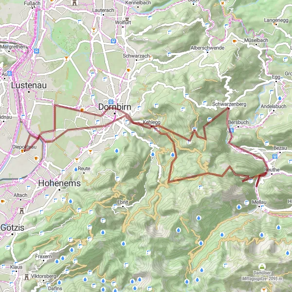
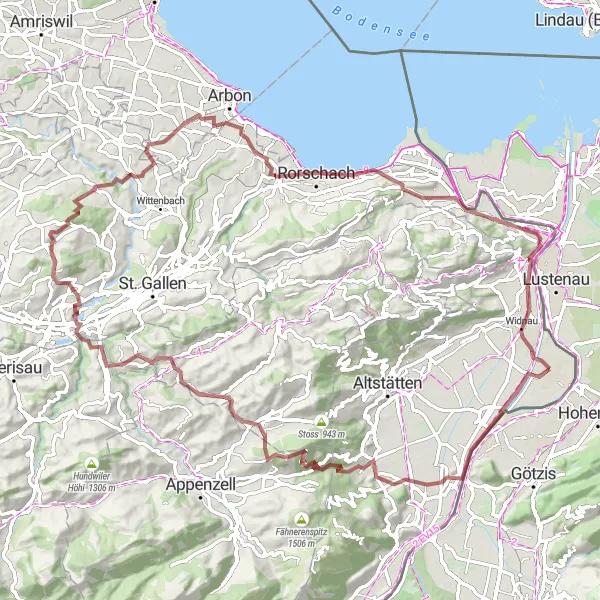
Embark on an epic gravel cycling journey through Ostschweiz, Switzerland.
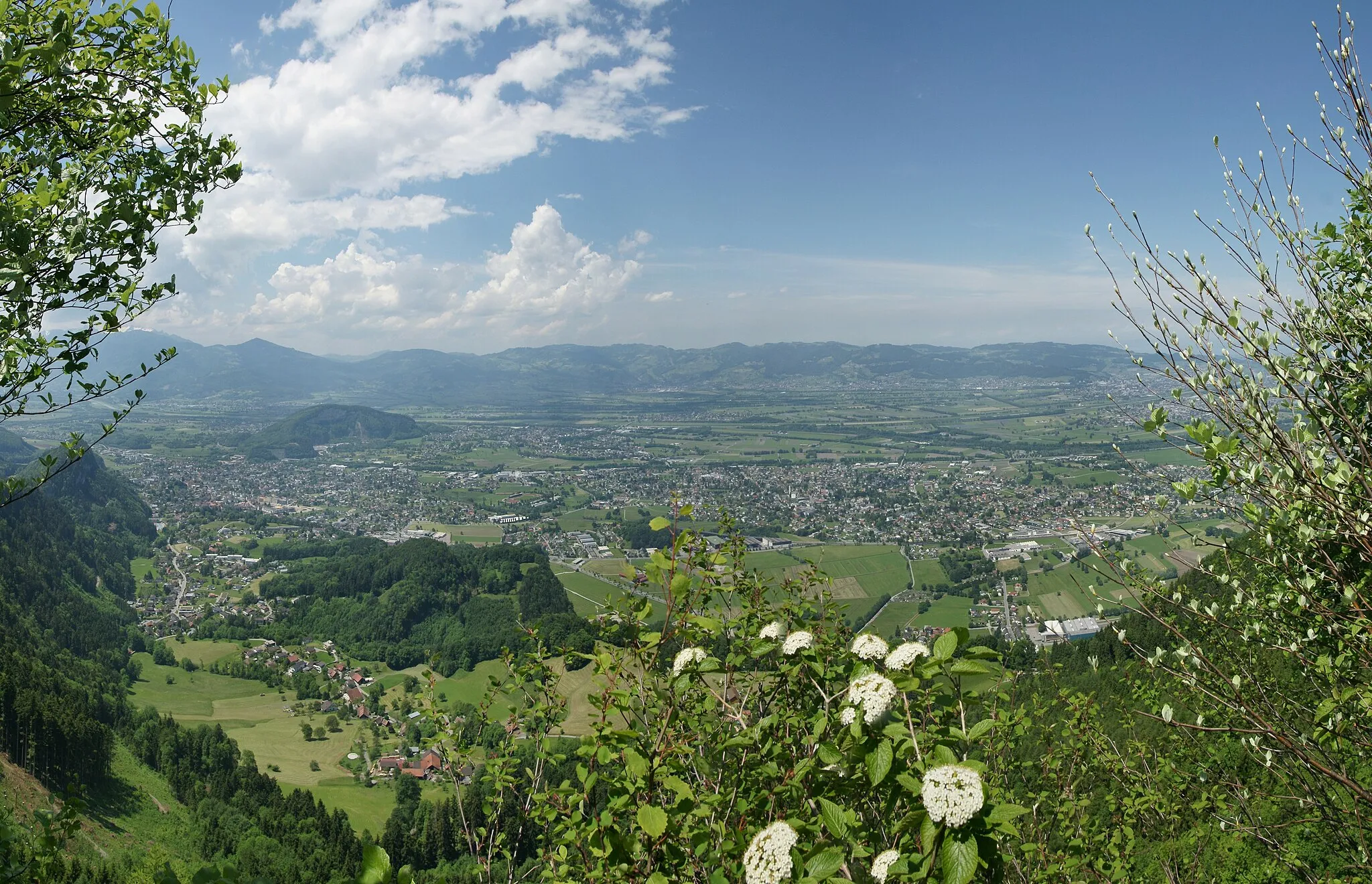
Prepare for an epic adventure through the mesmerizing landscapes of Ostschweiz, Switzerland on this gravel cycling route. Starting from Diepoldsau, you will embark on a challenging yet rewarding journey that promises breathtaking views and unforgettable experiences. The route takes you through a series of picturesque highlights, including Hatlerdorf, a charming village nestled amidst rolling hills and thick forests. Zanzenberg, another highlight, offers stunning views of the surrounding countryside, with its sloping vineyards and idyllic farms. Hangköpfle, on the other hand, boasts panoramic vistas that stretch as far as the eye can see. Klauser Wasserfall, a majestic waterfall surrounded by lush greenery, provides a refreshing stop on your journey. Schwarzenberg, with its beautifully preserved half-timbered houses and traditional Swiss charm, is a delight to explore. The route also includes Hochälpelekopf, a mountain peak that offers awe-inspiring panoramic views of the Swiss countryside and the distant mountains. Finally, you will reach Dornbirn, a vibrant city known for its lively atmosphere and cultural attractions. This gravel route offers a challenging climb and is recommended for experienced cyclists seeking an epic adventure. With its breathtaking views, remote landscapes, and diverse highlights, this route is guaranteed to deliver an unforgettable cycling experience.
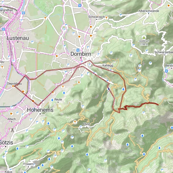
Venture off the main roads and explore the gravel paths through beautiful landscapes surrounding Diepoldsau.
This gravel route offers an adventurous alternative to road cycling, allowing riders to immerse themselves in nature. With an ascent of 1,204 meters over 45 kilometers, be prepared for a challenging but rewarding ride. Along the way, you'll discover hidden gems like Dornbirn and Zanzenberg, which offer unique insights into the region's culture and history. The Schlossberg in Hohenems presents a real test of your gravel biking skills, while the route's conclusion in Diepoldsau leaves you with a sense of accomplishment and a desire to explore even more adventurous paths.
Embark on an epic gravel ride exploring Rheineck and its mesmerizing surroundings
Get ready for the ultimate gravel adventure around Rheineck with this 93-kilometer route. With an ascent of 1,613 meters, the Rheineck Epic Gravel Ride promises a challenging but rewarding experience for experienced gravel riders. Highlights along the route include the historic town of Kadel, the stunning mountainside village of Koblach, and the majestic Hoher Hirschberg. This route also takes you through the charming village of Gais and the Schlössli Haggen nature reserve. With a difficulty rating of 5 out of 5, this gravel ride is only suitable for seasoned cyclists looking for an unforgettable challenge in breathtaking surroundings!
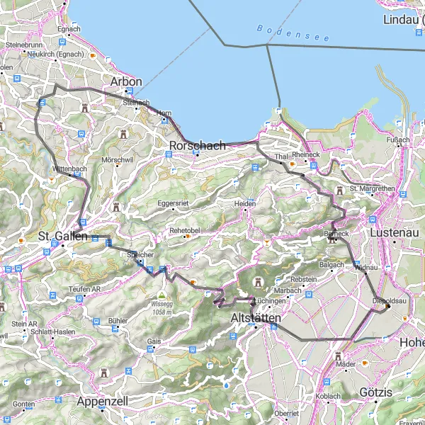
Embark on a thrilling climb through the St. Gallen foothills and test your cycling skills.
This road route presents a real challenge for experienced cyclists. With an ascent of 1,319 meters over 79 kilometers, expect some demanding climbs that will push you to your limits. The highlights along the way, such as Altstätten and Wächterhüüsli, offer brief respites and picturesque scenery. Get ready to reward yourself with epic views at Arbon and Rheineck, two spots that will leave a lasting impression. The route finishes in Diepoldsau, inviting you to relax and reflect on the challenging journey you've conquered.
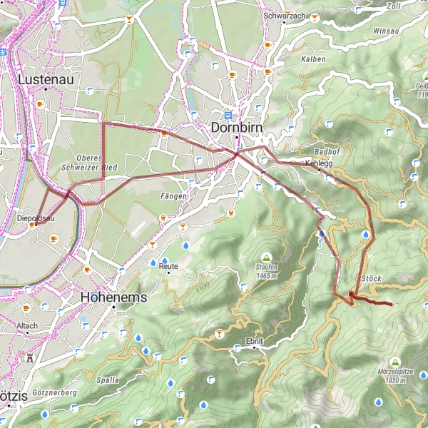
Take on an exhilarating gravel challenge and conquer the demanding mountain terrain near Diepoldsau.
This gravel route is a true test of skill and endurance, as it winds its way through challenging mountain paths. With an ascent of 945 meters over a distance of 39 kilometers, this will push even the most experienced riders to their limits. Highlights include Dornbirn, where you can immerse yourself in the local culture, and Hoher Knopf, which offers breathtaking views of the surrounding peaks. As you conquer the trail, admire the beauty of Kirchle and celebrate your achievement upon returning to Diepoldsau.
Cycling routes nearby:


Nearby regions: