Cycling Paradise in East Anglia
Cycling routes from Eye
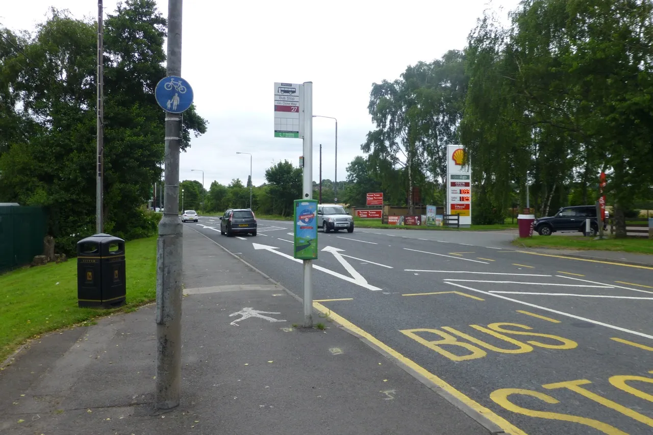
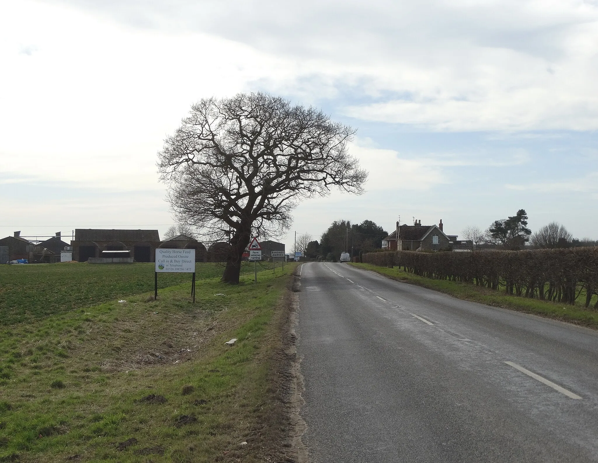
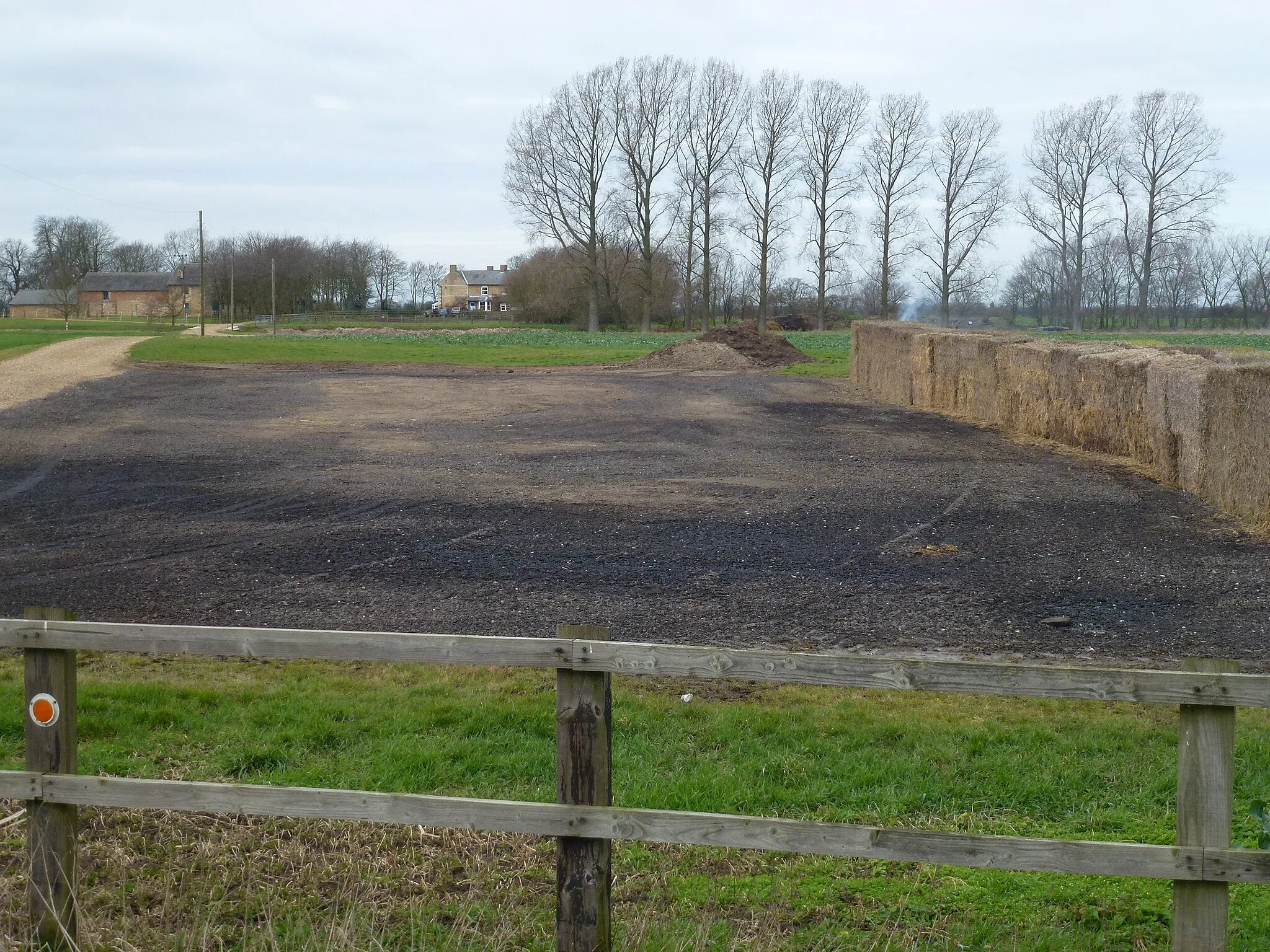
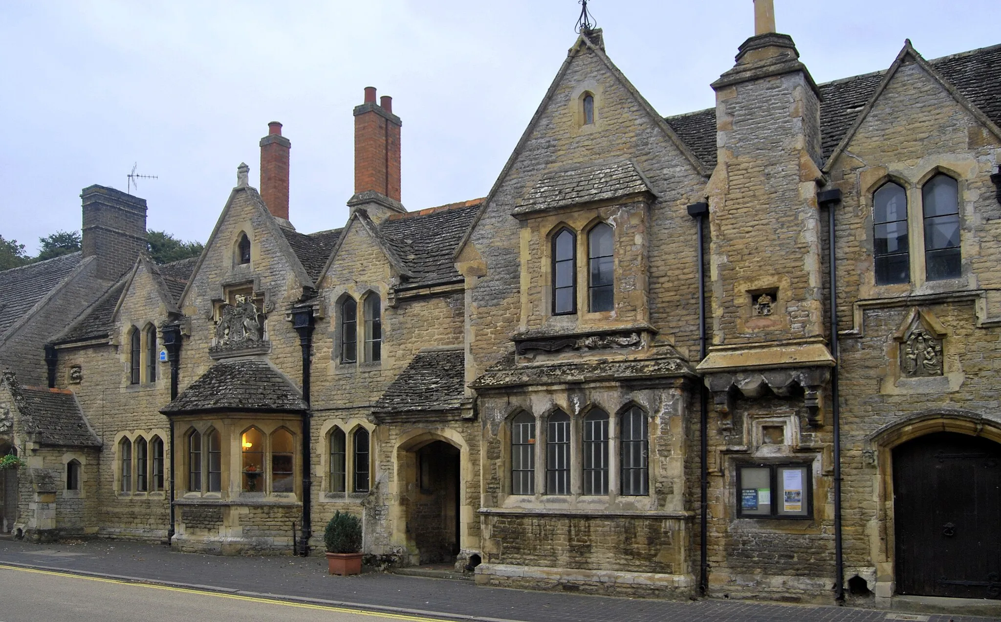
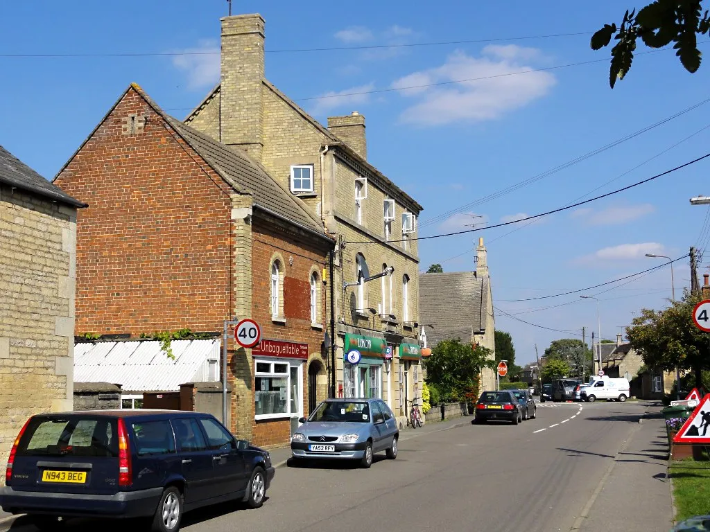
Eye is a small town located in East Anglia, United Kingdom. From a cyclist's perspective, Eye offers a peaceful and scenic environment for cycling. The roads are generally well-maintained, making it suitable for road cycling. Gravel cyclists can also explore the beautiful gravel trails that surround the area. Some well-known climbs nearby include Gissing Hill and Diss Hill, which offer a challenge to experienced cyclists. Eye is also popular among tourists for its ancient castle and charming town center. Overall, Eye is a cycling-friendly locality with picturesque routes and attractions.
Foul Anchor Adventure
Embark on a thrilling adventure through Foul Anchor on this exciting gravel cycling route.
Experience the thrill of off-road cycling as you traverse the picturesque countryside of Foul Anchor. This gravel route provides a moderate challenge and is perfect for adventurous cyclists looking to discover hidden gems in the area. Highlights include Whaplode Drove, Foul Anchor, and Murrow, offering diverse landscapes, including open fields and enchanting woodlands. Get off the beaten path in Foul Anchor and immerse yourself in the natural beauty and tranquility of this scenic cycling route.
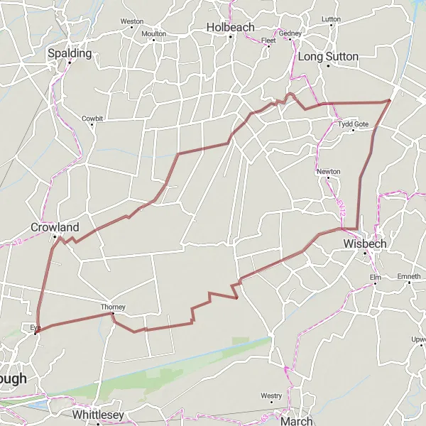
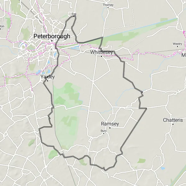
Crowland Loop
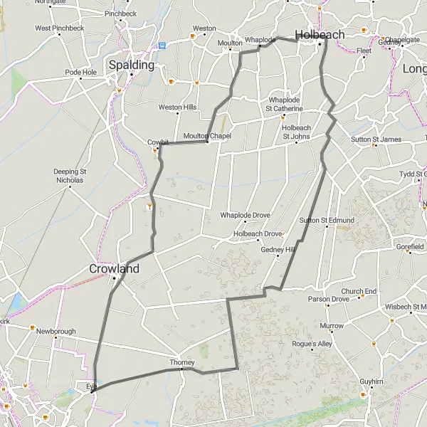
Explore the charming village of Crowland on this scenic cycling route
The Crowland Loop is a delightful cycling route that takes you through the picturesque landscapes near Eye in East Anglia. With a distance of 66 km and an elevation gain of 16 meters, it offers a pleasant ride suitable for all levels of cyclists. The route passes through stunning countryside, enchanting villages, and scenic farmlands. Enjoy the peacefulness of Cowbit, admire the historic landmarks in Crowland, and take in the beauty of nature in Whaplode and Thorney. Overall, this route provides a fulfilling cycling experience with its serene surroundings and cultural highlights.
Fenland Adventure
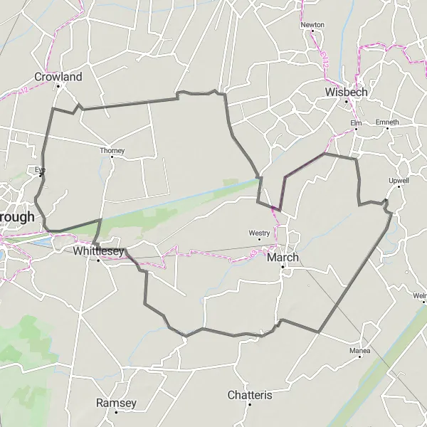
Cycle through the enchanting Fenland
Embark on a captivating cycling journey through the picturesque Fenland region. This route offers a delightful mix of road and off-road paths, allowing you to explore the stunning landscapes and charming villages that define this unique part of East Anglia. With moderate difficulty, the route is suitable for experienced amateurs seeking a fulfilling adventure. Discover ancient Bronze Age wonders at the Flag Fen Bronze Age Centre and soak in the tranquility of Eye Green before immersing yourself in the magical allure of Parson Drove, Friday Bridge, Wimblington, Benwick, Eastrea, and more.
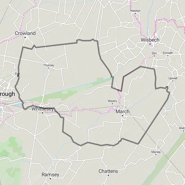
Discover the charming countryside of Eye Green on this scenic round-trip cycling route.
Embark on a picturesque journey through the tranquil countryside of Eye Green. This route offers beautiful landscapes, quaint villages, and a moderate level of challenge, making it ideal for intermediate cyclists. With highlights including Parson Drove, Friday Bridge, and Whittlesey, you'll encounter historical landmarks, traditional architecture, and stunning views along the way. Enjoy the idyllic charm of Eye Green as you pedal through this delightful cycling route.
Gravel Adventure
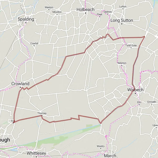
Embark on an off-road gravel adventure exploring the scenic countryside
If you're seeking an exciting off-road cycling experience, the Gravel Adventure route near Eye is perfect for you. Covering a distance of 78 km with an ascent of 22 meters, this route offers a mix of gravel paths, farm tracks, and quiet lanes. Journey through picturesque villages like Crowland and Guyhirn, and enjoy the tranquility of Whaplode Drove and Foul Anchor. Marvel at the beauty of nature in Guyhirn and Thorney, taking in the peaceful surroundings. This gravel adventure provides a unique way to explore the stunning countryside of East Anglia.
Embark on a scenic loop exploring the charming town of Whittlesey
The Whittlesey Loop is a picturesque road cycling route near Eye. With an ascent of 107 meters and a distance of 82 km, this route showcases the beauty of the Fenland region. Enjoy the scenic views as you cycle through Whittlesey, Benwick, Warboys, and Little Raveley. Discover the rich history and cultural heritage of these charming towns along the way. The highlight of the route is the enchanting Eastgate, offering a unique glimpse into the rural landscapes. This scenic loop guarantees a delightful cycling experience filled with captivating sights.
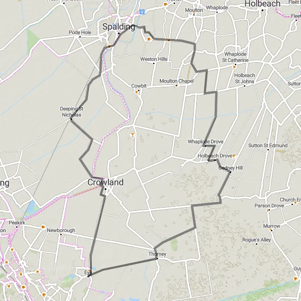
Discover the enchanting town of Spalding on this captivating road cycling route.
Embark on a memorable cycling journey through the charming town of Spalding. This road route offers a moderate challenge, taking cyclists through stunning landscapes and historical sites. Highlights include Deeping St Nicholas, Spalding, Austendike, and Gedney Hill, showcasing picturesque villages, enchanting waterways, and impressive architectural marvels. Immerse yourself in the history and beauty of Spalding as you pedal through this captivating road cycling tour.
Peterborough Excursion
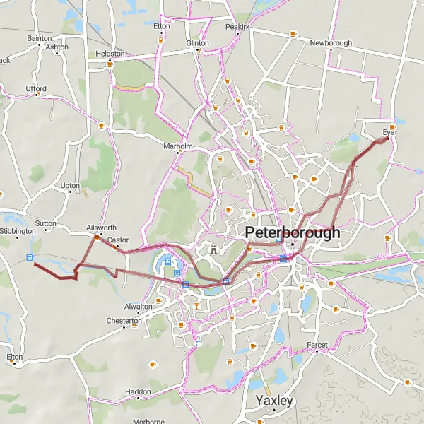
Embark on an adventurous gravel route exploring the outskirts of Peterborough.
Venture into the outskirts of Peterborough on this gravel cycling route and uncover hidden treasures along the way. With a challenging ascent and thrilling off-road sections, this route is designed for seasoned adventurers seeking a unique cycling experience. Highlights along the way include Castor and West Town, offering glimpses into the region's rich history and displaying natural beauty. Immerse yourself in the striking landscapes and historical charm as you conquer the Peterborough Excursion.
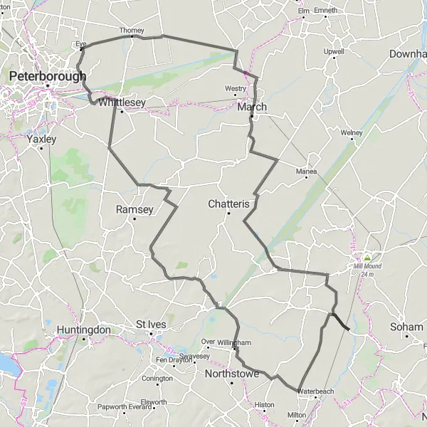
Embark on an adventurous journey exploring March and Ramsey
Embark on a cycling adventure through the charming towns of March and Ramsey near Eye. With an elevation gain of 143 meters and a distance of 134 km, this route offers an exciting journey through the Cambridgeshire Fens. Explore the stunning countryside as you pass through Guyhirn, Witcham, Stretham, Landbeach, and more. Don't miss the captivating Lockspit's viewpoint and the remarkable city of Ely. Immerse yourself in the rural charm of Stretham and enjoy the peacefulness of Ramsey Forty Foot. This adventure-packed route is perfect for cyclists looking for a mix of nature, culture, and challenge.
Rutland Circuit
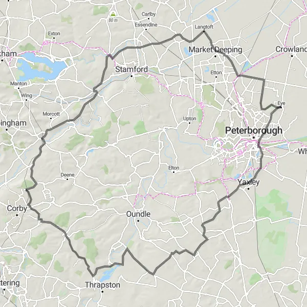
Embark on an epic circuit exploring the beautiful Rutland region
Covering a distance of 121 km and featuring an ascent of 481 meters, the Rutland Circuit is a challenging road cycling route near Eye. This circular route takes you through the breathtaking landscapes of Farcet, Great Gidding, Sudborough, and more. Experience the diverse terrain of rolling hills, picturesque villages, and serene countryside. Highlights include the historic village of Barrowden, the idyllic town of Market Deeping, and the charming village of Newborough. This epic route offers a chance to soak in the natural beauty and rich history of the Rutland region.
Cycling routes nearby:


Nearby regions: