Conquer challenging climbs and enjoy scenic landscapes in Ratho.
Cycling routes from Ratho
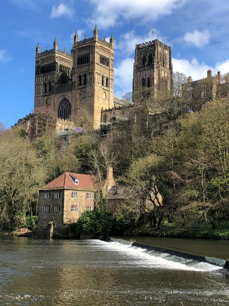
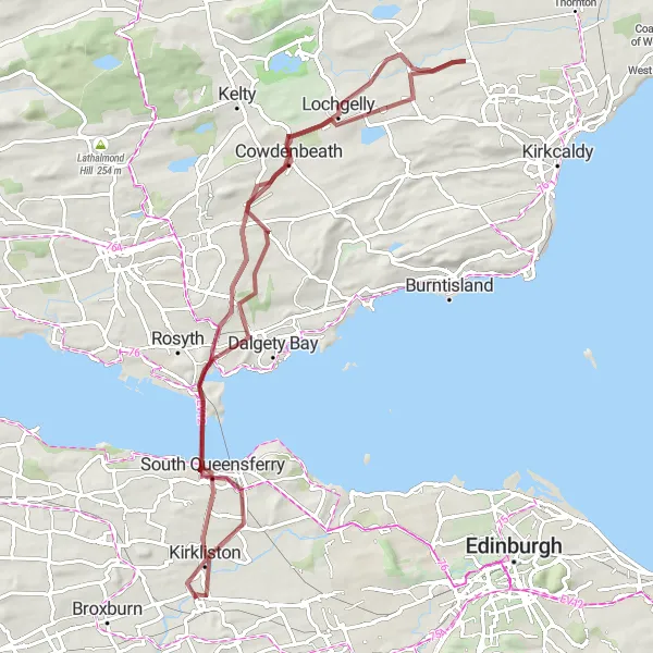
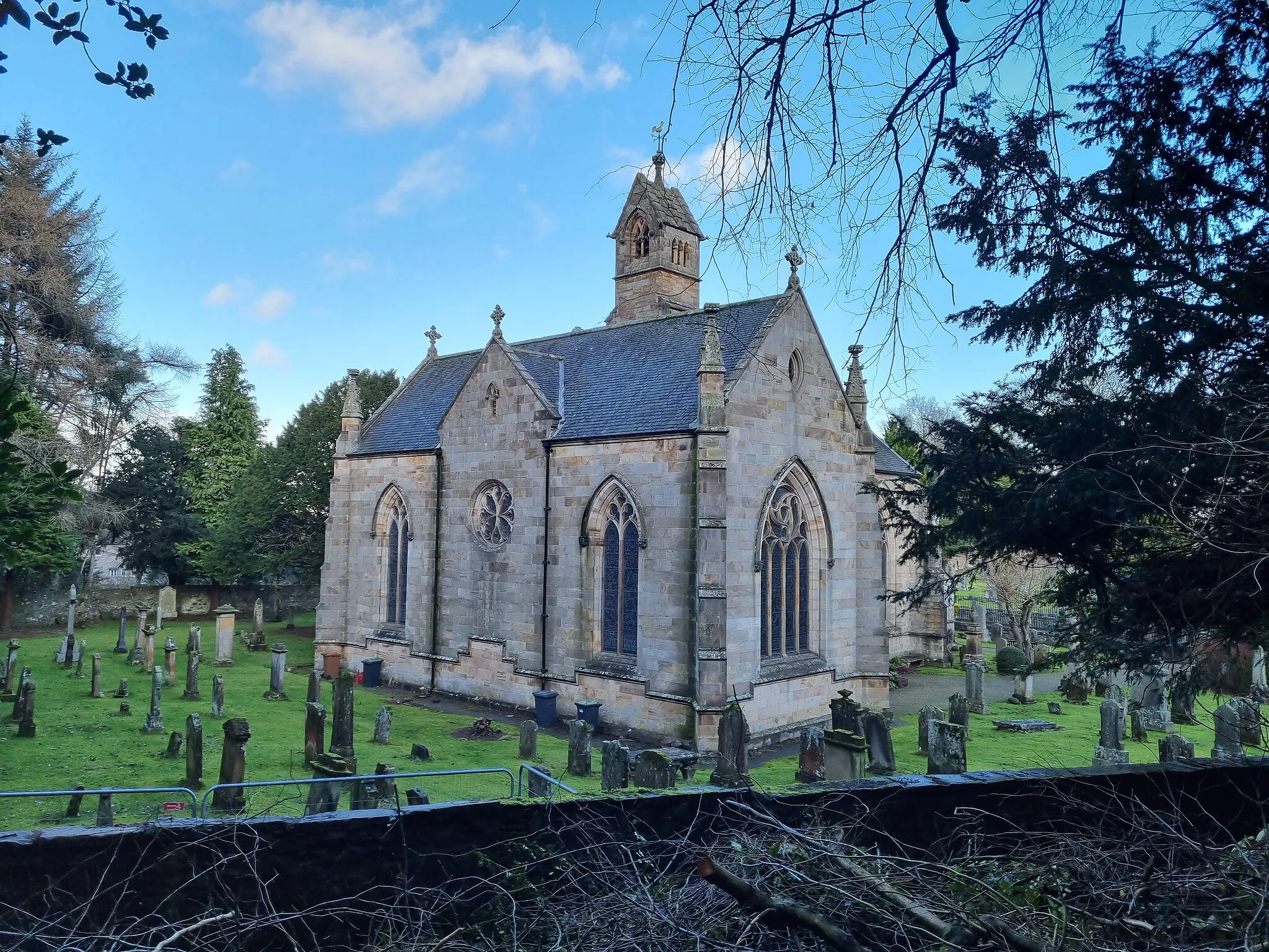
Ratho is located in Eastern Scotland, United Kingdom. From a cyclist's perspective, Ratho offers a mix of scenic countrysides and quiet back roads. The locality is relatively hilly, providing opportunities for challenging climbs. A well-known cycling spot nearby is the route to the iconic Forth Bridge, which offers both a scenic and challenging ride. Ratho is a great destination for cyclists looking to explore the beautiful Scottish landscapes and conquer some challenging climbs.
Embark on an adventurous gravel cycling route with stunning views of the Forth Bridges.
Experience the thrill of gravel cycling with this route that takes you along scenic paths near the Forth Bridges. With a distance of 69 kilometers and an ascent of 635 meters, this loop is suitable for well-trained amateur cyclists. The route offers a mix of gravel paths and off-road tracks, providing an exciting adventure for cyclists. Enjoy the panoramic views of the iconic Forth Bridges and explore the charming towns along the way.
The Calderis Ride
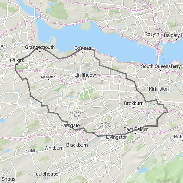
Explore the Calderis region and experience a mix of natural and urban beauty
The Calderis Ride takes cyclists on a captivating journey through the scenic Calderis region, showcasing the perfect harmony between nature and urban landscapes. With a distance of 73 kilometers and an ascent of 528 meters, this road cycling route provides a moderate level of challenge suitable for all skill levels. Highlights of this route include Tormain nature reserve, Livingston's thriving town center, Bathgate's quaint streets, Grangemouth's bustling port, and the panoramic views from the renowned Greendykes Bing. Each highlight adds a unique touch to the overall experience, showcasing the diverse beauty and rich cultural heritage of the Calderis region.
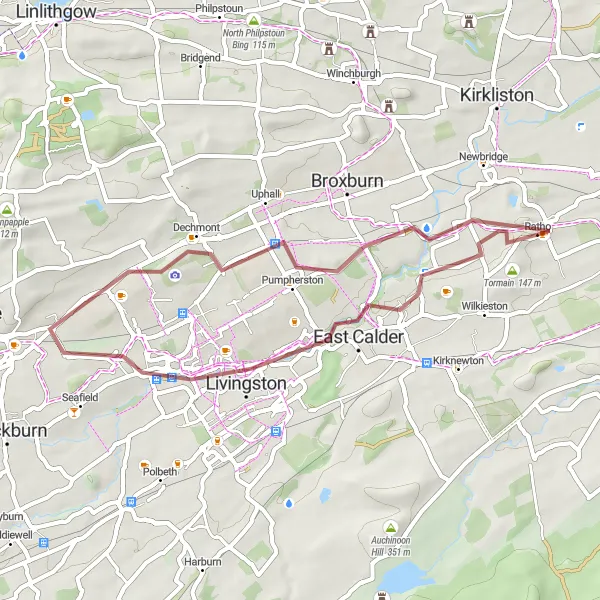
Explore the scenic gravel paths of Livingston and West Clifton on this adventurous cycling route.
Experience the excitement of gravel cycling with this route that takes you through Livingston and West Clifton. Covering a distance of 36 kilometers and featuring an ascent of 235 meters, this loop is suitable for well-trained amateur cyclists. Enjoy the scenic beauty of West Clifton and Livingston as you cycle along gravel paths and off-road tracks. Discover the fascinating history of Livingston, climb Dechmont Law for panoramic views, and immerse yourself in the serene landscapes of Tormain. This adventurous loop provides a mix of challenging terrain and enjoyable paths, offering a memorable gravel cycling experience.
The Linlithgow Expedition
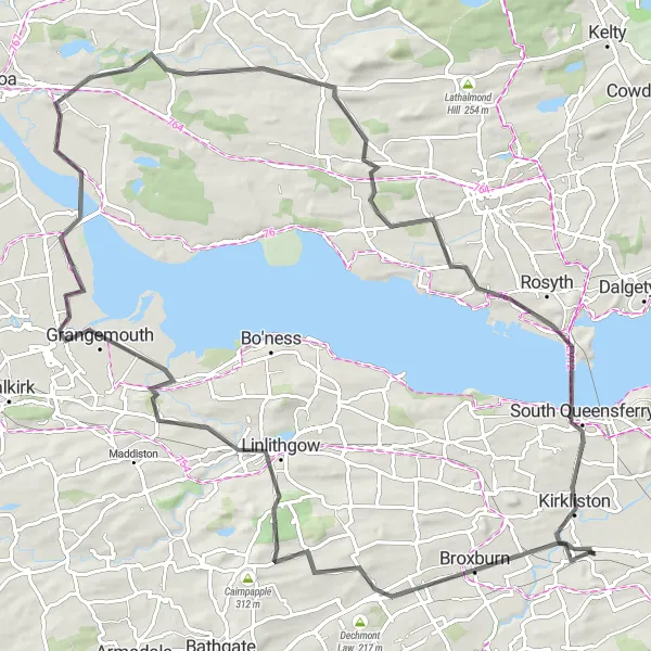
Embark on a historic journey through Linlithgow's picturesque landscapes and captivating history
The Linlithgow Expedition invites cyclists to embark on a historic journey through the picturesque landscapes and captivating history of Linlithgow and its surroundings. With a distance of 89 kilometers and an ascent of 723 meters, this road cycling route offers a moderate level of challenge paired with remarkable sights. Highlights along the route include Broxburn's charming village, Linlithgow's magnificent palace, and the scenic view from Colt Hill. Grangemouth's bustling atmosphere, Clackmannan's quaint village, and the vantage point offered at Bonnar Knoll are notable stops along the way. Additionally, riders will have the opportunity to experience the legendary Forth Bridges, connecting them to the intriguing North Queensferry and South Queensferry.
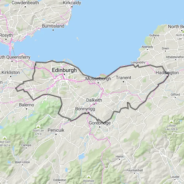
Cycle along the stunning Edinburgh coastline and explore its vibrant neighborhoods.
Explore the iconic city of Edinburgh and its beautiful coastline with this road cycling route. Covering a distance of 108 kilometers and featuring an ascent of 769 meters, this loop provides a mix of challenging climbs and flat stretches. Suitable for well-trained amateur cyclists, the route takes you through historic landmarks and vibrant neighborhoods, providing a diverse and enjoyable cycling experience. Discover the charm of Leith, enjoy panoramic views from Lauriston Castle, and immerse yourself in the rich history of Pathhead. End your journey with a visit to the picturesque Colinton village.
Wilkieston and Tarbrax Loop
Experience the stunning countryside views of Wilkieston and Tarbrax along this road cycling route.
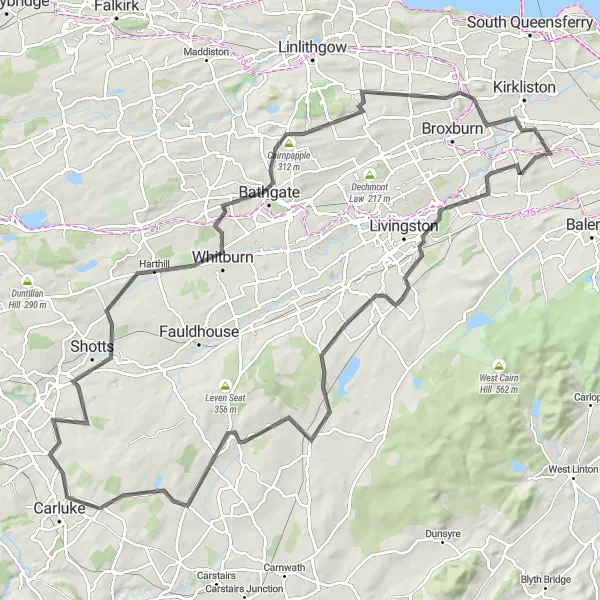
This road cycling route takes you through the charming villages of Wilkieston and Tarbrax, offering breathtaking views of the Scottish countryside. With a total distance of 71 kilometers and an ascent of 544 meters, this loop is suitable for well-trained amateur cyclists. The route provides a mix of flat stretches and moderate climbs. Enjoy the peaceful surroundings and discover the landmarks along the way.
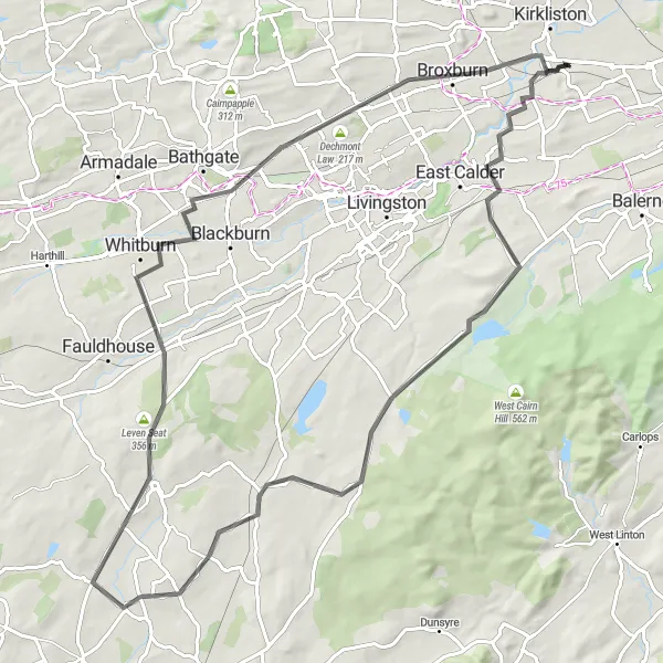
The Ratho Loop
Discover the beautiful countryside and historical landmarks around Ratho
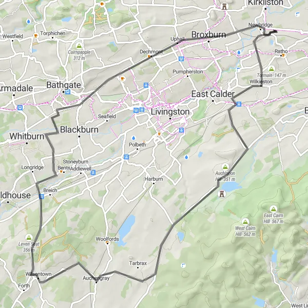
The Ratho Loop is a scenic cycling route that explores the picturesque countryside and historical landmarks near Ratho in Eastern Scotland. With a distance of 102 kilometers and an ascent of 847 meters, this route offers a challenging yet rewarding experience for road cyclists. The varied terrain and stunning views make it an ideal choice for riders seeking a mix of adventure and natural beauty. Highlights along the route include the Tormain nature reserve, the East Calder village, and the magnificent Pearie Law hill. Other notable attractions include Woolfords, Shotts, Whitburn, Cairnpapple, Bridgend, and Greendykes Bing.
Embark on a scenic road cycling adventure exploring Ratho and Broxburn.
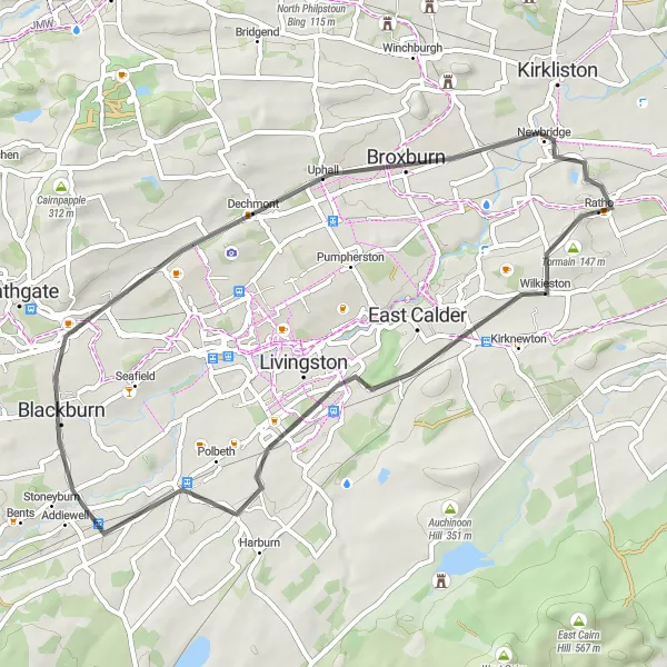
Discover the beauty of Ratho and Broxburn with this road cycling route. Covering a distance of 44 kilometers and featuring an ascent of 328 meters, this loop is suitable for well-trained amateur cyclists. The route offers a mix of flat stretches and gentle inclines, providing a delightful cycling experience. Explore the tranquil countryside around Tormain, enjoy picturesque views in Blackburn, and climb Dechmont Law for panoramic vistas. Immerse yourself in the charming atmosphere of Broxburn before heading back to Ratho.
Embark on an scenic cycling journey with breathtaking views of the iconic Forth Bridges
The Forthview Adventure offers cyclists an unforgettable experience, combining breathtaking natural beauty with awe-inspiring architectural marvels. Covering a distance of 91 kilometers and an ascent of 748 meters, this road cycling route is suitable for intermediate riders looking to explore Eastern Scotland's most iconic landmarks. The highlights of this route include the Forth Bridges Viewpoint, North Queensferry's historical charm, Kelty's scenic landscapes, Tullibole Castle's grandeur, and the spectacle of the Forth Bridges themselves. Each highlight provides a unique perspective on the region, showcasing its rich heritage, stunning landscapes, and magnificent engineering feats.
The West Calder Exploration
Embark on a scenic adventure through the enchanting landscapes around West Calder
The West Calder Exploration takes cyclists on a captivating journey through the enchanting landscapes surrounding West Calder. With a distance of 80 kilometers and an ascent of 650 meters, this road cycling route offers a moderate level of challenge suitable for riders of various skill levels. Highlights along the route include Auchinoon Hill's charming countryside, Cairns Castle's historical allure, Tarbrax's unique charm, and the panoramic view offered at Dechmont Law. Each highlight presents something distinct, showcasing areas of natural beauty, historical significance, and tranquil surroundings that make West Calder a hidden gem for cyclists to explore.
Cycling routes nearby:
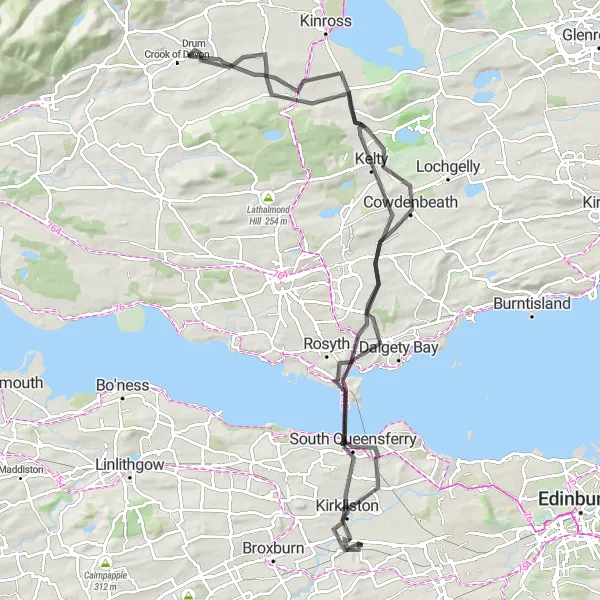
Nearby regions: