![Cover image](https://images.tarmacs.app/cycling-routes/covers/united-kingdom/gloucestershire-wiltshire-and-bristol-bath-area/south-cerney-4.webp)
Discover the cycling paradise of Cotswold Water Park starting from South Cerney.
Cycling routes from South Cerney
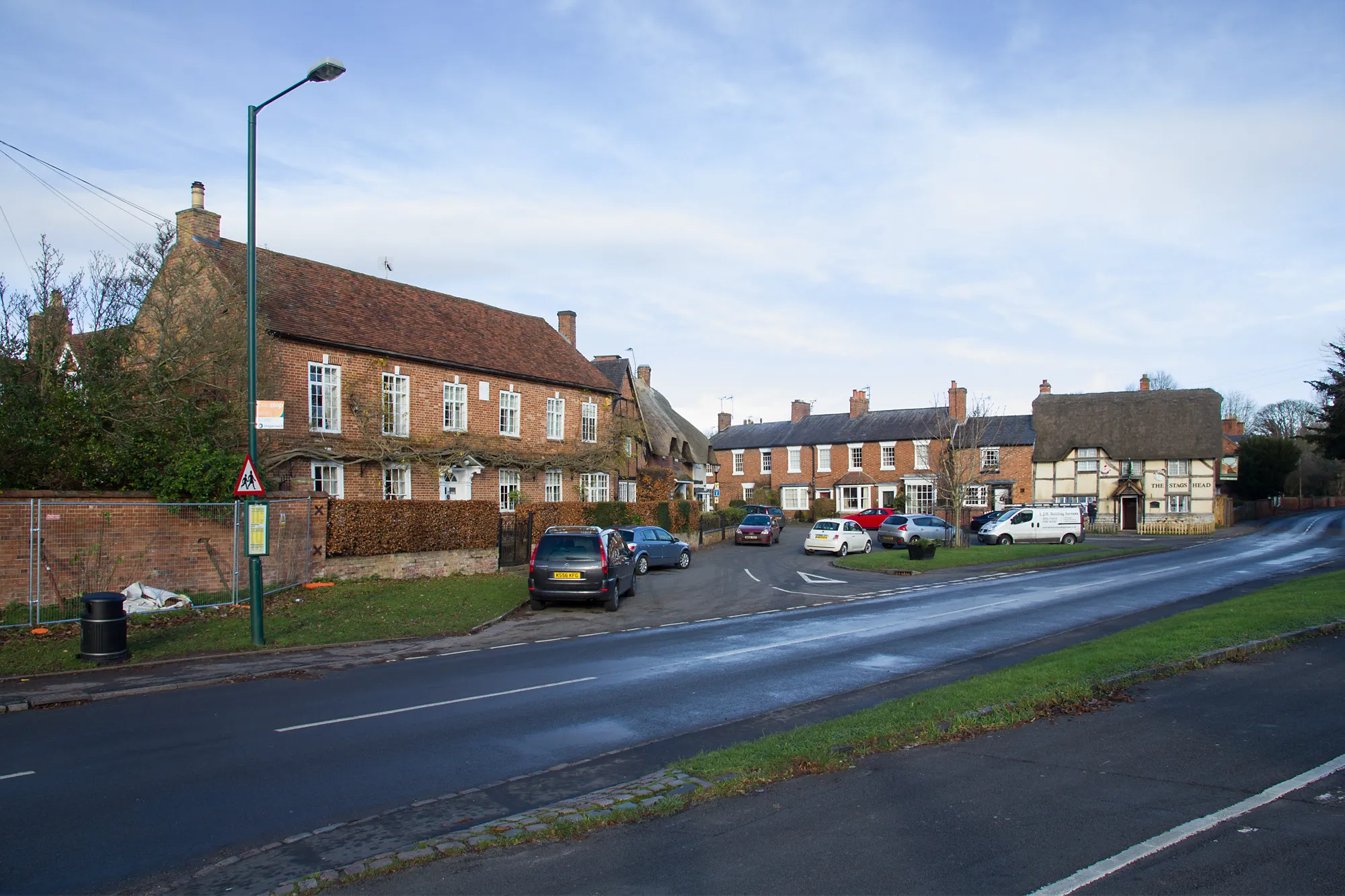
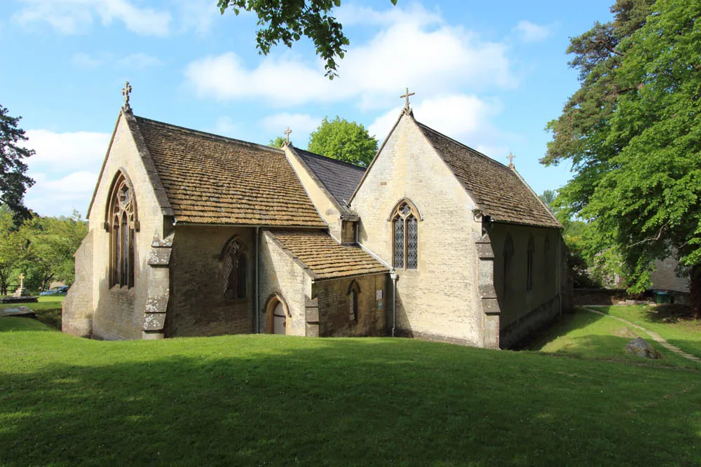
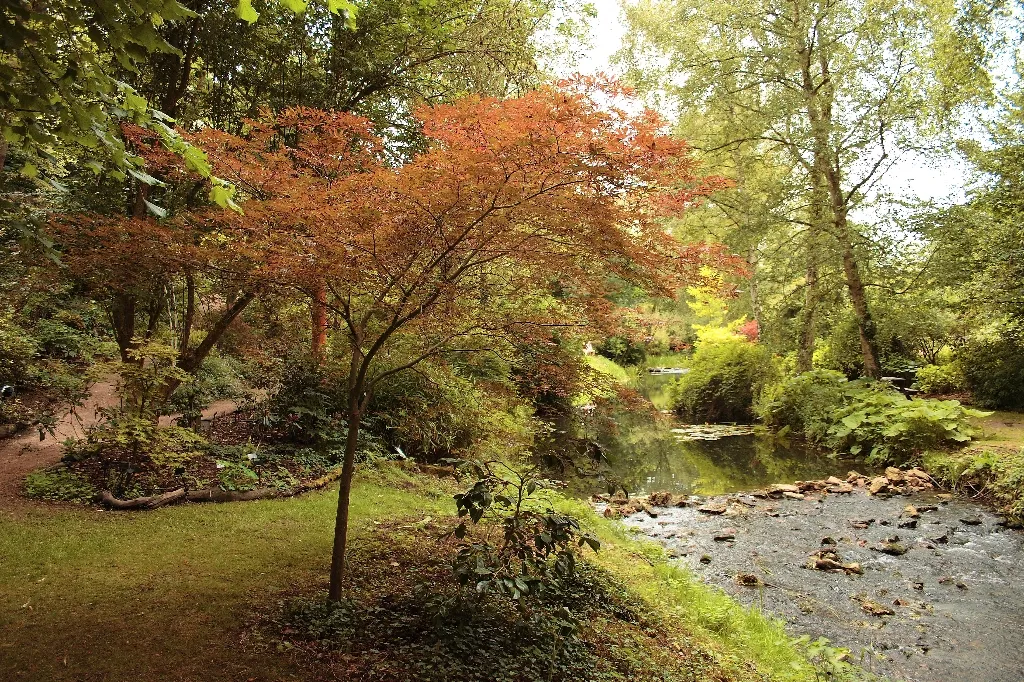
South Cerney, situated in the Gloucestershire, Wiltshire, and Bristol/Bath area of the United Kingdom, is an excellent locality for cyclists looking to enjoy outdoor adventures. The town is surrounded by the expansive Cotswold Water Park, offering numerous cycling opportunities on well-maintained paths and trails. Cyclists can explore the park's beautiful lakes, charming villages, and diverse wildlife. Additionally, South Cerney serves as a gateway to the nearby Cotswolds, renowned for its rolling hills and picturesque landscapes. The locality provides a perfect balance between leisurely rides and more challenging cycling routes, attracting cyclists of all skill levels.
![Map miniature of "The Historic Route" cycling inspiration in Gloucestershire, Wiltshire and Bristol/Bath area, United Kingdom. Generated by Tarmacs.app cycling route planner](https://images.tarmacs.app/cycling-routes/routemaps/600/united-kingdom/gloucestershire-wiltshire-and-bristol-bath-area/south-cerney/road/95706.webp)
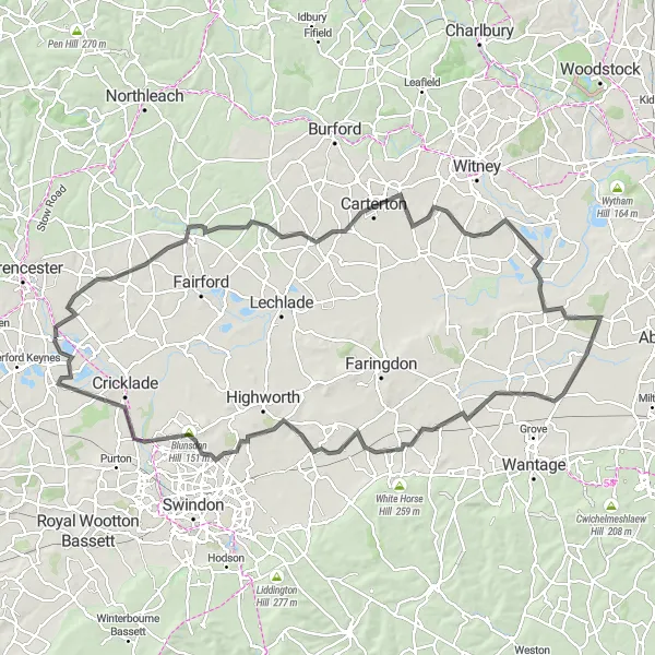
A historic road cycling route through scenic landscapes
The Historic Route is a 117 km long road cycling route that takes you through the historic landmarks and scenic landscapes near South Cerney. With an ascent of 402 m, this route offers a mix of challenging climbs and gentle rolling hills. Highlights of this route include Hatherop, Lew, Frilford, Uffington, Friars Hill, Common Hill, and Ashton Keynes.
Chedworth Circuit
![Map miniature of "Chedworth Circuit" cycling inspiration in Gloucestershire, Wiltshire and Bristol/Bath area, United Kingdom. Generated by Tarmacs.app cycling route planner](https://images.tarmacs.app/cycling-routes/routemaps/600/united-kingdom/gloucestershire-wiltshire-and-bristol-bath-area/south-cerney/road/95611.webp)
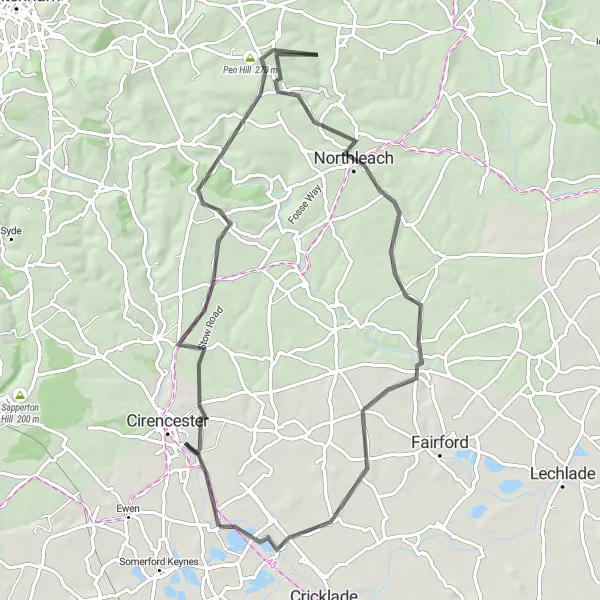
Immerse yourself in the beauty of the Chedworth countryside on this challenging road cycling route.
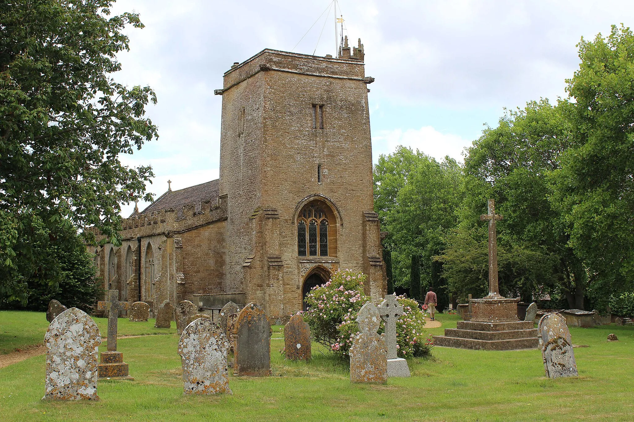
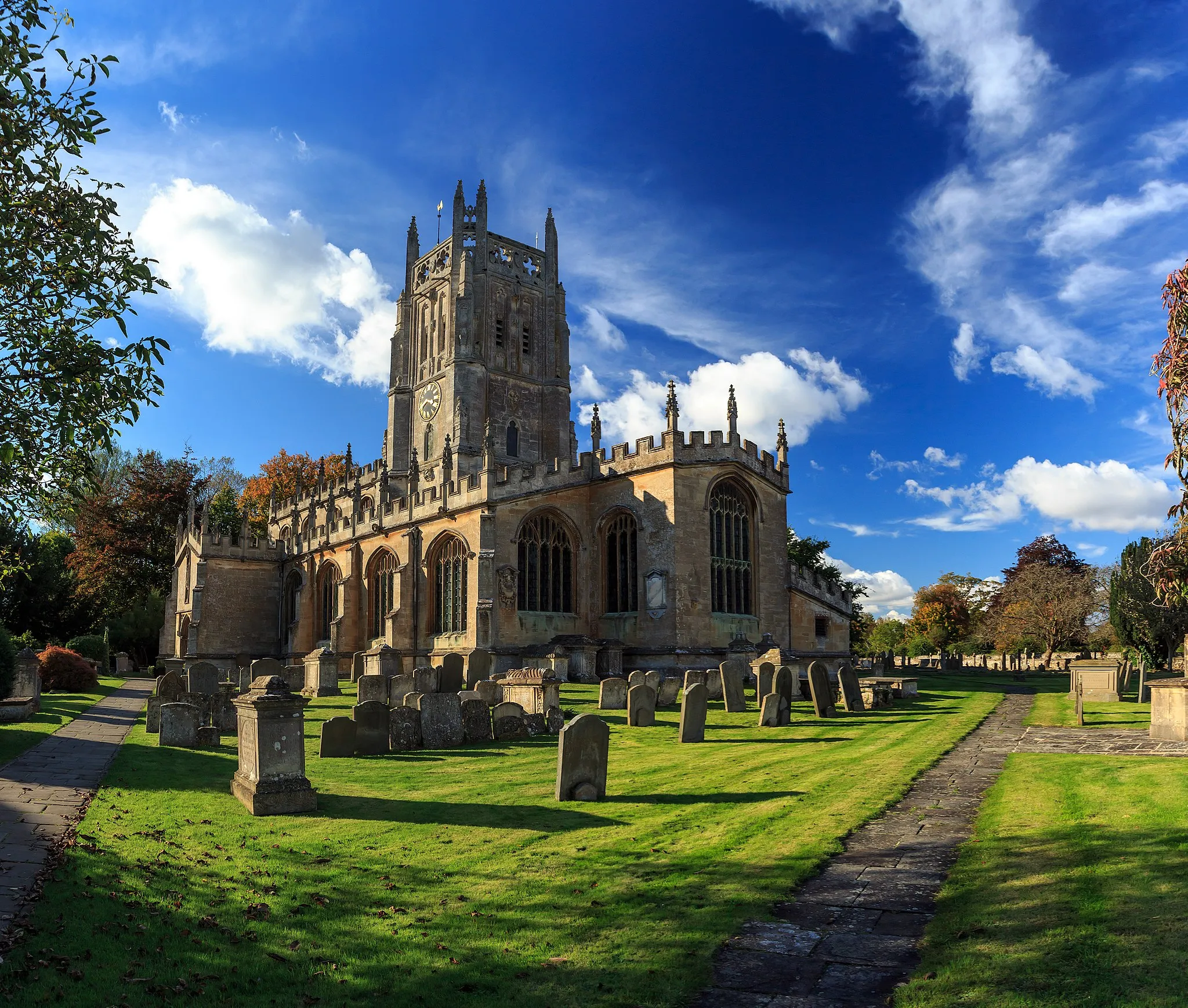
The Chedworth Circuit is a 70 km road cycling route that takes you through picturesque landscapes and charming villages in Gloucestershire. Starting near South Cerney, you'll pass through South Cerney, Shooters Hill, Chedworth, Chedworth Beacon, Pen Hill, Hampnett, Eastington, and finally Down Ampney. With a total ascent of 599 meters, this route is suitable for experienced cyclists looking for a challenge. Along the way, you'll enjoy breathtaking views of the Cotswold Hills, ancient Roman villas, and historic churches.
South Cerney Loop
![Map miniature of "South Cerney Loop" cycling inspiration in Gloucestershire, Wiltshire and Bristol/Bath area, United Kingdom. Generated by Tarmacs.app cycling route planner](https://images.tarmacs.app/cycling-routes/routemaps/600/united-kingdom/gloucestershire-wiltshire-and-bristol-bath-area/south-cerney/road/140035.webp)
A picturesque route through Gloucestershire and Wiltshire countryside
The South Cerney Loop is a beautiful cycling route that takes you on a journey through the stunning countryside of Gloucestershire and Wiltshire. With a total distance of 78 kilometers and an ascent of 355 meters, this route is suitable for intermediate to advanced cyclists. The picturesque villages, scenic landscapes, and historic attractions along the way make it a must-ride for cycling enthusiasts.
![Map miniature of "The Wootton Bassett Circuit" cycling inspiration in Gloucestershire, Wiltshire and Bristol/Bath area, United Kingdom. Generated by Tarmacs.app cycling route planner](https://images.tarmacs.app/cycling-routes/routemaps/600/united-kingdom/gloucestershire-wiltshire-and-bristol-bath-area/south-cerney/road/95580.webp)
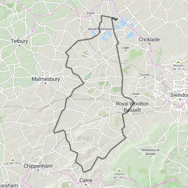
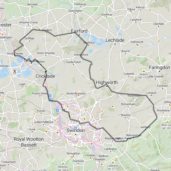
A scenic road cycling route through Wootton Bassett
The Wootton Bassett Circuit is a 74 km long road cycling route that takes you through the picturesque countryside near Wootton Bassett. With an ascent of 324 m, this route is suitable for well-trained amateur cyclists. Highlights of this route include Bury Hill, Royal Wootton Bassett, Christian Malford, Wood Hill, Oaksey, and South Cerney.
Cirencester Loop
![Map miniature of "Cirencester Loop" cycling inspiration in Gloucestershire, Wiltshire and Bristol/Bath area, United Kingdom. Generated by Tarmacs.app cycling route planner](https://images.tarmacs.app/cycling-routes/routemaps/600/united-kingdom/gloucestershire-wiltshire-and-bristol-bath-area/south-cerney/road/95659.webp)
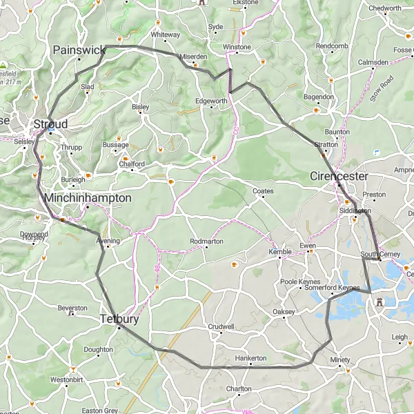
Explore the beautiful countryside of Gloucestershire on this challenging road cycling route.
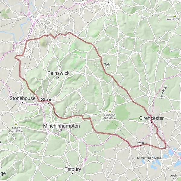
The Cirencester Loop is a picturesque route that takes you through charming villages and rolling hills in Gloucestershire. With a total distance of 73 km and an ascent of 538 meters, it provides a rewarding challenge for experienced cyclists. The route starts near South Cerney and passes through Hankerton, Tetbury, Stroud, Lypiatt Hill, Duntisbourne Abbots, and finally Cirencester. Along the way, you'll enjoy stunning views of the Cotswold countryside and have opportunities to stop and explore the historic towns and attractions.
The Gravel Adventure
![Map miniature of "The Gravel Adventure" cycling inspiration in Gloucestershire, Wiltshire and Bristol/Bath area, United Kingdom. Generated by Tarmacs.app cycling route planner](https://images.tarmacs.app/cycling-routes/routemaps/600/united-kingdom/gloucestershire-wiltshire-and-bristol-bath-area/south-cerney/gravel/95571.webp)
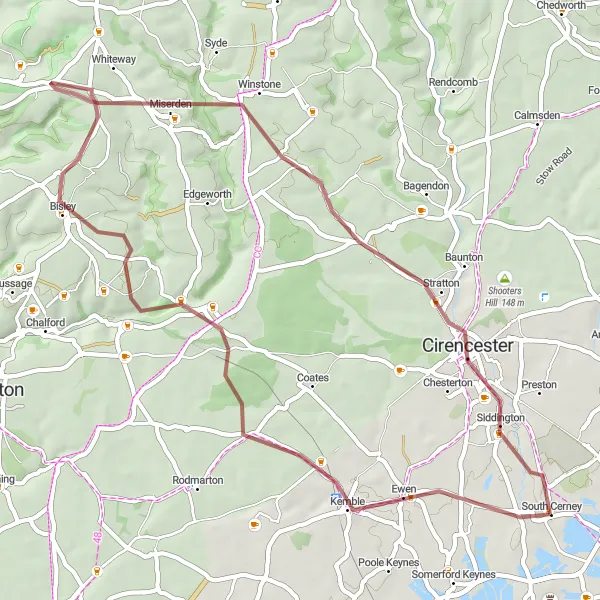
Gravel cycling adventure through scenic routes
The Gravel Adventure is a 50 km long gravel cycling route that takes you through scenic routes near South Cerney. With an ascent of 452 m, this route offers a challenging yet rewarding experience for gravel enthusiasts. Highlights of this route include Sapperton Hill, Bisley, and Duntisbourne Rouse.
The Cotswold Adventure
![Map miniature of "The Cotswold Adventure" cycling inspiration in Gloucestershire, Wiltshire and Bristol/Bath area, United Kingdom. Generated by Tarmacs.app cycling route planner](https://images.tarmacs.app/cycling-routes/routemaps/600/united-kingdom/gloucestershire-wiltshire-and-bristol-bath-area/south-cerney/road/95642.webp)
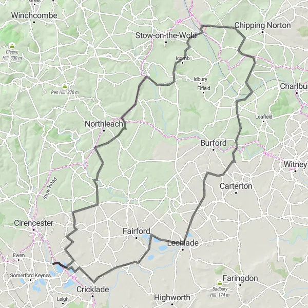
A challenging road cycling route in the Cotswolds
The Cotswold Adventure is a 113 km long road cycling route that takes you through the stunning Cotswold region. With an ascent of 924 m, this route is suitable for experienced cyclists looking for a challenge. Highlights of this route include Ampney Crucis, Ablington, Bourton-on-the-Water, Adlestrop, Shipton-under-Wychwood, Lechlade, and Cricklades North Meadow National Nature Reserve.
The Minety Loop
![Map miniature of "The Minety Loop" cycling inspiration in Gloucestershire, Wiltshire and Bristol/Bath area, United Kingdom. Generated by Tarmacs.app cycling route planner](https://images.tarmacs.app/cycling-routes/routemaps/600/united-kingdom/gloucestershire-wiltshire-and-bristol-bath-area/south-cerney/road/95610.webp)
A picturesque road cycling route through Minety
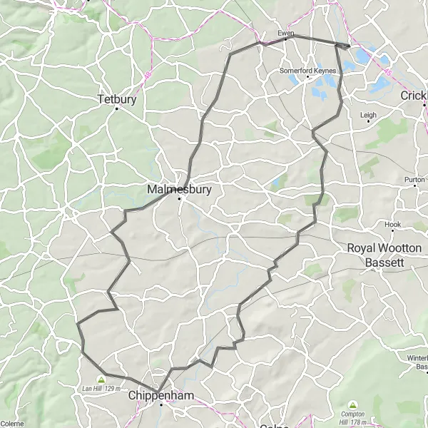
The Minety Loop is a road cycling route that takes you through the scenic countryside of Minety in Gloucestershire. With a total distance of 78 km and an ascent of 301 m, this route is suitable for well-trained amateur cyclists. The route offers beautiful views of the countryside and passes through charming villages such as Chippenham and Malmesbury.
![Map miniature of "Gloucestershire Gravel Adventure" cycling inspiration in Gloucestershire, Wiltshire and Bristol/Bath area, United Kingdom. Generated by Tarmacs.app cycling route planner](https://images.tarmacs.app/cycling-routes/routemaps/600/united-kingdom/gloucestershire-wiltshire-and-bristol-bath-area/south-cerney/gravel/95589.webp)
Embark on an epic gravel adventure through the stunning countryside of Gloucestershire.
The Gloucestershire Gravel Adventure is an 80 km route that combines challenging gravel sections with scenic views of the countryside. Starting near South Cerney, you'll pass through Chalford, Stroud, Quedgeley, Robinswood Hill, Brockworth, Barrow Wake, and finally South Cerney. With a total ascent of 712 meters, this route is suitable for experienced gravel riders looking for an adrenaline-pumping adventure. Along the way, you'll encounter charming villages, picturesque valleys, and beautiful nature reserves.
![Map miniature of "Somerford Keynes Gravel Loop" cycling inspiration in Gloucestershire, Wiltshire and Bristol/Bath area, United Kingdom. Generated by Tarmacs.app cycling route planner](https://images.tarmacs.app/cycling-routes/routemaps/600/united-kingdom/gloucestershire-wiltshire-and-bristol-bath-area/south-cerney/gravel/95567.webp)
Experience the beauty of the Somerford Keynes area on this scenic gravel cycling route.
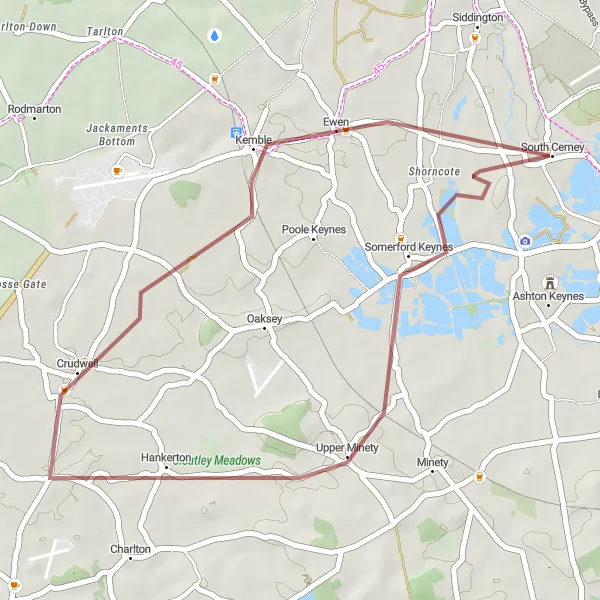
The Somerford Keynes Gravel Loop is a 31 km route that takes you through the stunning countryside near South Cerney. With a total ascent of 94 meters, this route is perfect for beginners and casual gravel riders. Starting near South Cerney, you'll pass through Somerford Keynes and Crudwell before returning to South Cerney. Along the way, you'll enjoy the tranquility of the countryside, peaceful reservoirs, and charming villages.
Cycling routes nearby:
![Image of Cirencester](https://images.tarmacs.app/cycling-routes/covers/united-kingdom/gloucestershire-wiltshire-and-bristol-bath-area/cirencester-3.webp)
![Image of Cricklade](https://images.tarmacs.app/cycling-routes/covers/united-kingdom/gloucestershire-wiltshire-and-bristol-bath-area/cricklade-5.webp)
![Image of Stratton](https://images.tarmacs.app/cycling-routes/covers/united-kingdom/gloucestershire-wiltshire-and-bristol-bath-area/stratton-5.webp)
![Image of Coates](https://images.tarmacs.app/cycling-routes/covers/united-kingdom/gloucestershire-wiltshire-and-bristol-bath-area/coates-5.webp)
![Image of Purton](https://images.tarmacs.app/cycling-routes/covers/united-kingdom/gloucestershire-wiltshire-and-bristol-bath-area/purton-3.webp)
![Image of Fairford](https://images.tarmacs.app/cycling-routes/covers/united-kingdom/gloucestershire-wiltshire-and-bristol-bath-area/fairford-4.webp)
![Image of Broad Blunsdon](https://images.tarmacs.app/cycling-routes/covers/united-kingdom/gloucestershire-wiltshire-and-bristol-bath-area/broad-blunsdon-5.webp)
![Image of Royal Wootton Bassett](https://images.tarmacs.app/cycling-routes/covers/united-kingdom/gloucestershire-wiltshire-and-bristol-bath-area/royal-wootton-bassett-5.webp)
![Image of Malmesbury](https://images.tarmacs.app/cycling-routes/covers/united-kingdom/gloucestershire-wiltshire-and-bristol-bath-area/malmesbury-5.webp)
Nearby regions:
![Image of Herefordshire, Worcestershire and Warwickshire](https://images.tarmacs.app/cycling-routes/covers/united-kingdom/herefordshire-worcestershire-and-warwickshire/wellesbourne-5.webp)
![Image of Shropshire and Staffordshire](https://images.tarmacs.app/cycling-routes/covers/united-kingdom/shropshire-and-staffordshire/eccleshall-2.webp)
![Image of West Midlands](https://images.tarmacs.app/cycling-routes/covers/united-kingdom/west-midlands/dorridge-5.webp)
![Image of Berkshire, Buckinghamshire and Oxfordshire](https://images.tarmacs.app/cycling-routes/covers/united-kingdom/berkshire-buckinghamshire-and-oxfordshire/charvil-5.webp)
![Image of Hampshire and Isle of Wight](https://images.tarmacs.app/cycling-routes/covers/united-kingdom/hampshire-and-isle-of-wight/shanklin-4.webp)
![Image of Dorset and Somerset](https://images.tarmacs.app/cycling-routes/covers/united-kingdom/dorset-and-somerset/merriott-4.webp)
![Image of West Wales and The Valleys](https://images.tarmacs.app/cycling-routes/covers/united-kingdom/west-wales-and-the-valleys/llangeler-3.webp)