![Cover image](https://images.tarmacs.app/cycling-routes/covers/united-kingdom/herefordshire-worcestershire-and-warwickshire/barnt-green-5.webp)
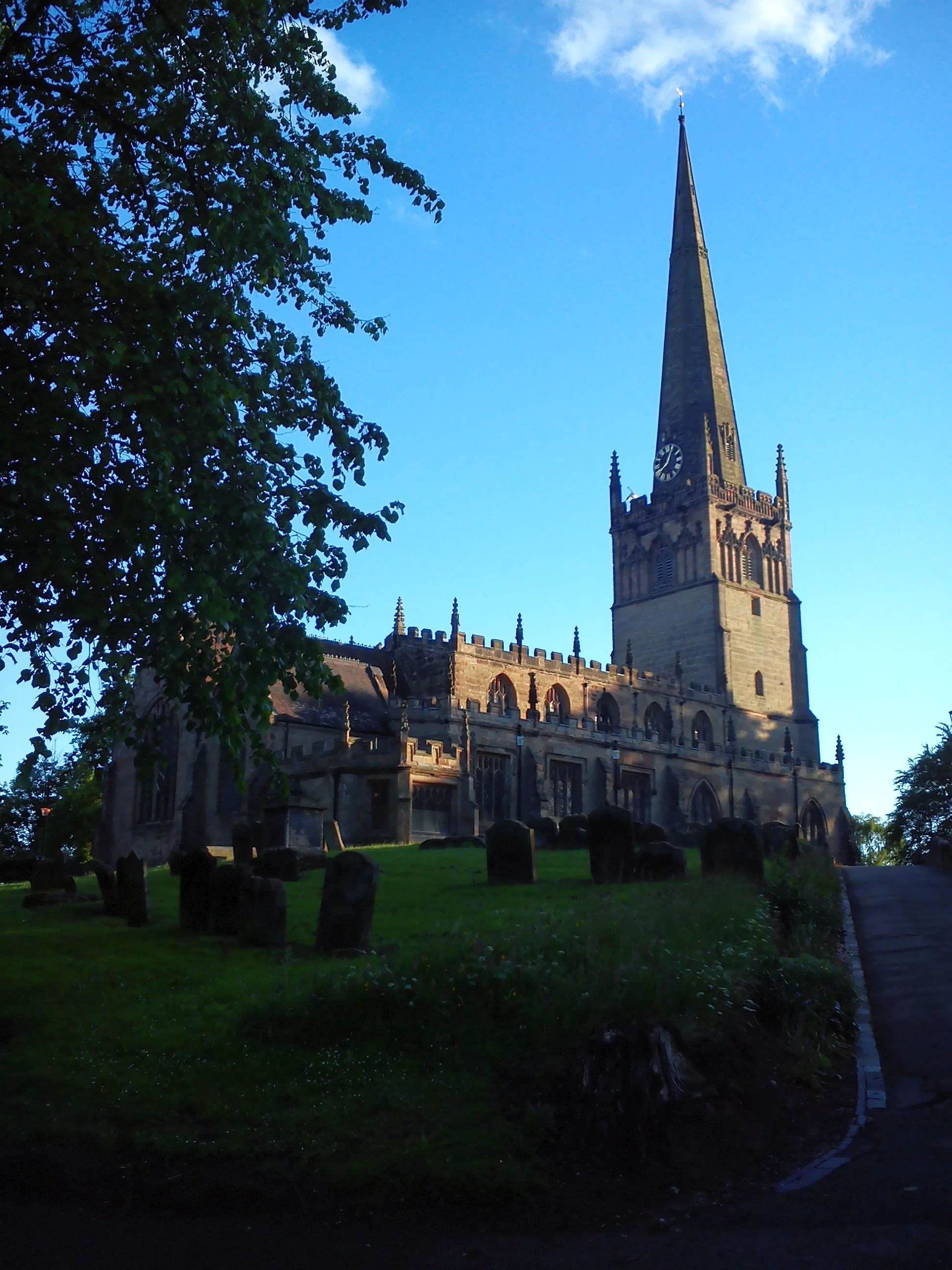
Cycling-friendly locality in Herefordshire, Worcestershire and Warwickshire, with access to famous climb at Waseley Hills.
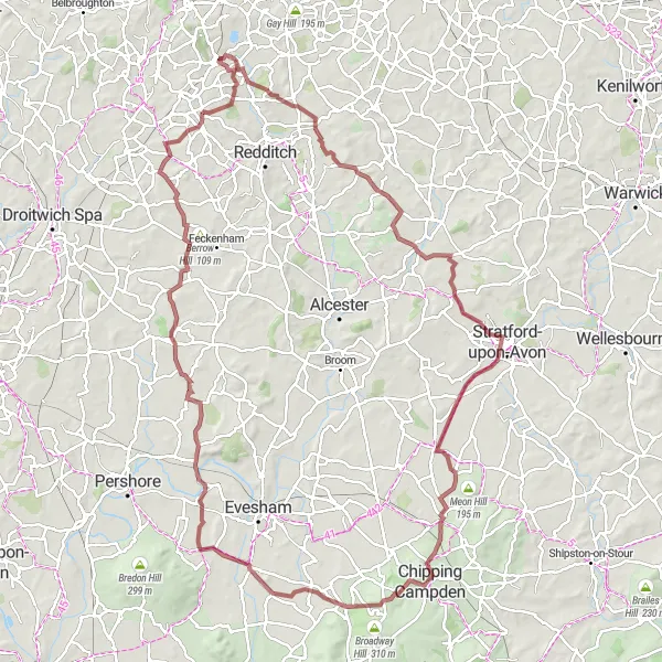
Cycling routes from Barnt Green
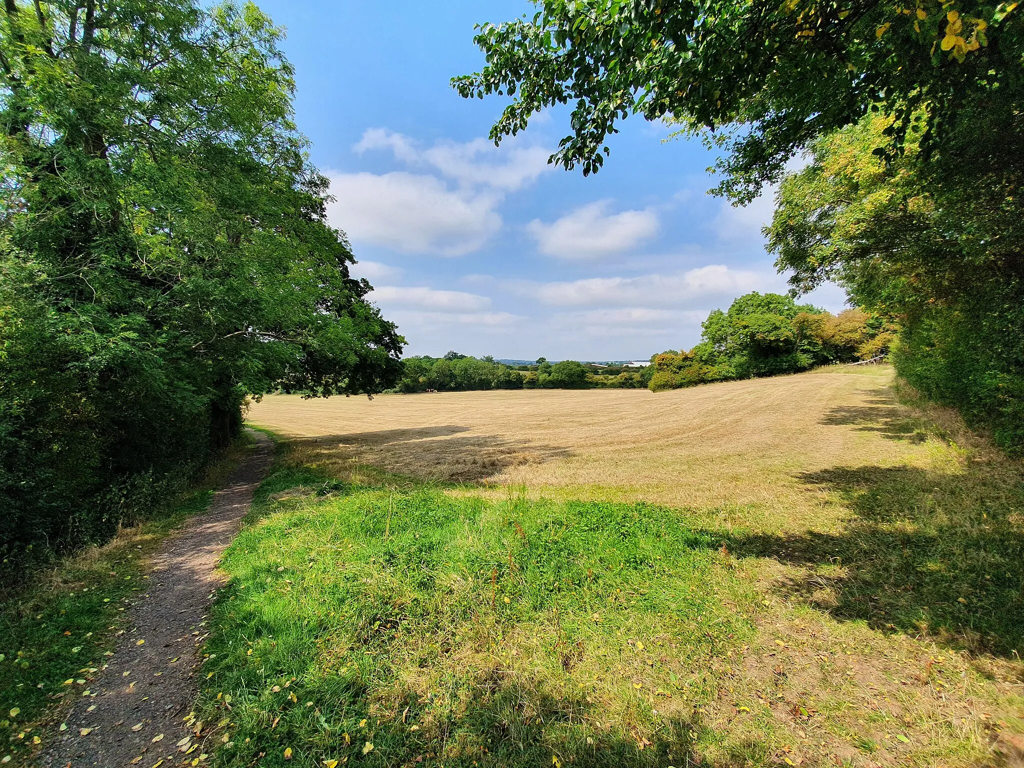
Barnt Green is a locality located in Herefordshire, Worcestershire and Warwickshire, United Kingdom, known for its cycling-friendly environment. Road and gravel cyclists will enjoy the region's scenic landscapes and well-maintained cycle paths. Barnt Green is close to the famous climb, Waseley Hills, which offers a thrilling challenge for seasoned cyclists. Additionally, the town itself boasts several cyclist-friendly amenities, making it an excellent base for exploring the local routes.
The Wyre Forest Gravel Challenge
![Map miniature of "The Wyre Forest Gravel Challenge" cycling inspiration in Herefordshire, Worcestershire and Warwickshire, United Kingdom. Generated by Tarmacs.app cycling route planner](https://images.tarmacs.app/cycling-routes/routemaps/600/united-kingdom/herefordshire-worcestershire-and-warwickshire/barnt-green/gravel/288980.webp)
Bike through the beautiful Wyre Forest and discover charming towns and villages along the way.
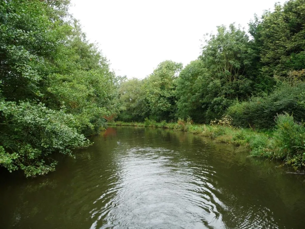
The Wyre Forest Gravel Challenge takes you on a scenic journey through the stunning Wyre Forest. You'll encounter picturesque countryside, charming towns, and inviting villages as you explore this beautiful area. With a moderate difficulty level, this route is perfect for well-trained amateurs looking for a challenge. The epicness of this route is rated 3 out of 5, offering a satisfying cycling experience with some exciting highlights along the way.
![Map miniature of "Belbroughton Gravel Adventure" cycling inspiration in Herefordshire, Worcestershire and Warwickshire, United Kingdom. Generated by Tarmacs.app cycling route planner](https://images.tarmacs.app/cycling-routes/routemaps/600/united-kingdom/herefordshire-worcestershire-and-warwickshire/barnt-green/gravel/288977.webp)
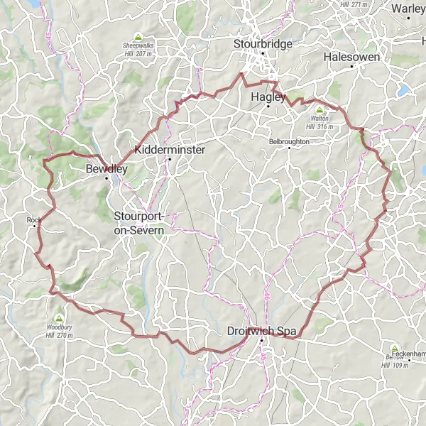
Embark on a gravel adventure through Belbroughton's scenic countryside
If you crave an exciting off-road experience, this 79-kilometer gravel route starting near Barnt Green is the perfect choice. With an ascent of 641 meters, it provides a demanding but rewarding journey. Take in the breathtaking views as you pedal through charming villages and tackle challenging inclines.
Barnt Green to Fairfield Loop
![Map miniature of "Barnt Green to Fairfield Loop" cycling inspiration in Herefordshire, Worcestershire and Warwickshire, United Kingdom. Generated by Tarmacs.app cycling route planner](https://images.tarmacs.app/cycling-routes/routemaps/600/united-kingdom/herefordshire-worcestershire-and-warwickshire/barnt-green/road/289126.webp)
Discover the charm of Fairfield on this scenic cycling route
Embark on a stunning journey from Barnt Green to Fairfield, a small village known for its beauty and tranquility. This route offers breathtaking views and a mix of challenging terrains, making it suitable for experienced riders. Covering a distance of 93 kilometers with an ascent of 880 meters, this loop is perfect for a day of adventure.
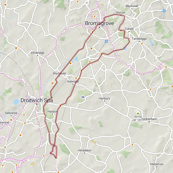
Burcot Excursion
![Map miniature of "Burcot Excursion" cycling inspiration in Herefordshire, Worcestershire and Warwickshire, United Kingdom. Generated by Tarmacs.app cycling route planner](https://images.tarmacs.app/cycling-routes/routemaps/600/united-kingdom/herefordshire-worcestershire-and-warwickshire/barnt-green/road/288974.webp)
Embark on a cycling journey through the scenic beauty of Burcot
This 99-kilometer road route starting near Barnt Green takes you through the captivating landscapes of Burcot. With an impressive ascent of 1121 meters, this route poses a challenge for experienced riders seeking an epic adventure. Experience the tranquility of the countryside and admire the breathtaking views along the way.
![Map miniature of "Barnt Green to Rous Lench Excursion" cycling inspiration in Herefordshire, Worcestershire and Warwickshire, United Kingdom. Generated by Tarmacs.app cycling route planner](https://images.tarmacs.app/cycling-routes/routemaps/600/united-kingdom/herefordshire-worcestershire-and-warwickshire/barnt-green/road/289049.webp)
Take a detour through Rous Lench to experience the beauty of the Worcestershire Countryside
Ideal for nature enthusiasts and outdoor lovers, this route leads from Barnt Green to Rous Lench, a charming village set amidst picturesque hills and meadows. With a distance of 69 kilometers and an ascent of 462 meters, this loop provides a pleasant cycling experience suitable for all skill levels.
![Map miniature of "The Worcestershire Hills Gravel Loop" cycling inspiration in Herefordshire, Worcestershire and Warwickshire, United Kingdom. Generated by Tarmacs.app cycling route planner](https://images.tarmacs.app/cycling-routes/routemaps/600/united-kingdom/herefordshire-worcestershire-and-warwickshire/barnt-green/gravel/288969.webp)
Embark on a challenging gravel adventure through Worcestershire's stunning hills and valleys.
The Worcestershire Hills Gravel Loop offers an exciting and challenging ride through the picturesque hills and valleys of Worcestershire. With an ascent of 736 meters and a distance of 58 kilometers, this route is tailored for well-trained amateurs seeking a thrilling adventure. With a difficulty rating of 4 out of 5 and an epicness rating of 3 out of 5, this loop guarantees a memorable cycling experience. Highlights along the way include The Toposcope, Romsley, and Hagley, each offering unique attractions and stunning views.
![Map miniature of "The Worcestershire Gravel Adventure" cycling inspiration in Herefordshire, Worcestershire and Warwickshire, United Kingdom. Generated by Tarmacs.app cycling route planner](https://images.tarmacs.app/cycling-routes/routemaps/600/united-kingdom/herefordshire-worcestershire-and-warwickshire/barnt-green/gravel/288971.webp)
Embark on an epic gravel adventure through the beautiful Worcestershire countryside.
The Worcestershire Gravel Adventure is a truly epic cycling route that takes riders on a challenging journey through the stunning Worcestershire countryside. With an ascent of 1,063 meters and a distance of 92 kilometers, this route offers a thrilling experience that will test the most experienced cyclists. Suitable for well-trained amateurs seeking a challenging ride, the difficulty level is rated 5 out of 5. Highlights along the way include Finstall, Salwarpe, and Holt Heath, each offering their own unique attractions and stunning natural beauty.
![Map miniature of "Bromsgrove Gravel Trail" cycling inspiration in Herefordshire, Worcestershire and Warwickshire, United Kingdom. Generated by Tarmacs.app cycling route planner](https://images.tarmacs.app/cycling-routes/routemaps/600/united-kingdom/herefordshire-worcestershire-and-warwickshire/barnt-green/gravel/288970.webp)
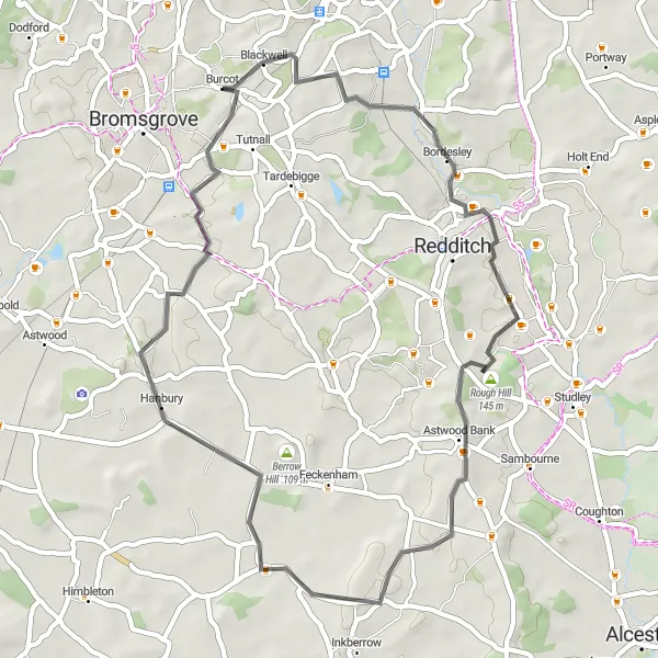
Escape the hustle and bustle on this serene gravel trail in Bromsgrove
Experience the rugged beauty of Bromsgrove on this 39-kilometer gravel trail. With an ascent of 252 meters, this route offers a mix of challenging terrains and picturesque landscapes. Suitable for gravel bike enthusiasts, this trail provides a refreshing escape from the urban hustle and bustle.
![Map miniature of "The Bromsgrove Country Roads Ride" cycling inspiration in Herefordshire, Worcestershire and Warwickshire, United Kingdom. Generated by Tarmacs.app cycling route planner](https://images.tarmacs.app/cycling-routes/routemaps/600/united-kingdom/herefordshire-worcestershire-and-warwickshire/barnt-green/road/288978.webp)
Uncover the picturesque countryside of Bromsgrove in this exhilarating road cycling route.
The Bromsgrove Country Roads Ride takes you on a scenic and enjoyable journey through the picturesque countryside of Bromsgrove. This road cycling route is perfect for cyclists of all levels, with a difficulty rating of 2 out of 5 making it ideal for leisure riders or amateurs looking for a relaxed ride. With highlights including Blackwell, Rough Hill, and Hanbury, this route offers plenty of intriguing stops along the way. Explore the charming village of Blackwell, tackle the beautiful climb at Rough Hill, and experience the tranquility of Hanbury's rural landscapes.
![Map miniature of "The Warwickshire Hills Road Adventure" cycling inspiration in Herefordshire, Worcestershire and Warwickshire, United Kingdom. Generated by Tarmacs.app cycling route planner](https://images.tarmacs.app/cycling-routes/routemaps/600/united-kingdom/herefordshire-worcestershire-and-warwickshire/barnt-green/road/289072.webp)
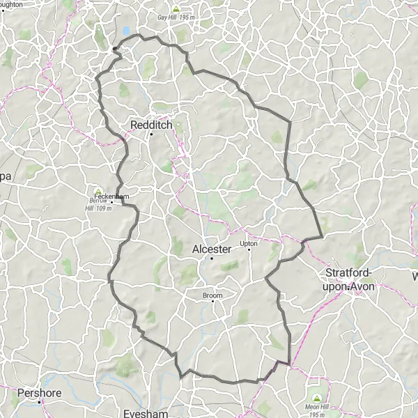
Embark on an exhilarating road cycling adventure through the hills of Warwickshire.
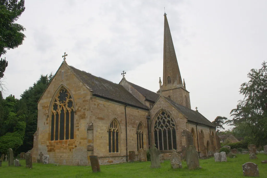
The Warwickshire Hills Road Adventure is a thrilling cycling route that takes riders on a challenging journey through the scenic hills of Warwickshire. With an ascent of 703 meters and a distance of 90 kilometers, this route offers a rich blend of beautiful landscapes and exhilarating climbs. Aimed at well-trained amateurs, the difficulty level is ranked 4 out of 5, ensuring a rewarding and physically demanding experience. Highlights along the way include Danzey Green, Botley Hill, and Callow Hill, each offering breathtaking panoramas and unique attractions.
Cycling routes nearby:
![Image of Bromsgrove](https://images.tarmacs.app/cycling-routes/covers/united-kingdom/herefordshire-worcestershire-and-warwickshire/bromsgrove-5.webp)
![Image of Redditch](https://images.tarmacs.app/cycling-routes/covers/united-kingdom/herefordshire-worcestershire-and-warwickshire/redditch-5.webp)
![Image of Stoke Prior](https://images.tarmacs.app/cycling-routes/covers/united-kingdom/herefordshire-worcestershire-and-warwickshire/stoke-prior-5.webp)
![Image of Bartley Green](https://images.tarmacs.app/cycling-routes/covers/united-kingdom/west-midlands/bartley-green-5.webp)
![Image of Halesowen](https://images.tarmacs.app/cycling-routes/covers/united-kingdom/west-midlands/halesowen-2.webp)
![Image of Hagley](https://images.tarmacs.app/cycling-routes/covers/united-kingdom/herefordshire-worcestershire-and-warwickshire/hagley-4.webp)
![Image of Dickens Heath](https://images.tarmacs.app/cycling-routes/covers/united-kingdom/west-midlands/dickens-heath-5.webp)
![Image of Astwood Bank](https://images.tarmacs.app/cycling-routes/covers/united-kingdom/herefordshire-worcestershire-and-warwickshire/astwood-bank-5.webp)
Nearby regions:
![Image of Derbyshire and Nottinghamshire](https://images.tarmacs.app/cycling-routes/covers/united-kingdom/derbyshire-and-nottinghamshire/hathersage-1.webp)
![Image of Leicestershire, Rutland and Northamptonshire](https://images.tarmacs.app/cycling-routes/covers/united-kingdom/leicestershire-rutland-and-northamptonshire/deanshanger-5.webp)
![Image of Shropshire and Staffordshire](https://images.tarmacs.app/cycling-routes/covers/united-kingdom/shropshire-and-staffordshire/pant-4.webp)
![Image of West Midlands](https://images.tarmacs.app/cycling-routes/covers/united-kingdom/west-midlands/brierley-hill-5.webp)
![Image of Bedfordshire and Hertfordshire](https://images.tarmacs.app/cycling-routes/covers/united-kingdom/bedfordshire-and-hertfordshire/meppershall-4.webp)
![Image of Berkshire, Buckinghamshire and Oxfordshire](https://images.tarmacs.app/cycling-routes/covers/united-kingdom/berkshire-buckinghamshire-and-oxfordshire/stone-5.webp)
![Image of Gloucestershire, Wiltshire and Bristol/Bath area](https://images.tarmacs.app/cycling-routes/covers/united-kingdom/gloucestershire-wiltshire-and-bristol-bath-area/mickleton-3.webp)
![Image of West Wales and The Valleys](https://images.tarmacs.app/cycling-routes/covers/united-kingdom/west-wales-and-the-valleys/tredegar-5.webp)
![Image of East Wales](https://images.tarmacs.app/cycling-routes/covers/united-kingdom/east-wales/crickhowell-5.webp)