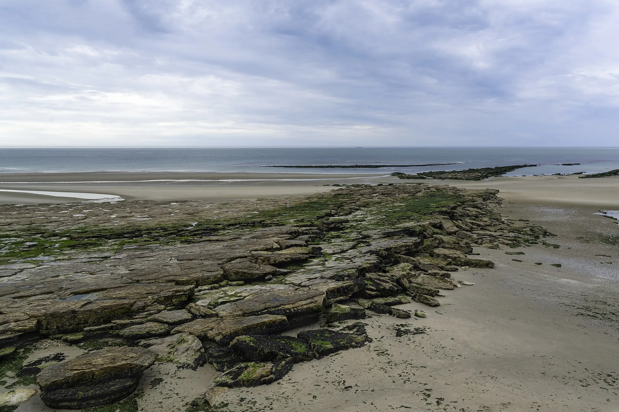
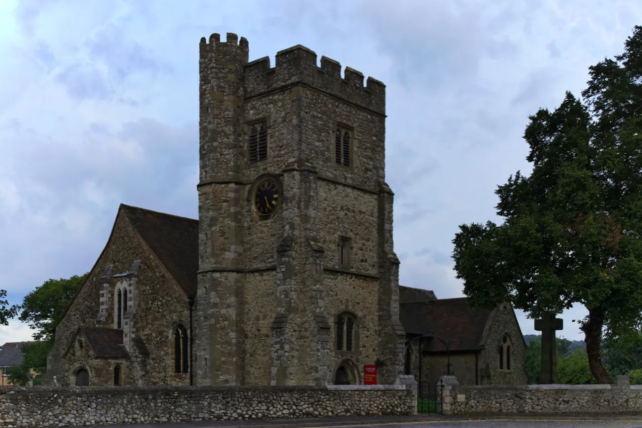
Halling: Enjoy a calm cycling experience in the peaceful countryside of Kent.
Cycling routes from Halling
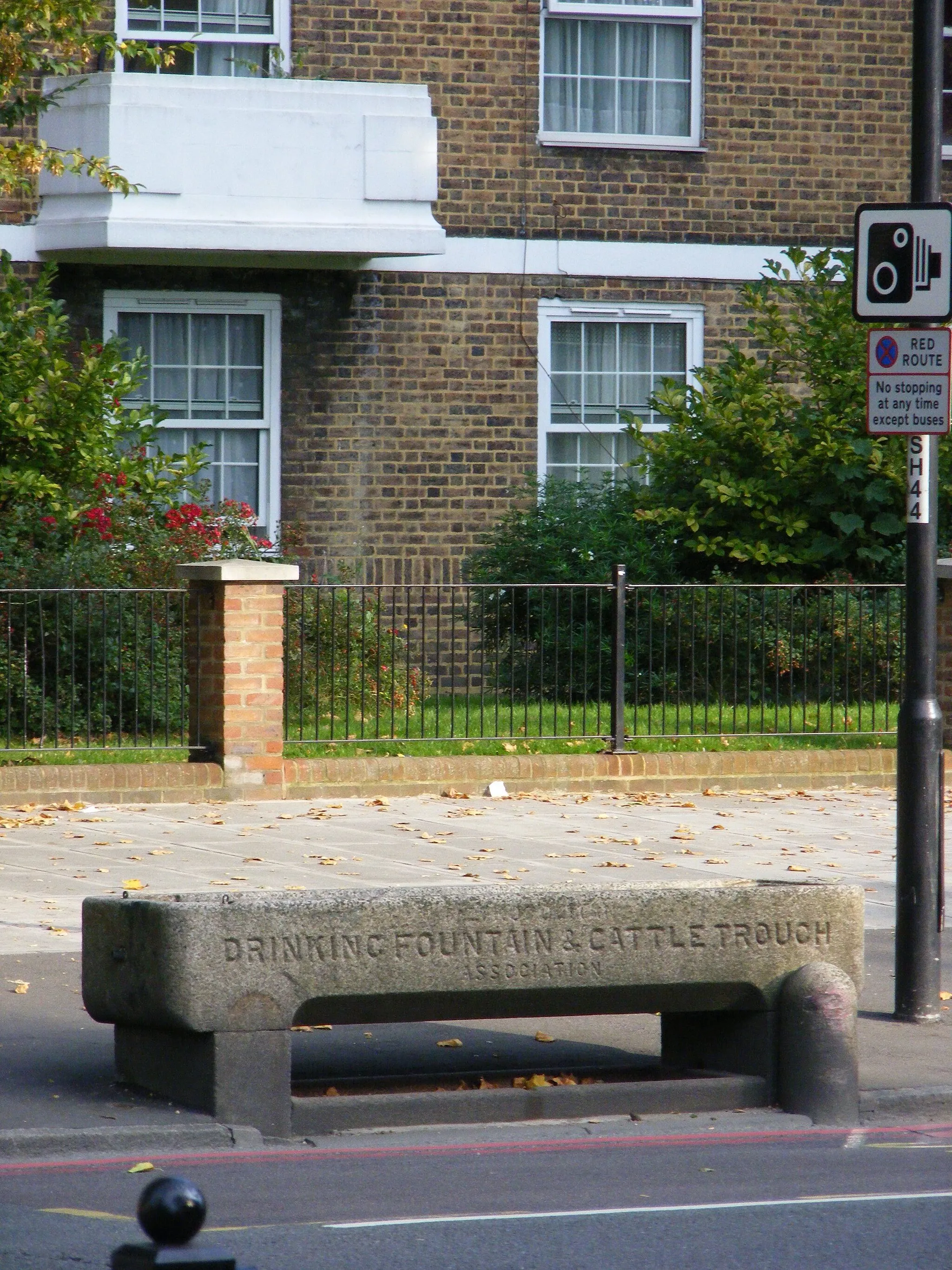
Halling, located in Kent, United Kingdom, is a small village that offers limited cycling opportunities for road and gravel cyclists. The surrounding area consists mainly of flat terrain, which is suitable for leisurely rides and beginners. Halling itself does not have any notable cycling attractions or well-known climbs. However, it provides a peaceful environment for cycling enthusiasts to explore the tranquil countryside and enjoy a quiet ride. While not the most thrilling destination, Halling can be a pleasant choice for cyclists looking for a relaxed cycling experience.
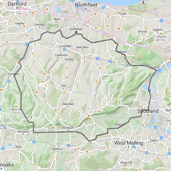
Embark on an exciting journey from Ryarsh to Southfleet on this road cycling route.
Get ready for an adrenaline-pumping adventure as you cycle from Ryarsh to Southfleet. With a total ascent of 543 meters and covering a distance of 56 kilometers, this route offers a mix of challenging climbs and fast descents. Experience the delightful landscapes and charming villages along the way.
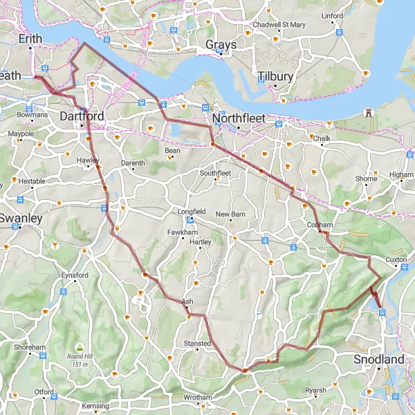
Embark on an off-road adventure from Snodland to Vigo Village on this gravel cycling route.
Gear up for an exhilarating off-road adventure on this gravel cycling route from Snodland to Vigo Village. With a total ascent of 939 meters and covering a distance of 86 kilometers, this challenging route will test your skills and endurance. Immerse yourself in nature's beauty and enjoy the peaceful surroundings along the way.
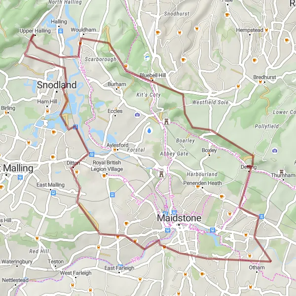
Halling Ring Gravel Route
Explore the scenic countryside near Halling on this distinctive gravel route.
This gravel route near Halling takes you through picturesque villages, rolling hills, and beautiful countryside. With a total distance of 65 km and an ascent of 664 m, this loop is perfect for intermediate level cyclists looking to challenge themselves. The route offers a diverse range of terrains and stunning views, making it a memorable cycling experience.
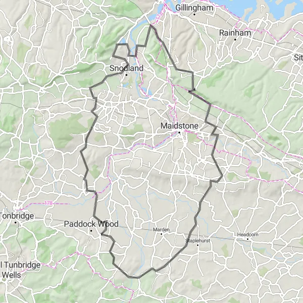
Embark on a rural adventure through the tranquil landscapes of Kent
Experience the essence of rural Kent on this moderate gravel ride. Passing through the scenic villages of Wouldham, Detling, and Boughton Monchelsea, this route offers a perfect mix of natural beauty and historical landmarks. With a difficulty rating of 2, this ride is suitable for moderately experienced cyclists. Rated with an epicness score of 2, this route showcases the peaceful charm of the Kent countryside.
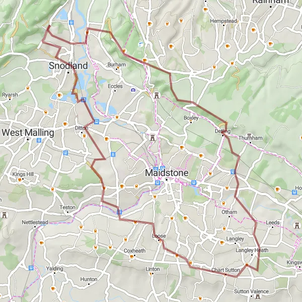
Embark on an off-road adventure from Boxley to New Hythe on this gravel cycling route.
Experience the thrill of gravel cycling as you embark on this scenic route from Boxley to New Hythe. With a total ascent of 479 meters and covering a distance of 43 kilometers, this off-road journey takes you through picturesque woodlands and peaceful countryside. Explore the hidden gems along the way and enjoy the tranquility of nature.

Take on a challenging gravel ride with exhilarating climbs and stunning vistas
This demanding gravel route offers a rewarding and exhilarating experience through the Kentish countryside. With challenging climbs and breathtaking views, this scenic ride takes you to Vigo Village, Dunton Green, Round Hill, Luddesdown, and Mill Hill. Suitable for experienced riders, this route has a difficulty rating of 4. Rated with an epicness score of 4, it promises an unforgettable cycling adventure.
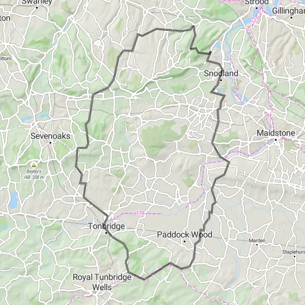
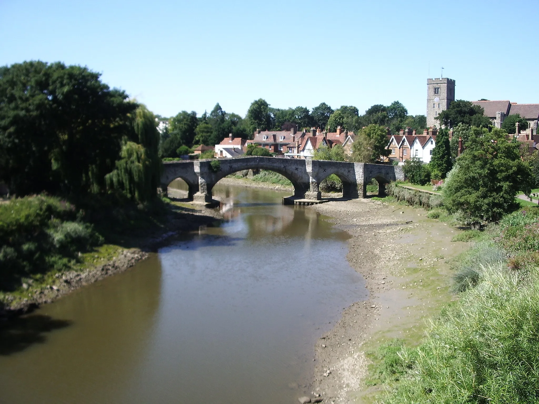
Discover historic towns and beautiful landscapes on this road cycling route
Experience the historical significance and natural beauty of Kent on this scenic road cycling route. From Aylesford to Maidstone, this ride takes you through charming towns and picturesque landscapes. With a difficulty rating of 2, this route is suitable for riders with moderate fitness levels. Rated with an epicness score of 2, it offers a pleasant and enjoyable cycling experience.

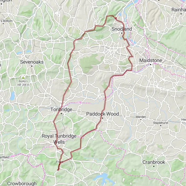
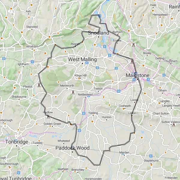
Immerse yourself in the rich history and natural beauty of Kent on this road cycling adventure
With a distance of 120 km, this road cycling route allows you to discover the cultural and natural treasures of Kent. From the historic town of Snodland to the scenic landscapes of Hadlow, Royal Tunbridge Wells, Forest Row, and Dormansland, this route offers a diverse range of highlights. With a difficulty rating of 4, this ride is suitable for well-trained amateurs. Rated with an epicness score of 5, it takes you through iconic locations and famous cycling spots.
Discover the scenic beauty from Leybourne to Luddesdown on this road cycling route
Explore the stunning landscapes of Kent as you cycle from Leybourne to Luddesdown. This route offers a challenging ride with a total ascent of 1103 meters and covers a distance of 81 kilometers. Enjoy the picturesque villages along the way and take in the breathtaking views of the countryside.
Embark on a thrilling road cycling journey from Wouldham to Snodland.
Experience the thrill of road cycling on this scenic route from Wouldham to Snodland. With a total ascent of 845 meters and covering a distance of 84 kilometers, this challenging ride offers breathtaking views and varied terrain. Discover the charm of the villages along the way and soak in the captivating landscapes of Kent.
Cycling routes nearby:


Nearby regions: