Scenic routes and challenging climbs, including Great Hill.
Cycling routes from Brinscall
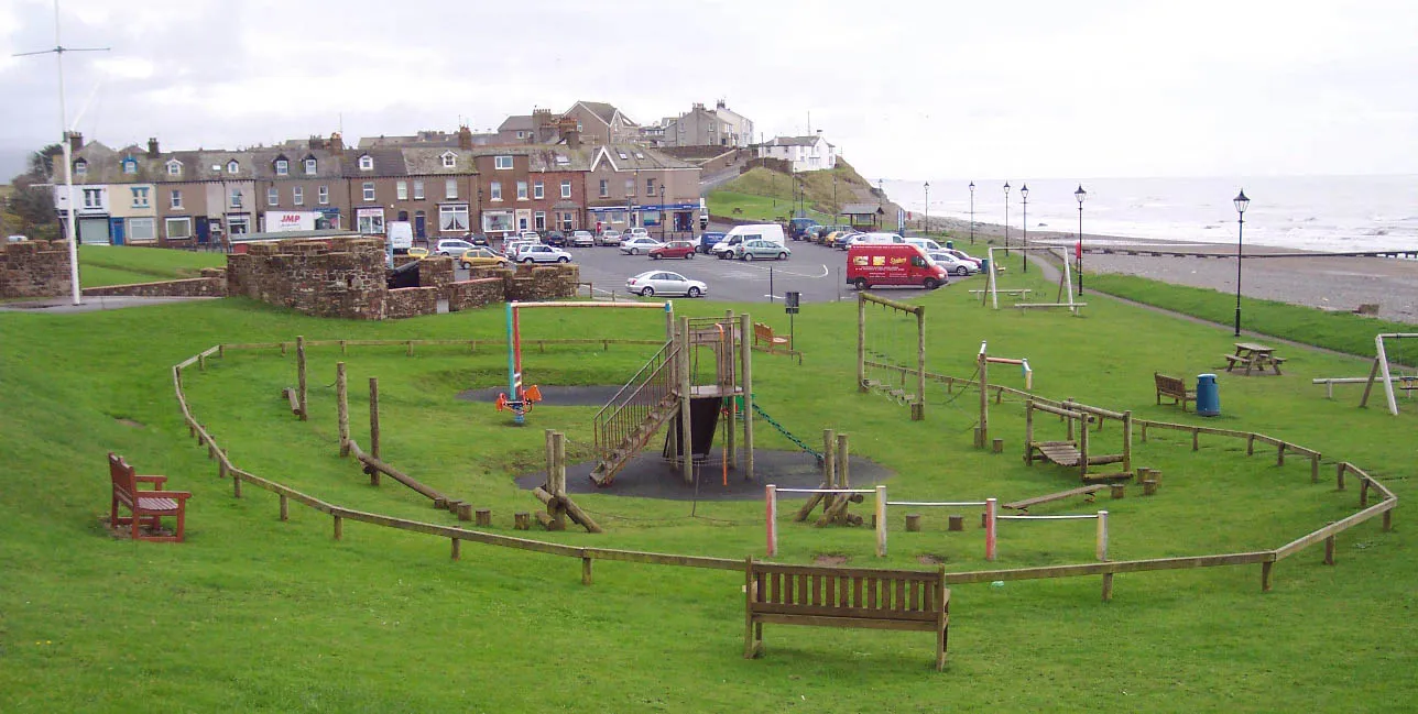
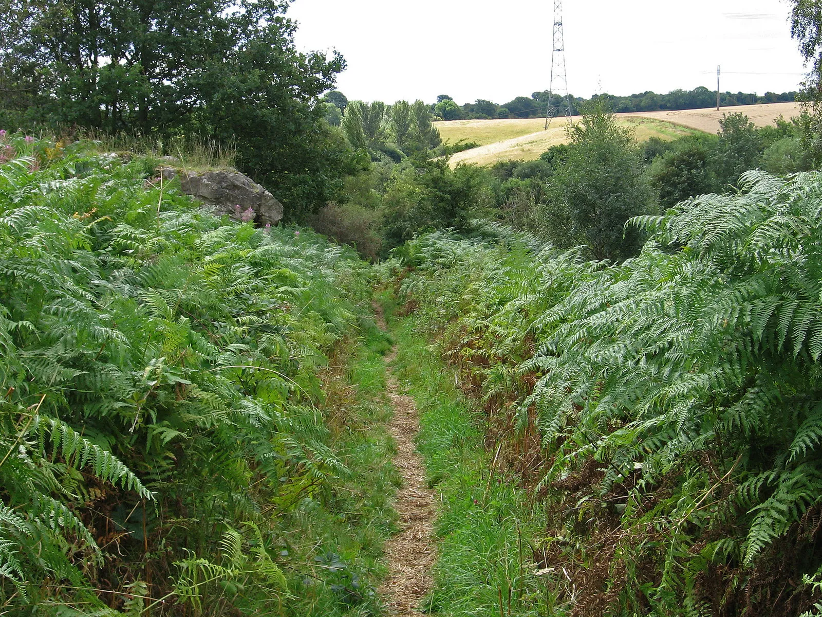
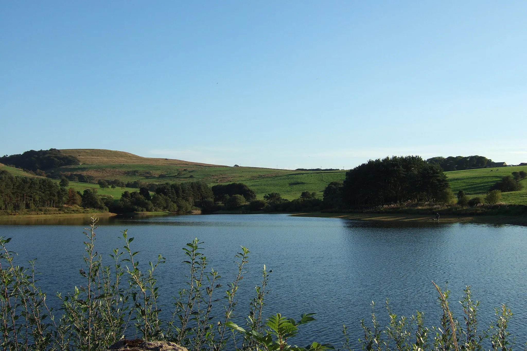
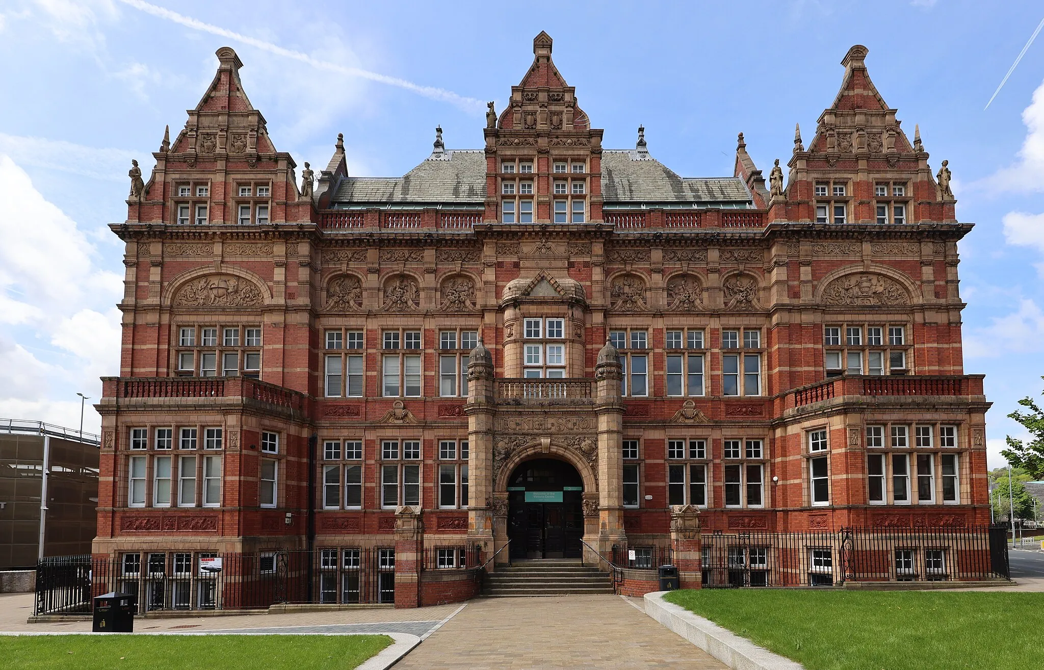
Brinscall is a town located in Lancashire, United Kingdom. For road and gravel cyclists, Brinscall offers a mixture of scenic routes, quiet country lanes, and challenging climbs. The town is surrounded by beautiful countryside, providing opportunities for peaceful rides along tree-lined lanes. Additionally, there are challenging ascents such as Great Hill, which offer panoramic views at the top. Brinscall has a well-maintained road network and designated cycling paths, creating a cyclist-friendly environment. With its combination of countryside beauty and challenging climbs, Brinscall ranks as a 4 in terms of cycling suitability.

Embark on an epic adventure with challenging climbs and breathtaking scenery.
Prepare to conquer the roads of Lancashire as you tackle the challenging ascent in Clayton-le-Woods, have a well-deserved break in Penwortham, and marvel at the historic Lancaster Castle. This route promises a blend of adrenaline-pumping challenges and awe-inspiring sights.
Scenic Hills Road Cycling Route
Experience the beauty of Lancashire's countryside through challenging ascents and exhilarating descents.
This route presents an exciting challenge for cyclists seeking to test their skills. With highlights such as Bog Heights, Darwen, Whitefield, Salford, Top-o-Cow, Old Man's Hill, and Brinscall, you'll be rewarded with stunning panoramic views and heart-pumping descents.

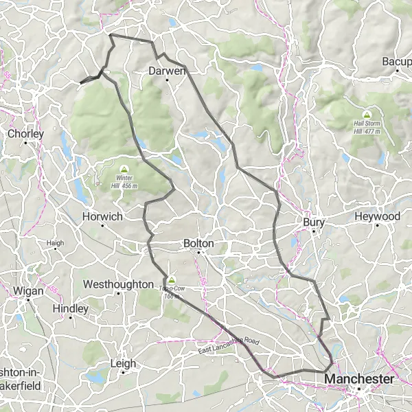
Discover the natural beauty of Bolton and its surrounding areas.
Immerse yourself in the wonders of nature as you cycle through Withnell, Lower Darwen, Hawkshaw, and Bury. This route offers a perfect combination of tranquil landscapes, charming villages, and stunning viewpoints, making it a fantastic choice for nature enthusiasts.
Wyresdale Explorer
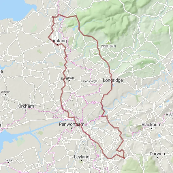
Discover the beauty of Wyresdale on this gravel cycling route
The Wyresdale Explorer is a gravel cycling route near Brinscall that allows you to immerse yourself in the stunning beauty of Wyresdale. With a challenging ascent of 730 meters and a distance of 93 kilometers, this route is suitable for experienced cyclists seeking an adventurous ride. Highlights along the route include Garstang, a charming market town with a rich history and fascinating architecture, and Longridge, situated on the outskirts of the Forest of Bowland, offering breathtaking views and peaceful surroundings. Wheelton, located at the beginning of the route, is a picturesque village with welcoming cafes and stunning countryside views. Overall, the Wyresdale Explorer is a true gem for gravel cyclists looking to discover the natural beauty and hidden treasures of Wyresdale.
Belmont Panorama
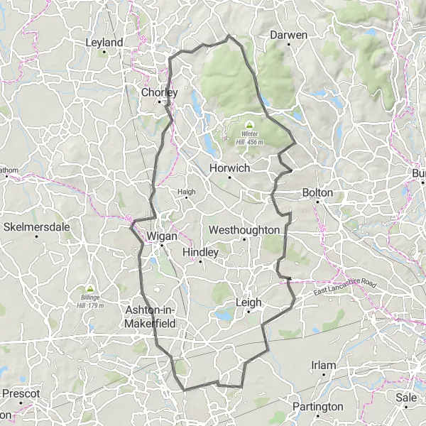
Experience breathtaking panoramas on this road cycling route
The Belmont Panorama is a road cycling route near Brinscall that offers breathtaking panoramic views of the countryside. With an ascent of 683 meters and a distance of 84 kilometers, this route is suitable for experienced cyclists looking for a challenging and rewarding ride. Highlights along the route include Belmont, a quaint village with charming cafes and beautiful architecture, and Top-o-Cow, a scenic location with captivating views. Ashton-in-Makerfield, located along the route, is a vibrant town known for its historical sites and interesting landmarks. Overall, the Belmont Panorama is a must-try route for road cycling enthusiasts looking to experience stunning panoramas and discover charming villages along the way.
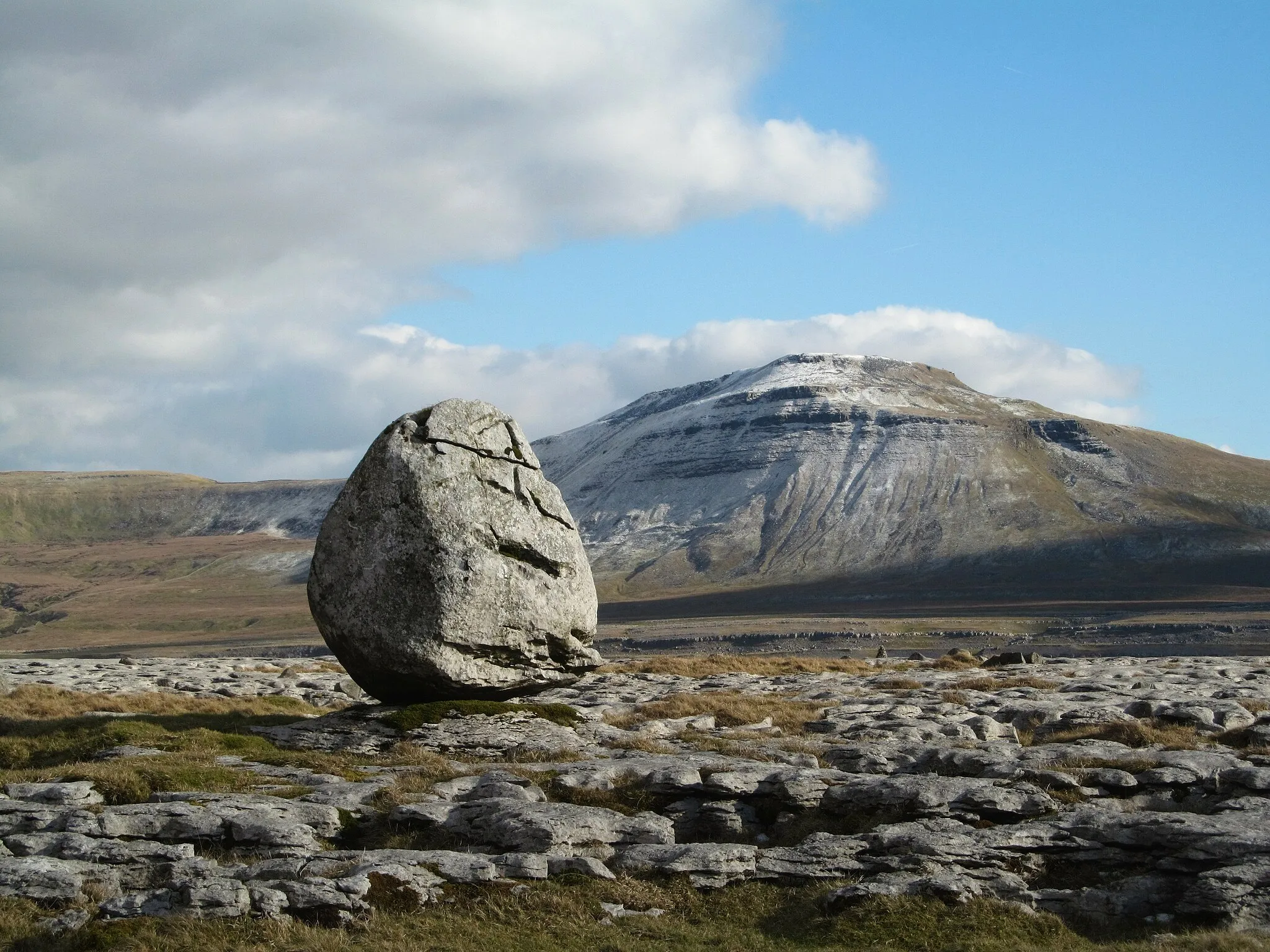
Black Hill Loop
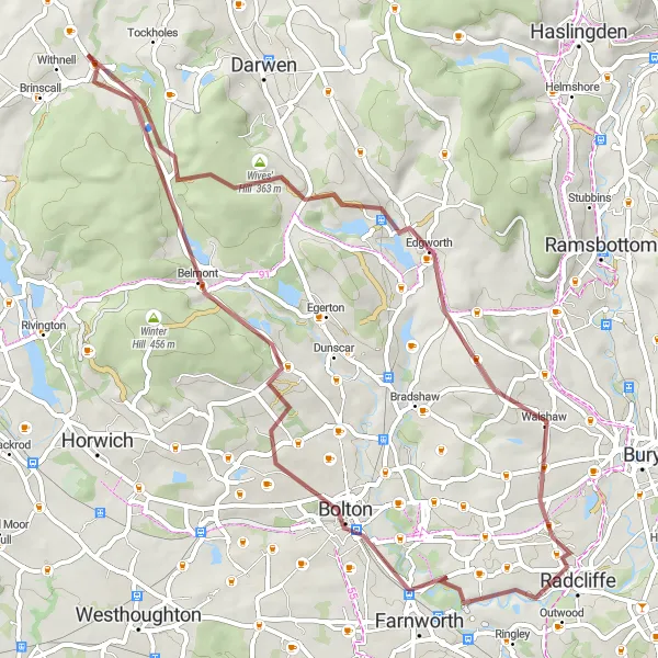
Ride through rugged landscapes and stunning scenery
The Black Hill Loop is a challenging gravel route near Brinscall that takes you through beautiful countryside and offers stunning panoramic views. This route is known for its rugged landscapes and varied terrain, making it suitable for experienced cyclists. With an ascent of 837 meters and a total distance of 54 kilometers, it is a challenging ride that will test your endurance and skills. Highlights along the route include the picturesque Black Hill, where you can enjoy breathtaking views, and Horrocks Fold, a historic landmark. Overall, the Black Hill Loop offers a unique and memorable cycling experience.
Embark on an adventurous journey through Grey Heights
The Grey Heights Adventure is a gravel cycling route near Brinscall that takes you through the enchanting Grey Heights. With a moderate ascent of 346 meters and a distance of 48 kilometers, this route is suitable for both intermediate and experienced cyclists. Highlights along the route include Grey Heights, a mystical area known for its unique rock formations and rich wildlife. Croston, a picturesque village along the way, offers charming pubs and idyllic views of the River Yarrow. Leyland, located at the end of the route, is a vibrant town with bustling markets and historical landmarks. Overall, the Grey Heights Adventure promises an exciting journey through mesmerizing landscapes and captivating natural beauty.
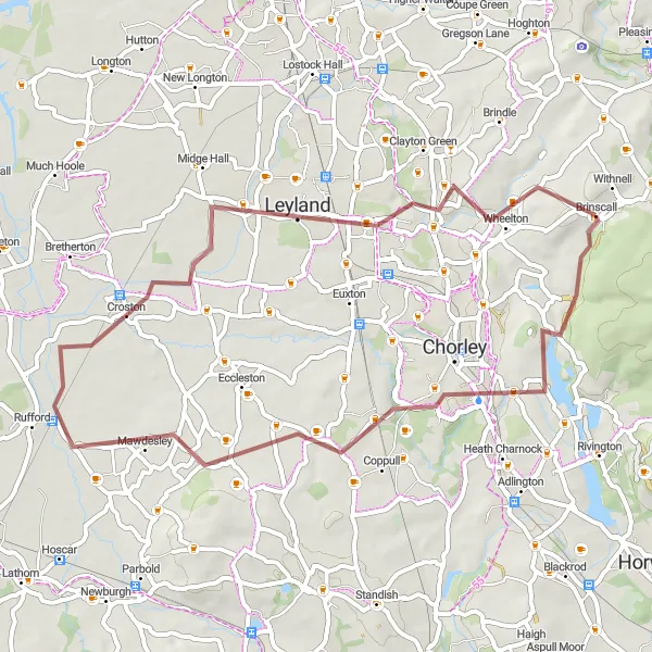
Gravel Adventure to Croston

Unleash your adventurous spirit on a gravel journey through Lancashire.
This off-road adventure takes you through Grey Heights, Heath Charnock, Skelmersdale, Croston, Clayton-le-Woods, and Brinscall. With diverse landscapes and rugged trails, this gravel route is perfect for cyclists looking for a thrilling and challenging off-road experience.
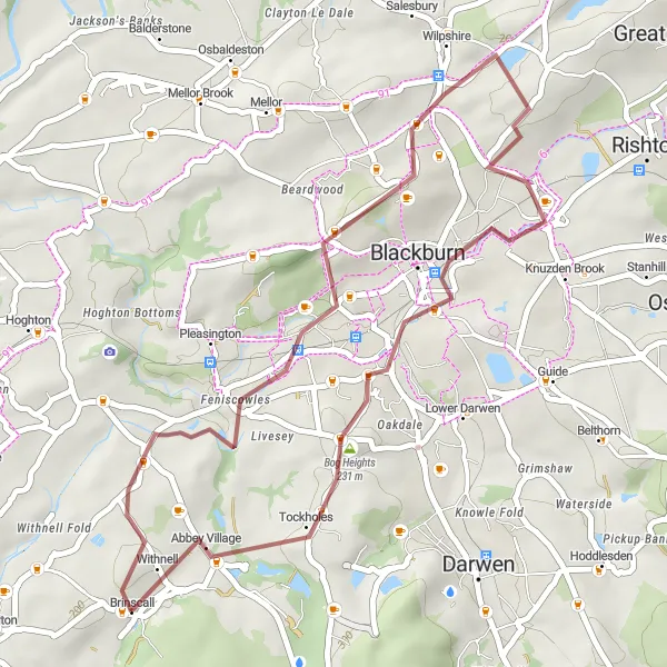
Savor the beauty of Blackburn Heights on this gravel cycling route
The Blackburn Heights route is a scenic gravel cycling route near Brinscall that takes you through the mesmerizing landscapes of Blackburn Heights. With a moderate ascent of 439 meters and a distance of 34 kilometers, this route is suitable for intermediate cyclists seeking a picturesque ride. Highlights along the route include Colourfields Panopticon, a unique art installation with stunning views of the surrounding countryside, and Livesey, a charming village with idyllic rural landscapes. Pike Lowe, located towards the end of the route, offers breathtaking panoramic views from its summit. Overall, the Blackburn Heights route promises a memorable and scenic cycling experience that showcases the beauty of the Blackburn Heights area.
Euxton Loop Road Cycling Route
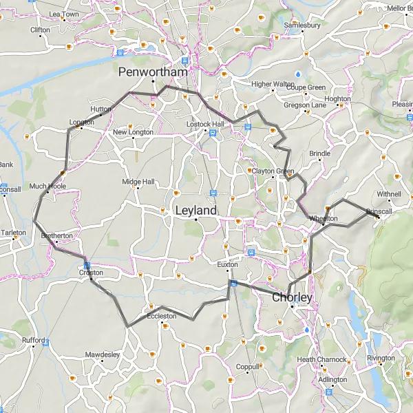
Enjoy a scenic journey through the villages surrounding Brinscall.
Experience the charm of Lancashire as you cycle through Euxton, Croston, Much Hoole, Penwortham, and Wheelton. This route provides a perfect mix of picturesque countryside and quaint villages.
Cycling routes nearby:

Nearby regions: