![Cover image](https://images.tarmacs.app/cycling-routes/covers/united-kingdom/leicestershire-rutland-and-northamptonshire/syston-5.webp)
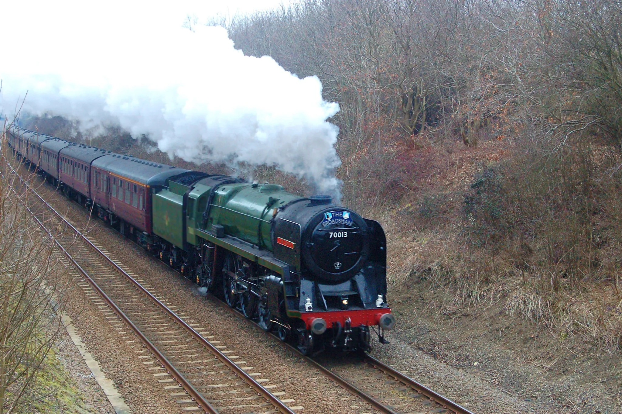
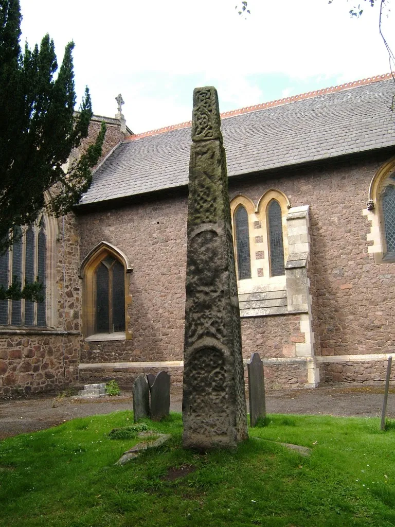
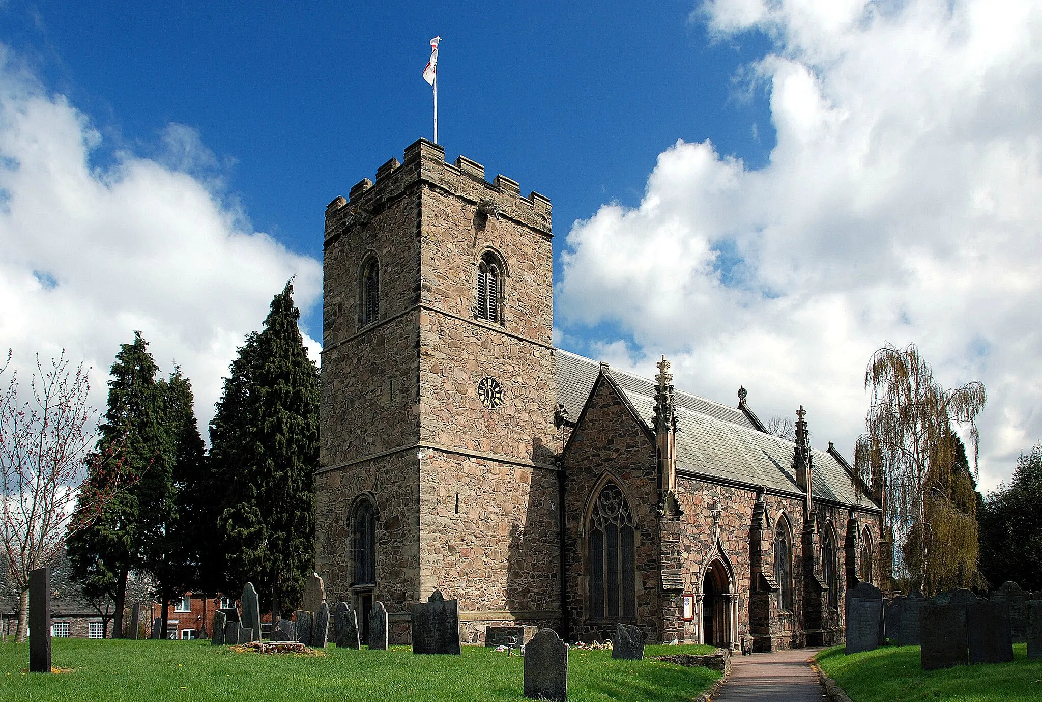
Cycle through diverse terrain and explore Bradgate Park on your bike in Syston.
Cycling routes from Syston
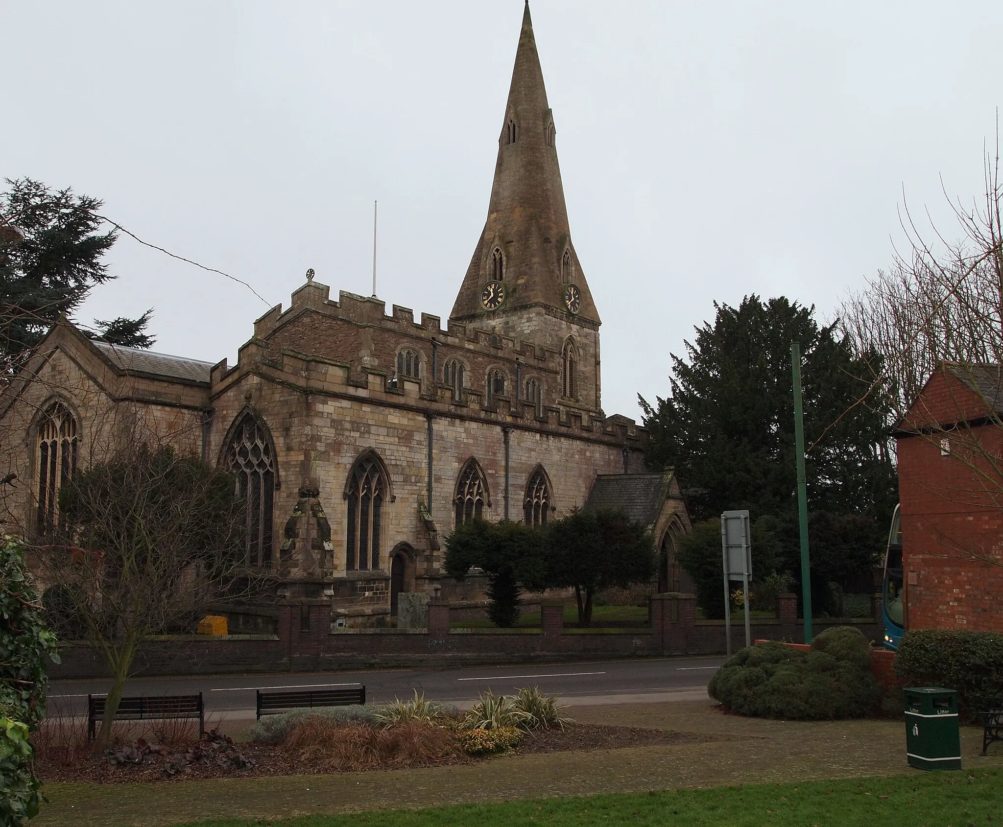
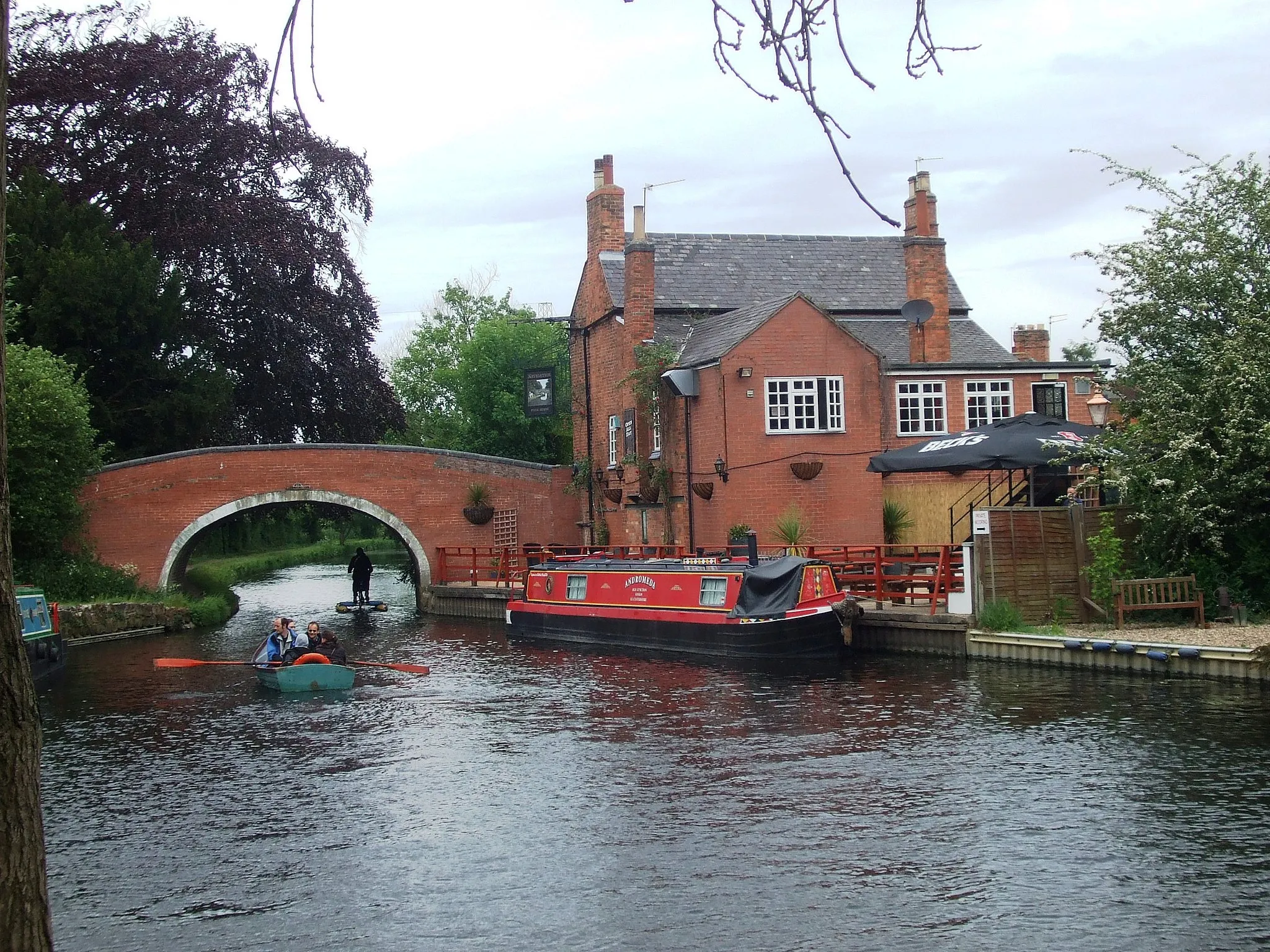
Syston is located in the Leicestershire, Rutland, and Northamptonshire region of the United Kingdom. For road and gravel cyclists, Syston offers a mix of flat and hilly terrain, providing options for both leisurely rides and more challenging routes. The town itself has limited cycling infrastructure, but connects to well-maintained roads that cyclists can explore. Cyclists can also visit nearby Bradgate Park, a beautiful nature reserve with cycling-friendly paths. Overall, Syston offers a pleasant cycling experience with its varied terrain and access to natural attractions.
![Map miniature of "Syston to Melton Mowbray Road Route" cycling inspiration in Leicestershire, Rutland and Northamptonshire, United Kingdom. Generated by Tarmacs.app cycling route planner](https://images.tarmacs.app/cycling-routes/routemaps/600/united-kingdom/leicestershire-rutland-and-northamptonshire/syston/road/58416.webp)
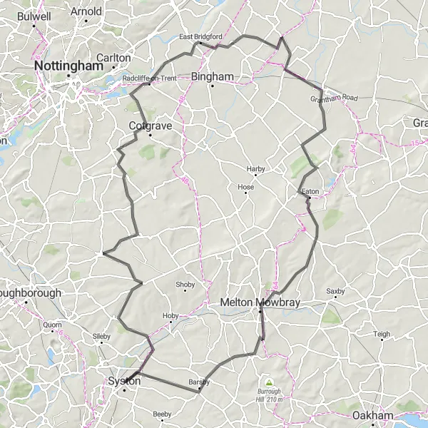
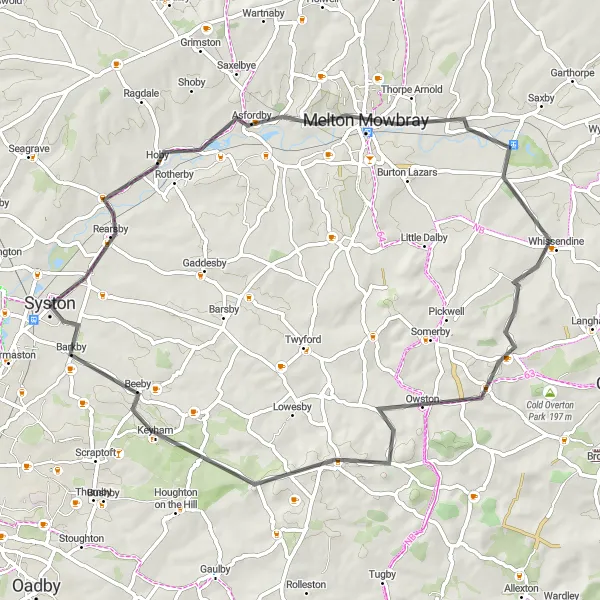
An epic road route from Syston to Melton Mowbray
Embark on an epic road cycling adventure from Syston to Melton Mowbray. Covering a distance of 110 kilometers with an ascent of 702 meters, this route is perfect for experienced cyclists seeking a challenge. Highlights along the way include Cotgrave, known for its scenic landscapes, and the historic town of Melton Mowbray.
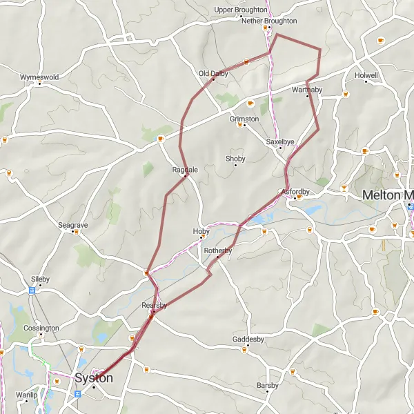
Syston Gravel Loop
![Map miniature of "Syston Gravel Loop" cycling inspiration in Leicestershire, Rutland and Northamptonshire, United Kingdom. Generated by Tarmacs.app cycling route planner](https://images.tarmacs.app/cycling-routes/routemaps/600/united-kingdom/leicestershire-rutland-and-northamptonshire/syston/gravel/58414.webp)
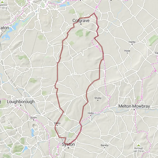
A scenic gravel loop starting from Syston
Embark on a scenic gravel adventure with this loop starting from Syston. Covering a distance of 64 kilometers and with an ascent of 459 meters, this route offers a balanced challenge for gravel enthusiasts. Highlights along the way include Keyworth, renowned for its natural beauty, and Windmill Hill, offering stunning panoramic views.
![Map miniature of "Loughborough Gravel Ride" cycling inspiration in Leicestershire, Rutland and Northamptonshire, United Kingdom. Generated by Tarmacs.app cycling route planner](https://images.tarmacs.app/cycling-routes/routemaps/600/united-kingdom/leicestershire-rutland-and-northamptonshire/syston/gravel/58423.webp)
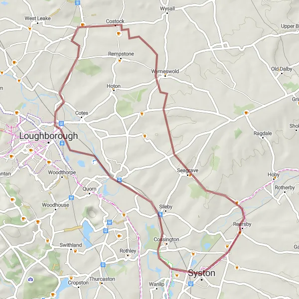
A scenic gravel ride through the outskirts of Loughborough
Escape the hustle and bustle of the city with this scenic gravel ride through the outskirts of Loughborough. Covering 45 kilometers with an ascent of 277 meters, this route offers a peaceful escape for gravel enthusiasts. Highlights along the way include Wymeswold with its charming countryside and Thrussington, known for its idyllic setting.
Syston to Leicester Gravel Route
![Map miniature of "Syston to Leicester Gravel Route" cycling inspiration in Leicestershire, Rutland and Northamptonshire, United Kingdom. Generated by Tarmacs.app cycling route planner](https://images.tarmacs.app/cycling-routes/routemaps/600/united-kingdom/leicestershire-rutland-and-northamptonshire/syston/gravel/58409.webp)
An exhilarating off-road adventure between Syston and Leicester
This gravel route takes you on a thrilling off-road journey from Syston to Leicester. With a distance of 84 kilometers and ascent of 400 meters, it offers a challenging but rewarding experience for gravel enthusiasts. The route includes highlights such as The Demostaph and Sutton Cheney, where you can explore historical landmarks along the way.
The Soar Valley Gravel Loop
![Map miniature of "The Soar Valley Gravel Loop" cycling inspiration in Leicestershire, Rutland and Northamptonshire, United Kingdom. Generated by Tarmacs.app cycling route planner](https://images.tarmacs.app/cycling-routes/routemaps/600/united-kingdom/leicestershire-rutland-and-northamptonshire/syston/gravel/58456.webp)
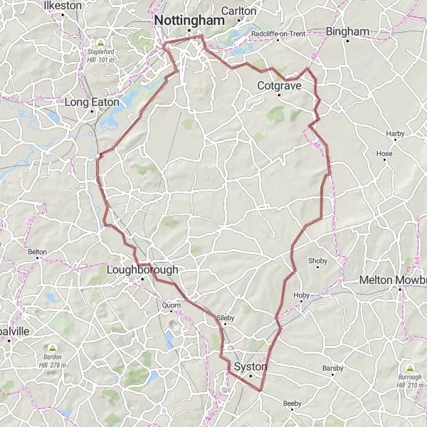
Discover the scenic beauty of the Soar Valley on this gravel adventure
The Soar Valley Gravel Loop is a captivating off-road cycling route that showcases the natural beauty of the Soar Valley. With a distance of 91 kilometers and an elevation gain of 387 meters, this route offers a challenging gravel ride through picturesque countryside. Along the way, you'll encounter charming villages and stunning viewpoints that provide breathtaking vistas of the valley.
![Map miniature of "Syston to Newtown Linford Road Route" cycling inspiration in Leicestershire, Rutland and Northamptonshire, United Kingdom. Generated by Tarmacs.app cycling route planner](https://images.tarmacs.app/cycling-routes/routemaps/600/united-kingdom/leicestershire-rutland-and-northamptonshire/syston/road/58404.webp)
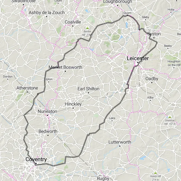
A thrilling road cycling route from Syston to Newtown Linford
This road route takes you on a challenging yet rewarding journey from Syston to Newtown Linford. Covering a distance of 90 kilometers and with an ascent of 584 meters, it's suitable for well-trained amateur cyclists looking for a bit of a challenge. Highlights along the way include a stunning viewing point and the historic Breedon on the Hill.
Syston to Naseby Loop
![Map miniature of "Syston to Naseby Loop" cycling inspiration in Leicestershire, Rutland and Northamptonshire, United Kingdom. Generated by Tarmacs.app cycling route planner](https://images.tarmacs.app/cycling-routes/routemaps/600/united-kingdom/leicestershire-rutland-and-northamptonshire/syston/road/129217.webp)
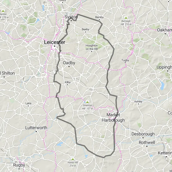
Explore the charming villages and beautiful countryside on this road cycling loop.
This 100-kilometer road cycling route takes you through picturesque villages and stunning countryside. Starting in Syston, you'll pass through Queniborough, Hungarton, East Langton, Market Harborough, Naseby, Husbands Bosworth, Countesthorpe, and Thurmaston. The route offers a moderate ascent of 669 meters, making it suitable for well-trained amateur cyclists. With its scenic views and peaceful surroundings, this loop is perfect for a leisurely day of cycling.
![Map miniature of "The Belvoir Loop" cycling inspiration in Leicestershire, Rutland and Northamptonshire, United Kingdom. Generated by Tarmacs.app cycling route planner](https://images.tarmacs.app/cycling-routes/routemaps/600/united-kingdom/leicestershire-rutland-and-northamptonshire/syston/road/58457.webp)
Explore the scenic countryside around Belvoir Castle
The Belvoir Loop is a picturesque round-trip cycling route that takes you through the beautiful countryside surrounding Belvoir Castle. Covering a distance of 61 kilometers and featuring 425 meters of ascent, this route is suitable for intermediate-level cyclists. Along the way, you'll pass through charming villages and enjoy the scenic views of the rolling hills in the area.
![Map miniature of "The Goscote Valley Gravel Loop" cycling inspiration in Leicestershire, Rutland and Northamptonshire, United Kingdom. Generated by Tarmacs.app cycling route planner](https://images.tarmacs.app/cycling-routes/routemaps/600/united-kingdom/leicestershire-rutland-and-northamptonshire/syston/gravel/58453.webp)
Embark on an off-road adventure through the scenic Goscote Valley
The Goscote Valley Gravel Loop is an exciting off-road cycling route that takes you through the picturesque Goscote Valley. Covering a distance of 38 kilometers and featuring 264 meters of ascent, this route offers a fun off-the-beaten-path experience for gravel enthusiasts. Along the way, you'll encounter charming villages and enjoy the diverse natural beauty of the valley.
![Map miniature of "Syston to Mountsorrel Loop" cycling inspiration in Leicestershire, Rutland and Northamptonshire, United Kingdom. Generated by Tarmacs.app cycling route planner](https://images.tarmacs.app/cycling-routes/routemaps/600/united-kingdom/leicestershire-rutland-and-northamptonshire/syston/road/129219.webp)
Discover the historic towns and picturesque landscapes on this challenging road cycling loop.
This 124-kilometer road cycling route takes you through historic towns and picturesque landscapes. Starting in Syston, you'll pass through Leicester, Frolesworth, Stretton under Fosse, Parson's Nose, Corley, Ansley, Nailstone, and Black Hill before reaching Mountsorrel. The route includes a challenging ascent of 782 meters, making it suitable for well-trained amateur cyclists. With its mix of historic landmarks and stunning scenery, this loop offers an unforgettable cycling experience.
Cycling routes nearby:
![Image of Queniborough](https://images.tarmacs.app/cycling-routes/covers/united-kingdom/leicestershire-rutland-and-northamptonshire/queniborough-5.webp)
![Image of Rothley](https://images.tarmacs.app/cycling-routes/covers/united-kingdom/leicestershire-rutland-and-northamptonshire/rothley-5.webp)
![Image of Sileby](https://images.tarmacs.app/cycling-routes/covers/united-kingdom/leicestershire-rutland-and-northamptonshire/sileby-4.webp)
![Image of Leicester](https://images.tarmacs.app/cycling-routes/covers/united-kingdom/leicestershire-rutland-and-northamptonshire/leicester-4.webp)
![Image of Mountsorrel](https://images.tarmacs.app/cycling-routes/covers/united-kingdom/leicestershire-rutland-and-northamptonshire/mountsorrel-5.webp)
![Image of Anstey](https://images.tarmacs.app/cycling-routes/covers/united-kingdom/leicestershire-rutland-and-northamptonshire/anstey-5.webp)
![Image of Oadby](https://images.tarmacs.app/cycling-routes/covers/united-kingdom/leicestershire-rutland-and-northamptonshire/oadby-5.webp)
![Image of Barrow upon Soar](https://images.tarmacs.app/cycling-routes/covers/united-kingdom/leicestershire-rutland-and-northamptonshire/barrow-upon-soar-5.webp)
Nearby regions:
![Image of Derbyshire and Nottinghamshire](https://images.tarmacs.app/cycling-routes/covers/united-kingdom/derbyshire-and-nottinghamshire/heanor-2.webp)
![Image of Lincolnshire](https://images.tarmacs.app/cycling-routes/covers/united-kingdom/lincolnshire/scotter-3.webp)
![Image of Herefordshire, Worcestershire and Warwickshire](https://images.tarmacs.app/cycling-routes/covers/united-kingdom/herefordshire-worcestershire-and-warwickshire/warwick-2.webp)
![Image of Shropshire and Staffordshire](https://images.tarmacs.app/cycling-routes/covers/united-kingdom/shropshire-and-staffordshire/shrewsbury-2.webp)
![Image of West Midlands](https://images.tarmacs.app/cycling-routes/covers/united-kingdom/west-midlands/kingswinford-5.webp)
![Image of East Anglia](https://images.tarmacs.app/cycling-routes/covers/united-kingdom/east-anglia/hethersett-5.webp)
![Image of Bedfordshire and Hertfordshire](https://images.tarmacs.app/cycling-routes/covers/united-kingdom/bedfordshire-and-hertfordshire/luton-4.webp)
![Image of Berkshire, Buckinghamshire and Oxfordshire](https://images.tarmacs.app/cycling-routes/covers/united-kingdom/berkshire-buckinghamshire-and-oxfordshire/steeple-claydon-2.webp)
![Image of Gloucestershire, Wiltshire and Bristol/Bath area](https://images.tarmacs.app/cycling-routes/covers/united-kingdom/gloucestershire-wiltshire-and-bristol-bath-area/banwell-2.webp)