Scenic routes in picturesque North Eastern Scotland and exploration of historic sites.
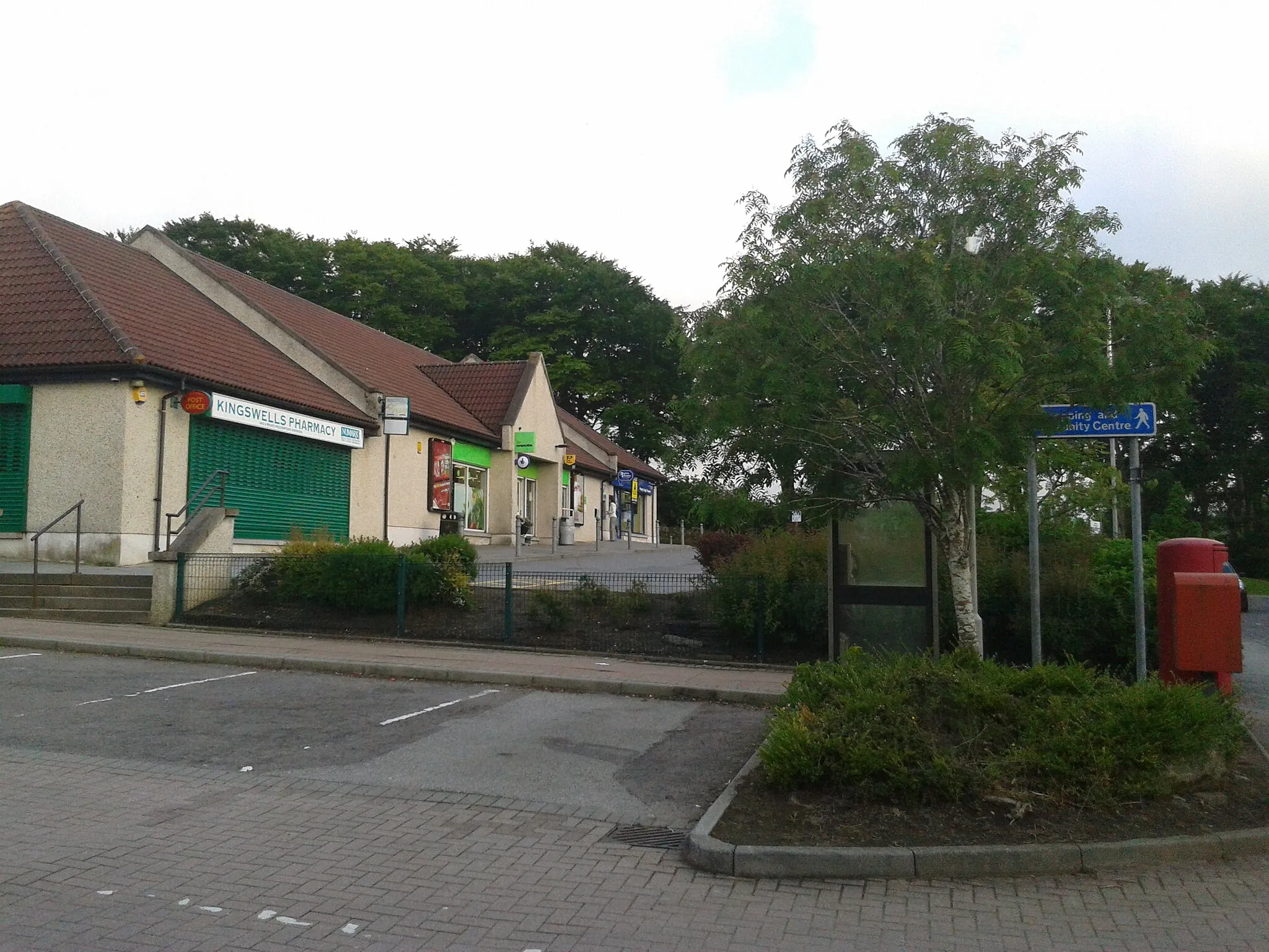
Cycling routes from Kingswells
Kingswells, located in North Eastern Scotland, United Kingdom, provides pleasant cycling routes suitable for road and gravel cyclists. The area offers a mixture of gentle hills and panoramic landscapes, allowing cyclists to enjoy the beautiful Scottish scenery. Kingswells is surrounded by charming rural countryside, dotted with picturesque castles and historic sites waiting to be discovered. Cyclists visiting Kingswells can explore the popular Tarland Routes, which provide a range of distances and difficulties suitable for different levels of fitness. With its peaceful surroundings, Kingswells offers an enjoyable cycling experience for those seeking tranquil rides.
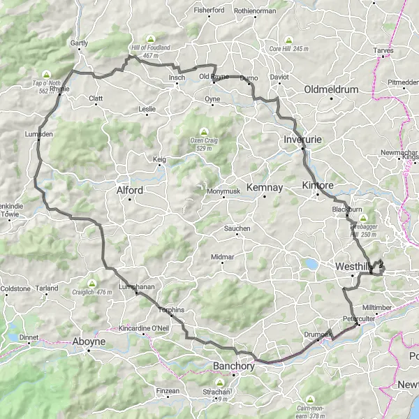
A challenging road route starting from Kingswells, offering picturesque landscapes and historical attractions.
For experienced cyclists looking for a challenging road cycling route near Kingswells, this option is perfect. Starting from Kingswells, the route takes you through Drumoak, Torphins, Stot Hill, Langgadlie Hill, Lumsden, Leith Hall, Old Rayne, Inverurie, Blackburn, and Longcairn. With a distance of 140 km and an ascent of 1450 meters, this route offers panoramic landscapes and historical attractions along the way. Highlights include Drumoak, home to the historic Drum Castle, and Inverurie, where you can visit the impressive ruins of Kinkell Church.
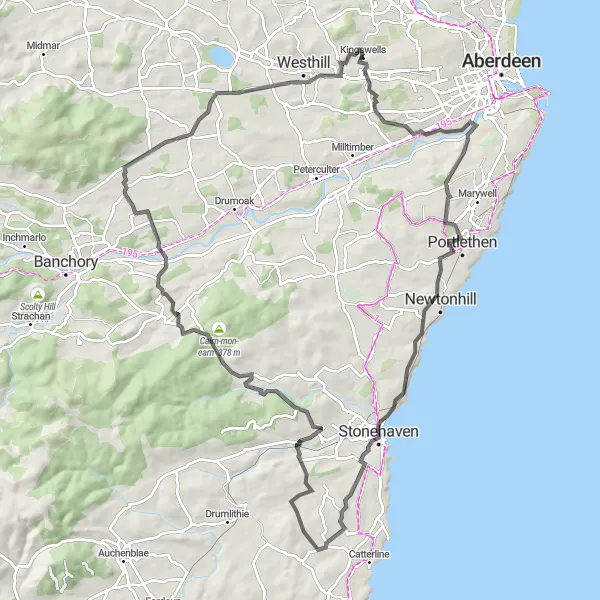
An adventurous road route starting from Kingswells, offering scenic views and passing by historical sites.
Embark on an adventurous road cycling journey near Kingswells with this route. Starting from Kingswells, the route takes you through Kaim Hill, Bridge of Muchalls, Hill of Megray, Glenton Hill, Cairn-mon-earn, Crathes, Garlogie, and West Hatton. With a distance of 92 km and an ascent of 998 meters, this route offers stunning panoramic views and takes you past historical sites. Highlights along the route include Hill of Megray, where you can enjoy breathtaking views of the surrounding area, and Crathes, home to the beautiful Crathes Castle.

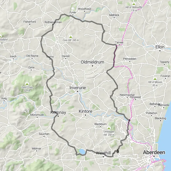
A challenging road route starting from Kingswells, passing through scenic villages and offering beautiful countryside views.
This road cycling route near Kingswells is a challenging option for experienced cyclists. Starting from Kingswells, the route takes you through scenic villages such as Kirkton of Skene, Burnhervie, Meikle Folla, Rothienorman, Hatton of Fintray, and Elrick Hill. With a distance of 106 km and 875 meters of ascent, this route offers stunning countryside views and a diverse landscape. Highlights along the route include Kirkton of Skene, known for its historic buildings, and Hatton of Fintray, where you can enjoy beautiful views of the surrounding countryside.
A scenic road route starting from Kingswells that passes through charming villages and beautiful countryside.
This road cycling route near Kingswells takes you through picturesque villages such as Kirkton of Skene, Dunecht, Pitcaple, Rothienorman, and Dyce. With a total distance of 103 km and 959 meters of ascent, this route offers scenic views of the North Eastern Scottish countryside. The route is suitable for experienced cyclists and offers a challenging ride through rolling hills. Highlights along the route include Kirkton of Skene, known for its historic buildings, and Rothienorman, which offers a charming countryside setting.
Cycle through scenic countryside from Kingswells to the picturesque village of Kirkton of Skene
This round-trip cycling route starts near Kingswells and takes you through beautiful Scottish countryside. Along the way, you'll pass by charming villages like Kirkton of Skene and Kintore. With a total ascent of 567 meters and a distance of 71 kilometers, this road route offers a moderate challenge for well-trained amateur cyclists. The route provides stunning views of the Hill of Barra and Cothal.
Kingswells to Drumoak Loop
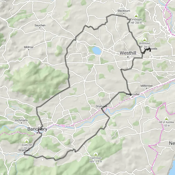
Embark on a scenic road cycling route from Kingswells to Drumoak
Cycle through picturesque Scottish countryside on this road route from Kingswells to Drumoak. The route covers a distance of 80 kilometers and has a total ascent of 810 meters. Along the way, you'll pass by fascinating landmarks such as Mulloch Hill and Strachan. The route also provides stunning views of Berry Hill, Echt, Blackburn, and Cairdhillock.
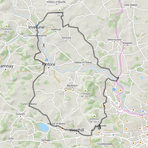
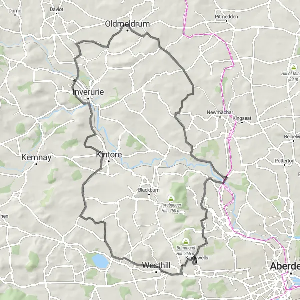
Explore the road cycling route from Kingswells to Inverurie through scenic Scottish landscapes
Head out on an adventure from Kingswells to Inverurie on this road cycling route. With a total distance of 59 kilometers and an ascent of 447 meters, this route is suitable for well-trained amateur cyclists. Along the way, you'll pass by Kirkton of Skene and Cothal, with opportunities to enjoy picturesque Scottish countryside views.
Kingswells to Burnhervie Loop
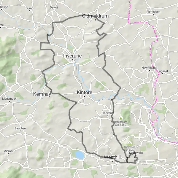
Embark on a challenging road cycling route from Kingswells to Burnhervie
This road cycling route is challenging and perfect for well-trained amateur cyclists. Starting near Kingswells, you'll journey through picturesque countryside to reach Burnhervie. The route has a total ascent of 730 meters and covers a distance of 79 kilometers. Along the way, you'll pass by Kirkton of Skene and Dilly Hill, with stunning views of Lawel Hill and Hatton of Fintray.
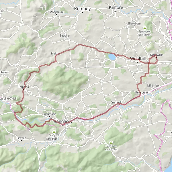
Experience the beauty of Scottish countryside on this gravel cycling route from Kingswells to Potarch
For those seeking a gravel trail adventure, this route is perfect. Starting from Kingswells, you'll pedal through 81 kilometers of beautiful Scottish countryside, with a total ascent of 854 meters. Highlights of this route include Drumoak, Kirkenie Hill, Ordie Caber, Midmar, Kirkton of Skene, and Kingswells, each offering unique attractions and breathtaking scenery.
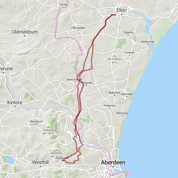
A gravel route starting from Kingswells that takes you through Dyce and Udny Station, offering scenic countryside views.
This gravel cycling route near Kingswells is perfect for off-road enthusiasts. Starting from Kingswells, the route passes through Dyce, known for its historical sites, and Udny Station, where you can enjoy peaceful countryside surroundings. With a total distance of 59 km and an ascent of 435 meters, this route provides a moderate challenge. Highlights along the route include Dyce, where you can explore the historic sites and picturesque landscapes, and Tillery House, which offers stunning countryside views.
Cycling routes nearby:
Nearby regions: