Embark on a cycling journey through the serene landscapes of Dromore.
Cycling routes from Dromore
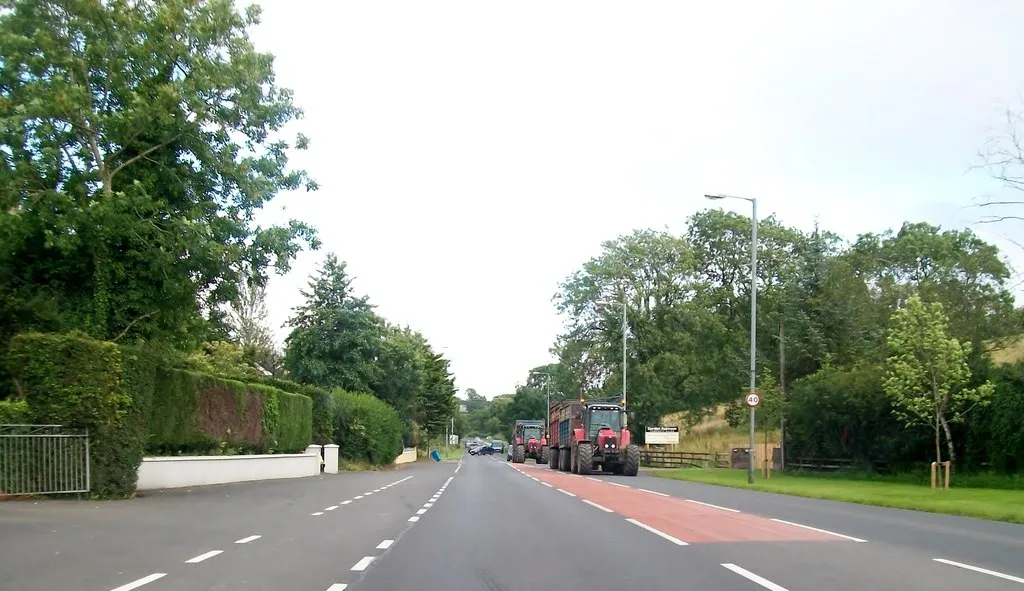
Dromore is a locality situated in Northern Ireland, United Kingdom. From a cyclist's perspective, Dromore offers pleasant road and gravel cycling routes suitable for cyclists of various skill levels. The locality features some scenic landscapes and well-maintained roads, ensuring a smooth cycling experience. While not famous for its climbs, Dromore showcases the beauty of Northern Ireland's countryside, allowing cyclists to enjoy peaceful rides. Visitors to Dromore can also explore the town's historical attractions and experience the local charm.
Explore the towns of Maguiresbridge and Enniskillen on this scenic road cycling route
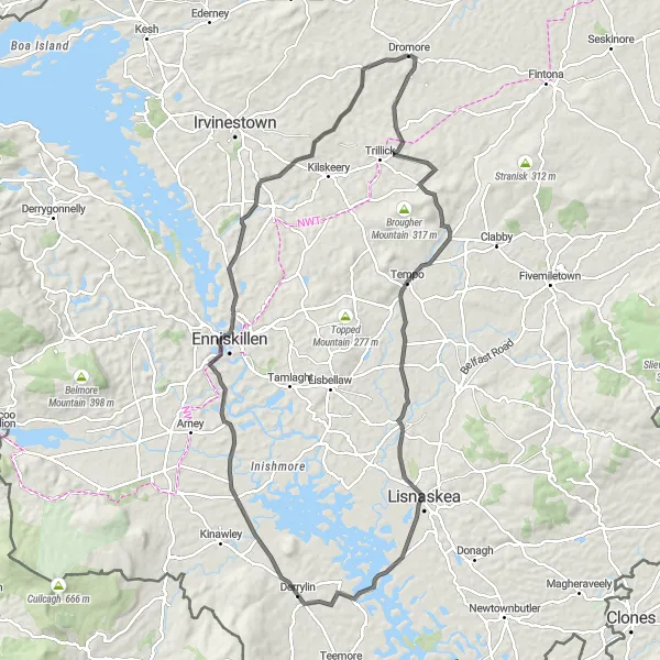
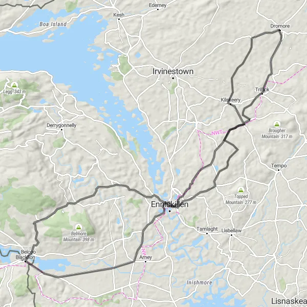
This 95-kilometer long route starting from Dromore takes you on a captivating journey through the countryside. With an ascent of 590 meters, this route presents a moderate challenge for cyclists. Highlights of this route include the village of Maguiresbridge, located 30 kilometers into the ride, and the vibrant town of Enniskillen, which you will reach after 69 kilometers.
Discover the quaint village of Brookeborough on this scenic cycling route.
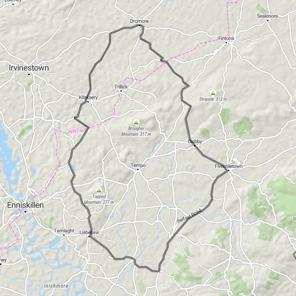
The Brookeborough Discovery route showcases the charming village of Brookeborough and its idyllic surroundings. With a total distance of 72km and an ascent of 630m, this road cycling route is suitable for intermediate cyclists. Starting near Dromore, you'll pedal through picturesque landscapes, passing by Maguiresbridge and enjoying views of the serene countryside. Upon reaching Brookeborough, take a moment to explore the village's rich history and soak in the tranquility of the area. This route offers a relaxing and immersive cycling experience away from the hustle and bustle of the city.
Conquer the challenging route to Castlederg and Dooish Mountain starting from Dromore
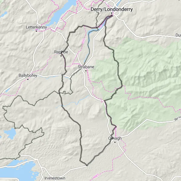
Embark on a thrilling adventure on this 146-kilometer long route with an ascent of 1350 meters. Starting from Dromore, this challenging road cycling route takes you through stunning landscapes and allows you to conquer the legendary Dooish Mountain after 58 kilometers. The highlights of this route also include the scenic town of Castlederg, situated 26 kilometers into the ride, as well as the charming village of Donemana, reached after 92 kilometers.
Mountfield Loop
Embark on a challenging cycling journey to the picturesque village of Mountfield.
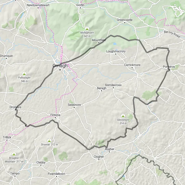
The Mountfield Loop offers a rewarding cycling experience with its challenging terrain and scenic beauty. With a total distance of 109km and an ascent of 884m, this road cycling route is suitable for experienced cyclists. Starting near Dromore, you'll tackle some demanding climbs before reaching Mountfield, a picturesque village nestled among rolling hills. Along the way, you'll pass by Killyclogher and discover its rich heritage. This route promises stunning views and a sense of accomplishment as you conquer the challenging terrain.
Enniskillen Castle Circuit
Embark on a splendid cycling journey around Enniskillen Castle.
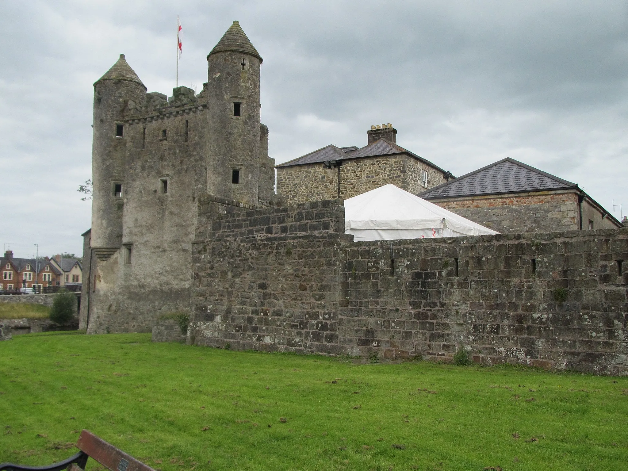
The Enniskillen Castle Circuit offers a delightful cycling experience with its picturesque surroundings and historic sites. With a total distance of 98km and an ascent of 908m, this road cycling route is suitable for intermediate cyclists. Starting near Dromore, you'll have the opportunity to explore Enniskillen Castle, a formidable medieval fortress that played a significant role in local history. Along the way, you'll also pass by Lower Lough MacNean, Belcoo, and Enniskillen, where you can immerse yourself in the rich cultural heritage of the region.
Lough MacNean Loop
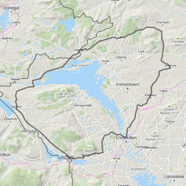
Discover the stunning beauty of Lough MacNean on this road cycling route.
The Lough MacNean Loop takes you on a scenic journey through the spectacular countryside of Northern Ireland. Starting near Dromore, you'll cycle along quiet roads and experience breathtaking views of Lough MacNean and its surrounding mountains. With a total distance of 131km and an ascent of 1134m, this route is suitable for well-trained amateur cyclists. The highlight of the route is visiting Enniskillen Castle, a historic site that showcases the region's rich heritage. The route also passes by Lower Lough MacNean, Belcoo, Garrison, Pettigo, and Drumskinny Stone Circle.
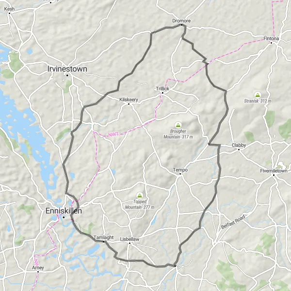
Enjoy the scenic beauty of Maguiresbridge and Tamlaght on this road cycling route
Embark on a 71-kilometer journey starting from Dromore, which takes you through beautiful landscapes and fascinating towns. With a moderate ascent of 442 meters, this route is suitable for cyclists of varying skill levels. Highlights of this route include the picturesque village of Maguiresbridge, located 31 kilometers into the ride, and the serene hamlet of Tamlaght, which you will reach after 39 kilometers.
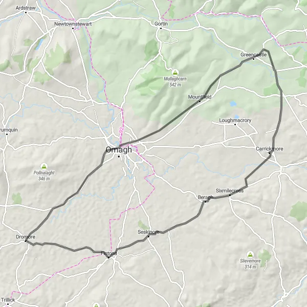
Embark on a scenic cycling excursion to the village of Killyclogher.
The Killyclogher Excursion takes you on a picturesque journey to the charming village of Killyclogher. With a total distance of 79km and an ascent of 700m, this road cycling route is suitable for intermediate cyclists. Starting near Dromore, you'll pedal through beautiful countryside, passing by Greencastle along the way. The highlight of the route is reaching Killyclogher, where you can take a break and explore the local attractions. Enjoy the serene ambiance and immerse yourself in the friendly community spirit of this quaint village.
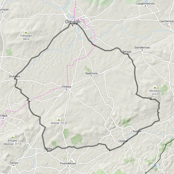
Experience the scenic beauty of Omagh and Augher on this road cycling route
This 81-kilometer long route starts from Dromore and takes you through picturesque landscapes. With an ascent of 680 meters, the route provides a moderate challenge for amateur cyclists. The highlights of this route include the charming town of Omagh, located 14 kilometers into the ride, and the scenic village of Augher, which you will reach after 47 kilometers.
Ederney and Castlederg Loop
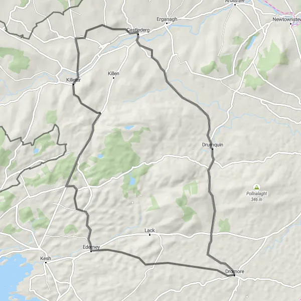
Experience the vibrant towns of Ederney and Castlederg on this road cycling route
Embark on a 71-kilometer journey starting from Dromore which will take you through fascinating towns and stunning landscapes. With a challenging ascent of 691 meters, this route is ideal for moderately experienced cyclists. Along the way, you will pass through the historic town of Ederney, located 13 kilometers into the ride, and the scenic town of Castlederg, which you will reach after 44 kilometers.
Cycling routes nearby:

Nearby regions: