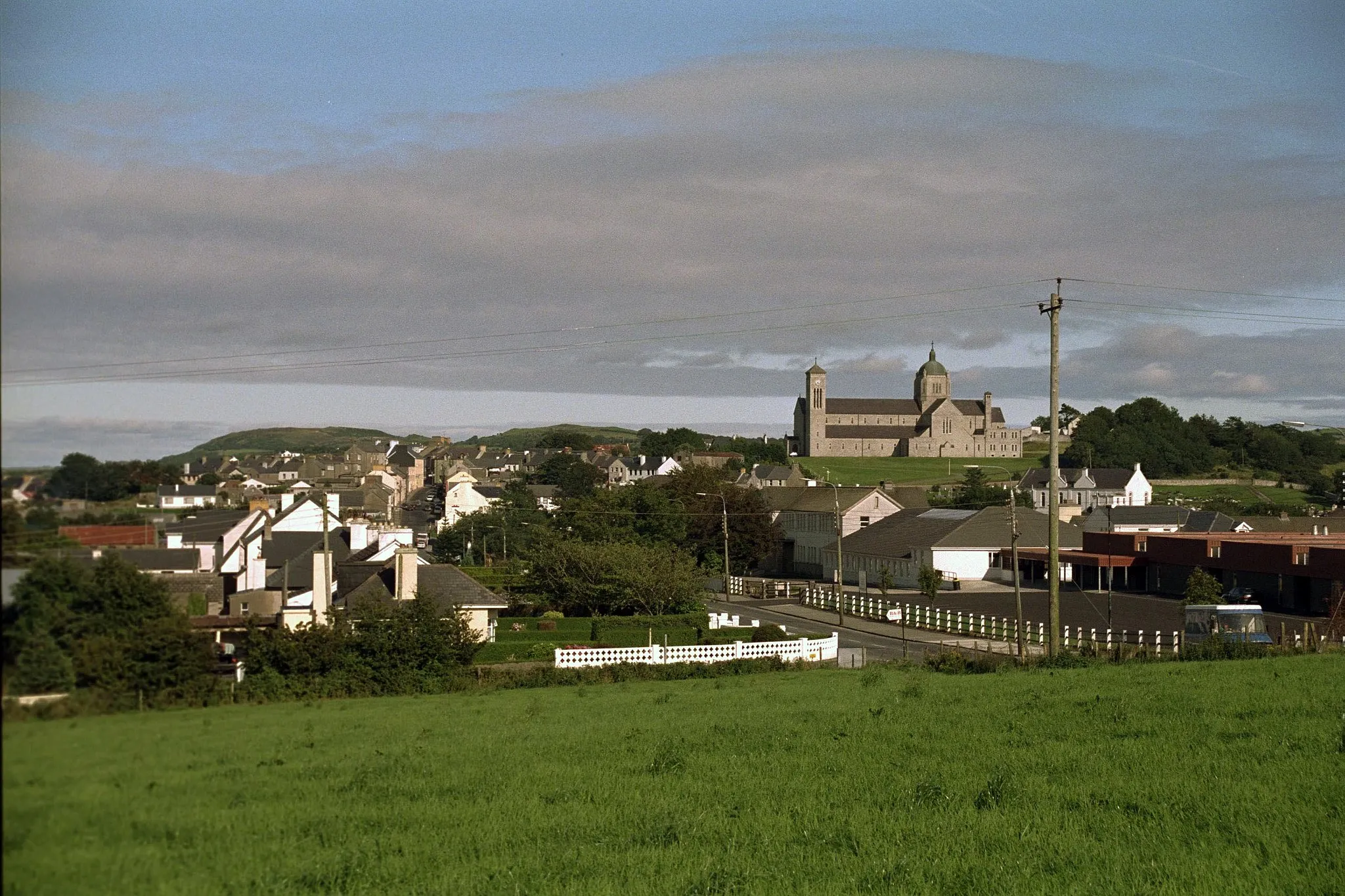
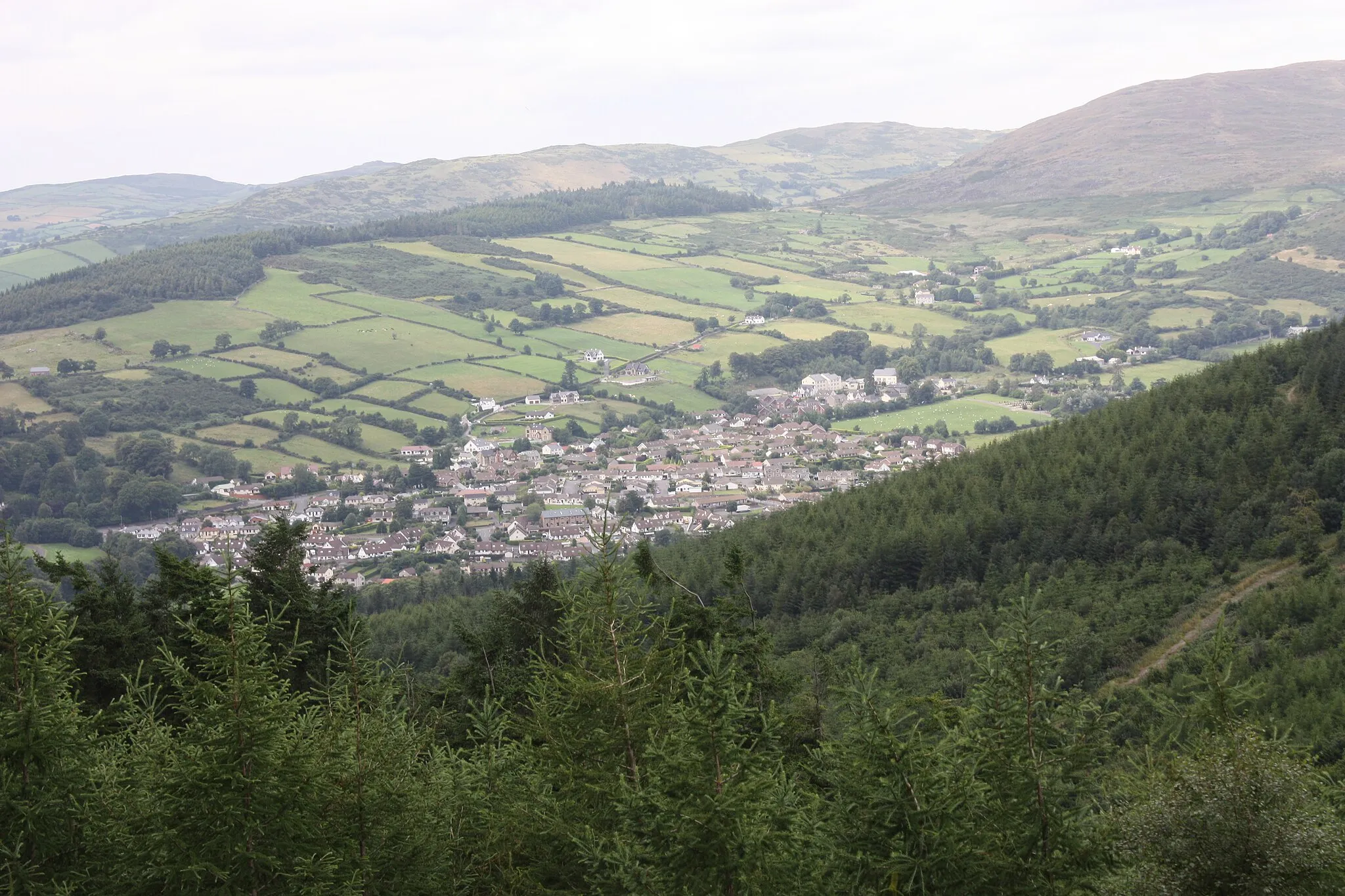
Serene cycling through countryside landscapes in Rathfriland.
Cycling routes from Rathfriland
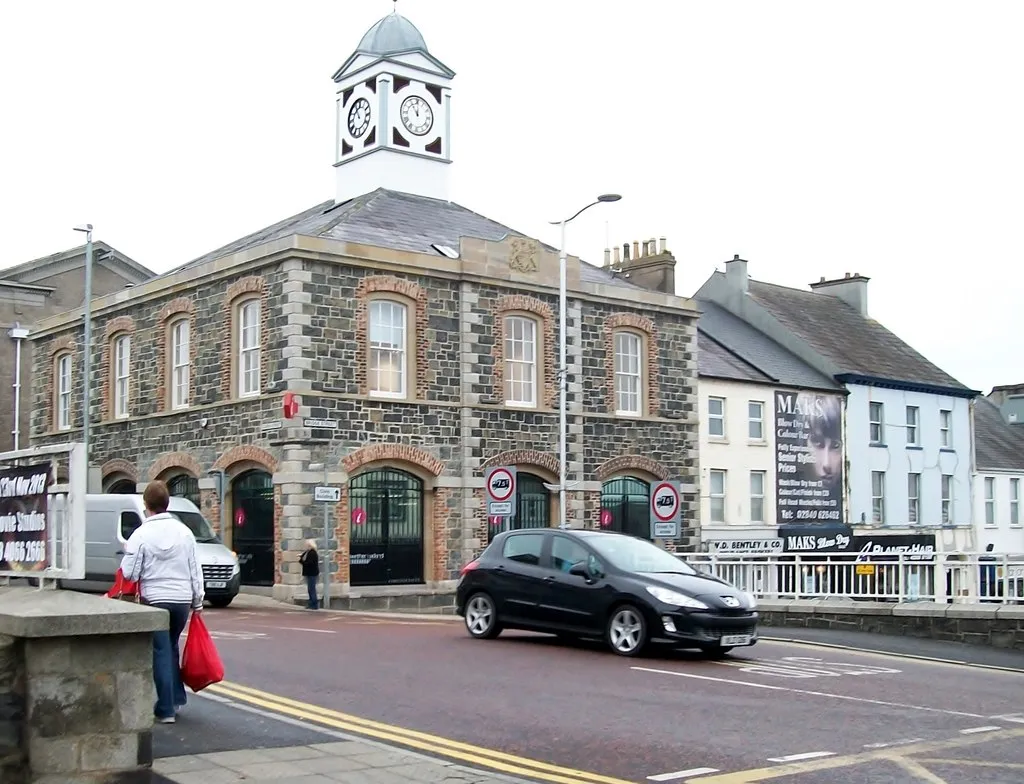
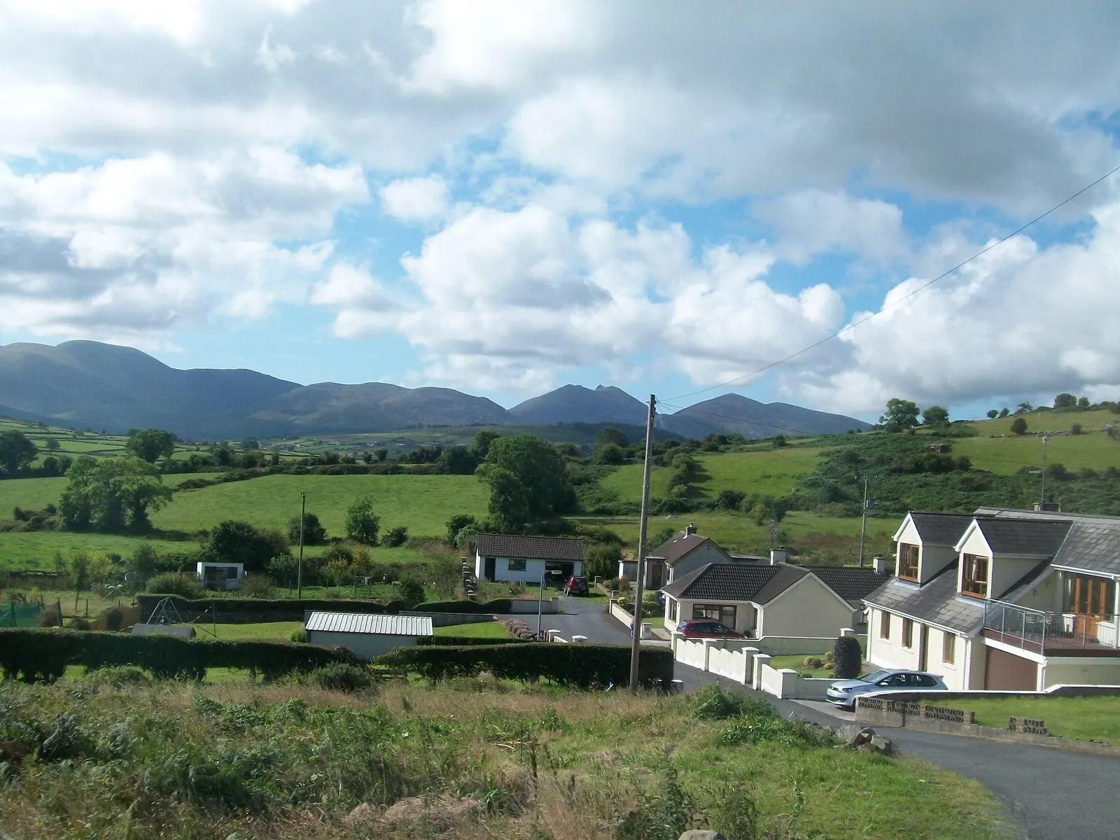
Rathfriland is a village located in Northern Ireland. From a cyclist's perspective, it offers picturesque rural roads surrounded by lush green fields and countryside views. While the area is ideal for leisurely rides, there are no famous cycling-related spots or well-known climbs nearby. Rathfriland provides a peaceful and scenic cycling experience for those seeking tranquility amidst nature.
Spelga to Rostrevor Route
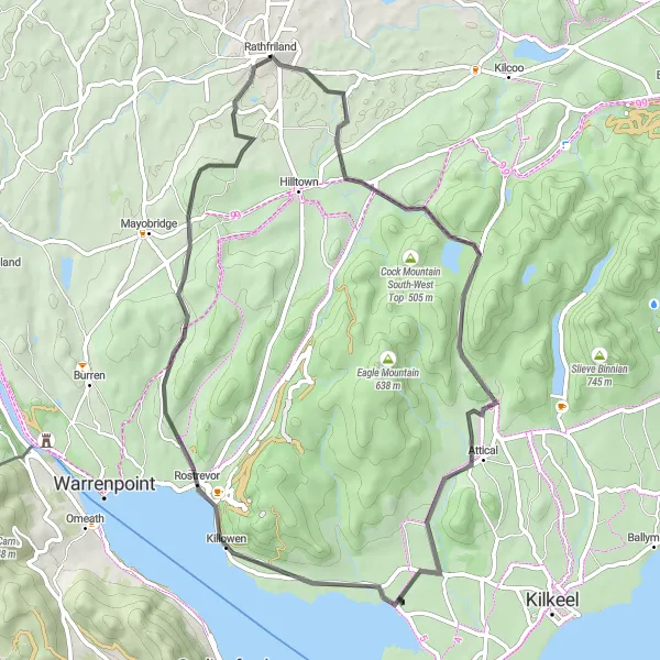
Witness the beauty of Spelga and Rostrevor on this scenic route
Discover the remarkable landscapes of Northern Ireland as you cycle from Spelga to Rostrevor. With a total ascent of 763 meters over a distance of 57 kilometers, this route offers a moderate challenge for experienced cyclists. Marvel at the natural beauty of Spelga Dam and enjoy the peace and tranquility of Rostrevor Forest.
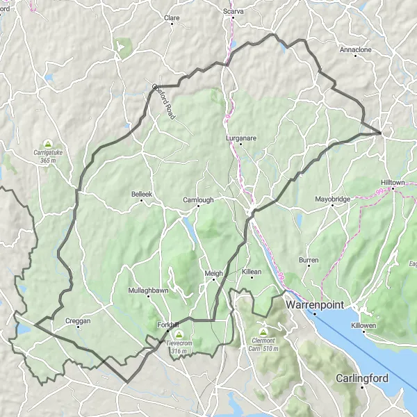
Embark on a thrilling journey from Newry to Cullyhanna through captivating landscapes
Prepare for an epic adventure as you cycle from Newry to Cullyhanna. With a total ascent of 1143 meters over a distance of 103 kilometers, this route is suitable for experienced cyclists looking for a challenging ride. Immerse yourself in the stunning beauty of the Irish countryside as you pass through charming villages and conquer formidable climbs.
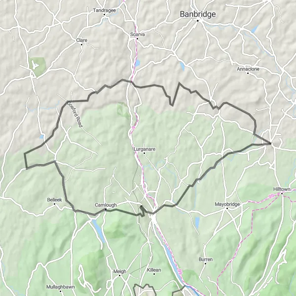
Rathfriland Loop
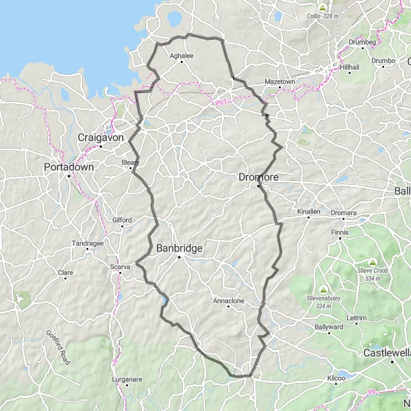
Discover the wonders Northern Ireland on this challenging Rathfriland loop.
This challenging 97-kilometre loop starts and finishes in Rathfriland and takes you through some of Northern Ireland's most picturesque countryside. With a total ascent of 965 metres, it is a strenuous ride suitable for experienced cyclists. Along the way, you'll pass through Loughbrickland, Lawrencetown, Lurgan, Maghaberry, Dromore, and Rathfriland. The route showcases the region's natural beauty and offers a mix of hill climbs and flat sections. The difficulty level for this route is rated as 4, making it suitable for very well-trained amateurs or experienced cyclists.
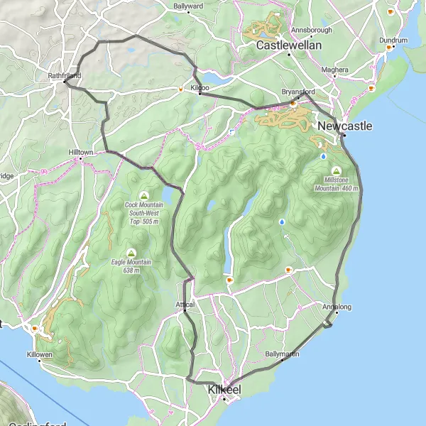
Embark on an epic journey from Kilcoo to Hen Mountain
This challenging route takes you from Kilcoo to Hen Mountain, offering breathtaking views and a variety of terrain. With a total ascent of 802 meters over a distance of 72 kilometers, it is suitable for experienced cyclists seeking a thrilling adventure. Experience the diversity of Northern Ireland's landscapes as you cycle through picturesque villages and up steep mountain trails.
Embark on a challenging ride from Rathfriland to Richhill and experience the stunning Northern Ireland countryside.
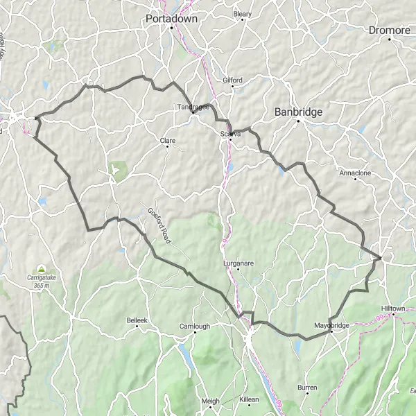
This 94-kilometre road cycling route takes you through the beautiful countryside of Northern Ireland, starting from Rathfriland and ending in Richhill. It offers a mix of flat terrain and challenging climbs, providing both beginner-friendly sections and vigorous challenges. The total ascent on this route is 1148 metres, making it suitable for experienced cyclists. Highlights along the route include Mayobridge, Mountnorris, Richhill, Tandragee, Loughbrickland, and Rathfriland. The overall difficulty of this route is rated as 4, appealing to well-trained amateurs seeking a challenging adventure.
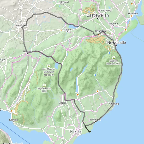
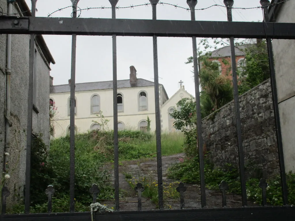
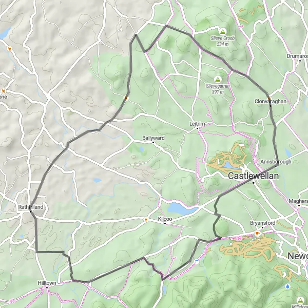
From Rathfriland to Hilltown, this route takes you through scenic countryside and past the ruins of Kilcoo Church.
This route offers a picturesque cycling experience through the rolling hills of Northern Ireland. It starts in Rathfriland and takes you along country roads with stunning views. One of the highlights along the route is the ruins of Kilcoo Church, located 11 kilometres into the ride. The overall difficulty of this route is moderate, suitable for well-trained amateurs. It is a 72-kilometre journey with a total ascent of 753 metres. The epicness score for this route is 4.
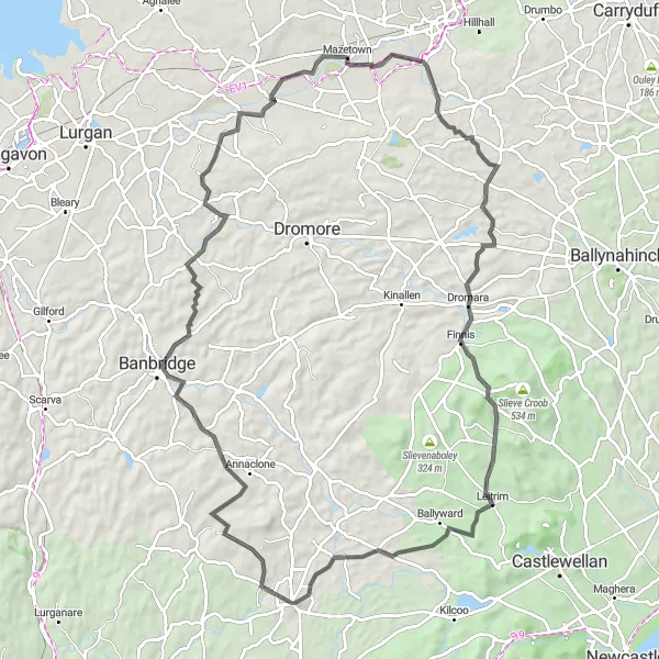
Take on the challenge of cycling from Rathfriland to Ballyward and experience the beauty of Northern Ireland.
This 91-kilometre road cycling route takes you through some of the most breathtaking landscapes in Northern Ireland, starting from Rathfriland and ending in Ballyward. With a total ascent of 988 metres, this route offers a mix of challenging climbs and scenic roadways. Highlights along the way include Banbridge, Annahilt, Dromara, Cratlieve, and Ballyward. The difficulty of this route is rated as 4, making it suitable for experienced cyclists seeking a challenging ride. The epicness score for this route is also 4, as it showcases the natural beauty and cultural richness of the region.
Rathfriland to Leitrim
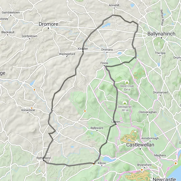
Experience the scenic beauty of Northern Ireland on this route from Rathfriland to Leitrim.
This 66-kilometre road cycling route takes you through the picturesque countryside, starting from Rathfriland and ending in Leitrim. Along the way, you'll encounter beautiful landscapes and charming towns. The ride is moderately challenging, with a total ascent of 905 metres. Highlights on this route include Kinallen, Magheraconluce, Finnis, Cratlieve, Leitrim, and Kilcoo Church. The difficulty level for this route is rated as 3, making it suitable for well-trained amateurs or intermediate cyclists.
Newry to Rathfriland Route
Cycling journey from Newry to Rathfriland filled with beautiful scenery
Embark on a scenic cycling adventure from Newry to Rathfriland, taking in the picturesque landscapes of Northern Ireland. With a total ascent of 840 meters over a distance of 71 kilometers, this route offers a challenging ride for experienced cyclists. Enjoy stunning views of the surrounding countryside as you traverse rolling hills and conquer challenging climbs.
Rathfriland to Salmon Leap Route
Cycle through scenic landscapes and make a stop at Salmon Leap
This picturesque route takes you from Rathfriland to Salmon Leap, offering breathtaking views of the surrounding countryside. The route is moderately difficult, with a total ascent of 831 meters over a distance of 56 kilometers. It is perfect for well-trained amateur cyclists looking for a challenging ride with beautiful scenery.
Cycling routes nearby:

Nearby regions: