Charming rural cycling in Cuckfield with access to popular climbs
Cycling routes from Cuckfield
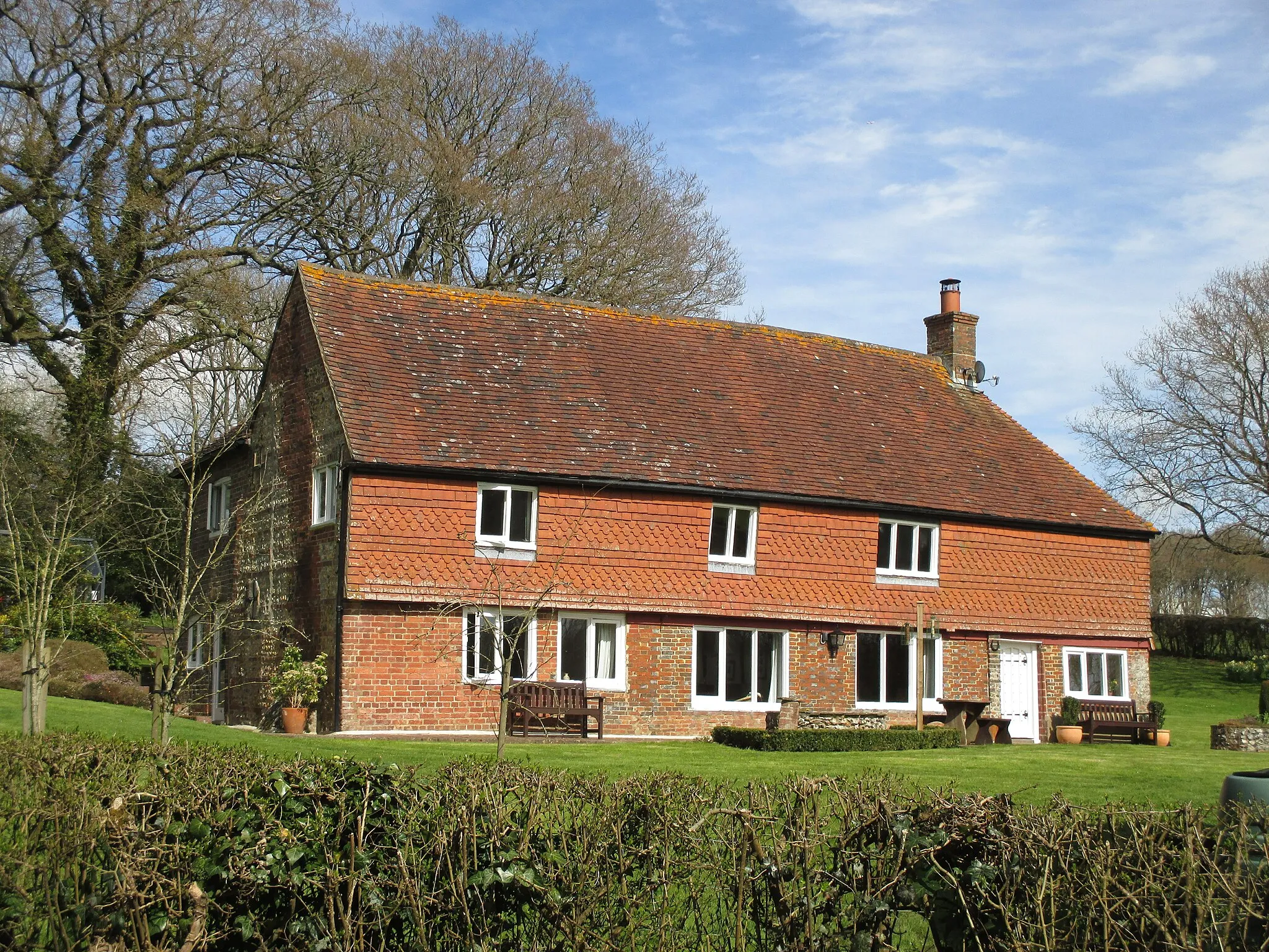
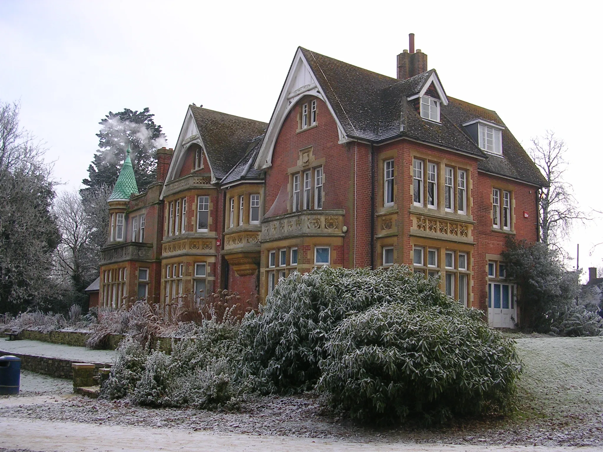
Cuckfield, part of Surrey, East and West Sussex in the United Kingdom, offers pleasant cycling opportunities. The locality features a mix of rolling countryside, quiet country roads, and charming villages to explore on two wheels. Cyclists can enjoy the picturesque surroundings, including nearby High Weald and Ashdown Forest. Cuckfield is not too far from Ditchling Beacon, a well-known climb and often part of popular local cycling events. While not bursting with cycling-specific facilities, the overall rural charm and proximity to notable cycling locations make Cuckfield suitable for road and gravel cyclists.

Indulge in a road cycling adventure through Colgate and Horley
Embark on an exhilarating road cycling adventure through the scenic routes near Cuckfield. This 60 km loop takes you through the charming village of Colgate, famous for its countryside charm and historic houses. As you pedal further, you'll pass through Horley, where you can enjoy picturesque views and explore its local attractions. With a total ascent of 568 meters, this route offers a mix of gentle slopes and thrilling descents, capturing the essence of road cycling enjoyment.
A scenic road cycling route featuring Goddards' Green and Devil's Dyke
This road cycling route takes you through picturesque villages and stunning countryside near Cuckfield. Begin your journey in Goddards' Green and enjoy the peaceful surroundings as you make your way to Devil's Dyke Public House. The route covers a distance of 50 km with a total ascent of 409 meters. The terrain is mainly flat with some gentle hills, making it suitable for both experienced and amateur cyclists alike.
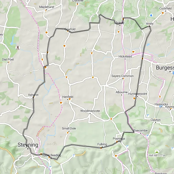
Indulge in an exciting gravel ride from Cuckfield to Ansty
This 45km off-road cycling route takes you through gravel paths and rural areas, offering a unique adventure. With a moderate ascent of 336m, it is suitable for well-trained amateur cyclists seeking a challenge. Highlights of the route include Twineham, a picturesque village with charming cottages and Partridge Green, known for its vibrant farming community. As you continue, you will pass through Crabtree, an area rich in natural beauty, and reach Ansty, where you can enjoy the peaceful surroundings.
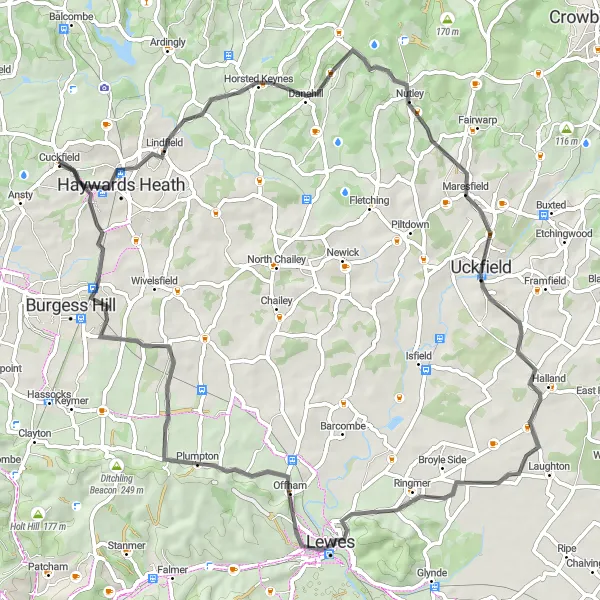
Embark on an epic road journey from Cuckfield to Lewes
Experience the thrill of this 71km road cycling route that takes you through the scenic beauty of East and West Sussex. Journey from Cuckfield to Lewes and encounter diverse landscapes along the way. Highlights include Horney Common, known for its heathland habitat and unique flora, and Lewes, a historic town with an impressive castle. With a moderate ascent of 689m, this route offers both excitement and natural beauty, making it a must for avid cyclists.

A scenic road cycling route with highlights including Twineham and Broadford Bridge
Discover the beauty of Surrey, East Sussex, and West Sussex on this 104 km road cycling route starting near Cuckfield. The route features picturesque villages, rolling hills, and scenic countryside. Take in the charming village of Twineham and pedal through the historic village of Washington. End your journey at Broadford Bridge and explore the natural beauty of the area. With a total ascent of 917 meters, this route is suitable for experienced cyclists looking for a challenge.
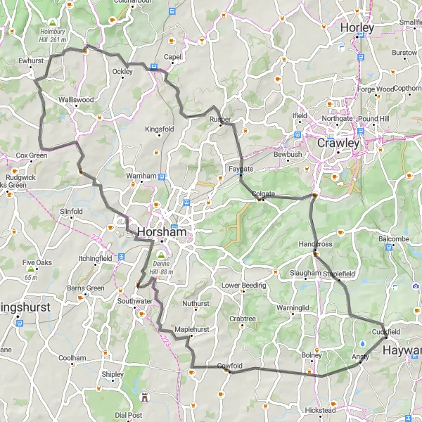
Experience the picturesque route from Cuckfield to Pease Pottage
Cycle through the beautiful countryside of Surrey and East and West Sussex on this road cycling route. The 77km journey takes you through charming villages and offers stunning views. The route includes highlights such as Copsale, Denne Hill, and Rusper, where you can take in the tranquility of the surroundings. With a moderate ascent of 634m, this route is ideal for well-trained amateur cyclists.
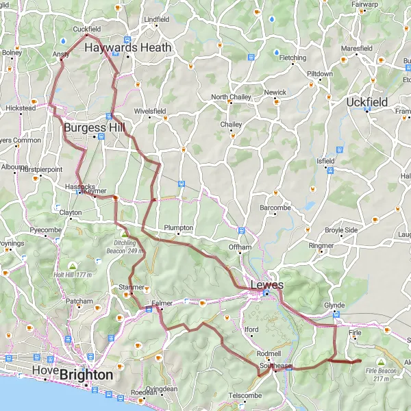
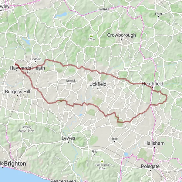
Experience the thrill of gravel cycling through Streat and Lewes Castle
Embark on an exciting gravel cycling adventure through the scenic routes near Cuckfield. This 74 km route offers thrilling off-road sections and spectacular landscapes. With a total ascent of 1036 meters, it is best suited for experienced cyclists looking for a challenging ride. Highlights along the way include Streat, Lewes Castle with its iconic Barbican gate, and stunning viewpoints like Downland Viewpoint. The combination of gravel paths, scenic views, and historical landmarks makes this route truly epic.
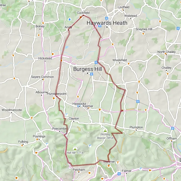
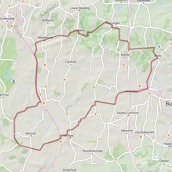
Discover the scenic beauty on the Cuckfield to Streat gravel route
Embark on a 43km gravel cycling journey across Surrey and East and West Sussex. This route offers diverse terrains, including charming country lanes and forested trails. With a moderate ascent of 591m, it caters to well-trained amateur cyclists seeking a moderate challenge. Notable highlights include Streat, a rural hamlet set amidst picturesque landscapes, and Stanmer, a nature lover's haven with its tranquil university park. Coney Hill offers sweeping views of the Varralls and South Downs, followed by a ride through Goddards' Green, known for its stunning countryside vistas.
Get ready for a challenging gravel adventure from Cuckfield to Horam
Take on the 81km circuit that winds through scenic countryside and charming villages. With a challenging ascent of 844m, this route is recommended for well-trained amateur cyclists seeking a more demanding ride. Highlights of the journey include Maresfield, where you can explore local history and architecture, and Horam, offering picturesque landscapes and serene surroundings. As you pedal through Isfield, you'll pass by rolling hills and verdant farmlands before encountering the peaceful village of South Chailey.
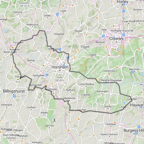
A road cycling route discovering Copsale and Warnham
Enjoy a scenic road cycling journey through the charming towns of Copsale and Warnham. This 71 km route offers varied terrain, with some moderate climbs and beautiful countryside views. Starting in Cuckfield, you'll pass through Copsale and admire its characterful houses and peaceful atmosphere. As you continue, you'll encounter Warnham, where you can explore its historic landmarks and idyllic surroundings. With a total ascent of 551 meters, this route provides a good balance of challenge and enjoyment for cyclists of intermediate skill level.
Cycling routes nearby:

Nearby regions: