Conquer Epic Climbs and Scenic Routes in Langley Green
Cycling routes from Langley Green
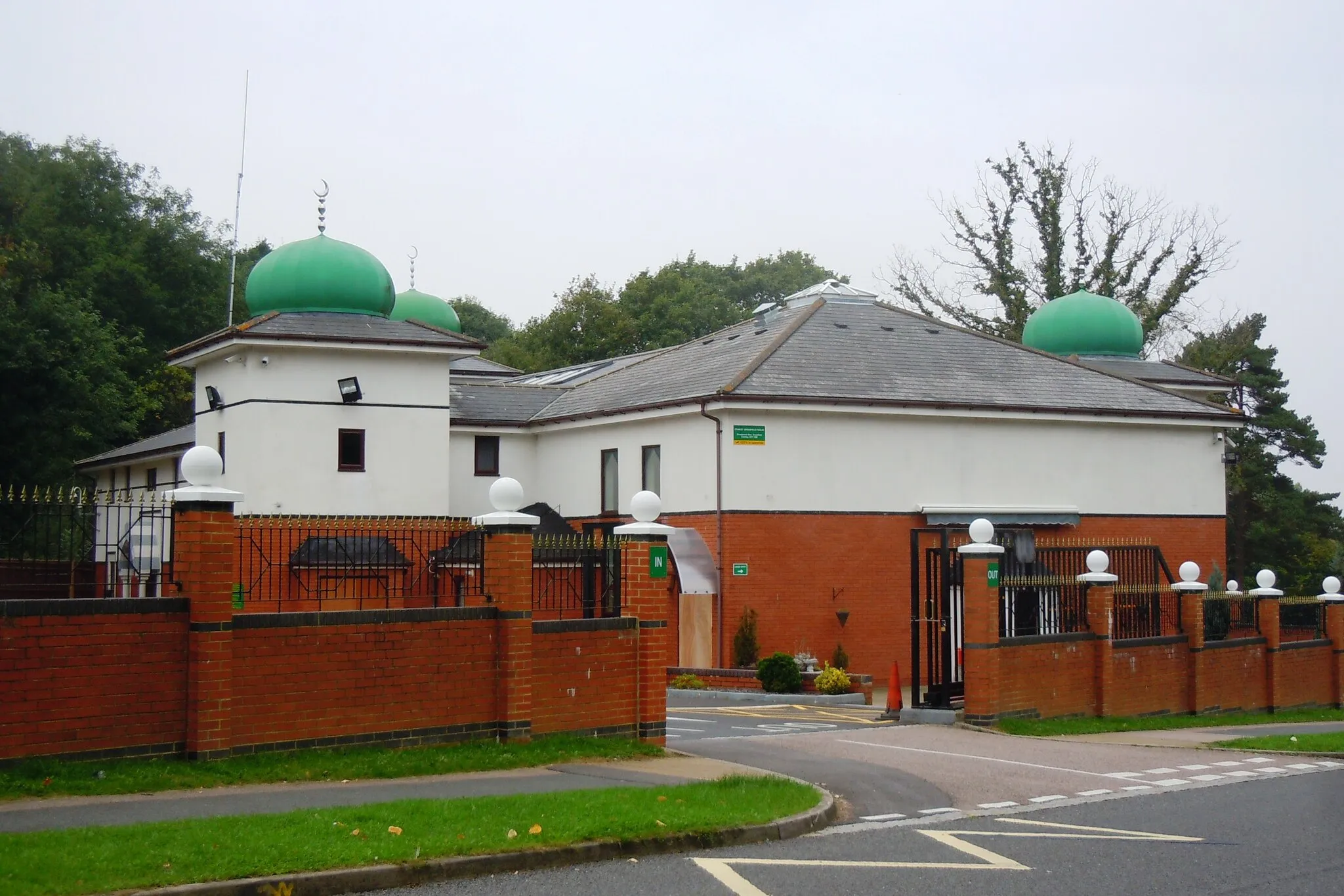
Langley Green, located in the Surrey, East and West Sussex region of the United Kingdom, offers excellent cycling opportunities for road and gravel cyclists. The locality features a mix of challenging climbs and scenic routes through picturesque countryside. Cyclists can tackle famous climbs such as Box Hill or Ditchling Beacon, both known for their thrilling ascents and stunning views at the top. Langley Green is also the starting point for the popular South Downs Way, a long-distance off-road cycling trail. With its diverse terrain and proximity to renowned cycling routes, Langley Green is a fantastic locality for cycling enthusiasts.
Cycle through beautiful landscapes from Three Bridges to Tinsley Green
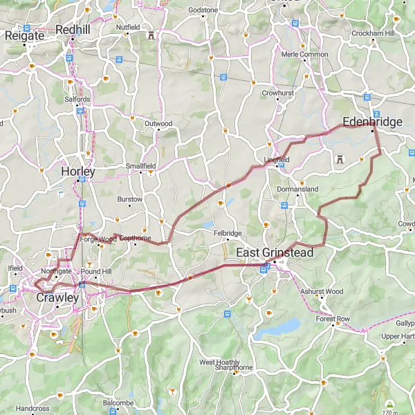
This unique gravel cycling route takes you through picturesque landscapes, starting from Three Bridges and ending at Tinsley Green. With a total distance of 52 kilometers and an ascent of 292 meters, this route offers a moderately challenging ride suitable for gravel bikes. The highlights along the route include East Grinstead, Edenbridge, and Tinsley Green.
The Three Bridges Loop

A ride that showcases the beauty of Three Bridges
The Three Bridges Loop is a picturesque cycling route that starts near Langley Green. It covers a distance of 47 km with a total ascent of 533 meters. The route is perfect for road biking enthusiasts and offers stunning views of the Three Bridges area. With highlights such as the Ouse Valley Viaduct Viewpoint, Ansty, Pease Pottage, and West Green, cyclists are bound to have an unforgettable experience. The difficulty level of this route is moderate, suitable for well-trained amateurs. It has an epicness rating of 3, making it a memorable journey for cyclists.
Embark on a scenic gravel cycling journey from Northgate to Kingsfold
Enjoy the beauty of Sussex and Surrey on this picturesque gravel cycling route starting from Northgate and ending at Kingsfold. With a total distance of 35 kilometers and an ascent of 253 meters, this route offers a relatively easy ride suitable for gravel bikes. The highlights along the route include Kingsfold and Langley Green. Immerse yourself in the peaceful countryside and embrace the tranquility of nature.
The Crawley Epic
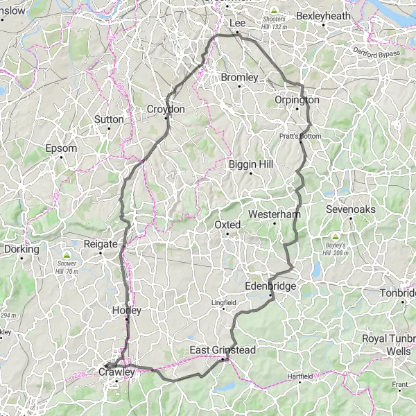
Embark on an epic cycling adventure starting from Langley Green to Crawley
The Crawley Epic is a challenging road cycling route spanning a distance of 114 km with an ascent of 1033 meters. This epic journey takes cyclists through various stunning locations, including South Earlswood, South Norwood, Catford, Pratt's Bottom, Brasted, Olivia Hill Well (disused), Dormansland, Turners Hill, and Crawley. The difficulty level of this route is high, suitable for well-trained amateurs seeking a demanding ride. It has an epicness rating of 5, as it features breathtaking landscapes and famous cycling spots. The Crawley Epic offers an unforgettable experience for adventurous cyclists.

Cycle through stunning landscapes on the Horley to Langley Green road route
Discover the beauty of Surrey and West Sussex on this scenic road cycling route starting from Horley and ending at Langley Green. With a total distance of 63 kilometers and an ascent of 586 meters, this route offers a challenging ride suitable for experienced road cyclists. The highlights along the route include South Nutfield, Caterham, Botley Hill, New Chapel, and Langley Green. Get ready for an epic adventure through picturesque countryside and charming villages.
Discover the charm of Nutfield on this road cycling route
The Nutfield Road Explorer is a road cycling route that covers a distance of 49 km with a total ascent of 294 meters. This route offers a mix of beautiful countryside scenery and charming village views. Cyclists will pass through locations such as Charlwood, Nalderswood, Reigate Hill, South Nutfield, and Langley Green. The Nutfield Road Explorer provides a moderate difficulty level, making it suitable for well-trained amateurs. With an epicness rating of 2, it offers a delightful exploration of the Surrey and Sussex regions.
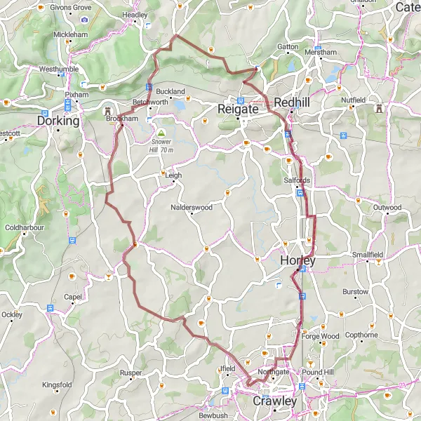
Discover the beauty of the countryside on the Langley Green to Northgate gravel route
Experience the scenic beauty of Surrey and West Sussex on this gravel route starting from Langley Green and ending at Northgate. With a total distance of 51 kilometers and an ascent of 430 meters, this route offers a moderately challenging ride suitable for gravel bikes. Highlights along the route include Brockham, Reigate Hill, and Horley. Immerse yourself in the peaceful surroundings and enjoy a refreshing cycling adventure.
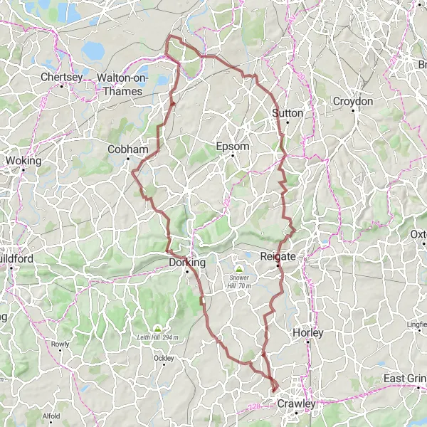
An adventurous gravel ride exploring the charm of Dorking
The Dorking Gravel Adventure offers an exhilarating journey for gravel bike enthusiasts. Covering a distance of 97 km and an ascent of 862 meters, this route showcases the natural beauty of Surrey and Sussex. Highlights include Newdigate, Dorking, Denbies Hillside, Tagg's Island, Belmont, Reigate Hill, Woodhatch, Charlwood, and Langley Green. With a difficulty level of 4, this adventure is recommended for well-trained amateurs seeking a challenging ride. It has an epicness rating of 4, highlighting the awe-inspiring landscapes and unique attractions along the way.
Embark on an epic road cycling journey from Ifield to Lowfield Heath Windmill
This road cycling route will take you on a thrilling adventure starting from Ifield and ending at Lowfield Heath Windmill. With a total distance of 93 kilometers and an ascent of 619 meters, this route is suitable for experienced road cyclists. The highlights along the route include Denne Hill, Wisborough Green, Dunsfold, and Newdigate. Get ready for a challenging but rewarding ride through beautiful landscapes.
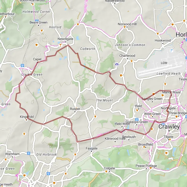
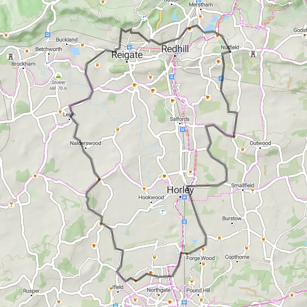
The Kingsfold Gravel Adventure

Embark on a gravel adventure from Langley Green to Kingsfold
The Kingsfold Gravel Adventure is a thrilling route for gravel bike enthusiasts. With a distance of 70 km and an ascent of 700 meters, this ride explores the picturesque countryside near Langley Green and Kingsfold. Highlights include the Kingsfold area, Holmbury Hill, Peaslake, Betchworth Castle, and Charlwood. This route presents a moderate difficulty level, perfect for well-trained amateurs seeking a challenge. With an epicness rating of 3, this adventure provides a satisfying and memorable experience for cyclists. The Kingsfold Gravel Adventure is designed to showcase the unique beauty of the Surrey and Sussex regions.
Cycling routes nearby:


Nearby regions: