Experience the challenging climbs of South Downs National Park and enjoy the scenic coastal routes in Peacehaven.
Cycling routes from Peacehaven
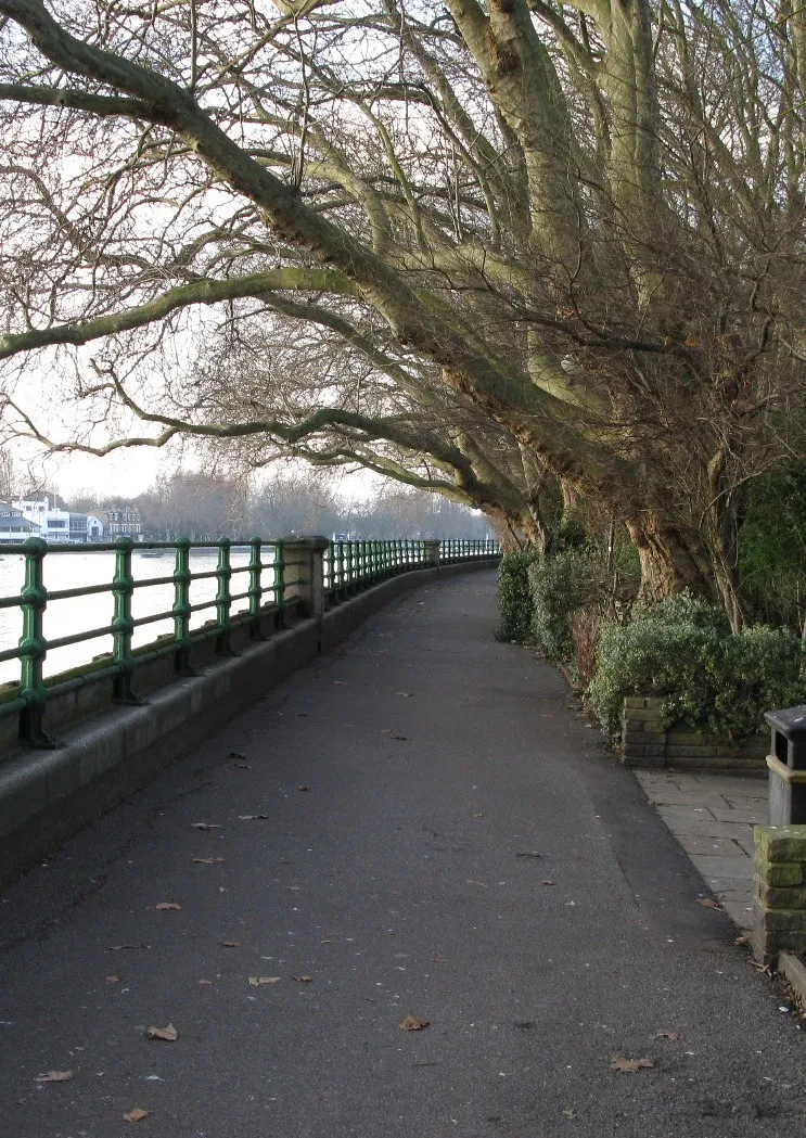
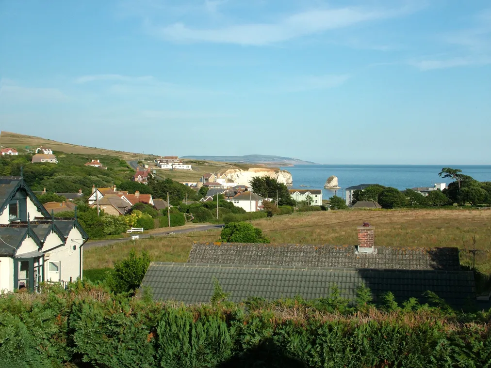
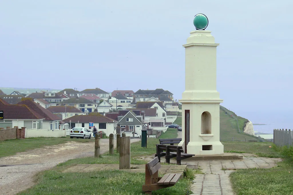
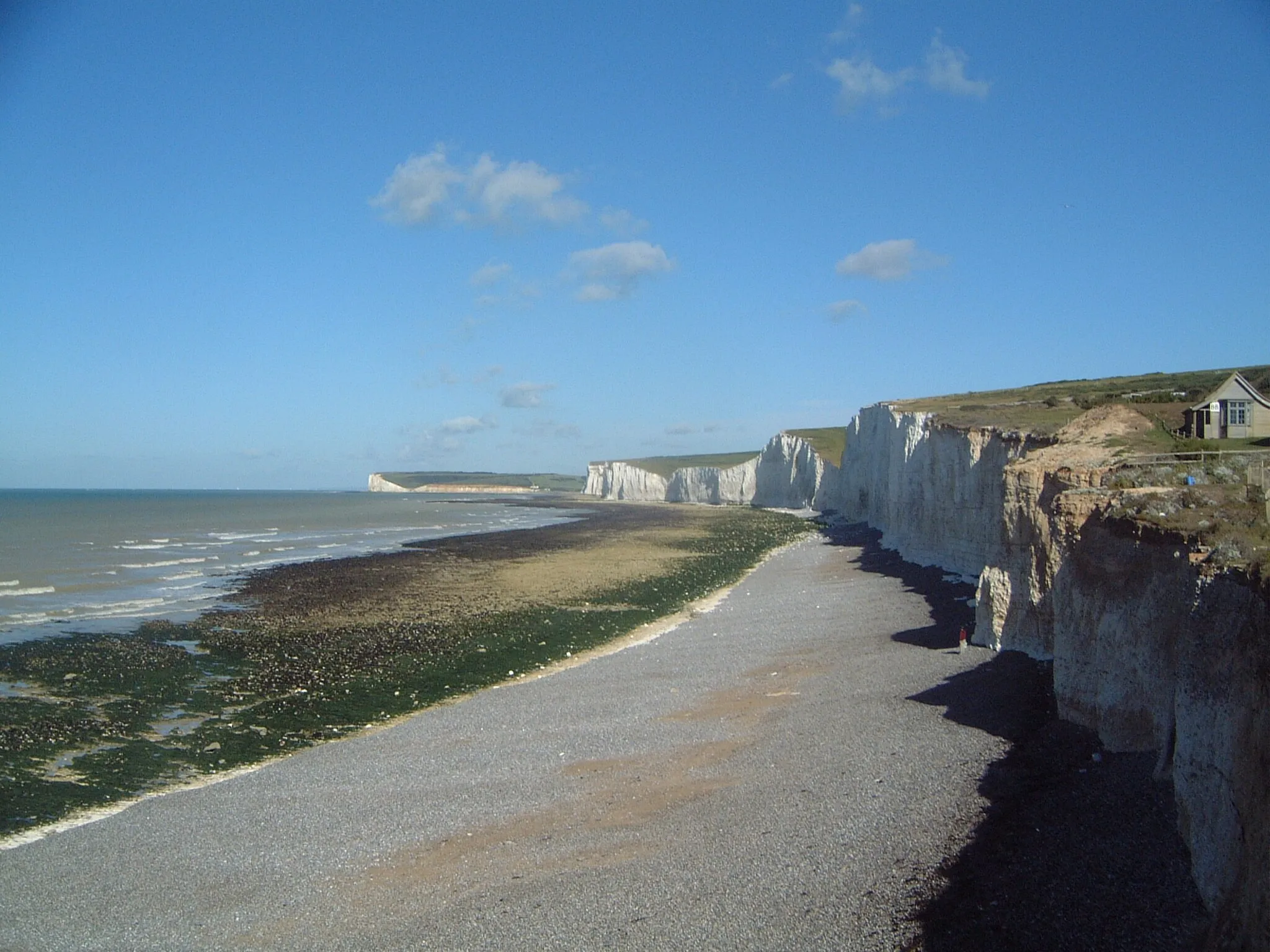
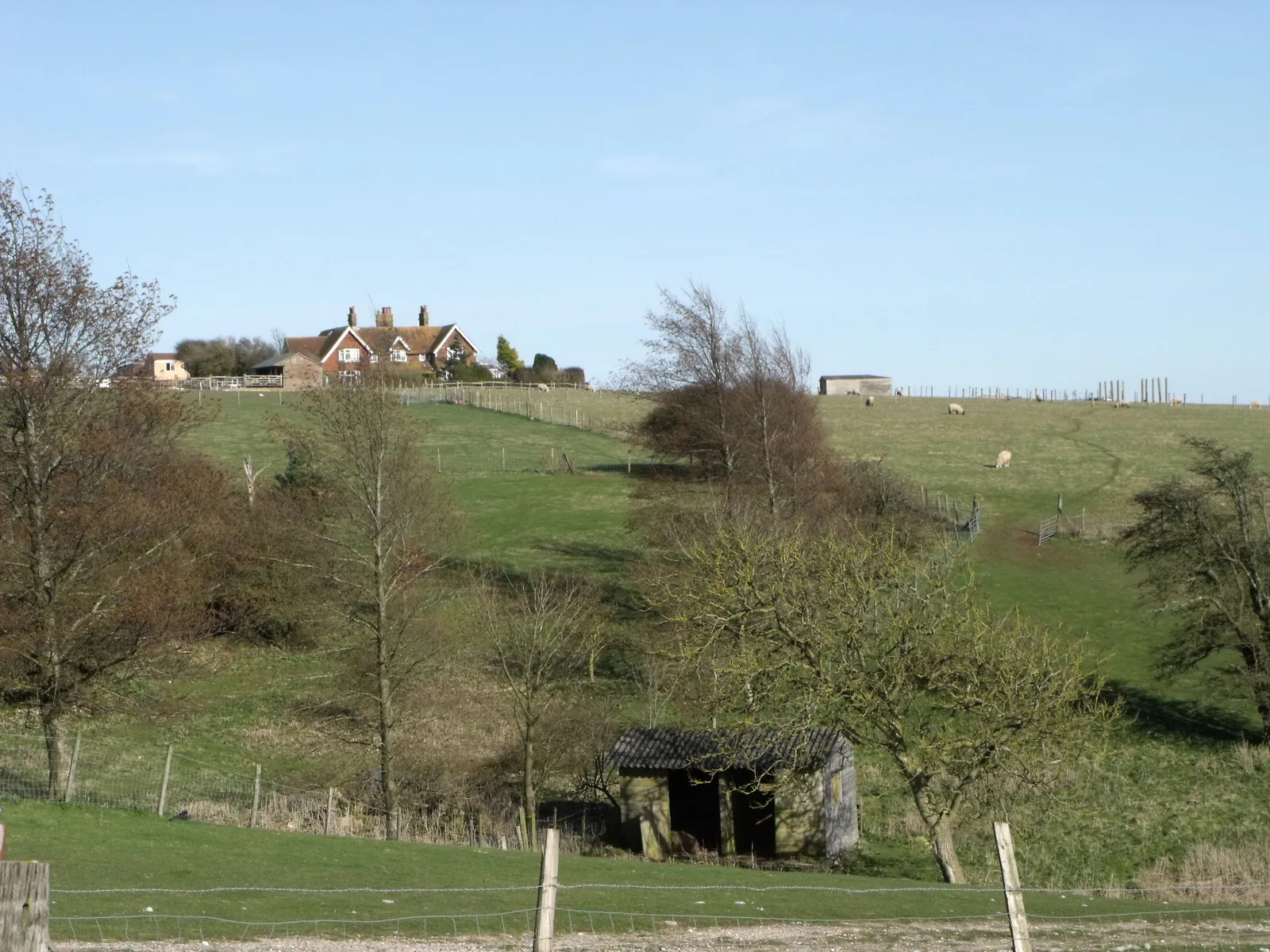
Peacehaven, located in Surrey, East and West Sussex, United Kingdom, is a popular destination for road and gravel cyclists. The locality offers a mix of hilly and flat terrain, catering to different cycling preferences. Peacehaven is surrounded by greenery, with beautiful countryside views and coastal stretches along the English Channel. The popular cycling spots in this area include South Downs National Park, which offers challenging climbs and scenic routes. With its variety of terrain and stunning landscapes, Peacehaven is a must-visit for cyclists seeking diverse cycling experiences.
Cycle through the tranquil countryside in and around Peacehaven
Experience the idyllic countryside surrounding Peacehaven on this 67 km road cycling route. With an ascent of 512 meters, this route offers a moderate challenge for well-trained amateurs. Enjoy the peace and tranquility of the countryside as you pedal through picturesque villages and take in the scenic views of rolling hills.
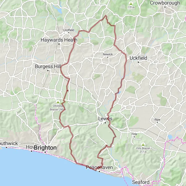
Embark on an epic journey through the South Downs, covering legendary climbs and famous spots.
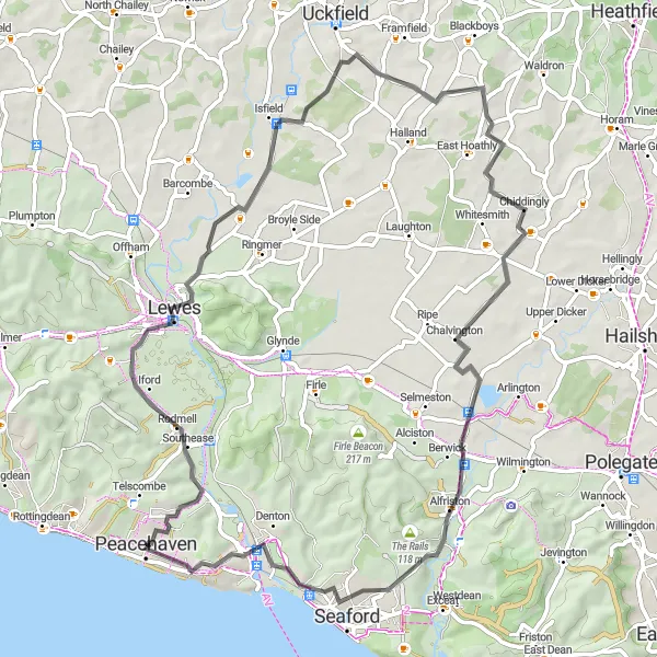
Prepare yourself for an epic 127 km road cycling route near Peacehaven that showcases the stunning beauty of the South Downs region. With a challenging ascent of 1386 meters, this route caters to seasoned cyclists seeking legendary climbs and breathtaking scenery. The highlights along the route include Rodmell at 6 km, home to the famous Monk's House and a favorite spot among literature enthusiasts. Mill Hill at the same distance offers panoramic views and a challenging climb. At 31 km, Maresfield boasts peaceful rural landscapes, while Groombridge at 48 km showcases historic architecture and stunning countryside views. Broad Oak at 81 km rewards cyclists with idyllic village charm. Cowbeech at 91 km adds another legendary climb to your journey. Litlington at 110 km offers a blend of natural beauty and rural tranquility, and the route concludes in Newhaven after 123 km.

Embark on a gravel adventure through Peacehaven's rugged terrain
Get ready for an exciting gravel adventure in Peacehaven. This 48 km route will take you through challenging off-road trails and provide a thrilling experience for gravel enthusiasts. With an ascent of 630 meters, this route offers a moderate challenge that will get your adrenaline pumping. Explore the picturesque landscape of the countryside as you ride through the gravel paths.

Enjoy a scenic gravel exploration through the idyllic countryside near Peacehaven.
This 57 km gravel cycling route near Peacehaven takes you on a picturesque journey through serene countryside. With a total ascent of 759 meters, this route caters to adventurous cyclists looking for a mix of challenges and notable highlights. Telscombe, located just 3 km from the start, provides picturesque coastal views before venturing deeper into the countryside. Beddingham Hill awaits at 10 km, offering an exhilarating uphill climb with rewarding panoramic vistas. Bostal Hill at 16 km will test your off-road skills, while Polegate at 25 km immerses you in the beauty of idyllic rural landscapes. Westdean at 41 km is known for its peaceful charm, and Exceat Hill at the same distance adds an extra challenge to your gravel exploration. Finally, at 48 km, Chailey Heritage Marine Hospital showcases historic architecture surrounded by stunning countryside. The route concludes back in Telscombe after 57 km.
Peacehaven to Rottingdean Loop
Cycle along the stunning coastal road from Peacehaven to Rottingdean
Embark on a scenic route that takes you from Peacehaven to Rottingdean along the beautiful coastal road. This 94 km road cycling route provides breathtaking views of the sea and cliffs, making it a perfect choice for cyclists who enjoy picturesque landscapes. With a total ascent of 813 meters, this route offers a moderate challenge for experienced amateurs.
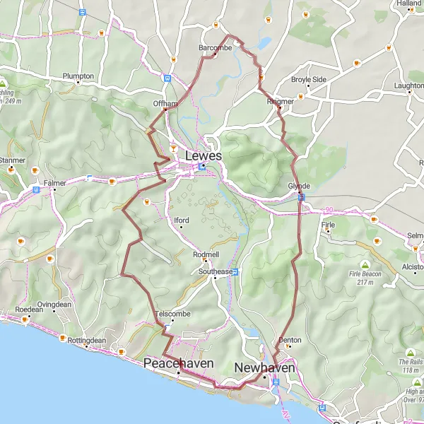
Embark on a thrilling gravel adventure through the picturesque South Downs region.
This round-trip gravel cycling route near Peacehaven is perfect for those seeking an off-road adventure. Covering a distance of 78 km and ascending a total of 902 meters, this route provides a challenging yet rewarding experience. Starting with a visit to Rottingdean, located at just 5 km, you'll enjoy stunning coastal views before venturing into the South Downs. The route features highlights such as Bow Hill at 17 km, offering breathtaking panoramic views of the surrounding countryside, and Wivelsfield at 28 km, known for its peaceful rural atmosphere. Piltdown awaits at 50 km, showcasing picture-perfect English countryside and quaint villages. At 73 km, Mill Hill provides a thrilling off-road ascent, offering unparalleled views of the landscape. Conclude your journey in the charming town of Telscombe after 75 km, where you can relax and reflect on your gravel adventure.
Explore Peacehaven's gravel trails on a thrilling cycling adventure
Embark on an exciting 42 km gravel cycling adventure in Peacehaven. This route takes you through challenging off-road trails and offers a thrilling experience for gravel enthusiasts. With a total ascent of 666 meters, this route provides a moderate challenge that will keep you engaged throughout the ride.
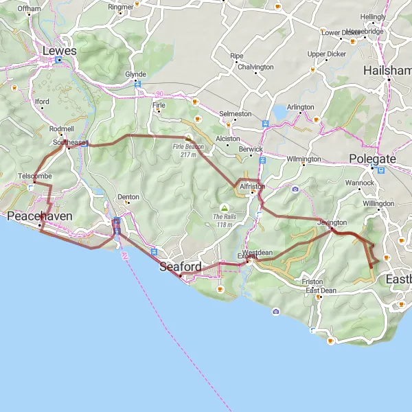
Escape the hustle and bustle and immerse yourself in the wonders of nature on this gravel route near Peacehaven.
Embrace the serenity of nature with this 53 km gravel cycling route near Peacehaven. With a challenging ascent of 940 meters, this route offers a mix of scenic beauty and notable highlights. Begin your journey in Telscombe, which provides picturesque coastal views at just 3 km. Beddingham Hill awaits at 10 km, offering unparalleled panoramic vistas of the surrounding countryside. At 24 km, Jevington showcases idyllic charm, surrounded by rolling hills and stunning landscapes. Westdean at 37 km offers a peaceful escape from the city, while Splash Point at 41 km rewards you with scenic coastal views. Conclude your adventure in the charming town of Newhaven after 47 km, known for its historical significance and maritime heritage.
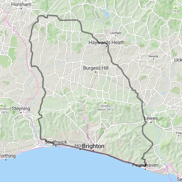
Peacehaven-Wide Route

Embark on a wide-ranging cycling adventure through Peacehaven and its surrounding areas
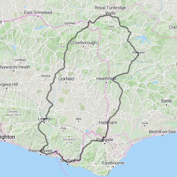
Get ready for an epic 137 km road cycling adventure from Peacehaven. This route will take you on a wide-ranging journey through stunning landscapes and picturesque villages. With a total ascent of 1039 meters, this challenging route is suitable for experienced cyclists who seek legendary climbs and breathtaking experiences.
Coastal and Countryside Delight

Experience the stunning natural beauty of the South Downs combined with picturesque coastal views.
This round-trip cycling route near Peacehaven takes you through a diverse landscape consisting of charming countryside and coastal scenery. With a total distance of 66 km and an elevation gain of 507 meters, this road route offers a challenging yet enjoyable ride for well-trained amateurs. The highlights along the route include the famous Chalk Pit at a distance of 13 km, which provides a unique geological experience, and the historic town of Uckfield at 31 km, known for its rich heritage. Another notable highlight is Halland, located at 37 km, where you can rest and admire the beautiful surroundings. The route concludes in the town of Newhaven after 61 km, where you can explore its harbor and learn about its maritime history.
Cycling routes nearby:

Nearby regions: