Cycling Through the Serene Countryside of Tycroes in West Wales and The Valleys, United Kingdom
Cycling routes from Tycroes
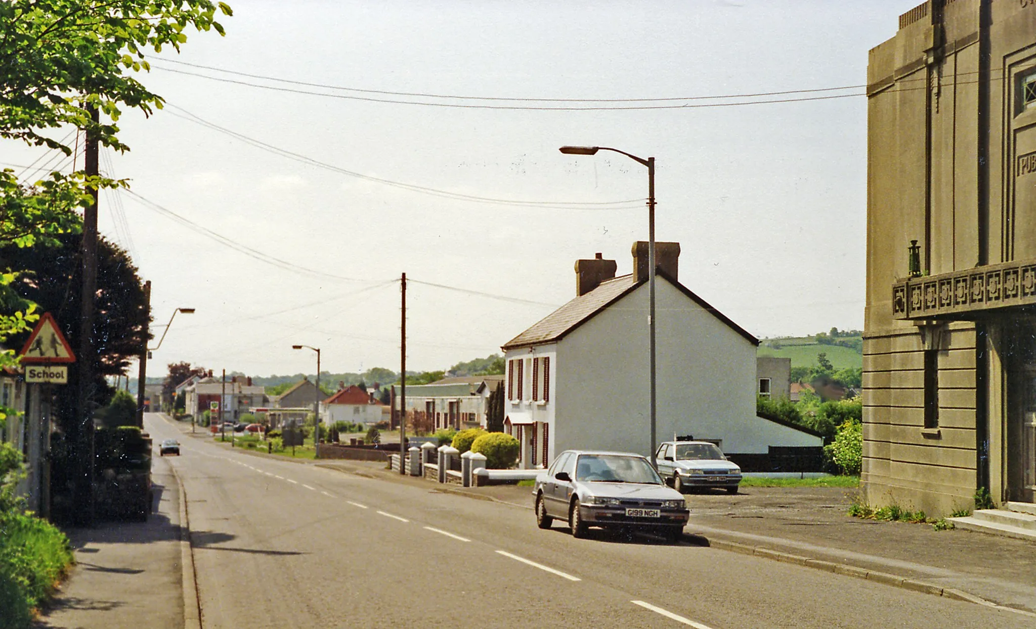
Tycroes, located in West Wales and The Valleys, United Kingdom, offers a serene countryside setting for road and gravel cyclists to enjoy. The quiet country roads are perfect for leisurely rides and allow cyclists to take in the rural charm of the area. Cyclists can venture into the nearby Brecon Beacons National Park, home to picturesque landscapes and challenging climbs. Tycroes is a peaceful destination for cyclists looking to escape the hustle and bustle of city life.
An enchanting ride through Gowerton and Gorseinon
Discover the enchanting beauty of the surroundings near Tycores with this scenic road adventure. Covering a total distance of 91 kilometers and an ascent of 1112 meters, this route takes you through charming villages and offers stunning panoramic views. With a difficulty rating of 3, it is ideal for cyclists with a moderate level of experience seeking a memorable ride.

A thrilling ride through Nantgaredig and Tir-y-dail
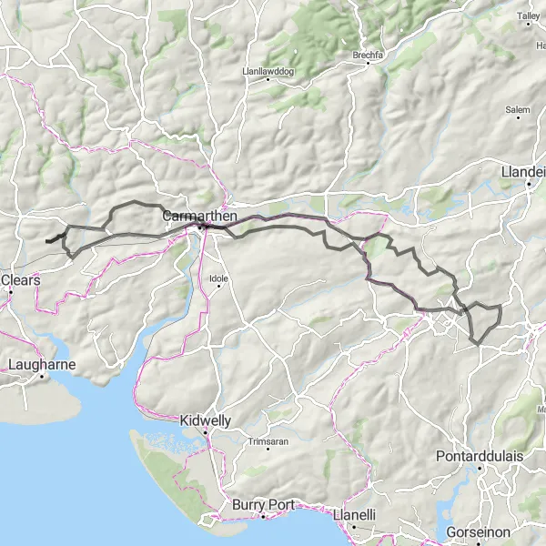
Embark on this challenging road loop starting near Tycroes, covering a total distance of 77 kilometers with an ascent of 1348 meters. This route takes you through the picturesque village of Nantgaredig and offers breathtaking views of the surrounding countryside. The ride is suitable for experienced cyclists seeking a thrilling adventure.
Bird Hide and Waterfalls

An adventurous route through West Wales with stunning waterfalls and a bird hide
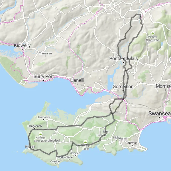
This round-trip cycling route near Tycroes takes you on an exciting adventure through West Wales. With a total distance of 102 km and an ascent of 1376 meters, this route is suitable for well-trained amateur cyclists. The highlights along the way include the Birde Hide, Tir-y-dail, Brynamman, Aberdulais, Moel Y Fen, Goytre, Warren Hill, Felindre, Mynydd Pysgodlyn, and Betws. The entire route provides breathtaking scenery, with picturesque waterfalls and lush green landscapes. Bird watchers will particularly enjoy the bird hide, where they can observe various species in their natural habitat. Tir-y-dail offers panoramic views of the surrounding valleys, while Brynamman boasts historic charm and a beautiful village atmosphere. Aberdulais features a stunning waterfall and historic industrial ruins, providing a unique blend of nature and history. Moel Y Fen offers unparalleled views from its summit, making it a must-see spot. Goytre is known for its picturesque canal and peaceful atmosphere, perfect for a relaxing break during the ride. Warren Hill offers a challenging climb with rewarding views at the top. Felindre and Mynydd Pysgodlyn showcase the raw beauty of the Welsh countryside, with rolling hills and iconic landscapes. Lastly, Betws is a charming village surrounded by untouched nature, offering a true escape from the modern world. Overall, this round-trip cycling route near Tycroes provides a mix of natural beauty, historical landmarks, and serene landscapes, making it an attractive option for both nature lovers and cycling enthusiasts alike.

Explore the picturesque villages of West Wales and immerse yourself in its scenic landscapes
Embark on a cycling adventure near Tycroes that will take you through the stunning landscapes and picturesque villages of West Wales. With a distance of 53 km and an ascent of 799 meters, this road cycling route is suitable for moderately experienced cyclists. The highlights along the way include Bird Hide, Tir-y-dail, Ffairfach, Bethlehem, Pen Rhiw-ddu, and Glanamman. The entire route offers diverse landscapes, from lush green meadows to charming countryside villages. Bird Hide is a tranquil spot along the route, perfect for bird watchers seeking moments of serenity. Tir-y-dail provides panoramic views of the surrounding valleys, offering a chance to fully appreciate the region's natural beauty. Ffairfach and Bethlehem are picturesque villages that exude charm and a sense of tranquility. Pen Rhiw-ddu offers breathtaking views from its summit, rewarding cyclists who tackle its challenging ascent. Glanamman is known for its beautiful landscapes and idyllic surroundings, creating a peaceful ambiance for travelers. Overall, this round-trip cycling route near Tycroes showcases the picturesque villages and scenic landscapes of West Wales, allowing cyclists to immerse themselves in the region's natural beauty and peaceful environment. It is a perfect choice for those seeking a blend of cycling adventure and serene countryside experiences.
Conquering challenging climbs from Betws to Ammanford
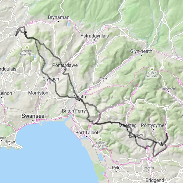
Experience the stunning hills and lush valleys near Tyroes with this epic cycling route. Covering a total distance of 122 kilometers and an ascent of 2449 meters, this challenging ride is ideal for experienced cyclists seeking an intense workout and unforgettable views. Ithholds legendary climbs, including Betws and Moel Troed-Y-Rhiw. Prepare for a thrilling and stunning adventure.
Exploring the scenic route from Pontyberem to Llanfynydd
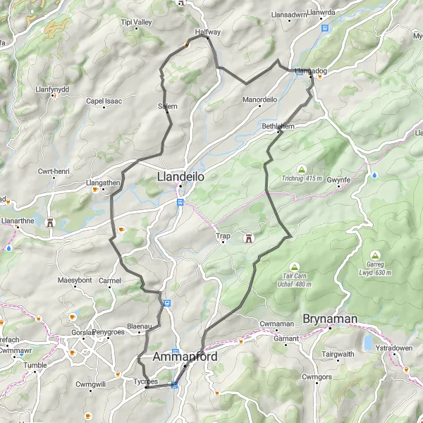
Embark on this road adventure from Tycroes to Llanfynydd, covering a total distance of 95 kilometers with an elevation gain of 1678 meters. Ride through the picturesque town of Pontyberem and enjoy the breathtaking views along the way. This route is perfect for experienced cyclists who are seeking a challenging and scenic ride.
Tycores Circular Road Route
A scenic ride through Capel Hendre and Banc-y-felin
This circular road route starting near Tycroes takes you through stunning landscapes, including the quaint village of Capel Hendre and the picturesque town of Banc-y-felin. With a total distance of 81 kilometers and an ascent of 1151 meters, this route is suitable for intermediate level cyclists. It provides a challenging but rewarding experience.
An exhilarating gravel journey through captivating landscapes
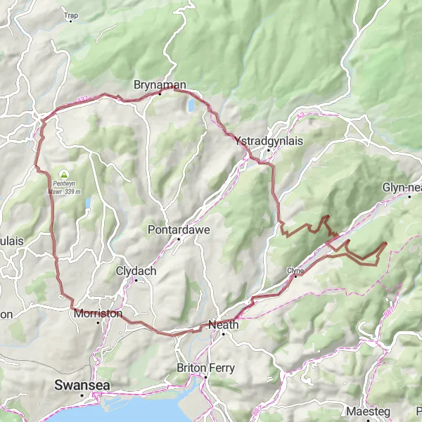
Hop on your trusty gravel bike and embark on an exciting adventure through West Wales. Starting near Tycroes, explore the rugged terrains and discover hidden gems along the route. This 84 km ride offers a challenge with 1430 meters of ascent, guaranteeing an unforgettable off-road experience. Discover the charming village of Betws and revel in the tranquility of Resolven. Boasting a difficulty level of 4 and an epicness rating of 4, this route is perfect for experienced gravel riders seeking an adrenaline-pumping exploit.
Capel Hendre and Back

A scenic road route with a thrilling climb
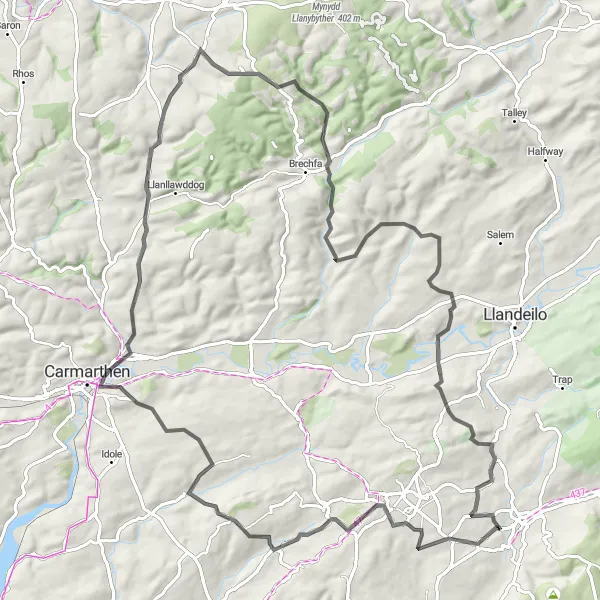
Embark on a picturesque road journey starting near Tycroes, taking you through the charming village of Capel Hendre. Enjoy the stunning landscapes and challenging terrain as you navigate through beautiful West Wales. Marvel at the splendor of Brechfa Forest and the majestic Mynydd Figyn. This adventure covers a distance of 69 km with an ascent of 1101 meters, providing a thrilling and fulfilling experience for cyclists of intermediate to advanced endurance levels with a taste for natural beauty.
Quiet roads and beautiful views
The Tycroes Loop is a scenic route starting near Tycroes in West Wales and The Valleys. This route offers quiet roads with minimal traffic and beautiful views of the surrounding countryside. It is suitable for road biking enthusiasts. The route covers a distance of 62 km with an ascent of 1109 meters.
Cycling routes nearby:


Nearby regions: