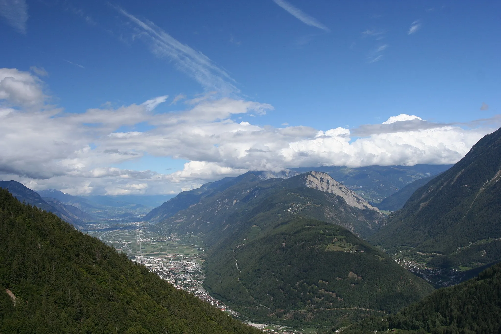
Pokojná cyklistická atmosféra v Provensalských krajinách
Cyklotrasy od Villelaure
Villelaure je malebná lokalita v regióne Provence-Alpes-Côte d’Azur vo Francúzsku. Cyklisti si tu môžu užiť krásne cesty a scenériu južného Francúzska. Okolie je vhodné pre cykloturistiku a ponúka množstvo možností na výlety po okolitých viniciach a dedinkách.
Explore picturesque villages and stunning landscapes on this challenging gravel route
This 109 km gravel route takes you through charming villages like Saint-Martin-de-la-Brasque and Manosque, with a total ascent of 1538m. Enjoy the beautiful views and peaceful surroundings along the way.
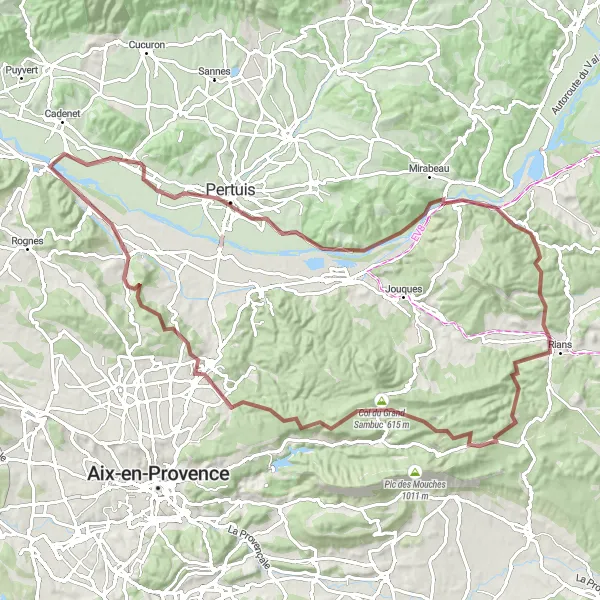
Explore the natural beauty and charming villages of the Provence countryside on this 98 km gravel route
With a total ascent of 1163m, this route takes you through picturesque villages like Pertuis, Rians, and Venelles. Enjoy the peaceful surroundings and stunning views as you cycle through the rolling hills and vineyards of the region.
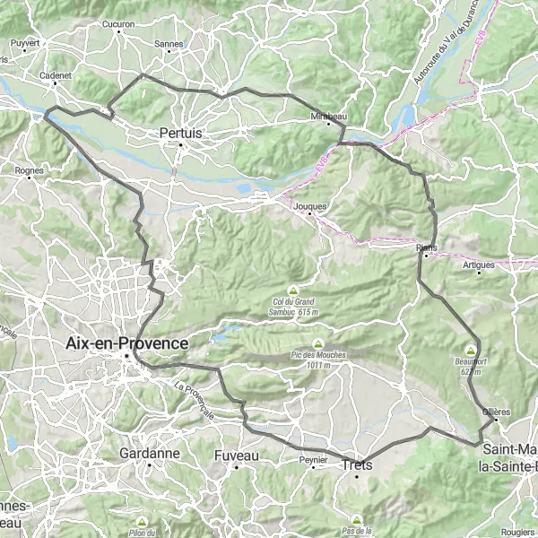
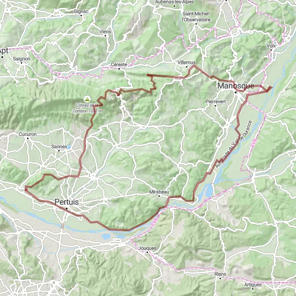
Náročná 134 km cesta s 1392 m prevýšením prevedie okolo historických miest ako La Tour-d'Aigues a Rians.
Táto trasa je vyžadujúca, no odmení vás krásnymi výhľadmi na Provensálsko a historické pamiatky. S prevýšením 1392 m môžete očakávať náročnú výzvu, ale aj možnosť ochutnať miestne gastronomické špeciality.
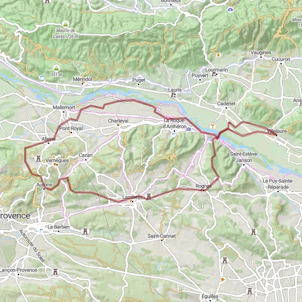
Náročná 69 km trasa s 565 m prevýšením vás prevedie okolo Rognes, La Baume až do Villelaure.
Táto trasa je vhodná pre zdatných cyklistov, ktorí si chcú užiť prírodu a malebné dedinky po ceste. S prevýšením 565 m ponúka náročnú výzvu, ale zároveň aj krásne výhľady a typickú provensálsku atmosféru.

Experience the rugged beauty of the Provence countryside on this 95 km gravel route
With a total ascent of 2588m, this challenging route takes you through picturesque villages like Vaugines, Saignon, and Viens. Enjoy the stunning views and test your cycling skills on the hilly terrain.
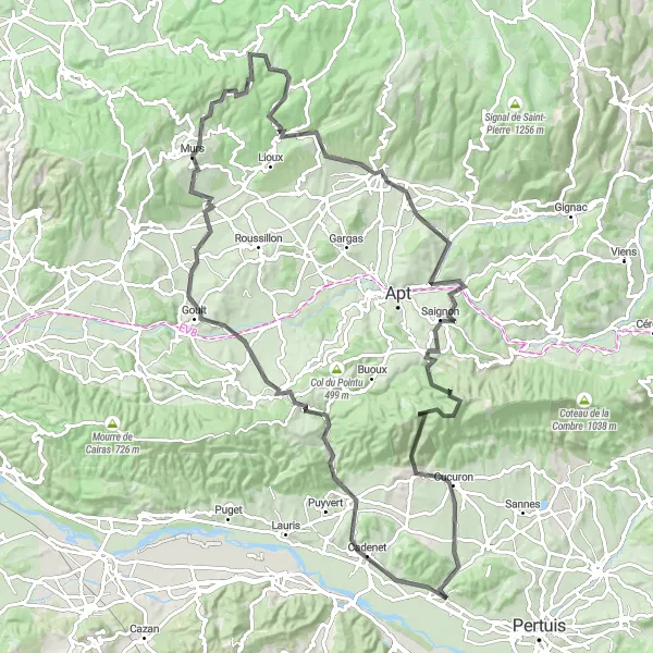
Zážitok z histórie a prírody
Táto 81-kilometrová cesta s prevýšením 1134 metrov ponúka úžasné výhľady na Cadenet a Buoux. Vychutnajte si scenériu a históriu na ceste plnej prírodných krás.
Historické poklady Provensálska
S prevýšením 2139 metrov a vzdialenosťou 112 kilometrov je táto trasa plná historických miest a úchvatných výhľadov. Prejdite cez Goult a Saignon a objavte poklady minulosti a prírody Provence.
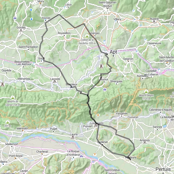
Villelaure to Cadenet extended loop
Scenic road cycling route with challenging climbs and stunning views
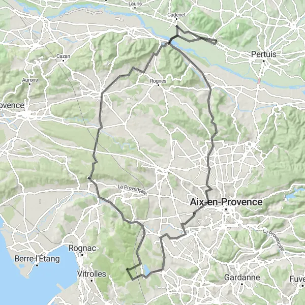
Experience the beauty of Provence on this 102 km route from Villelaure to Cadenet, passing by highlights such as Saint-Estève-Janson, Jas de Bouffan, and Coudoux. Enjoy the diverse landscapes, from rolling hills and vineyards to rocky outcrops and lush valleys, with some steep ascents and thrilling descents along the way. This route offers a mix of natural wonders and cultural treasures, making it a memorable cycling adventure for enthusiasts of all levels.
Short road cycling route exploring medieval villages and historical sites
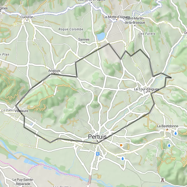
Embark on a leisurely ride from Ansouis to Château de la reine Laure, passing by highlights such as La Tour-d'Aigues and Tour Saint-Jacques. This 34 km route offers a glimpse into Provence's rich history and architectural heritage, with charming villages and ancient landmarks along the way. Enjoy the peaceful countryside, rolling hills, and vineyards that make this route a delightful choice for a relaxing cycle.
Villelaure to Cucuron gravel loop
Challenging gravel cycling route through scenic countryside and picturesque villages
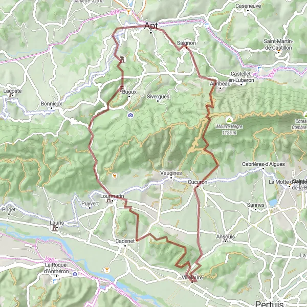
Embark on an adventurous gravel ride from Villelaure to Cucuron, passing by highlights such as Lourmarin and Apt. This 60 km route offers a mix of off-road trails, rocky paths, and challenging climbs, providing a thrilling experience for gravel cycling enthusiasts. Enjoy the rugged beauty of the Luberon Regional Park, with its diverse landscapes and stunning views, making this route a must-do for those seeking an adrenaline-fueled cycling adventure.
Cyklistické trasy v okolí:
Blízke regióny: