![Cover image](https://images.tarmacs.app/cycling-routes/covers/france/rhone-alpes/fontaines-saint-martin-2.webp)
Pokojné výlety na bicykli
Cyklotrasy od Fontaines-Saint-Martin
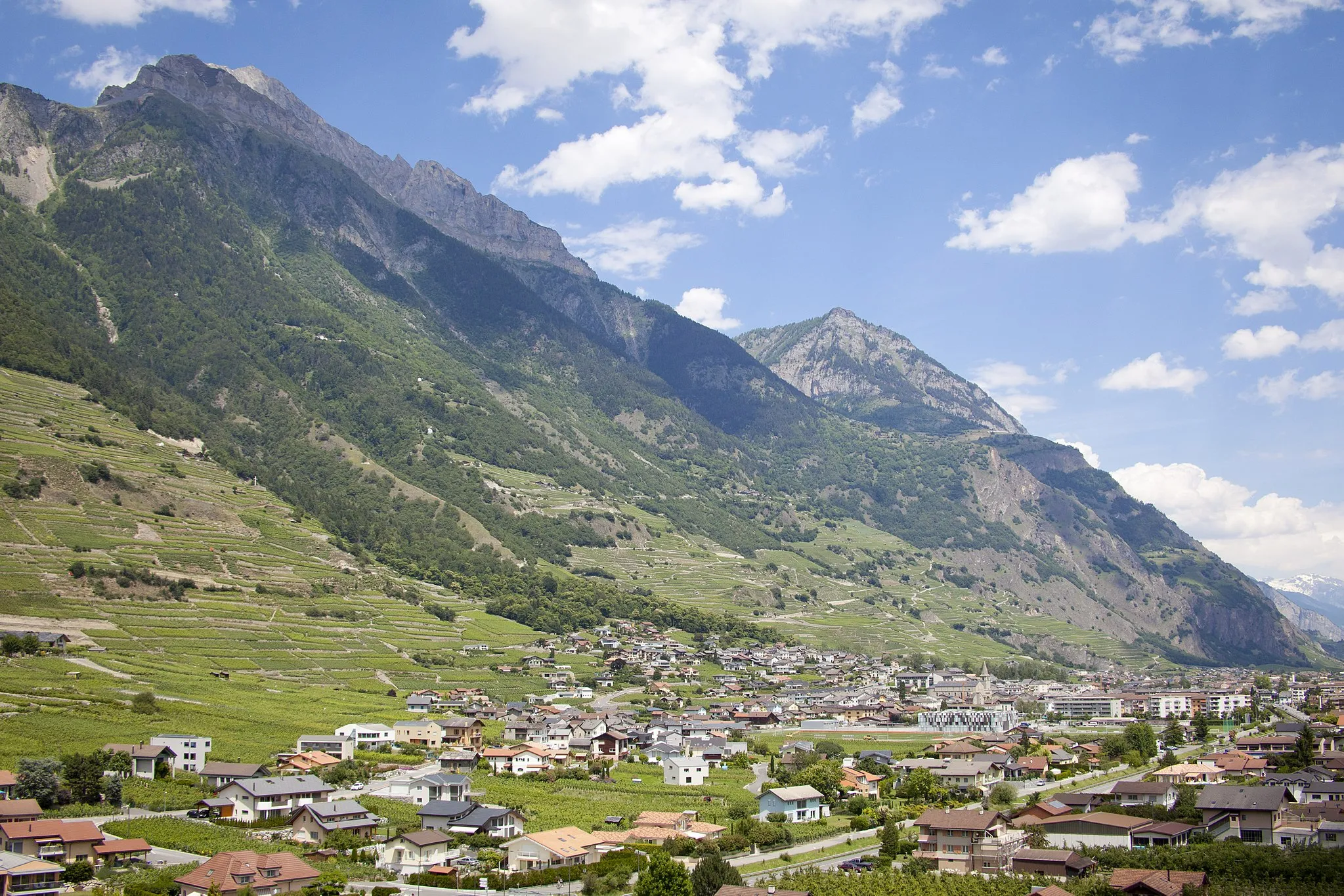
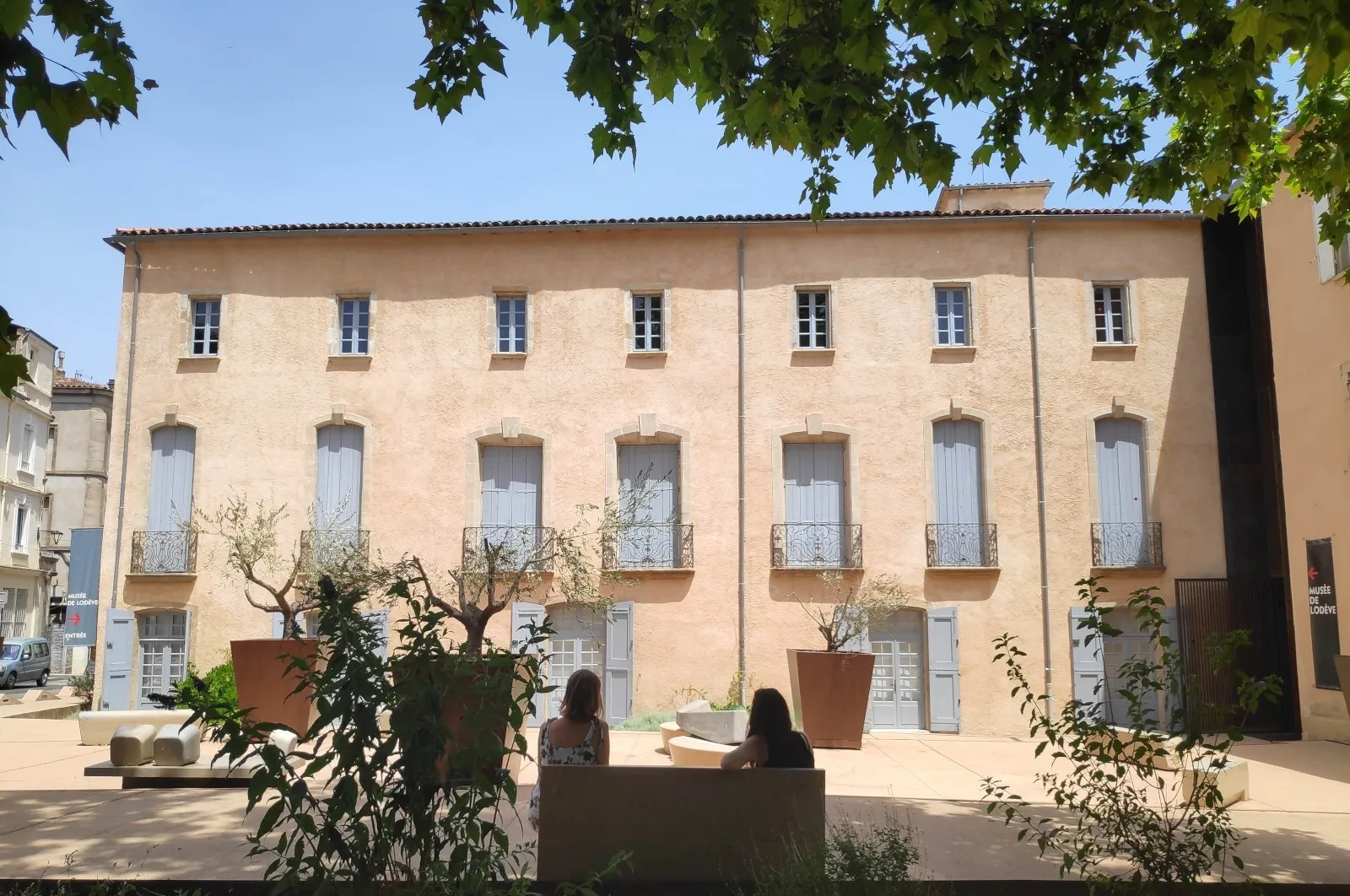
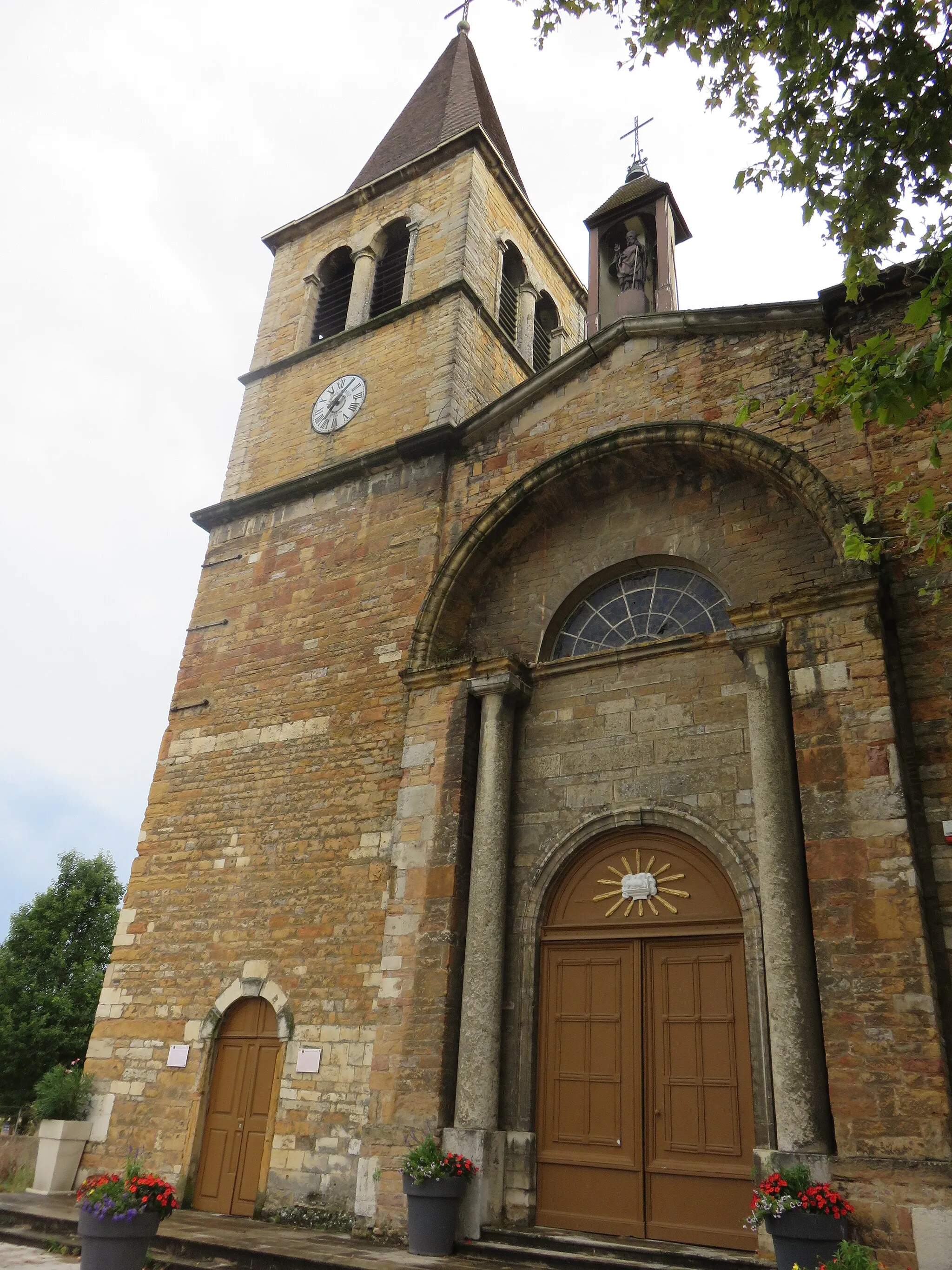
Fontaines-Saint-Martin je malá lokalita v regióne Rhône-Alpes vo Francúzsku. Pre cyklistov nie je veľmi atraktívna, ale ponúka možnosti na pokojné výlety.
![Mapa miniatúra "Road Cycling Adventure in Rhône-Alpes" cyklistická inšpirácia v Rhône-Alpes, France. Vygenerované cyklistickým plánovačom trás Tarmacs.app](https://images.tarmacs.app/cycling-routes/routemaps/600/france/rhone-alpes/fontaines-saint-martin/road/28780.webp)
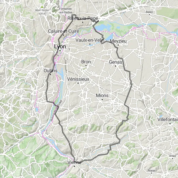
Epic road cycling journey covering 113 km with challenging ascents
Embark on a thrilling road cycling adventure through the scenic landscapes of Rhône-Alpes, passing by numerous charming towns and villages. With a total ascent of 589 meters, this route offers a mix of challenging climbs and exhilarating descents.
Road to Esplanade
![Mapa miniatúra "Road to Esplanade" cyklistická inšpirácia v Rhône-Alpes, France. Vygenerované cyklistickým plánovačom trás Tarmacs.app](https://images.tarmacs.app/cycling-routes/routemaps/600/france/rhone-alpes/fontaines-saint-martin/road/28778.webp)
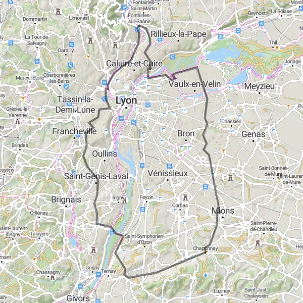
Embark on a road cycling journey to discover hidden gems along the way
This road route will take you through Fontaines-sur-Saône, Vaulx-en-Velin, and Saint-Priest, offering a mix of urban and rural landscapes. As you approach Collonges-au-Mont-d'Or, be prepared for stunning views of the Monts d'Or mountain range.
![Mapa miniatúra "Scenic Road Cycling Route near Fontaines-Saint-Martin" cyklistická inšpirácia v Rhône-Alpes, France. Vygenerované cyklistickým plánovačom trás Tarmacs.app](https://images.tarmacs.app/cycling-routes/routemaps/600/france/rhone-alpes/fontaines-saint-martin/road/28775.webp)
Picturesque road cycling route covering 79 km with moderate ascents
Discover the beauty of the Rhône-Alpes region on this 79 km road cycling route near Fontaines-Saint-Martin. With a total ascent of 584 meters, you'll pass through charming villages like Pizay, Jons, and Neyron, enjoying the stunning scenery along the way.
![Mapa miniatúra "Okružný cyklistický výlet z Fontaines-Saint-Martin" cyklistická inšpirácia v Rhône-Alpes, France. Vygenerované cyklistickým plánovačom trás Tarmacs.app](https://images.tarmacs.app/cycling-routes/routemaps/600/france/rhone-alpes/fontaines-saint-martin/road/28768.webp)
Kombinuje náročné stúpanie s krásnymi výhľadmi na okolité dediny a mestá
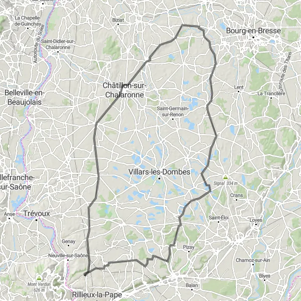
Tento cyklistický okruh ponúka 104 km adrenalínu pre cestné cyklisty, ktorí sa vyrovnajú s viac ako 1000 m prevýšením. Cestou z Fontaines-Saint-Martin na stretnutie s krásnymi miestami ako Décines-Charpieu, Vienne a Lyon. Trasa vedie cez úchvatné miesta, kde si môžete oddýchnuť a obdivovať okolitú prírodu.
![Mapa miniatúra "Gravel Tour around Fontaines-Saint-Martin" cyklistická inšpirácia v Rhône-Alpes, France. Vygenerované cyklistickým plánovačom trás Tarmacs.app](https://images.tarmacs.app/cycling-routes/routemaps/600/france/rhone-alpes/fontaines-saint-martin/gravel/28779.webp)
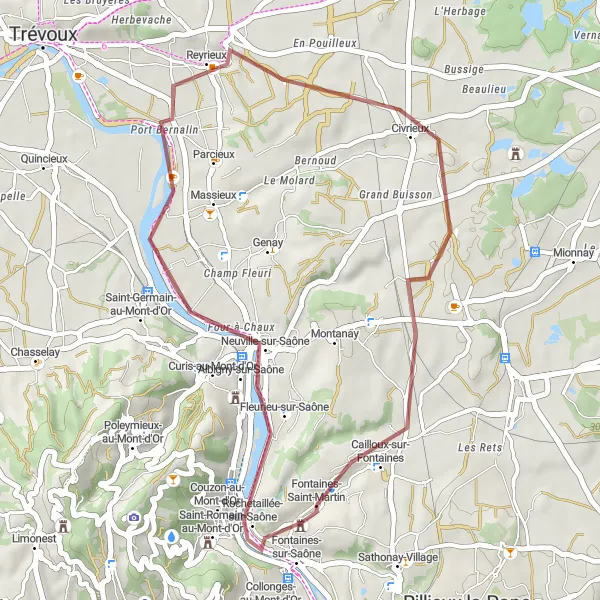
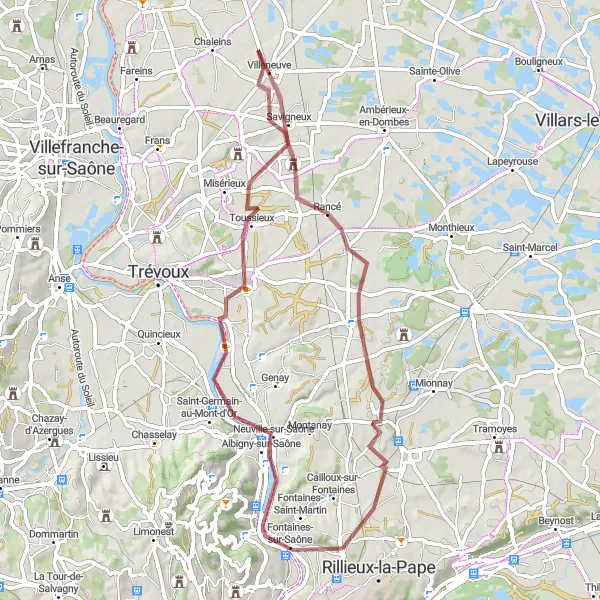
Scenic gravel route with gentle ascents and a total distance of 32 km
Explore the picturesque countryside near Fontaines-Saint-Martin on this 32 km gravel route, passing through charming villages like Albigny-sur-Saône and Reyrieux. Enjoy the peaceful surroundings and the stunning views along the way.
![Mapa miniatúra "Gravel Tour de Lyon" cyklistická inšpirácia v Rhône-Alpes, France. Vygenerované cyklistickým plánovačom trás Tarmacs.app](https://images.tarmacs.app/cycling-routes/routemaps/600/france/rhone-alpes/fontaines-saint-martin/gravel/28770.webp)
Explore the outskirts of Lyon on this gravel adventure
This route takes you through various towns like Givors and Saint-Genis-Laval, showcasing the diversity of the Rhône-Alpes region. The highlight is reaching Lyon, where you can experience the bustling city life before heading back.
![Mapa miniatúra "Cestný okružný cyklistický výlet od Fontaines-Saint-Martin" cyklistická inšpirácia v Rhône-Alpes, France. Vygenerované cyklistickým plánovačom trás Tarmacs.app](https://images.tarmacs.app/cycling-routes/routemaps/600/france/rhone-alpes/fontaines-saint-martin/road/28773.webp)
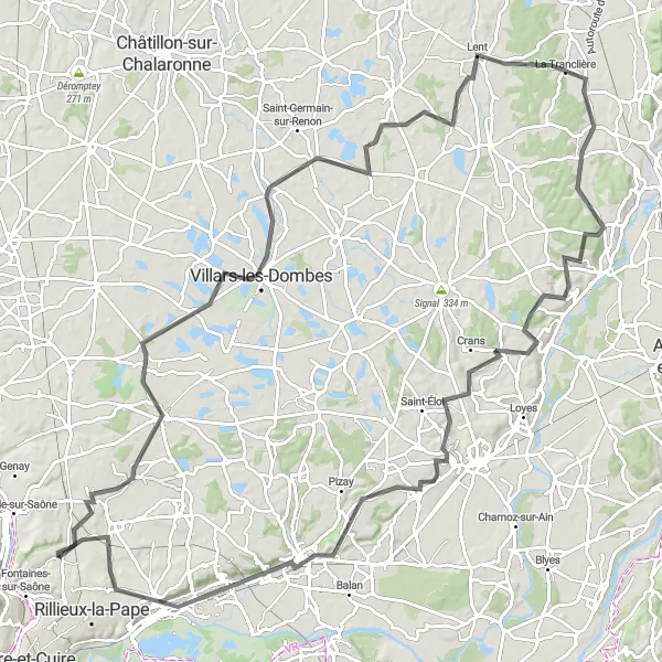
Ideálny výlet pre stredne pokročilých cyklistov, ktorí chcú preskúmať krásy prírody a dedín v okolí
Tento okruh ponúka 125 km výzvy pre cestných cyklistov s prevýšením 664 m. Preskúmajte malebné dedinky ako Saint-André-de-Corcy, La Boisse a Cailloux-sur-Fontaines. Trasa je plná krásnych miest, kde si môžete vychutnať atmosféru miestneho vidieka a oddýchnuť si od cyklistického úsilia.
![Mapa miniatúra "Scenic Route to Mionnay" cyklistická inšpirácia v Rhône-Alpes, France. Vygenerované cyklistickým plánovačom trás Tarmacs.app](https://images.tarmacs.app/cycling-routes/routemaps/600/france/rhone-alpes/fontaines-saint-martin/gravel/28789.webp)
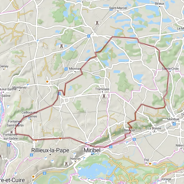
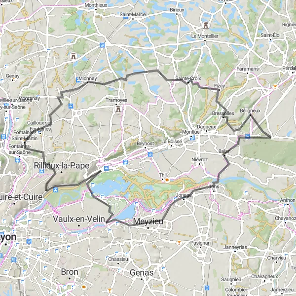
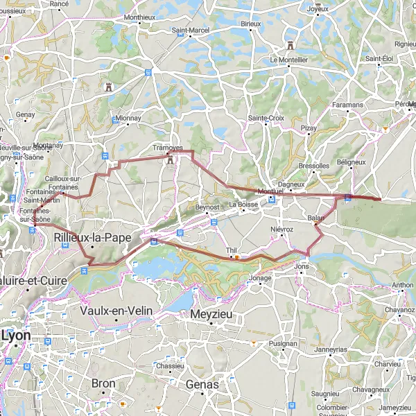
Discover the beauty of the Rhône-Alpes region on this gravel cycling adventure
This gravel route will take you through Mionnay, Cordieux, and Beynost, offering a mix of rolling hills and lush greenery. The highlight of this route is passing through Fontaines-sur-Saône, a charming town with historic architecture and cozy cafes.
Gravel Castle Adventure
![Mapa miniatúra "Gravel Castle Adventure" cyklistická inšpirácia v Rhône-Alpes, France. Vygenerované cyklistickým plánovačom trás Tarmacs.app](https://images.tarmacs.app/cycling-routes/routemaps/600/france/rhone-alpes/fontaines-saint-martin/gravel/28800.webp)
Cycle through scenic routes to reach the magnificent Château de Juis
This gravel route will take you through Albigny-sur-Saône, Reyrieux, and Civrieux, offering a mix of natural beauty and historical sites. The highlight of this route is reaching the Château de Juis, a stunning castle with panoramic views of the surrounding countryside.
![Mapa miniatúra "Exploration of Gravel Paths in Rhône-Alpes" cyklistická inšpirácia v Rhône-Alpes, France. Vygenerované cyklistickým plánovačom trás Tarmacs.app](https://images.tarmacs.app/cycling-routes/routemaps/600/france/rhone-alpes/fontaines-saint-martin/gravel/28755.webp)
Exciting gravel cycling adventure covering 62 km with varied terrain
Embark on an exciting gravel cycling journey through the diverse landscapes of Rhône-Alpes on this 62 km route. With a total ascent of 342 meters, you'll pass by panoramic viewpoints, charming villages, and lush greenery along the way, providing a truly immersive cycling experience.
Cyklistické trasy v okolí:
Blízke regióny:
![Obrázok Région lémanique](https://images.tarmacs.app/cycling-routes/covers/switzerland/region-lemanique/fully-4.webp)
![Obrázok Espace Mittelland](https://images.tarmacs.app/cycling-routes/covers/switzerland/espace-mittelland/gstaad-2.webp)
![Obrázok Bourgogne](https://images.tarmacs.app/cycling-routes/covers/france/bourgogne/urzy-3.webp)
![Obrázok Franche-Comté](https://images.tarmacs.app/cycling-routes/covers/france/franche-comte/bart-5.webp)
![Obrázok Languedoc-Roussillon](https://images.tarmacs.app/cycling-routes/covers/france/languedoc-roussillon/lodeve-1.webp)
![Obrázok Auvergne](https://images.tarmacs.app/cycling-routes/covers/france/auvergne/le-monastier-sur-gazeille-1.webp)
![Obrázok Provence-Alpes-Côte d’Azur](https://images.tarmacs.app/cycling-routes/covers/france/provence-alpes-cote-dazur/rognonas-4.webp)
![Obrázok Piemonte](https://images.tarmacs.app/cycling-routes/covers/italy/piemonte/silvano-d-orba-3.webp)
![Obrázok Valle d’Aosta/Vallée d’Aoste](https://images.tarmacs.app/cycling-routes/covers/italy/valle-daosta-vallee-daoste/saint-vincent-1.webp)