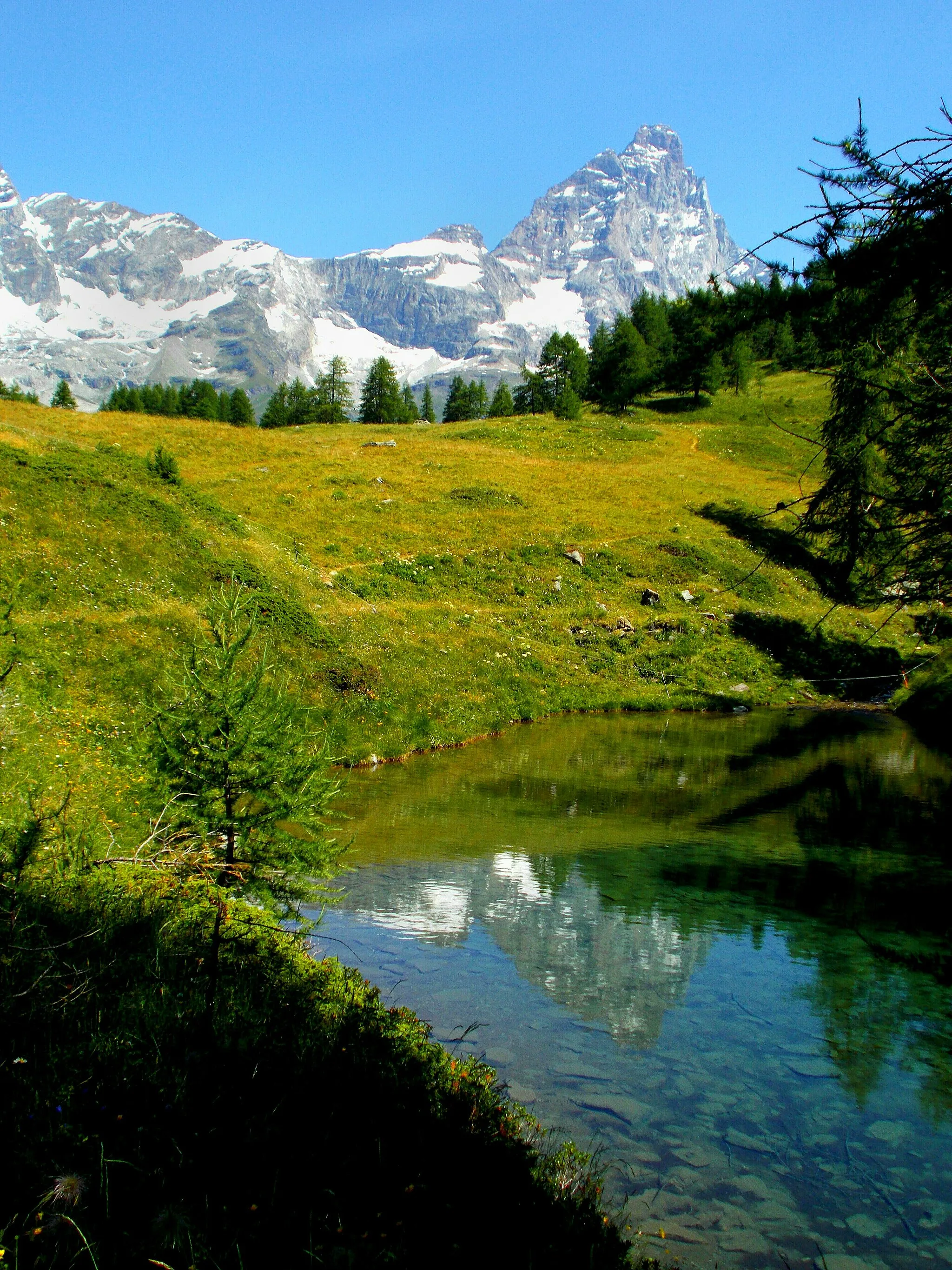
Tranquil gravel cycling in the lush forests and rolling hills of Lentilly.
Cyklotrasy od Lentilly
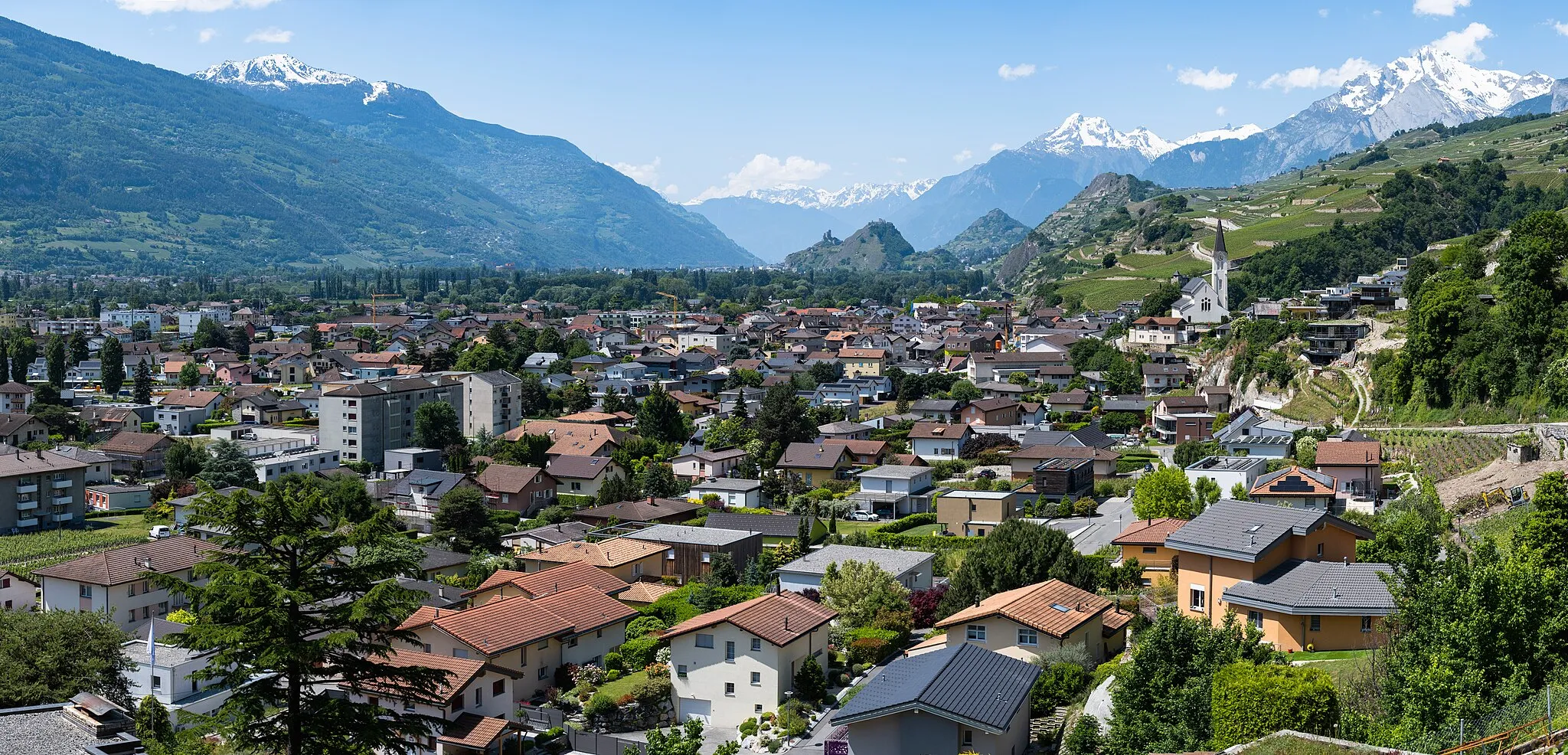
Lentilly is a peaceful locality surrounded by lush forests and rolling hills, making it a great destination for gravel cyclists. The area offers a variety of off-road trails and quiet country roads to explore, with stunning views of the French countryside. Cyclists can enjoy a mix of challenging climbs and relaxing descents in Lentilly.
Rozšírte svoje obzory počas tejto dlhej cyklotrasy plnej kontrastov
Táto okružná trasa vám ponúka všetko, čo by ste si mohli priate počas cyklovýletu - od malebných dediniek až po úchvatné panoramatické výhľady. Zastavte sa v miestach ako Toussieux alebo Dardilly a objavte krásu okolitého vidieka.
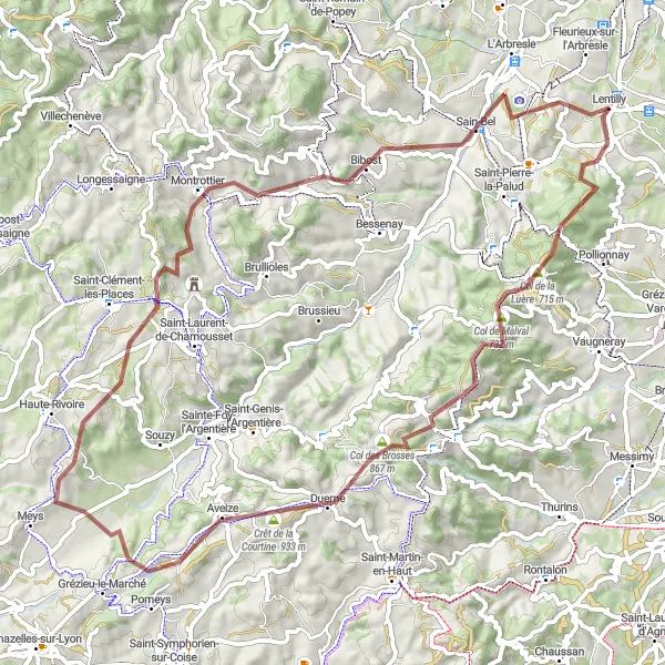
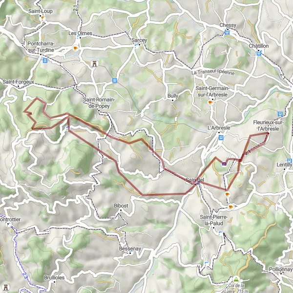
Explore the rugged terrain from Lentilly to Sain-Bel
This 71km gravel route offers a challenging ascent of 1753m, passing through picturesque villages like Aveize and Montrottier. Enjoy the scenic views and the remote nature of the landscape.
Cyklotúra okolo Lentilly
Prejdite 74 km trasou plnou malebných dediniek a nádherných výhľadov
Táto cyklotúra vás prevedie cez krásnu prírodu a typické francúzske dedinky. S prevýšením 1351 m a vzdialenosťou 74 km sa môžete tešiť na prekrásne výhľady a historické miesta. Okrem toho si môžete užiť pohodlnú jazdu po cestách alebo štrkových cestách podľa vašich preferencií.
Pokojná cyklistická trasa s historickými pokladmi
Táto 41 km dlhá trasa v okolí Lentilly vás prevedie krásnymi vinicami a dedinkami so zachovanou atmosférou minulých čias. Počas cesty budete mať možnosť ochutnať miestne vína a objavovať historické pamiatky.
Gravel Lozanne - La Tour-de-Salvagny
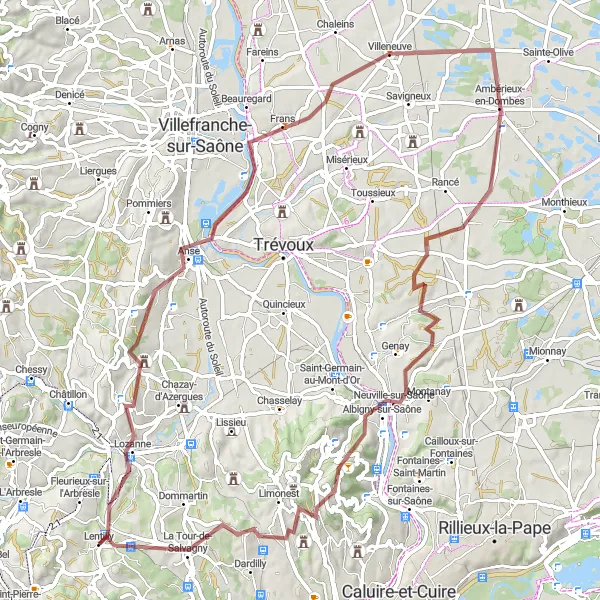
Príjemná cyklistická trasa s množstvom prírodných výhľadov
Táto 80 km dlhá trasa okolo Lentilly je ideálna pre milovníkov prírody a pekných výhľadov. Počas cesty budete môcť obdivovať krásne dedinky ako Lozanne či Neuville-sur-Saône.
Preskúmajte Rhône-Alpes počas tejto adrenalínovej jazdy
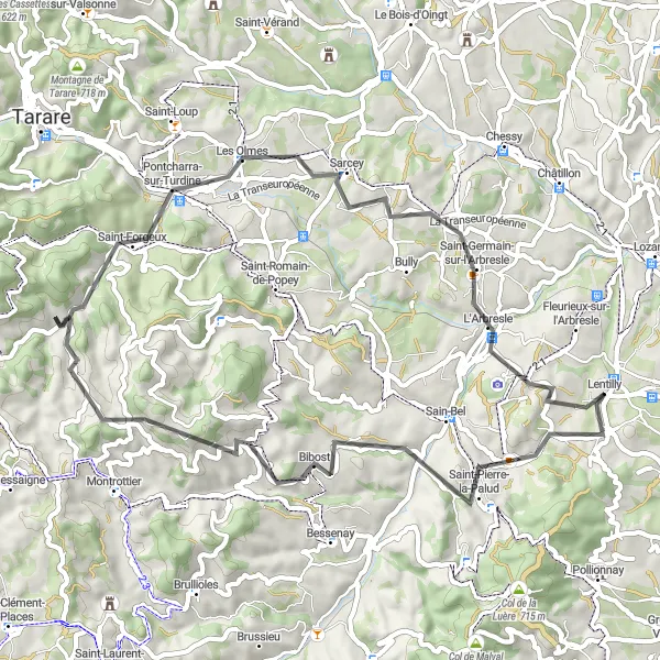
Táto okružná cyklotrasa vás zavedie cez náročné úseky a malebné dedinky ako Bessenay či Saint-Germain-sur-l'Arbresle. Nezabudnite si pozrieť krásne výhľady v Crêt Pélerat alebo vo Fleurieux-sur-l'Arbresle počas vašej cyklistickej výzvy.
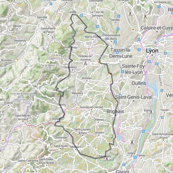
Road Lentilly - Courzieu
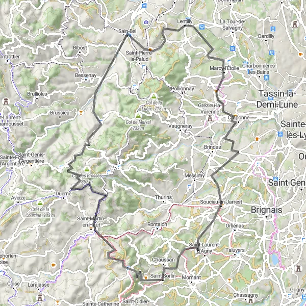
Embark on a road cycling journey from Lentilly to Courzieu
This 81km road route features a challenging ascent of 1399m, passing through historic towns like Craponne and Saint-Martin-en-Haut. Enjoy the smooth roads and the scenic countryside views along the way, with plenty of opportunities for rest and relaxation.
Road Saint-Pierre-la-Palud - L'Arbresle
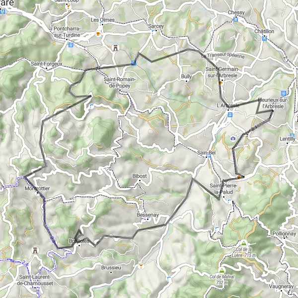
Adrenalínová cesta pre cyklistov s chuťou na dobrodružstvo
Táto 56 km dlhá trasa v okolí Lentilly je plná náročných stúpaní a rýchlych zjazdov. Počas cesty si užijete nádherné výhľady na okolitú prírodu a historické pamiatky.
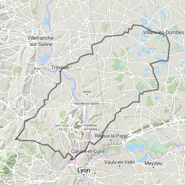
Road Lentilly - Dardilly
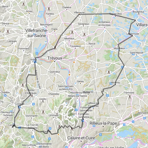
Embark on a scenic road trip from Lentilly to Dardilly
This 94km road route features a moderate ascent of 698m, passing through quaint towns like Saint-Didier-de-Formans and Collonges-au-Mont-d'Or. Enjoy the smooth roads and the idyllic countryside views along the way.
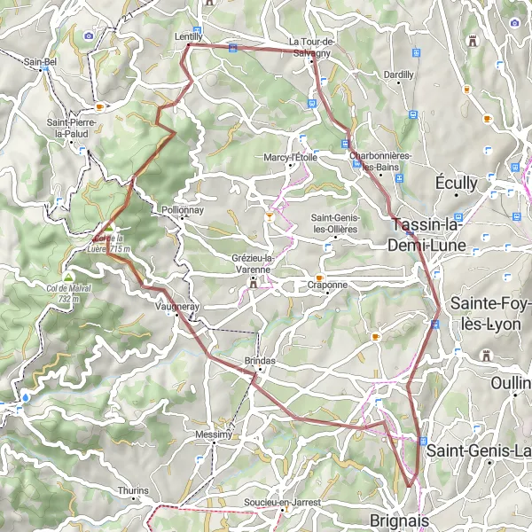
Venture into the wild on a gravel adventure from Lentilly to Charbonnières-les-Bains
This 47km gravel route offers an ascent of 896m, passing through scenic spots like Chaponost and Col de la Luère. Experience the thrill of off-road cycling and immerse yourself in the untouched nature of the region.
Cyklistické trasy v okolí:
Blízke regióny: