![Cover image](https://images.tarmacs.app/cycling-routes/covers/france/rhone-alpes/val-d-isere-4.webp)
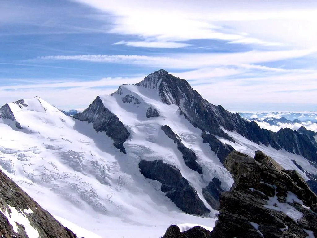
Slávna lokalita pre horskú cyklistiku v Alpách.
Cyklotrasy od Val-d'Isère
Val-d'Isère je známe ako východisko pre cyklistov hľadajúcich výzvy horských stúpaní a technických zjazdov. Okolité hory ponúkajú nádherné výhľady a možnosti pre skúsených jazdcov.
![Mapa miniatúra "Okružní cesta kolem Sainte-Foy-Tarentaise" cyklistická inšpirácia v Rhône-Alpes, France. Vygenerované cyklistickým plánovačom trás Tarmacs.app](https://images.tarmacs.app/cycling-routes/routemaps/600/france/rhone-alpes/val-d-isere/road/65763.webp)
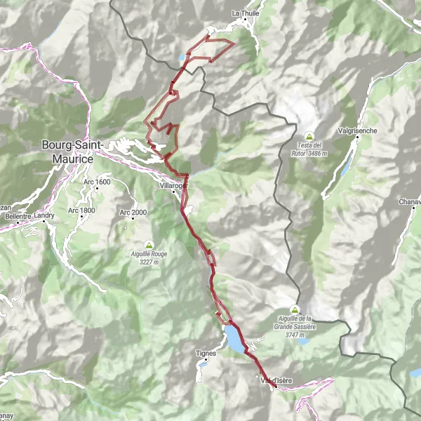
Nádherná trasa s horskými průsmyky a malebnými vesničkami
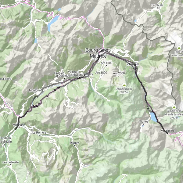
S převýšením 3555 metrů a délkou 102 km tato trasa nabízí skvělé možnosti pro cyklisty všech úrovní. Projedete kolem La Reculaz, Villaroger a Bourg-Saint-Maurice až se dostanete k Les Chapieux a Séez. Cesta pokračuje kolem Sainte-Foy-Tarentaise a končí v La Daille.
![Mapa miniatúra "Scenic Gravel Ride to Col du Petit-Saint-Bernard" cyklistická inšpirácia v Rhône-Alpes, France. Vygenerované cyklistickým plánovačom trás Tarmacs.app](https://images.tarmacs.app/cycling-routes/routemaps/600/france/rhone-alpes/val-d-isere/gravel/65866.webp)
Picturesque gravel route leading to the historic Col du Petit-Saint-Bernard
Discover the beauty of the French Alps on this 98km gravel ride with highlights including the ancient Cromlech du Petit-Saint-Bernard and the charming village of Sainte-Foy-Tarentaise. With a total ascent of 4053m, this route offers a mix of challenging climbs and scenic descents, perfect for adventurous cyclists.
Cyklistická trasa k La Reculaz
![Mapa miniatúra "Cyklistická trasa k La Reculaz" cyklistická inšpirácia v Rhône-Alpes, France. Vygenerované cyklistickým plánovačom trás Tarmacs.app](https://images.tarmacs.app/cycling-routes/routemaps/600/france/rhone-alpes/val-d-isere/road/65744.webp)
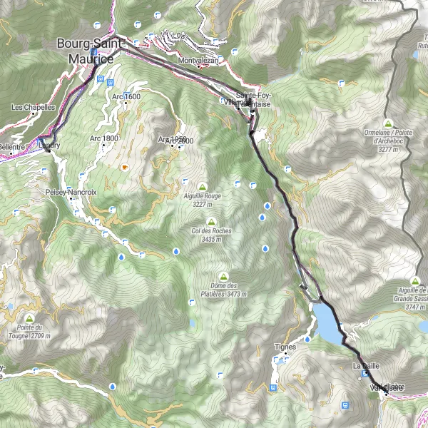
Zajímavá cesta plná krásných výhledů a horských vesniček
Trasa nabízí 80 km krásného cyklování s 2423 metry převýšení. Projedete kolem malebné vesnice Villaroger a zastavíte se v Bourg-Saint-Maurice. Cyklistické dobrodružství pokračuje kolem Sainte-Foy-Tarentaise a končí v La Daille.
![Mapa miniatúra "Gravelová jízda k Ouillon des Arcellins" cyklistická inšpirácia v Rhône-Alpes, France. Vygenerované cyklistickým plánovačom trás Tarmacs.app](https://images.tarmacs.app/cycling-routes/routemaps/600/france/rhone-alpes/val-d-isere/gravel/65741.webp)
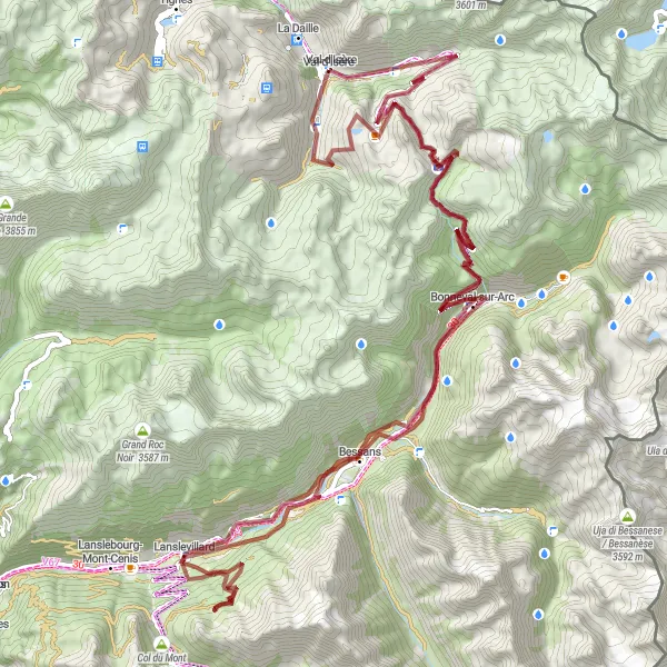
Náročný terén, krásná příroda a horské scenérie
S převýšením 3593 metrů a délkou 103 km tato gravelová trasa nabízí jedinečné zážitky z horské cyklistiky. Projedete kolem Col de l'Iseran, Bonneval-sur-Arc a Bessans, až se dostanete k Ouillon des Arcellins a Lanslevillard. Trasa dále vede přes Col de la Madeleine a Le Villaron a končí ve Val-d'Isère.
![Mapa miniatúra "Výlet k Col de la Madeleine" cyklistická inšpirácia v Rhône-Alpes, France. Vygenerované cyklistickým plánovačom trás Tarmacs.app](https://images.tarmacs.app/cycling-routes/routemaps/600/france/rhone-alpes/val-d-isere/road/65771.webp)
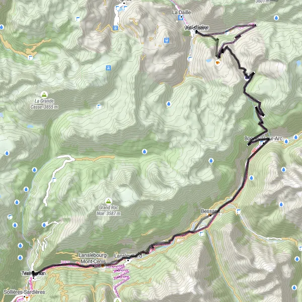
Náročná trasa s nádhernými výhledy a horskými průsmyky
S převýšením 2995 metrů a délkou 103 km tato trasa nabízí skvělé výzvy pro zkušené cyklisty. Projedete kolem Le Fornet, Pointe des Lessières a Bessans, až se dostanete k Col de la Madeleine a Termignon. Trasa pokračuje přes L'Adroit a Bonneval-sur-Arc a končí u Le Laisinant.
![Mapa miniatúra "Za úžasným výhľadom na ihrisko vo Val-d'Isère" cyklistická inšpirácia v Rhône-Alpes, France. Vygenerované cyklistickým plánovačom trás Tarmacs.app](https://images.tarmacs.app/cycling-routes/routemaps/600/france/rhone-alpes/val-d-isere/road/65752.webp)
Zážitok z horského cyklistického výletu v high-end horskom rezorte
Tento kruhový cyklistický výlet východne od Val-d'Isère v Rhône-Alpes ponúka náročné stúpanie a krásne výhľady. Okrem cyklistických výziev si môžete vychutnať bohatú kultúru a tradičnú architektúru okolitých miest.
![Mapa miniatúra "Gravel Route through the French Alps" cyklistická inšpirácia v Rhône-Alpes, France. Vygenerované cyklistickým plánovačom trás Tarmacs.app](https://images.tarmacs.app/cycling-routes/routemaps/600/france/rhone-alpes/val-d-isere/gravel/65772.webp)
Thrilling gravel adventure with stunning mountain views and challenging ascents
Explore the French Alps on this 125km gravel route with highlights including the breathtaking Col de l'Iseran and the majestic Monolithe de Sardières. With a total ascent of 3757m, this route offers a rewarding challenge for experienced cyclists.
Classic Road Cycling Tour in Rhône-Alpes
![Mapa miniatúra "Classic Road Cycling Tour in Rhône-Alpes" cyklistická inšpirácia v Rhône-Alpes, France. Vygenerované cyklistickým plánovačom trás Tarmacs.app](https://images.tarmacs.app/cycling-routes/routemaps/600/france/rhone-alpes/val-d-isere/road/65740.webp)
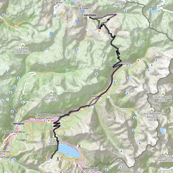
Classic road cycling tour through the scenic Rhône-Alpes region of France
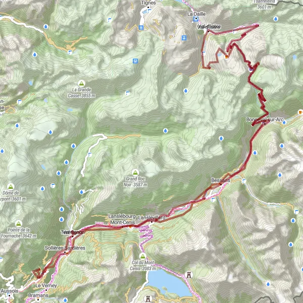
Embark on a 114km road cycling adventure with a total ascent of 3482m, exploring highlights such as the iconic Col de l'Iseran and the charming village of Lanslevillard. This route offers a mix of challenging climbs and fast descents, perfect for cyclists seeking a classic alpine experience in the heart of the French Alps.
Cyklistické trasy v okolí:
Blízke regióny:
![Obrázok Région lémanique](https://images.tarmacs.app/cycling-routes/covers/switzerland/region-lemanique/blonay-1.webp)
![Obrázok Espace Mittelland](https://images.tarmacs.app/cycling-routes/covers/switzerland/espace-mittelland/heimiswil-1.webp)
![Obrázok Bourgogne](https://images.tarmacs.app/cycling-routes/covers/france/bourgogne/longvic-2.webp)
![Obrázok Franche-Comté](https://images.tarmacs.app/cycling-routes/covers/france/franche-comte/pouilley-les-vignes-1.webp)
![Obrázok Languedoc-Roussillon](https://images.tarmacs.app/cycling-routes/covers/france/languedoc-roussillon/aimargues-4.webp)
![Obrázok Auvergne](https://images.tarmacs.app/cycling-routes/covers/france/auvergne/saint-georges-de-mons-4.webp)
![Obrázok Provence-Alpes-Côte d’Azur](https://images.tarmacs.app/cycling-routes/covers/france/provence-alpes-cote-dazur/auriol-3.webp)
![Obrázok Piemonte](https://images.tarmacs.app/cycling-routes/covers/italy/piemonte/borgo-ticino-2.webp)
![Obrázok Valle d’Aosta/Vallée d’Aoste](https://images.tarmacs.app/cycling-routes/covers/italy/valle-daosta-vallee-daoste/fenis-4.webp)