Serene cycling routes in Delémont
Cyklotrasy od Delemont
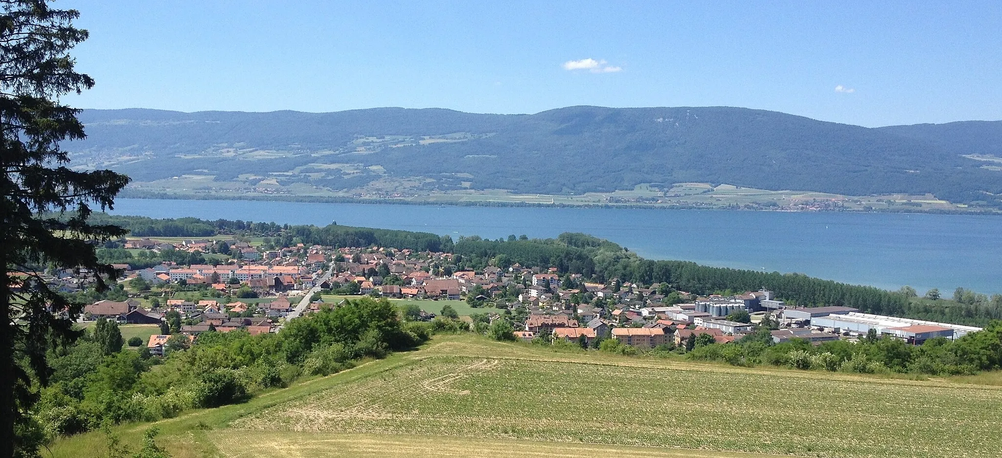
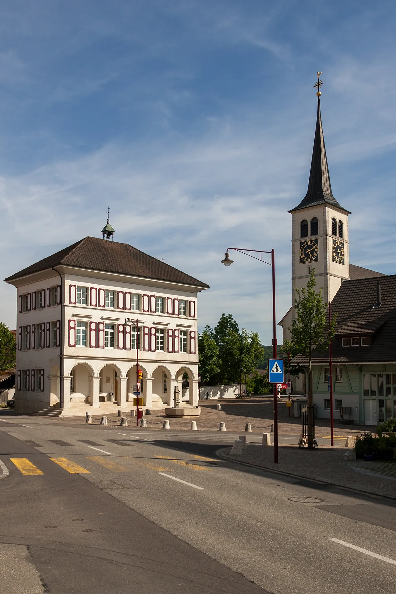
Delémont is a quaint town surrounded by beautiful countryside, ideal for gravel cycling. The region boasts a network of well-maintained cycling paths and peaceful routes for cyclists to explore. Delémont also offers various tourist attractions and accommodations for visitors. Nearby, you can test your skills on the challenging climb to Les Rangiers, a notable spot for cycling enthusiasts.
Silniční cyklostezka kolem Delémontu
Zajímavé trasování s pohledy na okolní krajinu
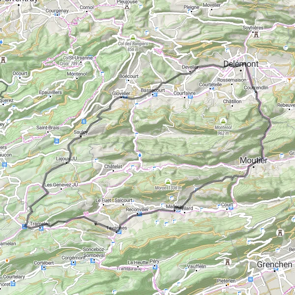
Tato 70 km dlouhá silniční trasa nabízí výhledy na Courrendlin, Mont Girod a Drapeau Jurassien. Cyklostezka vede převážně po silnicích a umožňuje objevovat krásy Espace Mittelland na kole.
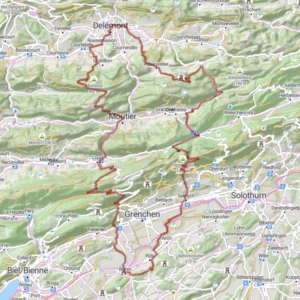
Jura Escapade
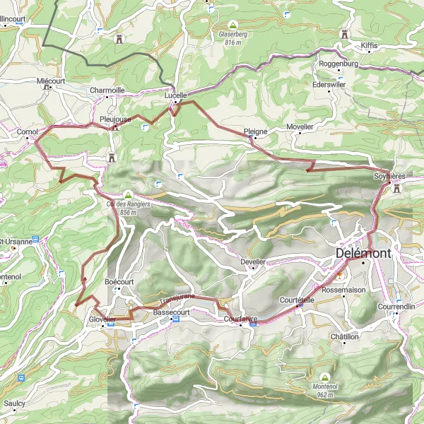
Discover the hidden gems of the Jura mountains on this scenic gravel route
Explore the beauty of the Jura mountains on this 52 km gravel route with a total ascent of 1162 m. Visit charming villages like Courtételle and Fregiécourt while enjoying the peaceful surroundings and picturesque landscapes of the region. Perfect for cyclists looking for a shorter yet rewarding ride in a tranquil setting.
Krátká cyklotrasa kolem Delémontu
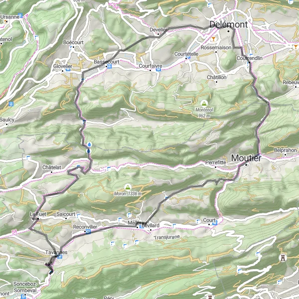
Vychutnejte si krátký cyklistický výlet plný malebných výhledů a zajímavých míst
Procestujte 65 km okruh s převýšením 1348 m a navštivte místa jako Courrendlin, Mont Girod a Delémont. Tato trasa nabízí skvělou kombinaci terénů a historických památek v okolí Delémontu.
Cyklovýlet plný dobrodružství
Tato 93 km dlouhá trasa s převýšením 2582 m je náročná a vyžaduje dobré fyzické připravení. Nabízí mnoho krásných výhledů a příležitostí pro objevování krajiny na kole.
Výlet plný zážitkových momentů
Jedná se o 67 km dlouhou trasu s převýšením 1689 m, která vede kolem různých zajímavostí, jako je Château de Delémont a Swiss Labyrinthe. Trasa nabízí krásné výhledy a možnost objevovat okolí na kole.
Jura Mountain Challenge
Conquer the Jura mountains on this epic gravel route with breathtaking views
Embark on a 109 km gravel adventure with a challenging ascent of 3518 m, showcasing the best of the Jura mountains. Visit iconic landmarks like Schlosshubel and Allerheiligen while enjoying the rugged terrain and diverse landscapes along the way. This route is ideal for experienced cyclists looking for a demanding ride in a stunning natural setting.
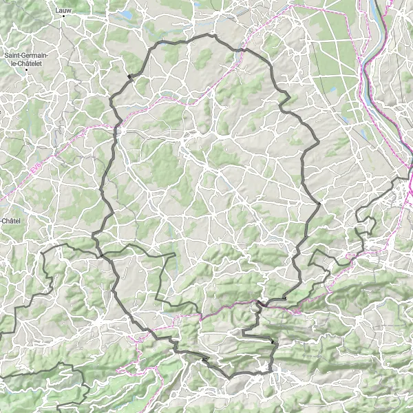
Trasa kolem Delémontu
Prozkoumejte malebné vesnice a úchvatné výhledy na horské scenérie
Procestujte 129 km okruh s převýšením 2425 m a navštivte zajímavá místa jako La Joux, Blauenberg a Ranspach-le-Haut. Cyklistický výlet nabízí pestrou směsici terénů a krásných výhledů na švýcarskou krajinu.
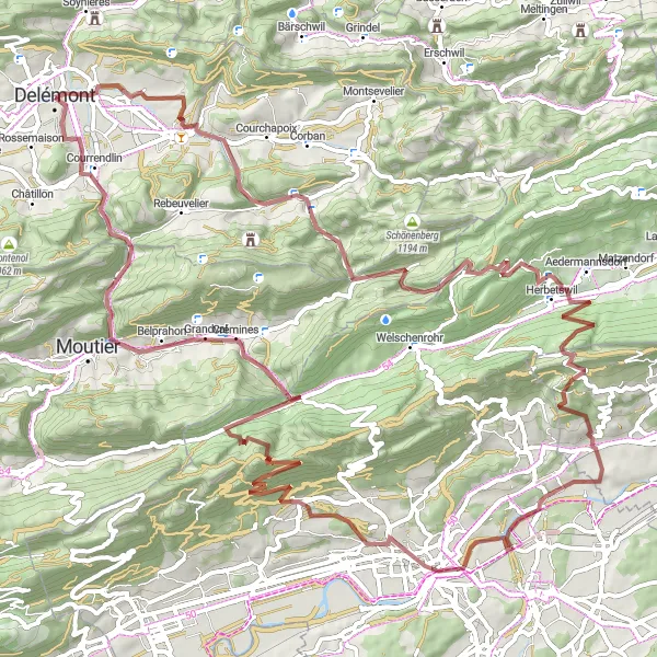
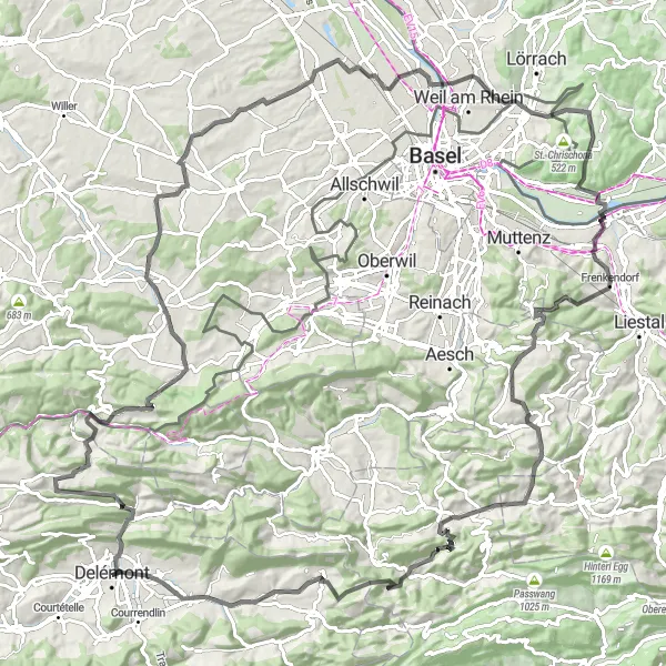
Náročný výlet pro zkušené cyklisty
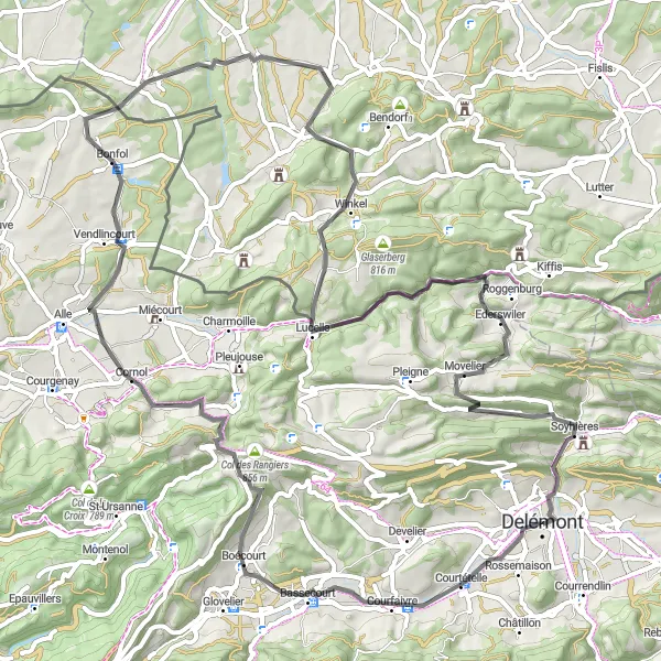
Tato 144 km dlouhá trasa nabízí mnoho náročných stoupání a sjezdů, včetně Col des Rangiers a Welschenberg. Cyklisti si mohou užít krásné výhledy a výzvy na této silniční trase.
Gravel Tour de Jura
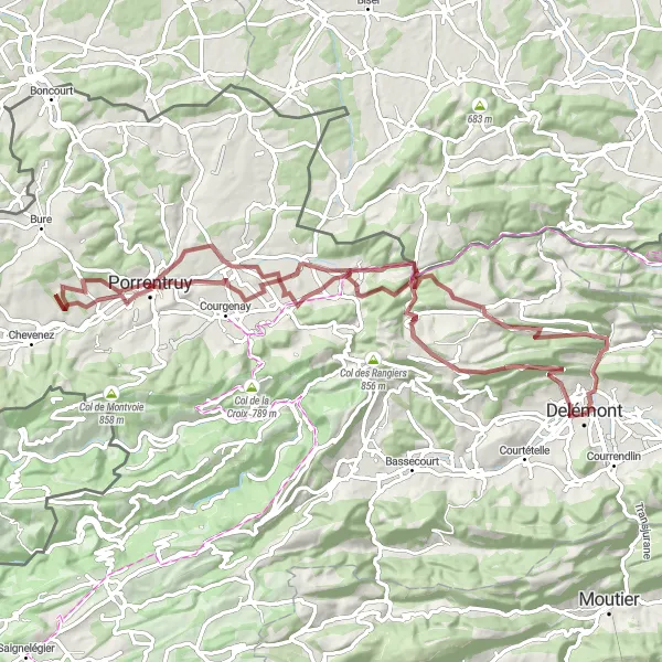
Explore the rugged Jura mountains on this challenging gravel route
This 82 km gravel route offers stunning views of the Jura mountains with a total ascent of 1499 m. Pass through charming villages like Porrentruy and Soyhières while experiencing the natural beauty of the region. A great choice for gravel enthusiasts seeking a challenging ride in a picturesque setting.
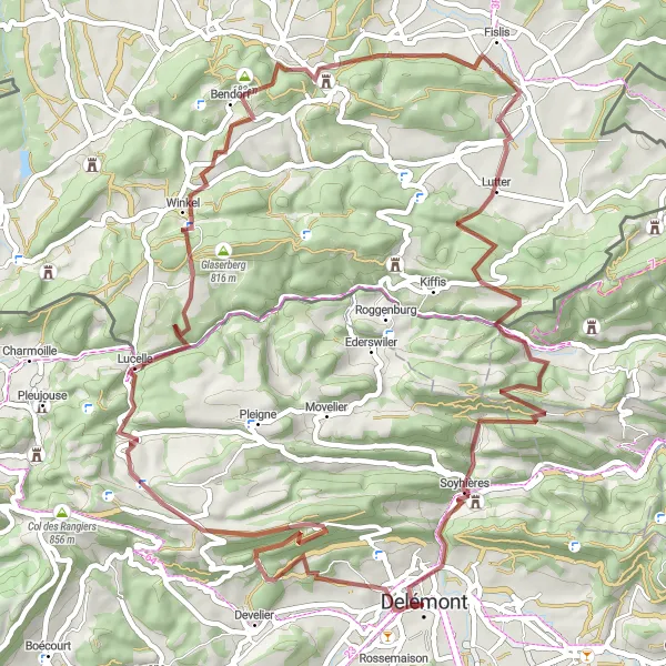
Jura Road Adventure
Experience the beauty of the Jura mountains on this scenic road route
Take on the challenge of this 79 km road adventure with a total ascent of 1395 m, showcasing the stunning landscapes and diverse terrain of the Jura mountains. Visit iconic sites like Col des Rangiers and Abbaye de Lucelle while enjoying the smooth roads and scenic vistas along the way. Ideal for road cyclists looking for a mix of challenging climbs and rewarding descents in a beautiful natural setting.
Cyklistické trasy v okolí:
Blízke regióny: