![Cover image](https://images.tarmacs.app/cycling-routes/covers/switzerland/zentralschweiz/entlebuch-4.webp)
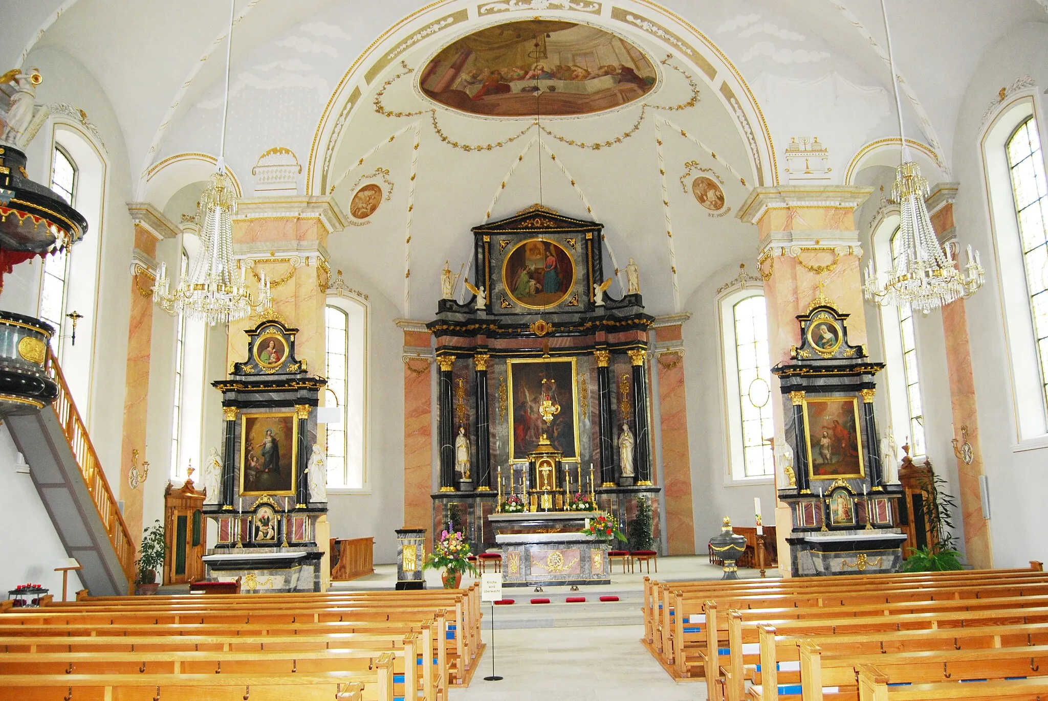
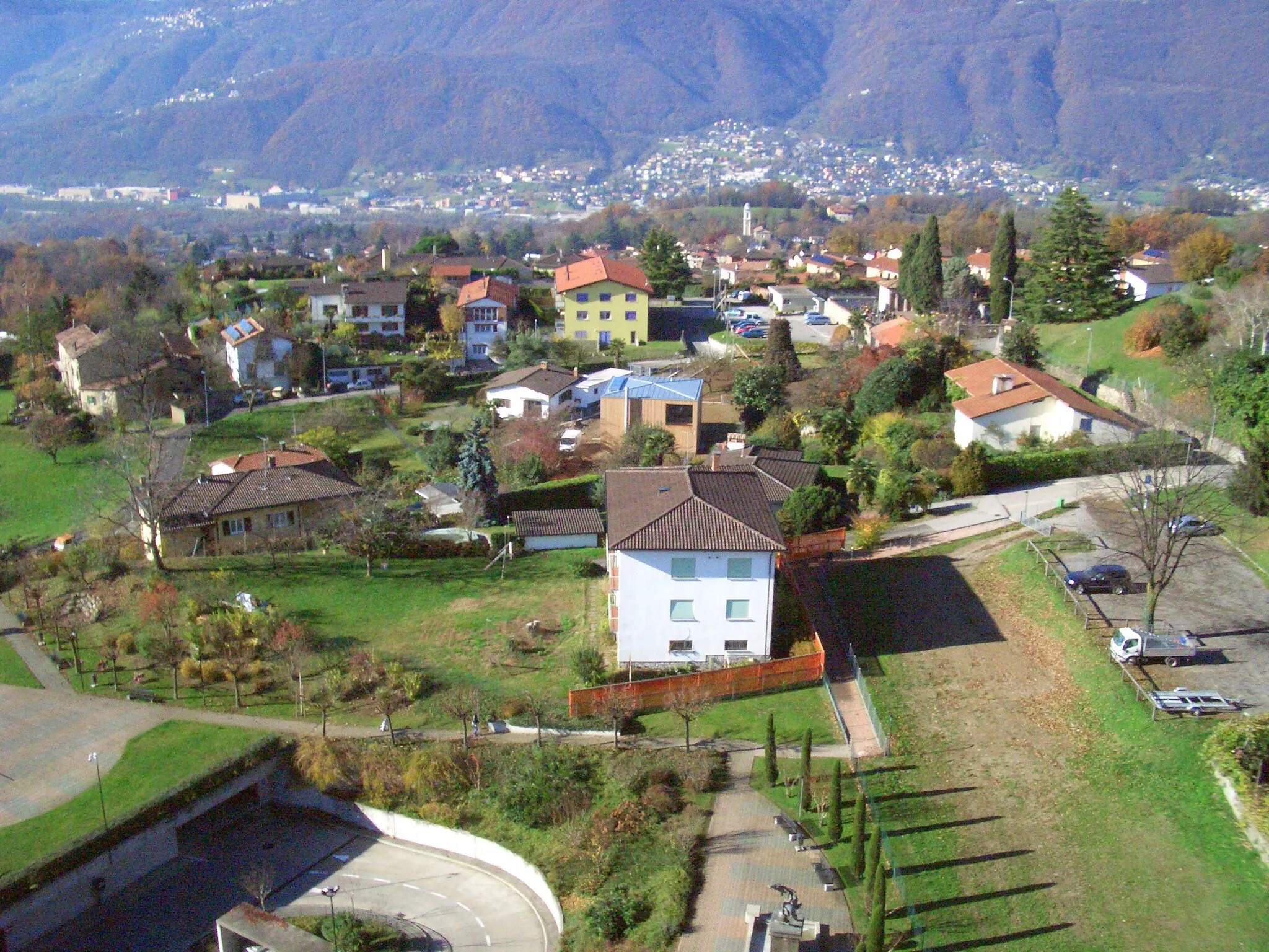
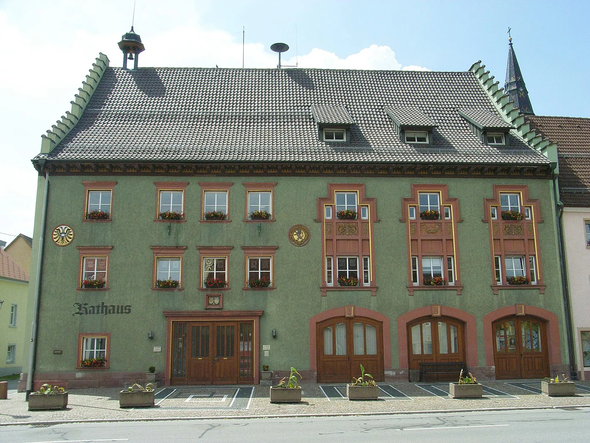
Cycling paradise with diverse landscapes in Zentralschweiz.
Cyklotrasy od Entlebuch
Entlebuch is a cycling paradise in Zentralschweiz, Switzerland, known for its diverse landscapes and well-marked cycling routes. Road cyclists can enjoy challenging climbs and fast descents through the rolling hills and valleys of the region. Gravel cyclists will find plenty of off-road trails to explore, with stunning views of the surrounding mountains. Famous climbs like Glaubenberg Pass are easily accessible from Entlebuch, making it a must-visit destination for cycling enthusiasts.
Road Route to Schwarzenberg
![Mapa miniatúra "Road Route to Schwarzenberg" cyklistická inšpirácia v Zentralschweiz, Switzerland. Vygenerované cyklistickým plánovačom trás Tarmacs.app](https://images.tarmacs.app/cycling-routes/routemaps/600/switzerland/zentralschweiz/entlebuch/road/157034.webp)
Challenging road cycling route with stunning views
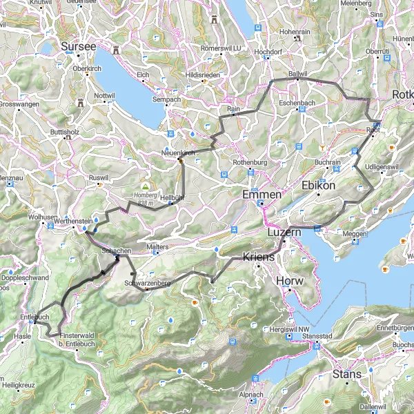
Embark on a 95 km road cycling adventure with an ascent of 2110 m, passing through highlights like Rain and Schwarzenberg. This route offers a mix of challenging climbs and exhilarating descents, perfect for road cycling enthusiasts.
Gravelová trasa kolem Entlebuchu
![Mapa miniatúra "Gravelová trasa kolem Entlebuchu" cyklistická inšpirácia v Zentralschweiz, Switzerland. Vygenerované cyklistickým plánovačom trás Tarmacs.app](https://images.tarmacs.app/cycling-routes/routemaps/600/switzerland/zentralschweiz/entlebuch/gravel/157001.webp)
Zajímavá cesta plná krásných výhledů a historických památek.
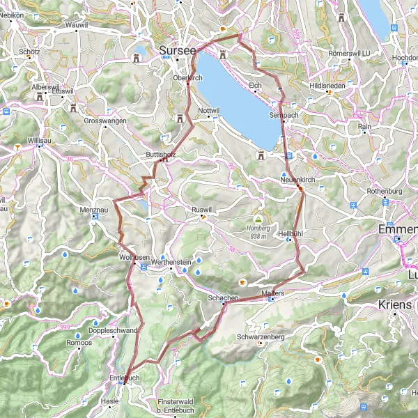
Tato 65km dlouhá gravlová trasa nabízí bohaté výhledy a zážitky. Začíná ve Wolhusenu a pokračuje přes malé vesnice Buttisholtz a Oberkirch. Projedete kolem jezera Sempach a historického města Malters. Cesta končí v Entlebuchu, kde si můžete odpočinout a obdivovat krásnou přírodu okolí.
![Mapa miniatúra "Okruhová cyklistická trasa Sörenberg-Entlebuch" cyklistická inšpirácia v Zentralschweiz, Switzerland. Vygenerované cyklistickým plánovačom trás Tarmacs.app](https://images.tarmacs.app/cycling-routes/routemaps/600/switzerland/zentralschweiz/entlebuch/road/156996.webp)
Úchvatný okruh s nádhernými výhledy a historickými památkami
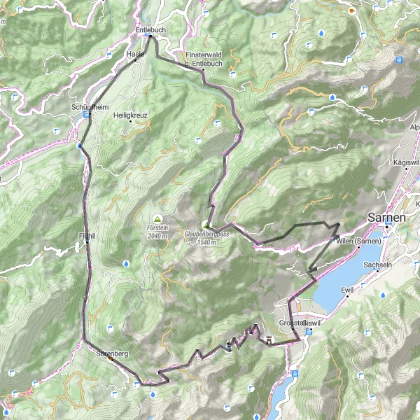
Tato 79km dlhá cesta ponúka nádherné výhľady cez Glaubenbergpass a Burgruine Rudenz. Prejdete popri Glaubenbielen, Flühli a Hasle až do Sörenbergu a naspäť do Entlebuchu.
![Mapa miniatúra "Road Adventure around Lake Sempach" cyklistická inšpirácia v Zentralschweiz, Switzerland. Vygenerované cyklistickým plánovačom trás Tarmacs.app](https://images.tarmacs.app/cycling-routes/routemaps/600/switzerland/zentralschweiz/entlebuch/road/157121.webp)
Exciting road cycling route with scenic views
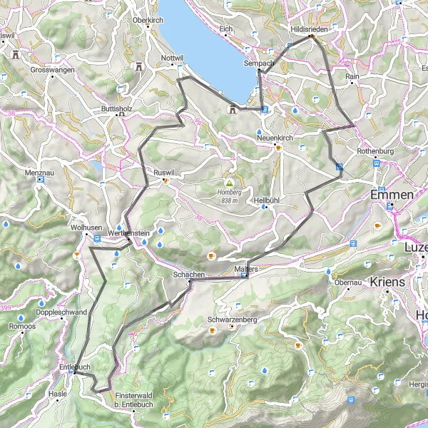
Embark on a thrilling 67 km road cycling adventure around Lake Sempach, with an ascent of 1143 m. Highlights along the route include Nottwil and Hildisrieden, offering a mix of challenging climbs and stunning panoramas of the Swiss landscape.
![Mapa miniatúra "Scenic Gravel Tour to Wallfahrtskirche Gormund" cyklistická inšpirácia v Zentralschweiz, Switzerland. Vygenerované cyklistickým plánovačom trás Tarmacs.app](https://images.tarmacs.app/cycling-routes/routemaps/600/switzerland/zentralschweiz/entlebuch/gravel/157007.webp)
Leisurely gravel cycling route with cultural highlights
Embark on a 74 km gravel cycling exploration with an ascent of 1290 m, passing through highlights like Soppensee and Malters. This route offers a mix of scenic landscapes and cultural attractions, perfect for cyclists looking for a relaxed and enjoyable ride.
![Mapa miniatúra "Epic Road Adventure to Kapfenberg" cyklistická inšpirácia v Zentralschweiz, Switzerland. Vygenerované cyklistickým plánovačom trás Tarmacs.app](https://images.tarmacs.app/cycling-routes/routemaps/600/switzerland/zentralschweiz/entlebuch/road/157011.webp)
Thrilling road cycling expedition through varied terrain
Embark on a challenging 119 km road cycling adventure with an ascent of 2690 m, passing through highlights like Schüpfheim and Ieschberg. This route offers a mix of climbs, descents, and breathtaking landscapes, making it an unforgettable cycling experience.
Gravel Route around Entlebuch
![Mapa miniatúra "Gravel Route around Entlebuch" cyklistická inšpirácia v Zentralschweiz, Switzerland. Vygenerované cyklistickým plánovačom trás Tarmacs.app](https://images.tarmacs.app/cycling-routes/routemaps/600/switzerland/zentralschweiz/entlebuch/gravel/157019.webp)
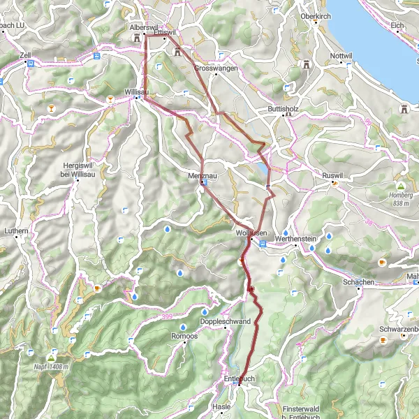
Journey through picturesque gravel paths
Explore the scenic countryside around Entlebuch on this 46 km gravel route, with highlights including Wolhusen and Menznau. The route offers a mix of challenging terrain and breathtaking views of the Swiss landscape.
Gravelový okruh Habschwanden-Entlebuch
![Mapa miniatúra "Gravelový okruh Habschwanden-Entlebuch" cyklistická inšpirácia v Zentralschweiz, Switzerland. Vygenerované cyklistickým plánovačom trás Tarmacs.app](https://images.tarmacs.app/cycling-routes/routemaps/600/switzerland/zentralschweiz/entlebuch/gravel/157300.webp)
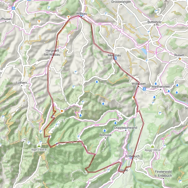
Krátka a pútavá trasa cez horskú krajinu a malebné dedinky
Táto 55km trasa ponúka krásne výhľady na okolie a prevedie vás cez Habschwanden, Mättebergegg a Gitzichnubel. Cesta pokračuje cez Hergiswil bei Willisau a Willisau späť do Entlebuchu.
![Mapa miniatúra "Okružná cesta cez Flühli a Escholzmatt" cyklistická inšpirácia v Zentralschweiz, Switzerland. Vygenerované cyklistickým plánovačom trás Tarmacs.app](https://images.tarmacs.app/cycling-routes/routemaps/600/switzerland/zentralschweiz/entlebuch/road/157022.webp)
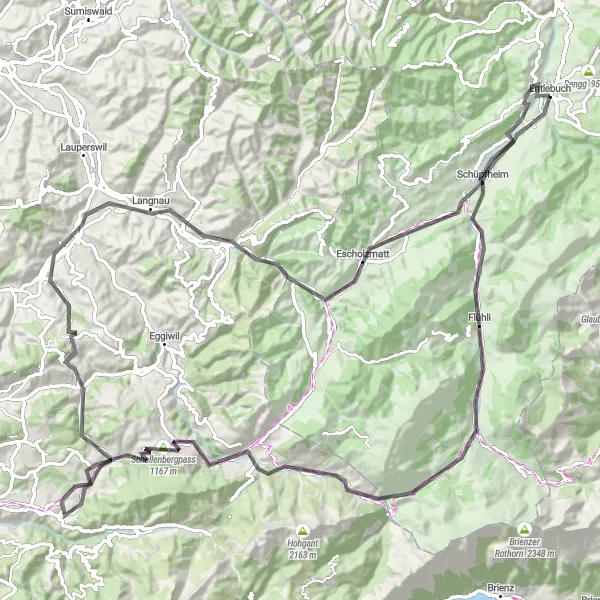
Netradičné horské cudzie slová cestovateľa nadchnú
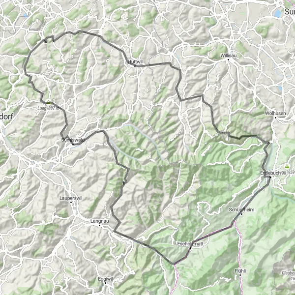
Okružná cesta vedie cez malebné obce Flühli a Escholzmatt s celkovým zdolaním 2120 metrov a dĺžkou 110 kilometrov. Trasa ponúka nádherný výhľad na pohoria Zentralschweiz a niekoľko zaujímavých miest zastavenia.
![Mapa miniatúra "Náročný gravelový okruh Rickenbach-Malters" cyklistická inšpirácia v Zentralschweiz, Switzerland. Vygenerované cyklistickým plánovačom trás Tarmacs.app](https://images.tarmacs.app/cycling-routes/routemaps/600/switzerland/zentralschweiz/entlebuch/gravel/156986.webp)
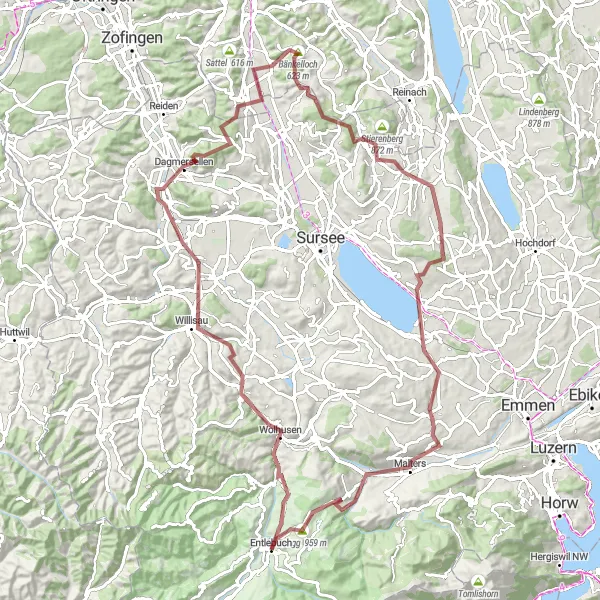
Rozmanitá a náročná trasa cez kopce a doliny s historickými miestami
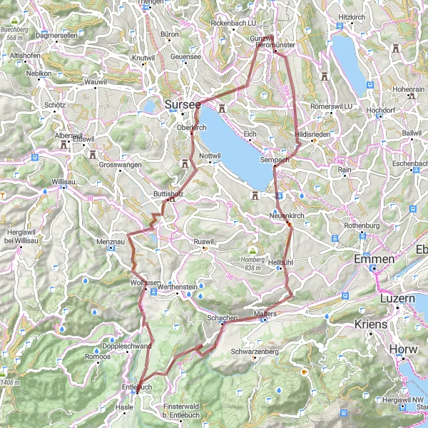
Táto 102km dlhá trasa prechádza cez Wolhusen, Willisau, Dagmersellen, Reitnau a Bänkelloch. Budete mať možnosť vidieť Rickenbach LU, Wallfahrtskirche Gormund, Rengg a Malters, než sa vrátite späť do Entlebuchu.
Cyklistické trasy v okolí:
Blízke regióny:
![Obrázok Région lémanique](https://images.tarmacs.app/cycling-routes/covers/switzerland/region-lemanique/grandson-1.webp)
![Obrázok Espace Mittelland](https://images.tarmacs.app/cycling-routes/covers/switzerland/espace-mittelland/langnau-3.webp)
![Obrázok Nordwestschweiz](https://images.tarmacs.app/cycling-routes/covers/switzerland/nordwestschweiz/aesch-1.webp)
![Obrázok Zürich](https://images.tarmacs.app/cycling-routes/covers/switzerland/zurich/waedenswil-3.webp)
![Obrázok Ostschweiz](https://images.tarmacs.app/cycling-routes/covers/switzerland/ostschweiz/kaltbrunn-1.webp)
![Obrázok Ticino](https://images.tarmacs.app/cycling-routes/covers/switzerland/ticino/comano-4.webp)
![Obrázok Freiburg](https://images.tarmacs.app/cycling-routes/covers/germany/freiburg/braunlingen-2.webp)
![Obrázok Piemonte](https://images.tarmacs.app/cycling-routes/covers/italy/piemonte/beinette-5.webp)
![Obrázok Liechtenstein](https://images.tarmacs.app/cycling-routes/covers/liechtenstein/liechtenstein/triesen-2.webp)