![Cover image](https://images.tarmacs.app/cycling-routes/covers/austria/niederosterreich/ebergassing-5.webp)
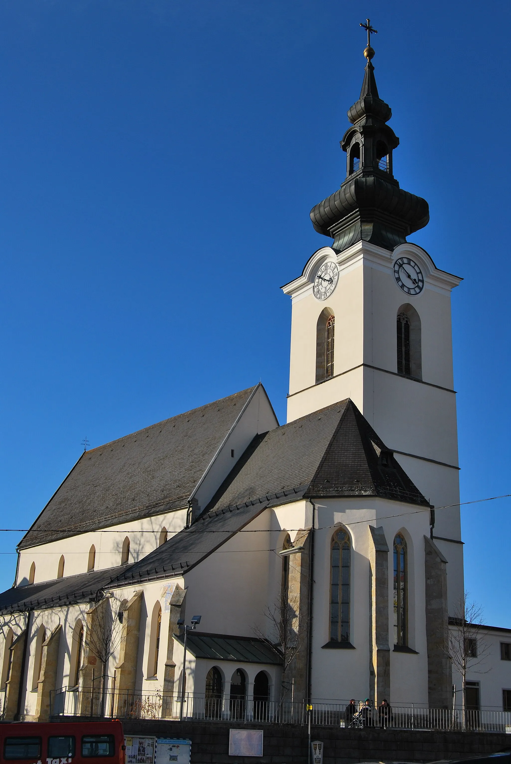
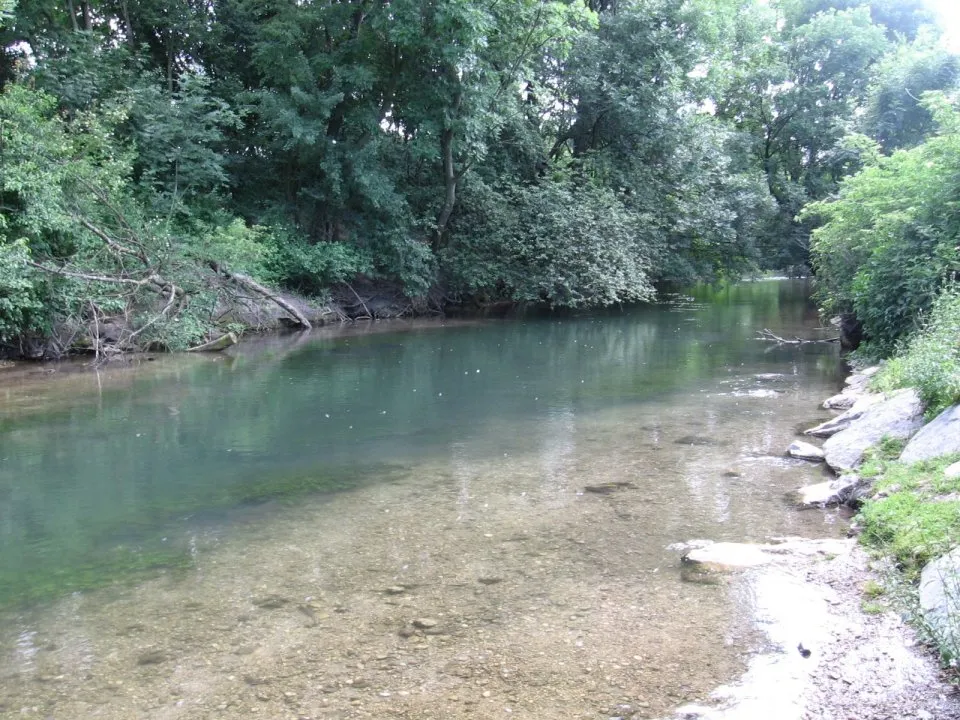
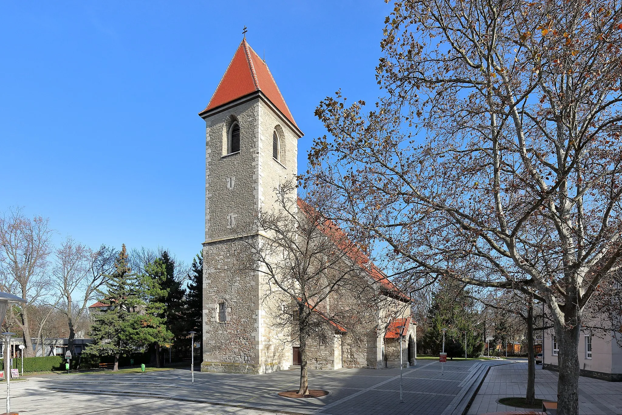
Příjemné prostředí pro cyklistické výlety.
Cyklistické trasy kolem Ebergassing
Ebergassing nabízí příjemné cyklistické trasy a cestu krajinou. I když není zde známý cyklistický okruh, je to stále příjemné místo k prozkoumání na kole.
![Miniaturní mapa "Scenic gravel route to Münchendorf" inspirace pro cyklisty v oblasti Niederösterreich, Austria. Vytvořeno pomocí plánovače tras Tarmacs.app](https://images.tarmacs.app/cycling-routes/routemaps/600/austria/niederosterreich/ebergassing/gravel/338183.webp)
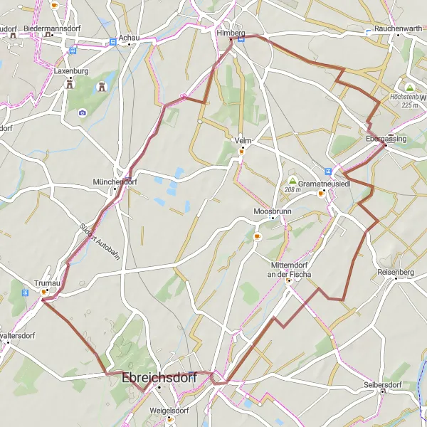
Enjoy a scenic gravel ride to Münchendorf via Ebreichsdorf
Cycle through Ebreichsdorf and Münchendorf on this 49 km route with an ascent of 79 m. Admire the historical landmarks of Himberg and Türkenhügel before returning to Ebergassing.
![Miniaturní mapa "Gravel route around Ebergassing" inspirace pro cyklisty v oblasti Niederösterreich, Austria. Vytvořeno pomocí plánovače tras Tarmacs.app](https://images.tarmacs.app/cycling-routes/routemaps/600/austria/niederosterreich/ebergassing/gravel/338181.webp)
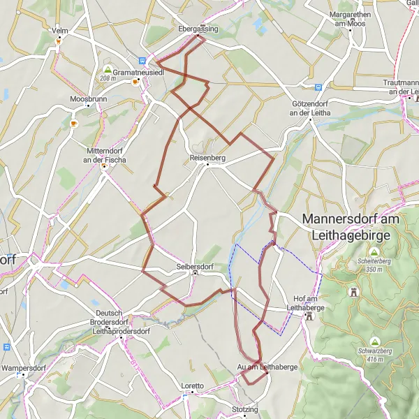
Explore the picturesque surroundings of Ebergassing on a gravel bike
Discover the charming Schloss Ebergassing and the scenic Reinspiegelberg on this 43 km route with 71 m of ascent. Enjoy the peaceful village of Au am Leithaberge before heading back to Ebergassing.
![Miniaturní mapa "Gravelová cyklistická trasa kolem Ebergassing" inspirace pro cyklisty v oblasti Niederösterreich, Austria. Vytvořeno pomocí plánovače tras Tarmacs.app](https://images.tarmacs.app/cycling-routes/routemaps/600/austria/niederosterreich/ebergassing/gravel/338180.webp)
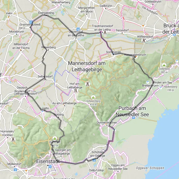
86 km štěrková trasa s 447 m stoupání
Dlouhá trasa s mnoha zajímavými zastávkami a malebnými výhledy na okolní krajinu. Pro zkušené cyklisty a milovníky gravelu ideální volba na celodenní výlet.
![Miniaturní mapa "Cyklistická trasa kolem Ebergassing" inspirace pro cyklisty v oblasti Niederösterreich, Austria. Vytvořeno pomocí plánovače tras Tarmacs.app](https://images.tarmacs.app/cycling-routes/routemaps/600/austria/niederosterreich/ebergassing/road/338191.webp)
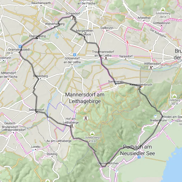
65 km silniční cyklistická trasa s 478 m stoupání
Tato okružní trasa vede přes několik malebných vesnic a okolo Neziderského jezera. Při cestě můžete obdivovat starobylé památky a krásnou přírodu. Ideální volba pro celodenní výlet na kole.
![Miniaturní mapa "Road route to Himberg" inspirace pro cyklisty v oblasti Niederösterreich, Austria. Vytvořeno pomocí plánovače tras Tarmacs.app](https://images.tarmacs.app/cycling-routes/routemaps/600/austria/niederosterreich/ebergassing/road/338188.webp)
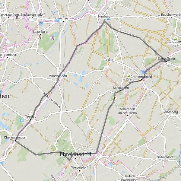
Embark on a road cycling adventure to the charming town of Himberg
Ride through Moosbrunn and Trumau on this 44 km route with an ascent of 76 m. Admire the beautiful landscapes of Himberg before heading back to Ebergassing.
![Miniaturní mapa "Okružní trasa z Ebergassing" inspirace pro cyklisty v oblasti Niederösterreich, Austria. Vytvořeno pomocí plánovače tras Tarmacs.app](https://images.tarmacs.app/cycling-routes/routemaps/600/austria/niederosterreich/ebergassing/road/338182.webp)
Road trasa s 458m převýšením na 80 km
Tato trasa vám nabídne pohledy na malebné vesnice a historické památky. Stezka vede skrz kopcovitou krajinu a nabízí nádherný výhled na okolní hory a jezera. Kromě cyklistických výzev, budete mít možnost ochutnat místní tradiční kuchyni a zastavit se na zajímavých místech v průběhu cesty.
![Miniaturní mapa "Cyklistická trasa kolem Ebergassing" inspirace pro cyklisty v oblasti Niederösterreich, Austria. Vytvořeno pomocí plánovače tras Tarmacs.app](https://images.tarmacs.app/cycling-routes/routemaps/600/austria/niederosterreich/ebergassing/road/338177.webp)
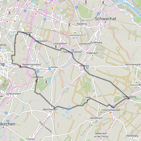
45 km silniční trasa s 89 m stoupání
Krátká cyklistická trasa ideální pro nedělní výlet kolem malebných vesnic a historických památek. Skvělá volba pro rodinné výlety a odpolední relaxaci na kole.
![Miniaturní mapa "Gravel adventure to Wienerberg" inspirace pro cyklisty v oblasti Niederösterreich, Austria. Vytvořeno pomocí plánovače tras Tarmacs.app](https://images.tarmacs.app/cycling-routes/routemaps/600/austria/niederosterreich/ebergassing/gravel/338197.webp)
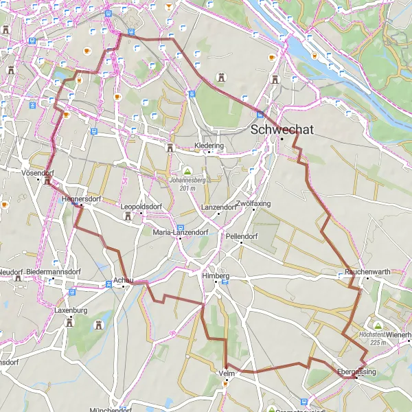
Embark on a gravel bike adventure to Wienerberg and Türkenhügel
Explore Kuckuckberg and Achau on this 53 km route with 215 m of ascent. Discover the historical Schloss Vösendorf and the impressive Wienerberg park before reaching Türkenhügel and returning to Ebergassing.
![Miniaturní mapa "Epic road journey to Pellendorf" inspirace pro cyklisty v oblasti Niederösterreich, Austria. Vytvořeno pomocí plánovače tras Tarmacs.app](https://images.tarmacs.app/cycling-routes/routemaps/600/austria/niederosterreich/ebergassing/road/338240.webp)
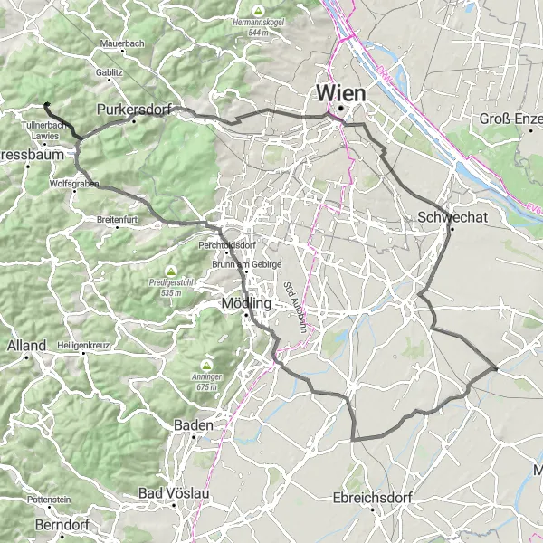
Embark on an epic road cycling journey to Pellendorf and beyond
Explore Moosbrunn, Guntramsdorf, and Hirschkogel on this 101 km route with 568 m of ascent. Pass by Laab im Walde and Brunnberg before reaching Hütteldorf and Pellendorf. Enjoy the impressive Palais Ofenheim before returning to Ebergassing.
![Miniaturní mapa "Gravelová cyklistická trasa okolo Ebergassing" inspirace pro cyklisty v oblasti Niederösterreich, Austria. Vytvořeno pomocí plánovače tras Tarmacs.app](https://images.tarmacs.app/cycling-routes/routemaps/600/austria/niederosterreich/ebergassing/gravel/338194.webp)
48 km štěrková trasa s 209 m stoupáním
Tato trasa vede převážně štěrkovými cestami a nám poskytne pohled na okolní krajinu. Pro milovníky gravelu ideální volba s možností zastavení u zajímavých památek.
Cyklotrasy v okolí:
![Obrázek Gramatneusiedl](https://images.tarmacs.app/cycling-routes/covers/austria/niederosterreich/gramatneusiedl-5.webp)
![Obrázek Schwadorf](https://images.tarmacs.app/cycling-routes/covers/austria/niederosterreich/schwadorf-5.webp)
![Obrázek Reisenberg](https://images.tarmacs.app/cycling-routes/covers/austria/niederosterreich/reisenberg-5.webp)
![Obrázek Götzendorf an der Leitha](https://images.tarmacs.app/cycling-routes/covers/austria/niederosterreich/goetzendorf-an-der-leitha-5.webp)
![Obrázek Moosbrunn](https://images.tarmacs.app/cycling-routes/covers/austria/niederosterreich/moosbrunn-5.webp)
![Obrázek Mitterndorf an der Fischa](https://images.tarmacs.app/cycling-routes/covers/austria/niederosterreich/mitterndorf-an-der-fischa-5.webp)
![Obrázek Himberg](https://images.tarmacs.app/cycling-routes/covers/austria/niederosterreich/himberg-4.webp)
![Obrázek Enzersdorf an der Fischa](https://images.tarmacs.app/cycling-routes/covers/austria/niederosterreich/enzersdorf-an-der-fischa-5.webp)
![Obrázek Zwölfaxing](https://images.tarmacs.app/cycling-routes/covers/austria/niederosterreich/zwoelfaxing-5.webp)
Okolní oblasti:
![Obrázek Burgenland](https://images.tarmacs.app/cycling-routes/covers/austria/burgenland/grosspetersdorf-5.webp)
![Obrázek Vídeň](https://images.tarmacs.app/cycling-routes/covers/austria/wien/hietzing-3.webp)
![Obrázek Kärnten](https://images.tarmacs.app/cycling-routes/covers/austria/karnten/radenthein-2.webp)
![Obrázek Steiermark](https://images.tarmacs.app/cycling-routes/covers/austria/steiermark/wetzelsdorf-4.webp)
![Obrázek Oberösterreich](https://images.tarmacs.app/cycling-routes/covers/austria/oberosterreich/gallneukirchen-5.webp)
![Obrázek Středočeský kraj](https://images.tarmacs.app/cycling-routes/covers/czech-republic/stredni-cechy/dobris-2.webp)
![Obrázek Jihozápad](https://images.tarmacs.app/cycling-routes/covers/czech-republic/jihozapad/jistebnice-5.webp)
![Obrázek Jihovýchod](https://images.tarmacs.app/cycling-routes/covers/czech-republic/jihovychod/zbysov-5.webp)
![Obrázek Střední Morava](https://images.tarmacs.app/cycling-routes/covers/czech-republic/stredni-morava/zlin-1.webp)
![Obrázek Nyugat-Dunántúl](https://images.tarmacs.app/cycling-routes/covers/hungary/nyugat-dunantul/taplanszentkereszt-4.webp)
![Obrázek Bratislavský kraj](https://images.tarmacs.app/cycling-routes/covers/slovakia/bratislavsky-kraj/marianka-3.webp)
![Obrázek Západné Slovensko](https://images.tarmacs.app/cycling-routes/covers/slovakia/zapadne-slovensko/surany-1.webp)