![Cover image](https://images.tarmacs.app/cycling-routes/covers/austria/oberosterreich/haid-4.webp)
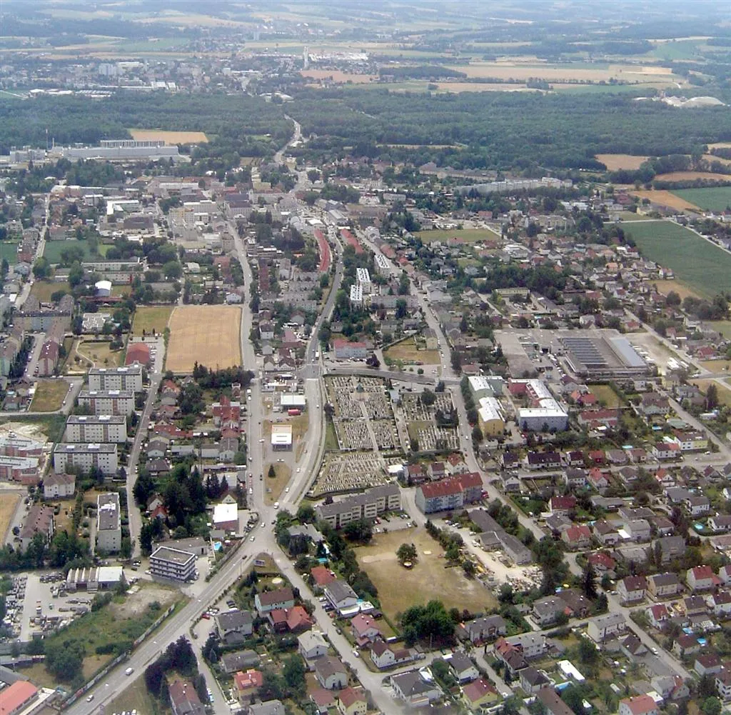
Poklidná oáza pro cyklisty v Oberösterreichu
Cyklistické trasy kolem Haid
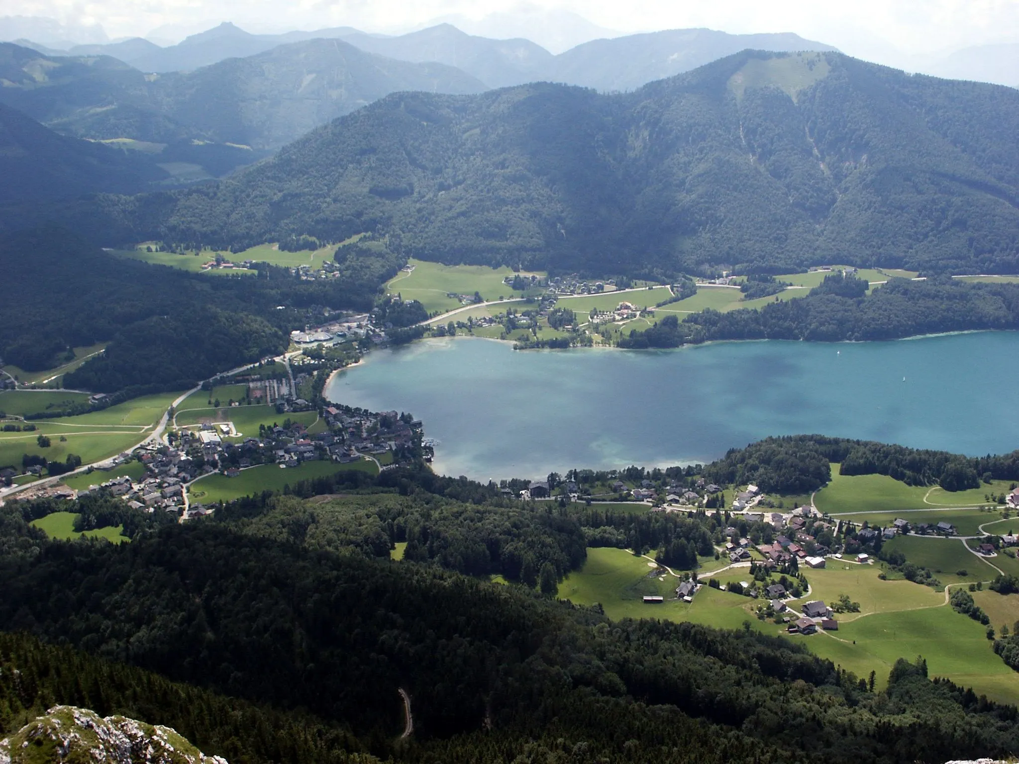
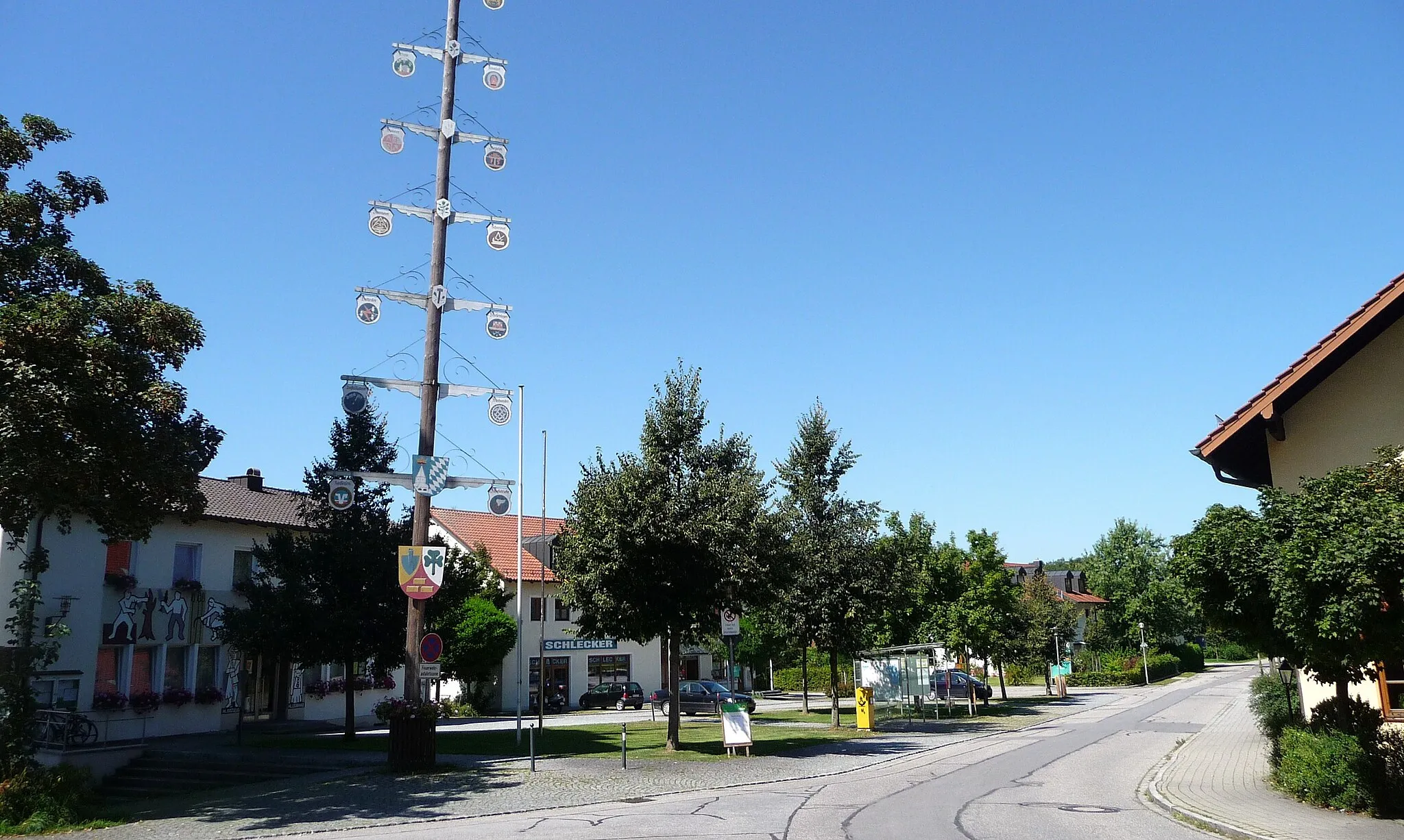
Haid je klidná lokalita v regionu Oberösterreich v Rakousku. Cyklisté zde mohou užívat klidné silnice a lesní stezky daleko od ruchu města. Poblíž se nachází pár náročných stoupání vhodných pro trénink.
![Miniaturní mapa "Výlet kolem Oberösterreichu" inspirace pro cyklisty v oblasti Oberösterreich, Austria. Vytvořeno pomocí plánovače tras Tarmacs.app](https://images.tarmacs.app/cycling-routes/routemaps/600/austria/oberosterreich/haid/road/188578.webp)
Náročný cyklistický výlet s mnoha zajímavostmi
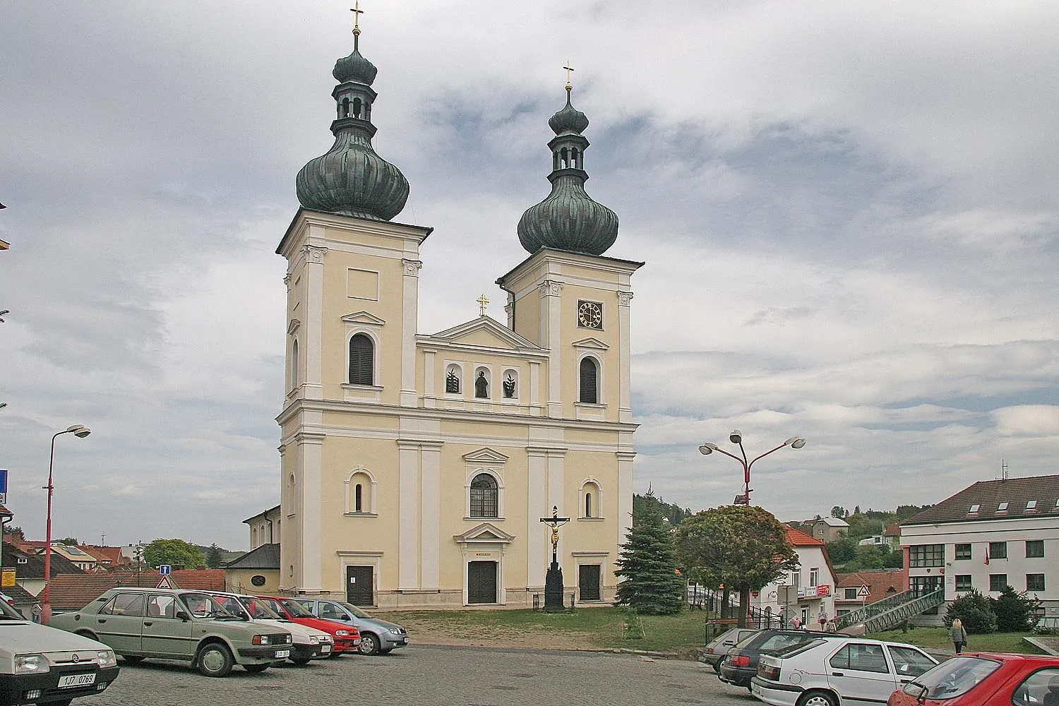
Tento 88 km dlouhý okruh nabízí nádherné výhledy a možnost navštívit historické památky jako Schloss Grünau a Stadtturm. S převýšením 753 m je určen spíše zkušenějším cyklistům.
![Miniaturní mapa "Prozkoumejte krajinu okolo Magdalenaberg" inspirace pro cyklisty v oblasti Oberösterreich, Austria. Vytvořeno pomocí plánovače tras Tarmacs.app](https://images.tarmacs.app/cycling-routes/routemaps/600/austria/oberosterreich/haid/road/188543.webp)
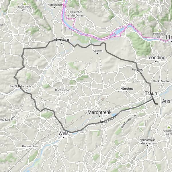
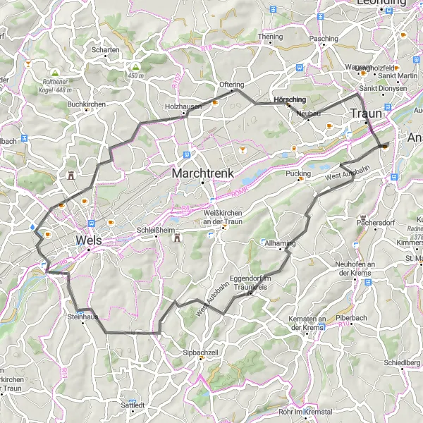
Malebná cesta plná krásných výhledů
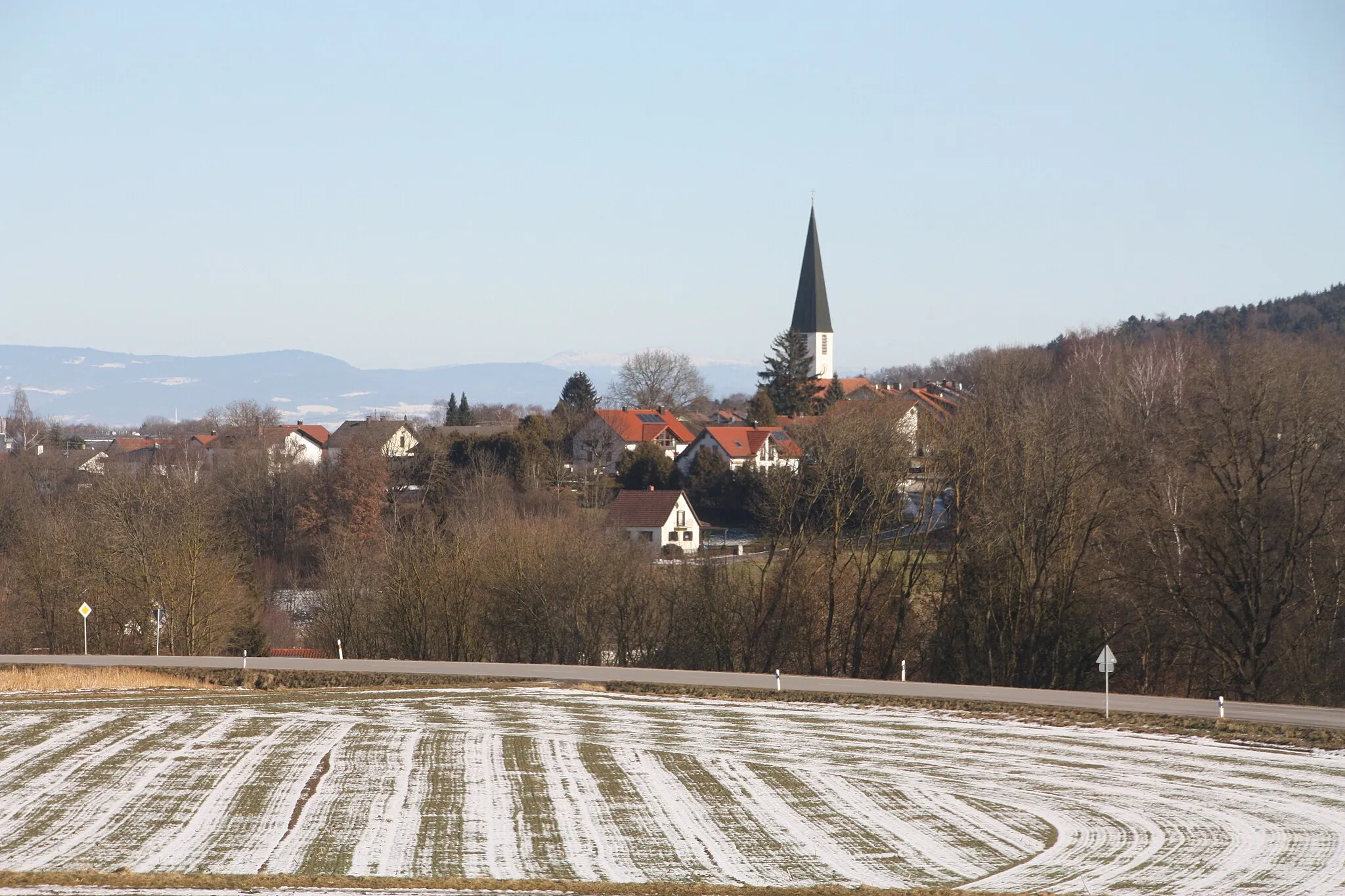
Tato 78km dlouhá cesta nabízí 607m stoupání a prochází oblastmi jako Schleißheim, Krenglbach, Magdalenaberg nebo Eferding. Objevte krásnou Traunskou kotlinu.
![Miniaturní mapa "Historické okruhy kolem Perg a Frankenberger Kircherl" inspirace pro cyklisty v oblasti Oberösterreich, Austria. Vytvořeno pomocí plánovače tras Tarmacs.app](https://images.tarmacs.app/cycling-routes/routemaps/600/austria/oberosterreich/haid/road/188615.webp)
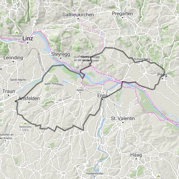
Cesta plná historických památek a krásných výhledů
S 1208m stoupání tato 119km dlouhá cesta vás provede kolem míst jako Ebelsberg, Frankenberger Kircherl, Perg nebo Baumgartenberg. Objevte historické památky a malebnou krajinu.
RoadExplorer
![Miniaturní mapa "RoadExplorer" inspirace pro cyklisty v oblasti Oberösterreich, Austria. Vytvořeno pomocí plánovače tras Tarmacs.app](https://images.tarmacs.app/cycling-routes/routemaps/600/austria/oberosterreich/haid/road/188588.webp)
Embrace the spirit of exploration on a road cycling quest through diverse landscapes
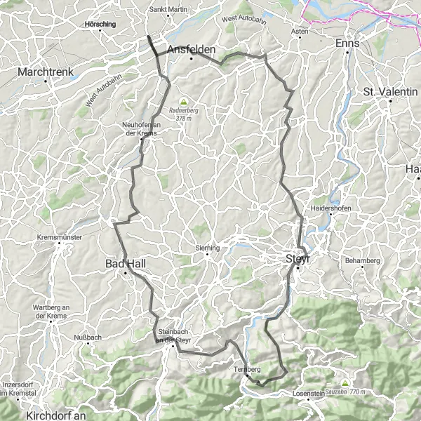
RoadExplorer is a 103 km road route with 1473 meters of ascent. The route includes Ansfelden, Eichkogel, Dietach, Garsten, Jochberg, Kaiblinger Kogel, Steinbach an der Steyr, Piberbach, Klangvulkan, and Traun. Cycling this route offers a mix of challenging climbs, scenic views, and cultural discoveries.
GravelHills
![Miniaturní mapa "GravelHills" inspirace pro cyklisty v oblasti Oberösterreich, Austria. Vytvořeno pomocí plánovače tras Tarmacs.app](https://images.tarmacs.app/cycling-routes/routemaps/600/austria/oberosterreich/haid/gravel/188536.webp)
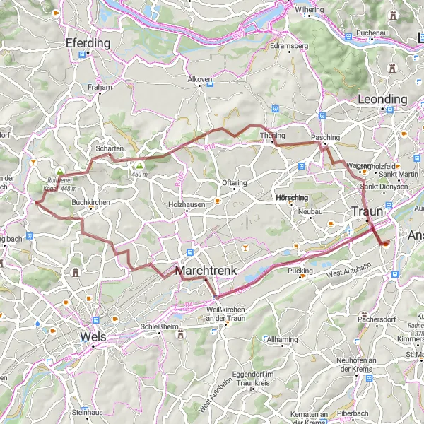
Venture into the rolling hills and gravel paths on an unforgettable cycling adventure
GravelHills is a 57 km gravel route with 527 meters of ascent. The route includes Pucking, Marchtrenk, Buchkirchen, Roithener Kogel, Pasching, and Traun. This cycling route offers a mix of challenging terrain, scenic views, and natural beauty in the Austrian countryside.
Okruh kolem Haidu
![Miniaturní mapa "Okruh kolem Haidu" inspirace pro cyklisty v oblasti Oberösterreich, Austria. Vytvořeno pomocí plánovače tras Tarmacs.app](https://images.tarmacs.app/cycling-routes/routemaps/600/austria/oberosterreich/haid/road/188553.webp)
Zajímavý cyklistický výlet nedaleko Haidu
Tento 63 km dlouhý cyklistický okruh nabízí krásné výhledy a zajímavá místa jako Schloss Hueb a Traun. S převýšením 302 m je vhodný pro středně pokročilé cyklisty.
RoadCastle
![Miniaturní mapa "RoadCastle" inspirace pro cyklisty v oblasti Oberösterreich, Austria. Vytvořeno pomocí plánovače tras Tarmacs.app](https://images.tarmacs.app/cycling-routes/routemaps/600/austria/oberosterreich/haid/road/188734.webp)
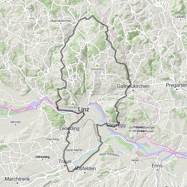
Embark on a cycling journey to explore ancient castles and rolling hills
RoadCastle is a 101 km road route with 1600 meters of ascent. The route features Leonding, Schloss, Eidenberg, Auf der Leithen, Haibach im Mühlkreis, Gallneukirchen, Steyregg, Ebelsberg Castle, and Kremsdorf. This cycling adventure offers a mix of history, culture, and natural beauty in the Austrian countryside.
![Miniaturní mapa "Výlet kolem Bad Zell a Neumarkt im Mühlkreis" inspirace pro cyklisty v oblasti Oberösterreich, Austria. Vytvořeno pomocí plánovače tras Tarmacs.app](https://images.tarmacs.app/cycling-routes/routemaps/600/austria/oberosterreich/haid/road/188574.webp)
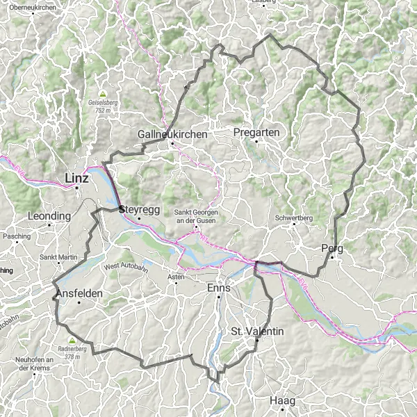
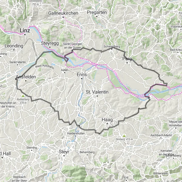
Dlouhá cesta plná přírodních krás
S 1805m stoupání tato 138km dlouhá trasa vás zavede kolem míst jako Kleinmünchen, Predigtstuhl, Gallneukirchen nebo Bad Zell. Objevte malebnou krajinu Mühlviertel.
RoadSerenity
![Miniaturní mapa "RoadSerenity" inspirace pro cyklisty v oblasti Oberösterreich, Austria. Vytvořeno pomocí plánovače tras Tarmacs.app](https://images.tarmacs.app/cycling-routes/routemaps/600/austria/oberosterreich/haid/road/188573.webp)
Discover the serene beauty of the countryside on a road cycling adventure
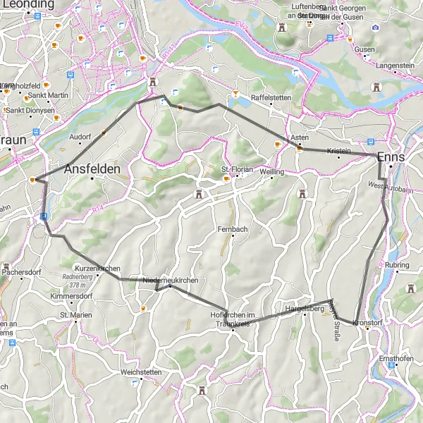
RoadSerenity is a 50 km road route with 438 meters of ascent. The highlights include Ebelsberg, Schiltenberg, Stadtturm, Kronstorf, Niederneukirchen, and Schreilberg. Cycling this route allows you to immerse yourself in the peaceful surroundings and traditional Austrian culture.
GravelKlang
![Miniaturní mapa "GravelKlang" inspirace pro cyklisty v oblasti Oberösterreich, Austria. Vytvořeno pomocí plánovače tras Tarmacs.app](https://images.tarmacs.app/cycling-routes/routemaps/600/austria/oberosterreich/haid/gravel/188550.webp)
Journey through intriguing landscapes and geological wonders
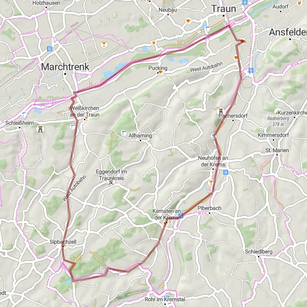
GravelKlang is a 46 km gravel route with 246 meters of ascent. The route takes you past the Klangvulkan, Piberbach, Sipbachzell, Pucking, and Kremsdorf. Cycling this route offers a unique experience filled with natural beauty and interesting geological formations.
Cyklotrasy v okolí:
![Obrázek Traun](https://images.tarmacs.app/cycling-routes/covers/austria/oberosterreich/traun-3.webp)
![Obrázek Sankt Dionysen](https://images.tarmacs.app/cycling-routes/covers/austria/oberosterreich/sankt-dionysen-4.webp)
![Obrázek Ansfelden](https://images.tarmacs.app/cycling-routes/covers/austria/oberosterreich/ansfelden-4.webp)
![Obrázek Oedt](https://images.tarmacs.app/cycling-routes/covers/austria/oberosterreich/oedt-5.webp)
![Obrázek Freindorf](https://images.tarmacs.app/cycling-routes/covers/austria/oberosterreich/freindorf-4.webp)
![Obrázek Langholzfeld](https://images.tarmacs.app/cycling-routes/covers/austria/oberosterreich/langholzfeld-5.webp)
![Obrázek Doppl](https://images.tarmacs.app/cycling-routes/covers/austria/oberosterreich/doppl-5.webp)
![Obrázek Pucking](https://images.tarmacs.app/cycling-routes/covers/austria/oberosterreich/pucking-5.webp)
Okolní oblasti:
![Obrázek Niederösterreich](https://images.tarmacs.app/cycling-routes/covers/austria/niederosterreich/ferschnitz-2.webp)
![Obrázek Vídeň](https://images.tarmacs.app/cycling-routes/covers/austria/wien/meidling-1.webp)
![Obrázek Kärnten](https://images.tarmacs.app/cycling-routes/covers/austria/karnten/warmbad-judendorf-1.webp)
![Obrázek Steiermark](https://images.tarmacs.app/cycling-routes/covers/austria/steiermark/spielberg-bei-knittelfeld-3.webp)
![Obrázek Salzburg](https://images.tarmacs.app/cycling-routes/covers/austria/salzburg/fuschl-am-see-5.webp)
![Obrázek Tirol](https://images.tarmacs.app/cycling-routes/covers/austria/tirol/soelden-5.webp)
![Obrázek Středočeský kraj](https://images.tarmacs.app/cycling-routes/covers/czech-republic/stredni-cechy/kourim-2.webp)
![Obrázek Jihozápad](https://images.tarmacs.app/cycling-routes/covers/czech-republic/jihozapad/loucovice-5.webp)
![Obrázek Jihovýchod](https://images.tarmacs.app/cycling-routes/covers/czech-republic/jihovychod/bystrice-nad-pernstejnem-4.webp)
![Obrázek Oberbayern](https://images.tarmacs.app/cycling-routes/covers/germany/oberbayern/kastl-5.webp)
![Obrázek Niederbayern](https://images.tarmacs.app/cycling-routes/covers/germany/niederbayern/mamming-3.webp)