![Cover image](https://images.tarmacs.app/cycling-routes/covers/austria/oberosterreich/steyregg-4.webp)
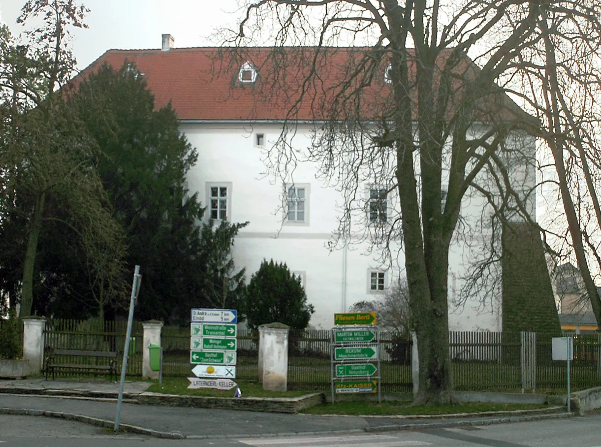
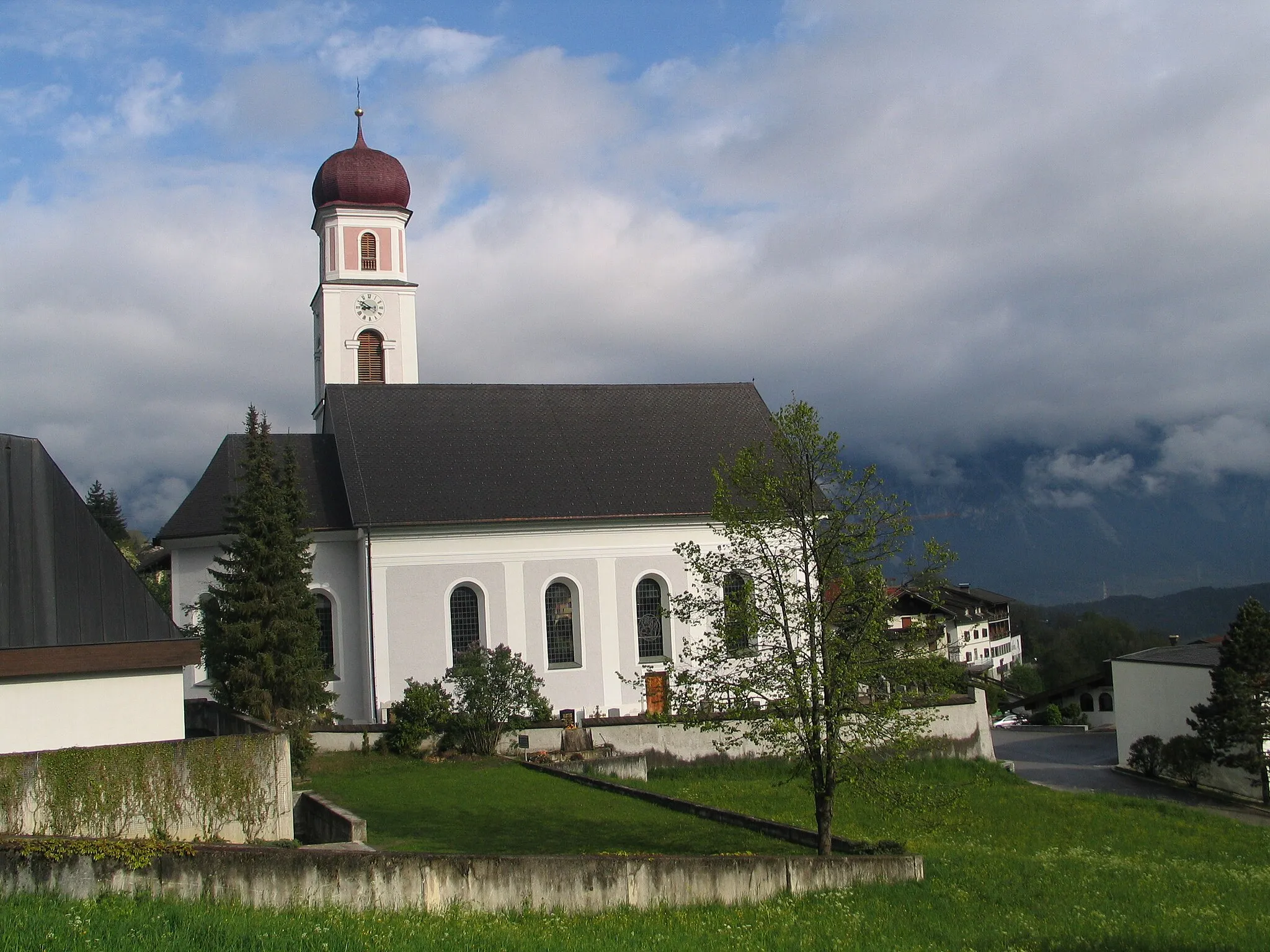
Cyklistika podél řeky v historickém městě
Cyklistické trasy kolem Steyregg
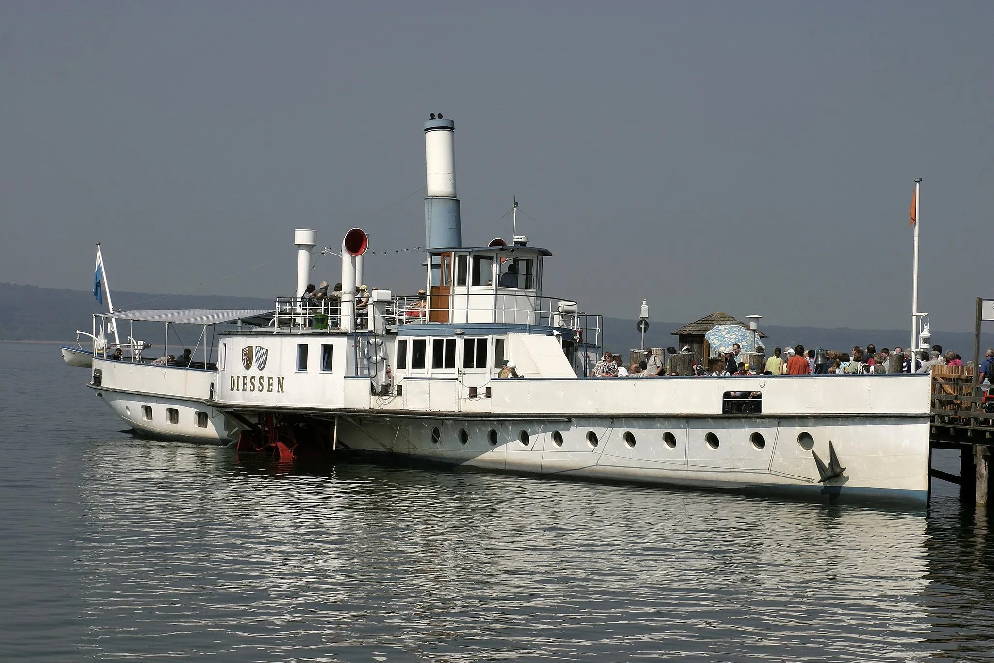
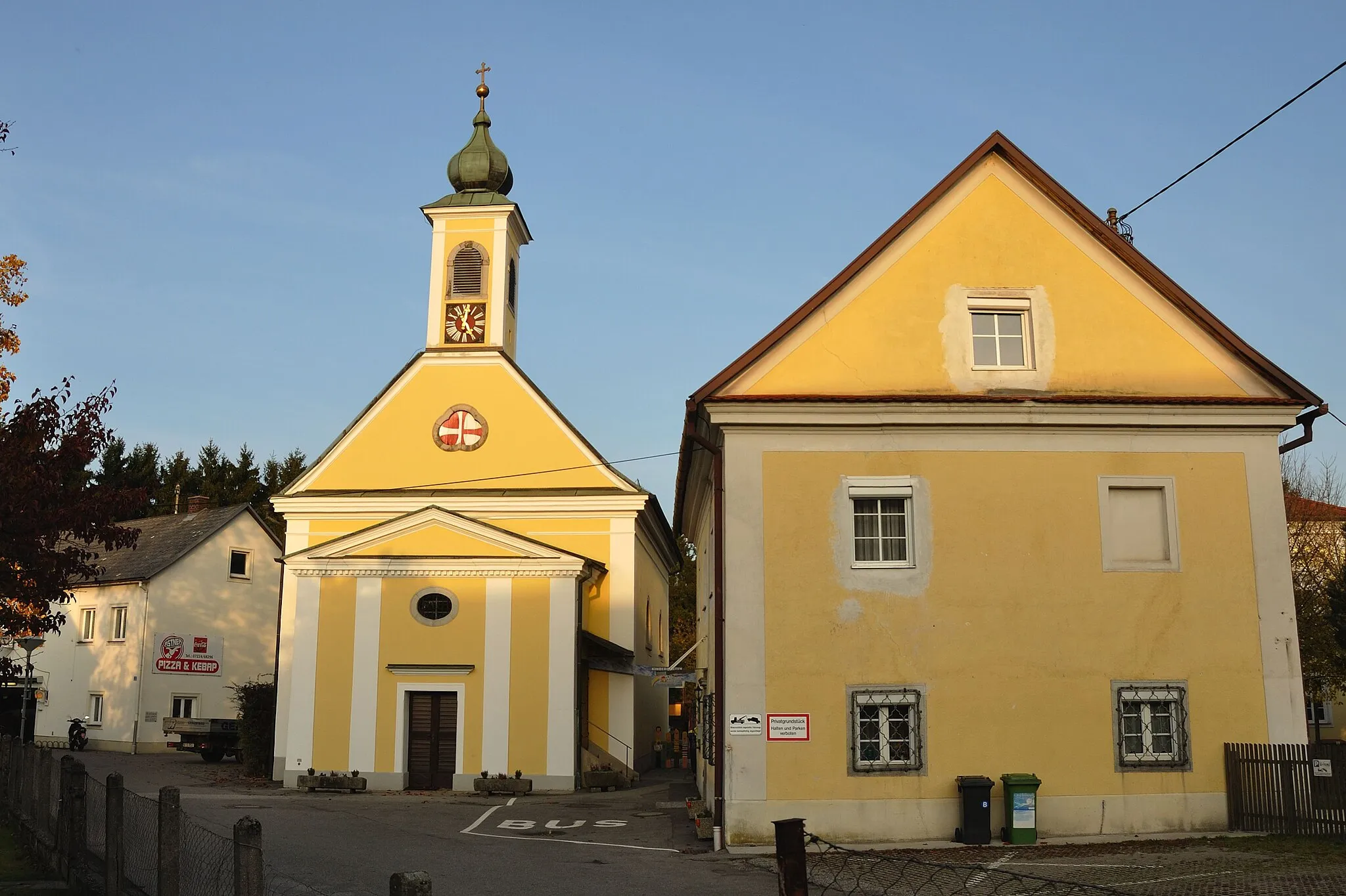
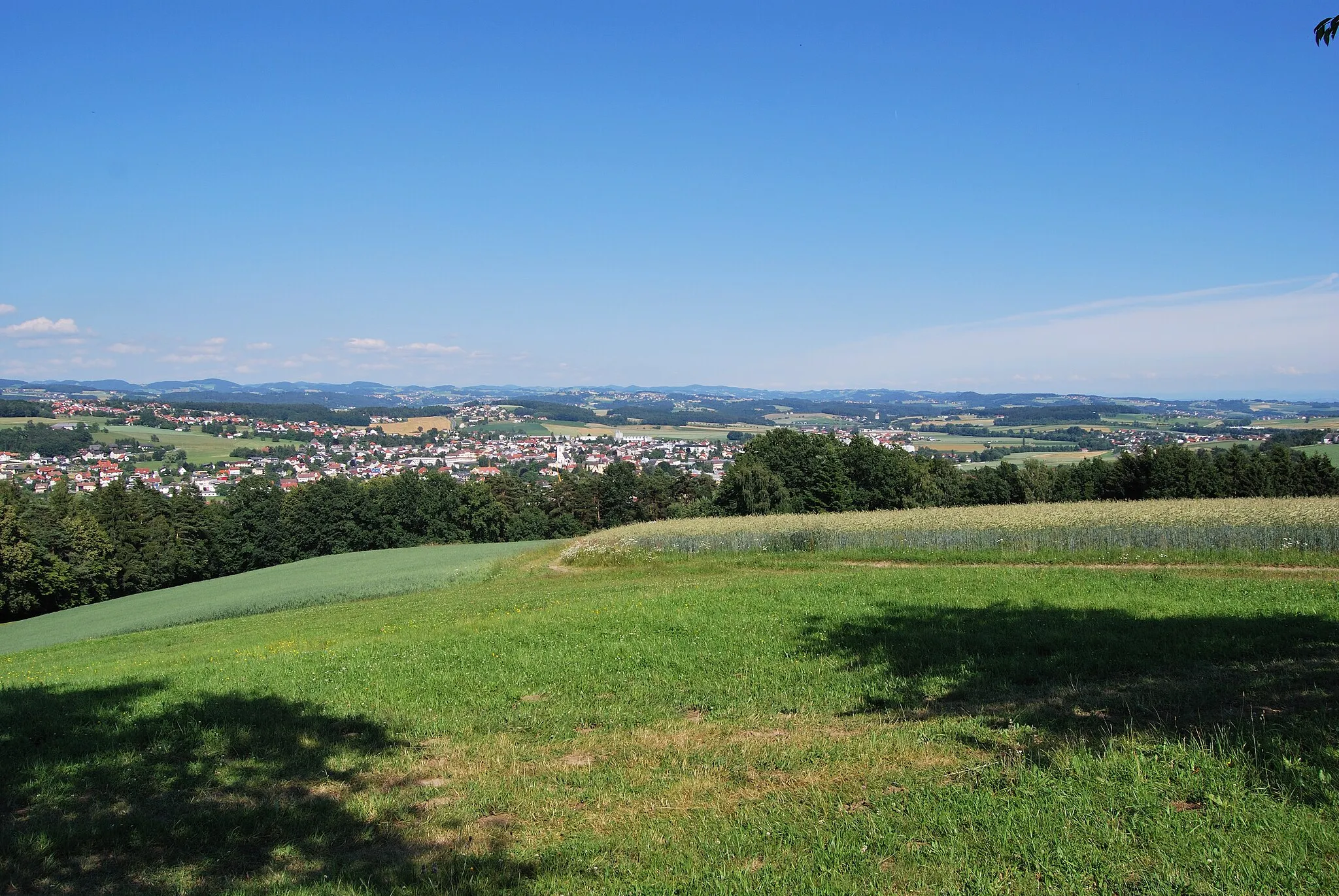
Steyregg v Oberösterreichu je malebné město ležící u řeky a poskytuje skvělé možnosti cyklistiky podél vody. Místní cyklostezky jsou dobře udržované a vhodné pro rodinné výlety.
![Miniaturní mapa "Steyregg - Luftenberg Road Loop" inspirace pro cyklisty v oblasti Oberösterreich, Austria. Vytvořeno pomocí plánovače tras Tarmacs.app](https://images.tarmacs.app/cycling-routes/routemaps/600/austria/oberosterreich/steyregg/road/182095.webp)
Panoramic road route with picturesque views
This road loop offers a scenic ride through charming villages and rolling hills, with highlights including the historic towns of Ried in der Riedmark and Langenstein. The route provides a good balance of challenging ascents and rewarding descents, making it suitable for intermediate cyclists.
![Miniaturní mapa "Ansfelden - Windegg Scenic Road Ride" inspirace pro cyklisty v oblasti Oberösterreich, Austria. Vytvořeno pomocí plánovače tras Tarmacs.app](https://images.tarmacs.app/cycling-routes/routemaps/600/austria/oberosterreich/steyregg/road/182276.webp)
Enjoy a scenic road ride through picturesque landscapes and charming villages
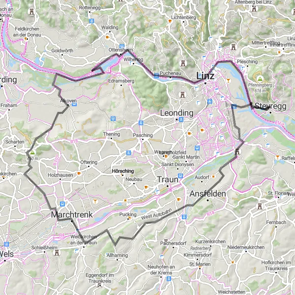
This scenic road ride takes cyclists on a relaxing journey through tranquil villages and rolling hills, with highlights including the charming town of Marchtrenk and the scenic viewpoint at Windegg. The route offers a mix of gentle climbs and long descents, making it suitable for riders of all levels. With stunning views and cultural attractions along the way, this road ride promises a peaceful and enjoyable cycling experience for all.
![Miniaturní mapa "106km gravelová trasa okolo Steyreggu" inspirace pro cyklisty v oblasti Oberösterreich, Austria. Vytvořeno pomocí plánovače tras Tarmacs.app](https://images.tarmacs.app/cycling-routes/routemaps/600/austria/oberosterreich/steyregg/gravel/182178.webp)
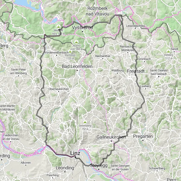
Náročná trasa s 2202m převýšením vám poskytne skvělý zážitek z jízdy po okolní kopcích.
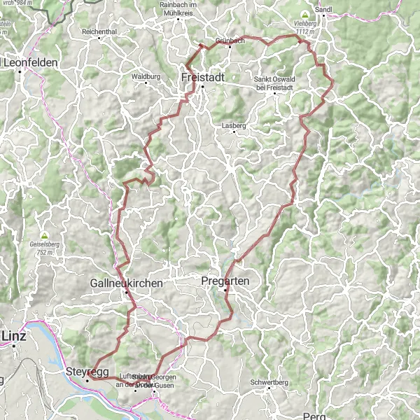
Projedete malebnými vesnicemi a přírodními scenériemi. Zastavte se v historickém městě Freistadt a dobijte síly na vrcholu Dreißger Berg s panoramatickým výhledem.
![Miniaturní mapa "Gravel cyklistická trasa kolem Steyreggu" inspirace pro cyklisty v oblasti Oberösterreich, Austria. Vytvořeno pomocí plánovače tras Tarmacs.app](https://images.tarmacs.app/cycling-routes/routemaps/600/austria/oberosterreich/steyregg/gravel/182309.webp)
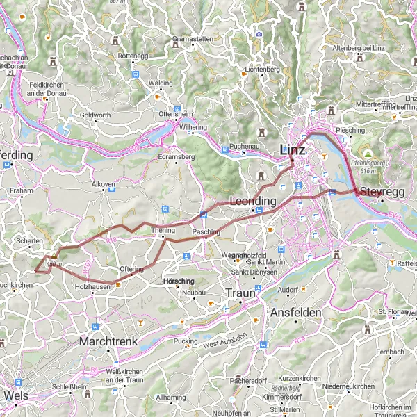
Vyzkoušejte tuto náročnou 63km trasu pro gravel bike s 543m převýšením.
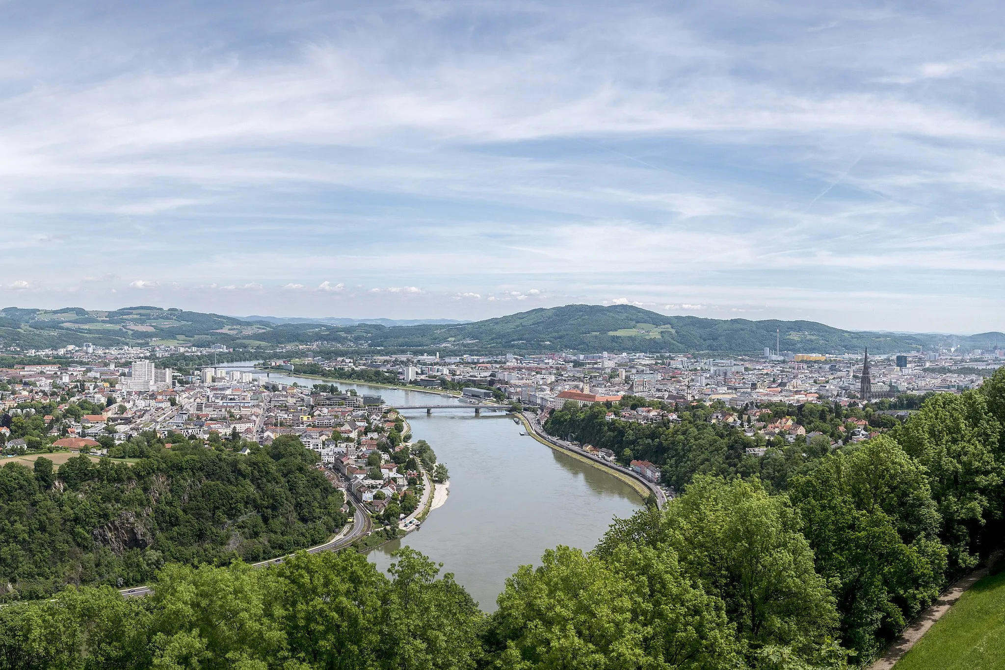
Tato trasa poskytuje krásné pohledy na město Linz a řeku Dunaj. Projedete okolo hradu a zastavíte se na vrcholu Predigtstuhl, odkud je úžasný panoramatický výhled.
![Miniaturní mapa "Steyregg - Luftenberg Gravel Adventure" inspirace pro cyklisty v oblasti Oberösterreich, Austria. Vytvořeno pomocí plánovače tras Tarmacs.app](https://images.tarmacs.app/cycling-routes/routemaps/600/austria/oberosterreich/steyregg/gravel/182122.webp)
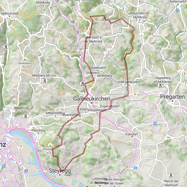
Explore off-road trails and hidden gems on this gravel adventure
This gravel route takes cyclists on a thrilling journey through diverse landscapes, from rugged terrain to lush forests. Highlights along the way include the scenic lookout at Pfenningberg and the tranquil village of Lasberg. With challenging ascents and thrilling descents, this route promises an unforgettable off-road experience for adventurous riders.
![Miniaturní mapa "Okružní cyklistická trasa z blízkosti Steyreggu" inspirace pro cyklisty v oblasti Oberösterreich, Austria. Vytvořeno pomocí plánovače tras Tarmacs.app](https://images.tarmacs.app/cycling-routes/routemaps/600/austria/oberosterreich/steyregg/road/207512.webp)
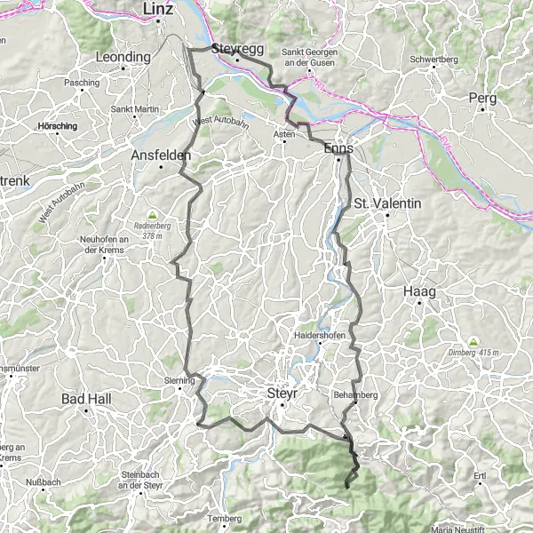
Významná silniční cyklistická trasa s 700 metry stoupání na 99 kilometrů
Tato trasa nabízí malebnou cestu s několika zajímavými body, jako Luftenberg, Schloss Tyllisburg a Allhaming. Pro milovníky cyklistiky a krásné krajiny je tato trasa skvělou volbou.
![Miniaturní mapa "113km silniční cyklistická trasa kolem Steyreggu" inspirace pro cyklisty v oblasti Oberösterreich, Austria. Vytvořeno pomocí plánovače tras Tarmacs.app](https://images.tarmacs.app/cycling-routes/routemaps/600/austria/oberosterreich/steyregg/road/182114.webp)
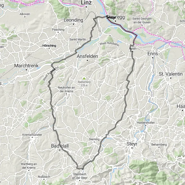
Oživte svůj cyklistický adrenalin na této dlouhé trase s 1430m převýšením.
Trasa vede okolo historických památek a malebných vesnic. Projetím městy Garsten a Neuzeug si užijete kulturou nabité zastavení. Zastavte se na zámku a pohleďte do dávné minulosti.
![Miniaturní mapa "Epic Cycling Tour: Linz to Steyregg and Back" inspirace pro cyklisty v oblasti Oberösterreich, Austria. Vytvořeno pomocí plánovače tras Tarmacs.app](https://images.tarmacs.app/cycling-routes/routemaps/600/austria/oberosterreich/steyregg/road/182139.webp)
Embark on an epic cycling adventure through diverse landscapes and historic sites
This epic cycling tour takes riders on a journey through picturesque towns, lush forests, and rugged mountains, with highlights including the historical landmarks of Ottensheim and Freistadt Castle. The route offers a mix of challenging climbs and thrilling descents, promising an unforgettable experience for cyclists of all levels. With stunning viewpoints and cultural attractions along the way, this tour is a must-do for cycling enthusiasts seeking a memorable adventure in the Austrian countryside.
![Miniaturní mapa "Cyklistická trasa kolem Steyreggu" inspirace pro cyklisty v oblasti Oberösterreich, Austria. Vytvořeno pomocí plánovače tras Tarmacs.app](https://images.tarmacs.app/cycling-routes/routemaps/600/austria/oberosterreich/steyregg/gravel/182132.webp)
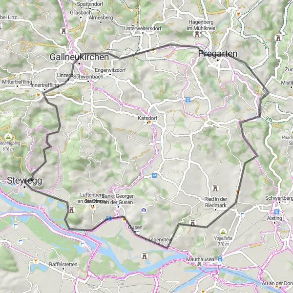
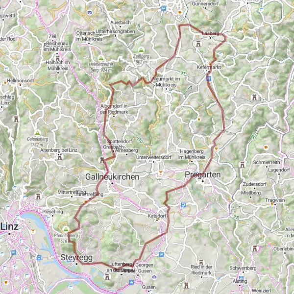
Nástupní bodem je Steyregg a trasa vede po 51km s 1173m převýšením okolím.
Projetím malebnými vesnicemi a zastavení na zajímavých místech, jako je Ura Stoa nebo Kogl, si zaručeně užijete expediční atmosféru. Trasa skýtá pohledy na přírodu a historické památky.
![Miniaturní mapa "Okružní cyklistická trasa z blízkosti Steyreggu" inspirace pro cyklisty v oblasti Oberösterreich, Austria. Vytvořeno pomocí plánovače tras Tarmacs.app](https://images.tarmacs.app/cycling-routes/routemaps/600/austria/oberosterreich/steyregg/gravel/207628.webp)
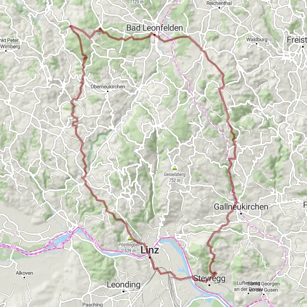
Náročná štěrková cyklistická trasa s 2047 metrech stoupání na 93 kilometrů
Tato trasa vede přes zajímavá místa jako Linz, Schallenberg a Bad Leonfelden. Pro dobrodružné cyklisty a milovníky terénní cyklistiky je tato trasa ideální volbou.
Cyklotrasy v okolí:
![Obrázek Luftenberg an der Donau](https://images.tarmacs.app/cycling-routes/covers/austria/oberosterreich/luftenberg-an-der-donau-5.webp)
![Obrázek Sankt Georgen an der Gusen](https://images.tarmacs.app/cycling-routes/covers/austria/oberosterreich/sankt-georgen-an-der-gusen-5.webp)
![Obrázek Linec](https://images.tarmacs.app/cycling-routes/covers/austria/oberosterreich/linz-5.webp)
![Obrázek Gaumberg](https://images.tarmacs.app/cycling-routes/covers/austria/oberosterreich/gaumberg-2.webp)
![Obrázek Asten](https://images.tarmacs.app/cycling-routes/covers/austria/oberosterreich/asten-5.webp)
![Obrázek Gallneukirchen](https://images.tarmacs.app/cycling-routes/covers/austria/oberosterreich/gallneukirchen-2.webp)
![Obrázek Freindorf](https://images.tarmacs.app/cycling-routes/covers/austria/oberosterreich/freindorf-4.webp)
![Obrázek Hart](https://images.tarmacs.app/cycling-routes/covers/austria/oberosterreich/hart-5.webp)
![Obrázek Leonding](https://images.tarmacs.app/cycling-routes/covers/austria/oberosterreich/leonding-3.webp)
Okolní oblasti:
![Obrázek Niederösterreich](https://images.tarmacs.app/cycling-routes/covers/austria/niederosterreich/traismauer-3.webp)
![Obrázek Vídeň](https://images.tarmacs.app/cycling-routes/covers/austria/wien/simmering-5.webp)
![Obrázek Kärnten](https://images.tarmacs.app/cycling-routes/covers/austria/karnten/woelfnitz-1.webp)
![Obrázek Steiermark](https://images.tarmacs.app/cycling-routes/covers/austria/steiermark/judenburg-3.webp)
![Obrázek Salzburg](https://images.tarmacs.app/cycling-routes/covers/austria/salzburg/bergheim-5.webp)
![Obrázek Tirol](https://images.tarmacs.app/cycling-routes/covers/austria/tirol/sautens-1.webp)
![Obrázek Středočeský kraj](https://images.tarmacs.app/cycling-routes/covers/czech-republic/stredni-cechy/beroun-1.webp)
![Obrázek Jihozápad](https://images.tarmacs.app/cycling-routes/covers/czech-republic/jihozapad/veseli-nad-luznici-2.webp)
![Obrázek Jihovýchod](https://images.tarmacs.app/cycling-routes/covers/czech-republic/jihovychod/rousinov-5.webp)
![Obrázek Oberbayern](https://images.tarmacs.app/cycling-routes/covers/germany/oberbayern/diessen-am-ammersee-3.webp)
![Obrázek Niederbayern](https://images.tarmacs.app/cycling-routes/covers/germany/niederbayern/leiblfing-3.webp)