![Cover image](https://images.tarmacs.app/cycling-routes/covers/austria/steiermark/goess-5.webp)
Zajímavá cyklistika ve Štýrsku
Cyklistické trasy kolem Göss
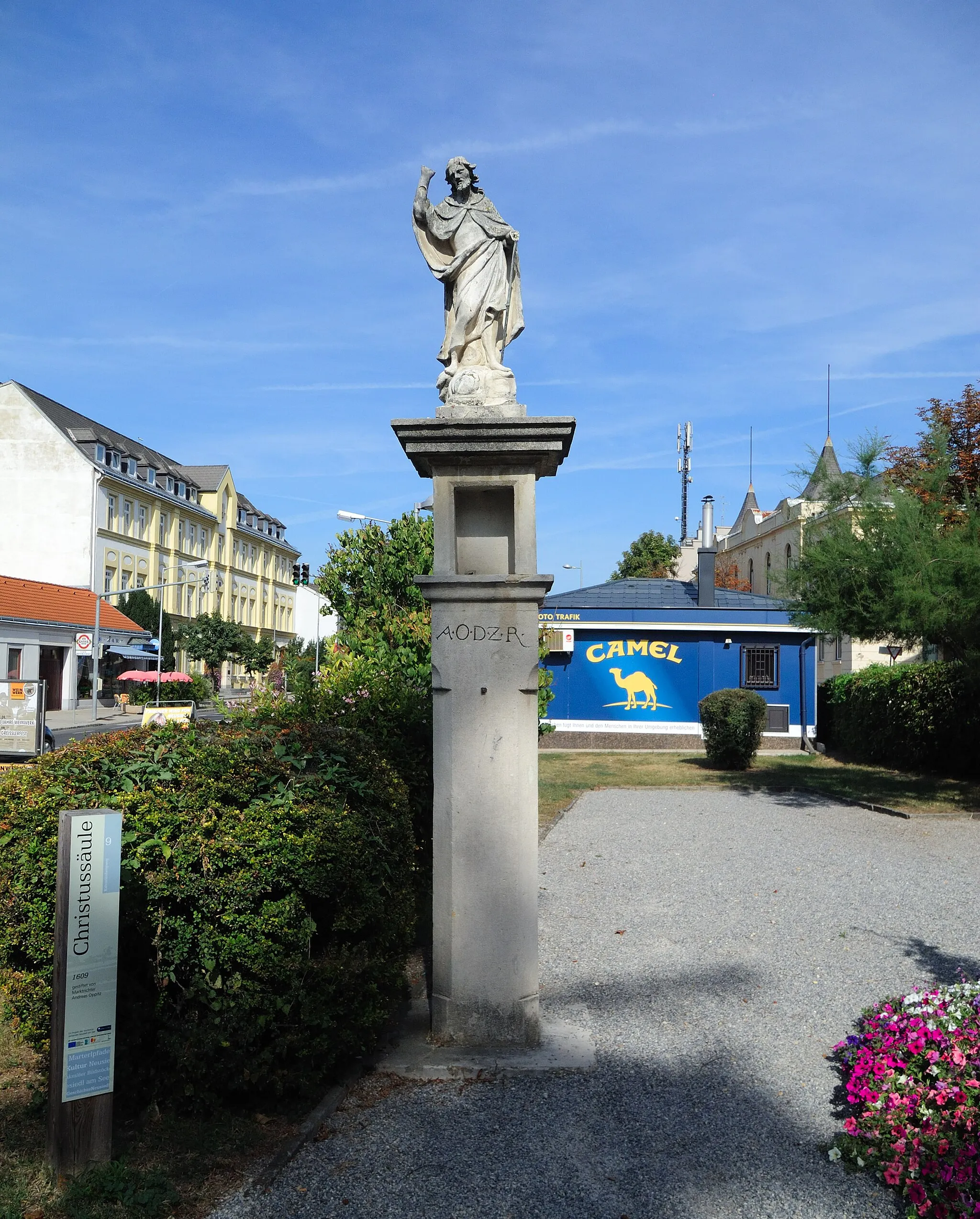
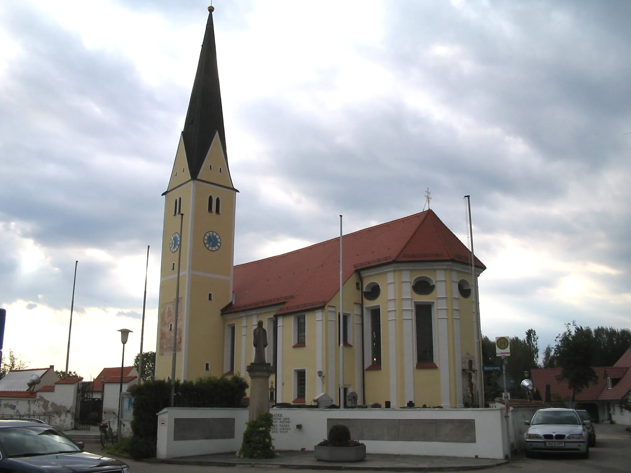
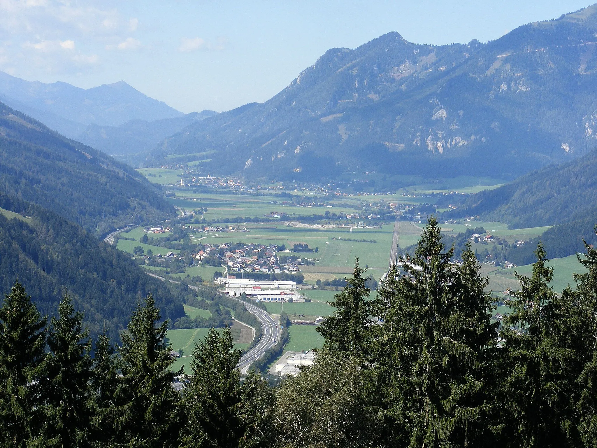
Göss se nachází ve Štýrsku a je zajímavým místem pro cyklistiku. V blízkosti města se nachází úchvatná krajina a některé významné cyklistické trasy pro nadšence.
![Miniaturní mapa "Sankt Peter-Freienstein - Mautern in Steiermark Road" inspirace pro cyklisty v oblasti Steiermark, Austria. Vytvořeno pomocí plánovače tras Tarmacs.app](https://images.tarmacs.app/cycling-routes/routemaps/600/austria/steiermark/goess/road/181724.webp)
Cycle through diverse landscapes and cultural sites
Tato trasa ze Sankt Peter-Freiensteinu do Mauternu in Steiermark vám přinese pestrou paletu krajin a kulturních památek. Cestou projedete Baierhubermauer a zakončíte u Galgenbergu.
![Miniaturní mapa "Trasattel - Pernegg an der Mur Gravel" inspirace pro cyklisty v oblasti Steiermark, Austria. Vytvořeno pomocí plánovače tras Tarmacs.app](https://images.tarmacs.app/cycling-routes/routemaps/600/austria/steiermark/goess/gravel/181680.webp)
Bike through amazing landscapes and historical sites
Tato trasa z Trasattelu do Perneggu an der Mur vede kolem zámku Thalhof a nabízí krásné výhledy na okolní krajinu. Cestou projedete Frohnleiten a zakončíte u Groß-Gößgrabenu.
![Miniaturní mapa "Okružní cyklotrasa z Göss (Štýrsko, Rakousko)" inspirace pro cyklisty v oblasti Steiermark, Austria. Vytvořeno pomocí plánovače tras Tarmacs.app](https://images.tarmacs.app/cycling-routes/routemaps/600/austria/steiermark/goess/road/207120.webp)
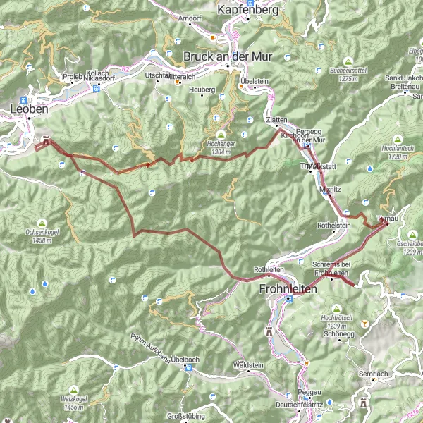
Zajímavá cyklotrasa pro horská kola po stezkách s asfaltovým povrchem
Tato 114 km dlouhá trasa nabízí malebné výhledy a zahrnuje významné body jako Römerbrücke a Peggau. Cyklisté budou potěšeni stoupáním o 991 m a mohou si užít krásné panoramata na stezkách kolem Niklasdorfu a Perneggu an der Mur.
![Miniaturní mapa "Silniční cyklotrasa Liesingberg - Kalvarienberg" inspirace pro cyklisty v oblasti Steiermark, Austria. Vytvořeno pomocí plánovače tras Tarmacs.app](https://images.tarmacs.app/cycling-routes/routemaps/600/austria/steiermark/goess/road/181728.webp)
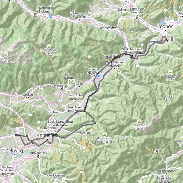
Náročná trasa s malebnými výhledy
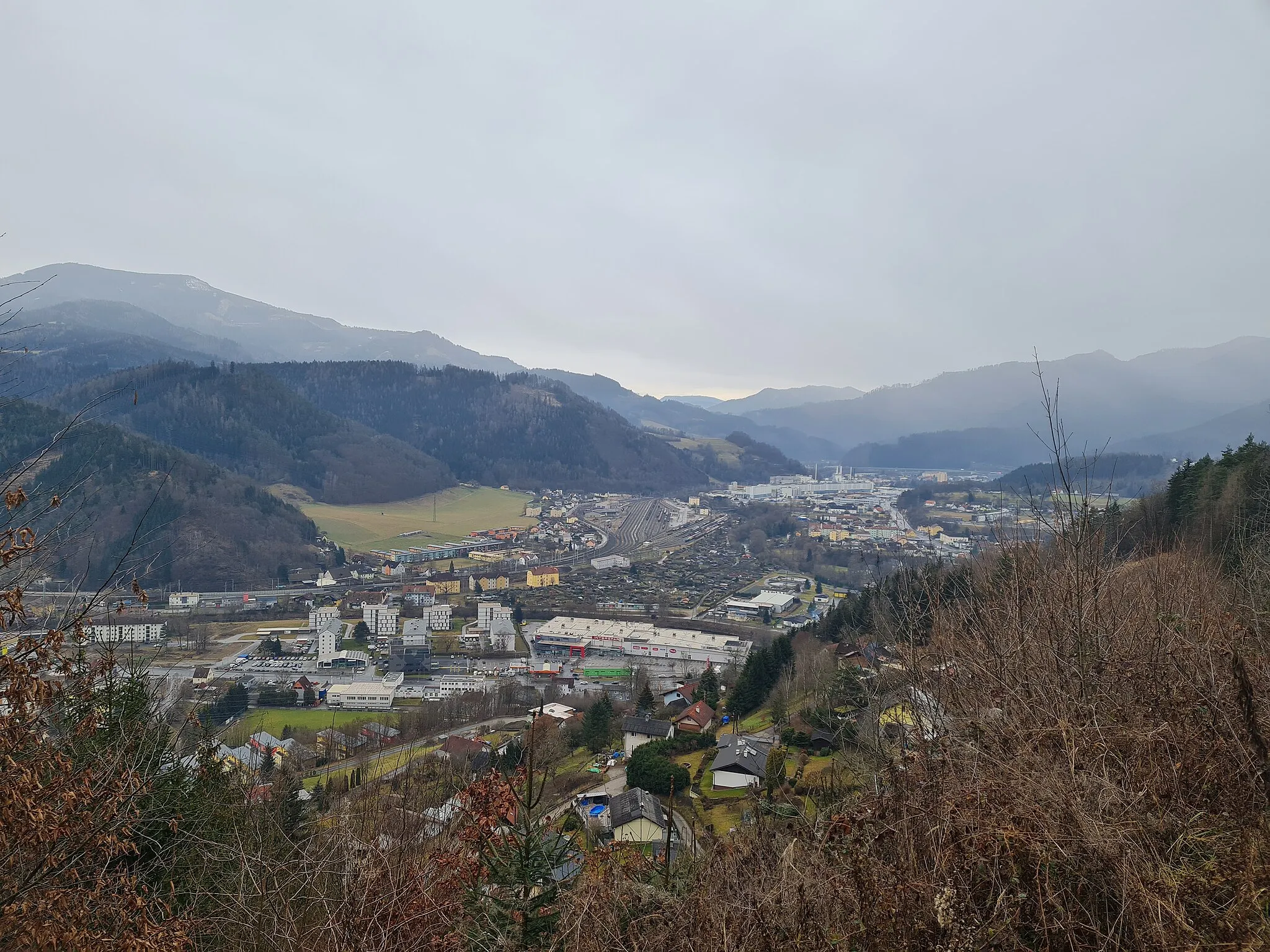
Tato 86km dlouhá trasa vede přes Liesingberg, Sankt Stefan ob Leoben, Knittelfeld a Kalvarienberg. Během cesty můžete obdivovat krásnou krajinu a historické památky.
![Miniaturní mapa "Gravelová cyklotrasa Leoben - Trasattel - Klein-Gößgraben" inspirace pro cyklisty v oblasti Steiermark, Austria. Vytvořeno pomocí plánovače tras Tarmacs.app](https://images.tarmacs.app/cycling-routes/routemaps/600/austria/steiermark/goess/gravel/181749.webp)
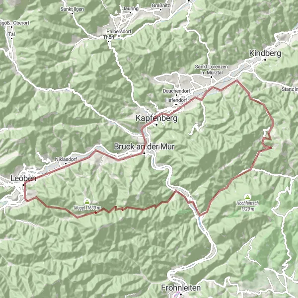
Zajímavá trasa s mnoha významnými body
Tato 86km dlouhá trasa nabízí krásné výhledy na Leoben, Allerheiligen im Mürztal a Pernegg an der Mur. Cesta vede přes Lockenegg a Hamreiterkogel a končí v Trasattelu a Klein-Gößgraben.
![Miniaturní mapa "Kalvarienberg - Bruck an der Mur Gravel" inspirace pro cyklisty v oblasti Steiermark, Austria. Vytvořeno pomocí plánovače tras Tarmacs.app](https://images.tarmacs.app/cycling-routes/routemaps/600/austria/steiermark/goess/gravel/181750.webp)
Discover charming villages and picturesque landscapes
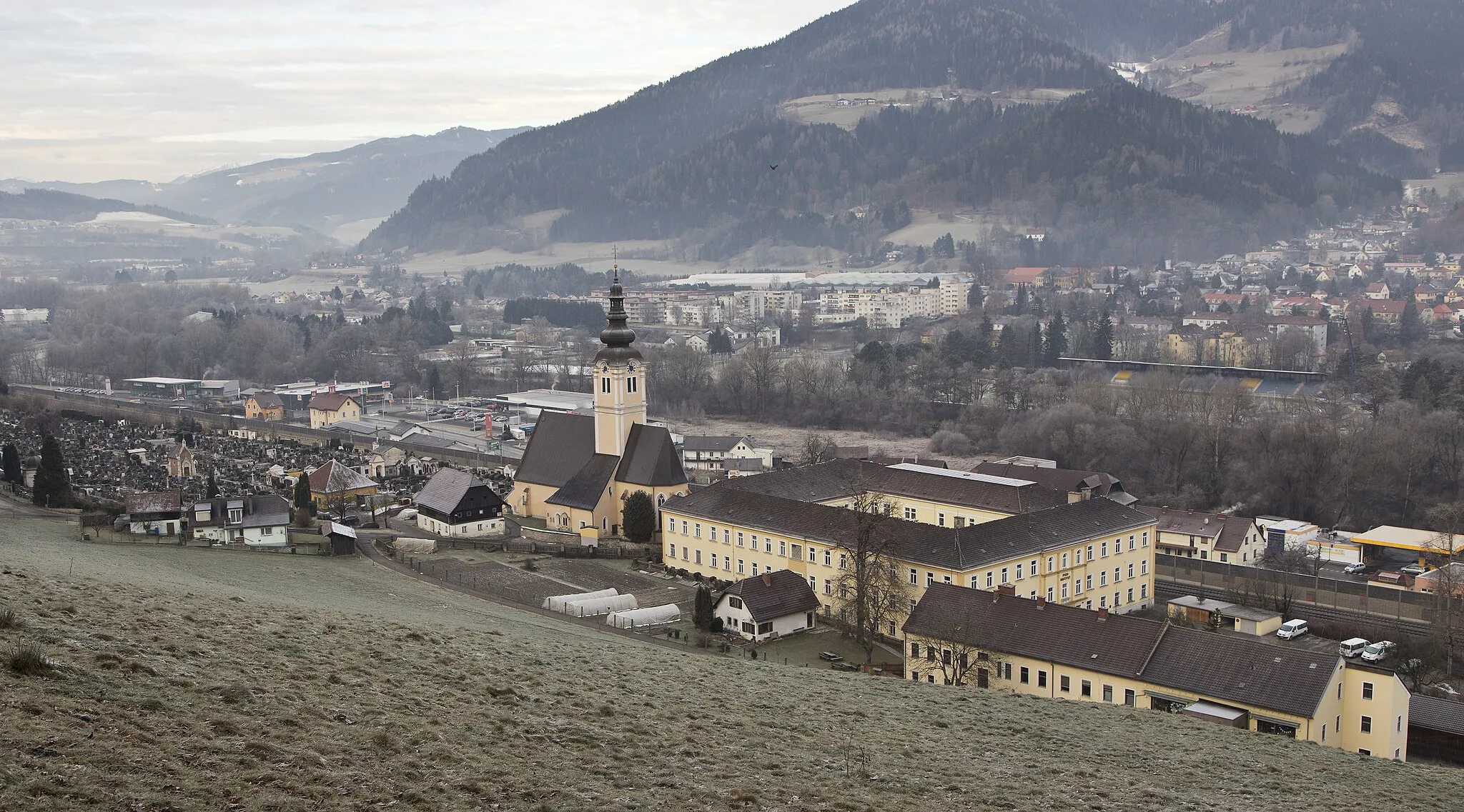
Tato trasa z Kalvarienbergu do Bruck an der Mur vás provede malebnými vesnicemi a typickou rakouskou krajinou. Cestou projedete Aussichtsplattform a zakončíte u Trasattelu.
![Miniaturní mapa "Silniční cyklotrasa Bruck an der Mur - Sankt Lorenzen bei Knittelfeld" inspirace pro cyklisty v oblasti Steiermark, Austria. Vytvořeno pomocí plánovače tras Tarmacs.app](https://images.tarmacs.app/cycling-routes/routemaps/600/austria/steiermark/goess/road/181752.webp)
Náročná trasa s bohatou historií
Tato 169km dlouhá trasa vede přes Bruck an der Mur, Juliuswarte, Frohnleiten, Ruppbauernhöhe a Sankt Lorenzen bei Knittelfeld. Během cesty si můžete prohlédnout historické památky a užít si krásné výhledy na okolní krajinu.
![Miniaturní mapa "Silniční cyklotrasa Niklasdorf - Proleb" inspirace pro cyklisty v oblasti Steiermark, Austria. Vytvořeno pomocí plánovače tras Tarmacs.app](https://images.tarmacs.app/cycling-routes/routemaps/600/austria/steiermark/goess/road/181779.webp)
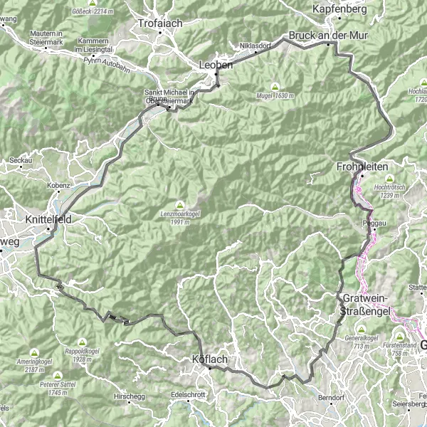
Náročná trasa s úchvatnými výhledy
Tato 126km dlouhá trasa vede přes Niklasdorf, Aussichtsplattform, Schöckl, Römerbrücke a Proleb. Během cesty si můžete užít krásné výhledy a historické památky.
![Miniaturní mapa "Gravel Route near Göss" inspirace pro cyklisty v oblasti Steiermark, Austria. Vytvořeno pomocí plánovače tras Tarmacs.app](https://images.tarmacs.app/cycling-routes/routemaps/600/austria/steiermark/goess/gravel/181738.webp)
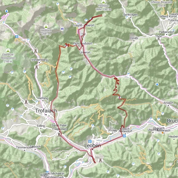
Explore the scenic gravel route starting near Göss with challenging ascents and beautiful landscapes.
This 76km gravel route near Göss offers a challenging ride with a total ascent of 2136m. Highlights include the breathtaking Kalvarienberg, picturesque Sankt Peter-Freienstein, and the stunning Planauerkogel. Don't miss the charming village of Tal and the historic Unterort. The route also takes you to the impressive Rabensteinerwand and the quaint village of Penggen before finishing in the vibrant city of Leoben.
![Miniaturní mapa "Leoben - Schartnerkogel Gravel" inspirace pro cyklisty v oblasti Steiermark, Austria. Vytvořeno pomocí plánovače tras Tarmacs.app](https://images.tarmacs.app/cycling-routes/routemaps/600/austria/steiermark/goess/gravel/181743.webp)
Experience the beauty of nature and historical landmarks
Tato trasa z Leobenu na Schartnerkogel vás provede krajinou s bohatou historií a úchvatnými výhledy. Cestou projedete Heuberg a zakončíte u Schloß Thalhof.
Cyklotrasy v okolí:
![Obrázek Leitendorf](https://images.tarmacs.app/cycling-routes/covers/austria/steiermark/leitendorf-5.webp)
![Obrázek Leoben](https://images.tarmacs.app/cycling-routes/covers/austria/steiermark/leoben-5.webp)
![Obrázek Donawitz](https://images.tarmacs.app/cycling-routes/covers/austria/steiermark/donawitz-5.webp)
![Obrázek Niklasdorf](https://images.tarmacs.app/cycling-routes/covers/austria/steiermark/niklasdorf-5.webp)
![Obrázek Liesingtal](https://images.tarmacs.app/cycling-routes/covers/austria/steiermark/liesingtal-5.webp)
![Obrázek Trofaiach](https://images.tarmacs.app/cycling-routes/covers/austria/steiermark/trofaiach-1.webp)
![Obrázek Berndorf](https://images.tarmacs.app/cycling-routes/covers/austria/steiermark/berndorf-3.webp)
![Obrázek Bruck an der Mur](https://images.tarmacs.app/cycling-routes/covers/austria/steiermark/bruck-an-der-mur-3.webp)
![Obrázek Diemlach](https://images.tarmacs.app/cycling-routes/covers/austria/steiermark/diemlach-5.webp)
Okolní oblasti:
![Obrázek Burgenland](https://images.tarmacs.app/cycling-routes/covers/austria/burgenland/neusiedl-am-see-2.webp)
![Obrázek Niederösterreich](https://images.tarmacs.app/cycling-routes/covers/austria/niederosterreich/brunn-am-gebirge-3.webp)
![Obrázek Vídeň](https://images.tarmacs.app/cycling-routes/covers/austria/wien/vienna-4.webp)
![Obrázek Kärnten](https://images.tarmacs.app/cycling-routes/covers/austria/karnten/priel-4.webp)
![Obrázek Oberösterreich](https://images.tarmacs.app/cycling-routes/covers/austria/oberosterreich/aschach-an-der-steyr-3.webp)
![Obrázek Salzburg](https://images.tarmacs.app/cycling-routes/covers/austria/salzburg/werfen-3.webp)
![Obrázek Tirol](https://images.tarmacs.app/cycling-routes/covers/austria/tirol/roppen-3.webp)
![Obrázek Jihozápad](https://images.tarmacs.app/cycling-routes/covers/czech-republic/jihozapad/chlumcany-4.webp)
![Obrázek Jihovýchod](https://images.tarmacs.app/cycling-routes/covers/czech-republic/jihovychod/rousinov-3.webp)
![Obrázek Oberbayern](https://images.tarmacs.app/cycling-routes/covers/germany/oberbayern/waidhofen-5.webp)
![Obrázek Sjeverna Hrvatska](https://images.tarmacs.app/cycling-routes/covers/croatia/sjeverna-hrvatska/ivanec-3.webp)
![Obrázek Nyugat-Dunántúl](https://images.tarmacs.app/cycling-routes/covers/hungary/nyugat-dunantul/koszeg-5.webp)
![Obrázek Vzhodna Slovenija](https://images.tarmacs.app/cycling-routes/covers/slovenia/vzhodna-slovenija/novo-mesto-1.webp)