![Cover image](https://images.tarmacs.app/cycling-routes/covers/austria/steiermark/krieglach-4.webp)
Pohodlná cyklistická destinace v rakouském Krieglachu.
Cyklistické trasy kolem Krieglach
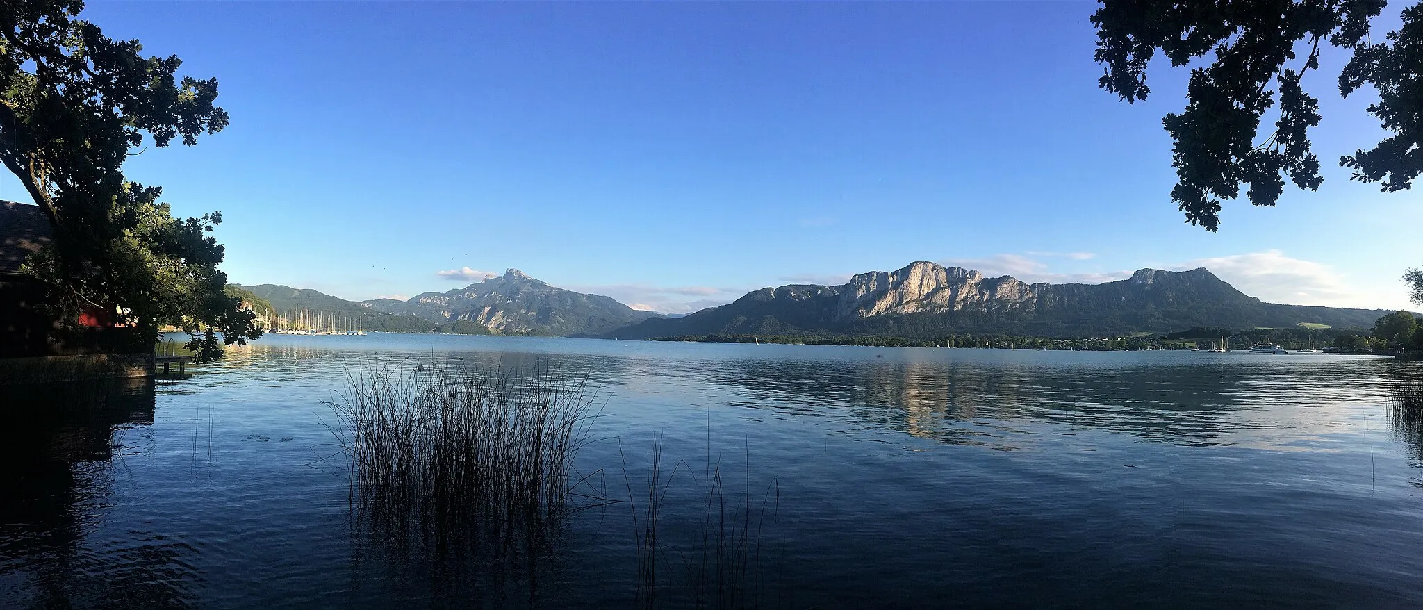
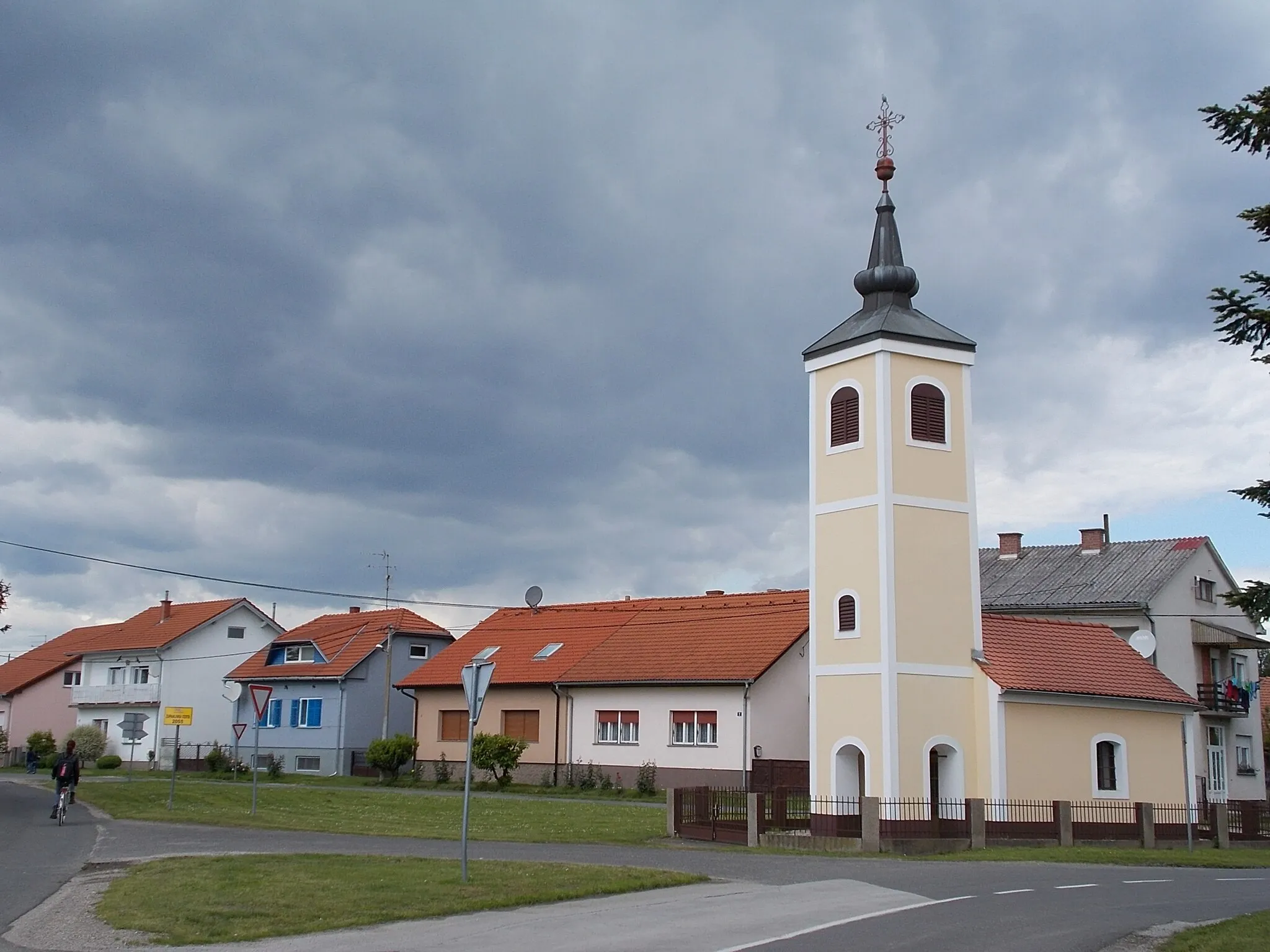
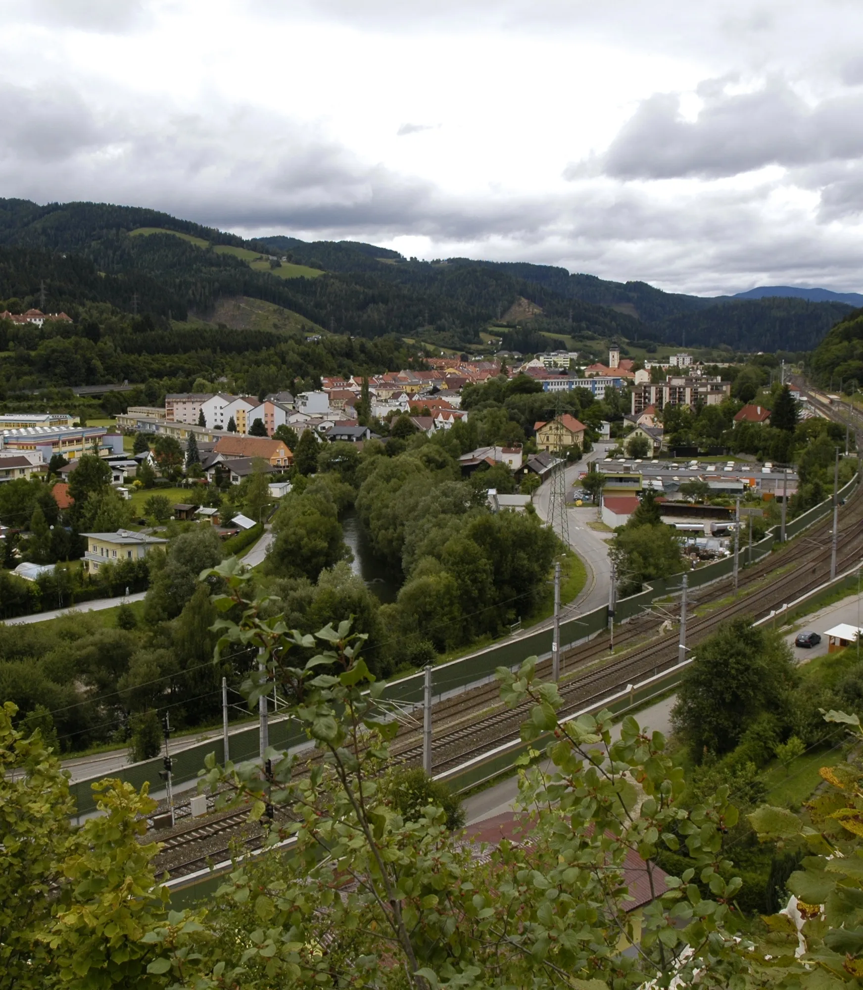
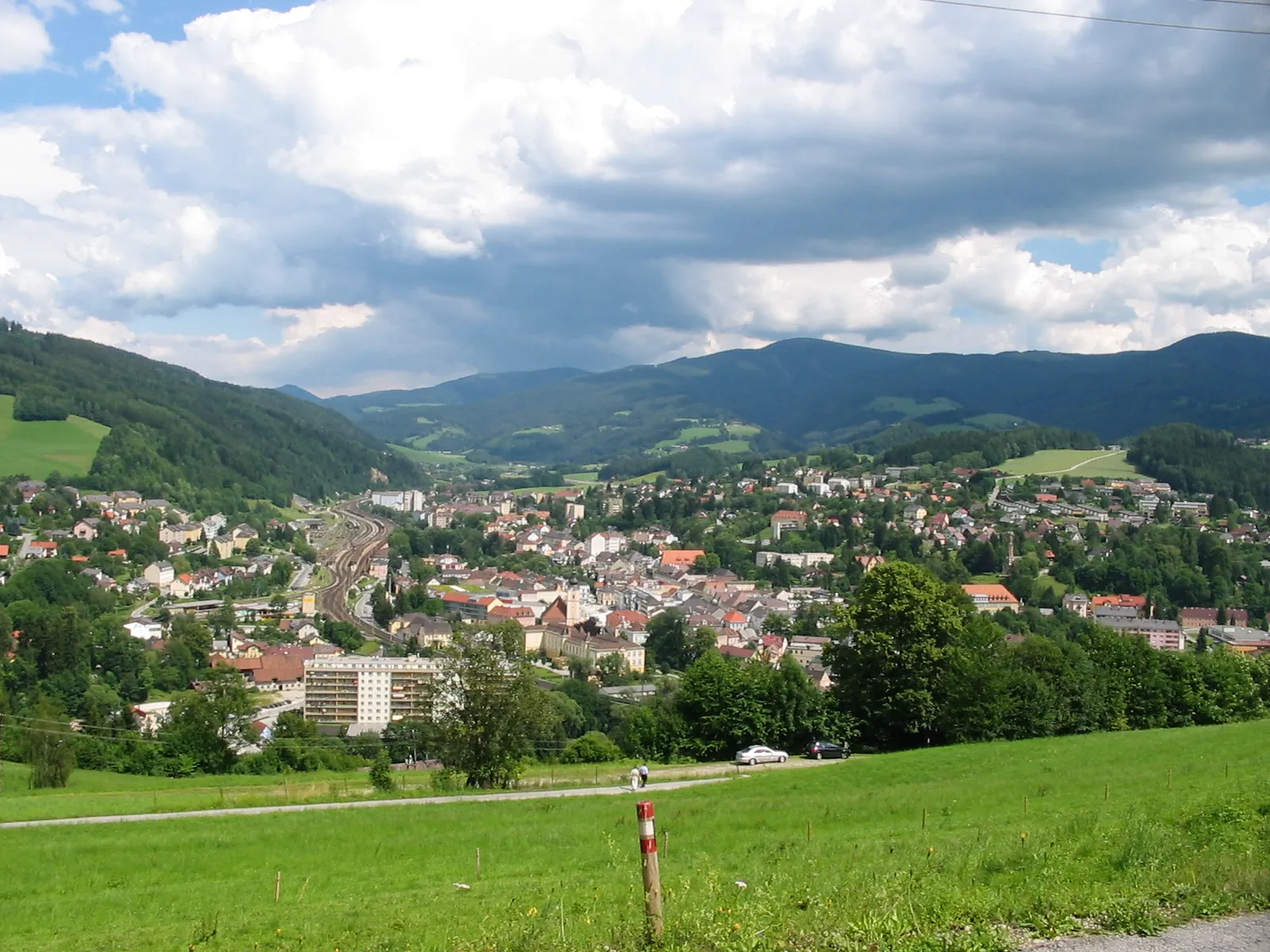
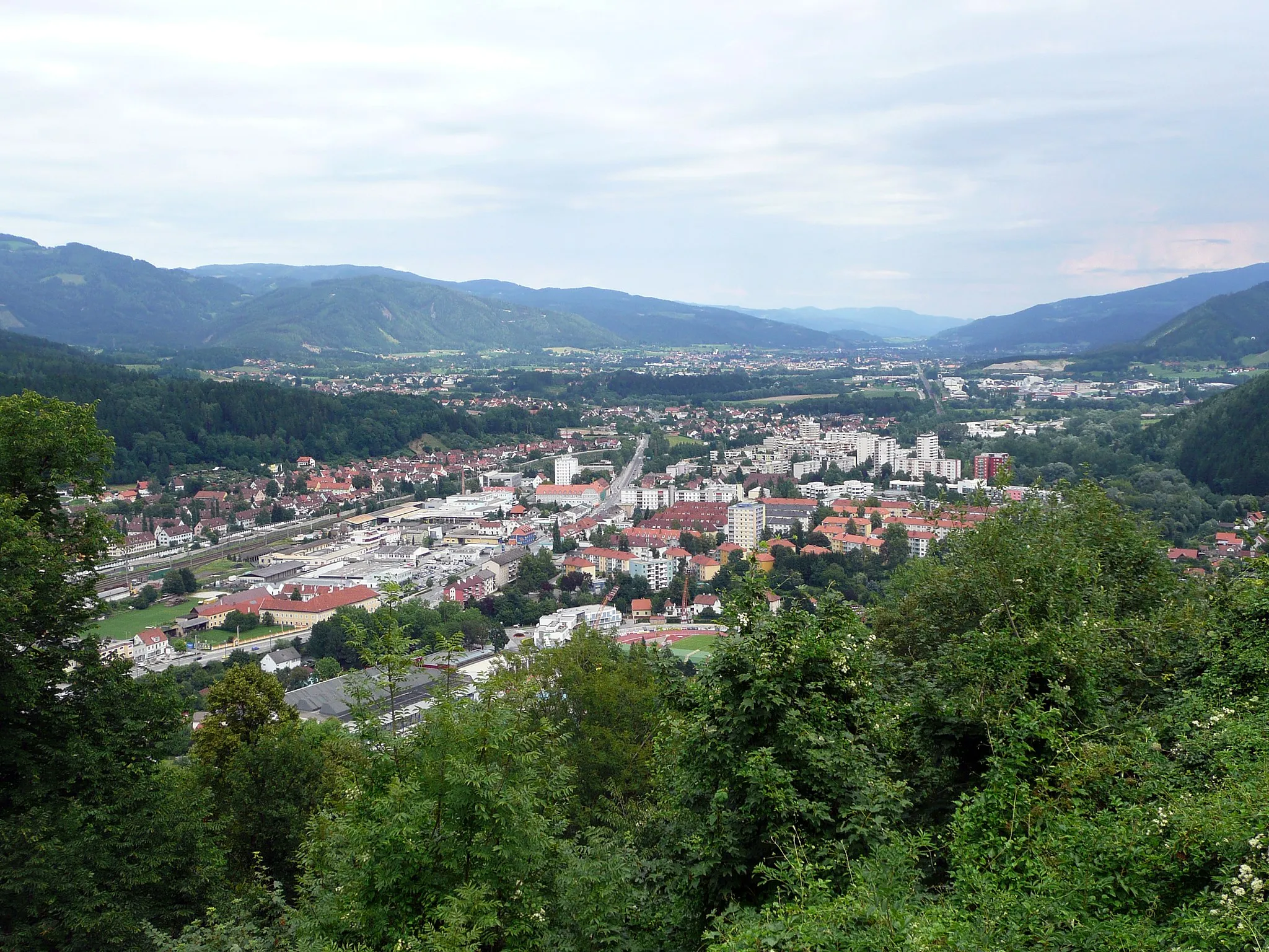
Krieglach je malebné město v rakouském Steiermarku s malebnými cyklistickými trasami a staženými lesy. Pro cyklisty nabízí různorodé terény a pěkné scenérie pro jízdu na kole.
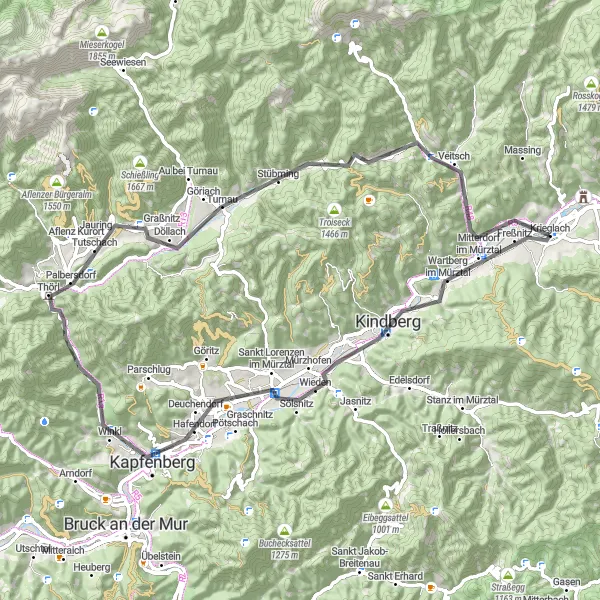
Mürztalrunde
![Miniaturní mapa "Mürztalrunde" inspirace pro cyklisty v oblasti Steiermark, Austria. Vytvořeno pomocí plánovače tras Tarmacs.app](https://images.tarmacs.app/cycling-routes/routemaps/600/austria/steiermark/krieglach/road/147432.webp)
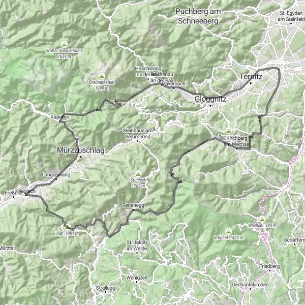
Náročná silniční trasa s výstupem o 2825 m na 139 km.
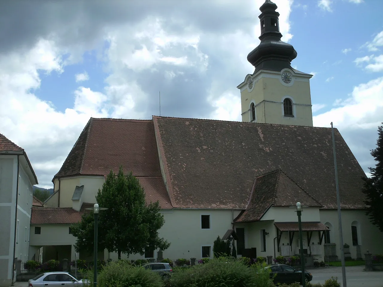
Můžete očekávat nádherné výhledy na okolní hory a přírodní scenérie. Trasa nabízí mnoho historických památek a malebných vesniček. Cesta vede převážně po silnicích s minimálním provozem. Doporučuje se pro zkušené cyklisty, kteří mají rádi výzvy a krásnou krajinu.
Road Mitterdorf Loop
![Miniaturní mapa "Road Mitterdorf Loop" inspirace pro cyklisty v oblasti Steiermark, Austria. Vytvořeno pomocí plánovače tras Tarmacs.app](https://images.tarmacs.app/cycling-routes/routemaps/600/austria/steiermark/krieglach/road/147390.webp)
Vydejte se na 120 km dlouhý okruh kolem Mitterdorfu
Tato 120 km dlouhá trasa s převýšením 2271 m vám přinese krásné výhledy na Mitterdorf im Mürztal, Pretalsattel, Turnau, Gaiberg a další zajímavá místa. Objevte krásy rakouské krajiny během této náročné cyklistické trasy.
![Miniaturní mapa "Road Route Veitsch - Langenwang" inspirace pro cyklisty v oblasti Steiermark, Austria. Vytvořeno pomocí plánovače tras Tarmacs.app](https://images.tarmacs.app/cycling-routes/routemaps/600/austria/steiermark/krieglach/road/175236.webp)
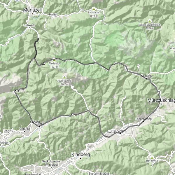
Scenic road cycling journey through the mountains
Road route with a total ascent of 2067m and a distance of 102km. The route includes highlights such as Veitsch, Pretalsattel, Turnau, Gaiberg, Wegscheid, Wetterin, Kreuzmauer, Neuberg an der Mürz, Ganzstein, and Langenwang.
![Miniaturní mapa "Gravelová výzva kolem Krieglachu" inspirace pro cyklisty v oblasti Steiermark, Austria. Vytvořeno pomocí plánovače tras Tarmacs.app](https://images.tarmacs.app/cycling-routes/routemaps/600/austria/steiermark/krieglach/gravel/175259.webp)
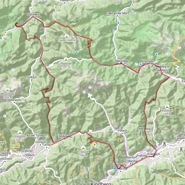
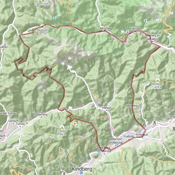
Napínavá offroad trasa se strmými stoupáními a malebnými lukami
Nabízející 110 km plných dobrodružství a dohromady 3373 metrů stoupání, tato cesta vás zavede skrz krásnou krajinu kolem Mitterdorf im Mürztal, Aschbach a Gußwerk. Nezapomeňte si vyfotit starobylý kříž Nikolauskreuz a obdivovat pohled na lesy a kopce na Mürzstegu. Závěrem vás čeká malebný výhled z Kreuzmaueru a Rabinsteinu.
![Miniaturní mapa "Gravel route via Langenwang, Bärenkogel, Alpl" inspirace pro cyklisty v oblasti Steiermark, Austria. Vytvořeno pomocí plánovače tras Tarmacs.app](https://images.tarmacs.app/cycling-routes/routemaps/600/austria/steiermark/krieglach/gravel/147331.webp)
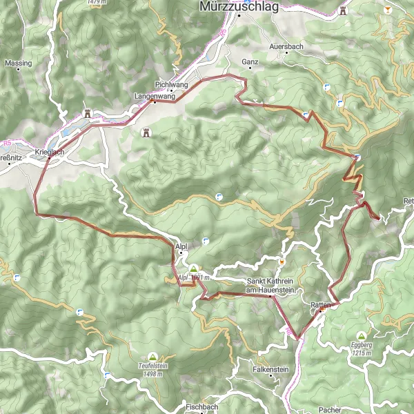
Scenic gravel route through mountainous terrain
This 56 km gravel route offers a mix of challenging climbs and beautiful landscapes. Pass through Langenwang, conquer the Bärenkogel ascent, and enjoy the serene Alpl village. With 1546 m of ascent, this route is perfect for nature lovers and adventurers.
![Miniaturní mapa "Gravel route via Mitterdorf im Mürztal, Pretalsattel, Reißeck" inspirace pro cyklisty v oblasti Steiermark, Austria. Vytvořeno pomocí plánovače tras Tarmacs.app](https://images.tarmacs.app/cycling-routes/routemaps/600/austria/steiermark/krieglach/gravel/147338.webp)
Challenging gravel route with stunning mountain views
This 86 km gravel route starts in Krieglach and takes you through picturesque villages like Mitterdorf im Mürztal, up to the challenging Pretalsattel and Reißeck. You will enjoy breathtaking scenery and a total ascent of 2815 m.
![Miniaturní mapa "Jedinečná cesta okolo Krieglachu" inspirace pro cyklisty v oblasti Steiermark, Austria. Vytvořeno pomocí plánovače tras Tarmacs.app](https://images.tarmacs.app/cycling-routes/routemaps/600/austria/steiermark/krieglach/road/175432.webp)
Náročná cesta s krásnými výhledy a zajímavými památkami
Nenechte si ujít tento 90 km dlouhý výlet, který vám přinese 1198 metrů stoupání. Trasa vás zavede kolem malebných vesnic Kindberg, Kapfenberg a Bruck an der Mur. Nezapomeňte se zastavit na vrcholu Wartbergkogel a osvěžit se v horském prameni ve Veitschu. Cílem je okouzlující Karnerkogel s panoramatickým výhledem na okolní hory.
![Miniaturní mapa "Road Route Wartbergkogel - Langenwang" inspirace pro cyklisty v oblasti Steiermark, Austria. Vytvořeno pomocí plánovače tras Tarmacs.app](https://images.tarmacs.app/cycling-routes/routemaps/600/austria/steiermark/krieglach/road/147447.webp)
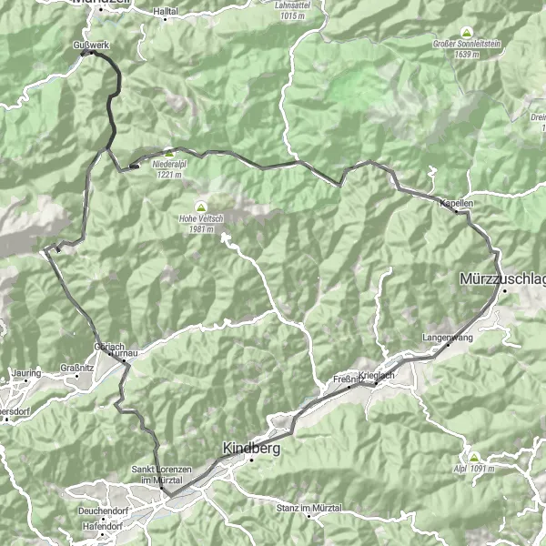
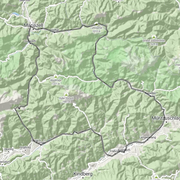
Challenging road cycling adventure with stunning landscapes
Road route with a total ascent of 2257m and a distance of 117km. The route features highlights such as Wartbergkogel, Kindberg, Sankt Lorenzen im Mürztal, Fuchsegg, Turnau, Gaiberg, Sauwand, Gußwerk, Niederalpl, Dobrein, Neuberg an der Mürz, Stelzer, Ganzstein, and Langenwang.
![Miniaturní mapa "Road route via Kindberg, Kapfenberg, Turnau" inspirace pro cyklisty v oblasti Steiermark, Austria. Vytvořeno pomocí plánovače tras Tarmacs.app](https://images.tarmacs.app/cycling-routes/routemaps/600/austria/steiermark/krieglach/road/147400.webp)
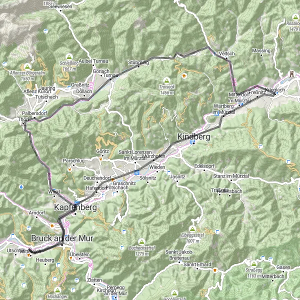
Scenic road route through charming villages
This 74 km road route takes you through quaint villages, challenging climbs, and scenic viewpoints. Pass through Kindberg, enjoy the panoramic views from Kapfenberg, tackle the challenging Einödriegel ascent, and relax in the picturesque village of Turnau. With 1163 m of ascent, this route is ideal for cyclists looking for a mix of cultural and natural attractions.
![Miniaturní mapa "Gravel route via Mitterdorf im Mürztal, Hochreiterkogel, Veitsch" inspirace pro cyklisty v oblasti Steiermark, Austria. Vytvořeno pomocí plánovače tras Tarmacs.app](https://images.tarmacs.app/cycling-routes/routemaps/600/austria/steiermark/krieglach/gravel/147326.webp)
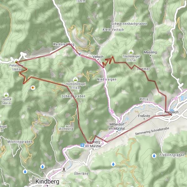
Adventure gravel route through diverse landscapes
Embark on this 35 km gravel route that takes you through varying terrain and challenging ascents. Pass through Mitterdorf im Mürztal, conquer the peaks of Hochreiterkogel and Veitsch, and enjoy the thrill of the Karnerkogel descent. With 1209 m of ascent, this route is suitable for experienced cyclists seeking a thrilling ride.
Cyklotrasy v okolí:
![Obrázek Mitterdorf im Mürztal](https://images.tarmacs.app/cycling-routes/covers/austria/steiermark/mitterdorf-im-muerztal-3.webp)
![Obrázek Langenwang](https://images.tarmacs.app/cycling-routes/covers/austria/steiermark/langenwang-5.webp)
![Obrázek Wartberg](https://images.tarmacs.app/cycling-routes/covers/austria/steiermark/wartberg-4.webp)
![Obrázek Hönigsberg](https://images.tarmacs.app/cycling-routes/covers/austria/steiermark/hoenigsberg-5.webp)
![Obrázek Kindberg](https://images.tarmacs.app/cycling-routes/covers/austria/steiermark/kindberg-5.webp)
![Obrázek Mürzzuschlag](https://images.tarmacs.app/cycling-routes/covers/austria/steiermark/muerzzuschlag-3.webp)
![Obrázek Sankt Lorenzen im Mürztal](https://images.tarmacs.app/cycling-routes/covers/austria/steiermark/sankt-lorenzen-im-muerztal-3.webp)
![Obrázek Deuchendorf](https://images.tarmacs.app/cycling-routes/covers/austria/steiermark/deuchendorf-4.webp)
![Obrázek Hafendorf](https://images.tarmacs.app/cycling-routes/covers/austria/steiermark/hafendorf-5.webp)
Okolní oblasti:
![Obrázek Burgenland](https://images.tarmacs.app/cycling-routes/covers/austria/burgenland/neufeld-an-der-leitha-5.webp)
![Obrázek Niederösterreich](https://images.tarmacs.app/cycling-routes/covers/austria/niederosterreich/wiener-neustadt-3.webp)
![Obrázek Vídeň](https://images.tarmacs.app/cycling-routes/covers/austria/wien/innere-stadt-1.webp)
![Obrázek Kärnten](https://images.tarmacs.app/cycling-routes/covers/austria/karnten/woelfnitz-3.webp)
![Obrázek Oberösterreich](https://images.tarmacs.app/cycling-routes/covers/austria/oberosterreich/mondsee-5.webp)
![Obrázek Salzburg](https://images.tarmacs.app/cycling-routes/covers/austria/salzburg/oberalm-3.webp)
![Obrázek Tirol](https://images.tarmacs.app/cycling-routes/covers/austria/tirol/kematen-in-tirol-4.webp)
![Obrázek Jihozápad](https://images.tarmacs.app/cycling-routes/covers/czech-republic/jihozapad/pobezovice-2.webp)
![Obrázek Jihovýchod](https://images.tarmacs.app/cycling-routes/covers/czech-republic/jihovychod/zastavka-5.webp)
![Obrázek Oberbayern](https://images.tarmacs.app/cycling-routes/covers/germany/oberbayern/mittelstetten-5.webp)
![Obrázek Sjeverna Hrvatska](https://images.tarmacs.app/cycling-routes/covers/croatia/sjeverna-hrvatska/orehovica-1.webp)
![Obrázek Nyugat-Dunántúl](https://images.tarmacs.app/cycling-routes/covers/hungary/nyugat-dunantul/letenye-5.webp)
![Obrázek Vzhodna Slovenija](https://images.tarmacs.app/cycling-routes/covers/slovenia/vzhodna-slovenija/race-5.webp)