![Cover image](https://images.tarmacs.app/cycling-routes/covers/france/provence-alpes-cote-dazur/le-pontet-5.webp)
Cyklostezky kolem Rhôny u Le Pontetu
Cyklistické trasy kolem Le Pontet
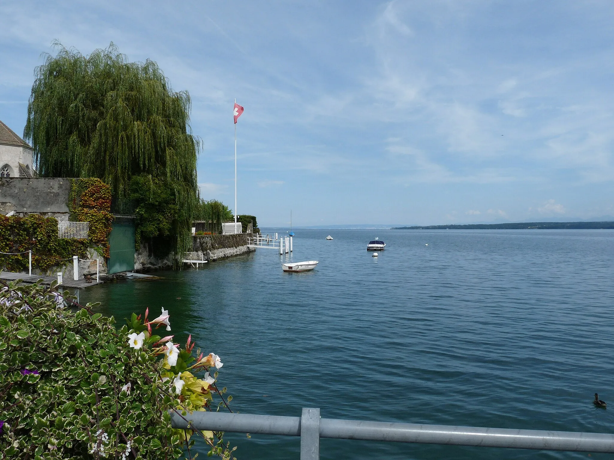
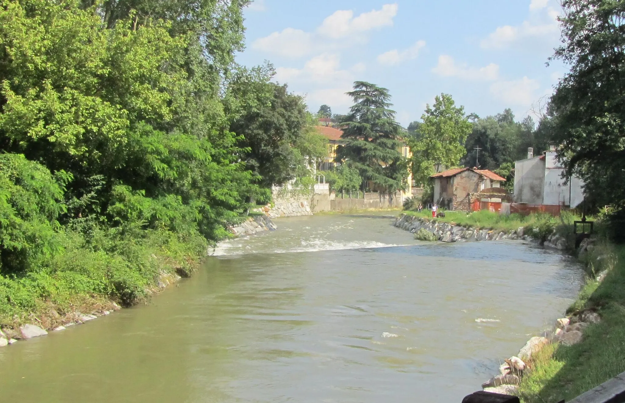
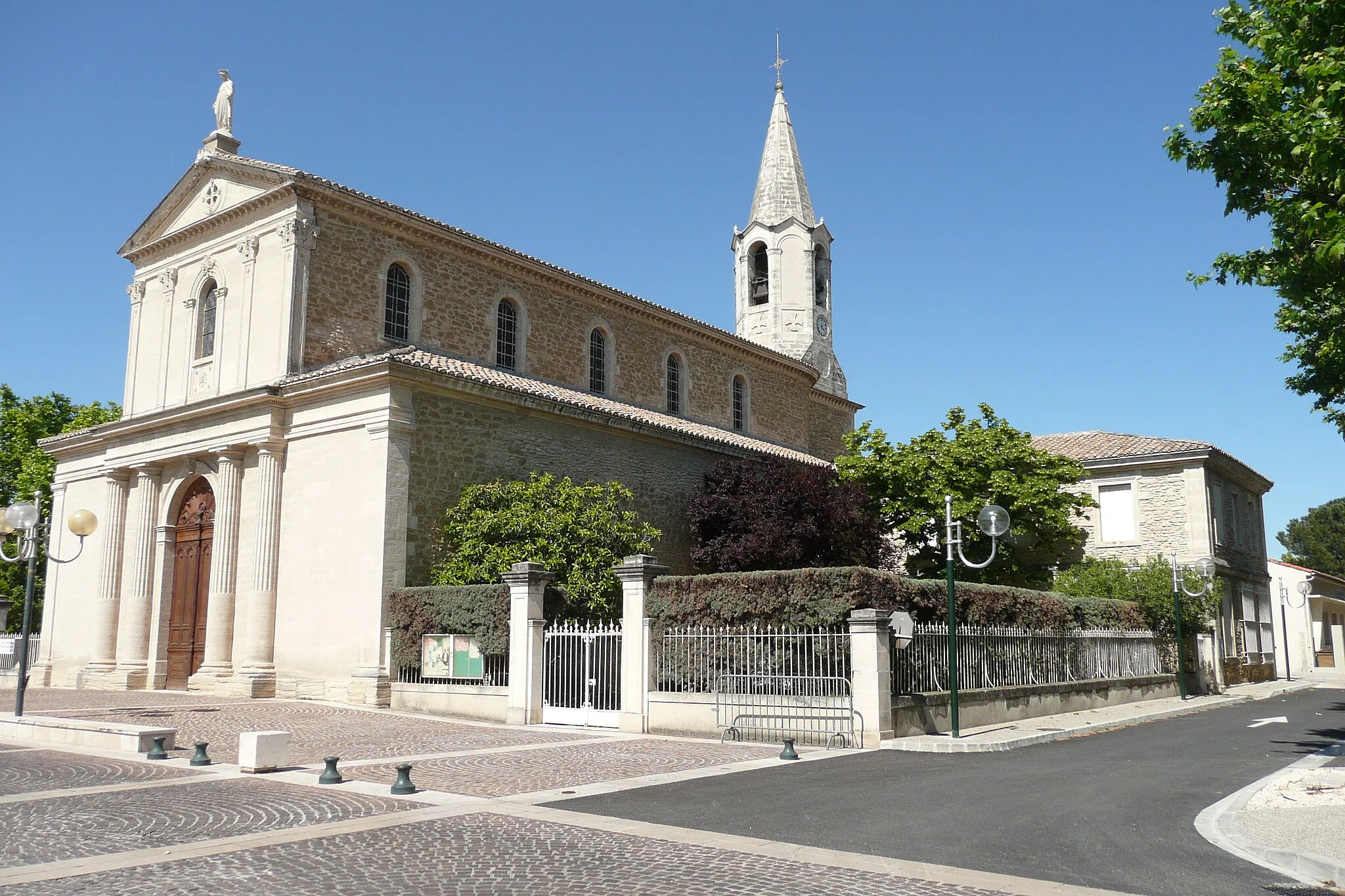
Le Pontet leží nedaleko Avignonu a nabízí pěkné cyklostezky kolem Rhôny a vinic. Město samo o sobě není turisty příliš navštěvované, což je pro cyklisty výhoda.
![Miniaturní mapa "Výzva na Mont Ventoux" inspirace pro cyklisty v oblasti Provence-Alpes-Côte d’Azur, France. Vytvořeno pomocí plánovače tras Tarmacs.app](https://images.tarmacs.app/cycling-routes/routemaps/600/france/provence-alpes-cote-dazur/le-pontet/road/213332.webp)
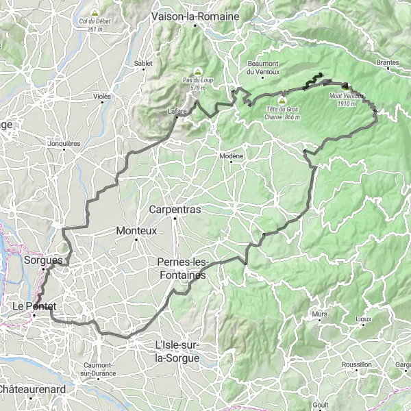
Náročná trasa s úchvatnými výhledy na Provence.
Tato 141 km dlouhá trasa vede přes Bédarrides, Beaumes-de-Venise, Carabelle, Malaucène, Mont Serein, Tête de la Grave, Les Vendrans a Venasque. Nejvyšším bodem je Château de Fargues. Trasa je náročná, ale nabízí úžasné výhledy na vinice a okolní krajinu.
![Miniaturní mapa "Gravel cyklistická trasa kolem Le Pontet" inspirace pro cyklisty v oblasti Provence-Alpes-Côte d’Azur, France. Vytvořeno pomocí plánovače tras Tarmacs.app](https://images.tarmacs.app/cycling-routes/routemaps/600/france/provence-alpes-cote-dazur/le-pontet/gravel/218791.webp)
Zajímavá cyklistická trasa pro milovníky štěrku
Tato 75 km dlouhá trasa nabízí malebné výhledy na region Provence-Alpes-Côte d’Azur. Propletete se malebnými vesnicemi a projedete kolem úchvatných památek a historických památek. Cyklování po této trase je skvělý způsob, jak poznat krásu francouzské krajiny a užít si aktivní den venku.
![Miniaturní mapa "Jízda kolem Carpentras" inspirace pro cyklisty v oblasti Provence-Alpes-Côte d’Azur, France. Vytvořeno pomocí plánovače tras Tarmacs.app](https://images.tarmacs.app/cycling-routes/routemaps/600/france/provence-alpes-cote-dazur/le-pontet/road/213331.webp)
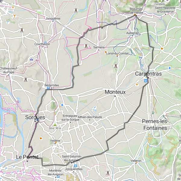
Překrásná cesta plná vinic a historických památek.
Tato 62 km dlouhá trasa vede přes Sorgues, Beaumes-de-Venise, Carpentras a Saint-Saturnin-lès-Avignon. Nejvyšším bodem je Château de Fargues. Cesta nabízí nezapomenutelné výhledy na vinice a starobylé vesnice.
![Miniaturní mapa "Gravel route around Le Pontet" inspirace pro cyklisty v oblasti Provence-Alpes-Côte d’Azur, France. Vytvořeno pomocí plánovače tras Tarmacs.app](https://images.tarmacs.app/cycling-routes/routemaps/600/france/provence-alpes-cote-dazur/le-pontet/gravel/213326.webp)
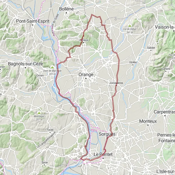
Journey through panoramic views and historic sites
Discover the breathtaking Rochers des Domes Panoramic View and the majestic Popes' Palace along this gravel route near Le Pontet. With a total ascent of 372 meters and a distance of 97 kilometers, this scenic ride will take you through the picturesque Montfaucon, Uchaux, Travaillan, and Courthézon. Don't miss the Belvédère viewpoint and the charming town of Sorgues on your way.
![Miniaturní mapa "Easy gravel route through picturesque villages" inspirace pro cyklisty v oblasti Provence-Alpes-Côte d’Azur, France. Vytvořeno pomocí plánovače tras Tarmacs.app](https://images.tarmacs.app/cycling-routes/routemaps/600/france/provence-alpes-cote-dazur/le-pontet/gravel/213327.webp)
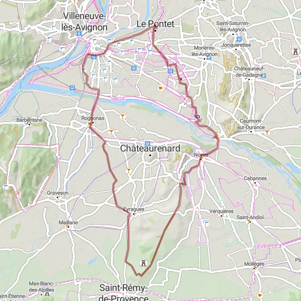
Explore the quaint towns and countryside near Le Pontet
Enjoy a leisurely gravel ride with a gentle ascent of 91 meters and a distance of 50 kilometers. Discover the charming villages of Noves, Eyragues, and Avignon as you cycle through the scenic countryside of Provence-Alpes-Côte d’Azur. This route offers a perfect mix of natural beauty and cultural heritage, making it an ideal cycling adventure for all ages.
![Miniaturní mapa "Kolo okolo Le Pontet skrze Noves" inspirace pro cyklisty v oblasti Provence-Alpes-Côte d’Azur, France. Vytvořeno pomocí plánovače tras Tarmacs.app](https://images.tarmacs.app/cycling-routes/routemaps/600/france/provence-alpes-cote-dazur/le-pontet/road/213329.webp)
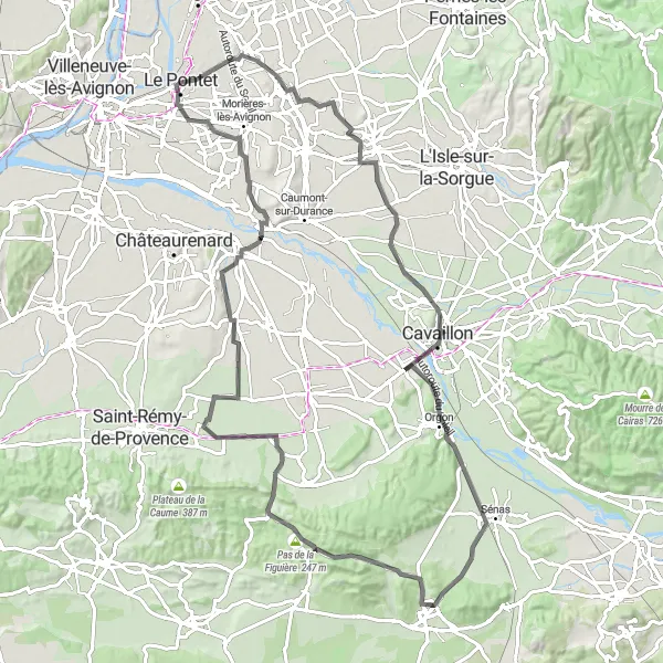
Zajímavá cesta plná starých vesnic a krásné krajiny.
Tato 95 km dlouhá cesta vede přes malebná místa jako Le Thor, La Durance, Orgon a Eyguières. Nejvyšším bodem je Pas de la Figuière. Trasa končí ve městě Noves, které je známé svými historickými památkami.
![Miniaturní mapa "Cyklotrasa k Grotte de Thouzon" inspirace pro cyklisty v oblasti Provence-Alpes-Côte d’Azur, France. Vytvořeno pomocí plánovače tras Tarmacs.app](https://images.tarmacs.app/cycling-routes/routemaps/600/france/provence-alpes-cote-dazur/le-pontet/road/213310.webp)
Cesta plná přírodních úžasů
Trasa o délce 43 km a s převýšením 93 m vás zavede k úchvatné Grotte de Thouzon. Cestou projedete krásné prostředí Caumont-sur-Durance a končíte zpět v Le Pontet.
![Miniaturní mapa "Road cycling experience with cave exploration" inspirace pro cyklisty v oblasti Provence-Alpes-Côte d’Azur, France. Vytvořeno pomocí plánovače tras Tarmacs.app](https://images.tarmacs.app/cycling-routes/routemaps/600/france/provence-alpes-cote-dazur/le-pontet/road/213339.webp)
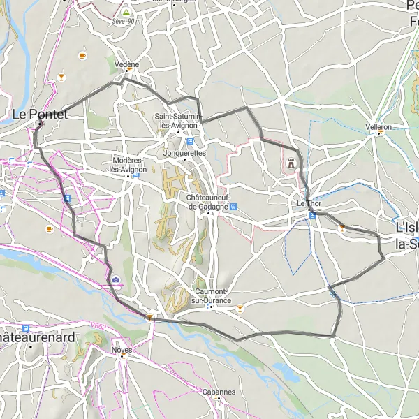
A journey through scenic landscapes and hidden treasures
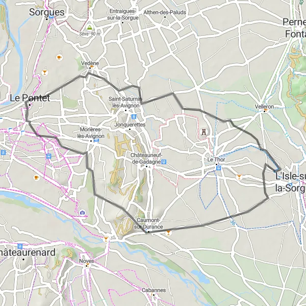
Embark on a road cycling adventure with a total ascent of 150 meters and a distance of 41 kilometers. Explore the natural wonders of Vedène, Grotte de Thouzon, Caumont-sur-Durance, and Morières-lès-Avignon before returning to Le Pontet. This route offers a unique blend of outdoor exploration and historical discovery, providing a memorable experience for cyclists seeking a diverse and rewarding journey.
![Miniaturní mapa "Gravelová jízda kolem Rognonas" inspirace pro cyklisty v oblasti Provence-Alpes-Côte d’Azur, France. Vytvořeno pomocí plánovače tras Tarmacs.app](https://images.tarmacs.app/cycling-routes/routemaps/600/france/provence-alpes-cote-dazur/le-pontet/gravel/213566.webp)
Skvělá trasa pro milovníky gravelu s úžasnými výhledy.
Tato 60 km dlouhá trasa vede přes Rognonas, Tarascon, Montagnette, Boulbon - Pont d'Aramon a Popes' Palace. Nejvyšším bodem je Château de Fargues. Cesta nabízí jedinečné pohledy na okolní krajinu a historické památky.
![Miniaturní mapa "Historic and scenic gravel tour in Provence" inspirace pro cyklisty v oblasti Provence-Alpes-Côte d’Azur, France. Vytvořeno pomocí plánovače tras Tarmacs.app](https://images.tarmacs.app/cycling-routes/routemaps/600/france/provence-alpes-cote-dazur/le-pontet/gravel/213334.webp)
A cycling journey through ancient ruins and enchanting landscapes
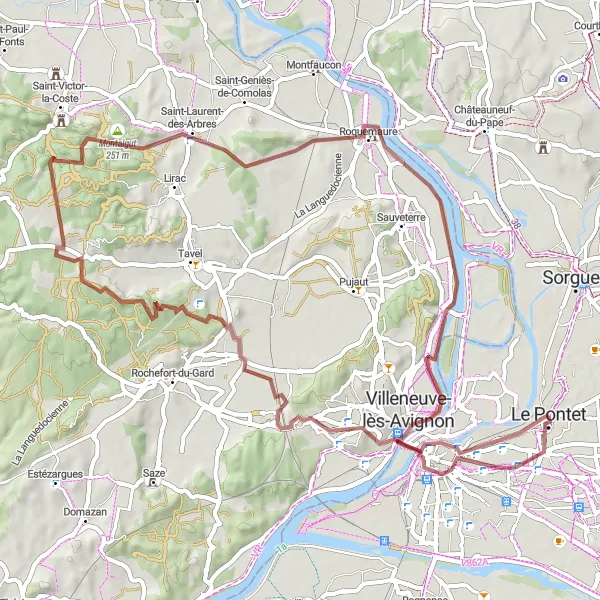
Cycle through the historic sites and picturesque landscapes of Provence-Alpes-Côte d’Azur on this gravel tour. With a total ascent of 565 meters and a distance of 68 kilometers, this route will lead you to the Rochers des Domes Panoramic View, Popes' Palace, Montaigut, Saint-Laurent-des-Arbres, Roquemaure, Avignon, and Château de Fargues. Experience the rich history and natural beauty of the region on this unforgettable cycling adventure.
Cyklotrasy v okolí:
Okolní oblasti:
![Obrázek Région lémanique](https://images.tarmacs.app/cycling-routes/covers/switzerland/region-lemanique/coppet-3.webp)
![Obrázek Aragón](https://images.tarmacs.app/cycling-routes/covers/spain/aragon/caspe-1.webp)
![Obrázek Katalánsko](https://images.tarmacs.app/cycling-routes/covers/spain/cataluna/alcover-4.webp)
![Obrázek Languedoc-Roussillon](https://images.tarmacs.app/cycling-routes/covers/france/languedoc-roussillon/remoulins-5.webp)
![Obrázek Midi-Pyrénées](https://images.tarmacs.app/cycling-routes/covers/france/midi-pyrenees/ramonville-saint-agne-5.webp)
![Obrázek Auvergne](https://images.tarmacs.app/cycling-routes/covers/france/auvergne/cournon-d-auvergne-4.webp)
![Obrázek Rhône-Alpes](https://images.tarmacs.app/cycling-routes/covers/france/rhone-alpes/septeme-4.webp)
![Obrázek Piemonte](https://images.tarmacs.app/cycling-routes/covers/italy/piemonte/castagnole-delle-lanze-1.webp)
![Obrázek Valle d’Aosta/Vallée d’Aoste](https://images.tarmacs.app/cycling-routes/covers/italy/valle-daosta-vallee-daoste/gressan-1.webp)
![Obrázek Liguria](https://images.tarmacs.app/cycling-routes/covers/italy/liguria/laigueglia-4.webp)
![Obrázek Lombardia](https://images.tarmacs.app/cycling-routes/covers/italy/lombardia/monza-5.webp)