![Cover image](https://images.tarmacs.app/cycling-routes/covers/france/provence-alpes-cote-dazur/saint-etienne-du-gres-5.webp)
Relaxační cyklistický výlet
Cyklistické trasy kolem Saint-Etienne-du-Gres
Saint-Étienne-du-Grès je ideální destinací pro silniční cyklisty hledající klidné trasy a pohodlné cesty. Okolní kopce a vinice tvoří malebné prostředí pro cyklistické výlety pro všechny úrovně dovedností.
![Miniaturní mapa "Trasa Montagnette a okolí" inspirace pro cyklisty v oblasti Provence-Alpes-Côte d’Azur, France. Vytvořeno pomocí plánovače tras Tarmacs.app](https://images.tarmacs.app/cycling-routes/routemaps/600/france/provence-alpes-cote-dazur/saint-etienne-du-gres/gravel/139512.webp)
Cesty kolem Montagnette nabízejí úchvatné výhledy a krásnou krajinu
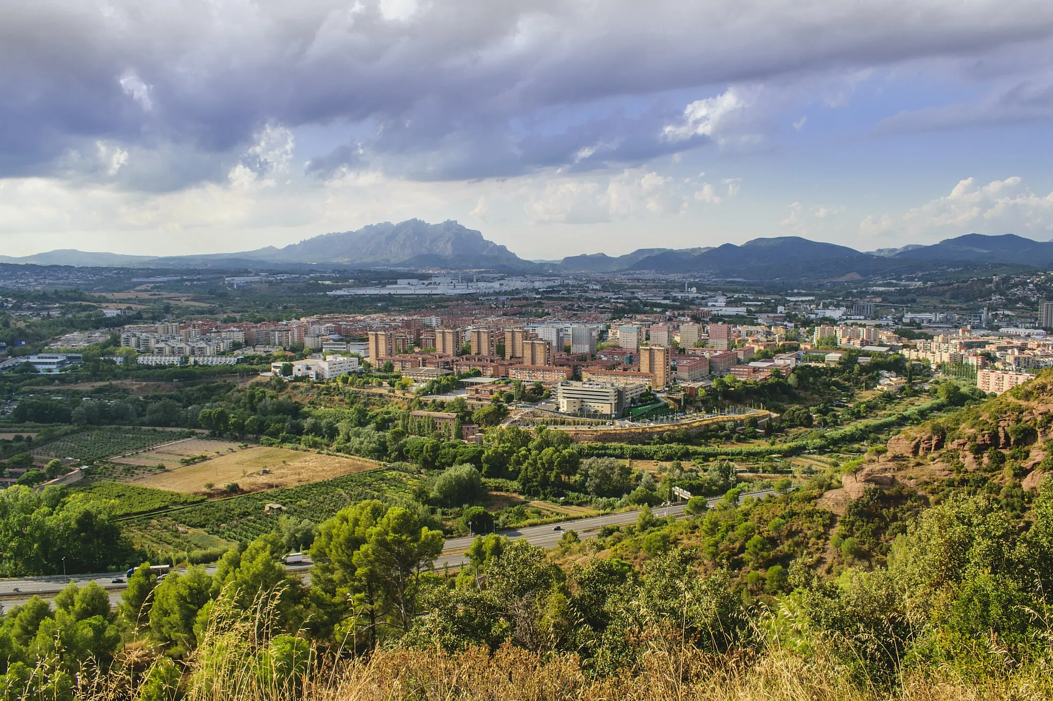
Tato trasa vede kolem malebné hory Montagnette a okolních vesnic, nabízí 57 km dobrodružství s celkovým převýšením 340 metrů. Na trase nechybí historické památky a malebná krajina, která láká cyklisty všech úrovní.
![Miniaturní mapa "Cyklistický okruh blízko Saint-Étienne-du-Grès" inspirace pro cyklisty v oblasti Provence-Alpes-Côte d’Azur, France. Vytvořeno pomocí plánovače tras Tarmacs.app](https://images.tarmacs.app/cycling-routes/routemaps/600/france/provence-alpes-cote-dazur/saint-etienne-du-gres/road/139540.webp)
Krásný okruh s historickými památkami a venkovskými scenériemi
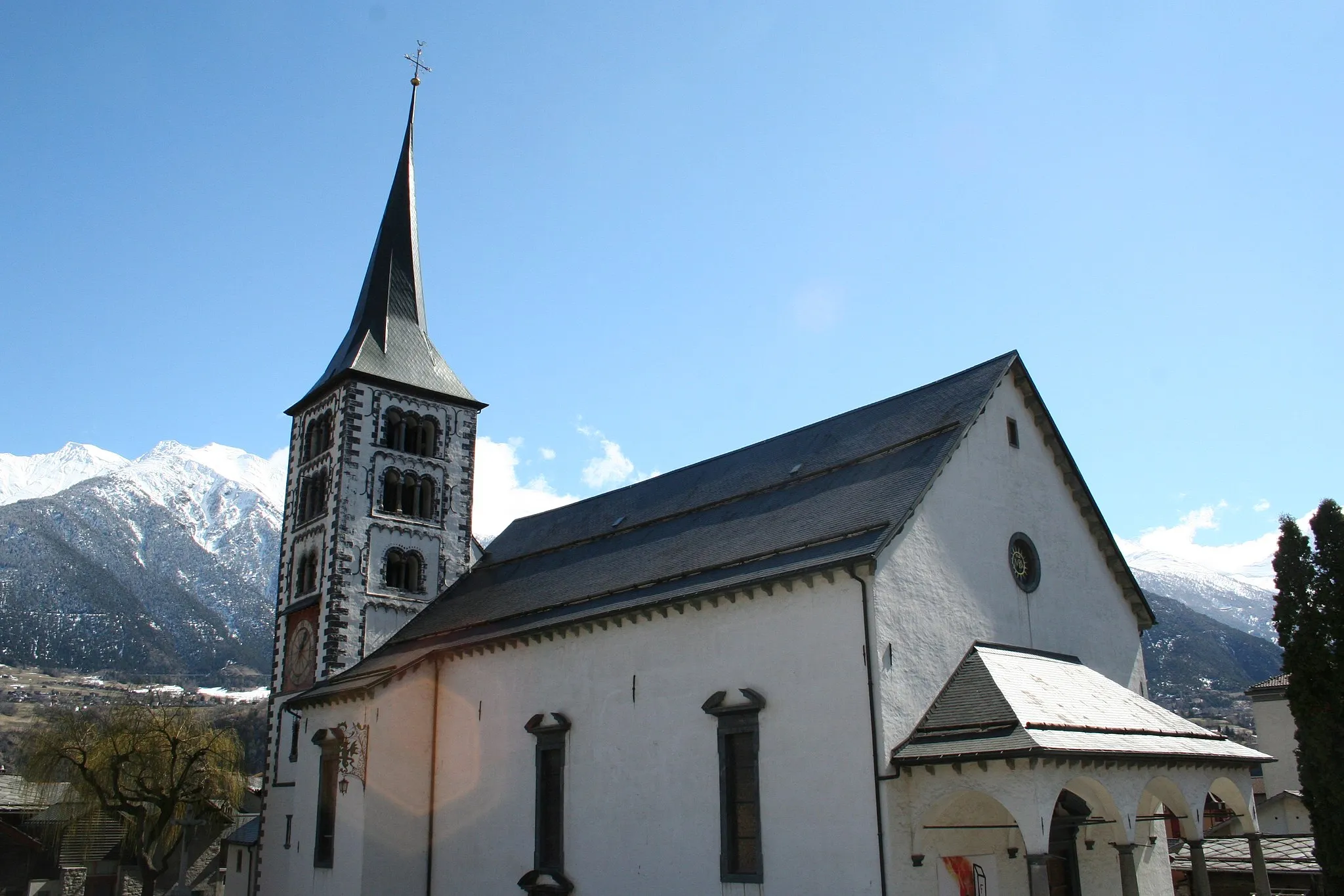
Tento okruh v Provence vás provede historickými památkami v okolí Saint-Étienne-du-Grès a malebnými vesničkami. Projedeme kolem Tour Saint-Gabriel, Redessan, Meynes, L'Aiguille, Tarascon a vrátíme se zpět do výchozího bodu.
![Miniaturní mapa "Challenging Gravel Route in Provence" inspirace pro cyklisty v oblasti Provence-Alpes-Côte d’Azur, France. Vytvořeno pomocí plánovače tras Tarmacs.app](https://images.tarmacs.app/cycling-routes/routemaps/600/france/provence-alpes-cote-dazur/saint-etienne-du-gres/gravel/139509.webp)
Take on a challenging gravel route through the rugged terrain of Provence.
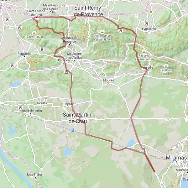
Embark on a cycling adventure through Notre-Dame-du-Château, Saint-Rémy-de-Provence, Aureille, Entressen, Saint-Martin-de-Crau, Les Baux-de-Provence, and finally return to Saint-Étienne-du-Grès - Les Écoles. With a significant ascent and an 87 km distance, this route is perfect for experienced cyclists looking for a tough challenge.
Výlet k Point de Vue
![Miniaturní mapa "Výlet k Point de Vue" inspirace pro cyklisty v oblasti Provence-Alpes-Côte d’Azur, France. Vytvořeno pomocí plánovače tras Tarmacs.app](https://images.tarmacs.app/cycling-routes/routemaps/600/france/provence-alpes-cote-dazur/saint-etienne-du-gres/gravel/139539.webp)
Náročná gravel trasa s úchvatnými výhledy
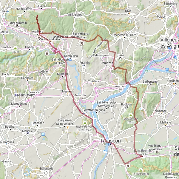
Tato cyklistická cesta nabízí krásné výhledy na L'Aiguille a Capitelle de l'Homme mort. Projedete Point de Vue, Vers-Pont-du-Gard a Saint-Hilaire-d'Ozilhan před návratem do Saint-Étienne-du-Grès.
![Miniaturní mapa "Road Tour around Saint-Étienne-du-Grès" inspirace pro cyklisty v oblasti Provence-Alpes-Côte d’Azur, France. Vytvořeno pomocí plánovače tras Tarmacs.app](https://images.tarmacs.app/cycling-routes/routemaps/600/france/provence-alpes-cote-dazur/saint-etienne-du-gres/road/139529.webp)
Experience the beauty of the Provencal countryside on this road tour around Saint-Étienne-du-Grès.
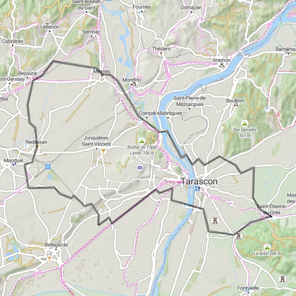
Enjoy the scenic route passing by Tour Saint-Gabriel, Bezouce, Meynes, L'Aiguille, and finally returning to Saint-Étienne-du-Grès. With a moderate ascent and a 67 km distance, this tour offers a perfect balance of challenge and enjoyment.
![Miniaturní mapa "Trasa Notre-Dame-du-Château" inspirace pro cyklisty v oblasti Provence-Alpes-Côte d’Azur, France. Vytvořeno pomocí plánovače tras Tarmacs.app](https://images.tarmacs.app/cycling-routes/routemaps/600/france/provence-alpes-cote-dazur/saint-etienne-du-gres/gravel/191929.webp)
Náročná gravel trasa s úžasnými výhledy
Tato trasa nabízí překrásné výhledy na Notre-Dame-du-Château a Les Baux-de-Provence. Projedete Mollégès, Sénas a Pas du Loup, než se vrátíte zpět do Saint-Étienne-du-Grès.
![Miniaturní mapa "Gravel Route through Provence-Alpes-Côte d’Azur" inspirace pro cyklisty v oblasti Provence-Alpes-Côte d’Azur, France. Vytvořeno pomocí plánovače tras Tarmacs.app](https://images.tarmacs.app/cycling-routes/routemaps/600/france/provence-alpes-cote-dazur/saint-etienne-du-gres/gravel/139657.webp)
Explore the picturesque countryside of Provence on this gravel adventure.
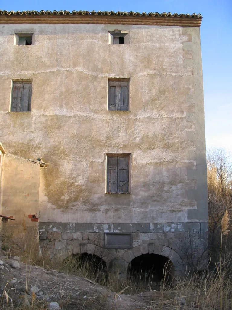
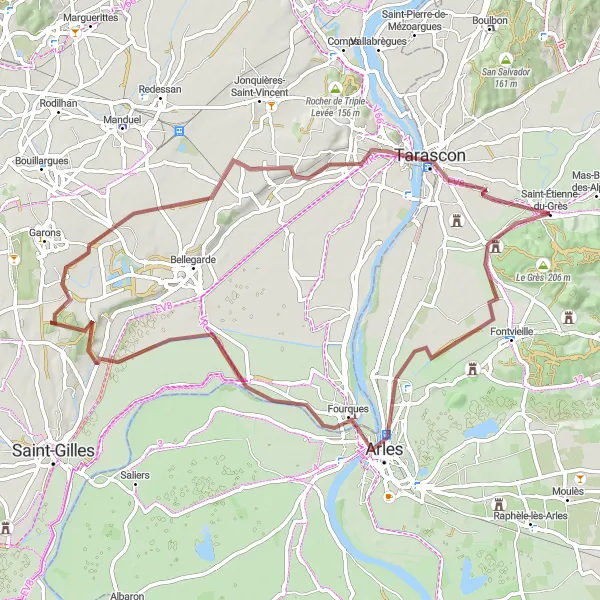
Embark on a 73 km gravel journey starting near Saint-Étienne-du-Grès, with a total ascent of 166 meters. Along the way, you will pass by the charming town of Arles, known for its Roman and Romanesque monuments. Enjoy the scenic views of the Rhône River as you cycle towards Tarascon, a historic town with a medieval castle. The route also features Les 2 lions, a unique natural rock formation that adds a touch of wonder to your cycling experience.
![Miniaturní mapa "Gravel Route through Provence" inspirace pro cyklisty v oblasti Provence-Alpes-Côte d’Azur, France. Vytvořeno pomocí plánovače tras Tarmacs.app](https://images.tarmacs.app/cycling-routes/routemaps/600/france/provence-alpes-cote-dazur/saint-etienne-du-gres/gravel/139530.webp)
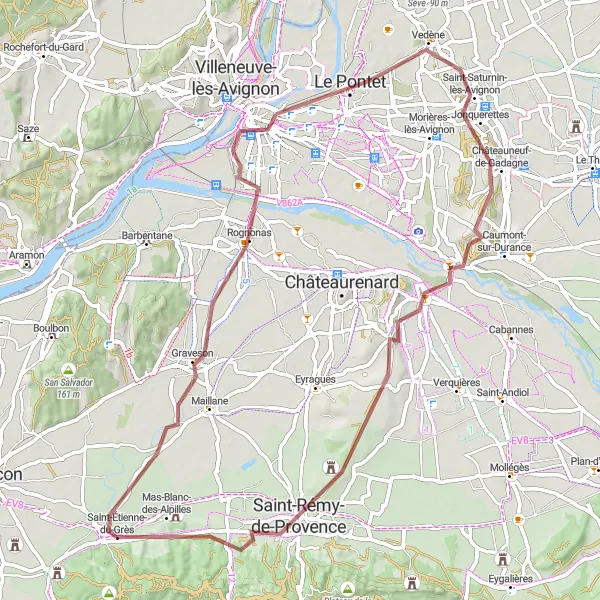
Explore picturesque villages and stunning landscapes in Provence on this gravel route.
Cycle through Graveson, Popes' Palace, Châteauneuf-de-Gadagne, Noves, Saint-Rémy-de-Provence, Mas-Blanc-des-Alpilles, and Notre-Dame-du-Château, experiencing the beauty and history of the region along the way. Enjoy the challenging ascent and the 69 km distance, with plenty of highlights to discover.
![Miniaturní mapa "Významný okruh s panoramatickými výhledy" inspirace pro cyklisty v oblasti Provence-Alpes-Côte d’Azur, France. Vytvořeno pomocí plánovače tras Tarmacs.app](https://images.tarmacs.app/cycling-routes/routemaps/600/france/provence-alpes-cote-dazur/saint-etienne-du-gres/road/139554.webp)
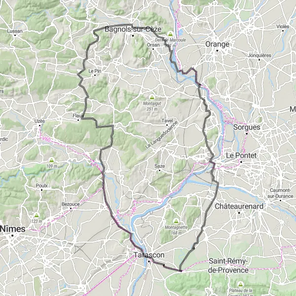
Náročný okruh s dramatickými scenériemi a historickými památkami
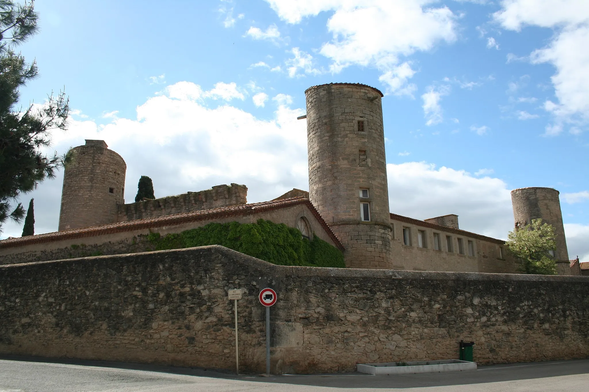
Tento okruh v Provence nabízí náročnou trasu s významnými vyhlídkami a historickými památkami. Projedeme kolem Beaucaire, L'Aiguille, Valliguières, Pougnadoresse, Bagnols-sur-Cèze, Pied Serbe, Caderousse, Villeneuve-lès-Avignon, Rochers des Domes Panoramic View a dojedeme zpět do Saint-Étienne-du-Grès.
![Miniaturní mapa "Cesta k Château de Goubelet" inspirace pro cyklisty v oblasti Provence-Alpes-Côte d’Azur, France. Vytvořeno pomocí plánovače tras Tarmacs.app](https://images.tarmacs.app/cycling-routes/routemaps/600/france/provence-alpes-cote-dazur/saint-etienne-du-gres/road/163661.webp)
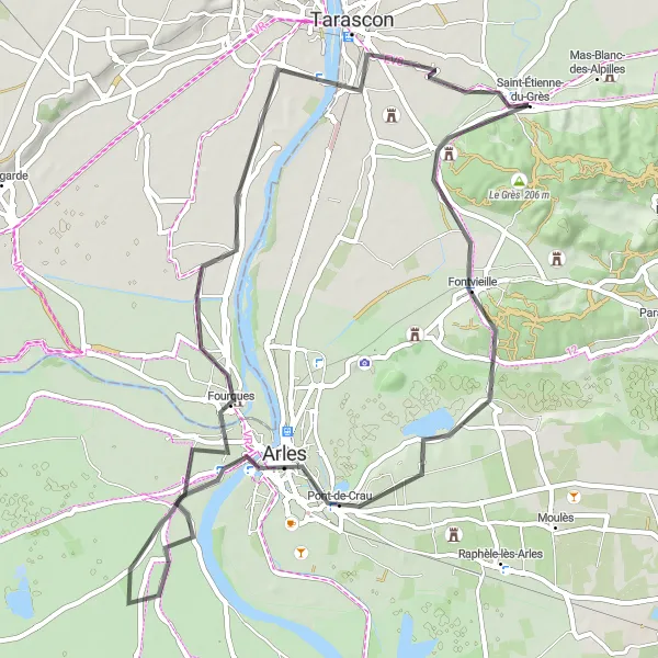
Road cyklistická trasa s nádhernými výhledy a historií
Tato silniční trasa vede kolem Moulin de Daudet, Nécropole des Alyscamps a Château de Goubelet. Uvidíte také Les Alpilles a Fourques, než se vrátíte zpět do Saint-Étienne-du-Grès.
Cyklotrasy v okolí:
Okolní oblasti:
![Obrázek Région lémanique](https://images.tarmacs.app/cycling-routes/covers/switzerland/region-lemanique/naters-1.webp)
![Obrázek Aragón](https://images.tarmacs.app/cycling-routes/covers/spain/aragon/epila-2.webp)
![Obrázek Katalánsko](https://images.tarmacs.app/cycling-routes/covers/spain/cataluna/martorell-4.webp)
![Obrázek Languedoc-Roussillon](https://images.tarmacs.app/cycling-routes/covers/france/languedoc-roussillon/maureilhan-4.webp)
![Obrázek Midi-Pyrénées](https://images.tarmacs.app/cycling-routes/covers/france/midi-pyrenees/plaisance-3.webp)
![Obrázek Auvergne](https://images.tarmacs.app/cycling-routes/covers/france/auvergne/aulnat-3.webp)
![Obrázek Rhône-Alpes](https://images.tarmacs.app/cycling-routes/covers/france/rhone-alpes/soyons-2.webp)
![Obrázek Piemonte](https://images.tarmacs.app/cycling-routes/covers/italy/piemonte/bardonecchia-2.webp)
![Obrázek Valle d’Aosta/Vallée d’Aoste](https://images.tarmacs.app/cycling-routes/covers/italy/valle-daosta-vallee-daoste/saint-christophe-4.webp)
![Obrázek Liguria](https://images.tarmacs.app/cycling-routes/covers/italy/liguria/campomorone-1.webp)
![Obrázek Lombardia](https://images.tarmacs.app/cycling-routes/covers/italy/lombardia/muscoline-4.webp)