![Cover image](https://images.tarmacs.app/cycling-routes/covers/france/rhone-alpes/montboucher-sur-jabron-3.webp)
Ideální místo pro cyklistické výlety v přírodě
Cyklistické trasy kolem Montboucher-sur-Jabron
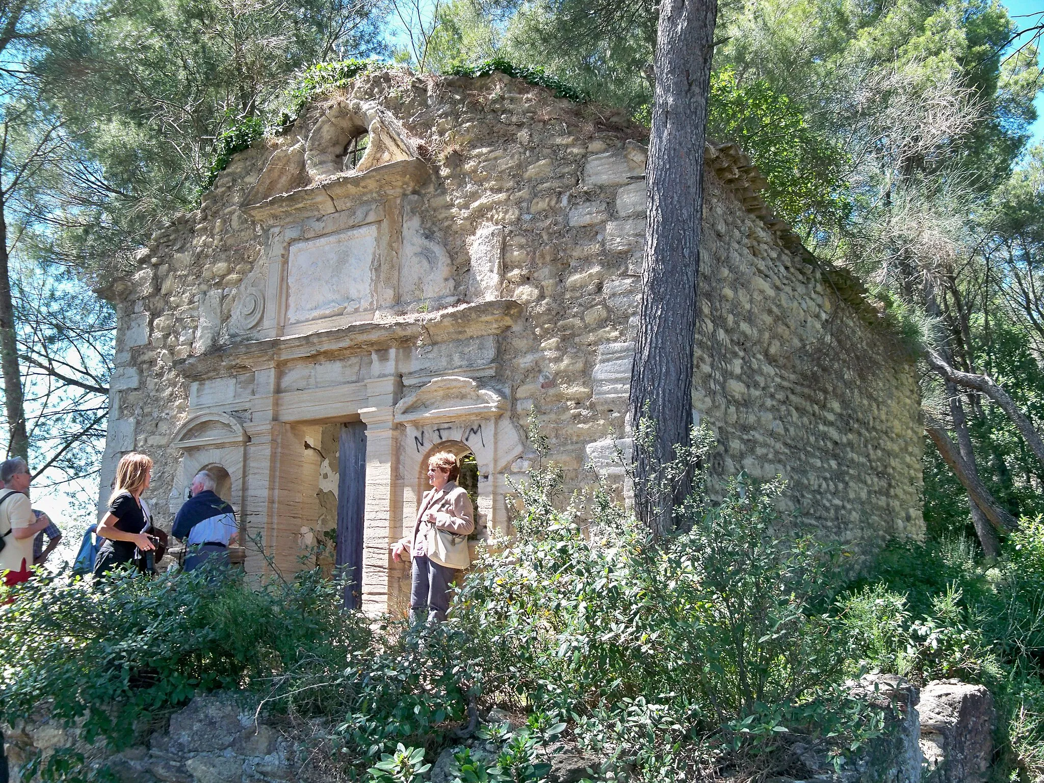
Montboucher-sur-Jabron je malebná obec ležící v regionu Rhône-Alpes. Okolí obce nabízí mnoho cyklistických tras vhodných pro silniční i gravel biking. Cyklisté zde mohou objevovat historické památky a krásnou přírodu.
![Miniaturní mapa "Krátký okruh kolem Montboucher-sur-Jabron" inspirace pro cyklisty v oblasti Rhône-Alpes, France. Vytvořeno pomocí plánovače tras Tarmacs.app](https://images.tarmacs.app/cycling-routes/routemaps/600/france/rhone-alpes/montboucher-sur-jabron/road/107327.webp)
62 km trasa nabízí pohodovou jízdu krajem
Tento okruh s 736 m převýšením vás provede malebnými vesnicemi a zelenými poli. Navštivte Réauville a Chantemerle-lès-Grignan nebo si užijte krásné výhledy z Col du Colombier.
![Miniaturní mapa "Road Route near Montboucher-sur-Jabron" inspirace pro cyklisty v oblasti Rhône-Alpes, France. Vytvořeno pomocí plánovače tras Tarmacs.app](https://images.tarmacs.app/cycling-routes/routemaps/600/france/rhone-alpes/montboucher-sur-jabron/road/143573.webp)
Experience the scenic roads and charming villages in the vicinity of Montboucher-sur-Jabron.
Discover a 98 km road route with 939 m of ascent, showcasing the beauty of Rhône-Alpes. Visit Saint-Marcel-lès-Sauzet, Livron-sur-Drôme, and Aouste-sur-Sye along the way. Admire the stunning views from Col des Deux Serres and soak in the tranquility of Soyans and La Bégude-de-Mazenc. Conclude your journey back in Montboucher-sur-Jabron.
![Miniaturní mapa "Gravel Route around Montboucher-sur-Jabron" inspirace pro cyklisty v oblasti Rhône-Alpes, France. Vytvořeno pomocí plánovače tras Tarmacs.app](https://images.tarmacs.app/cycling-routes/routemaps/600/france/rhone-alpes/montboucher-sur-jabron/gravel/107317.webp)
Explore the picturesque gravel roads near Montboucher-sur-Jabron.
Embark on a challenging 111 km gravel route with a total ascent of 2021 m. The route takes you through charming villages like Châteauneuf-du-Rhône, Saint-Remèze, and Montélimar. Enjoy the stunning views from the Belvédère de la Vierge and Dent de Rez. End your journey in Valvignères after experiencing the beauty of the Rhône-Alpes region.
![Miniaturní mapa "Silniční okruh přes Montboucher-sur-Jabron" inspirace pro cyklisty v oblasti Rhône-Alpes, France. Vytvořeno pomocí plánovače tras Tarmacs.app](https://images.tarmacs.app/cycling-routes/routemaps/600/france/rhone-alpes/montboucher-sur-jabron/road/107330.webp)
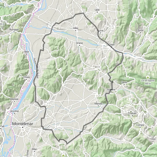
Jízda po silnici s 1324 metry stoupání na 103 kilometrů
Tato trasa nabízí různorodé scenérie od historických památek až po malebné vesničky. Úsek přes Col du Benas je vyzkouškoou síly, ale výhledy za to stojí.
![Miniaturní mapa "Okruh kolem Montboucher-sur-Jabron" inspirace pro cyklisty v oblasti Rhône-Alpes, France. Vytvořeno pomocí plánovače tras Tarmacs.app](https://images.tarmacs.app/cycling-routes/routemaps/600/france/rhone-alpes/montboucher-sur-jabron/road/107309.webp)
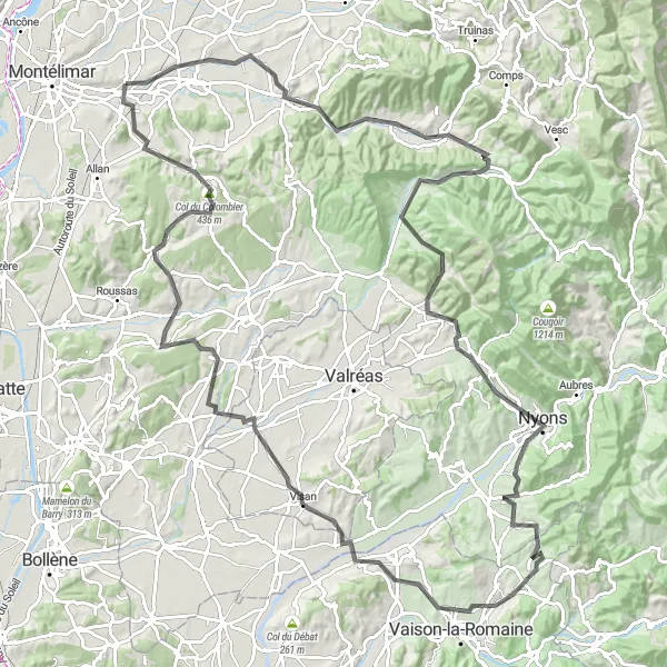
Malebná cesta přes údolí a horské průsmyky
Tento 136 km dlouhý okruh nabízí nádherné výhledy a malebné vesnice, včetně Roche-Saint-Secret-Béconne a Col de Novezan. Nezapomenutelný je také výstup na Rocher de l'Aiguille a sjezd do Visan.
![Miniaturní mapa "Trasa kolem Montboucher-sur-Jabron" inspirace pro cyklisty v oblasti Rhône-Alpes, France. Vytvořeno pomocí plánovače tras Tarmacs.app](https://images.tarmacs.app/cycling-routes/routemaps/600/france/rhone-alpes/montboucher-sur-jabron/road/107364.webp)
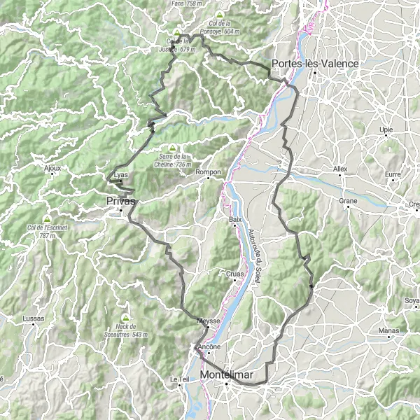
Horská silnice s 2360 metry stoupání na 140 kilometrů
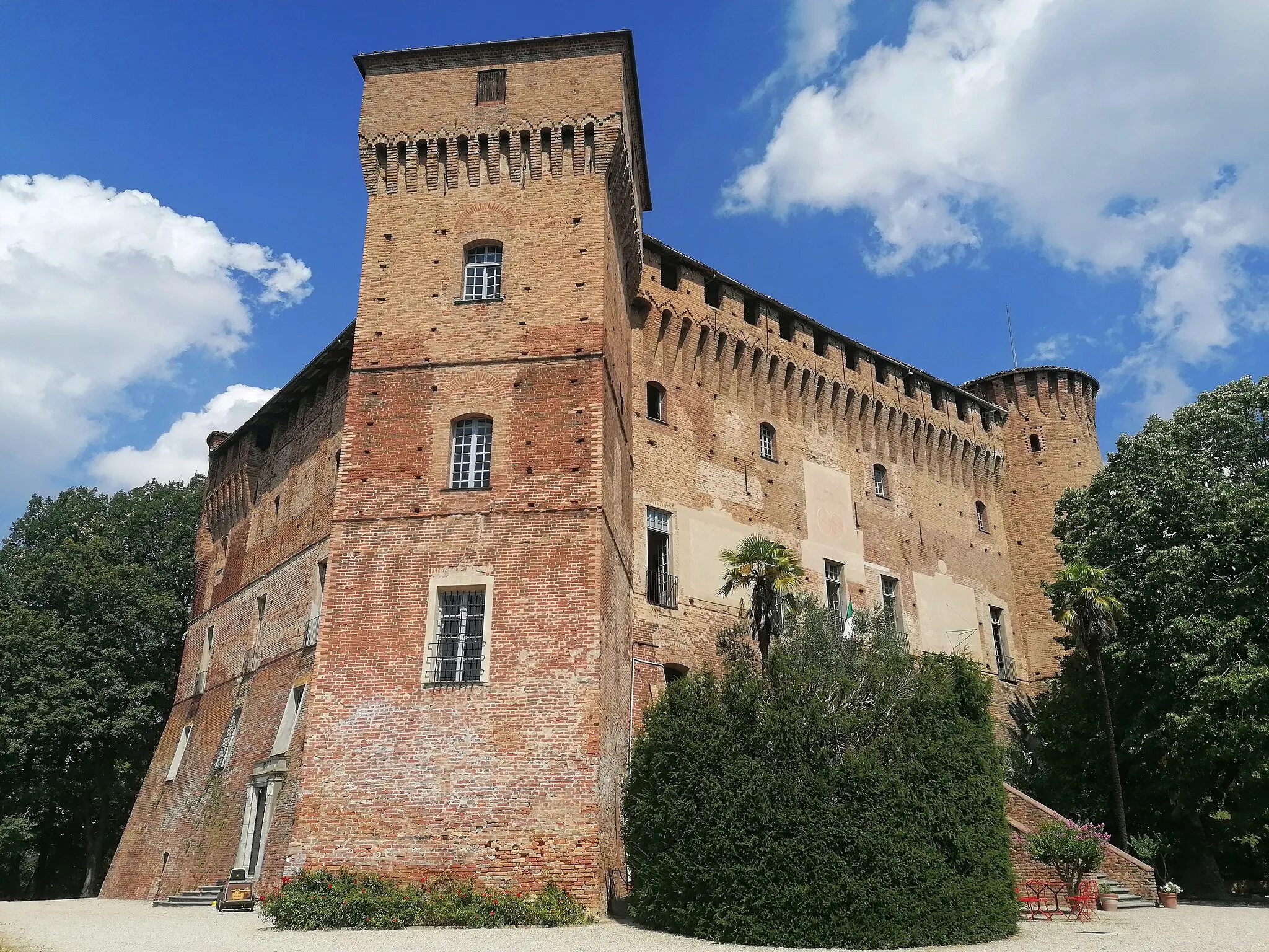
Tato náročná cesta nabízí nádherné výhledy z Col de la Justice a historické památky jako Château de la Tourrette. Kromě toho projedete malebnými vesničkami a údolím řeky Rón.
![Miniaturní mapa "Gravel tour near Montboucher-sur-Jabron" inspirace pro cyklisty v oblasti Rhône-Alpes, France. Vytvořeno pomocí plánovače tras Tarmacs.app](https://images.tarmacs.app/cycling-routes/routemaps/600/france/rhone-alpes/montboucher-sur-jabron/gravel/107314.webp)
Scenic gravel tour with moderate ascent covering 49 km
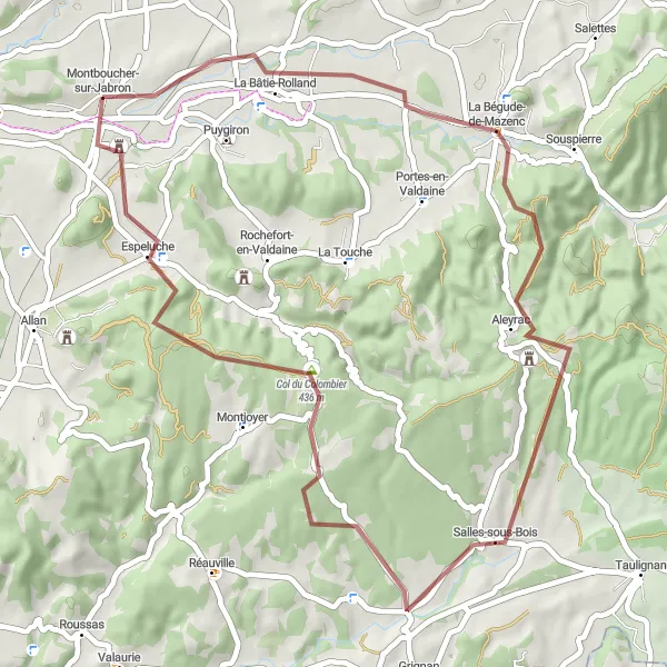
Enjoy a pleasant gravel tour near Montboucher-sur-Jabron covering a distance of 49 km with a moderate ascent of 823 meters. Pass through lovely villages like La Bâtie-Rolland, Salles-sous-Bois, and Espeluche, and take in the beauty of the countryside. Cycling enthusiasts will appreciate the peaceful atmosphere and the opportunity to explore the rural landscapes of the region.
![Miniaturní mapa "Gravel route around Montboucher-sur-Jabron" inspirace pro cyklisty v oblasti Rhône-Alpes, France. Vytvořeno pomocí plánovače tras Tarmacs.app](https://images.tarmacs.app/cycling-routes/routemaps/600/france/rhone-alpes/montboucher-sur-jabron/gravel/107348.webp)
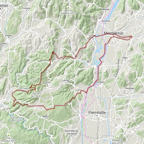
Scenic gravel route with a challenging ascent and a total distance of 67 km
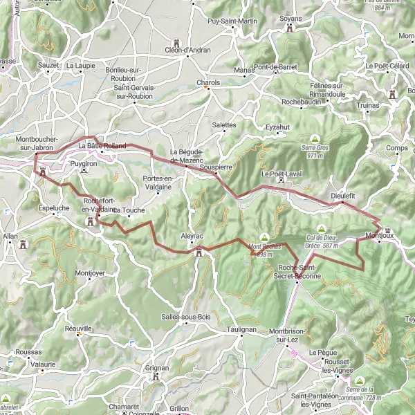
Explore the picturesque countryside surrounding Montboucher-sur-Jabron on this 67 km gravel route with a total ascent of 1105 meters. The route takes you through charming villages such as La Bégude-de-Mazenc, Le Poët-Laval, and Aleyrac, offering stunning views of the Mont Rachas and La Touche. Don't miss the beautiful landscapes and the peaceful atmosphere of this cycling adventure.
![Miniaturní mapa "Náročný okruh přes kopců kolem Montboucher-sur-Jabron" inspirace pro cyklisty v oblasti Rhône-Alpes, France. Vytvořeno pomocí plánovače tras Tarmacs.app](https://images.tarmacs.app/cycling-routes/routemaps/600/france/rhone-alpes/montboucher-sur-jabron/road/107362.webp)
147 km trasa s výzvami a nádhernými výhledy
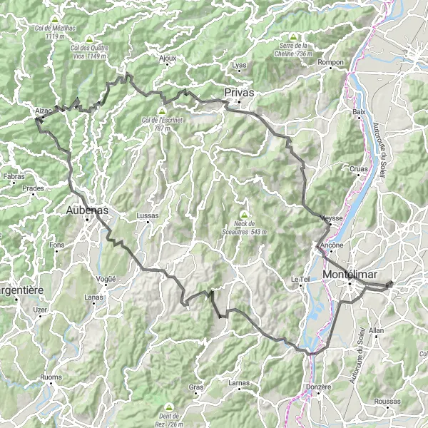
Tato trasa s převýšením 2393 m vás provede malebnými vesnicemi a horskými průsmyky. Navštivte Aubenas, Aizac a Andance nebo si užijte výhled z Rocher de la table.
![Miniaturní mapa "Road route through La Garde-Adhémar" inspirace pro cyklisty v oblasti Rhône-Alpes, France. Vytvořeno pomocí plánovače tras Tarmacs.app](https://images.tarmacs.app/cycling-routes/routemaps/600/france/rhone-alpes/montboucher-sur-jabron/road/107331.webp)
Scenic ride with a challenging ascent to Grignan.
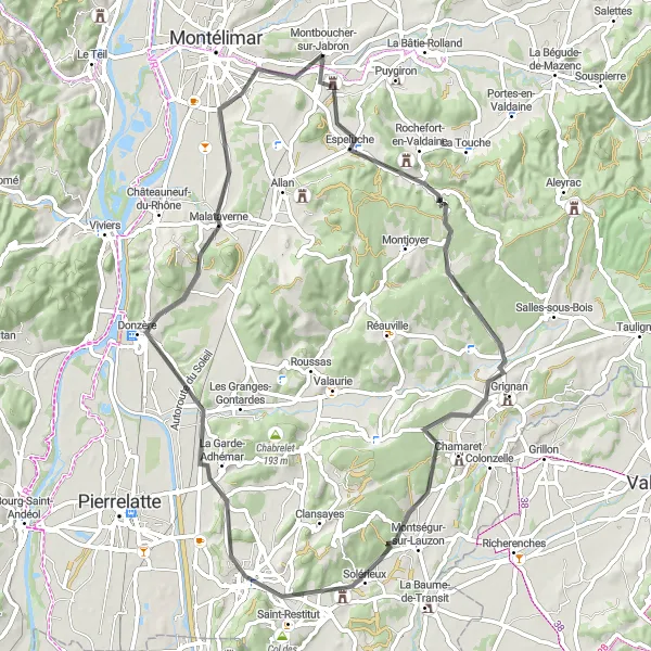
This road route offers beautiful views and passes through charming villages like Espeluche and Malataverne. The ascent to Grignan is a challenge but the breathtaking scenery makes it worth it. The route finishes in La Garde-Adhémar, perfect for exploring historical sites and enjoying local cuisine.
Cyklotrasy v okolí:
Okolní oblasti:
![Obrázek Tirol](https://images.tarmacs.app/cycling-routes/covers/austria/tirol/weer-1.webp)
![Obrázek Vorarlberg](https://images.tarmacs.app/cycling-routes/covers/austria/vorarlberg/bartholomaeberg-5.webp)
![Obrázek Région lémanique](https://images.tarmacs.app/cycling-routes/covers/switzerland/region-lemanique/montana-3.webp)
![Obrázek Espace Mittelland](https://images.tarmacs.app/cycling-routes/covers/switzerland/espace-mittelland/meiringen-5.webp)
![Obrázek Katalánsko](https://images.tarmacs.app/cycling-routes/covers/spain/cataluna/piera-3.webp)
![Obrázek Bourgogne](https://images.tarmacs.app/cycling-routes/covers/france/bourgogne/saint-georges-sur-baulche-5.webp)
![Obrázek Franche-Comté](https://images.tarmacs.app/cycling-routes/covers/france/franche-comte/scey-sur-saone-et-saint-albin-2.webp)
![Obrázek Languedoc-Roussillon](https://images.tarmacs.app/cycling-routes/covers/france/languedoc-roussillon/pezenas-4.webp)
![Obrázek Auvergne](https://images.tarmacs.app/cycling-routes/covers/france/auvergne/bourbon-l-archambault-2.webp)
![Obrázek Provence-Alpes-Côte d’Azur](https://images.tarmacs.app/cycling-routes/covers/france/provence-alpes-cote-dazur/sarrians-5.webp)
![Obrázek Piemonte](https://images.tarmacs.app/cycling-routes/covers/italy/piemonte/monticello-d-alba-4.webp)
![Obrázek Valle d’Aosta/Vallée d’Aoste](https://images.tarmacs.app/cycling-routes/covers/italy/valle-daosta-vallee-daoste/chatillon-2.webp)