![Cover image](https://images.tarmacs.app/cycling-routes/covers/france/rhone-alpes/saint-jean-de-muzols-3.webp)
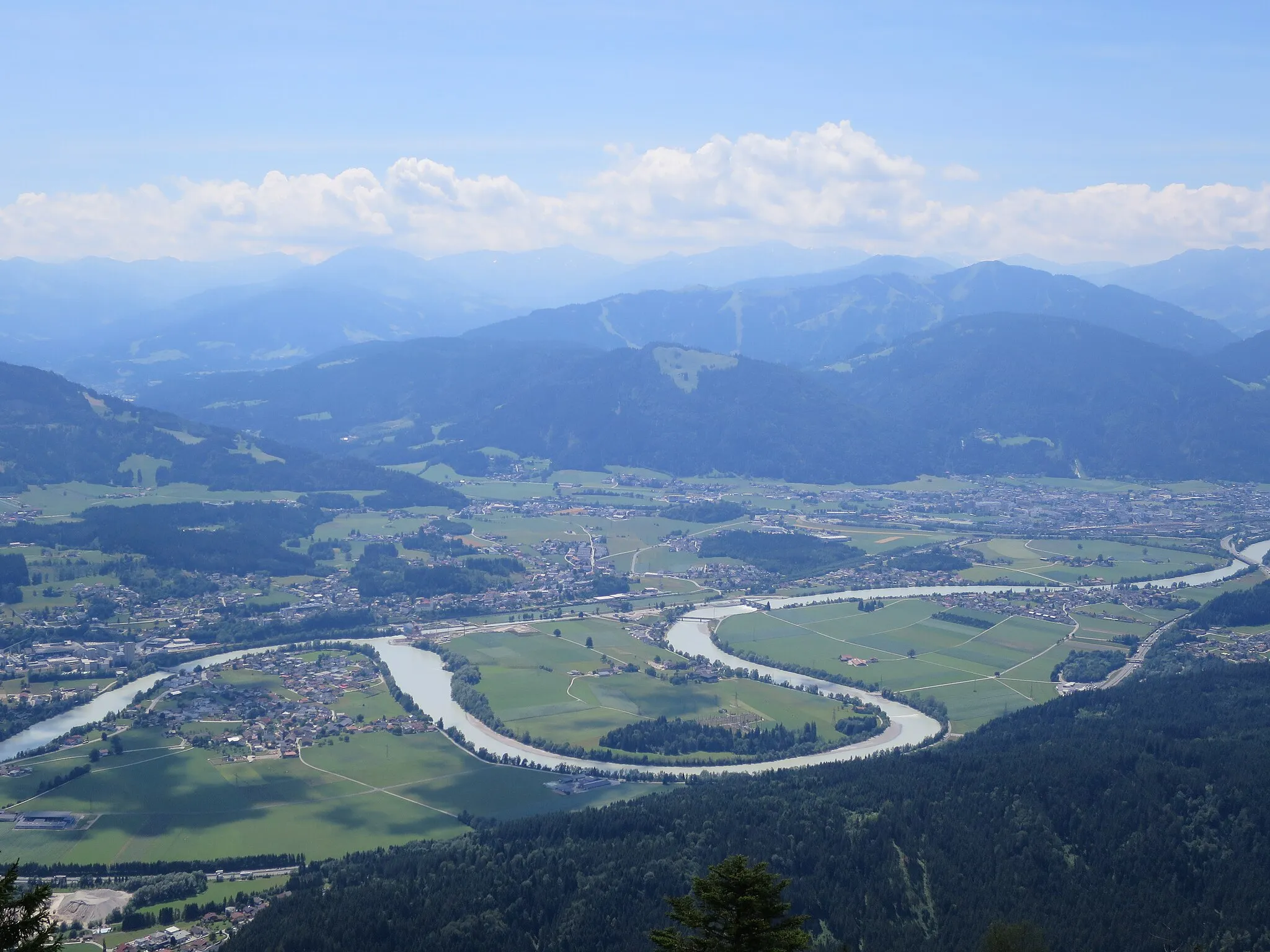
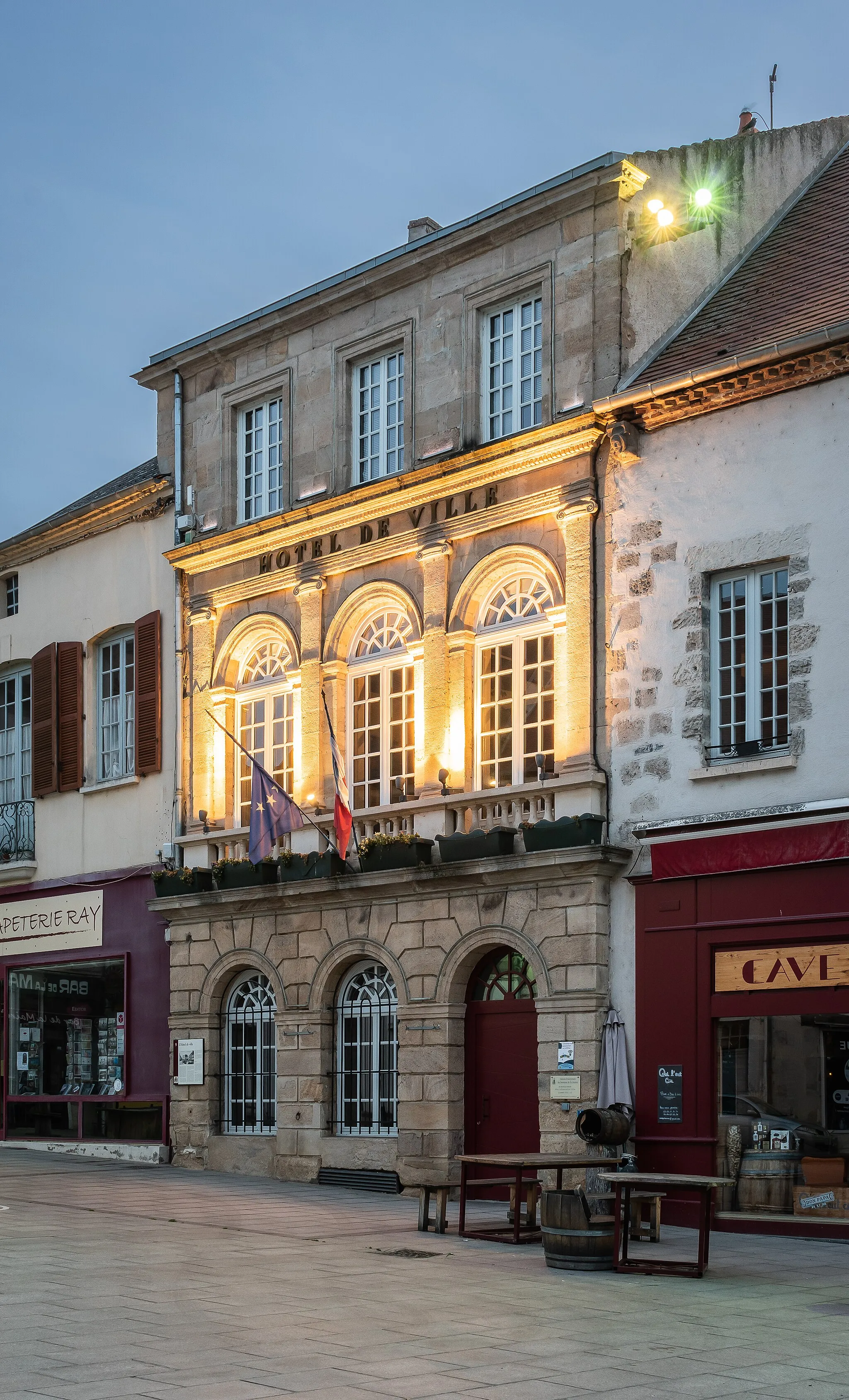
Charming village with challenging climbs and stunning views.
Cyklistické trasy kolem Saint-Jean-de-Muzols
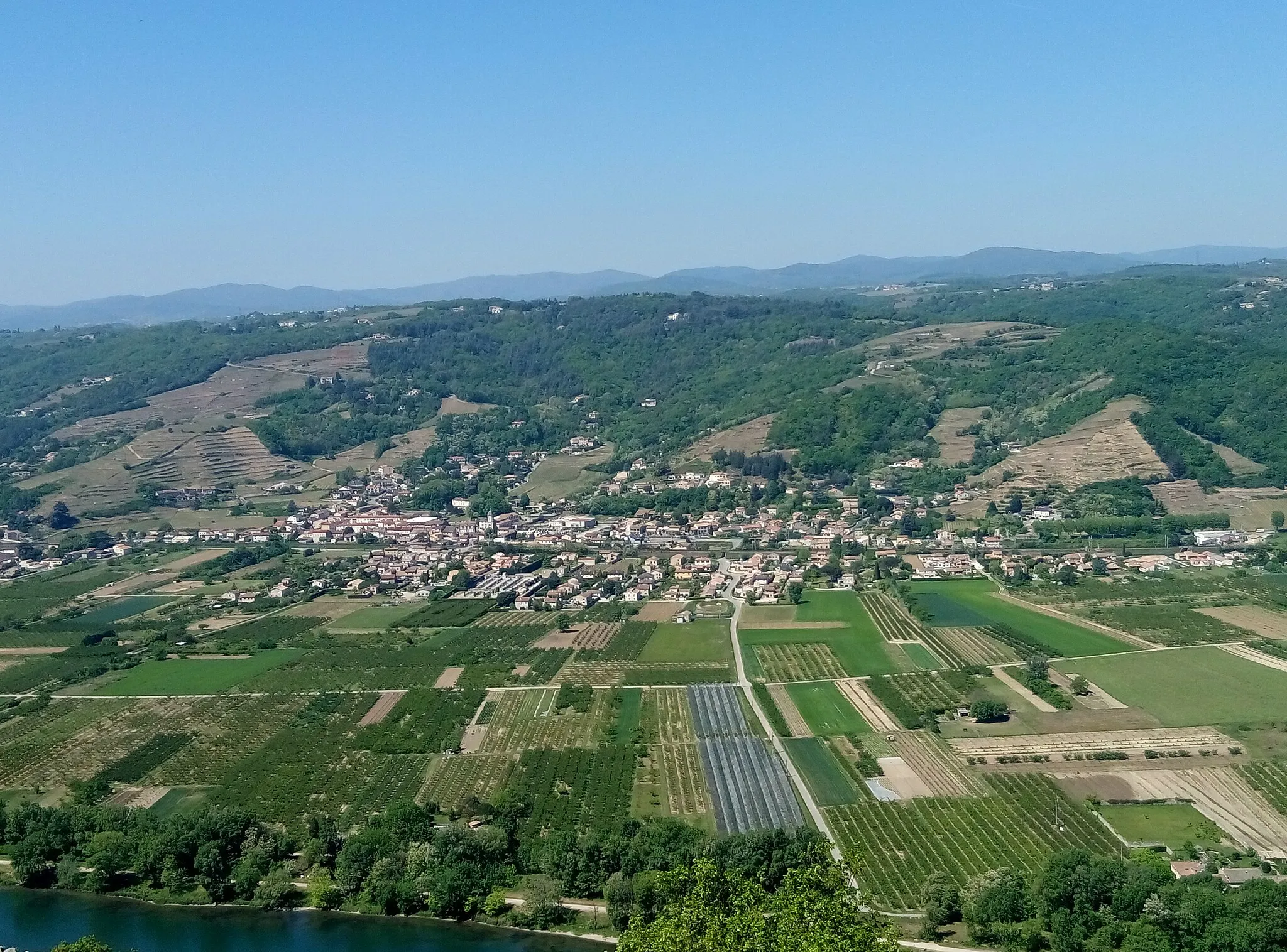
Saint-Jean-de-Muzols offers scenic routes for road cyclists with challenging climbs and beautiful views of the Rhône-Alpes region. The locality is surrounded by vineyards and picturesque villages, making it a great destination for gravel cyclists looking to explore the countryside. Nearby, cyclists can tackle the famous Col de la Mure climb, known for its steep gradients and stunning vistas.
![Miniaturní mapa "Road Kola – Saint-Jean-de-Muzols okruh" inspirace pro cyklisty v oblasti Rhône-Alpes, France. Vytvořeno pomocí plánovače tras Tarmacs.app](https://images.tarmacs.app/cycling-routes/routemaps/600/france/rhone-alpes/saint-jean-de-muzols/road/45960.webp)
Skvělá cesta pro nadšence do kopcovitého terénu.
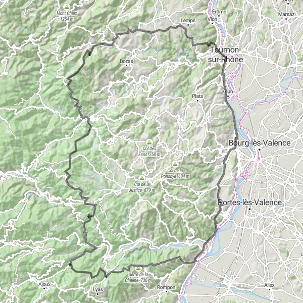
Tato 151 km dlouhá cesta nabízí převýšení 2924 m. Projedete kolem Belvédère de la Chapelle, Cornas a Château de Rosières až na Étables. Trasa vás zavede kolem Saint-Cierge-la-Serre s úžasnými výhledy a Chalencon s historickými památkami.
![Miniaturní mapa "Road Kola – St-Jean-de-Muzols Circuit" inspirace pro cyklisty v oblasti Rhône-Alpes, France. Vytvořeno pomocí plánovače tras Tarmacs.app](https://images.tarmacs.app/cycling-routes/routemaps/600/france/rhone-alpes/saint-jean-de-muzols/road/45981.webp)
Vyzkoumejte rozmanité výhledy a malebná městečka.
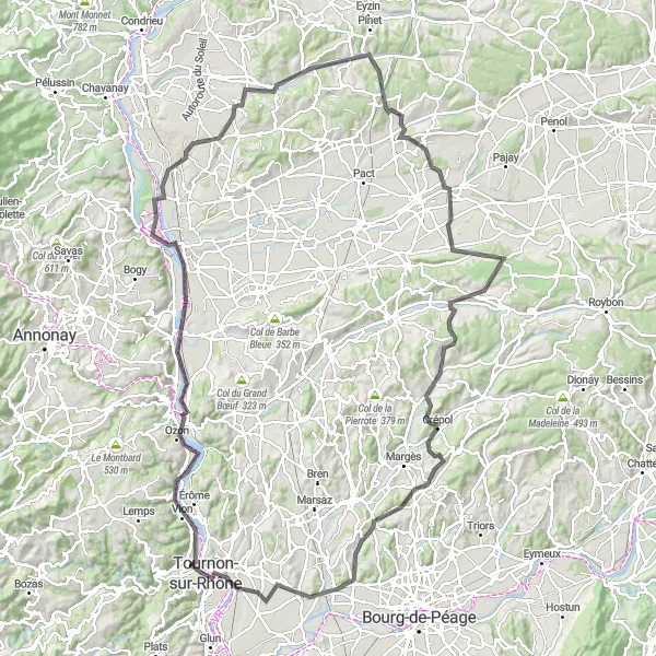
Tato 138 km dlouhá cesta nabízí převýšení 1268 m. Projedete kolem Belvédère de la Chapelle, Calvaire des Trois Saints až na Tain-l'Hermitage. Cesta vás zavede přes krásné Primarette a Chanos-Curson.
![Miniaturní mapa "Gravel Route to Col de la Justice" inspirace pro cyklisty v oblasti Rhône-Alpes, France. Vytvořeno pomocí plánovače tras Tarmacs.app](https://images.tarmacs.app/cycling-routes/routemaps/600/france/rhone-alpes/saint-jean-de-muzols/gravel/45969.webp)
Discover the stunning beauty of the Rhône-Alpes region on this gravel route with a challenging ascent to the Col de la Justice.
Explore picturesque villages like Saint-Romain-de-Lerps, enjoy the panoramic views from Col de Leyrisse and marvel at the historic Château de Crozat. Don't miss the impressive Château des Faugs and the charming Pont Douce Plage along the way.
![Miniaturní mapa "Gravel Expedition to Le Montbard" inspirace pro cyklisty v oblasti Rhône-Alpes, France. Vytvořeno pomocí plánovače tras Tarmacs.app](https://images.tarmacs.app/cycling-routes/routemaps/600/france/rhone-alpes/saint-jean-de-muzols/gravel/45962.webp)
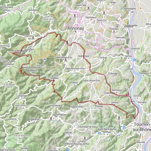
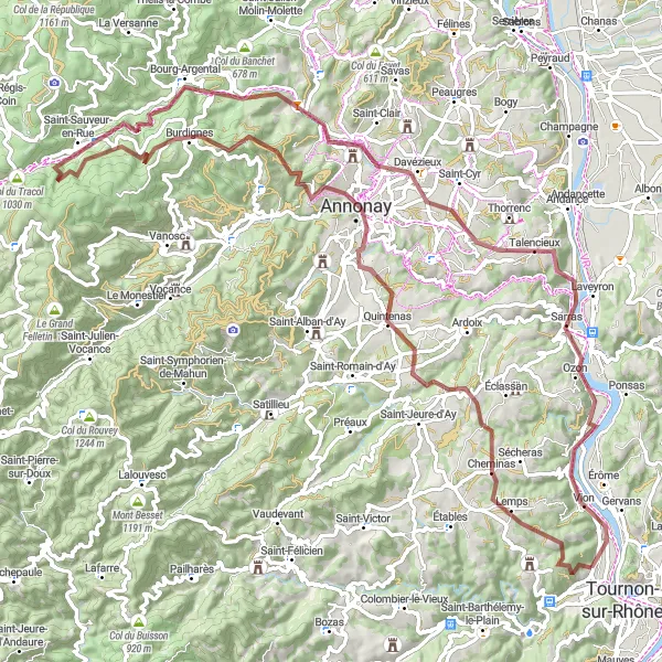
Embark on an epic gravel expedition with a challenging ascent to Le Montbard.
Explore the hidden gems of Étables and Saint-Symphorien-de-Mahun, marvel at the panoramic views from Col de Juvenet and Le Monestier, and immerse yourself in the beauty of Quintenas and Cheminas. Don't miss the historic sites of Vion and Le Montbard along the way.
![Miniaturní mapa "Gravel Kola – Saint-Jean-de-Muzols" inspirace pro cyklisty v oblasti Rhône-Alpes, France. Vytvořeno pomocí plánovače tras Tarmacs.app](https://images.tarmacs.app/cycling-routes/routemaps/600/france/rhone-alpes/saint-jean-de-muzols/gravel/45954.webp)
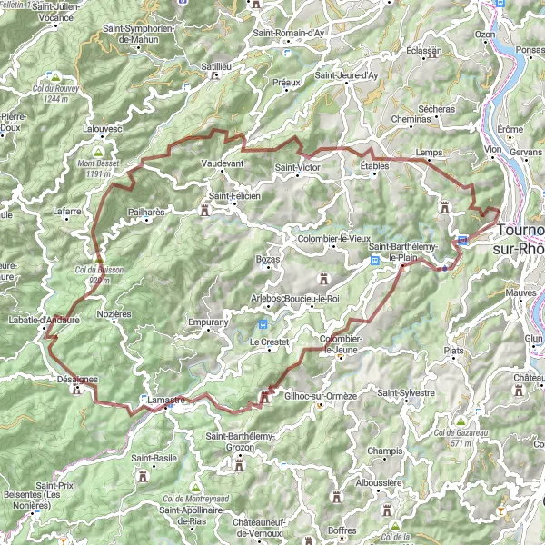
Užijte si strmý výstup a malebné výhledy.
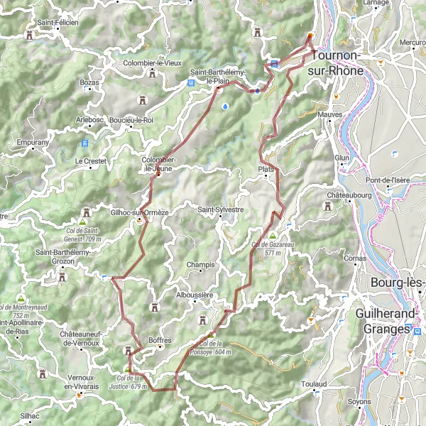
Tato trasa nabízí 89 km jízdy po skalnatých cestách s převýšením 2458 m. Projedete okolo Saint-Barthélemy-le-Plain, Lamastre a Désaignes až na Col du Marchand. Cesta končí v Lemps.
![Miniaturní mapa "Gravel Kola – Okolí Saint-Jean-de-Muzols" inspirace pro cyklisty v oblasti Rhône-Alpes, France. Vytvořeno pomocí plánovače tras Tarmacs.app](https://images.tarmacs.app/cycling-routes/routemaps/600/france/rhone-alpes/saint-jean-de-muzols/gravel/45978.webp)
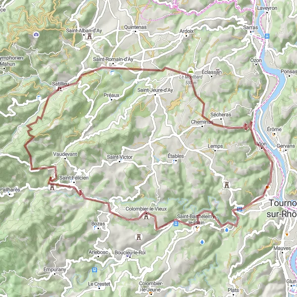
Zajezděte si okružní trasu s kopcovitým terénem.
Tato 68 km dlouhá trasa nabízí převýšení 1543 m. Projedete kolem Saint-Barthélemy-le-Plain, Colombier-le-Vieux a dále na Col du Gibet. Trasa končí ve Vion.
![Miniaturní mapa "Trasa kolem Tain-l'Hermitage" inspirace pro cyklisty v oblasti Rhône-Alpes, France. Vytvořeno pomocí plánovače tras Tarmacs.app](https://images.tarmacs.app/cycling-routes/routemaps/600/france/rhone-alpes/saint-jean-de-muzols/road/45944.webp)
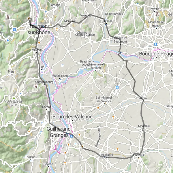
Prozkoumejte úchvatné výhledy a historii v okolí Tain-l'Hermitage
Tato cyklistická trasa o délce 73 km vás provede údolím řeky Rhône a kolem měst Tain-l'Hermitage, Montélier a Valence. Se 325 m převýšení si užijete malebné scenerie a zajímavé zastávky. Nezapomeňte se zastavit na Belvédère de Veaunes s úchvatným výhledem.
![Miniaturní mapa "Gravel Adventure to La Madone de Boulieu" inspirace pro cyklisty v oblasti Rhône-Alpes, France. Vytvořeno pomocí plánovače tras Tarmacs.app](https://images.tarmacs.app/cycling-routes/routemaps/600/france/rhone-alpes/saint-jean-de-muzols/gravel/45974.webp)
Embark on an exhilarating gravel adventure with a challenging ascent to La Madone de Boulieu.
Explore hidden gems like Lemps and Quintenas, marvel at the stunning views from Croix de Chirol, and immerse yourself in the beauty of Bourg-Argental and Davézieux. Don't miss the historic sites of Le Montbard and Saint-Vallier along the way.
![Miniaturní mapa "Road Cycling Journey to Belvédère de la Chapelle" inspirace pro cyklisty v oblasti Rhône-Alpes, France. Vytvořeno pomocí plánovače tras Tarmacs.app](https://images.tarmacs.app/cycling-routes/routemaps/600/france/rhone-alpes/saint-jean-de-muzols/road/45997.webp)
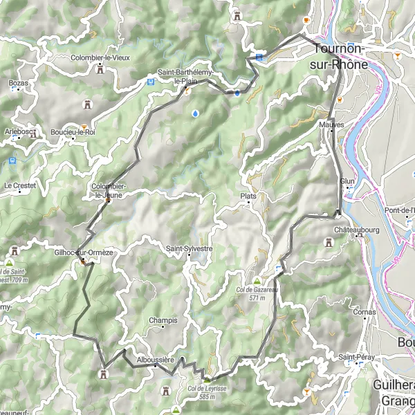
Embark on a scenic road cycling journey with a challenging ascent to Belvédère de la Chapelle.
Explore the picturesque village of Mauves, marvel at the panoramic views from Col de Leyrisse, and immerse yourself in the beauty of Alboussière and Gilhoc-sur-Ormèze. Don't miss the historic sites of Saint-Barthélemy-le-Plain and Saint-Jean-de-Muzols along the way.
![Miniaturní mapa "Trasa kolem Crozes-Hermitage" inspirace pro cyklisty v oblasti Rhône-Alpes, France. Vytvořeno pomocí plánovače tras Tarmacs.app](https://images.tarmacs.app/cycling-routes/routemaps/600/france/rhone-alpes/saint-jean-de-muzols/road/45938.webp)
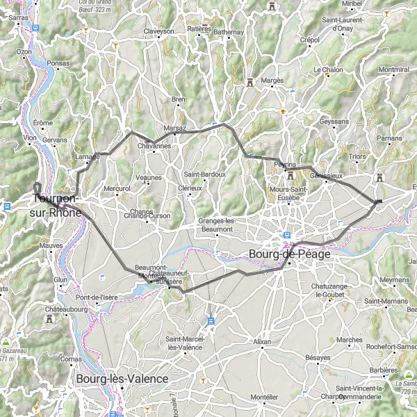
Projděte malebnou krajinou okolo vinic a historických památek
Tato trasa nabízí 69 km krásné cyklistiky přes města Crozes-Hermitage, Génissieux a Romans-sur-Isère. Vystoupáte do stoupání s 457 m převýšení a budete obdivovat krásnou krajinu kolem řeky Rhône. Na vrcholu vás čeká Belvédère de la Chapelle s úchvatným výhledem.
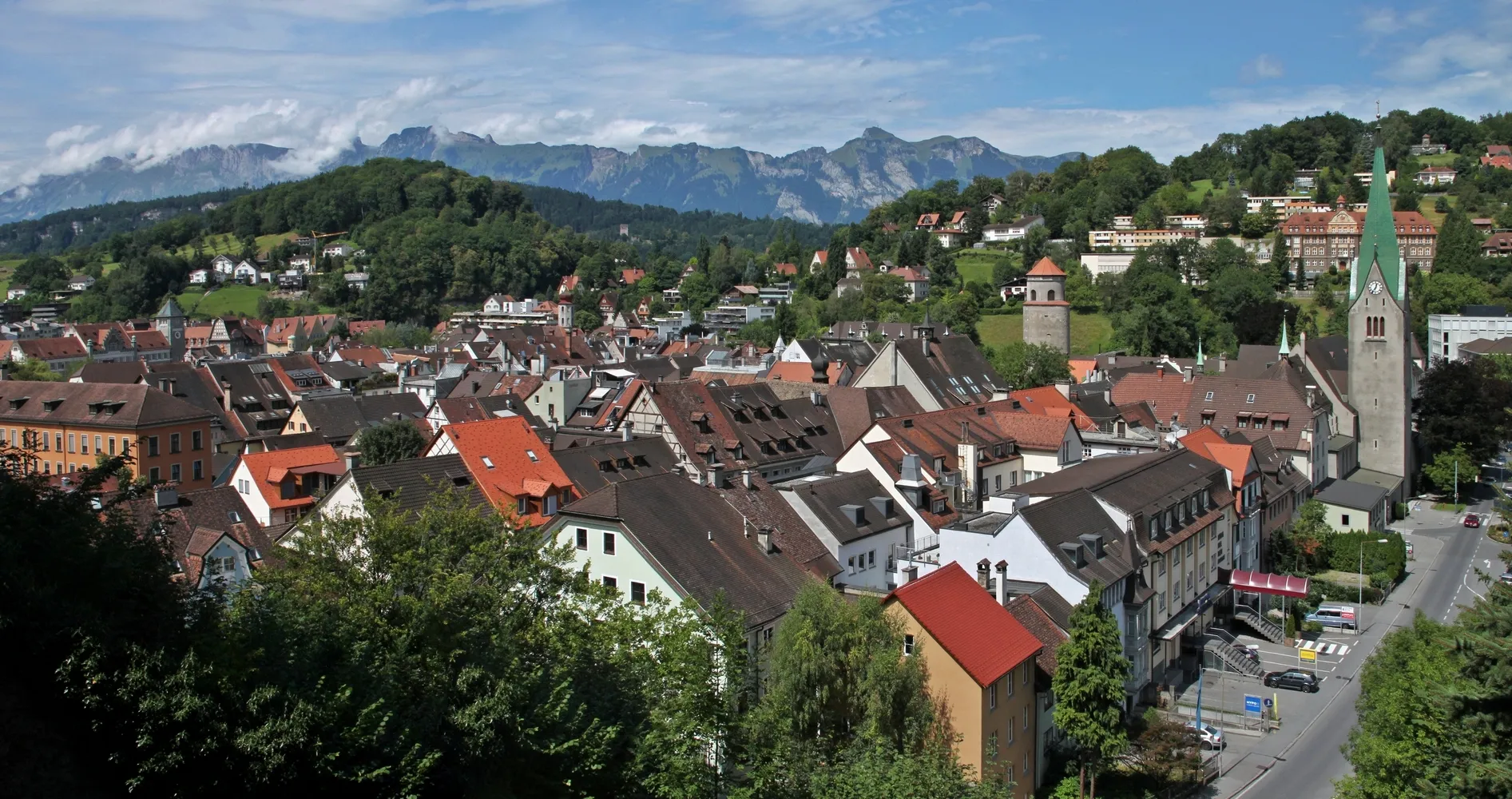
Cyklotrasy v okolí:
Okolní oblasti:
![Obrázek Tirol](https://images.tarmacs.app/cycling-routes/covers/austria/tirol/kirchbichl-4.webp)
![Obrázek Vorarlberg](https://images.tarmacs.app/cycling-routes/covers/austria/vorarlberg/feldkirch-5.webp)
![Obrázek Région lémanique](https://images.tarmacs.app/cycling-routes/covers/switzerland/region-lemanique/coppet-1.webp)
![Obrázek Espace Mittelland](https://images.tarmacs.app/cycling-routes/covers/switzerland/espace-mittelland/vechigen-3.webp)
![Obrázek Katalánsko](https://images.tarmacs.app/cycling-routes/covers/spain/cataluna/seva-4.webp)
![Obrázek Bourgogne](https://images.tarmacs.app/cycling-routes/covers/france/bourgogne/tournus-4.webp)
![Obrázek Franche-Comté](https://images.tarmacs.app/cycling-routes/covers/france/franche-comte/pirey-2.webp)
![Obrázek Languedoc-Roussillon](https://images.tarmacs.app/cycling-routes/covers/france/languedoc-roussillon/portiragnes-1.webp)
![Obrázek Auvergne](https://images.tarmacs.app/cycling-routes/covers/france/auvergne/saint-pourcain-sur-sioule-4.webp)
![Obrázek Provence-Alpes-Côte d’Azur](https://images.tarmacs.app/cycling-routes/covers/france/provence-alpes-cote-dazur/vence-1.webp)
![Obrázek Piemonte](https://images.tarmacs.app/cycling-routes/covers/italy/piemonte/pavone-canavese-3.webp)
![Obrázek Valle d’Aosta/Vallée d’Aoste](https://images.tarmacs.app/cycling-routes/covers/italy/valle-daosta-vallee-daoste/saint-vincent-3.webp)