![Cover image](https://images.tarmacs.app/cycling-routes/covers/france/rhone-alpes/toulaud-5.webp)
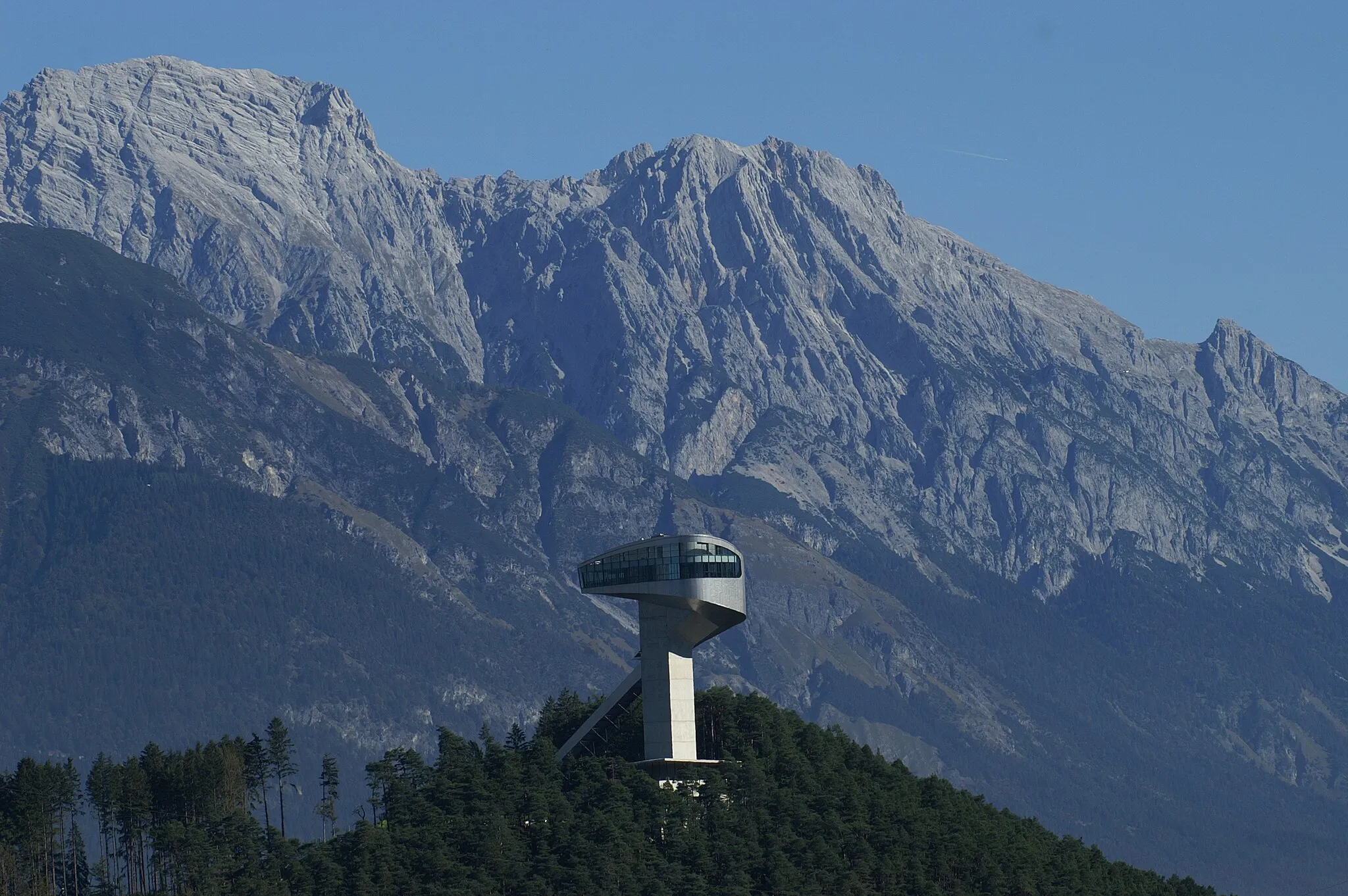
Úchvatné výhledy na údolí a hory
Cyklistické trasy kolem Toulaud
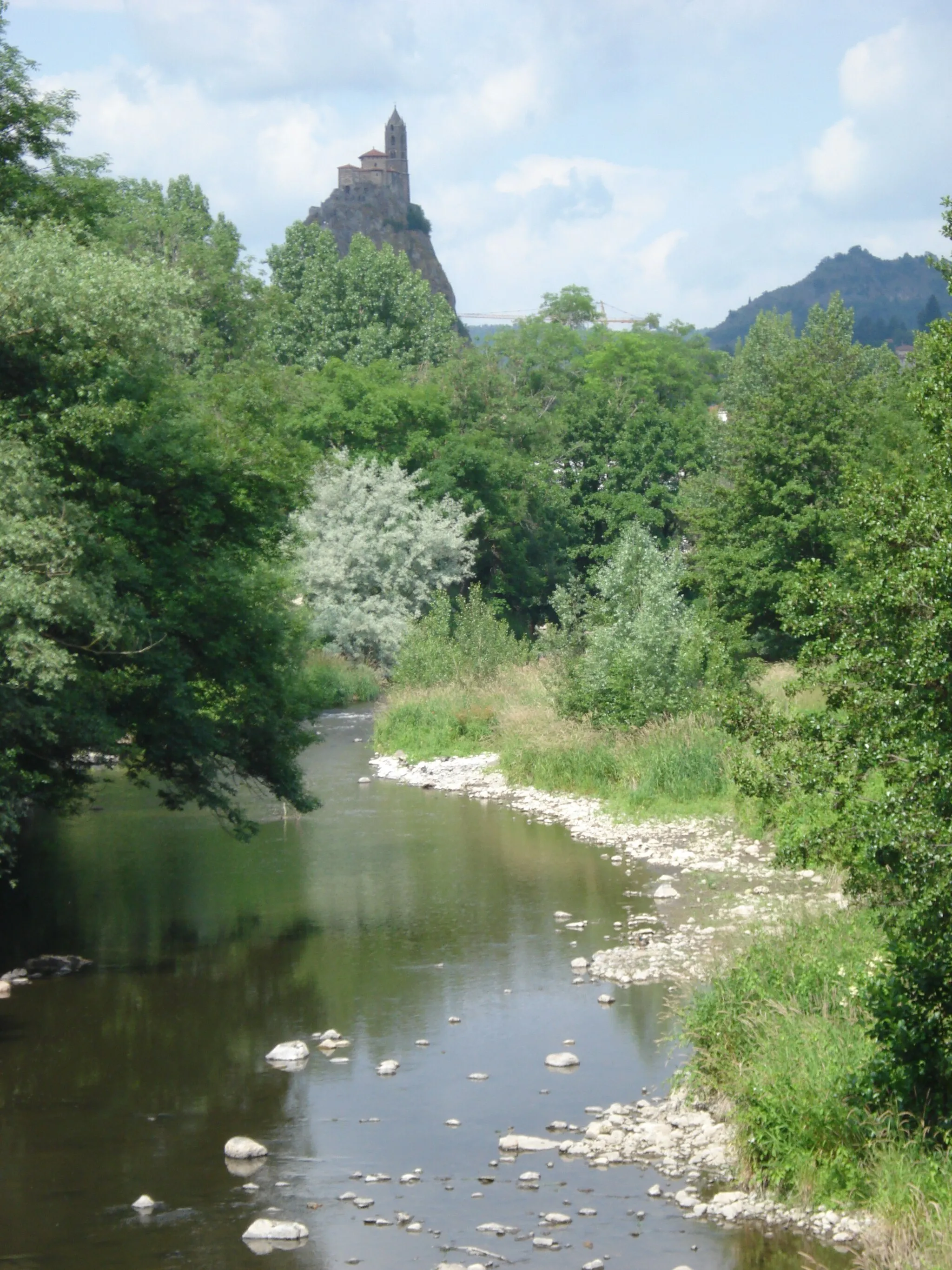
Toulaud je malebná obec v regionu Rhône-Alpes ve Francii. Zdejší cyklistické cesty vás provedou okolo úchvatných výhledů na údolí a hory. Nedaleko se nachází slavný cyklistický kopec Col d'Aubisque, který je výzvou pro každého cyklistu.
![Miniaturní mapa "Scenic Road Trip to Saint-Sauveur-de-Montagut" inspirace pro cyklisty v oblasti Rhône-Alpes, France. Vytvořeno pomocí plánovače tras Tarmacs.app](https://images.tarmacs.app/cycling-routes/routemaps/600/france/rhone-alpes/toulaud/road/51394.webp)
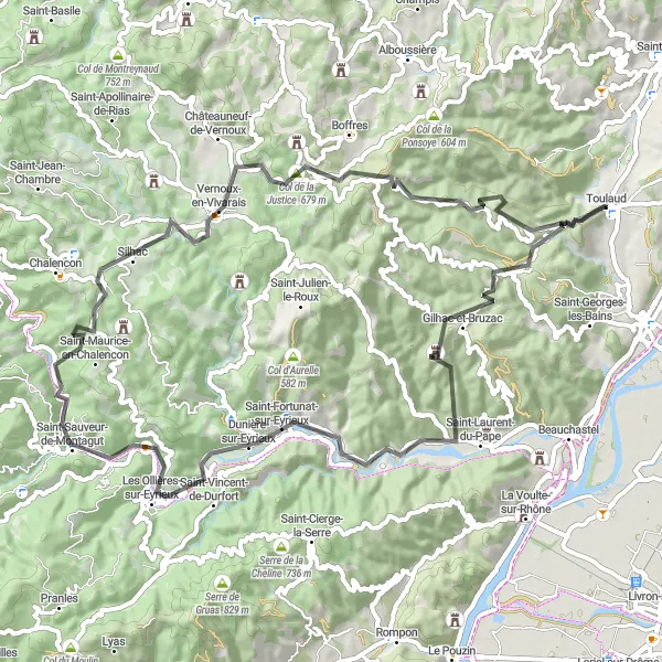
Embark on a 72 km road trip through picturesque landscapes to Saint-Sauveur-de-Montagut
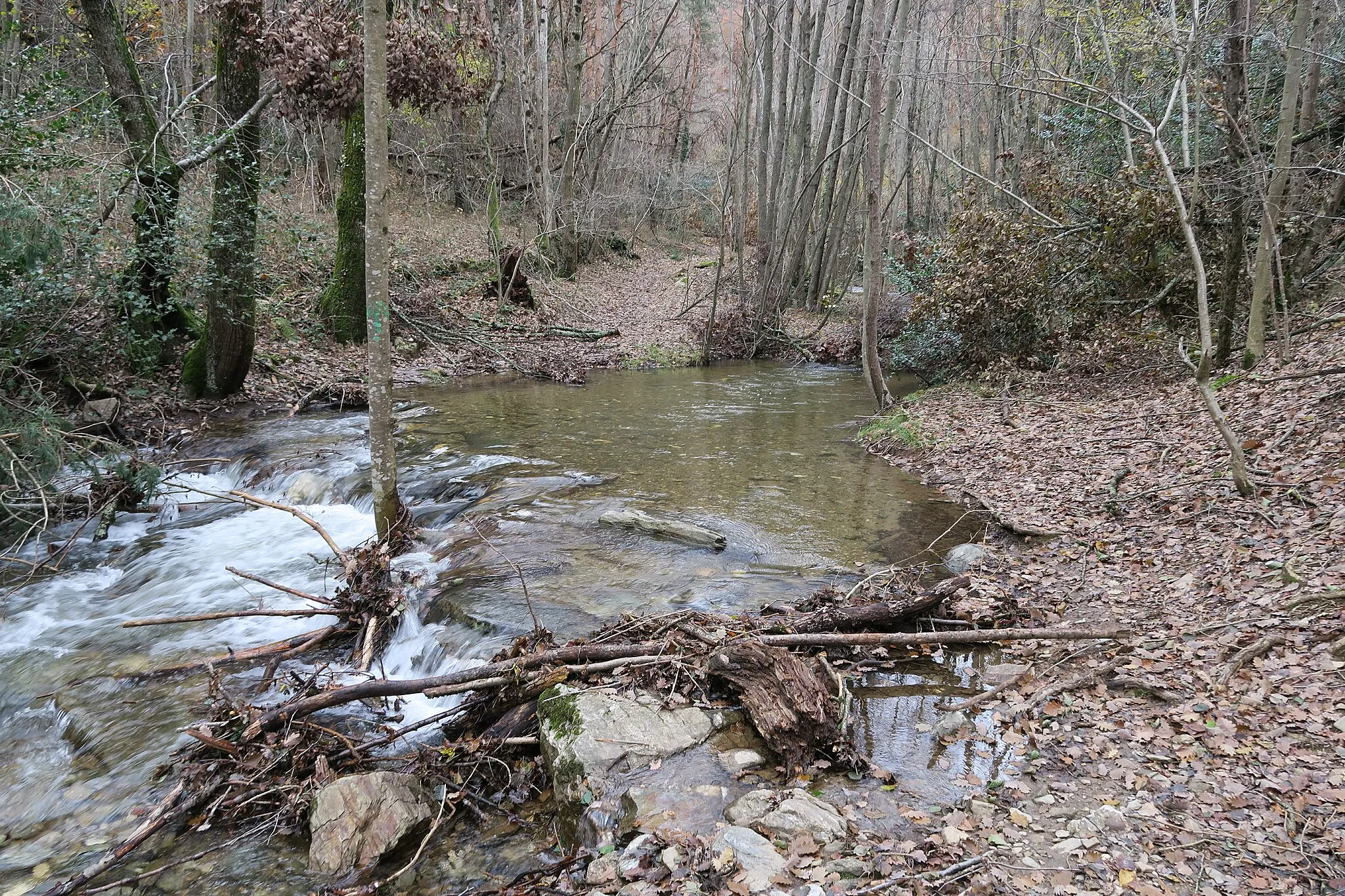
Cycle through the beautiful Défilé du Pontpierre and enjoy the breathtaking views of Les Ollières-sur-Eyrieux. Challenge yourself with climbs to Col de Combéron and Col de la Justice for a rewarding journey.
![Miniaturní mapa "Náročný okruh kolem Toulaudu" inspirace pro cyklisty v oblasti Rhône-Alpes, France. Vytvořeno pomocí plánovače tras Tarmacs.app](https://images.tarmacs.app/cycling-routes/routemaps/600/france/rhone-alpes/toulaud/road/51399.webp)
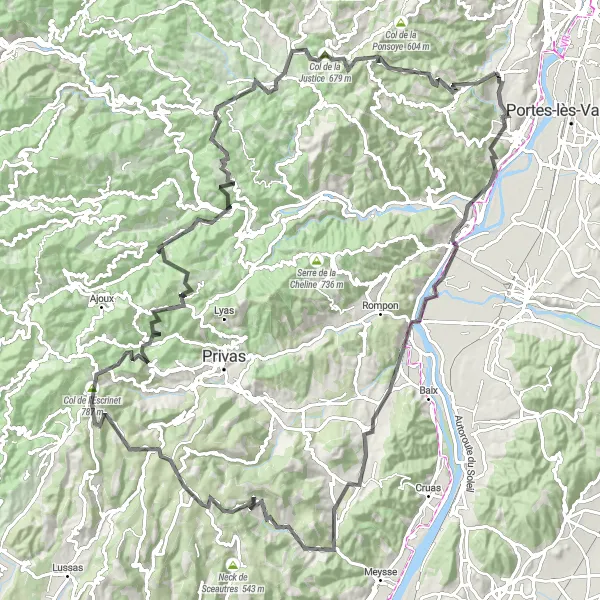
Cyklistická výzva s 2512 m převýšením a krásnými výhledy
Tento 133km okruh vás zavede kolem malebných vesnic a vrcholů s 2512 m převýšením. Projedete kolem Beauchastel, Point de vue, Saint-Vincent-de-Barrès až k Col de l'Escrinet.
![Miniaturní mapa "Horská cyklistika kolem Toulaudu" inspirace pro cyklisty v oblasti Rhône-Alpes, France. Vytvořeno pomocí plánovače tras Tarmacs.app](https://images.tarmacs.app/cycling-routes/routemaps/600/france/rhone-alpes/toulaud/gravel/51387.webp)
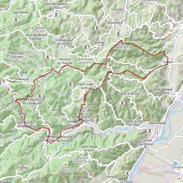
Náročný okruh s 2080 m převýšením a malebnými výhledy
Tato 73km trasa nabízí adrenalinový zážitek s náročnými podmínkami pro horskou cyklistiku. Projedete kolem Saint-Julien-le-Roux, Col d'Aurelle, Les Ollières-sur-Eyrieux až k Saint-Maurice-en-Chalencon.
![Miniaturní mapa "Gravel Trail through Eyrieux Valley" inspirace pro cyklisty v oblasti Rhône-Alpes, France. Vytvořeno pomocí plánovače tras Tarmacs.app](https://images.tarmacs.app/cycling-routes/routemaps/600/france/rhone-alpes/toulaud/gravel/51410.webp)
Discover the hidden gems of Eyrieux Valley on this 57 km gravel trail
Explore the picturesque villages of Saint-Vincent-de-Durfort and Saint-Fortunat-sur-Eyrieux along with challenging ascents like Col d'Aurelle. Enjoy the stunning views and diverse terrain of this scenic route.
![Miniaturní mapa "Dlouhý okruh po silnici od Toulaudu" inspirace pro cyklisty v oblasti Rhône-Alpes, France. Vytvořeno pomocí plánovače tras Tarmacs.app](https://images.tarmacs.app/cycling-routes/routemaps/600/france/rhone-alpes/toulaud/road/51402.webp)
Užijte si 156km cesty s 2789 m převýšením a malebnými výhledy
Tento okruh je určen pro zkušené cyklisty, kteří hledají výzvu. S 2789 m převýšením se dostanete od Toulaudu až k Saint-Péray, projíždějíc zajímavými městy a krásnou přírodou.
![Miniaturní mapa "Epic Road Cycling Adventure to Château de la Tourrette" inspirace pro cyklisty v oblasti Rhône-Alpes, France. Vytvořeno pomocí plánovače tras Tarmacs.app](https://images.tarmacs.app/cycling-routes/routemaps/600/france/rhone-alpes/toulaud/road/51424.webp)
Embark on a 101 km road cycling adventure through the stunning landscapes of Rhône-Alpes
Ride through the historic villages of Pranles and Saint-Michel-de-Chabrillanoux, with challenging ascents to Serre de Pied Vernet and Col de la Justice. Explore the magnificent Château de la Tourrette and enjoy the panoramic views from the summit.
![Miniaturní mapa "Okruh po silnici kolem Toulaudu" inspirace pro cyklisty v oblasti Rhône-Alpes, France. Vytvořeno pomocí plánovače tras Tarmacs.app](https://images.tarmacs.app/cycling-routes/routemaps/600/france/rhone-alpes/toulaud/road/51386.webp)
Vydejte se na malebnou jízdu s výhledem na Vercors a Valence
Tento okruh nabízí 72 km malebné cesty s 468 m převýšením. Projedete kolem Cornas, La Roche-de-Glun a Belvédère de Veaunes až do Valence, kde si užijete pohodový závěr.
![Miniaturní mapa "Scenic Cycling Journey to Valence and Beaumont-Monteux" inspirace pro cyklisty v oblasti Rhône-Alpes, France. Vytvořeno pomocí plánovače tras Tarmacs.app](https://images.tarmacs.app/cycling-routes/routemaps/600/france/rhone-alpes/toulaud/road/51398.webp)
Explore the charming towns of Valence and Beaumont-Monteux on this 91 km road cycling journey
Cycle through the picturesque landscapes of the Vercors and enjoy stunning views of the Rhône River along the way. Discover the historic towns of Bourg-de-Péage and Bésayes, with challenging climbs to Charmes-sur-Rhône for a memorable adventure.
Cyklotrasy v okolí:
Okolní oblasti:
![Obrázek Tirol](https://images.tarmacs.app/cycling-routes/covers/austria/tirol/pradl-3.webp)
![Obrázek Vorarlberg](https://images.tarmacs.app/cycling-routes/covers/austria/vorarlberg/buers-5.webp)
![Obrázek Région lémanique](https://images.tarmacs.app/cycling-routes/covers/switzerland/region-lemanique/bellevue-2.webp)
![Obrázek Espace Mittelland](https://images.tarmacs.app/cycling-routes/covers/switzerland/espace-mittelland/fraubrunnen-1.webp)
![Obrázek Katalánsko](https://images.tarmacs.app/cycling-routes/covers/spain/cataluna/constanti-4.webp)
![Obrázek Bourgogne](https://images.tarmacs.app/cycling-routes/covers/france/bourgogne/mirebeau-sur-beze-1.webp)
![Obrázek Franche-Comté](https://images.tarmacs.app/cycling-routes/covers/france/franche-comte/bethoncourt-3.webp)
![Obrázek Languedoc-Roussillon](https://images.tarmacs.app/cycling-routes/covers/france/languedoc-roussillon/meze-1.webp)
![Obrázek Auvergne](https://images.tarmacs.app/cycling-routes/covers/france/auvergne/chadrac-5.webp)
![Obrázek Provence-Alpes-Côte d’Azur](https://images.tarmacs.app/cycling-routes/covers/france/provence-alpes-cote-dazur/la-roquebrussanne-2.webp)
![Obrázek Piemonte](https://images.tarmacs.app/cycling-routes/covers/italy/piemonte/romentino-5.webp)
![Obrázek Valle d’Aosta/Vallée d’Aoste](https://images.tarmacs.app/cycling-routes/covers/italy/valle-daosta-vallee-daoste/aymavilles-1.webp)