![Cover image](https://images.tarmacs.app/cycling-routes/covers/italy/valle-daosta-vallee-daoste/valtournenche-2.webp)
Klid a cyklistické výzvy v Alpách
Cyklistické trasy kolem Valtournenche
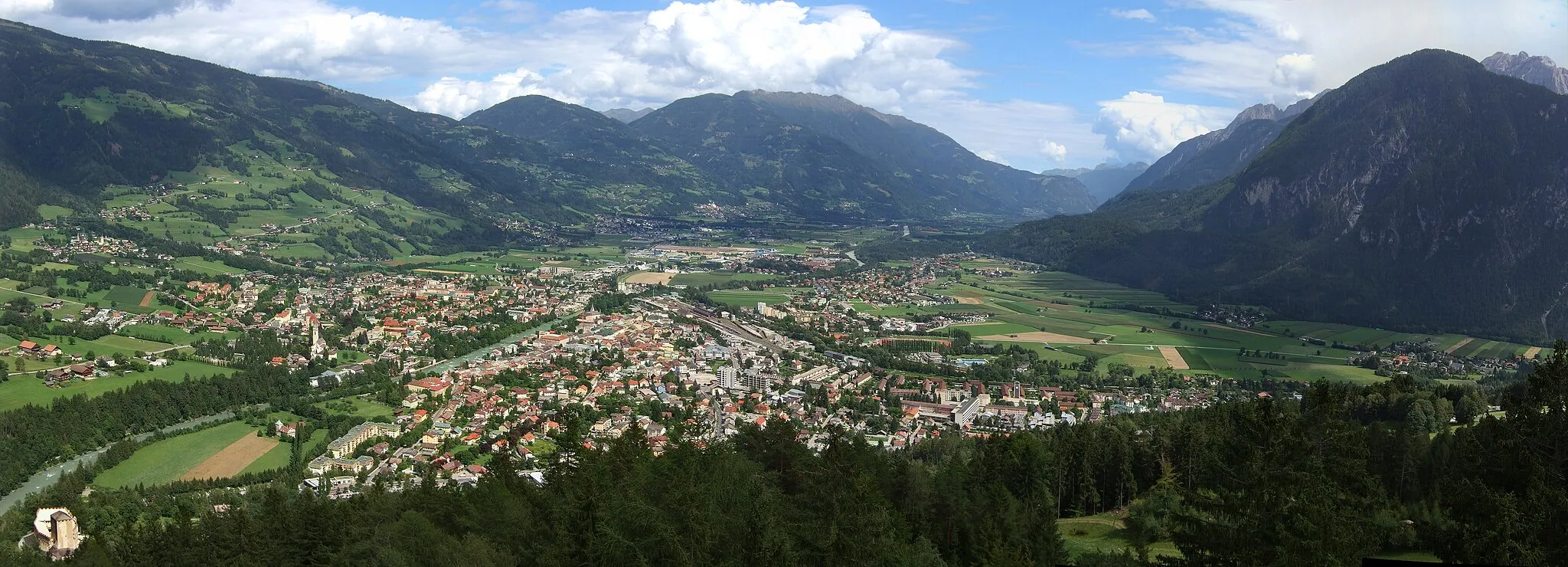
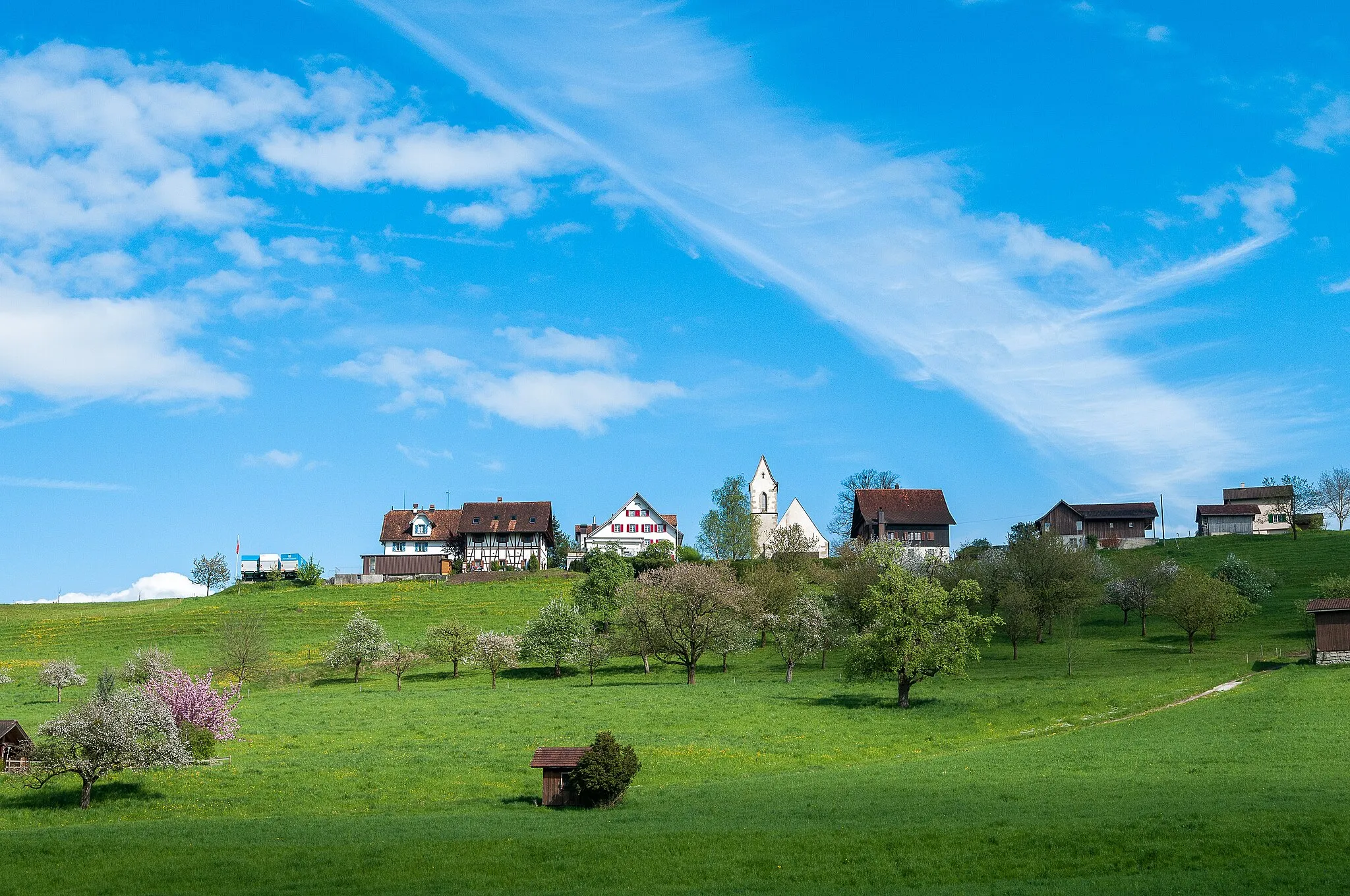
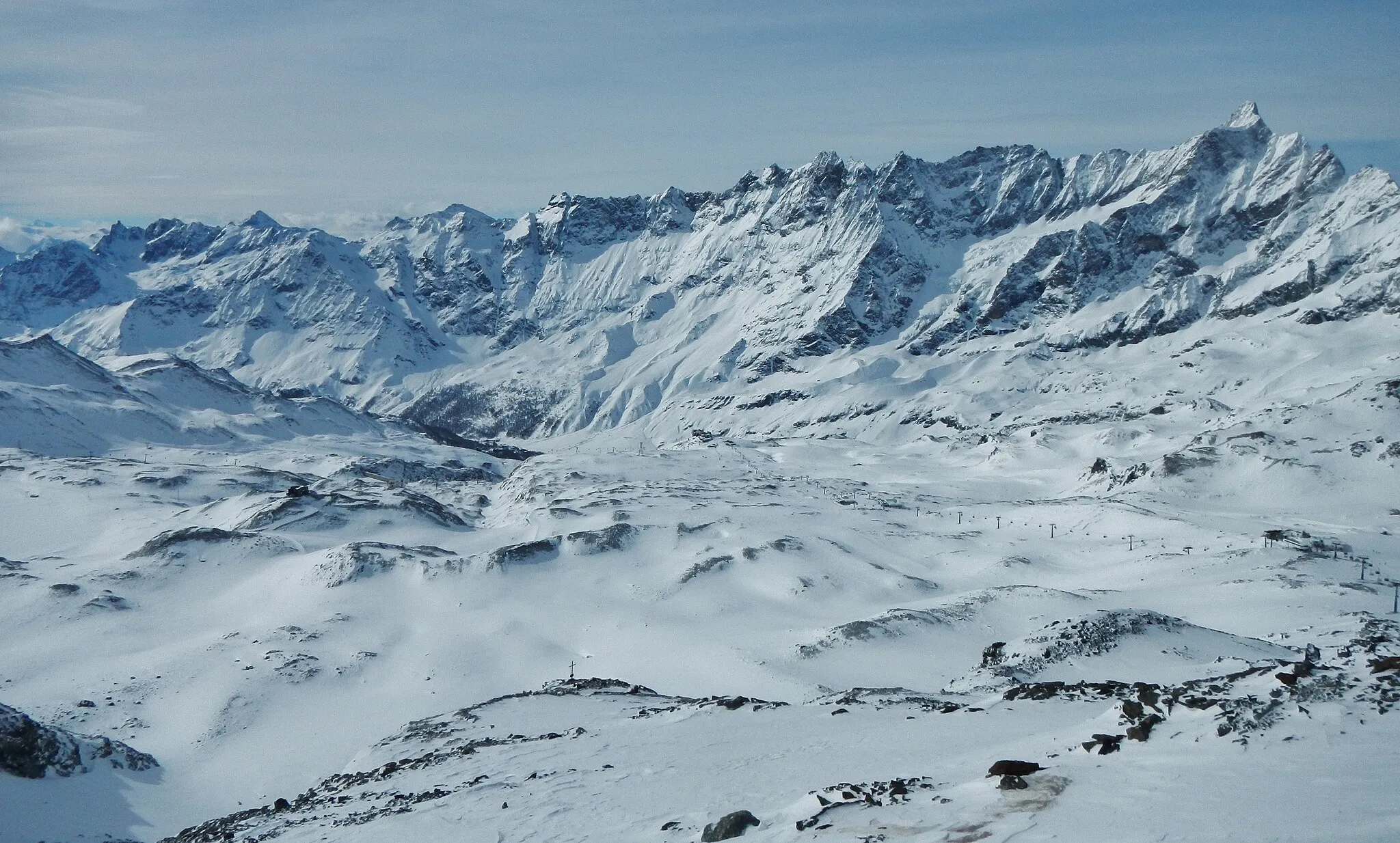
Valtournenche je malebná obec ve Valle d’Aosta, surrounded by majestic Alps. Pro cyklisty nabízí klidné silnice a úchvatnou přírodu. V blízkosti se nachází známý cyklistický výstup do oblasti Cervinia.
![Miniaturní mapa "Gravelová trasa Torre di Conoz - Valtournenche" inspirace pro cyklisty v oblasti Valle d’Aosta/Vallée d’Aoste, Italy. Vytvořeno pomocí plánovače tras Tarmacs.app](https://images.tarmacs.app/cycling-routes/routemaps/600/italy/valle-daosta-vallee-daoste/valtournenche/gravel/354244.webp)
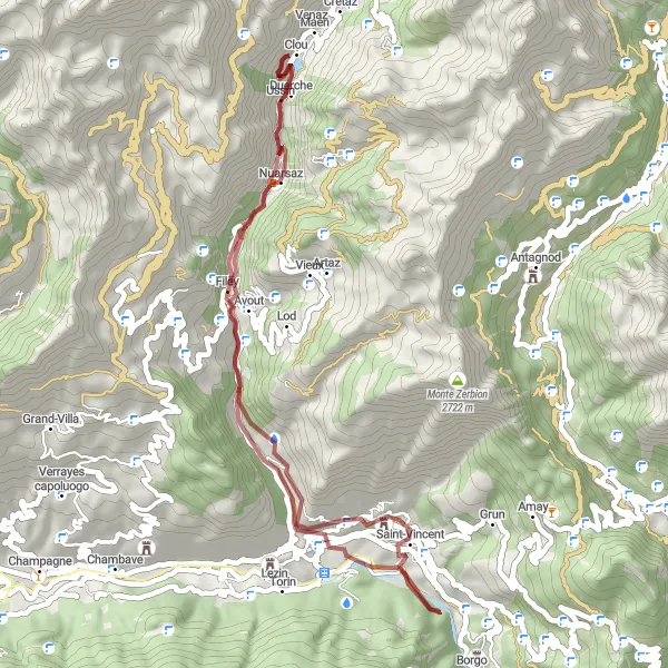
Náročná trasa přes údolí s výstupem 4415 metrů
Pro cestovatele, kteří hledají dobrodružství, je tato trasa ideální volbou. Projedete kolem historické věže Torre di Conoz a dostanete se až do malebného Valtournenche, kde můžete odpočinout.
![Miniaturní mapa "Gravel Panoramic Tour" inspirace pro cyklisty v oblasti Valle d’Aosta/Vallée d’Aoste, Italy. Vytvořeno pomocí plánovače tras Tarmacs.app](https://images.tarmacs.app/cycling-routes/routemaps/600/italy/valle-daosta-vallee-daoste/valtournenche/gravel/354198.webp)
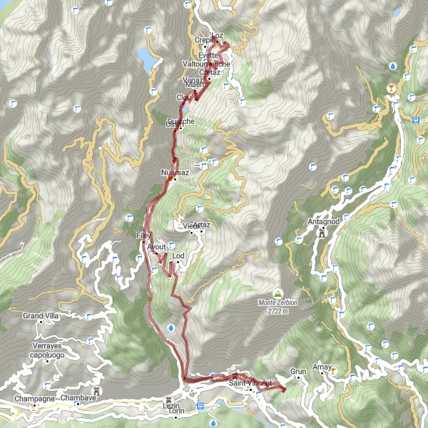
Explore stunning panoramic views on this gravel route.
This gravel route offers a thrilling adventure with a moderate ascent providing breathtaking views along the way. Pass by charming villages and lush landscapes while enjoying the tranquility of the surroundings. A perfect combination of nature, culture, and physical activity awaits you.
![Miniaturní mapa "Scenic Road Cycling Challenge" inspirace pro cyklisty v oblasti Valle d’Aosta/Vallée d’Aoste, Italy. Vytvořeno pomocí plánovače tras Tarmacs.app](https://images.tarmacs.app/cycling-routes/routemaps/600/italy/valle-daosta-vallee-daoste/valtournenche/road/354224.webp)
Challenge yourself with a scenic road cycling route through picturesque landscapes and charming villages.
This road cycling route offers a mix of challenging climbs and gentle descents, providing a balanced workout for cyclists of all levels. Explore the beauty of the Aosta Valley while passing through traditional villages and historic sites. A perfect combination of nature, culture, and physical activity awaits you on this scenic journey.
![Miniaturní mapa "Trasa Belvedere - Ruvere" inspirace pro cyklisty v oblasti Valle d’Aosta/Vallée d’Aoste, Italy. Vytvořeno pomocí plánovače tras Tarmacs.app](https://images.tarmacs.app/cycling-routes/routemaps/600/italy/valle-daosta-vallee-daoste/valtournenche/road/354220.webp)
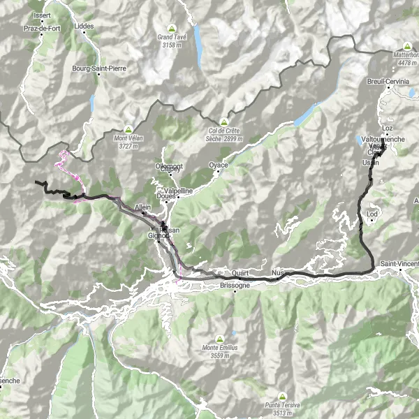
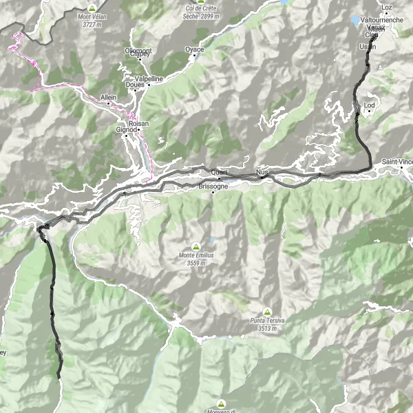
Náročná silniční cyklistická trasa s výstupem 3099 metrů
Tato trasa nabízí náročné stoupání a krásné výhledy na hrad Castello di Aymavilles a vesnici Vieyes. Projedete kolem historického Castello Gamba až do Ruvere, kde si můžete odpočinout.
![Miniaturní mapa "Cyklistická cesta k Castello Gamba" inspirace pro cyklisty v oblasti Valle d’Aosta/Vallée d’Aoste, Italy. Vytvořeno pomocí plánovače tras Tarmacs.app](https://images.tarmacs.app/cycling-routes/routemaps/600/italy/valle-daosta-vallee-daoste/valtournenche/road/364514.webp)
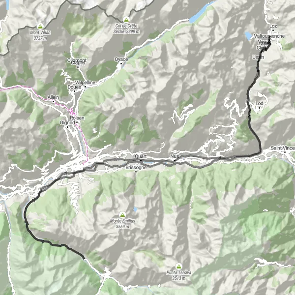
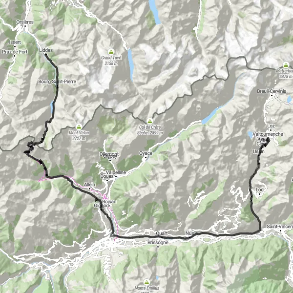
Náročná trasa s úžasnými památkami
Tato 144 km dlouhá trasa nabízí 3098 m stoupání a prochází krásnými místy jako je Belvedere a Castello di Bramafam. Objevte krásné zámky a historická místa a nakonec dorazte do Valtournenche k Castello Gamba.
![Miniaturní mapa "Jízda k Jovençanu" inspirace pro cyklisty v oblasti Valle d’Aosta/Vallée d’Aoste, Italy. Vytvořeno pomocí plánovače tras Tarmacs.app](https://images.tarmacs.app/cycling-routes/routemaps/600/italy/valle-daosta-vallee-daoste/valtournenche/road/354227.webp)
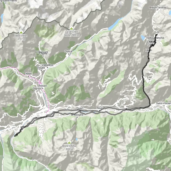
Zajímavá trasa plná historických památek
Tato 110 km dlouhá trasa nabízí 2047 m stoupání a prochází historickými místy jako je Belvedere a Castello di Aymavilles. Objevte staré zámky a malebné vesnice a nakonec dorazte do Valtournenche k Castello Gamba.
Trasa k Val d'Aosta
![Miniaturní mapa "Trasa k Val d'Aosta" inspirace pro cyklisty v oblasti Valle d’Aosta/Vallée d’Aoste, Italy. Vytvořeno pomocí plánovače tras Tarmacs.app](https://images.tarmacs.app/cycling-routes/routemaps/600/italy/valle-daosta-vallee-daoste/valtournenche/road/364527.webp)
Náročná trasa s úžasnými výhledy
Tato 148 km dlouhá trasa nabízí 3085 m stoupání a prochází malebnými místy jako je Torre di Conoz a Introd. Navštivte historické památky a krásné vesnice a nakonec dorazte zpět do Valtournenche.
![Miniaturní mapa "Silniční trasa Buisson - Valtournenche" inspirace pro cyklisty v oblasti Valle d’Aosta/Vallée d’Aoste, Italy. Vytvořeno pomocí plánovače tras Tarmacs.app](https://images.tarmacs.app/cycling-routes/routemaps/600/italy/valle-daosta-vallee-daoste/valtournenche/road/354242.webp)
Náročná trasa s výstupem 5254 metrů
Tato trasa je ideální pro zkušené cyklisty, kteří hledají výzvu a nádherné výhledy. Projedete kolem historického hradu Castello di Jovençan až do Valtournenche, kde si můžete odpočinout a obdivovat krásu horské krajiny.
![Miniaturní mapa "Epic Road Cycling Journey" inspirace pro cyklisty v oblasti Valle d’Aosta/Vallée d’Aoste, Italy. Vytvořeno pomocí plánovače tras Tarmacs.app](https://images.tarmacs.app/cycling-routes/routemaps/600/italy/valle-daosta-vallee-daoste/valtournenche/road/354243.webp)
Embark on an epic road cycling journey through breathtaking landscapes and challenging ascents.
This road cycling route is a true test of endurance and skill, with steep climbs and fast descents. Explore diverse landscapes, from lush valleys to rugged mountains, while passing through charming villages and historic sites. An unforgettable journey awaits for cyclists looking for a challenging adventure.
Mountain Adventure Ride
![Miniaturní mapa "Mountain Adventure Ride" inspirace pro cyklisty v oblasti Valle d’Aosta/Vallée d’Aoste, Italy. Vytvořeno pomocí plánovače tras Tarmacs.app](https://images.tarmacs.app/cycling-routes/routemaps/600/italy/valle-daosta-vallee-daoste/valtournenche/gravel/354196.webp)
Embark on a mountain adventure ride with challenging climbs and rewarding descents.
This gravel route is perfect for adventurous cyclists seeking a thrilling challenge. With steep ascents and exhilarating descents, the route offers a mix of adrenaline and natural beauty. Explore remote areas and rugged terrain while experiencing the true essence of mountain biking.
Cyklotrasy v okolí:
Okolní oblasti:
![Obrázek Tirol](https://images.tarmacs.app/cycling-routes/covers/austria/tirol/lienz-4.webp)
![Obrázek Vorarlberg](https://images.tarmacs.app/cycling-routes/covers/austria/vorarlberg/alberschwende-4.webp)
![Obrázek Région lémanique](https://images.tarmacs.app/cycling-routes/covers/switzerland/region-lemanique/sitten-2.webp)
![Obrázek Espace Mittelland](https://images.tarmacs.app/cycling-routes/covers/switzerland/espace-mittelland/marsens-4.webp)
![Obrázek Zentralschweiz](https://images.tarmacs.app/cycling-routes/covers/switzerland/zentralschweiz/hunenberg-4.webp)
![Obrázek Ticino](https://images.tarmacs.app/cycling-routes/covers/switzerland/ticino/magadino-5.webp)
![Obrázek Franche-Comté](https://images.tarmacs.app/cycling-routes/covers/france/franche-comte/arc-les-gray-2.webp)
![Obrázek Rhône-Alpes](https://images.tarmacs.app/cycling-routes/covers/france/rhone-alpes/saint-etienne-de-fontbellon-2.webp)
![Obrázek Provence-Alpes-Côte d’Azur](https://images.tarmacs.app/cycling-routes/covers/france/provence-alpes-cote-dazur/gargas-1.webp)
![Obrázek Piemonte](https://images.tarmacs.app/cycling-routes/covers/italy/piemonte/roccavione-3.webp)
![Obrázek Lombardia](https://images.tarmacs.app/cycling-routes/covers/italy/lombardia/pian-camuno-4.webp)